Zugspitze Hike: Five Routes to Germany's Highest Summit
Compare five Zugspitze hiking routes from the Reintal to the Höllental via ferrata, with distance, ascent, time, gear and where each trailhead starts.
On this page
The Zugspitze, at 2,962 m (9,718 ft), is Germany's highest mountain, and you can stand on top on your own two feet without touching a technical climb. Five marked routes leave the valleys around Garmisch-Partenkirchen and Ehrwald, ranging from a long but gear-free valley walk to a gorge, via ferrata and glacier crossing that requires crampons and a harness. Which one fits you comes down to how many hours you have, how comfortable you are with exposure and whether you carry climbing equipment.
This guide sets the routes side by side, then walks each one from trailhead to summit, with the huts, landmarks and exposed passages that decide the day. Use it to pick a line, work out whether to descend on foot or by cable car, and line up a hut bed if you want to split the climb over two days.
The five routes at a glance
Two routes share the same upper approach and need no technical gear. The Reintal from Garmisch-Partenkirchen runs 21 km (13 mi) with 2,300 m (7,546 ft) of ascent and takes 8 to 10 hours. The Gatterl route from Ehrwald covers 14 km (8.7 mi) with 2,100 m (6,890 ft) of ascent in 7 to 8 hours. The two join at the Knorrhütte and continue together to the summit.
The other three routes are harder. The Austrian Snow Cirque climbs about 8 hours from Eibsee, 8 km (5 mi) with 2,015 m (6,611 ft) of ascent, or from Ehrwald, 5 km (3.1 mi) with 1,735 m (5,692 ft). The Höllental from Hammersbach is 9 km (5.6 mi) with 2,200 m (7,218 ft) of ascent over roughly 10 hours. The Jubilee Ridge is 8 km (5 mi) with 2,015 m (6,611 ft) of ascent, also around 10 hours. The Höllental and Jubilee Ridge both require a via ferrata set, helmet and harness; the Höllental also crosses a glacier that calls for crampons.
A fit hiker with boots and no climbing kit can realistically choose the Reintal, the Gatterl route or the Snow Cirque. The Höllental and Jubilee Ridge belong to parties with via ferrata experience, and the Höllental gorge leg alone is enough to rule it out for anyone uneasy on ironwork above drops.
Where the Zugspitze stands
The mountain is the highest point of the Wetterstein massif, the limestone block that rises directly above Garmisch-Partenkirchen in Bavaria and the Tyrolean village of Ehrwald on its Austrian side. The Reintal, the long valley on the German side, drains toward Garmisch, while the Ehrwald side gives shorter, steeper access to the Gatterl and the Snow Cirque.
That geography shapes your plans. If you base in Garmisch-Partenkirchen, the Reintal and Höllental start from your doorstep and the Eibsee is a short trip away; if you stay in Ehrwald, the Gatterl and Snow Cirque routes are closest, and the Austrian lifts cut the approach. For a wider look at where to sleep and what else is in reach, the hiking in Garmisch Partenkirchen guide to the valleys, lifts and village bases around the massif helps you match a base to a route.
Reintal route: distance, ascent and time
The Reintal is the longest route to the summit and the one that needs the least technical skill. Count on 21 km (13 mi) and 2,300 m (7,546 ft) of ascent from Garmisch-Partenkirchen, with 8 to 10 hours for the climb alone.
This is a full day, and most hikers split it with a night in the valley or at the Knorrhütte. With a hut bed booked, the climb becomes two manageable halves and you reach the summit plateau fresher. If you want a single push, start well before dawn and plan to descend by cable car rather than walk back down.
Reintal route description
The route leaves Garmisch-Partenkirchen toward the Partnach valley. Where the river has cut its deep crevasse, walkways bolted to the rock give access to the gorge, and the Partnach Gorge Hike guide covers that approach in detail if you want to start with the classic tourist path before the long valley opens out.
Above the gorge the Reintal widens into a stony valley floor, and the Reintalangerhütte makes the natural first stop or overnight. Continue upvalley to the Knorrhütte, where the Gatterl route from Ehrwald joins from the left; from that point you follow the same line as everyone climbing from the Austrian side.
The upper stretch crosses the broad Zugspitzplatt, an expanse of loose rock and snow patches below the summit block. In fog this is the place to be careful with navigation, and snowfields linger at the summit edge even in summer, so keep an eye on footing where the trail crosses old snow.
Ehrwalder Alm and Gatterl: distance, ascent and time
From Ehrwald the Gatterl route covers 14 km (8.7 mi) with 2,100 m (6,890 ft) of ascent and takes 7 to 8 hours to the summit. It is rated simple to medium: a long mountain walk, but with no technical climbing.
You can shorten the approach with the Ehrwalder Alm cable car, which lifts the first part of the climb and saves your legs for the plateau above. Whether it runs on your date is worth checking with the lift operator before you build a plan around it.
Gatterl route description
The trail climbs from Ehrwald to the Ehrwalder Alm pastures, then works up to the Gatterl, the saddle on the German-Austrian border. Snow can lie in the Gatterl hollow well into the season, so treat that section as a place to watch footing rather than hurry through.
Beyond the Gatterl the path drops briefly to the Knorrhütte, where it merges with the Reintal, and then follows the shared climb over the Zugspitzplatt to the summit. The snowfields at the summit edge are the same for both routes, so carry the kit you would want on any high alpine walk in the Wetterstein.
Austrian Snow Cirque from Eibsee or Ehrwald
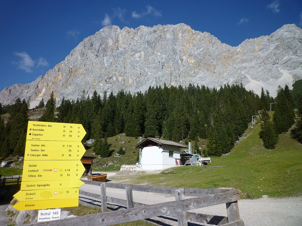
The Snow Cirque gives the shortest line to the top, at 8 km (5 mi) and 2,015 m (6,611 ft) of ascent from Eibsee or 5 km (3.1 mi) and 1,735 m (5,692 ft) from Ehrwald, with about 8 hours on the climb. It is graded medium to difficult, and the short distance hides a steep, sustained ascent.
The route passes under the Stopselzieher section, where falling rock loosened by hikers above is a real hazard; move steadily and avoid lingering directly beneath others. This side of the mountain also gets little direct sun, so it stays cold and can hold snow later than sunnier slopes.
Höllental from Hammersbach: gorge, via ferrata and glacier
The Höllental is the classic technical ascent: 9 km (5.6 mi) and 2,200 m (7,218 ft) of ascent over roughly 10 hours, graded difficult because it strings together a gorge, a via ferrata and a glacier crossing.
From Hammersbach the route enters the Höllentalklamm gorge, a long passage of walkways and tunnels under the rock. The Höllentalklamm Hike from Hammersbach page explains how the gorge itself is walked and where it leaves you above the ravine.
Past the Höllentalangerhütte the route turns to the via ferrata and then the glacier. Carry crampons and an ice axe and know how to use them: slush and ice on the glacier make spikes alone unreliable. The Randkluft, where the rock meets the ice, is a bottleneck, so start early to avoid queuing there.
The final climb follows the ridge to the summit, where the crowds from the cable car share the top. The step-by-step layout of this route, from the gorge through the Klettersteig to the glacier and summit, is mapped in the Höllental walkthrough for anyone planning the climb.
Jubilee Ridge from Osterfelderkopf
The Jubilee Ridge is a long, exposed scramble, given as 8 km (5 mi) and 2,015 m (6,611 ft) of ascent with about 10 hours on the go. It matches the Höllental in difficulty and demands the same equipment: via ferrata set, helmet and harness.
The route starts from the Osterfelderkopf above Garmisch, reached from the Alpspitzbahn valley station. If you want a taste of the terrain without committing to the full ridge, the Alpspitz Ferrata on the Alpspitze above the same station is the neighbouring objective and is covered separately.
Once on the ridge, stamina decides the day as much as technique: the scrambling goes on for hours. There is no water source between the Zugspitze summit and the Alpspitze, so carry everything you need, and summer thunderstorms build through the afternoon, which argues for an early start and a turn-around time you actually keep to.
Descent by cable car
Many hikers climb on foot and ride down. From the summit, the Eibsee cable car drops to the lake on the German side, and the Austrian side brings you down toward Ehrwald. That turns a one-way climb into a realistic day for fit walkers without a second night out.
The logic is simple: start early, summit by mid-afternoon, and be at the lift with time to spare. Last-cable-car times change with the season and operator, so confirm the final descent for your date with the lift company before you set off, and build a margin rather than cutting it close.
Gear each route demands
For the Reintal, the Gatterl route and the Snow Cirque, normal hiking boots and weather layers are the baseline; crampons are worth packing in shoulder season when snow lingers on the plateau. For the Höllental and Jubilee Ridge you need a helmet, harness, via ferrata set and, on the Höllental, crampons and an ice axe with the skill to use them on the glacier.
If you own the kit but not the glacier experience, the Höllental is better done with a mountain guide or an experienced partner. Self-rescue on the glacier or the ironwork is not realistic for a first-timer, and the summit ladder and the ridge sections are no place to learn.
When to go
Summer is the practical window for a foot ascent. The Gatterl and the Zugspitzplatt can hold snow outside the warm months, and the glacier on the Höllental needs firm, well-frozen conditions or good slush management with proper crampons.
Afternoon storms are the main seasonal hazard on the ridge and plateau. On the Jubilee Ridge in particular, thunderstorm risk in summer is a reason to be off the exposed ground early, so plan the day around a morning summit and leave the descent to the lift or an easy path.
Huts and base towns
The Reintalangerhütte and the Knorrhütte are the two natural stops on the German side, and the Knorrhütte is also where the Gatterl route joins. Sleeping at either lets you split a long climb, but beds on popular summer dates fill, so book directly with the hut well ahead. In the guided inn-to-inn format, one night is typically in a mountain hut with half-board and the rest in valley hotels, which tells you how the hut night fits into a multi-day plan.
Garmisch-Partenkirchen suits the Reintal, Höllental and Jubilee Ridge, and its train connections to Munich and Innsbruck make it an easy arrival base. Ehrwald is the better base for the Gatterl and Snow Cirque routes and gives quick access to the Austrian lifts. If you cross the border for the Ehrwald side, hiking in Austria covers the mountain areas, trails and seasons that frame those routes.
The Zugspitze Circuit: a low-level alternative
If the summit push is more than you want, the Zugspitze Circuit circles the massif over several days at valley level, through the Partnach gorge, Mittenwald and across into the Leutasch valley, with a night in a hut and the rest in hotels. The route is rated low on technical difficulty and is designed for hikers who want alpine scenery without exposed ground.
Stages run roughly 8 to 12 mi (13 to 19 km) a day, with daily elevation gains up to about 2,198 ft (670 m). The circuit can end at Eibsee, where you can add the cable car to the summit for the panorama without the climb.
Plan Your Zugspitze Hike
Pick your route by gear first, then by fitness. If you carry no climbing kit, the Reintal or the Gatterl route gives you a genuine summit day; if you own via ferrata equipment and can use it, the Höllental and Jubilee Ridge are the technical lines worth planning around.
Fix your base and your descent, then work backward: a hut bed on the Reintal, a planned cable-car ride off the summit and an early alarm make the day realistic, and the same discipline turns the low-level circuit into a relaxed multi-day option if the summit is not for you.
Frequently Asked Questions
Can you climb the Zugspitze without climbing gear?
Yes, on three of the five routes. The Reintal from Garmisch-Partenkirchen, the Gatterl route from Ehrwald and the Austrian Snow Cirque are walked with normal hiking boots, weather layers and, outside high summer, crampons for lingering snow on the plateau. The Höllental and the Jubilee Ridge require a via ferrata set, helmet and harness, and the Höllental also crosses a glacier where crampons and an ice axe are needed.
How long does a Zugspitze hike take?
The Reintal takes 8 to 10 hours to the summit over 21 km and 2,300 m of ascent, and the Gatterl route from Ehrwald takes 7 to 8 hours over 14 km and 2,100 m. The Snow Cirque runs about 8 hours, while the Höllental and the Jubilee Ridge each need roughly 10 hours. These are climbing times only, so add the descent by cable car or a second day on foot.
Which town is the best base for a Zugspitze hike?
Garmisch-Partenkirchen puts the Reintal, the Höllental from Hammersbach and the Jubilee Ridge within easy reach, and it has train links to Munich and Innsbruck. Ehrwald on the Austrian side is the closer base for the Gatterl route and the Snow Cirque, and it gives quick access to the lifts that shorten those approaches.
What can you see from the Zugspitze summit?
The summit panorama from the cable car station takes in peaks across Germany, Austria, Switzerland and Italy, as the summit viewpoint is described. Walkers arriving on foot share the same top, so the reward for the climb is that wide alpine view over the Wetterstein massif and the surrounding ranges.
Do you need crampons on the Höllental route?
Yes. The Höllental crosses a glacier below the summit where slush and ice make simple spikes unreliable, so carry crampons and an ice axe and know how to use them. The Randkluft, where rock meets ice, is a bottleneck on busy days, and an early start keeps you out of the queue.
Sources
Trail notes for your next trip
Optional updates when we add or revise hiking guides.
You might also like
Continue reading
More guides you'll find useful