Hiking in the Lake District: Which Walk Fits Your Level
Plan Lake District hiking around the right fell or lakeside path for your fitness and season, with distances, ascents, walking times and trailheads.
On this page
The Lake District packs England's highest mountain, a ring of glacial lakes and enough ridge lines to fill a fortnight into one national park. You can spend a morning on a flat two-mile (3 km) shoreline path and the next day climbing 900 m (2,950 ft) to a summit.
The useful split for planning is by climbing, not by fame: short lake circuits, half-day fells, big summits and graded scrambles each suit a different hiker and a different forecast. The routes below give named start points, distances and walking times so you can choose on the ground rather than by reputation alone.
How to choose a Lake District walk
Match the day to the cloud, not just to your ambition. When the tops are in mist, the lakeside paths around Buttermere, Loweswater and Tarn Hows still deliver, while the big summits give you a view of the inside of a cloud. Save the fells for a clear forecast and bank a low-level circuit for the grey day.
Then decide how much ascent you want underfoot. A short fell such as Catbells asks for about 475 m (1,558 ft) of climbing over 7.5 km (4.5 miles), while Great Gable from Honister stacks up 1,275 m (4,183 ft) over 12.5 km (8 miles). That gap is the difference between a two-hour outing and most of a day. If you want to weigh these grades against long-distance routes elsewhere, our England hiking guide covers long-distance trails, national parks and coast paths.
Easy and short walks
The Tarn Hows circuit is the gentlest introduction in the park: a flat, level path of about 2 miles (3 km) around a tarn ringed by conifers and fells, starting from the Tarn Hows car park. It is short enough for children and rewarding enough for anyone, with an optional detour to Tom Gill waterfall where the ground turns rougher.
Catbells, above Derwent Water, is the classic short fell. From the start near Hawse End Outdoor Centre the route runs 7.5 km (4.5 miles) with 475 m (1,558 ft) of ascent and takes 2 to 2.5 hours, giving continuous views over the lake. It is popular on peak weekends, so a midweek morning keeps the ridge quieter.
Dodd Fell, reached from the car park off the A591, is a 5 km (3 miles) woodland climb of 391 m (1,282 ft) that takes 1.5 to 2 hours and ends with views over Bassenthwaite Water. Families walk it regularly because the trail is clear and the navigation simple.
The Buttermere round is the shortest full-lake circuit worth planning a day around, at 4.5 miles (about 7 km) of easy shoreline walking. It works in almost any weather because the path stays low, and it can be walked comfortably in a morning.
Lakeside and valley walks for poor-visibility days
Grasmere and neighbouring Rydal Water link into a circular walk of about 5.5 miles (9 km) with the fells rising from the foot of the lake throughout. The shore trees give some shelter in rain, which makes it a sensible choice when the summits are clagged in.
The Derwentwater round from Keswick is a 10 mile (16 km) circuit with little strenuous climbing, keeping the lake on one side to navigate. Friar's Crag and a short detour to Lodore Falls are the natural stops, and the route is popular enough that solo walkers are rarely isolated.
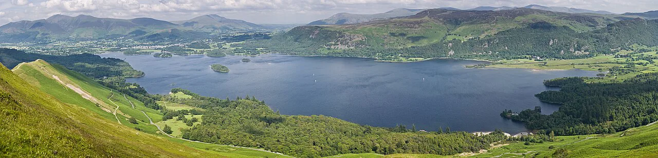
For a quieter half-day, take the boat from Glenridding to Howtown and walk the Ullswater shore path back, an 8.5 mile (about 14 km) route that is rough in places but gives outstanding views across the water to Helvellyn. The boat removes the need for a second car.
Ennerdale Water offers 7.5 miles (12 km) of shoreline split between a rough lakeside path and a good track, with unusual scenery and few people. Loweswater, tucked into a side valley near Buttermere, gives an easy 4 mile (6.5 km) circuit whose southern shore runs through woodland.
Devoke Water, a large tarn between Eskdale and the Duddon Valley, is reached easily from the road and gives a 4 mile (6.5 km) circuit among low hills. The quiet side of Derwentwater, best reached by ferry from Keswick or Lodore and walked one way, covers 4 miles (6.5 km) of woodland bank.
Half-day fells
Blencathra from Scales, off the A66, climbs 881 m (2,890 ft) over 8.5 km (5 miles) in 3 to 3.5 hours, passing Scales Tarn before the final steep pull to the summit. The rock is slippery in the wet, which matters more than the distance on this route.
For a quieter line on the same mountain, start at Mungrisdale and return over Souther Fell on a 9 mile (14.5 km) circuit that sees few walkers away from the summit. The views take in several Lake District ranges, the Forest of Bowland and, on a clear day, the Galloway hills in Scotland.
Angle Tarn from Cow Bridge car park is 11 km (7 miles) with 716 m (2,349 ft) of ascent, taking 3.5 to 4.5 hours. The ground near the tarn is boggy after rain, and the path junction below Rest Dodd is the one spot where the line is easy to lose.
Haystacks and Fleetwith Pike from Honister Hause pair two summits in 11 km (6.5 miles) with 1,142 m (3,747 ft) of climbing over 4 to 4.5 hours. The descent from Fleetwith Edge drops over 500 m in 1.5 to 2 km, so hikers who dislike steep downhills should reverse the circuit and climb it instead.
The Fairfield round from Patterdale takes in Arnison Crag, Hart Crag and Fairfield over 15 km (9 miles) with 1,209 m (3,967 ft) of ascent and 4 to 5 hours. It stays far quieter than neighbouring Helvellyn even on busy weekends.
The big summits
Scafell Pike from Wasdale Head is 11.5 km (7 miles) with about 1,117 m (3,665 ft) of ascent and takes 3.5 to 4 hours. The path is heavily trodden, with a stream crossing early on and long stretches above it that offer no water or shade, so carry your own.
Helvellyn from Glenridding, taking in Catstye Cam and the edges, runs 11.5 km (7 miles) with about 1,069 m of ascent over 4 to 4.5 hours. The approach along Striding Edge involves hands-on scrambling before the final pull to the plateau, and the ridge is exposed in wind.
Great Gable via Grey Knotts and Kirk Fell starts at Honister Slate Mine and covers 12.5 km (8 miles) with 1,275 m (4,183 ft) of ascent over 4.5 to 5 hours. The summit path has loose stone and a short scrambly section, and on a clear day the view reaches the Isle of Man and Scotland.
The Skiddaw extension from Dodd adds Carl Side and Ullock Pike for 12 km (7.5 miles) and 1,095 m (3,592 ft) over 4 to 4.5 hours. The summit plateau is broad and exposed, with a small stone shelter for a windy lunch stop.
Ridges and scrambling routes
Sharp Edge on Blencathra and Hall's Fell are graded scrambling terrain, and the wet-rock problem is real: a light shower makes the flat slabs noticeably slick. The Sharp Edge circuit totals 8 km (5 miles) with 1,125 m (3,690 ft) of ascent, similar in length to the Scales route but harder in character.
Striding Edge is the best-known ridge line on Helvellyn, with hands-on movement and sustained exposure in wind and rain. Hikers who suffer from vertigo should take one of the other ascent routes and enjoy Striding Edge from below; the plateau gives a fine view of it from a safe distance.
On the popular summit routes, the crowds thin once you leave the main path. Neither ridge is a place to learn scrambling, and a dry forecast matters as much as a good level of fitness on either.
Reaching trailheads without a car
Boats do real transport work here. The Glenridding to Howtown boat turns the Ullswater shore path into a one-way walk of 8.5 miles (14 km), and ferries from Keswick or Lodore reach the quiet side of Derwentwater for a 4 mile (6.5 km) walk back.
The main trailheads sit at valley car parks along the A591 and A66, including the Tarn Hows car park, the Dodd car park off the A591, and Cow Bridge for Angle Tarn. Parking pressure on peak weekends is the strongest argument for public transport or an early start.
Scafell Pike from Wasdale Head and Great Gable from Honister Slate Mine both start at road ends or passes, so the drive is part of the day. Plan a return leg before you set off, because the nearest facilities are in the valleys.
Base villages and what each suits
Keswick is the best all-round base: it puts the Derwentwater round, Catbells and Dodd within easy reach and has the widest choice of beds. Hikers wanting the northern fells and quieter approaches, such as Mungrisdale, also start from here.
Glenridding and Patterdale suit the eastern valleys: Helvellyn, the Fairfield round and the Ullswater boat all start close by. Ambleside and Great Langdale work well for Rydal Water, Loughrigg Tarn and the southern fells, while Buttermere and Wasdale Head are small, remote bases for the western and southern summits. If you are comparing mountain bases across Britain, the same base-versus-trailhead logic shapes hiking in wales. The same question of which trails suit which level applies to the Yorkshire Dales hiking guide.
When to go
Late spring to early autumn gives the longest days and the driest rock, which is when the ridges and long circuits such as Haystacks and Great Gable are most enjoyable. Winter shortens the day sharply, and snow or ice on high passes and ridges calls for axe and crampons or a change of plan.
Low-level circuits work year-round, and February can be excellent for Tarn Hows and Buttermere between storms. Whatever the season, build in a fallback lake walk for the day the cloud refuses to lift.
Hazards on the fells
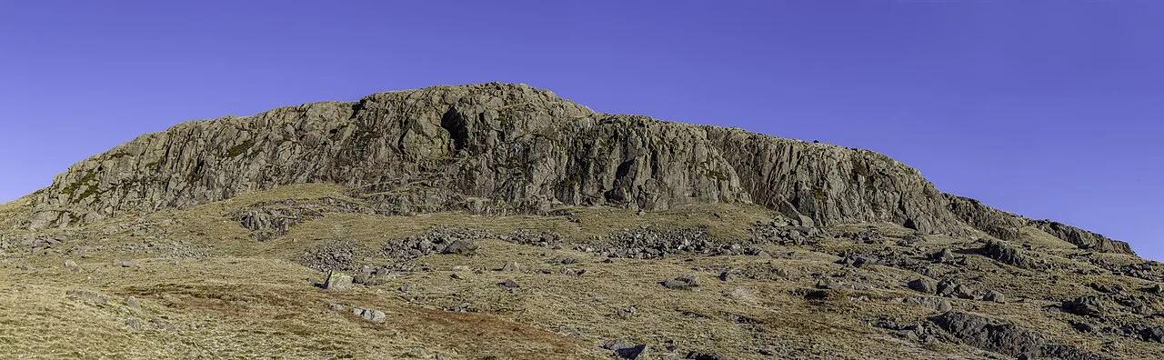
Exposure on the edges, loose stone on the Gable path and boggy ground around Angle Tarn are the recurring hazards rather than any single technical difficulty. Wet rock makes the scrambles materially harder, so a dry forecast is worth waiting for on Sharp Edge and Striding Edge.
Livestock grazes the fells throughout the year, and dogs should be kept close or on a lead around sheep. Carry water for the high routes, because long stretches of Scafell Pike and Blencathra offer none.
Maps and navigation
Ordnance Survey sheets OL4 to OL7 cover the park in four blocks, from Keswick and Cockermouth in the northwest to Coniston and Ulverston in the southwest. Carry the paper sheet for your block and use a phone as backup, not as the primary tool.
The fairer summits count toward the 214 fells in Alfred Wainwright's guidebooks, and many walkers plan around bagging them over several visits. A navigation course or a few days with a leader pays back quickly on the featureless plateaus.
Splitting a multi-day trip
A sensible three-day plan puts the easy lakeside walks on the arrival day, a half-day fell such as Blencathra or Angle Tarn on day two, and a big summit such as Scafell Pike or Helvellyn on the clearest day. Keep the ridges for a dry forecast and leave the ferry-based routes for a changeable day.
Basing yourself once and driving to trailheads beats moving hotels every night in the Lake District, where the valleys are close together. Book beds early for summer weekends, and keep a short lake circuit in reserve for the last morning.
Plan Your Visit
Pick your walk by climbing and by forecast: a flat tarn circuit when the cloud is down, a half-day fell when it is clearing, and a summit or ridge when the day is dry and long. Named trailheads such as Hawse End, Cow Bridge, Honister and Wasdale Head make the planning concrete.
For the scrambles, read the route description before you commit and carry a paper map for your Ordnance Survey block. Check the boat and ferry times with the Ullswater and Keswick operators on the day you plan a one-way lakeside walk.
Explore more Lake District hiking guides
- Aira Force Walk
- Buttermere Walk
- Catbells Walk
- Coledale Horseshoe
- Easedale Tarn Walk from Grasmere
- Fairfield Horseshoe
- Grasmere Walks
- Helvellyn Walk
- Lake District Via Ferrata
- Loughrigg Fell Walk from Ambleside
- Orrest Head Walk from Windermere
- Scafell Pike Walk
- Skiddaw Walk
- Striding Edge
- Tarn Hows Walk
- The Old Man of Coniston Walk
- The Wainwrights
- Ullswater Way
- Blencathra Walk via Hall's Fell Ridge from Threlkeld
- Castle Crag Walk
- Derwentwater Walk
- Easy Walks in the Lake District
- Great Gable Walk
- Haystacks Walk from Gatesgarth
- Lake District Walking Holidays
- Rydal Water Walk
- The Langdale Pikes Walk
- Lake District Multi-Day Hikes
Frequently Asked Questions
What are some easy walks in the Lake District?
Tarn Hows has a flat circuit of about 2 miles (3 km) from its car park, and the Buttermere round covers 4.5 miles of easy shoreline. Catbells adds 475 m (1,558 ft) of climbing over 7.5 km (4.5 miles) and remains the classic short fell.
Is Scafell Pike or Helvellyn harder?
Helvellyn via Striding Edge involves sustained scrambling and exposure on the ridge before the plateau, which makes it more demanding for many hikers. Scafell Pike from Wasdale Head is a long, heavily trodden climb with roughly 1,117 m (3,665 ft) of ascent and no scrambling on the main path.
What is the hardest walk in the Lake District?
Difficulty depends on conditions as much as distance. Sharp Edge and Hall's Fell on Blencathra and Striding Edge on Helvellyn carry the most serious scrambling and exposure, particularly when the rock is wet. Long circuits such as Great Gable via Grey Knotts and Kirk Fell demand fitness over 12.5 km (8 miles) and 1,275 m (4,183 ft) of ascent.
Where should I base myself for hiking in the Lake District?
Keswick gives the widest range of walks nearby, including Catbells, Dodd and the Derwentwater round. Glenridding and Patterdale suit Helvellyn and the eastern valleys, while Buttermere and Wasdale Head are quieter bases for the western and southern fells.
Can you hike in the Lake District without a car?
Yes, using the Ullswater boat between Glenridding and Howtown for the shore path, and the Derwentwater ferries from Keswick or Lodore for the quiet side of the lake. Both routes depend on the boat running, so check current sailing times.
Sources
Trail notes for your next trip
Optional updates when we add or revise hiking guides.
You might also like



Continue reading
More guides you'll find useful