
Old Man of Coniston Walk: Route, Distance and Parking
Plan the Old Man of Coniston walk from Walna Scar Road: 9.9 km (6.2 mi) and 780 m (2,560 ft) of climbing over Dow Crag, with a Low Water descent.
On this page
The Old Man of Coniston, the 802 m (2,633 ft) summit that dominates the southern fells above Coniston village, offers one of the most complete half-days in the Lake District. The classic circuit climbs the Dow Crag ridge from Walna Scar Road, traverses three summits and returns past Low Water and old copper and slate workings. It suits hill walkers with some rough-ground experience who want a full day out rather than a short stroll.
This guide covers the trailhead, distance and ascent, the route section by section, the descent through the quarries and the harder ridge variant for fitter walkers. For the wider context of fells, valleys and bases, see this guide to hiking in Lake District.
Where the Old Man of Coniston Walk Starts
The walk begins at a pay-and-display parking area about 1 km (0.6 mi) above Coniston, at the end of the tarmac section of Walna Scar Road. The grid reference is SD 288 970, and the Ordnance Survey Explorer OL6 map covers the whole route. Drive up the steep lane out of the village, pass through the gate where the tarmac ends, and park in the large unmetalled area where the walk starts.
There are wooden waymarkers at the parking area, and the route heads west along the now-unsurfaced Walna Scar Road. If the car park is full, there is further parking about 1 km back down the road towards Coniston. No facilities sit at the start, so arrive with what you need for the day.
Parking and Getting to the Trailhead
Parking at the Walna Scar Road area is the sensible choice. Parking in Coniston village instead adds roughly 150 m (490 ft) of climbing to the day without extra views, so the higher car park buys you a shorter and more rewarding ascent. There is no need to plan around a bus or a lift: the trailhead sits at the end of a driveable lane from the village.
Allow for the narrow, steep approach road, which is the slowest part of the drive. A fallback plan of parking lower in the village keeps the day workable if the upper area is busy, and it turns the walk into a slightly longer version of the same circuit. Treat the pay-and-display machine as part of the trip rather than an afterthought.
Distance, Ascent and Time
The circuit over Brown Pike, Buck Pike, Dow Crag and the Old Man of Coniston is 9.9 km (6.2 mi) with 780 m (2,560 ft) of climbing. The route summary gives an estimated walking time of 3 hours 25 minutes. Add time on the summit and the descent through the quarries, and a half-day out is realistic.
Difficulty and Terrain
The route is graded 2-C: a medium-length walk with rugged terrain and some steep climbs. The ridge between Brown Pike and Dow Crag is the most demanding ground, with rocky sections and steep drops on the Goat's Water side. The climb from Goat's Hawse to the summit is long and stony rather than technical, but it keeps you working to the cairn.
This is not a beginner's first fell walk, though a fit walker comfortable on rough paths can manage it. The commitment comes from the combination of distance, ascent and rocky ground rather than from any single hard move. If you want a gentler introduction to the district, look at shorter valley and lakeside routes before stepping up to this circuit; those heading further east can compare options in the Yorkshire Dales hiking guide before committing to a big fell day.
Route Description: Walna Scar Road to Brown Pike
From the parking area, walk west through the waymarkers along the old Walna Scar track. The path rises gently through bracken, with Coniston Water appearing on your left, and ignores a track that branches off to the right. It steepens, levels out, then reaches steps that lead up towards Goat's Water; ignore those steps and continue along the main track.
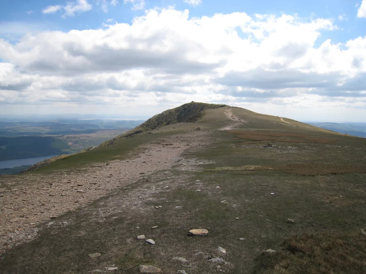
Cross the bridge and follow the track as it curves around Brown Pike, becoming rougher underfoot. After a small shelter the crest is reached, with Harter Fell and Ulpha Fell ahead. Turn right at the small cairn and wooden sign on the brow, and follow the gravel path as it zig-zags up to the Brown Pike summit cairn.
Buck Pike and the Dow Crag Ridge
From Brown Pike, continue in the same direction along the ridge to Buck Pike, passing its summit cairn without turning off. Blind Tarn sits below to the right, and the Old Man of Coniston comes into view on the hillside ahead. Keep going towards Dow Crag, where the path runs close to the edge above Goat's Water.
The final pull to the Dow Crag summit is the rockiest section before Goat's Hawse, with steep gullies dropping to the right. The exposure is real here: keep the group together, watch your footing on wet rock and save the gully-edge photos for a calm moment away from the path. That ridge is the part that most repays an early start and dry weather.
Goat's Hawse to the Summit Cairn
From Dow Crag, a short descent drops you to Goat's Hawse, the saddle from which you can see the path climbing to the summit ahead. Take the more distinct left-hand path and climb steadily along a wide stony track past many small cairns. About 700 m beyond Goat's Hawse, the summit cairn comes into view.
The final few metres to the cairn are short and the reward is wide. With the climb done, the day becomes a descent, and the zig-zag track down towards Low Water is visible to your left. In poor visibility the wide stony path is straightforward to follow; in strong wind it is the last exposed stretch before the drop-off.
The Summit Views
The panorama from the summit takes in the surrounding fells in every direction: Dow Crag to the west, the Scafell group and Bowfell to the north, and Helvellyn and Blencathra to the east. On a clear day the Isle of Man is visible across the sea. Below the summit, Blind Tarn and Goat's Water sit on the slopes you have just crossed.
Low Water, the Quarries and the Return
Leave the summit on the path that gently descends towards Coniston with views of Coniston Water ahead, then swings left into a steeper zig-zag down to Low Water. Pass the lake on its right-hand side, ignoring the fork that runs down to the water's edge. The stony path then heads between rocky outcrops towards Coniston.
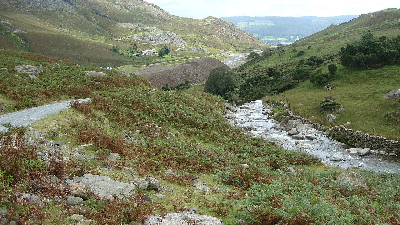
Disused quarries soon appear, with small heaps of slate and the remains of old quarry buildings beside the path. Keep to the main path past the buildings and keep descending until the car parking area comes back into view. The final stretch slackens to a gentle walk through low outcrops and returns to the parking area.
When to Go
Late spring through early autumn gives the best chance of dry rock on the Dow Crag ridge and clear summit views. Snow and ice linger on the summit slopes into spring and can return early in autumn, turning the stony climb above Goat's Hawse into crampon-and-axe ground. If you want the full ridge rather than the direct ascent, choose a settled window of weather.
Whatever the forecast, start early enough to be off the ridge before afternoon weather builds, and carry full waterproofs: the wind on this exposed ridge can arrive and leave within an hour. A flexible plan is useful for hiking here, since cloud can shut down the tops while the valley stays clear.
Hazards and Exposure
The Dow Crag section is the place to concentrate. The path runs close to steep drops into Goat's Water, and wet rock on the gullies makes the edge feel closer than it looks. Keep well back from the rim, and avoid being on the ridge in high wind or when cloud has dropped to summit level.
The climb from Goat's Hawse is long rather than exposed, but the stony path and small cairns demand care on tired legs. Take the descent to Low Water slowly: the zig-zags are steep and loose in places. Taking a navigation app or map is worthwhile even in summer, as the numerous cairns can mislead you in mist.
Facilities, Water and Food
There are no facilities on the route or at the Walna Scar Road parking area, so carry your own food and water. Pubs, cafés and shops in Coniston village stand roughly 1 km (0.6 mi) from the car park, and make a good post-walk stop. Fill bottles before you leave the village.
A Harder Variant over Swirl How and Wetherlam
Fitter walkers can extend the day into a high-level ridge walk that takes in the Old Man of Coniston, Swirl How and Wetherlam, a route of 13.8 km (8.5 mi) with 1,043 m (3,422 ft) of ascent. That is a longer and more committing day with much more climbing than the standard circuit, so it repays a good early start and settled weather. Treat it as a separate outing rather than a detour on the Walna Scar Road route.
The Wetherlam route joins the same Coniston fells, so stay on the named paths and keep your bearings on the connecting ridges. This variant is best left for walkers who already know how they handle a full day of ascent. The Old Man is one of many summits on the list collected by Alfred Wainwright, and walkers ticking off The Wainwrights will find this circuit bags three of them in a single round.
Plan Your Visit
The standard Old Man of Coniston walk starts at Walna Scar Road, climbs Brown Pike, Buck Pike and Dow Crag, then reaches the summit from Goat's Hawse before descending via Low Water and the quarries. It is a half-day out for fit walkers with rough-ground experience, with the ridge above Goat's Water as the key test.
Pack for changeable weather, plan the ridge for a settled morning and save energy for the steep descent. If you want a gentler introduction to these fells, start with a shorter valley route and work up to this circuit once your legs and confidence are ready.
Frequently Asked Questions
How long is the Old Man of Coniston walk?
The Brown Pike, Buck Pike, Dow Crag and Old Man of Coniston circuit from Walna Scar Road is 9.9 km (6.2 mi) with 780 m (2,560 ft) of climbing. Allow roughly three and a half hours of walking plus time on the summit and in the quarries on the descent.
Where do you park for the Old Man of Coniston walk?
Park at the pay-and-display area at the end of the tarmac section of Walna Scar Road, about 1 km above Coniston. Parking in the village adds roughly 150 m of climbing with no extra views, so the upper car park is the better choice for a shorter day.
How hard is the Old Man of Coniston walk?
The circuit carries the grade 2-C: a medium-length route with rugged terrain and steep climbs. The Dow Crag ridge is rocky with real exposure above Goat's Water, so it suits walkers comfortable on rough ground rather than complete beginners.
Can a beginner climb the Old Man of Coniston?
A fit beginner can manage the direct ascent from Goat's Hawse, which is long and stony but not technical. The full ridge circuit over Dow Crag is a step up in commitment and exposure, so start with a shorter route before attempting the traverse.
What is the best route up the Old Man of Coniston?
The Walna Scar Road circuit is the classic option: Brown Pike, Buck Pike and the Dow Crag ridge, then the summit from Goat's Hawse, with a descent past Low Water and the quarry remains. It gains the most interest for its length and returns you to the same parking area.
When is the best time of year to walk the Old Man of Coniston?
Late spring to early autumn gives the best chance of dry rock and clear views. Snow and ice can persist on the summit slopes into spring and return early in autumn, so plan the ridge for a settled weather window.
Sources
Trail notes for your next trip
Optional updates when we add or revise hiking guides.
You might also like



Continue reading
More guides you'll find useful





