Scotland Hiking: Best Trails and Where to Base Yourself
Plan Scotland hiking around Munros, island coast paths and Great Trails like the West Highland Way, with distances, ascent, seasons and base villages for each.
On this page
Scotland offers hikers an unusual range in a compact country: a 1,345 m (4,413 ft) mountain day, short forest loch circuits, cliff-top island walks and multi-day routes that cross the Highlands. You can build a week around one long trail or string together day hikes from a single base. The choice comes down to your fitness, your time budget and how much weather you are willing to walk through.
This guide groups the main hiking areas by the kind of day they deliver, gives the distances and hours where they are documented, and names the base town or village that makes each one work. Long-distance walkers get stage-planning notes on the West Highland Way and its alternatives; day hikers get route-by-route detail on Skye, Torridon, the Cairngorms and the coast.
Why Scotland hiking suits walkers from first-timers to Munro baggers
Scotland's access rights let you walk almost anywhere on open ground, which is why the country's route network ranges from waymarked forest paths to pathless moor. Beginners can start on low-level loch circuits and city hills, while experienced walkers can move straight onto rocky ridges and long summit days. The key decision is matching the route to the conditions rather than the other way round.
The Munros, the 282 Scottish peaks above 3,000 ft (914 m), are the organizing principle for many hillwalkers. Bagging them is a lifelong project, and the logistics of starting are covered in a separate guide to the Munros: Scotland's 3,000-Foot Mountains and How to Start Bagging Them. Not every good Scottish day needs a summit, though, and several of the best outings here stay low.
Weather is the constant variable. Atlantic fronts arrive quickly, cloud can drop onto ridgelines within an hour, and snow lingers on high ground into spring. Build in a spare day on any multi-day plan and carry waterproofs and a map and compass even on short hill routes where phone coverage is patchy.
How Scotland's hiking areas differ: Highlands, both national parks, Skye and the islands
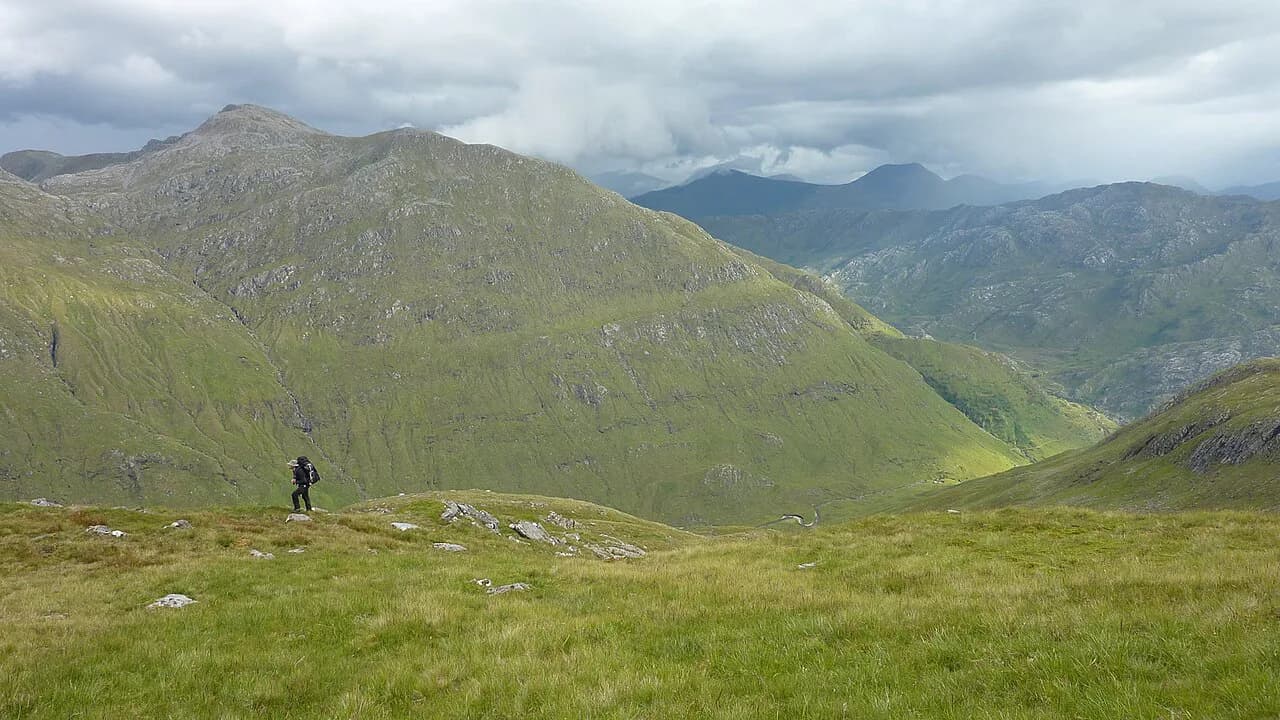
The Highlands hold the biggest mountains and the most remote ground, from Ben Nevis near Fort William to the Torridon peaks and the far northwest. Loch Lomond and the Trossachs National Park, on Glasgow's doorstep, mixes lochside trails with hill routes and is Britain's largest freshwater lake area by some distance. Cairngorms National Park, further east, offers high plateau country and pine forest around Aviemore.
The Isle of Skye delivers dramatic coastal scenery and steep short climbs rather than long summit days, with the Old Man of Storr as its signature walk. The islands off the west and north coasts, including Arran, Bute and Orkney, add coastal paths and cliff walks that work well as standalone trips. City walkers are not left out: Arthur's Seat in Edinburgh gives 360-degree views from an extinct volcano inside the city.
For a walker based in the Central Belt, the Fife coastal path follows the shoreline between the Firth of Forth and the Firth of Tay, linking fishing villages, sea caves and beaches on relatively easy ground. It is a good introduction to Scotland's long-distance style without committing to a mountain itinerary.
Ben Nevis: the tourist path, distance, ascent and the day it demands
Ben Nevis is Britain's highest mountain and the classic Scottish summit objective, reached from Glen Nevis just outside Fort William. The full ascent and descent take most walkers 7 to 9 hours depending on pace, so plan a whole day and start early enough to be off the summit before afternoon weather builds. The mountain path is a long, steady grind rather than a technical climb, but it climbs roughly 1,350 m (4,400 ft) and the summit plateau is exposed.
Navigation matters most near the top, where the path fades into a boulder-strewn plateau and cloud can erase the view in minutes. Carry a map and compass, take the descent seriously when legs are tired, and treat snow on the upper slopes as a reason to turn back unless you have winter gear and experience. Fort William is the natural base, with accommodation and services for both this route and the end of the West Highland Way.
Old Man of Storr on Skye: the 3.8 km (2.4 mi) climb and what it suits
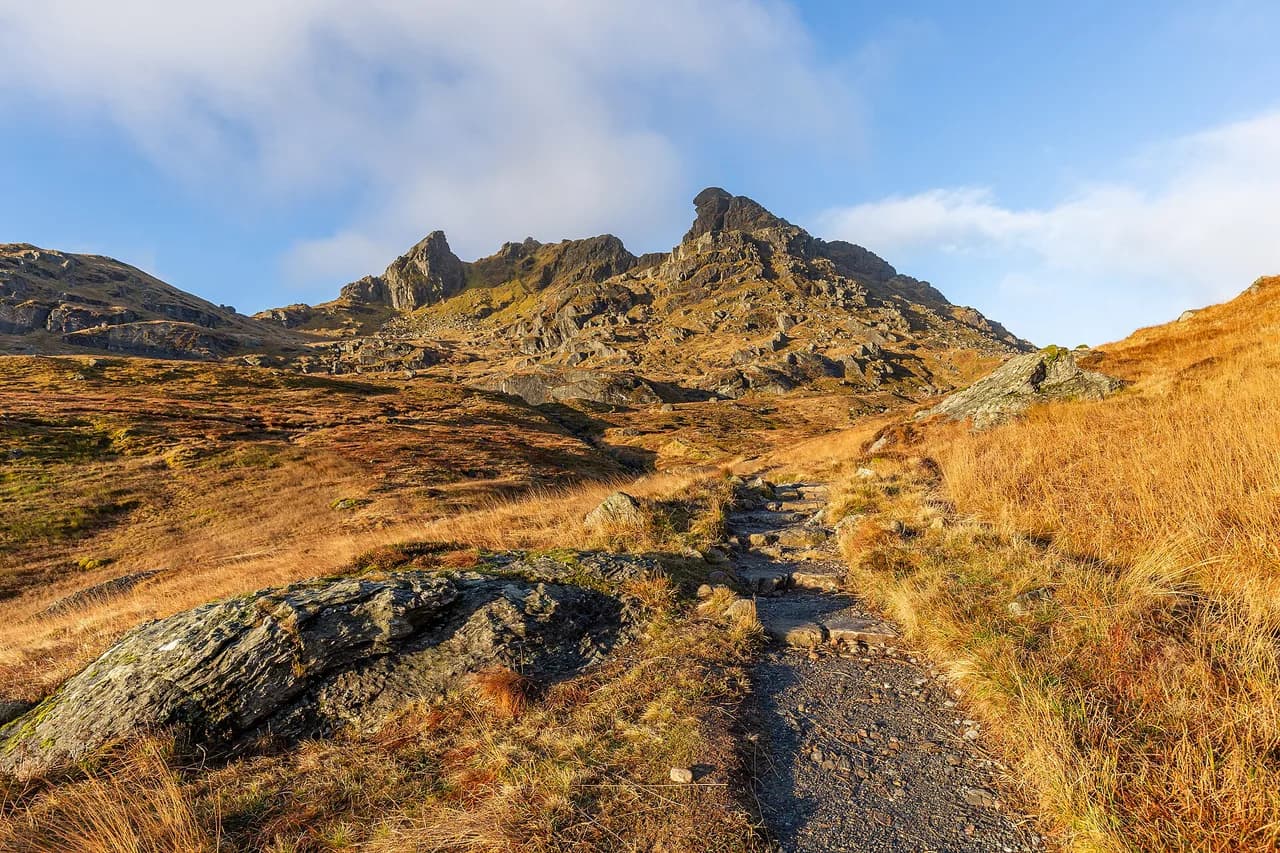
The Old Man of Storr is a large rock pinnacle standing above the east coast of Skye, and the climb to it is one of Scotland's most popular short walks. The route runs about 3.8 km (2.4 mi) and is steep near the top, but the effort is modest enough for beginners with reasonable fitness. Views open across the Sound of Raasay toward the islands of Raasay and Rona, and back to the Storr Lochs, Portree and the Cuillin hills.
Because it is short and iconic, it draws crowds; walking early or late in the day gives you a quieter path and better light on the pinnacle. The ground is rough and can be slick in rain, so grippy footwear matters more than distance would suggest. Portree is the practical base for this walk and for the rest of Skye's northern trails.
Beinn Eighe Mountain Trail in Torridon: waymarked, rocky and not a beginner's walk
The Beinn Eighe Mountain Trail in Torridon is described as Britain's only waymarked mountain walk, and it is not a beginner's route. The path leads through pine forest and up steep rocky ground to a Conservation Cairn at about 560 m (1,837 ft), where the views open to the Beinn Eighe massif. Allow more time than the distance implies because the rock steps and rough sections slow progress.
Waymarking helps with route-finding but does not reduce the exposure or the footing, so treat this as a mountain day with full kit. Torridon village is the closest base, and the surrounding area rewards a longer stay with other steep, rocky routes. For walkers who want a gentler introduction to the same landscape, the lower forest trails give a taste without the scramble.
Quinag: one, two or three summits and the hours each option takes
Quinag is a single mountain massif in the northwest Highlands with three summits, and the way you climb it decides your day length. Completing all three summits takes eight to ten hours, while going up and back down the same way to one summit is relatively easy and far shorter. That flexibility makes Quinag one of the best choices in Scotland for a group with mixed ambitions.
The landscape is dramatic and exposed, so wind and rain decide more than fitness on the higher sections. Pick a single-summit out-and-back if the forecast is unsettled and save the full traverse for a settled day with long daylight. The nearest services are limited, so carry food and water for the whole outing.
Loch an Eilein in Rothiemurchus: the short forest loch circuit
Loch an Eilein sits in Rothiemurchus Forest within Cairngorms National Park, with castle ruins on an island in the middle of the loch. The circuit around the water is one of Scotland's most popular short walks and takes only a couple of hours, making it a good family day or a rest-day leg-stretcher. The forest setting keeps the walking sheltered when higher routes are in cloud.
Aviemore is the obvious base, with the widest range of accommodation and food in the area, and the loch is a short drive from town. Pair the circuit with other forest and low-level trails near Aviemore if you want a full day without committing to a summit. The path is easy underfoot, so trail shoes are sufficient in dry conditions.
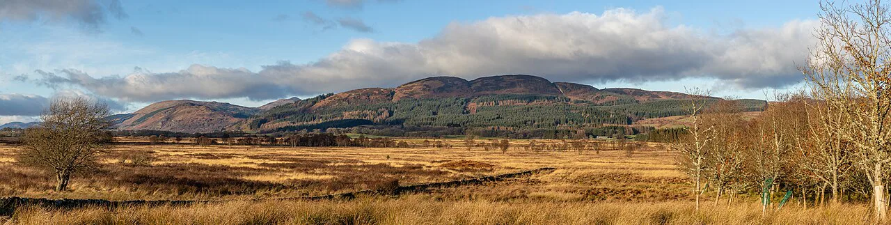
Sandwood Bay: the moorland walk out to the beach
Sandwood Bay is a remote beach in the far northwest reached by walking through moorland before the coastline opens up. The contrast between the rough approach and the wide sand and cliffs is what makes the day memorable, and the beach itself looks nothing like the typical image of a Scottish coast. There are no facilities at the bay, so carry everything you need and leave no trace.
The terrain is open and exposed to wind and rain, and the return leg is into the weather if the wind turns. Navigation is straightforward on a clear day but the moor can be confusing in mist, so take a map. This is a fine choice for walkers who value solitude over summits, and it combines well with the other northwestern routes for a longer trip.
Arthur's Seat in Edinburgh and the Old Man of Hoy on Orkney: coastal and city contrasts
Arthur's Seat in Edinburgh is an extinct volcano in Holyrood Park, and the walk to the top gives 360-degree views across the city. It is the least strenuous way to add a hill day to a city break, with a short climb from the park and no need for a car. Wear shoes with grip, because the paths are worn and can be slippery after rain.
On Orkney, the Old Man of Hoy is a sea stack reached by following the coastal path up from Rackwick. The route is a cliff walk with real exposure at the edges, so keep back from the tops in wind and take care on wet grass. Climbers with the right experience can attempt the stack itself, but walkers should treat the viewpoint as the objective.
The West Highland Way: 154 km (96 mi) from Milngavie to Fort William, stage planning and luggage transfer
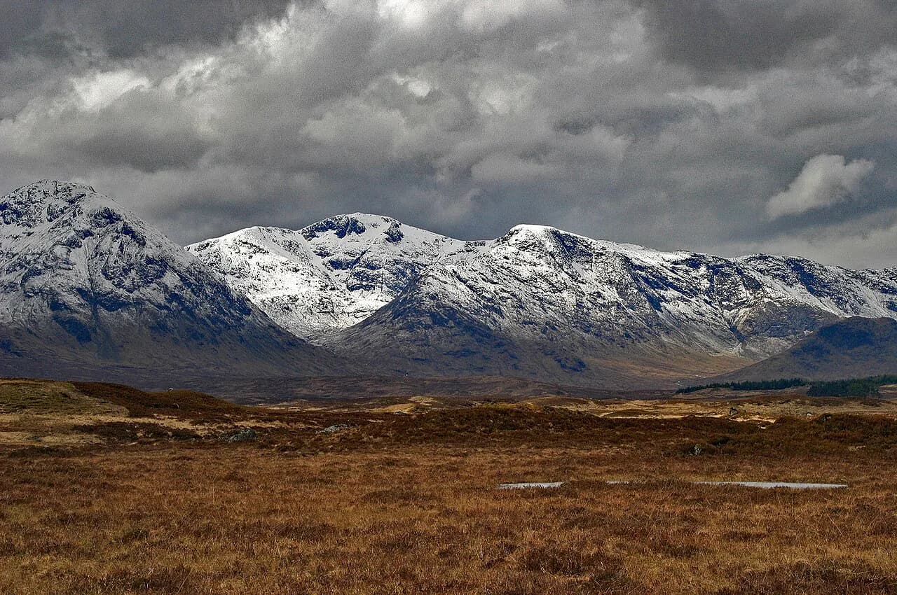
The West Highland Way runs 154 km (96 mi) from Milngavie on the northern edge of Glasgow to the foot of Ben Nevis at Fort William. It follows the shores of Loch Lomond in its lower reaches, crosses the edge of Rannoch Moor and climbs the Devil's Staircase, with strenuous rough and remote walking in the middle sections. Most walkers need at least eight days, and many take nine or ten to keep stages comfortable.
Accommodation runs from bunkhouses and B&Bs to hotels, and holiday operators on the route offer luggage transfer between overnight stops so you can walk with a day pack. That transfer is an operator service rather than something built into the trail, so arrange it when you book your beds. Booking stages early matters most in the middle of the season, when demand for beds along the route is highest.
Self-guided operators sell the route as packaged itineraries of roughly eight to nine days including accommodation, which suits walkers who want the logistics handled. A dedicated West Highland Way guide covers stage-by-stage details and how to split the walk.
Other Great Trails worth building a trip around: Great Glen Way, Fife Coastal Path, Arran Coastal Way, Speyside Way
Scotland's Great Trails network includes more than two dozen branded routes, each at least 25 miles long, waymarked and largely off-road, providing over 1,700 miles of managed path in total. They work as multi-day journeys or as day sections, which makes them flexible for shorter trips. The Great Glen Way runs 125 km (77 mi) from Fort William to Inverness along the Caledonian Canal and past Loch Lochy, Loch Oich and Loch Ness, ending in Inverness.
The Speyside Way covers 68 km (42 mi) from Spey Bay on the Moray Firth through riverside tracks and quiet lanes to Aviemore, with a spur toward Tomintoul. The Arran Coastal Way gives 100 km (63 mi) of low-level walking around the Isle of Arran, passing most of the island's villages. The Fife Coastal Path stretches 187 km (117 mi) from Kincardine to Newburgh.
For the toughest end of the spectrum, the Cape Wrath Trail runs 326 km (202 mi) from Fort William through the northwest Highlands with rough, pathless ground in places. That is serious backpacking country and should only be attempted with solid navigation and camping experience. The Scotland's Great Trails network and Mountaineering Scotland's route listings are the place to match a trail to your available days.
Huts, bunkhouses and B&Bs: how accommodation shapes a Scottish itinerary
Unlike continental alpine routes, Scotland's long-distance paths are mostly low-level and designed around village guesthouses, bunkhouses and B&Bs rather than mountain huts. That means your itinerary is shaped by where beds exist, and remote sections need planning around the nearest settlement. Most walkers book accommodation in advance for the middle sections of the West Highland Way and the Great Glen Way.
Self-guided operators package the trail with accommodation and often luggage transfer, which removes the daily logistics but locks in the itinerary. Independent walkers get more flexibility on dates and can shorten a day if weather turns, at the cost of more booking work. Either way, book the busy middle stretch first and build the rest around it.
Getting to trailheads by train, bus and ferry
Scotland's trailheads range from city-edge starts like Milngavie, reachable by train from Glasgow, to remote coastal and island points that need a car or a combination of ferry and bus. The Great Glen Way is unusual in linking two towns with rail and bus connections at each end, which simplifies a point-to-point walk. For Skye and the islands, ferries are part of the journey and should be booked as part of the plan.
Rail-and-hike itineraries are a practical way to combine the West Highland Line with day walks, and operators sell packages built around train journeys. If you are driving, the far northwest and Torridon reward a car, but single-track roads and passing places demand patience. Check the relevant operator's timetable for the exact service you need before fixing your dates.
When to go: midges, daylight, snow and weather windows
Late spring to early autumn gives the longest daylight and the most reliable walking conditions, with midges at their worst on still, damp days in summer. Snow can lie on high ground into spring and return in autumn, so Ben Nevis and the Torridon routes demand winter skills outside the summer window. May and June often bring the best combination of long days and manageable insect numbers.
Afternoon cloud and rain are common in the west, and coastal routes such as Sandwood Bay and the Old Man of Hoy need settled weather to be enjoyable. Build a flexible plan with one or two spare days so a bad forecast does not wreck the trip. If a summit day is clouded in, switch to a low-level loch or forest route and save the mountain for better conditions.
What to carry: footwear, waterproofs, navigation
Scottish ground is often wet, rocky and boggy, so waterproof boots or trail shoes with good grip and a full waterproof shell are baseline kit. Carry a paper map and compass and know how to use them, because phone batteries and signal both fail in cold, wet conditions. A headtorch matters on short winter days and on any route where a delay would push you into dusk.
For multi-day trails, pack for changing weather rather than a single forecast: spare dry layers, a warm mid-layer and blister treatment earn their weight. Water is plentiful on most routes but should be treated where livestock graze. Trekking poles help on the long descents from Ben Nevis and the rough sections of the Cape Wrath Trail.
Scottish access rights, deer stalking and leaving no trace
Scotland's access rights allow walking on most open ground, but they come with responsibilities: close gates, avoid disturbing livestock and wildlife, and follow local signage. Deer stalking takes place on many estates in autumn, and some areas ask walkers to use alternative routes on certain days. Check estate or land-manager notices at the trailhead before setting out.
Leave no trace: carry out all litter, bury human waste well away from water, and avoid lighting fires in dry conditions. On popular routes like the Old Man of Storr and Loch an Eilein, staying on the path protects fragile ground. These habits keep access open for the walkers who follow.
Choosing a base: Fort William, Skye, Torridon, Aviemore, Edinburgh
Fort William is the best all-round Highland base, with Ben Nevis on the doorstep, the end of the West Highland Way and the start of the Great Glen Way. Skye and Portree suit coastal and short dramatic walks, with the Old Man of Storr as the headline. Torridon is the pick for rocky mountain days, while Aviemore gives access to Cairngorms forest and plateau routes.
Edinburgh works as a city break with a hill day attached, thanks to Arthur's Seat, and it is the gateway to the Fife Coastal Path and the Borders routes. If you want a walking-focused week with varied mountain days, base in Fort William or Torridon and use the other areas for day trips. Outside Scotland, the Lake District is a separate destination worth its own trip, covered in the Hiking in the Lake District guide.
Plan Your Visit
Start by deciding what kind of Scottish day you want: a summit, a long-distance stage or a short coastal walk. That choice points you to a base, and the base points you to the trails. Match distance and ascent to your fitness honestly, and leave room for weather to change the plan. If you are still weighing whether to commit to Scotland at all, the best hikes in Europe: where to walk and what to choose put the country's options alongside the continent's other classic routes.
Book accommodation on the busy middle sections of the long trails early, arrange luggage transfer if you want to walk light, and carry proper waterproofs and navigation whatever the forecast says. Scotland rewards walkers who prepare for its weather and respect its ground.
Explore more Scotland hiking guides
Frequently Asked Questions
What is the toughest hike in Scotland?
The Cape Wrath Trail is the most demanding long-distance route in the country, running 326 km (202 mi) from Fort William through remote northwestern Highlands with pathless and rough ground in places. For a single-day challenge, Ben Nevis is the biggest ascent but follows a continuous path, while the full three-summit traverse of Quinag takes eight to ten hours.
How many days do you need to walk the West Highland Way?
The West Highland Way covers 154 km (96 mi) from Milngavie to Fort William, and most walkers need at least eight days. Many take nine or ten days to keep stages manageable, especially through the rougher middle sections around Rannoch Moor and the Devil's Staircase. Self-guided itineraries are typically sold over eight to nine days.
What is the best hike in Scotland for beginners?
Loch an Eilein in Rothiemurchus Forest is a gentle circuit that takes only a couple of hours, and Arthur's Seat in Edinburgh gives a short climb with city views. The Old Man of Storr on Skye is also within reach for beginners despite being steep near the top, at about 3.8 km (2.4 mi) round trip.
Do you need a permit to hike in Scotland?
Scotland's access rights allow walking on most open ground without a permit, but responsibilities apply: close gates, avoid disturbing livestock and follow trailhead notices. Deer stalking in autumn may require using alternative routes on certain days, so read estate signage before setting out.
When is the best time of year to go hiking in Scotland?
Late spring to early autumn brings the longest daylight and the most reliable conditions, with May and June often the best balance. Midges are worst on still summer days, and snow can lie on high ground into spring and return in autumn. Coastal routes are best saved for settled weather.
Can you hike Ben Nevis in a day?
Yes. The full ascent and descent of Ben Nevis takes most walkers 7 to 9 hours, so it fits within a long day if you start early. The plateau is exposed and navigation near the summit matters, so carry a map and compass and turn back if snow or cloud makes the upper section unsafe.
Sources
Trail notes for your next trip
Optional updates when we add or revise hiking guides.
You might also like
Continue reading
More guides you'll find useful