Scotland Coast to Coast Walk: Route Options and How to Plan
Compare ways to walk Scotland coast to coast, from the far-north North Coast Trail to links of waymarked long-distance routes, with terrain and season advice.
On this page
A coast-to-coast walk across Scotland rewards hikers who like building their own line rather than following one continuous signposted national trail. You can string together waymarked long-distance routes for a lower, better-supported crossing, or head north for cliff tops, empty moor and indistinct ground where map and compass skills decide the day. The choice comes down to how much navigation you want and how much time you can give the crossing.
This guide sets out the realistic options, the trade-offs between remote and waymarked ground, and how to plan transport, accommodation and season around your chosen line. If you are still weighing up where Scotland fits among your wider plans, the scotland hiking overview is a useful starting point before you commit to a route.
Why a Scotland coast-to-coast walk is a route you assemble
There is no official, waymarked coast-to-coast trail running across Scotland. Instead, crossings are put together from existing long-distance routes, old roads, drove paths and stretches of open hill, which means every itinerary is a personal design rather than a fixed itinerary. That freedom is the appeal: you can trade remoteness for support, or support for solitude.
Long-distance walkers regularly combine existing major trails into a crossing, and the Cape Wrath Trail appears among the routes used in such plans. A sensible approach is to decide your start and finish coast first, then join the intervening paths with the shortest logical links you can find on the map.
The west-to-east crossing: Cape Wrath and the far north
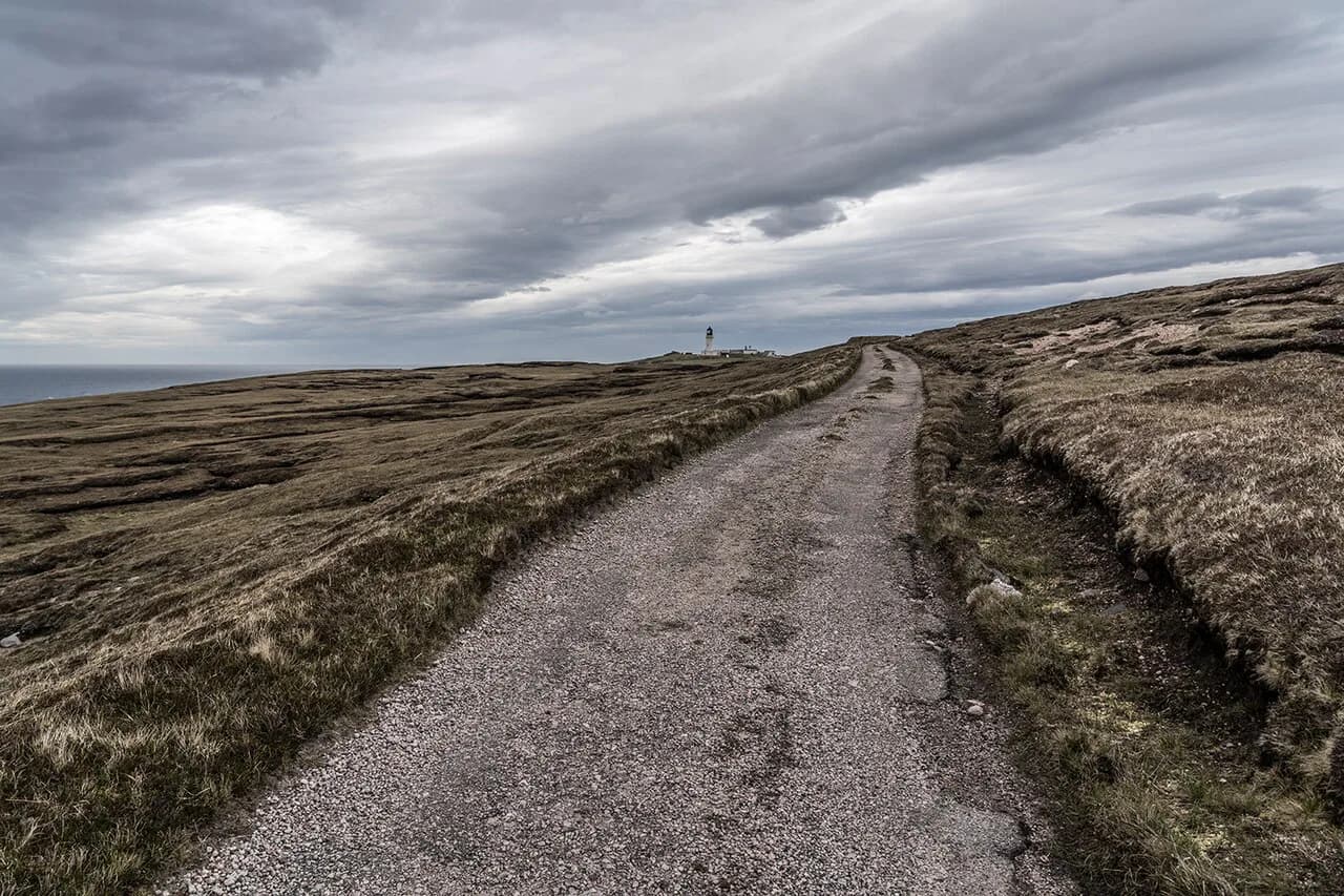
The most demanding option starts in the far northwest, where Cape Wrath marks the Atlantic corner of the mainland. The lighthouse there was built in 1828 and is a Category A listed building, and the headland sits at the end of a long, exposed approach with no waymarking on much of the ground. From Cape Wrath you would work east and south across Sutherland and Caithness, linking glens and estate tracks toward the east coast.
Treat this as a serious navigation route. The distances between shelter are long, the ground is often wet and trackless, and the north coast weather can turn quickly. Plan shorter days than your fitness suggests and carry a paper map and compass as your primary tools.
If you want the far-north coast without the route-finding burden, self-guided operators run organised itineraries that begin at John O' Groats and finish at Cape Wrath, walking the coast in stages. Bag transfer and accommodation are handled for you, which removes logistics but not the exposure to weather. Departures run April through October, and the published per-person rate is set out on the visitscotland.com listing for the North Coast Trail, so look there for the season you want.
Southern crossing options using the Southern Uplands
A southern crossing uses the rounded hills and broad valleys of the Southern Uplands and the Borders, running roughly between the Solway coast in the southwest and the North Sea coast near Berwick or Dunbar. These hills are lower than the Highlands but the ground is often tussocky, boggy and lightly waymarked, and the weather can be as changeable as anywhere in Scotland.
The advantage is a shorter overall line with more villages and minor roads to break up the days, which makes resupply and accommodation easier to arrange. The trade-off is less dramatic scenery than the northwest, so the appeal here is quiet walking and a realistic first crossing rather than big mountain days.
Linking waymarked long-distance routes: the central spine
The most straightforward assembled crossing links established waymarked routes through the centre of the country. A logical line follows the West Highland Way north from Milngavie to Fort William, continues along the Great Glen Way to Inverness, and then uses the East Highland Way to reach the east coast. Each of these routes is well waymarked and has a strong network of accommodation and services.
This is the option for hikers who want long daily distances on clear paths without committing to trackless ground. You sacrifice the wildest coastal scenery, but you gain reliable navigation, frequent villages and easy transport connections at both ends. It also works well as a first multi-day crossing before tackling something remoter. If you are weighing up a gentler first crossing further south, the Lake District hiking guide is a good place to compare day-by-day options.
Northern coastal alternatives: John O' Groats to Cape Wrath
The North Coast Trail option follows the northern rim from John O' Groats around Duncansby Head, Dunnet Head, Strathy, Bettyhill and Tongue, then west to Durness and on toward Cape Wrath. Dunnet Head is the most northerly point of the mainland, with cliff views over the sea, and the summer months between May and August bring active puffin colonies to the coast. Elsewhere, the route is described as having low distances and moderate height gain but indistinct trails and little waymarking, suited to experienced walkers with good map and compass reading. The self-guided tour version runs nine days with Thurso as the base for the first three nights, alongside optional ferry trips to Orkney and a walk to Sandwood Bay via the Kinlochbervie hamlets, and full details appear on the VisitScotland listing. An optional ferry crosses the Kyle near Durness, and Cape Wrath is reached on foot from there.
Staging and daily distance: how many days each option really needs
The nine-day figure applies to the North Coast Trail self-guided itinerary, including time based in Thurso and optional add-ons, so treat it as a supported version rather than a minimum. For an independent crossing, the reliable method is to divide the line into days on the map and then add a buffer for weather and rough ground, because bog, pathless sections and short daylight in spring and autumn all cost time.
Plan your first and last days loosely so a missed connection does not derail the whole schedule. Build in at least one rest day on anything longer than a week, and carry enough food for one extra day between resupply points.
Terrain and difficulty: cliff paths, indistinct ground, bog and road sections
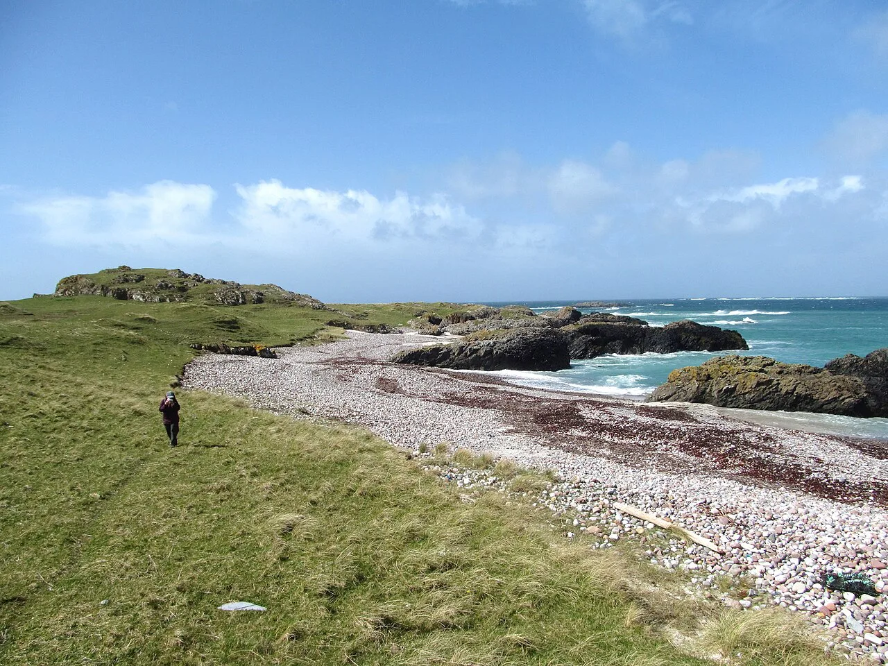
Expect three distinct types of ground. The far north mixes cliff-top paths and grassy clifftop walking with trackless moor, the central spine offers firm, waymarked paths and old military roads, and the Southern Uplands give tussocky hill ground with boggy patches after rain. Road sections appear on all three options where valleys link the hills, and they are often the quickest way between trail systems.
Bog and wet ground slow you far more than ascent does in Scotland, so waterproof boots and gaiters are worth their weight. On cliff sections, keep back from the edge in wind, and expect exposure on headlands where there is no shelter.
Navigation and map skills on unwaymarked ground
On waymarked routes, navigation is straightforward and a phone with offline maps is a useful backup. On the northern and southern crossings, the trail is often indistinct or absent, and the North Coast Trail guidance rates it as suitable only for reasonably experienced walkers with good map and compass ability. Carry a paper map at the right scale, a compass you can use without thinking, and a route card for each day.
Getting to the start and back from the finish: rail, bus and ferry connections
Thurso, the northernmost town on the UK mainland, is the starting base for the North Coast Trail style of crossing and has rail and bus links from Inverness. For the central spine, Milngavie sits on the Glasgow suburban rail network, Fort William and Inverness are on the Highland line, and the east coast finish connects onward by rail. Ferries to Orkney run from the far north and make a worthwhile detour; check operator timetables when you book, as these change by season.
Plan the return leg before you leave, because remote finishes in the northwest have very limited public transport. Booking accommodation near the finish for the night after you arrive gives you a buffer against delays.
Huts, bothies and accommodation along the way
Waymarked routes through the centre of the country offer plentiful guesthouses, bunkhouses and hotels in the villages along the line. The far north and the Southern Uplands are far more sparsely served, so you may need to arrange transfers to nearby accommodation or use bothies where the map shows them. Book accommodation early in the popular spring and early summer period, and always confirm your arrival day directly with the provider.
Luggage transfer and self-guided walking holidays
Self-guided operators package accommodation booking, bag carrying and taxi transfers, leaving you to walk each stage with a day pack. This suits hikers who want a first crossing without arranging every night, and it is especially valuable in the far north where accommodation is thin on the ground. The North Coast Trail self-guided version covers a nine-day route from John O' Groats to Cape Wrath, runs April to October, and quotes from £1065 per adult, with prices varying by season. Compare that against the cost of booking independently before you decide, and check the current itinerary on the VisitScotland listing.
Best months and weather windows
Late spring and early summer bring the longest daylight and the best chance of settled weather, and the North Coast Trail departures run from April to October. Puffin colonies on the north coast are active between May and August. Midges are worst on still, damp summer evenings on the west, while autumn brings fewer walkers and shorter days.
What to pack for a multi-day Scottish crossing
Pack for wet ground and changeable weather rather than for cold alone: waterproof jacket and trousers, waterproof boots, gaiters, spare warm layers, and a map and compass to supplement your phone. Carry a water filter or purification tablets so you can refill from streams, plus a first-aid kit and a lightweight emergency shelter.
Islands and detours worth adding
Orkney is a natural add-on from the far north, and the tour version of the North Coast Trail offers an optional ferry day trip to the island group, known for its Viking heritage. Sandwood Bay on the Atlantic coast is another optional extra, reached by walking from Kinlochbervie past the hamlets of Blairmore, Batrick and Shegra. Adding either lengthens your trip, so decide early and check ferry or access arrangements when you plan.
Safety on exposed coastal and moorland sections
The real hazards are exposure on cliff tops, trackless moor in poor visibility, and afternoon weather that arrives faster than forecast. Carry a shelter and spare layers, know your escape routes, and turn back if conditions deteriorate. On unwaymarked stretches, tell someone your daily plan and keep to the route card.
Plan Your Visit
Choose your crossing style first, then let the logistics follow. A central link of waymarked routes gives you a supported, clearly signed start, while the far north delivers the wildest coast at the price of real navigation. Match the line to your experience, not to the number of days you can spare.
Whichever option you take, plan your transport and first and last nights before you set off, build slack into the schedule, and check current prices and dates on the official listings for anything time-sensitive.
Frequently Asked Questions
Is there an official Scotland coast to coast walk?
No. Scotland has no single signposted national trail running coast to coast, so crossings are assembled by walkers from long-distance routes, old roads and open hill. The main choice is between a remote northern line, a central link of waymarked long-distance routes, and a southern crossing of the Southern Uplands.
How long does a coast to coast walk across Scotland take?
There is no fixed answer because the route is assembled. The organised North Coast Trail self-guided version runs nine days, including a base in Thurso, but independent crossings vary widely depending on the line and the buffer days you build in. Plan by dividing each day on the map and adding slack for weather.
How hard is a coast to coast walk in Scotland?
Difficulty depends on the line. Waymarked central routes are firm and well signed, while the far north and Southern Uplands bring indistinct trails, boggy ground and genuine navigation. The North Coast Trail is rated suitable only for reasonably experienced walkers with good map and compass ability.
What is the best time of year to cross Scotland on foot?
Late spring and early summer offer the longest daylight and the best chance of settled weather. North Coast Trail departures run from April to October, and puffin colonies are active from May to August. Autumn brings fewer walkers but shorter days, so plan shorter stages.
Can you do a Scotland coast to coast walk with luggage transfer?
Yes, self-guided operators handle accommodation booking, bag carrying and taxi transfers, which is especially useful in the far north where accommodation is sparse. The organised North Coast Trail version includes these services. Independent walkers can arrange transfers locally but should book ahead for remote sections.
Sources
Trail notes for your next trip
Optional updates when we add or revise hiking guides.
You might also like
Continue reading
More guides you'll find useful