Fife Coastal Path: Stages, Distance, Ascent and Route Guide
Plan the Fife Coastal Path from Kincardine to Newburgh: 187 km with 1,865 m of ascent, eight sections, tide-dependent stretches and transport between stages.
On this page
The Fife Coastal Path strings together long sands, old harbours and the string of fishing villages known as the East Neuk, all within a short train ride of Edinburgh. It suits hikers who want distance without altitude: a linear route where the sea sets the rhythm and the main planning questions are tides, transport and how many days you can spare.
This guide takes the official route from Kincardine-on-Forth to Newburgh and works through it section by section, with the options for shortening the walk and the stretches that demand a low tide. Treat it as a framework for booking beds and trains rather than a substitute for the trail's own waymarkers and maps.
Why walk the Fife Coastal Path and who it suits
Scotland's Great Trails lists the route at 187 km (117 miles) with about 1,865 m (6,120 ft) of ascent, spread over 8 to 10 days. That is modest climbing for a long-distance walk, and the underfoot going is the real variable: level paths alternate with sand and, on some stretches, wild and demanding rocky beach.
It makes a sensible first long-distance trail, since the route is clearly waymarked throughout and map-and-compass skills are not essential. The terrain mix is wide, from the former coal-mining towns of central Fife to the university city of St Andrews and the harbours of the East Neuk, so the days rarely feel repetitive.
Hikers used to bigger Scottish days should look elsewhere for summits; this is a coast walk where weather and tides matter more than gradient. If you want a hill-focused Scottish trip instead, our scotland hiking guides cover the mountain alternatives, including routes like the west highland way for those who prefer inland glens and lochs, and for a classic mountain valley with serious ridges, see our guide to hiking in Glencoe.
Route overview: distance, ascent and direction
The trail starts at Kincardine on the Firth of Forth and finishes at Newburgh on the Firth of Tay, a linear route across the Fife peninsula. Walking from west to east and then north puts the prevailing wind at your back for most of the way, which is why the trail body recommends that direction.
The Fife Coast & Countryside Trust splits the path into eight official sections: Kincardine to Limekilns, Limekilns to Burntisland, Burntisland to Buckhaven, Buckhaven to Elie, Elie to Cambo Sands, Cambo Sands to Leuchars, Leuchars to Wormit Bay, and Wormit Bay to Newburgh. Each section lists its own distance and approximate walking time on the trust's pages, which is the most reliable way to match a day's length to your fitness.
A shorter bridge-to-bridge version from North Queensferry to Newport-on-Tay is still sold by some walking-holiday companies because clients find the shorter route easier to fit into a week. Be clear which version you are booking: on the full route the first section from Kincardine to North Queensferry runs 27 km (16.8 miles), and the last from Wormit Bay to Newburgh runs 29.5 km (18.3 miles).
Getting to the start and back from the finish
Kincardine is reachable by bus from Stirling and Dunfermline, but the cleanest rail approach is to travel to a station on the line through Fife and connect onward by local bus. The trust directs walkers to Traveline Scotland for planning trains, express coaches and local buses across the Kingdom of Fife, and it encourages public transport where possible.
Trains operated by ScotRail serve stations along the south Fife coast, which makes Kirkcaldy, Burntisland and the towns around them useful places to break the route. Public transport covers the entire path from Kincardine as far as Newport-on-Tay, with mainline railway between Kincardine and Kirkcaldy, so most stages can be joined and left without a car.
The last stretch is the exception: reaching the path between Balmerino and Newburgh by public transport is difficult, so plan the final day with a lift, taxi or a friend's car at the Newburgh end. If you are walking the whole route, this single logistics problem is worth solving before you book the rest of your beds.
Kincardine to Limekilns and Limekilns to Burntisland
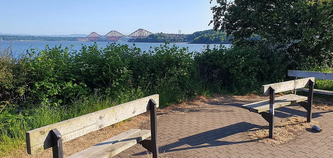
The opening section leaves Kincardine along the Forth and passes Culross, a historic village of white-harled houses and a palace worth an hour of your day. It is a gentle introduction to the trail, with the three bridges over the Forth as the recurring landmark on the horizon.
From Limekilns the path continues east to Burntisland, passing Aberdour with its two beaches, Black Sands and Silver Sands. This is one of the easier stages to shorten if a train or bus timetable suits you better, since stations sit close to the coast at several points. Note that the trust has flagged the toilet at Aberdour Black Sands as closed for repair.
Burntisland to Buckhaven and Buckhaven to Elie
The middle stretch runs past Kirkcaldy and Leven, through the industrial and former mining towns of central Fife. This is the least picturesque part of the route, though it gives the walk its contrast: the old docks and windmills here make the East Neuk villages further east land harder.
From Buckhaven the path improves as it heads toward Elie, where Ruby Bay and Elie Ness lighthouse sit at the edge of the village. The trust's notices have included the closure of the Elsan toilet disposal point at Elie Ruby Bay, so don't count on that facility.
Elie to Cambo Sands and Cambo Sands to Leuchars
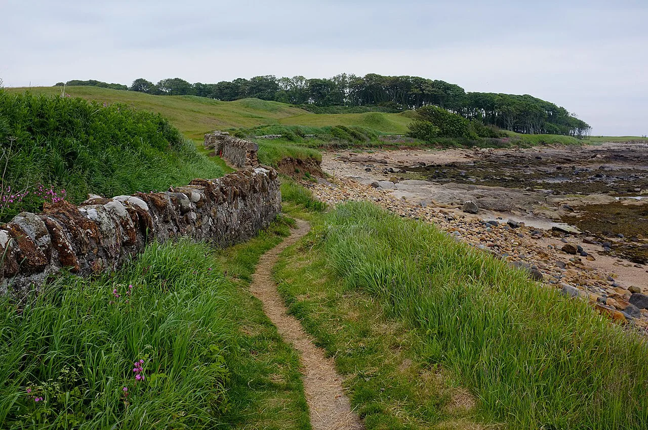
Many walkers rate this stretch the highlight: the path passes through the East Neuk fishing villages of Crail and Anstruther, with sandy bays and small harbours at every turn. The village-to-village rhythm makes it easy to plan short days and long lunches if you have the time.
South of Crail the route continues past Buddo Rock, a sandstone formation with a natural arch just off the path, before reaching Cambo Sands and the edge of St Andrews. From Cambo the walk turns inland around the Eden Estuary Nature Reserve and on to Leuchars, where a railway station gives you an exit point.
Keep to the marked path near the golf courses around St Andrews and avoid greens and fairways, both to protect the turf and to avoid distracting players. The West Sands beach runs alongside the Old Course, so expect golfers and walkers to share the same strip of coast.
Leuchars to Wormit Bay and Wormit Bay to Newburgh
Beyond Leuchars the path crosses Tentsmuir beach and forest, a flat, sandy stretch with nationally important estuary and wildlife interest. It is straightforward walking but exposed, and the forest tracks make a welcome change when the wind picks up.
The final section from Wormit Bay to Newburgh is the longest single day on the route at 29.5 km (18.3 miles), and the one where transport is hardest. Accommodation is plentiful along most of the trail but thin between Balmerino and Newburgh, so book early and consider splitting the day if the distance is beyond your comfort zone.
Tide-dependent stretches and coastal hazards
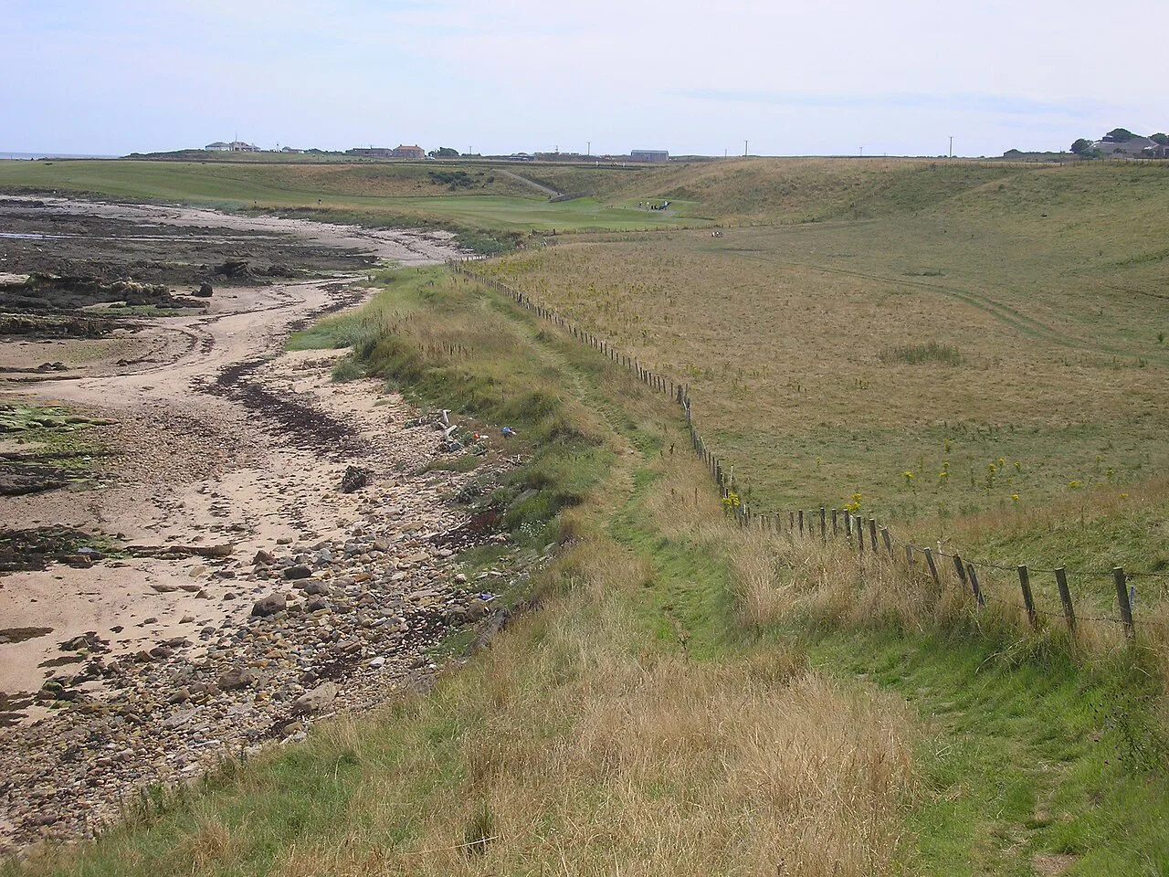
Some sections of the path are only passable at low tide, so tide times, not just daylight, should drive your daily plan. The trust's plan-your-trip pages link to tide times alongside transport and public toilets, and the trail body advises checking local tide tables before setting out.
Beyond the tides, the hazards are ordinary coastal ones: wet rocky beach underfoot, wind off the Forth and Tay, and long exposed stretches on sand. Time your beach sections for a falling tide where you can, so a slow pace does not leave you cut off on the way back.
The Elie Chainwalk option
The Elie Chainwalk near Elie Ness is an optional scramble along the cliffs, with chains fixed to the rock, and the trail body describes it as Scotland's secret via ferrata. It needs agility, a good head for heights and careful tide timing rather than technical climbing skill, and it should not be folded into your main route distance.
Treat it as a side trip on a rest day or a short stage: arrive at low tide, wear shoes with grip, and skip it in wet or windy conditions. Hikers who enjoy this kind of ground will find plenty of bigger challenges in Scotland's higher hills, and our munros guides explain how to start on those safely.
Huts, accommodation and luggage transfer
There are no mountain bothies or huts on this route; the accommodation is B&Bs, guest houses, inns and hotels in the towns and villages. The trail body notes that beds are plentiful except on the Balmerino to Newburgh stretch, and it recommends booking early, particularly in summer.
Wild camping is legally allowed in Scotland if practised responsibly under the Scottish Outdoor Access Code, which gives you a fallback where beds are scarce. If you would rather not camp, self-guided operators such as Macs Adventure sell itineraries of five, six or eight walking days with luggage transferred between B&Bs, guest houses and inns, and GPS navigation on their app.
When to go and how long to allow
Allow ten days for the full route if you want a comfortable pace, as the trail body advises, though fit walkers with good weather can compress it. Spring and early summer bring long days and nesting seabirds; late summer and autumn often give settled weather, while winter days are short and the wind and wet ground slow you down.
The full walk is 8 to 10 days on a self-guided or independent basis, but many visitors take only the eastern half, from Elie to St Andrews, where the villages and beaches are concentrated. If you have just a long weekend, pick a stretch with a railway station at each end and walk it one way.
Public transport and daily logistics
Because trains and buses run along most of the coast, you can walk the path as a series of day stages based in one or two towns rather than carrying a pack the whole way. Base yourself in Kirkcaldy or Burntisland for the western stages, and in Anstruther or St Andrews for the East Neuk.
Book your final day's transport before you start, since the Newburgh end is the weak link. For walkers extending their Scottish trip, the great glen way offers a contrasting inland route with its own transport plan, and our dedicated guide covers it separately.
Plan Your Visit
The Fife Coastal Path rewards planning more than fitness: eight sections, 187 km and 1,865 m of ascent are within reach of most regular walkers, provided the tides and the final day's transport are sorted in advance. Decide early whether you want the full Kincardine-to-Newburgh route or the shorter bridge-to-bridge version, then book beds and trains around the sections that suit your days.
Check tide times and the trust's current notices for toilets and path issues before you travel, and keep a printed map or guidebook in your pack alongside the waymarkers. With the logistics settled, the walk itself is simple: follow the coast, take the villages as they come, and leave time for the beaches.
Frequently Asked Questions
How long is the Fife Coastal Path?
The full route from Kincardine-on-Forth to Newburgh is 187 km (117 miles) with roughly 1,865 m (6,120 ft) of ascent, according to the Scotland's Great Trails listing. The trust's own pages divide it into eight sections, each with its own distance and approximate walking time.
How many days should I allow for the Fife Coastal Path?
Plan for 8 to 10 walking days on the full route, and allow ten if you want a comfortable pace. Shorter versions, such as the bridge-to-bridge route from North Queensferry to Newport-on-Tay, are sold by some operators for walkers with a week to spare.
What is the prettiest part of the Fife Coastal Path?
The East Neuk stretch between Elie and Crail, with its fishing villages, harbours and sandy bays, is the one most walkers single out. The sections around St Andrews and Tentsmuir also offer long beaches and estuary scenery.
Is the Fife Coastal Path difficult?
The climbing is modest, but the underfoot conditions vary from level paths to wild, rocky beach, and some sections are only passable at low tide. It is a good first long-distance walk because the waymarking is clear and map-and-compass skills are not essential.
Do I need to time my walk around the tides?
Yes. Some stretches are only passable at low tide, so check local tide tables before each day and plan beach sections accordingly. The trust's plan-your-trip pages link to tide times and other practical information.
How do I reach the start and finish by public transport?
Kincardine and the towns along the south Fife coast are served by buses and ScotRail trains, and public transport covers the route as far as Newport-on-Tay. The stretch between Balmerino and Newburgh is hard to reach by public transport, so arrange a lift or taxi for the final day.
Can I walk the Elie Chainwalk as part of the route?
The Elie Chainwalk is an optional scramble with chains fixed to the cliffs, not part of the main trail distance. It requires agility, a head for heights and a low tide, so treat it as a separate side trip.
Where can I stay on the Fife Coastal Path?
B&Bs, guest houses, inns and hotels are plentiful in most towns and villages along the route, though beds are thin between Balmerino and Newburgh. Some self-guided operators arrange accommodation and luggage transfer, and wild camping is legal in Scotland under the Scottish Outdoor Access Code if done responsibly.
Sources
Trail notes for your next trip
Optional updates when we add or revise hiking guides.
You might also like
Continue reading
More guides you'll find useful