Mont Blanc Hiking: Tour du Mont Blanc Stages and Planning
Plan Mont Blanc hiking on the Tour du Mont Blanc: distance, ascent, stage highlights, huts, season, trailhead access and how to reach Les Houches.
On this page
Mont Blanc hiking, for most walkers, means circling the massif rather than standing on its summit. The Tour du Mont Blanc is a long-distance footpath through France, Italy and Switzerland, starting and finishing at Les Houches near Chamonix, with a standard route that crosses a series of high passes and links valley villages with mountain huts. It suits fit hillwalkers who are comfortable with five to eight hours of walking a day and repeated ascents of several hundred metres.
This guide treats the circuit as a planning problem: how far and how high each section is, which direction to walk, where to sleep, how lifts and buses reach the trail, and how the season changes the ground underfoot. The climbing route to the 4,808 m (15,774 ft) summit of Mont Blanc is a separate mountaineering objective and is not covered here.
What Mont Blanc hiking means: the circuit versus the summit
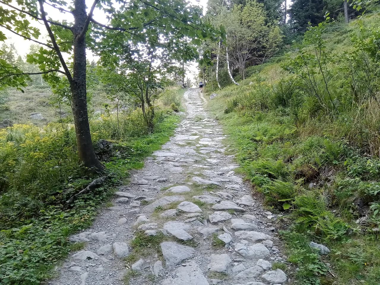
The Tour du Mont Blanc is a walking trail, not a climbing route. It uses waymarked paths, forest tracks, ski pistes and some country lanes, and there is no glacier travel, via ferrata or rock climbing on the standard route. The route is well marked through all three countries, though signage varies and a map and compass remain part of the kit.
Reaching the summit of Mont Blanc is a mountaineering ascent with glacier terrain, and it follows a different set of rules, gear and guiding expectations from the walk. If your goal is the summit, treat it as a separate trip and plan it with a qualified mountain guide; if your goal is a multi-day alpine trek with villages, huts and passes, the circuit is the right choice.
Distance, ascent and the shape of the circuit
The circuit is usually quoted as roughly 160–180 km (100–112 miles) with about 8,000–10,600 m (26,000–35,000 ft) of total ascent, depending on the exact route, variants and where you start and stop. That range reflects real choices: the main route, the higher variants, and how many valley detours you add. Plan on 10 to 11 walking days for the full loop at a steady pace, or 7 to 9 days if you are fit and keep the days long. Shorter alpine options exist if you want a comparable multi-day fix, such as hiking in Annecy around its lake and ridges, and our guide to hiking in France covers other long-distance trails if you want to compare regions.
The highest point on the standard route is usually given as around 2,500–2,600 m (8,200–8,500 ft), at passes such as Col de la Seigne or Grand Col Ferret, while the higher variants reach around 2,665 m (8,743 ft). Daily stages typically cover 12–22 km (7–14 miles) with 700–1,400 m (2,300–4,600 ft) of ascent, so the trek rewards a steady rhythm rather than occasional big days.
Which direction to walk and where to start
Most hikers walk counter-clockwise from Les Houches, heading south into the Bionnassay valley and crossing into Italy before Switzerland. This puts the Italian flanks, the Grand Col Ferret and the Swiss valleys in the second half, when your legs and mountain judgement have settled. The clockwise direction is less crowded on some sections but reverses the steepest ascents and can be harder on the knees.
Les Houches is the practical start and finish, with buses into Chamonix and road access from the Arve valley. If you are short on time, the western half from Les Houches to Courmayeur makes a complete five-day walk, and the eastern half from Courmayeur back to Chamonix is its own trip. Starting in Courmayeur or Champex is also possible if your accommodation is easier to secure there.
Stage highlights: Les Houches to Les Contamines
The first stage climbs from Les Houches to Col de Voza at 1,653 m (5,423 ft), then descends through the Montjoie valley villages to Les Contamines. The high alternative over Col de Tricot at 2,120 m (6,955 ft) is harder but gives close views of the Bionnassay glacier. Either way, the first day is a fitness test rather than a technical challenge.
From Les Contamines the route follows the Bon Nant valley to the church of Nôtre Dame de la Gorge, then climbs past Refuge la Balme to Col du Bonhomme at 2,329 m (7,641 ft) and Col de la Croix du Bonhomme at 2,479 m (8,133 ft). The descent to the hamlet of Les Chapieux is grassy and long, and this is one of the toughest stages in terms of total ascent.
Over Col de la Seigne into Italy
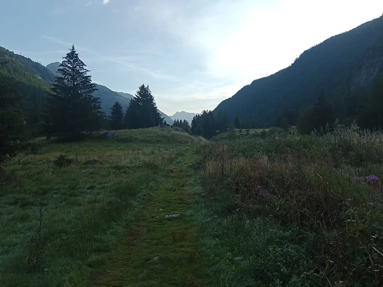
The route continues up the Vallée des Glaciers past Refuge des Mottets to the Italian border at Col de la Seigne at 2,516 m (8,255 ft). The view from the col stretches along the Val Veni and Italian Val Ferret toward the Grand Col Ferret, with the Mont Blanc massif on the left. From there the path drops to Rifugio Elisabetta, below a trio of glaciers.
The next stage descends toward Val Veni with the Glacier du Miage in view, then takes a high route along the northern slopes of Mont Favre for better views of Mont Blanc. From Col Checroui the path drops steeply down ski runs to Dolonne and into Courmayeur, a lively Italian town with shops and restaurants and a natural rest stop.
Courmayeur, Rifugio Bonatti and the Grand Col Ferret
Leaving Courmayeur, the route passes Rifugio Bertone on the way to Rifugio Bonatti, with options to make the day easier or harder. The long grassy ridge of Mont de la Saxe is a variant rather than the main trail, but it gives a sustained lookout over the Mont Blanc range and is worth the extra effort in clear weather. The main route crosses Col Sapin at 2,436 m (7,992 ft) and Pas Entre Deux Sauts at 2,524 m (8,281 ft) before reaching the hut.
From Rifugio Bonatti the path traverses the hillside before the stiff climb to Grand Col Ferret at 2,537 m (8,323 ft), where you cross into Switzerland. The Glacier de Pre de Bar dominates the view to the north, and from the col you can look back over the Italian stages. The descent runs gently past la Peule to the Swiss Val Ferret and the village of La Fouly.
Champex, Trient and the return to Chamonix
The Swiss section is gentler in places, with the stage from La Fouly to Champex following meadows, the Drance de Ferret and the Crête de Saleina moraine before a gradual climb to Champex. This is the easiest and lowest stage of the Tour, crossing no passes, and it makes a good rest-day base. From Champex the route splits: the main path climbs to the alp of Bovine at 1,987 m (6,519 ft), while the alternative crosses the Fenêtre d'Arpette at 2,665 m (8,743 ft).
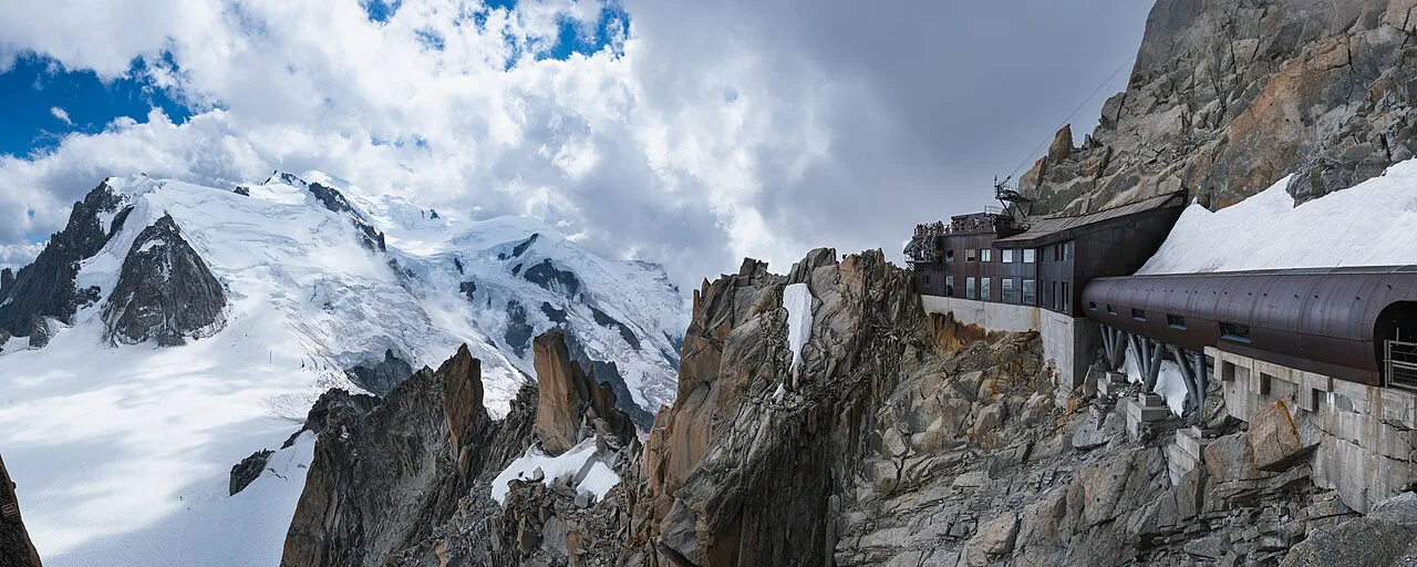
From Trient the route climbs steeply to Col de Balme at 2,131 m (6,991 ft), where the Chamonix valley and Mont Blanc come back into view. The path then follows the narrow ridge of Aiguillette des Posettes at 2,201 m (7,221 ft) and descends to Tré-le-Champ and Argentière. The final stages traverse the Aiguilles Rouges above the Chamonix valley, with a diversion to Lac Blanc and a finish over Le Brévent at 2,525 m (8,284 ft).
Route variants: Col de Tricot, Col des Fours and Lac Blanc
The main route is only one option on a network of paths. Col de Tricot on the first stage is a harder, higher alternative with closer glacier views; Col des Fours extends beyond Col de la Croix du Bonhomme to around 2,665 m (8,743 ft) and is best saved for clear, stable days; and the Lac Blanc balcony above the Chamonix valley is a classic final-day detour with a famous view of the massif. Each variant adds ascent, exposure or time, so match it to the weather and your legs rather than treating it as a shortcut.
The Fenêtre d'Arpette is the most demanding variant, crossing a steep and rocky col between Champex and Trient with good balance and foot placement required. It is dramatic in stable weather but not the place to be in cloud or rain. The lower Bovine route is the safer, more relaxed choice when conditions are uncertain.
How long to take: 7 to 11 days and half circuits
A comfortable full circuit takes 10 to 11 walking days, with one or two rest days if you have the time. Fit, experienced trekkers can compress it to 7 or 8 days, but that means long days of 20 km (12 miles) or more with sustained ascent. The western half from Les Houches to Courmayeur works well as a five-day trip, and the eastern half from Courmayeur to Chamonix can be walked in a similar window.
Where you sleep determines the shape of each day. Huts and villages are spaced unevenly, so a hut booking in one place can turn an easy stage into a long one. Many walkers plan around the key huts and then adjust the days between them, rather than fixing a rigid daily distance.
Huts and accommodation: booking and half-board
Accommodation on the circuit ranges from mountain huts with dormitories to valley hotels and gîtes. Most huts offer half-board, with dinner and breakfast included, and many also have private rooms subject to availability. Dormitories are the norm, so bring a sleeping bag liner, earplugs and a headlamp.
Popular huts for July and August, such as Rifugio Elisabetta and Rifugio Bonatti, fill months ahead, so aim to have your itinerary confirmed by February for peak-season dates. For late August and September there is more flexibility, but the best-placed huts still go first. The hut operator or alpine club that runs each refuge sets its own booking window and cancellation terms.
Camping and bivouacking rules by country section
Wild camping rules differ between France, Italy and Switzerland. In France, bivouacking above a certain altitude and outside protected areas is generally tolerated if you arrive late and leave early, while camping in the Contamines-Montjoie nature reserve is restricted. In Italy and Switzerland, wild camping in national parks and nature reserves is largely prohibited.
Designated campsites exist in several valley towns, including Les Contamines, Courmayeur, Champex-Lac and Trient, and they can be a useful budget option on rest days. If you plan to camp, research the rules for each country section before you go and carry cash for small sites.
Getting to Les Houches and Chamonix from Geneva
Geneva is the nearest major airport to the circuit. Shared shuttle buses run from Geneva to Chamonix and Les Houches, and the journey takes roughly one and a half hours depending on traffic and border checks. Trains and private transfers are also available, so compare timetables before booking your flight.
Les Houches is a short bus or taxi ride from Chamonix, and local buses link the valley villages. If you are starting in Courmayeur or Champex, plan a transfer through the Mont Blanc Tunnel or the Swiss road network. Book your onward transfer at the same time as your hut reservations, since late arrivals can miss the last valley bus.
Lifts and shortcuts that shorten stages
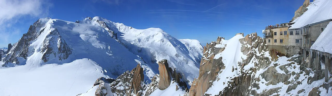
Several lifts can shorten or exit stages. From Les Houches, the Bellevue cable car skips the initial climb to Col de Voza, which is useful if you arrive late or want a gentler first day. Above Chamonix, the La Flégère and Planpraz lifts connect the valley with the Grand Balcon Sud and the Le Brévent area, giving an easy escape from the final stages or a head start on them.
Lift operating seasons vary, and some close outside the main summer window. Check the lift operator's timetable before you rely on a lift to catch a bus or a hut booking, and have a walking alternative in mind.
When to go: June to September month by month
The main season runs from mid-June to mid-September, though the best window depends on your priorities. June can still have snow on the higher passes, including Col de Tricot, Col Ferret and the Fenêtre d'Arpette, and some huts may be on limited service. July brings full hut service and long, warm days, but afternoon thunderstorms are common, so aim to reach your hut by early afternoon.
Late August is often the sweet spot, with fewer crowds after the French school holidays and stable weather, though the UTMB race week in late August brings thousands of runners and spectators to Chamonix and can make the town and some huts exceptionally busy. September has beautiful light and far fewer people, but early-season snow can arrive on the high passes from mid-September and some huts begin closing in the first two weeks of the month.
Hazards: exposure, ladders, snow and storms
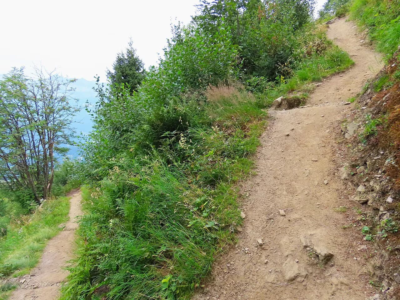
The circuit is a walk, but it crosses rocky and exposed ground. Three sections above the Chamonix valley use metal ladders or steps, and the two hardest of these can be avoided by alternative routes. The Fenêtre d'Arpette and Col des Fours variants cross steeper, looser ground and require good balance and foot placement.
Snow can fall in any summer month, usually as a light coating on the higher passes that clears within a day or two, but it can make navigation harder and hide ground features. Afternoon storms are common in July and August, and exposed cols and ridges are the wrong place to be when thunder starts. Start early, watch the sky and be prepared to turn back or take a lower variant.
Fitness, training and pack weight
The circuit is manageable for fit mountain walkers who can walk five to seven and a half hours a day with a pack, but it is not a beginner's first multi-day trek. Build an eight- to twelve-week training programme with back-to-back long days, stair climbing and loaded-pack walks. Train your descents too, since the long, steep drops take a toll on knees and quads.
Keep your pack light: a sleeping bag liner, a warm layer, waterproofs, water, snacks and a map and compass cover the essentials. Half-board at huts reduces the food you need to carry, and refilling water at fountains and streams along the route is usually possible. If you want the logistics handled for you, self guided and fully guided formats exist; compare what each includes before you book.
Plan Your Visit
Mont Blanc hiking on the Tour du Mont Blanc rewards planning more than improvisation. Choose your direction, decide whether you are walking the full circuit or a half, and build your days around hut availability rather than an ideal daily distance. Book the popular huts early, train on long days with a pack, and keep a flexible plan for weather.
If you would rather have the itinerary, huts and transfers arranged, guided and self-guided hiking tours are available through operators who work this route each season. Compare what each format includes, then match it to your fitness, time and appetite for logistics.
Explore more Mont Blanc hiking guides
Frequently Asked Questions
Is the Tour du Mont Blanc hard?
It is a serious multi-day trek rather than a technical climb. Expect five to eight hours of walking a day, repeated ascents of several hundred metres and some exposed rocky sections with ladders. Fit hillwalkers with prior multi-day experience manage it well; beginners should train first and consider a half circuit or a guided format.
How many days does the Tour du Mont Blanc take?
Most walkers take 10 to 11 days for the full circuit, with rest days added if time allows. Fit trekkers can compress it to 7 or 8 days, while the western or eastern halves can each be walked in about five days. Hut spacing often shapes the itinerary more than a fixed daily distance.
How much ascent is there on the Tour du Mont Blanc?
Sources give a range of roughly 8,000–10,600 m (26,000–35,000 ft) of total ascent, depending on the route, variants and where you start and stop. Daily stages typically include 700–1,400 m (2,300–4,600 ft) of climbing, so a steady pace matters more than one big day.
When is the best time to hike the Tour du Mont Blanc?
Mid-June to mid-September is the main season. July has full hut service but frequent afternoon storms, late August is quieter after the French holidays but busy around UTMB race week, and September has fewer people but can bring early snow and hut closures. June often still has snow on the higher passes.
Can you hike the Tour du Mont Blanc without a guide?
Yes. Most people walk it self-guided, and the route is well marked through France, Italy and Switzerland. A map and compass are still essential for cloudy spells and confusing junctions, and the higher variants such as the Fenêtre d'Arpette demand sure footing and stable weather.
Do you need to book huts on the Tour du Mont Blanc in advance?
Yes, especially for July and August, when popular huts fill months ahead. Aim to confirm your itinerary by February for peak-season dates, and have a backup plan for full huts, such as a valley gîte or a split stage. Late August and September offer more flexibility.
Can you walk up Mont Blanc?
The summit of Mont Blanc is a mountaineering ascent with glacier terrain, not a hiking route. The Tour du Mont Blanc circles the massif on footpaths and does not go to the summit. Treat a summit attempt as a separate objective planned with a qualified mountain guide.
How do you get to the Tour du Mont Blanc start from Geneva?
Geneva is the nearest major airport. Shared shuttle buses run from Geneva to Chamonix and Les Houches in roughly one and a half hours, and trains and private transfers are also available. From Chamonix, local buses and taxis reach Les Houches and the valley villages.
Sources
Trail notes for your next trip
Optional updates when we add or revise hiking guides.
You might also like
Continue reading
More guides you'll find useful