Hiking in Switzerland: Where to Go, Best Trails and Seasons
Plan hiking in Switzerland with day hikes in the Bernese Oberland, lift access, hut-to-hut routes, trail times and the season that suits each route.
On this page
Switzerland rewards hikers who plan around transport as much as terrain. A dense rail and cable-car network puts you on a high trailhead in the morning and back at a valley station by late afternoon, so a single week can mix an easy lake loop with a long ridge traverse. The trade-off is cost and weather: rail passes and lift tickets add up, and high passes hold snow well into summer. Choosing one base village and one long-distance objective before booking keeps the week coherent.
This guide groups the country by hiking region, then works through named routes with the start, finish, lift access and figures the official sources give. Bernese Oberland day hikes come first because they are the easiest to string together from car-free villages, followed by the Kandersteg lake basin, the high Valais terrain around the Aletsch Glacier, and the long Via Alpina stages in the north. Read the difficulty ladder before you commit: a 10-mile (16 km) traverse with 3,200 ft (975 m) of ascent and a 3.6-mile (5.8 km) climb straight up a ski slope are not interchangeable days.
Why Switzerland suits hikers
Three things make Swiss hiking unusually efficient. Marked trails run from almost every village, staffed mountain huts and restaurants sit on the main routes, and trains, postbuses and cable cars connect the valleys to the trailheads. You can walk point to point for days and return by public transport rather than backtracking. The catch is that you pay for that convenience in lift fares, hut nights and rail tickets, so budget and itinerary have to be planned together.
The Bernese Oberland is the classic introduction: the villages of Wengen, Mürren and Grindelwald sit under the Eiger, Mönch and Jungfrau, and a web of trains and gondolas links them. Wengen is car-free, which means parking in Lauterbrunnen and riding up by train; the village train runs roughly every half hour and the ride takes under twenty minutes, according to one hiker's account. That rhythm sets the shape of a day: ride up, walk across, ride down from a different valley station.
If you would rather let someone else handle the logistics, guided and self-guided formats exist for the classic routes, and comparing what each includes is a planning decision in itself. The rest of this guide assumes you build your own days, with lifts and trains slotted into the route plan.
The main hiking regions and who each suits
The Bernese Oberland suits hikers who want big views with short approaches and are happy to pay for lifts. The villages are small, the network dense, and the days range from an hour's meadow stroll to a full traverse. It is the best first choice if you have a week and want variety without moving hotels.
Valais and the Aletsch area suit stronger hikers who want altitude and glaciated scenery. Terrain is higher and routes are longer, and a guided or self-guided high-altitude itinerary in the Valais is pitched at hikers with solid fitness and some technical comfort. Expect more time above the treeline, more weather exposure and a longer season margin than in the Bernese Oberland.
The Alpstein, in eastern Switzerland, offers limestone summits and ridge walking in a more compact range, and it appears among Hut to Hut Hiking Switzerland's itineraries alongside the Aletsch Glacier Panorama Trail. Nearby, the Hardergrat ridge above Brienzersee carries several celebrated summits, including Augstmatthorn. Both regions reward hikers who want sharper terrain than the meadow traverses further west.
Bernese Oberland: day hikes from Wengen, Mürren and Grindelwald
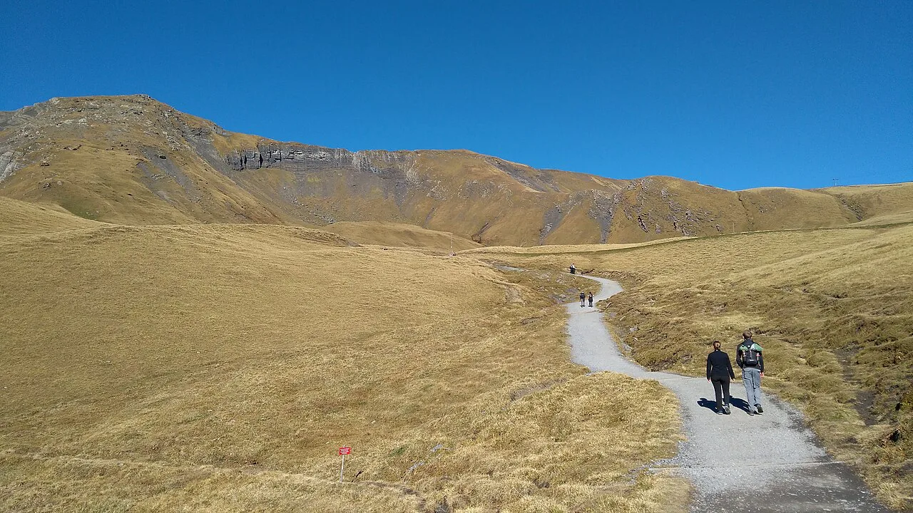
From Wengen, the walk up to Männlichen is the defining climb of the area: 3.6 miles (5.8 km) point to point with 3,441 ft (1,049 m) of gain, which a fit party took about two and a half hours to complete. The grade is listed as moderate but feels harder because it climbs straight up a ski slope without switchbacks. Ride the Wengen–Männlichen cable car up and walk down if you want the views without the grind.
At the top, restaurants at Männlichen let you eat and warm up before descending. The last cable car down to Wengen leaves around 5pm, so plan the day around that rather than starting late. Carrying a snack for the climb matters at this altitude, where the effort feels heavier than the distance suggests.
Mürren to Gimmelwald is the opposite kind of day: 1.7 miles (2.7 km) of mostly downhill walking rated easy, with flower meadows, chalets and the snow-capped peaks across the valley. A cable car at Gimmelwald takes you back up to Mürren, where the Mürren Flower Trail adds 1.4 miles (2.3 km) of easy point-to-point walking. These are family days, and the playgrounds along the way show why the area works for mixed-ability groups.
Getting to Mürren takes a train down to Lauterbrunnen, a cable car to Grütschalp and then a mountain railway up to the village, which a visitor priced at roughly twenty dollars each way. If you carry a Swiss rail pass, check whether the segment is covered before buying a separate ticket. Staying in Mürren rather than day-tripping buys you quieter mornings before the first train arrives.
Classic Bernese traverses: Wengen to Männlichen and on to Kleine Scheidegg
Männlichen to Kleine Scheidegg is the panorama day: 5 miles (8 km) rated moderate but mostly flat or gently downhill, with the Eiger north face ahead and the Jungfrau across the valley. Ride the gondola up to Männlichen, walk across to Kleine Scheidegg, then continue down the wide road track to Wengen for a few more miles of easy descent. Finishing at Bergrestaurant Allmend, close to Wengen, gives you raclette and a view as a reward.
Kleine Scheidegg itself is a railway junction with a handful of shops and chalets serving drinks and food, so it works as a bail-out point if weather turns. From here the Jungfrau railway climbs toward the high station, an option for a rest day rather than a hiking day. Keep the descent to Wengen for the afternoon, when clouds often build over the peaks.
Schynige Platte to First: the long high traverse
The Schynige Platte to First traverse is the longest standard day in the area: 10 miles (16 km) point to point, rated hard for its length, with about 3,200 ft (975 m) of ascent spread along the way. A cog railway from Wilderswil climbs to Schynige Platte, where the Berghotel sits at the trail start, and the route finishes at First above Grindelwald. Allow a full day and start early, because the walking is exposed and the weather can change. If you want to weigh this long traverse against the trails on the other side of the valley, our Grindelwald hiking guide covers the lifts and difficulty of each.
Halfway along, Berghaus Männdlenen provides a toilet stop and a cold drink in genuinely remote surroundings. Near the end, small lakes sit under snow-capped peaks, and the route reaches the First Cliff Walk, a suspended walkway on the mountainside that is free to use. From First, a gondola drops to Grindelwald and trains connect onward via Zweilütschinen back to Wengen.
Kandersteg and Oeschinensee
Oeschinensee sits in a basin above Kandersteg, reached by a cable car from the village before you even start walking. The lake loop is a 4.8-mile (7.7 km) circuit rated moderate, busy in high season but worth the crowds for the turquoise water and the cliffs above. Berghotel Oeschinen at the end serves meals on a terrace overlooking the lake.
The drive from Lauterbrunnen to Kandersteg takes about an hour, making it a long but feasible day trip from the Bernese Oberland villages, though staying in Kandersteg gives you a quieter start. Whichever you choose, check the cable car's operating season before you commit, since the lift does not run year-round. The steeper paths above the lake shore demand care with loose ground.
Valais and high altitude: the Aletsch Glacier Panorama Trail
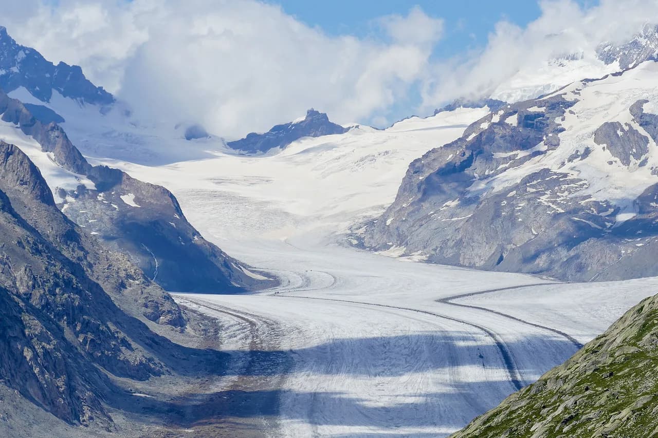
The Aletsch Glacier Panorama Trail is graded two out of five for fitness and two for technical difficulty on Hut to Hut Hiking Switzerland's scale, making it the gentlest of the high-altitude options they run. The route looks onto the longest glacier in the Alps and spends its length above the treeline, so weather and snow cover matter more than the gradient. Fit hikers with no glacier-travel experience can walk it comfortably.
The Valais High Altitude Escape is pitched higher: three out of five for fitness and four for technical difficulty, a step up for hikers moving from valley paths to steeper ground. If you want the Monte Rosa summits and passes next door, the Tour de Monte Rosa is a separate circuit based in Italy and Switzerland. Plan at least one rest day in a Valais week; altitude and long days add up.
Long-distance and hut-to-hut options
The Via Alpina's Bear Trek is the best-known Swiss section, a nine-day itinerary rated four out of five for fitness and three for technical difficulty on Hut to Hut Hiking Switzerland's scale. It strings together high passes and hut nights across the Bernese Alps and beyond, so you carry only a day pack while a booked itinerary handles beds and meals. For a first hut-to-hut week, this is a manageable step up from day hiking.
The Walker's Haute Route is the toughest option in the operator's Swiss portfolio: fourteen days graded five out of five for fitness and four for technical difficulty. That is a serious summer commitment, and hikers should arrive with long days in their legs. For a shorter hut-to-hut introduction, compare the stages and booking arrangements before committing to a full fortnight.
Hut-to-hut weeks depend on beds: alpine club huts take bookings, and half-board arrangements are the norm on the classic routes. Decide whether you want a self-guided itinerary with booked beds or a fully guided trip, and check whether luggage transfer is included for valley nights. Stage length matters more than total distance; a run of short stages with one big pass day is easier than seven medium days back to back.
Distance, ascent and time: reading Swiss trail grades
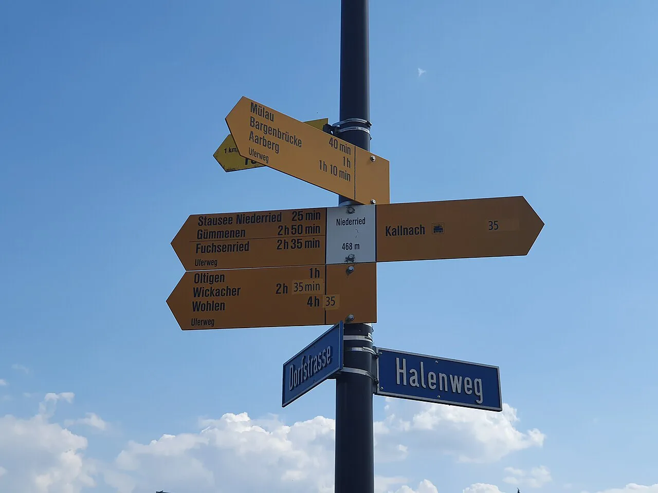
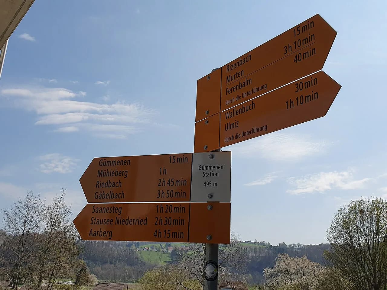
Swiss signposts give destination, altitude and a walking time in hours and minutes, calculated for an average pace that many hikers beat downhill and struggle to match uphill. Treat the posted time as a minimum for the ascent and add breaks. A route graded moderate in a guidebook can still feel hard if it climbs a uniform slope, as the Wengen to Männlichen path does.
Ascent figures are the better planning tool. Roughly 3,200 ft (975 m) spread over 10 miles is a comfortable day, while 3,441 ft (1,049 m) over 3.6 miles is relentless. Match the ratio to your fitness, not the headline distance.
Getting to trailheads by train, bus and cable car
Swiss trailheads are mostly reached by public transport, and that shapes what you carry. Zurich is the closest airport to the Lauterbrunnen valley, about a two-hour drive away, and the mountain railways then climb to the villages. Wengen is car-free, so you park at the Lauterbrunnen station garage and ride up; parking cost one visitor about twenty dollars a day.
Cable cars and gondolas are the second half of most itineraries. The Wengen–Männlichen aerial cableway, the Grindelwald–Männlichen gondola, the Schynige Platte cog railway and the First gondola each serve different trails, and each has its own operating season and last-ascent time. Check the lift company's timetable for the day you plan to walk, and build in a fallback in case the lift closes for wind.
A car helps for valley-to-valley moves such as Lauterbrunnen to Kandersteg, but it hurts in car-free villages where you pay to park it. Base yourself on a rail junction if you plan to move between regions.
Huts and booking
Staffed huts on the main routes sell meals and drinks, and some smaller chalets on the trails only take cash, so carry Swiss francs even if you pay by card elsewhere. On long traverses, huts such as Berghaus Männdlenen serve as the mid-route stop for food and a toilet break. Book hut beds ahead in July and August, when the classic routes fill.
For a booked hut-to-hut week, the itinerary operator handles beds and half-board; independent hikers book directly with the alpine club or hut keeper. Either way, confirm the hut is open for your dates before you build a route around it.
When to go
July to September is the reliable window for high routes, with the longest days and the most stable weather. June often still holds snow on passes above 2,000 m (6,560 ft), and early October storms can close lifts for the season. One hiker, visiting in September, timed a cheese festival into a rest day on her trip.
Afternoon thunderstorms are the main summer hazard on exposed ridges: start early, plan to be off the crest by early afternoon, and carry a shell even on clear mornings. In shoulder months, ask at the tourist office about snow on the specific pass you plan to cross.
Where to base yourself
Wengen suits hikers who want the widest choice of trails from the door, with the Männlichen cable car and the train to Lauterbrunnen close by. Mürren is quieter and prettier, better for slow days and the Gimmelwald walk, but every outing starts with a train and cable car. Grindelwald gives direct access to the First gondola and the Schynige Platte traverse finish.
Kandersteg works as a base for the Oeschinensee basin and the surrounding valleys, and it is a short train ride from the Bernese Oberland villages. Valley towns such as Interlaken and Lauterbrunnen are cheaper and more practical for drivers, at the cost of a daily commute uphill.
Gear and preparation
Swiss trails are well made but not uniform: rocky sections, exposed ridge walking and snow patches on north-facing slopes call for boots with grip rather than trainers. Carry layers, sunscreen, water and snacks, since a planned three-hour walk can stretch when you stop for the views.
For via ferrata terrain, a guided introduction is the sensible first step, and the equipment differs enough from hiking kit that borrowing or renting before you buy is worth it. Compare routes by grade and access before committing a day to one.
Difficulty ladder: from meadow walks to glacier viewpoints
At the easy end, the Mürren to Gimmelwald walk and the Mürren Flower Trail are short, mostly downhill and suitable for families. Next come the panorama traverses, such as Männlichen to Kleine Scheidegg, where length rather than steepness is the challenge. Above that sit the long high days, including Schynige Platte to First and the Wengen to Männlichen climb.
The hardest tier covers multi-day routes such as the Walker's Haute Route and high-altitude itineraries in Valais, where exposure, snow and long days combine. Choose honestly, and build one rest day into any week that includes a five-out-of-five fitness route.
Practical costs and reservations
Lift tickets, rail fares and hut nights are the three costs that shape a Swiss hiking budget, and all three are volatile. A visitor found cable car tickets notably expensive and food and transport high overall, so set a daily budget before you book. Prices for the specific lifts and huts you plan to use come from the operator or the alpine club.
Reserve hut beds and any guided itinerary early for July and August, and check the deposit and cancellation terms when you book. Self-guided tours usually include booked beds and sometimes luggage transfer, while guided trips add a leader and fixed dates.
Nearby options outside Switzerland
If your trip runs long, the French and Italian Alps extend the same style of hut-to-hut walking beyond the Swiss border, with their own booking systems and seasons.
Plan Your Visit
Start with one base and one long objective. Wengen or Mürren for a first Bernese Oberland week, Kandersteg for the lake basin, and a booked hut itinerary for a Via Alpina or Haute Route attempt. Fit the lift timetable and the weather window around the walking, not the other way round. If you are still weighing this trip against other ranges, our Best Hikes in Europe: Where to Walk and What to Choose puts the Swiss options alongside the rest of the continent.
Check lift seasons, hut opening and trail conditions with the specific operator or hut keeper before you travel, then pack for a cold morning and a stormy afternoon even in midsummer.
Explore more Switzerland hiking guides
Frequently Asked Questions
What is the best time of year for hiking in Switzerland?
July to September is the dependable window for high routes, with long days and the most settled weather. June can still hold snow on passes above 2,000 m (6,560 ft), and autumn storms can end the lift season early. For valley and meadow walks, late spring and early autumn are quieter and still comfortable.
Which Swiss hikes suit beginners?
The Mürren to Gimmelwald walk and the Mürren Flower Trail are the gentlest introductions, both short and mostly downhill. Männlichen to Kleine Scheidegg is longer but mostly flat or gently descending. Save the Schynige Platte to First traverse and the Wengen to Männlichen climb for later trips.
How difficult is the Via Alpina?
The Bear Trek section is graded four out of five for fitness and three for technical difficulty on the operator's scale. That means long days with real ascent, but no glacier travel or climbing. The fourteen-day Walker's Haute Route is harder, graded five for fitness.
Do I need a car for hiking in Switzerland?
No. Trains, postbuses and cable cars reach most trailheads, and car-free villages such as Wengen require you to park in the valley anyway. A car helps only for valley-to-valley moves, such as Lauterbrunnen to Kandersteg.
How do hut-to-hut hikes in Switzerland work?
You walk between staffed mountain huts, sleeping in dormitories and eating meals on site, with a day pack rather than a full load. Book beds ahead in midsummer, either through a booked itinerary operator or directly with the hut or alpine club. Some small chalets only accept cash.
What should I pack for a Swiss mountain hike?
Boots with grip, layers for a cold morning and a stormy afternoon, sunscreen, water and snacks cover most days. Carry Swiss francs for small chalets, and add a shell and warm layer for any route above the treeline.
Which base village suits which hikes?
Wengen gives the widest choice from the door, including the Männlichen cable car. Mürren is quieter and best for the Gimmelwald and flower trails. Kandersteg suits the Oeschinensee basin, and Grindelwald puts you at the First gondola and the end of the Schynige Platte traverse.
Sources
Trail notes for your next trip
Optional updates when we add or revise hiking guides.
You might also like
Continue reading
More guides you'll find useful