Haute Route Hike: Chamonix to Zermatt Trail Guide
The Walker's Haute Route hike runs 213 km from Chamonix to Zermatt over high Swiss passes. Get the stages, ascents, huts, season and trailhead access.
On this page
The Walker's Haute Route is the long-distance hike from Chamonix, beneath Mont Blanc, to Zermatt, beneath the Matterhorn, and it strings together the finest high passes of the French and Swiss Alps in roughly two weeks. It suits fit mountain walkers who are comfortable with six to eight-and-a-half-hour days on rocky, steep ground and who want a route that builds steadily toward a dramatic finish. This guide breaks the trek into stages so you can judge which sections match your time, fitness and nerve.
What the Haute Route hike is
The Walker's Haute Route is a walking trail of about 213 km (132 mi) from Chamonix in France to Zermatt in Switzerland, crossing from the Mont Blanc massif to the Matterhorn. It is not a single marked path: the route follows existing paths, tracks and farm lanes that have been linked into a recognized itinerary, so your exact distance and daily stages shift with the alternatives and transport you include. Do not confuse it with the Classic Haute Route, which is a ski and mountaineering line across glaciers and runs generally to the south.
Expect continuous mountain terrain rather than a valley ramble. The route climbs over a succession of cols, drops into working Valais villages, and spends long stretches in remote high basins where the path is rocky, loose or faint. Alpine Exploratory rates it as the most challenging of its Alpine treks, suitable for walkers already used to similar distance, terrain and height gain.
Distance, ascent and the highest point
The classic itinerary covers about 213 km (132 mi) with roughly 14,000 m (46,000 ft) of elevation gain. Alpine Exploratory puts the standard route at 221 km (137 mi) with around 15,200 m (49,867 ft) of climb, a reminder that variant choices and overnight stops change the totals. Either way, plan for sustained ascent rather than one or two big days.
The highest point on the standard route is Col de Prafleuri at 2,987 m (9,800 ft), reached on the tough stage between Cabane du Mont Fort and Cabane de Prafleuri. Most other passes sit between roughly 2,100 m and 2,900 m (6,900–9,500 ft), so you spend days at altitude without ever needing glacier travel or technical climbing.
Choosing a direction: Chamonix to Zermatt or the reverse
Almost everyone walks west to east, from Chamonix to Zermatt, and most guidebooks and organized itineraries follow that direction. The scenery builds gradually from the Mont Blanc valleys into the remoter Swiss passes, and the Matterhorn grows more prominent until the final descent into Zermatt. Travelling west to east can also put more of some morning stages in shade.
Reversing the route to start in Zermatt gives you a quieter trail and a different sequence of climbs, finishing beneath Mont Blanc instead. The trade-off is practical: trail reports and updates are published in the standard direction, so you will need to read them backwards when planning. Pick the direction that matches your transport and your appetite for company.
Where to start and finish, and how to reach each end
Chamonix is the traditional start, with direct connections from Geneva and a full range of shops for last-minute gear. Zermatt is car-free and reached by train through Visp and Täsch, which makes it an easy finish or an alternative start. Champex-Lac, reached via Orsières, suits hikers who have already walked the shared sections near Chamonix, while Évolène, reached via Sion, gives a shorter eastern itinerary through the Val d'Hérens and Moiry.
If you want a short break inside the trek rather than at either end, Arolla, Champex and Zinal all work as rest stops, and some operators build one or two rest days into their schedules there. Confirm lift and bus times for your chosen start before booking lodging, because the first stage depends on them.
The stages from Chamonix to Le Châble
The first stage leaves Chamonix at around 1,000 m (3,281 ft) and climbs to Lac Blanc at 2,352 m (7,717 ft), with a cable car available to shorten the gain, before a steep descent to Argentière. A lower valley variant reaches Argentière through woods and meadows without the high lake. Either way, the day is a hard introduction.
From Argentière the route crosses the grassy Col de Balme at 2,131 m (6,991 ft) and drops to Trient for the first night in Switzerland. The next stage offers a choice between the alpage of Bovine at 1,987 m (6,519 ft) and the challenging Fenêtre d'Arpette variant at 2,665 m (8,743 ft), a steep rocky crossing with views toward the Trient Glacier. Both end at Champex-Lac.
A largely valley stage then descends through woods and fields to Sembrancher, where the railway from Martigny connects, and continues across the valley floor to Le Châble. Treat it as a recharge day before three hard stages of sustained ascent.
The high crux: Mont Fort, Lac de Louvie, Prafleuri and Arolla
From Le Châble the route gains about 1,700 m (5,577 ft) to Cabane du Mont Fort at 2,457 m (8,061 ft), with cable cars available to skip part of the climb. The hut sits in a grand setting rimmed by jagged peaks, with Mont Blanc visible in clear weather. This is where the trek shifts from rural valleys to the high mountains.
The following stage is the hardest: two or four cols depending on your choice, including Col de la Louvie and Col de Prafleuri at 2,987 m (9,800 ft), across a remote, bouldery basin above Lac de Louvie. Alpine Exploratory advises against hiking this stage in bad weather and recommends the escape routes instead. Navigation is genuinely difficult here when visibility drops, so carry a map and compass and know how to use them.
The next day climbs over Col des Roux into the Grande Dixence reservoir basin, skirts the Glacier de Cheilon, then takes the steep, loose Col de Riedmatten with chains in place to help the ascent. A gentler descent leads to Arolla at the head of the Val d'Hérens. Chains make the col safer but do not remove the exposure, so keep your hands free and your footing deliberate.
Val d'Hérens and Val d'Anniviers: La Sage, Moiry, Sorebois and Zinal
After the crux, a moderate day drops to Les Haudères and climbs above the valley to La Sage, a stone-roofed Valais village where agriculture continues around you. The Lac Bleu makes a worthwhile detour on the way. Use the shorter day to restock and recover before the next big climb.
The route then crosses Col du Tsaté at 2,868 m (9,409 ft) and descends to the Lac de Moiry basin before a second climb to Cabane de Moiry, with about 1,690 m of ascent across the day. The reward is a night beside the Glacier de Moiry. From there the route traverses high above the lake and climbs the grassy Col de Sorebois at 2,835 m (9,301 ft) before a long descent to Zinal.
Across the Turtmann valley and Augstbordpass to St Niklaus
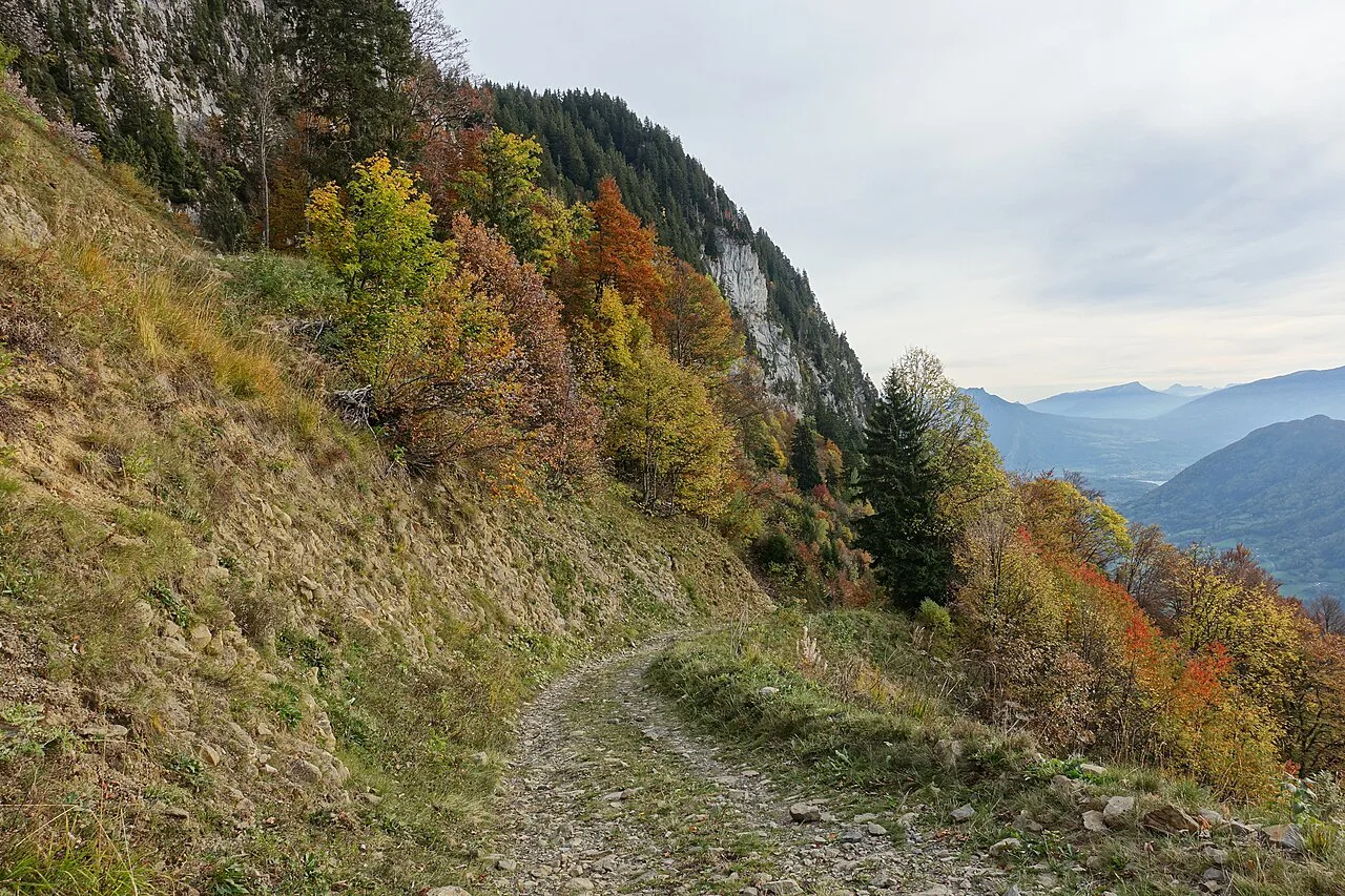
From Zinal the route climbs the rocky Forcletta at 2,874 m (9,429 ft) at the divide into German-speaking Switzerland, then drops to the small village of Gruben in the Turtmann valley. The landscape changes here, and the valley can be explored as a quieter alternative with a possible night near the Turtmann Glacier.
The last classic up-then-down stage climbs the wide but rocky Augstbordpass at 2,893 m (9,492 ft) and descends into the Mattertal. The path passes the high alp of Jungen before zig-zagging down to St Niklaus on the valley floor. The Matterhorn stays hidden behind the valley walls for now, saved for the finish.
The Europaweg finish into Zermatt
The two-day finale follows the Europaweg high above the Mattertal, crossing improbably rocky combes and bringing the Matterhorn into view. The Charles Kuonen Suspension Bridge features on the stage into Zermatt, one of the most celebrated sections of the trek. Tunnels and avalanche-protection walls are part of the landscape here.
Europaweg routing changes because of rockfall and landslips, and recent seasons have seen closures and diversions between the Europahütte and Taschalphütte. Check current conditions close to your trip, because the high finish may not be open on the dates you walk. If the high trail is unavailable or beyond your comfort, the easier valley route from St Niklaus to Zermatt is a reasonable substitute.
Terrain and difficulty: what the cols ask of you
This is a walk, not a mountaineering route: there is no glacier travel, via ferrata or rock climbing on the standard line. There are, however, steep loose descents and ascents around the cols, boulder fields, and the very steep Col de Riedmatten with its chains. The Pas de Chevres ladders have been closed permanently because of severe rockfall, so do not plan on that alternative.
Navigation is a real part of the difficulty. Some sections are well signposted, but the stretch between Cabane du Mont Fort and Cabane de Prafleuri is notoriously hard to follow in poor visibility, and summer snowfalls can hide the ground for a day or two. Carry a map and compass and make sure at least one person in your group can use them. If technical assisted terrain is what you want, plan a separate day on a rated route rather than expecting it here.
Distances, ascent and walking time per stage
Plan on daily walking times of about six to eight-and-a-half hours on the hardest days, and more if you are slower on loose ground or take a high variant. The stage to Cabane de Moiry carries about 1,690 m of ascent, while the two crux stages between Cabane du Mont Fort and Arolla demand four cols over remote terrain. Most hikers complete the whole route in 11 to 14 days.
A fast, transport-supported itinerary of eight to ten days suits very experienced hikers or groups using trains, buses, gondolas and cable cars to skip sections. A 13- or 14-day schedule spreads the big passes into more manageable days and leaves time in the villages. There is no shortcut to the ascent itself: a shorter itinerary means harder days, not fewer metres climbed.
Mountain huts and village lodging
Accommodation is one of the attractions of the trek, mixing remote huts with family-run hotels and auberges. Mountain huts generally mean dormitories and meals, while valley villages such as Zinal, Arolla and Champex-Lac offer private rooms and a chance to dry gear. Where you sleep shapes each day's distance, so build the route around what is available for your dates.
Properties use different booking systems and open reservations at different times, so treat lodging as a planning constraint rather than an afterthought. Book huts through the hut operator or the relevant alpine club, and be ready to switch overnight stops if your first choice is full. A booking service or tour operator can handle this if you would rather not coordinate it yourself.
When to go: the summer season and snow on the passes
The trekking season runs from late June or early July into mid-September, depending on the itinerary. Alpine Exploratory runs its Walker's Haute Route trips from late July to mid-September because late-spring snow can linger on the higher passes into early July and the weather can deteriorate late in September. Snow can also fall in summer on two or three occasions, usually a light coating on the highest passes that clears in a day or two.
Aim for settled weather in July, August or early September and keep a flexible day in reserve for a storm or a snowy pass. Afternoon storms are common on summer days in the Alps, so start early on exposed stages and be ready to turn back. Snow on the Col de Prafleuri or Col de Riedmatten changes the difficulty sharply.
Camping and bivouac on the route
Camping can form part of a Walker's Haute Route itinerary, but it is difficult to rely on a tent alone for the entire trek. Established campgrounds exist near selected valley stages, while high mountain sections have no formal camping. Most camping itineraries mix campgrounds with huts and village lodging.
Bivouacking is not unrestricted wild camping. Rules vary between regions, municipalities and protected areas, and permission may depend on the exact location, elevation and land ownership. Check the local rules for the specific place you intend to sleep before you rely on it.
Transport at the start, middle and finish
Geneva Airport is the usual arrival point for hikers starting in Chamonix. Swiss trains, buses and postbuses connect the valley villages, and lifts and cable cars on several stages can cut ascent, notably above Chamonix and from Le Châble toward Cabane du Mont Fort. Confirm lift operating dates before you build a day around them.
Zermatt is car-free, reached by train through Visp and Täsch, which makes the finish straightforward if you are flying home from Zurich or Geneva. If you plan to add a rest day or a shorter trip on another Swiss route before or after, a look at the wider options helps fit the Haute Route into a longer trip, and hiking in Lucerne offers easy lake trails and peak walks as a gentler contrast to the high passes.
Getting fit for six to eight-and-a-half hour days
Arrive used to the distance, terrain and height gain you will face: this is not a trek to start cold. Build long hill days with a pack, including steep descents, and practice moving on loose scree and rough paths. The crux stages between Cabane du Mont Fort and Arolla combine four cols with remote terrain, so your longest training days should approach that effort.
If you have walked the Tour du Mont Blanc comfortably, that is a fair guide to your capacity, but the Haute Route is harder: higher passes, rockier ground and longer stretches in wild places. Train on consecutive days, not single efforts, so you know how you recover.
Guided, self-guided and luggage-transfer formats
Guided trips suit hikers who want company, a qualified leader and the logistics handled. Alpenwild, for example, runs a classic guided hotel-to-hut trek and a Deluxe version with hotels, a spa rest day and laundry service instead of huts. Self-guided trips provide the route notes, lodging and transfers while you walk independently.
Independent hikers can plan the route themselves with maps, route notes and pre-booked lodging, using a guidebook or routecard set to handle the navigation and the huts. If you are considering a guided trip, compare what is included, particularly meals, luggage transfer and transport to and from the trail.
Route alternatives and who each suits
There are many alternatives on the way, and each one changes your distance, elevation, terrain and lodging. High options include the Fenêtre d'Arpette near Champex, the panoramic Aiguillette des Posettes ridge above Le Tour, and the Lac de Louvie variant. Valley options include the Grande Dixence dam landscape and the Turtmann valley.
Some hikers stay high above the Val d'Anniviers at the historic Hotel Weisshorn before continuing toward the next valley. High alternatives can be unsuitable in poor weather, snow or difficult trail conditions, so treat them as options to choose on the day rather than fixed plans. For those already considering other Swiss long routes, comparing the Haute Route with a circuit such as the Tour de Monte Rosa clarifies the difficulty gap.
Plan Your Haute Route Hike
Start with your dates and your direction, then build the stages around the huts and villages that are available. Decide early whether you want the high Europaweg finish or the valley route into Zermatt, and leave a flexible day in case the weather or a diversion changes your plan. Fit hikers with realistic expectations get the most from this classic traverse.
If you want the same logistics support on a shorter Swiss route, look at hut-to-hut hiking options in the Valais before committing to the full two-week trek. Either way, book the huts and the transport early, and arrive ready for long days on rock and loose ground.
Frequently Asked Questions
How difficult is the Haute Route?
It is a demanding multi-day mountain walk rather than a technical climb. The standard route has no glacier travel or climbing, but it includes steep, loose cols, boulder fields and long days of six to eight-and-a-half hours. Experienced mountain walkers with good fitness and navigation skills will find it rewarding; beginners should build up on shorter routes first.
Can you hike the Haute Route without a guide?
Yes. The route follows existing paths and tracks rather than a single marked trail, so you need map and compass skills and at least one competent navigator in your group. Many hikers plan it themselves with route notes and pre-booked lodging, while others prefer a guided or self-guided tour for the logistics.
How long does the Walker's Haute Route take?
Most hikers complete the route in 11 to 14 days. A fast, transport-supported itinerary of eight to ten days suits very experienced hikers or those using lifts, buses and trains to skip sections. Longer schedules of 13 or 14 days spread out the big passes and allow time in the villages.
How much ascent is there on the Haute Route?
The classic route carries roughly 14,000 m (46,000 ft) of elevation gain, with Alpine Exploratory putting its standard line at about 15,200 m (49,867 ft). Your total depends on the variants and transport you include. Expect the biggest single day to be the climb to Cabane de Moiry.
When is the best time to hike the Haute Route?
The main season runs from late June or early July into mid-September, with many operators starting in late July to avoid lingering snow on the high passes. Snow can fall in summer on a few occasions, and afternoon storms are common, so build in a flexible day and start early on exposed stages.
Do you need to book mountain huts on the Haute Route?
Yes. Hut and hotel availability shapes your daily stages, and properties open reservations at different times. Book huts through the hut operator or alpine club and be ready to adjust overnight stops if your first choice is full. A booking service or tour operator can coordinate this for you.
Can you camp along the Haute Route?
Camping can be part of an itinerary, but it is difficult to rely on a tent alone for the whole trek. Formal campgrounds exist near selected valley stages, and bivouac rules vary by region, municipality and protected area. Check the local rules for each overnight spot before you rely on it.
What is the highest point of the Walker's Haute Route?
Col de Prafleuri at 2,987 m (9,800 ft) is the highest point on the standard route, reached on the tough stage between Cabane du Mont Fort and Cabane de Prafleuri. The route stays below 3,000 m throughout, so altitude is a factor but not a mountaineering challenge.
Sources
Trail notes for your next trip
Optional updates when we add or revise hiking guides.
You might also like
Continue reading
More guides you'll find useful