Morskie Oko Hike: Trailhead, Distance and Route Guide
Plan the Morskie Oko hike from Palenica Białczańska in Poland's Tatra Mountains, with distance, ascent, walking time, the route past Wodogrzmoty and when to go.
On this page
Morskie Oko is the classic first day in Poland's Tatra Mountains: a broad, well-graded road climbing through spruce forest to a glacial lake sitting directly under the Mnich ridge and the Rysy summit. It suits hikers who want a full half-day out with steady height gain rather than scrambling, and families with older children who can handle a long, exposed-to-nothing but sun-and-crowds kind of walk.
The walk is almost entirely on a maintained surface, so the decision is less about technical difficulty and more about timing, crowds and whether you add the rougher section above the lake. Read this alongside the wider guide to hiking in tatra mountains before you commit to a full itinerary.
Where the hike starts and ends: Palenica Białczańska to Schronisko PTTK Morskie Oko
Every version of the Morskie Oko hike begins at Palenica Białczańska, a clearing at roughly 990 m (3,250 ft) where the road up the Białka valley stops for motorized traffic. Buses and the highlander carriages terminate here, so the last stretch to the lake is on foot for everyone. The route finishes at the shore, where Schronisko PTTK Morskie Oko stands beside the water.
There is no lift or cable car on this route, so the whole height gain is yours. If you are weighing up other valley walks based from the same Zakopane side, Dolina Kościeliska makes a lower, quieter contrast day. For the Slovak side of the range, where lift access changes the planning, see this guide to hiking in High Tatras.
Getting to the trailhead from Zakopane by bus and minibus
Buses and minibuses run from Zakopane to Palenica Białczańska, and this is the simplest way to start the walk without hunting for a parking space. Because services are seasonal and timetables change, take the departure board at the Zakopane bus station as your authority rather than a printed plan made months earlier.
If you arrive by car, drive the road toward Łysa Polana and stop at the Palenica Białczańska clearing, the end point for vehicles heading up the valley. Arrive early in high season; the parking area fills on fine summer mornings and the walk back at the end of the day is all uphill-free downhill road.
Distance, ascent and walking time
The main route from Palenica Białczańska to the lake is about 8 km (5 mi) one way and usually takes 2 to 3.5 hours at a steady pace, not counting time at the shore or the hut. The path is wide and well maintained, with a moderate gain in height spread across the whole distance rather than steep bursts, which is why it works for most fitness levels.
Plan the day as an out-and-back on the same road unless you are continuing above the lake. A relaxed walk with a long stop at the water typically fills five to six hours from the trailhead, so leave the afternoon free rather than stacking a second valley into the same day.
Route description: the asphalt road, Wodogrzmoty Mickiewicza waterfalls, and the climb through forest
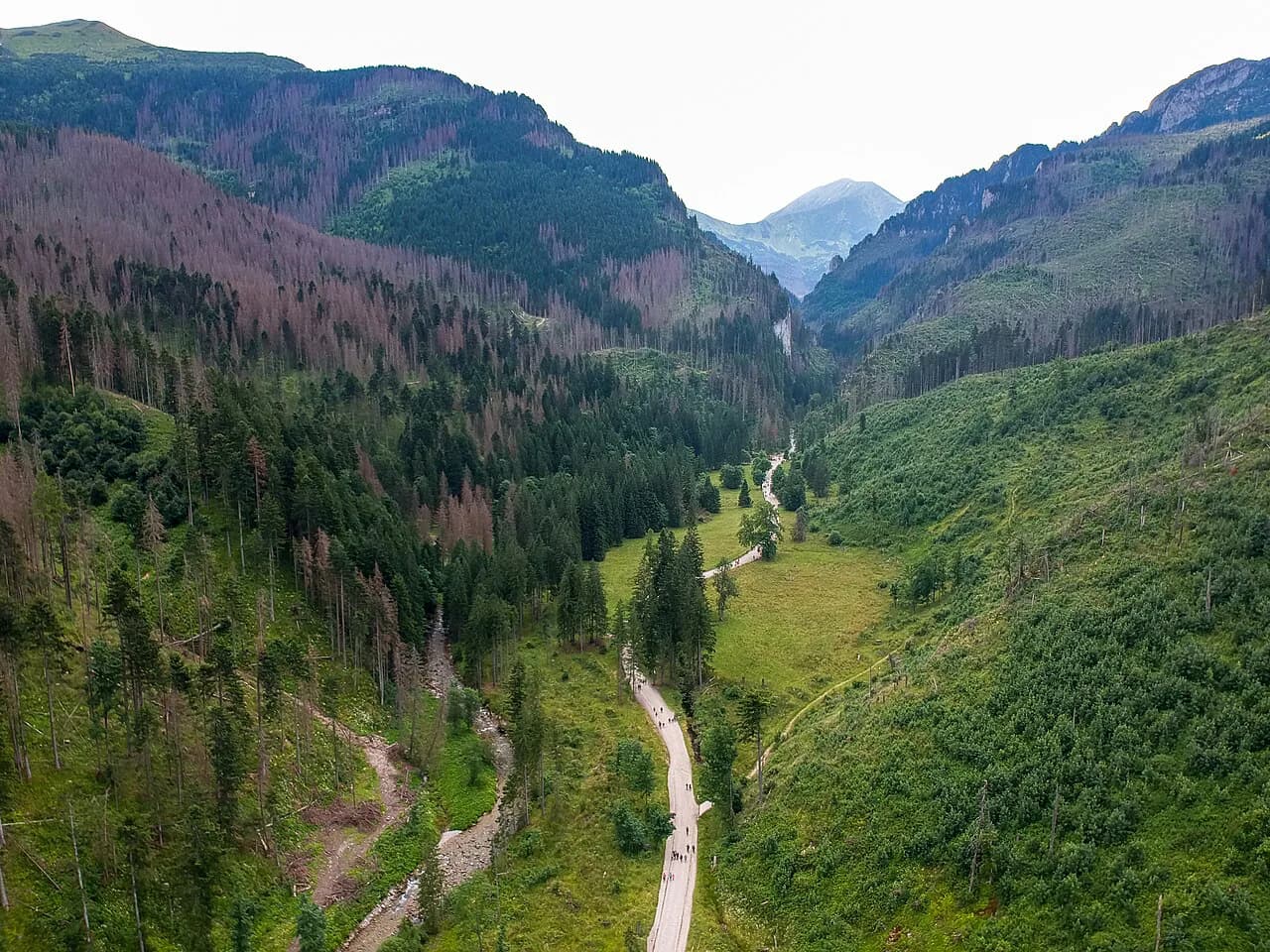
From the clearing the route follows a broad road beside the Białka, climbing gently through spruce and Swiss pine forest. The first landmark is Wodogrzmoty Mickiewicza, a waterfall right beside the path that makes a natural early stop and a good place to shed a layer before the steeper middle section.
Above the falls the road swings into the forest and keeps climbing in long, even gradients, with the Białka running below on your right. The surface is firm throughout, so trail shoes are enough in dry weather; the exposure is nil, but the road is sunless in places and cool early in the morning.
The final stretch opens out as the trees thin and the rock walls of the Mnich and Mięguszowiecki peaks appear ahead. The road bends left and drops slightly to the lake shore, with the hut on your right as you arrive.
Arriving at the lake: the hut, the shoreline path and the views to Mnich and Rysy
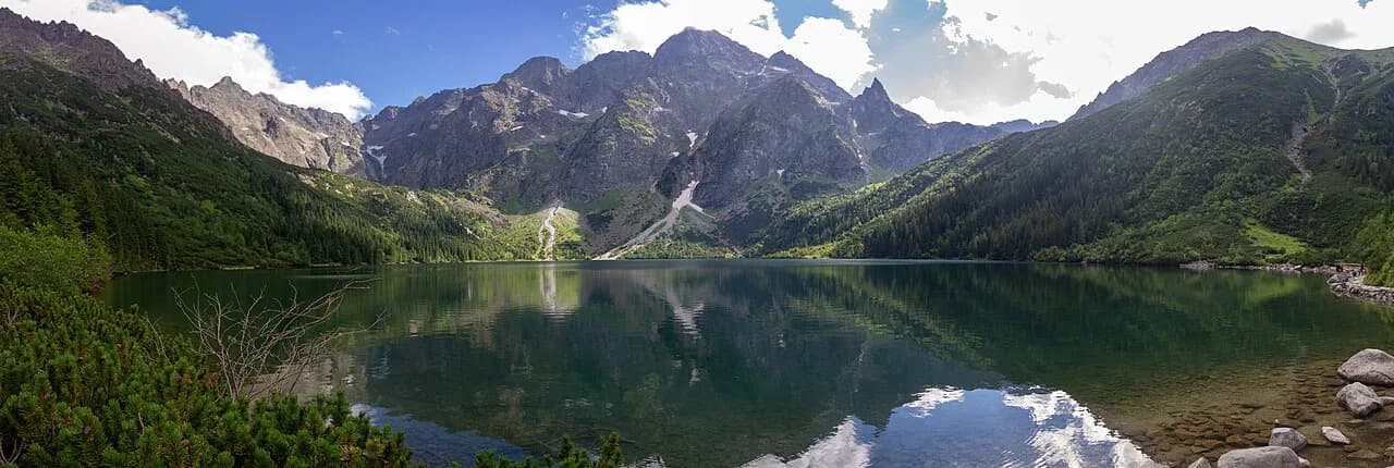
Schronisko PTTK Morskie Oko sits directly by the water and serves as the natural pause point: food, shelter and overnight beds if you want to split the walk. From the shore, the classic view takes in Mnich across the lake and the Rysy summit behind it, and a flat path runs around the near shoreline for anyone who wants more time at the water without more climbing.
Hikers continuing upward will find the ground steepens sharply as the route leaves the lake, so judge the day here rather than at the trailhead. The path around the shore is the easy option; everything above the hut is a different proposition.
Beyond the lake: the harder option toward Wrota Chałubińskiego
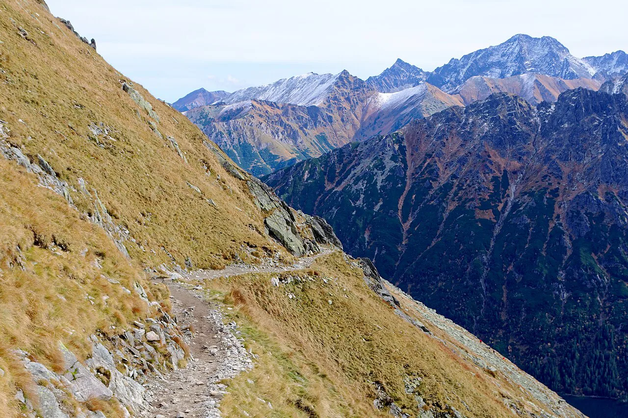
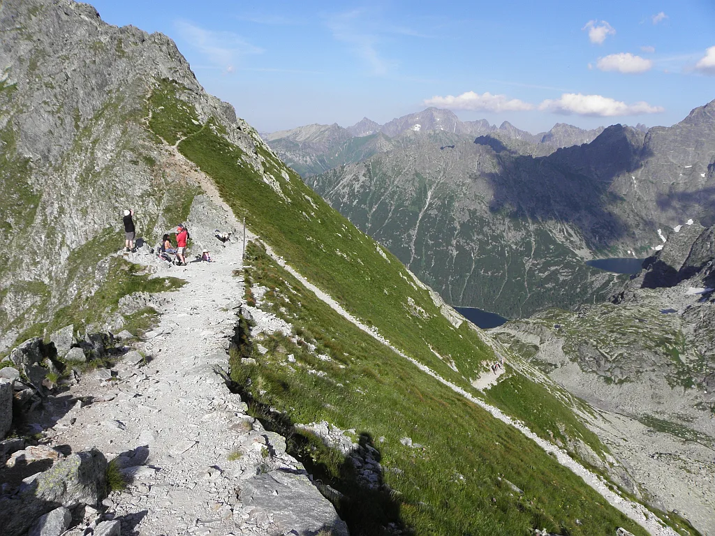
The extension from the lake toward Wrota Chałubińskiego is a hard hike covering about 4.6 mi (7.4 km) with around 1,942 ft (592 m) of elevation gain, taking roughly 3.5 to 4 hours. That is a separate outing from the road walk, with rougher footing and real height above the water, so treat it as the demanding version of the day rather than an add-on.
If your goal is a summit rather than a high pass, the rysy hike from the same trailhead is the bigger objective and needs an early start and settled weather. Either way, snow lingers on the upper ground into late spring and returns early in autumn, and afternoon storms build quickly on the high ridges.
Horse-drawn carriages on the road and what they mean for walkers
Highlander horse-drawn carriages work the road between Palenica Białczańska and the lake, so you will share the route with them rather than having a quiet forest path to yourself. Walk to one side, keep an eye on the bends where the road narrows, and expect the surface to be busier and dustier where the carriages pass. The presence of carriages is a fixed condition of this walk, not an occasional surprise.
When to go: seasons, snow and afternoon storms
Late spring to early autumn, roughly May to October, is when the road is generally clear of snow and the lake sits under open skies. Winter walking is possible but the road ices up and the day shortens, so check avalanche and weather bulletins through Tatra National Park before setting out.
In summer, start early to reach the lake before the midday crowds and to leave the exposed upper ground before storms build in the afternoon. Autumn brings clearer air and fewer walkers, but the days are shorter and the first snow can close the higher options.
Huts, food and water on the route
Schronisko PTTK Morskie Oko by the lake is the only hut on the route and the place to eat, refill and shelter if the weather turns. Toilets and food stalls sit along the main road, so you can travel light and top up on the way rather than carrying a full day of supplies.
Rules, fees and staying on the marked trail
The trail lies inside Tatra National Park, and entry to the park is ticketed; buy your ticket at the entrance rather than assuming the walk is free. Stay on the marked road and paths, and keep to the park's rules on pets and off-trail access.
The park is a strictly protected area, so the marked route is the only sensible line through the forest. If you want a more demanding marked route in the same range later in the trip, the orla perc traverse is a very different grade of day and calls for scrambling experience.
Where to base yourself for the hike
Zakopane is the practical base: it has the bus links to Palenica Białczańska and enough beds and restaurants to support a multi-day Tatra trip. Staying in Zakopane also makes it easy to slot the Morskie Oko walk alongside other valley days without moving accommodation.
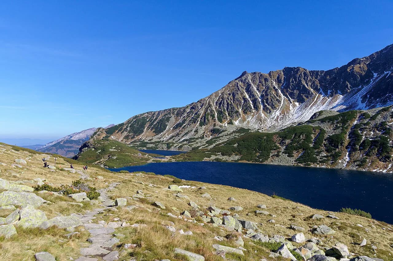
If you want a second lake day on the same trip, the Dolina Pięciu Stawów hike starts from the same road system and gives a longer, quieter circuit. Combining the two into one itinerary works well because the trailheads are close together.
Plan Your Visit
Decide first whether you want the road walk to the lake or the harder ground above it, because the two days are shaped differently: one is a steady forest climb with a big view at the end, the other is a short, steep outing with real exposure. Build the day around an early start, a bus from Zakopane, and time at the hut before the afternoon weather arrives.
Check the Tatra National Park ticket rules and the current bus times from Zakopane the week you go, then pack for sun and rain in the same day. The lake rewards the walker who arrives early and stays long.
Frequently Asked Questions
How long is the Morskie Oko hike from Palenica Białczańska?
It is about 8 km (5 mi) one way and usually takes 2 to 3.5 hours at a steady pace, not counting time at the lake or the hut. Most walkers treat it as an out-and-back day of five to six hours with a proper stop at the water.
Can you take a horse-drawn carriage to Morskie Oko?
Yes. Highlander horse-drawn carriages work the road between Palenica Białczańska and the lake, and walkers share the route with them. Keep to one side on the bends and expect a busier, dustier surface where they pass.
How do you get to the Morskie Oko trailhead from Zakopane?
Buses and minibuses run from Zakopane to Palenica Białczańska, the clearing where motorized traffic stops. Timetables change with the season, so use the departure board at the Zakopane bus station rather than an old printed plan.
Is the Morskie Oko hike suitable for children?
The road to the lake is wide, well maintained and gains height gradually, which makes it workable for families with older children who can manage a long half-day on foot. The stroller-friendly sections are on the lower road; the ground above the lake is not a family route.
What is the best time of year to hike to Morskie Oko?
Roughly May to October, when the road is generally clear of snow and the days are long. Autumn brings clearer air and fewer walkers but shorter days, and the first snow can close the higher options above the lake.
Are dogs allowed on the trail to Morskie Oko?
The route lies inside Tatra National Park, which sets the rules on pets. Check the park's current pet regulations before you bring a dog, and follow the guidance you find at the park entrance.
How hard is the extension toward Wrota Chałubińskiego?
It is rated a hard hike, covering about 4.6 mi (7.4 km) with around 1,942 ft (592 m) of elevation gain and roughly 3.5 to 4 hours. Treat it as a separate outing from the lake road, with rougher footing and real height above the water.
Sources
Trail notes for your next trip
Optional updates when we add or revise hiking guides.
You might also like
Continue reading
More guides you'll find useful