Dolina Pięciu Stawów Hike: Route, Distance and Ascent
Plan the Dolina Pięciu Stawów hike from Palenica Białczańska: 17 km (10.6 mi) round trip, 690 m (2,264 ft) of ascent, the Siklawa waterfall and a hut stop.
On this page
Dolina Pięciu Stawów Polskich, the Valley of Five Polish Ponds, is a high glacial basin in the Polish High Tatras, and it delivers more variety per kilometre than almost any other day walk in the range. You get the Wielka Siklawa waterfall, a chain of lakes set below the Buczynowe Turnie ridge, and a mountain hut at 1,670 m (5,479 ft) that gives you a bed, a hot meal and a famous apple cake at the top of the climb. The route suits fit hikers who can keep walking for five hours or so, and anyone prepared for a long, steady climb on rock and stone.
The classic line starts at Palenica Białczańska and reaches the hut by about 17 km (10.6 mi) round trip with roughly 690 m (2,264 ft) of ascent and about five hours of walking; you can walk it as an out-and-back or close it into a loop with the black trail on the way down. Read the figures as a planning baseline rather than a fixed schedule: pace, photo stops and a long break at the hut change the day. The two trails into the valley give you a genuine choice, a green valley line past the waterfall or a shorter black traverse under Niżna Kopa.
What the Valley of Five Polish Ponds offers and who it suits
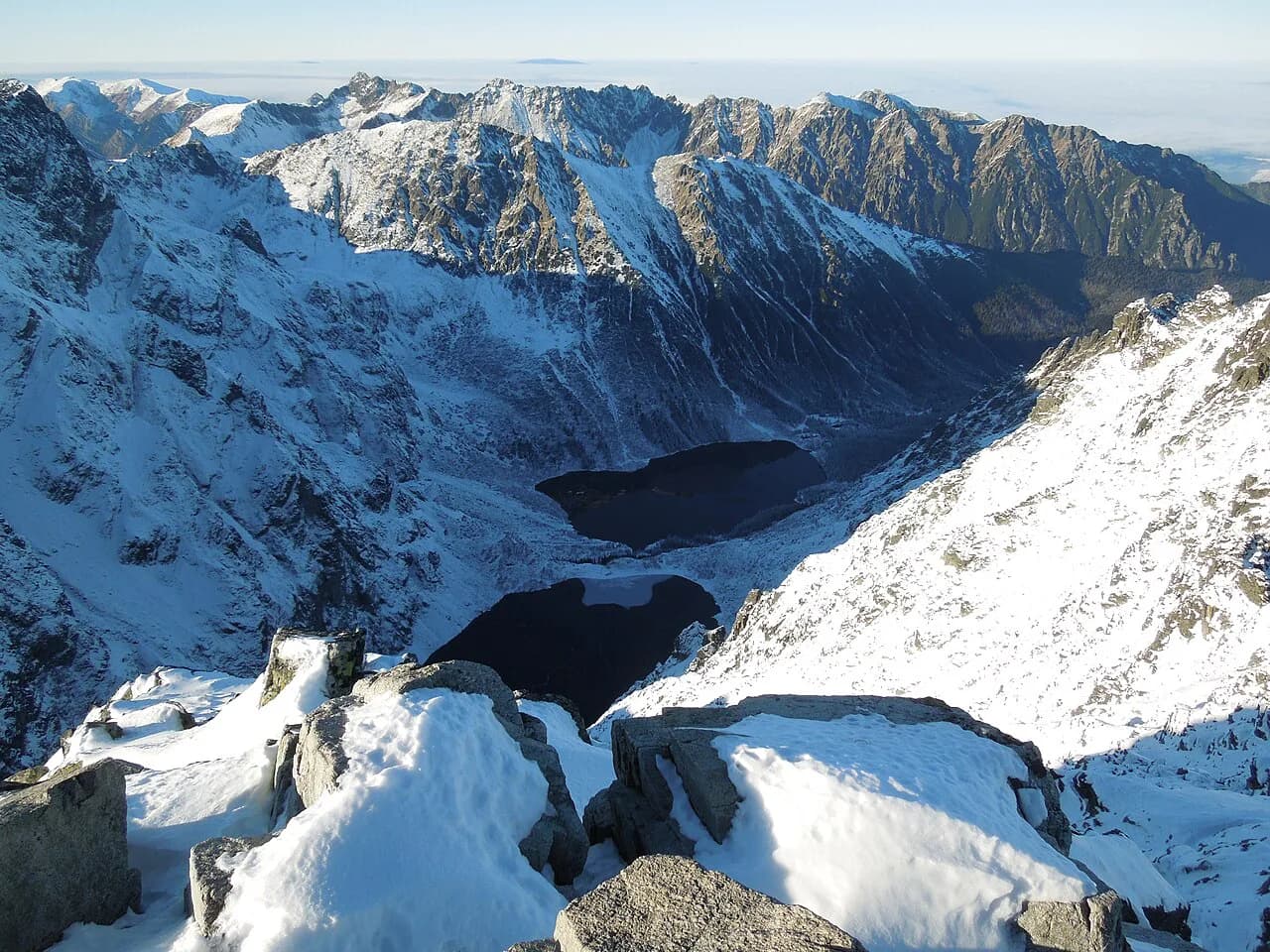
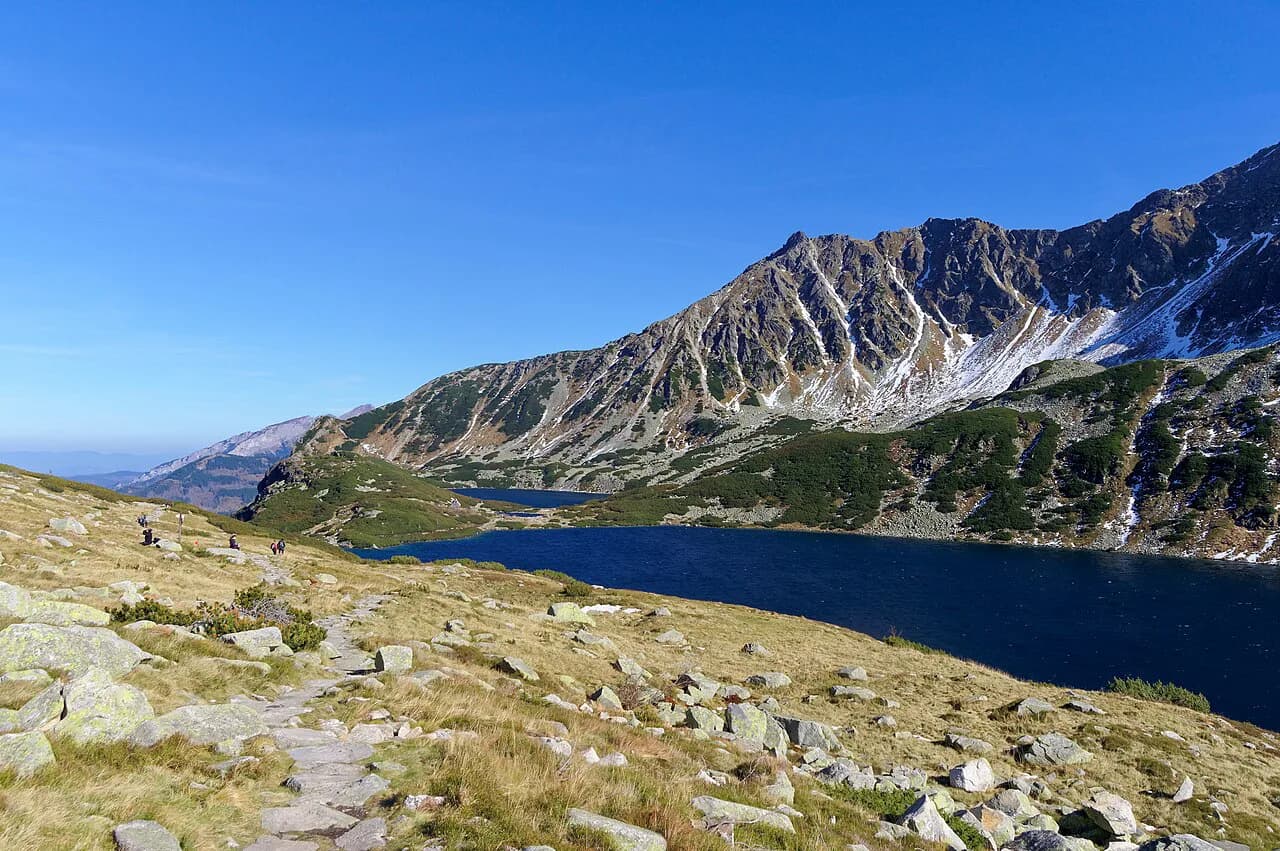
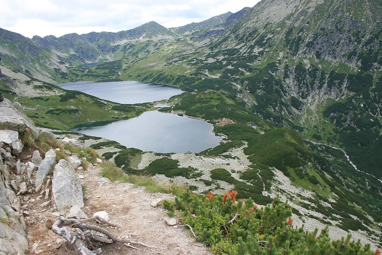
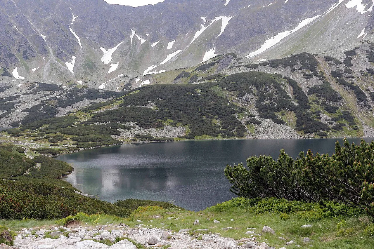
The valley holds six lakes, five of them named: Wielki, Zadni, Czarny, Mały and Przedni, plus the seasonal Wole Oko. Wielki Staw Polski is the star, lying at 1,665 m (5,463 ft) and reaching 79.3 m (260 ft) deep and 998 m long, which makes it the deepest and longest lake in the Tatras. A bridge at its outflow, with a boulder standing in the water beside it, is the photographic spot of the whole walk.
The lakes give the valley its name, but the high walls around it are why hikers come back. The Buczynowe Turnie and Wołoszyn ridge forms the eastern wall, while Kozi Wierch, the highest peak lying entirely inside Poland, closes the basin to the north at 2,291 m (7,516 ft). Hikers with a head for exposure can use the hut as a base for Zawrat, Kozi Wierch or Szpiglasowy Wierch, all of which leave directly from the lakes.
Because the walking is on a built trail with short sections of rough stone, the valley suits anyone comfortable on a full day in the mountains. It is less suitable for a first hike with small children or for hikers who dislike long descents on uneven rock, since the return is as steady as the climb. If you want the lake basin without the crowds, start early; Palenica Białczańska fills up on summer weekends and long weekends.
Where the hike starts: Palenica Białczańska trailhead and parking
The walk begins at Palenica Białczańska, the busy trailhead on the road from Zakopane toward Morskie Oko and the most popular starting point in the Polish Tatras. A Tatra National Park ticket office stands right beside the parking area, so you can sort out park entry before setting off. Arrive early: on summer weekends and long weekends the lot is full and the road in is congested.
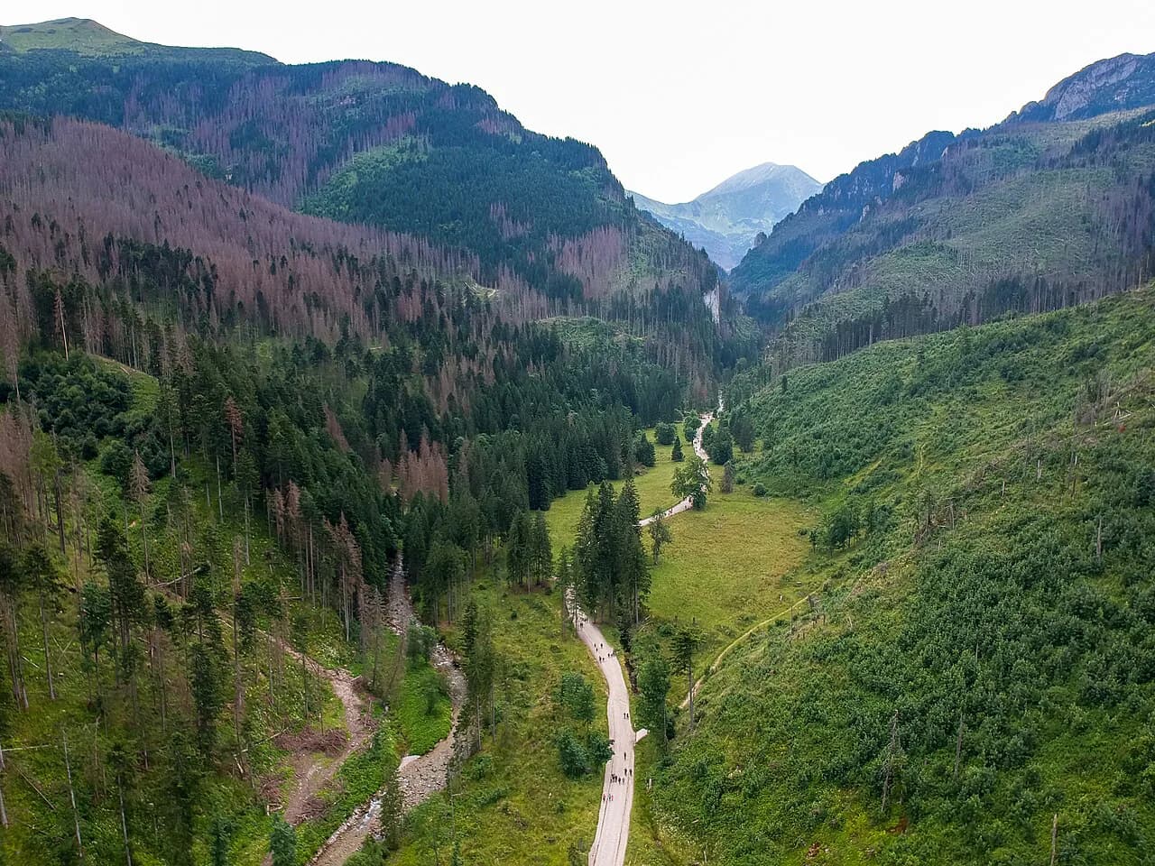
Save the parking ticket and the park ticket separately, and work out your entry charge at the ticket window rather than guessing, since the park sets the rates. From the lot, the first stretch is an asphalt road shared with everyone heading to Morskie Oko, so it feels more like a promenade than a mountain trail. That shared road is the reason an early start matters so much here.
Getting to the trailhead by bus and the Tatra National Park entry
Most hikers reach Palenica Białczańska by minibus or bus from Zakopane, which is the simplest way to avoid the parking crush. Services run along the Morskie Oko road from the Zakopane bus station, and the exact timetables and fares change season to season, so buy your ticket locally or read the departure boards in Zakopane. If you drive, allow extra time for the queue at the lot in peak season and have your park entry sorted at the ticket office.
Distance, ascent and walking time at a glance
To the hut and back the route measures about 17 km (10.6 mi) with roughly 690 m (2,264 ft) of ascent, and the walking time alone comes to around five hours. The asphalt stretch to the green trail turn-off takes about 50 minutes, and the green trail from Wodogrzmoty Mickiewicza into the valley is signed at roughly 2 hours 10 minutes. Those are steady times; they assume you keep moving and stop only on the way up.
Read the total as a minimum for a full day out. A break at the hut, the detour to the bridge over the Wielki Staw outflow and photo stops at Wielka Siklawa easily add an hour. A hiker in average shape should plan six to seven hours of daylight for the round trip, including food and rest.
Route description: the asphalt road to Wodogrzmoty Mickiewicza
From the parking, follow the asphalt road toward Morskie Oko. After about 40 minutes a red trail branches right toward Rówień Waksmundzka and Rusinową Polanę, but you stay on the road and pass the Tatra National Park building known as Dróżnikówka. This first stretch opens views into the Biała Woda valley and toward the high peaks, and on a clear day Gerlach is visible ahead.
At about 50 minutes you reach Wodogrzmoty Mickiewicza, the Mickiewicz waterfalls, where the Roztoka stream drops over rock steps. The cascades are viewed from a stone bridge on the road, and the Pośredni Wodogrzmot is the most clearly seen step. Just past the bridge a large flat area opens on the left: the green trail down to the Roztoka hut branches there in about 10 minutes, while you turn right and uphill.
Into Dolina Roztoki: Nowa Roztoka clearing and the trail fork
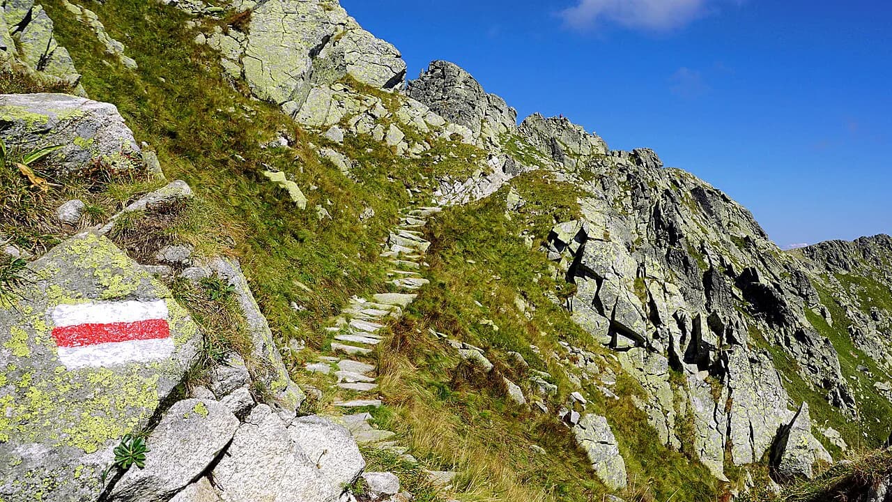
The green trail climbs steeply at first over big stones through a thinned spruce forest and crosses the Roztoka stream. After about 30 minutes you come out at the szałas on Polana Nowa Roztoka, a shepherd's clearing where most walkers take their first rest. From here the Wołoszyn ridge appears on the right and the stream is audible below the path.
Above the clearing the trail keeps climbing among dwarf pines and reaches a junction in under an hour and a half. The lower station of a small supply lift for the hut stands just off the path. The black trail leaves sharply uphill to the left and traverses Niżna Kopa toward the hut above Przedni Staw, while the green trail continues up the valley floor past the Wielka Siklawa waterfall. Take the green route in snow-free conditions; the black line is the winter alternative when ice coats the approach above the waterfall.
The climb past Wielka Siklawa and the Danielki slabs
The green trail passes a small hydroelectric plant that supplies the hut, then climbs toward Wielka Siklawa, the highest waterfall in Poland. Its water drops almost 70 m (230 ft) over the rock step that separates the valley of the five ponds from Dolina Roztoki, and on a sunny day the spray throws a rainbow across the rock. The waterfall is best seen from the valley floor, so look up as you approach rather than after you pass.
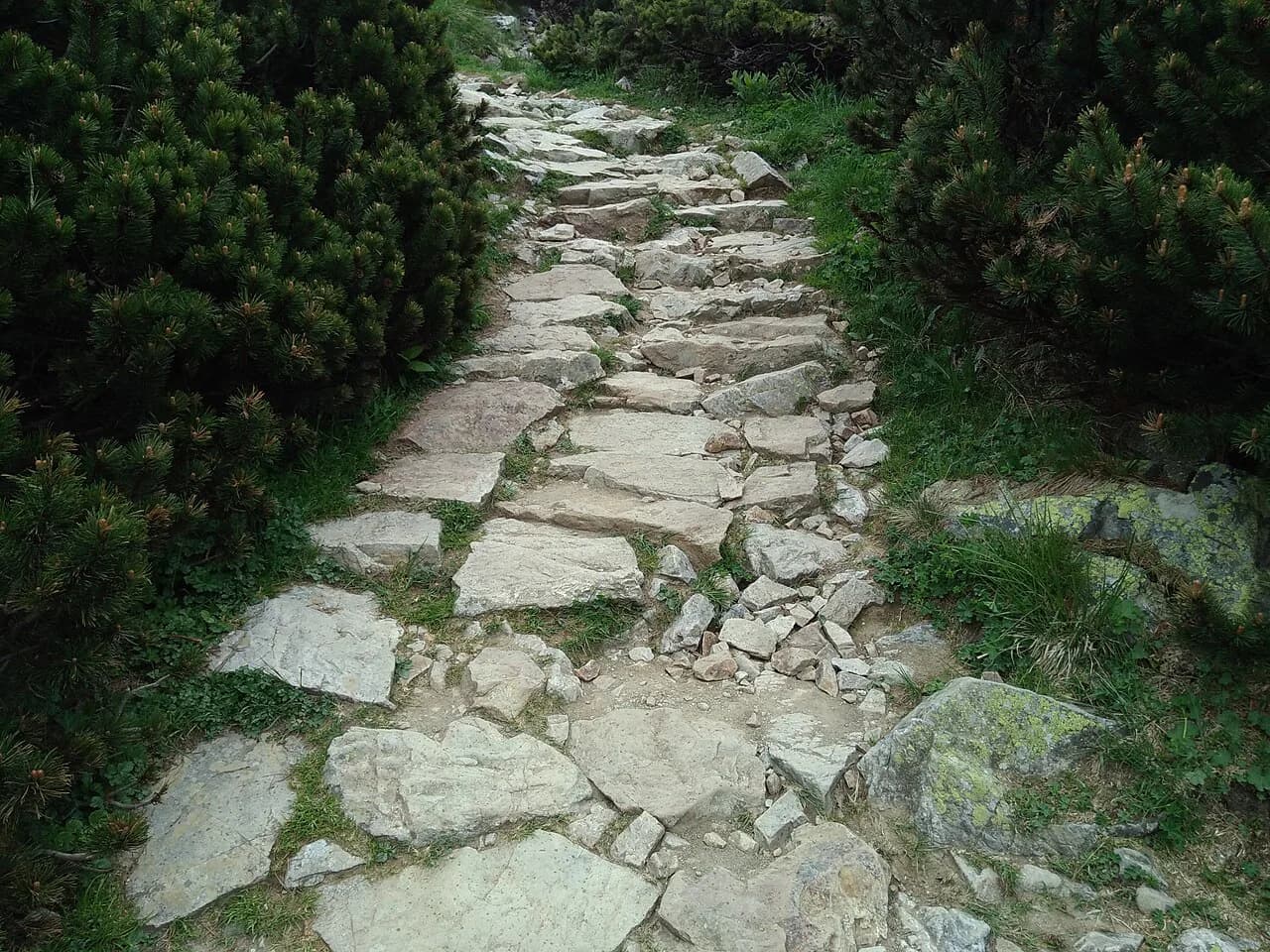
Above the waterfall the path crosses the Danielki, smooth glacial slabs that are the one technical challenge of the route when wet or icy. Short steel or stone steps make the crossing straightforward in dry weather, but the slabs give no grip in ice and stay slick after rain. Continue past them up a short, steep climb to the rocky threshold of the valley.
Arriving at Wielki Staw and the bridge crossing
The climb ends abruptly at the threshold of the valley, and you step out directly at Wielki Staw. To the right, the way opens into Buczynowa Dolinka and the ridge of Buczynowe Turnie and Wołoszyn. The bridge over the outflow, with its boulder in the water, is a few steps away and is the spot everyone stops for.
From the bridge a blue trail runs past Mały Staw and along Przedni Staw, bringing you to the PTTK hut in about 10 minutes. The direct valley floor route is gentler than it looks, and you can see the hut roof across the water as you approach. Stay on the marked path along the shore; the grassy banks around the lakes are fragile and the park expects hikers to keep to the trail.
The PTTK hut above Przedni Staw: beds, food and water
Schronisko PTTK w Dolinie Pięciu Stawów sits above Przedni Staw at about 1,670 m (5,479 ft), the highest mountain hut in Poland. It holds 67 beds, serves meals, and provides a luggage store for hikers who want to head higher with a light pack. A tourist kitchen is available for people carrying their own food, and winter equipment and touring skis can be hired on site.
The hut is open year-round and is famously busy, so reserve a bed through the operator before you rely on one, and expect a queue for meals at lunchtime. The apple cake is the house specialty and worth the stop even if you are walking back down the same day. Fill bottles at the hut rather than at the stream crossings lower down.
Mobile signal in the valley is poor, so plan your navigation and any check-in messages before you start up from Palenica Białczańska. Download an offline map and tell someone at your accommodation when you expect to be back. A paper map and a charged power bank cover the rest.
Return options: the black trail under Niżna Kopa
The most satisfying way down is a loop: from the hut take the black trail that starts near the top station of the hut's supply lift, traverse the slope of Niżna Kopa, and switchback down through dwarf pine to rejoin the green trail below the hydroelectric plant. That gets you back to the asphalt road without repeating the waterfall climb, and it shows a different face of the valley. It is longer in distance than dropping straight back down the green trail, but easier underfoot in dry conditions.
In winter or after an ice storm, take the black line in both directions and bypass the slabs above Wielka Siklawa; hikers heading down the green route in those conditions need crampons. In summer, the choice comes down to whether you want the waterfall at close range on the way down or a quieter traverse. Either way, the junction below the lift station is your landmark for rejoining the main road.
Extending the day: Zawrat, Kozi Wierch and Szpiglasowy Wierch
From the hut, the blue trail toward Zawrat climbs to a pass on the Świnica ridge, and from there the route continues toward Kasprowy Wierch or Świnica. It is a firm step up from the lake basin: steep, exposed in places, and much longer than the valley walk, so treat it as a separate half-day or full day rather than an add-on to the waterfall circuit. Only take it with proper boots and settled weather.
The yellow trail into Pusta Dolinka leads to the approach to Kozi Wierch, a sustained climb onto the highest wholly Polish summit, and the connecting line to Krzyżne gives access to the western end of the Orla Perć. These are exposed high-mountain routes where a slip can be serious; snow lingers on the passes early and late in the season, and afternoon thunderstorms come fast. Start early and turn around at the first sign of building cloud.
The Szpiglasowy Wierch route leaves the valley toward the Świstówka bowl and the Morskie Oko area, and the connecting path on that side is open from mid-May to the end of November. If you want a longer traverse rather than an out-and-back, that is the link to plan. All of these extensions are in the High Tatras, the same range as the valley itself, so nothing here pulls you into neighbouring ranges; for the equivalent decision on the Slovak side of the range, see this hiking in High Tatras guide.
When to go: seasons, snow and ice on the slabs
The valley is walkable from late spring into autumn, and the green trail past Wielka Siklawa is the summer line. Snow can lie on the Danielki slabs well into spring and return in late autumn, and the slabs are the wet-weather hazard on the route. Check the latest conditions and the avalanche forecast before you go; the hut operates all year, but that does not make the approach safe in winter without winter gear.
Summer is the busiest season, and weekends and holidays at Palenica Białczańska are heavy. Early autumn often gives clear air, stable weather and a quieter trail, while deep winter suits only experienced hikers with crampons and the winter route. The valley is a long day in any season, so plan daylight generously.
Gear, phone signal and mountain hazards
Wear boots with stiff soles for the Danielki slabs and carry a waterproof shell; the valley catches rain while the surrounding peaks stay clear. Bring enough water and food for the full day if you do not plan to eat at the hut, and carry a headlamp for the descent in autumn. Ropes and technical gear are not needed for the valley trail, but they are for the high routes above the lakes.
The main hazards are the slick slabs above the waterfall, snow lingering on the high passes, and fast-moving afternoon storms. Turn back if the sky builds over Kozi Wierch in the early afternoon, and keep to the marked trail along the lake shores. For route planning across the rest of the range, compare this walk with the other valleys and ridges in the Tatra Mountains hiking guide and match each day to your fitness.
Plan Your Visit
The Valley of Five Polish Ponds is best treated as a full mountain day: start early from Palenica Białczańska, take the green trail past Wielka Siklawa, and choose whether to return the same way or finish the loop on the black traverse. Book a hut bed if you want to climb higher the next morning, and leave the high routes above the lakes for a separate, better-rested day. Pack for wet slabs and a long descent.
Frequently Asked Questions
How long does the hike to Dolina Pięciu Stawów take?
Budget about five hours of walking for the round trip to the hut, plus an hour for stops at the bridge, the hut and the waterfall. Most hikers spend six to seven hours out from Palenica Białczańska and back.
Is the Valley of Five Polish Ponds trail difficult?
It is a long, steady mountain walk rather than a technical route. The only demanding ground is the smooth slab section above Wielka Siklawa, which needs care when wet, and the final climb to the lake basin.
How far is the walk from the parking at Palenica Białczańska?
It is roughly 17 km (10.6 mi) round trip from Palenica Białczańska to the hut and back, with about 690 m (2,264 ft) of ascent and about 50 minutes of the outbound route on asphalt.
Which route into Dolina Pięciu Stawów is the most scenic?
The green trail through Roztoki past Wielka Siklawa is the scenic choice, since it takes you directly beneath Poland's highest waterfall and onto the glacial slabs. The black route under Niżna Kopa makes a fine return and avoids repeating the waterfall.
Can you stay overnight at the Pięciu Stawów hut?
Yes, the PTTK hut above Przedni Staw has 67 beds and is open year-round, but it is popular, so arrange a reservation in advance. It also has a mountain kitchen and a luggage store.
Sources
Trail notes for your next trip
Optional updates when we add or revise hiking guides.
You might also like
Continue reading
More guides you'll find useful