Orla Perć: Trail Stats, Route and Trailhead Access
Orla Perć crosses the Polish High Tatras from Zawrat to Krzyżne with chains, ladders and real exposure. Get distance, ascent, access and timing details.
On this page
Orla Perć, the Eagle's Path, is the most demanding marked trail in the Polish High Tatras: a knife-edge ridge traverse above Zakopane where fixed chains and a few ladders protect narrow steps over long drops. It suits experienced mountain hikers with a head for heights, solid fitness and the patience to plan around weather and daylight. Beginners and anyone uneasy on exposed rock will find far better days on the valley trails below.
The trail itself runs between Zawrat Pass and Krzyżne Pass, crossing about eleven peaks with Kozi Wierch as the highest point. Getting to Zawrat is a serious hike in its own right, so the day is longer than the ridge numbers suggest. Plan the approach first, then the ridge, then the descent before you decide anything about start times.
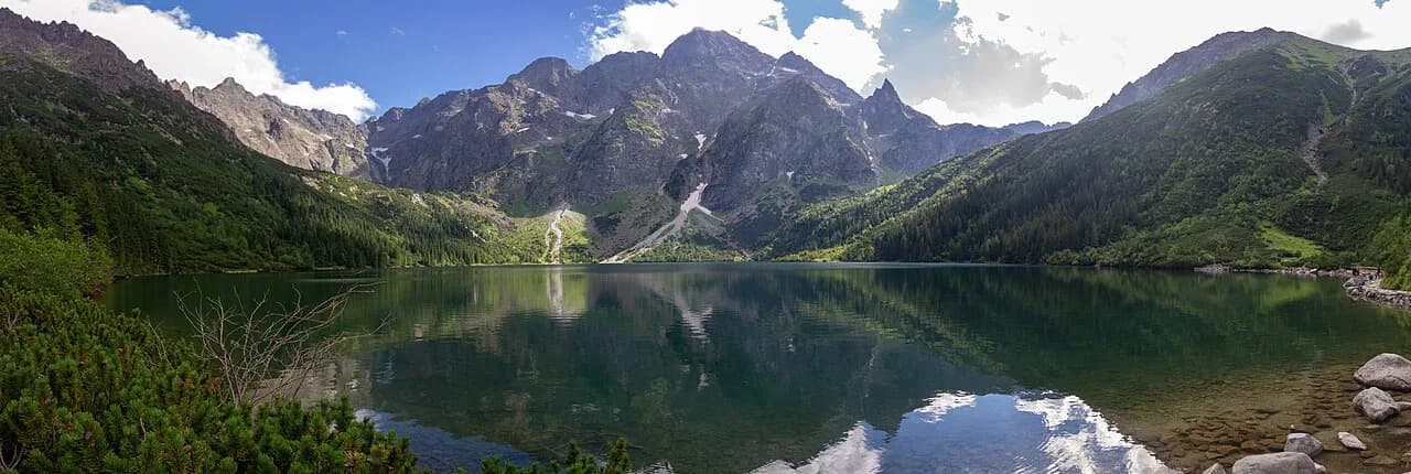
Huts and trailheads: Kuźnice to Murowaniec, or Łysa Polana and the Five Polish Lakes Valley
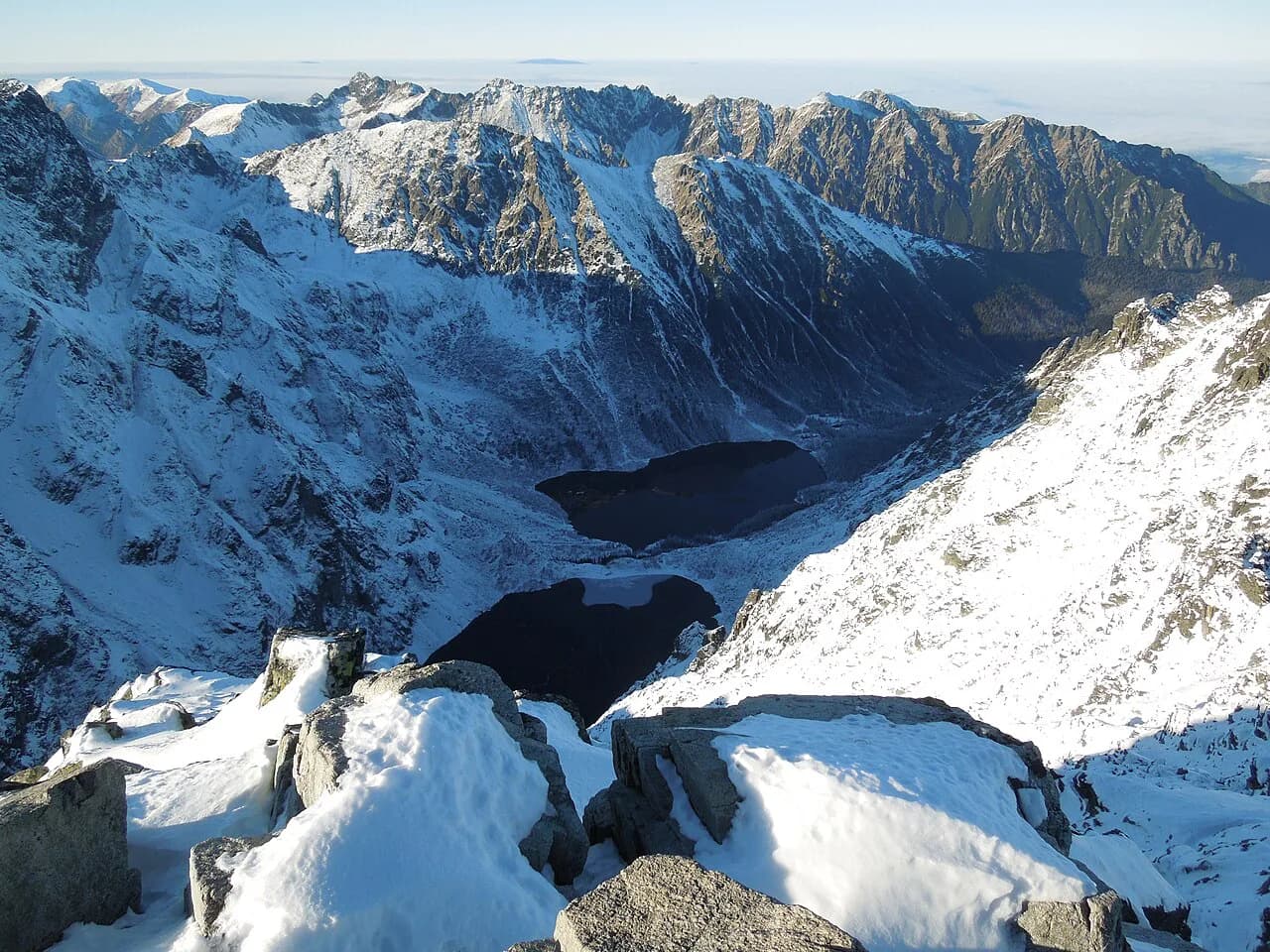
There are two main ways onto the ridge. From Zakopane, the classic approach starts at Kuźnice and climbs on the blue trail to Murowaniec Hut on Hala Gąsienicowa in about 2 to 2.5 hours, and from the hut you continue to Zawrat Pass where Orla Perć begins. The alternative, useful if you are coming from the Slovak side or staying near Łysa Polana, enters through the Five Polish Lakes Valley from Łysa Polana and climbs past Siklawa Falls and Wielki Staw Polski to Zawrat.
A third line onto the ridge uses the cable car from Kuźnice to Kasprowy Wierch, followed by the red-marked trail past Świnica to Zawrat. That saves the valley climb but commits you to a high, exposed traverse straight away, so it suits hikers already confident on steep rock. Kuźnice is the transport hub for the Zakopane side, with buses and the cable car base in the same small valley.
Parking fills early in summer at both ends, and the Palenica Białczańska lot near Łysa Polana is the big trailhead for the Five Lakes and Morskie Oko valleys; reserving a space online saves a 15-minute walk each way. If you park further out at Łysa Polana, allow extra time on the paved road before the red trail proper begins. Fix your return transport before you set off, because the last leg back from the Five Lakes hut to the trailhead is long and can end after dark.
Distance, ascent and time for the Zawrat–Krzyżne ridge section and full approach routes
The ridge section between Zawrat Pass (2,159 m / 7,083 ft) and Krzyżne Pass (2,112 m / 6,929 ft) is 4.3 km (2.7 mi) long, crosses roughly eleven peaks and involves about 607 m (1,991 ft) of ascent and 651 m (2,136 ft) of descent, with Kozi Wierch at 2,291 m (7,516 ft) as the high point. Expect 6 to 7 hours for this stretch alone, because the technical ground, the queues at chains and the constant up-and-down slow everything down.
From Murowaniec Hut, the full outing covers about 14 km (8.7 mi) with roughly 1,422 m (4,665 ft) of gain and can take 10 to 14 hours. Approaching from Łysa Polana through the Five Lakes valley adds distance and height before you even touch the chains; one party reached Zawrat in 4 hours after 12.5 km (7.8 mi) and around 1,300 m (4,265 ft) of climbing, then finished at the Łysa Polana lot 16 hours and 40 minutes after starting.
Treat those figures as planning baselines, not targets. A ridge day of 10 to 14 hours leaves no margin for a slow chain bottleneck or an afternoon storm, so most hikers who finish comfortably start in the dark and keep breaks short. If your schedule only allows a single day, the Murowaniec approach is the shorter and more common choice. If you are weighing this ridge against exposed routes across the border, the High Tatras hiking guide covers the Slovak-side alternatives.
Route description: Zawrat Pass, Świnica flank, Kozi Wierch, Granaty, Krzyżne Pass
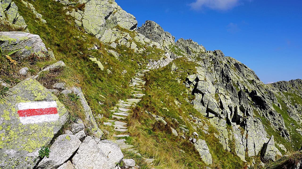
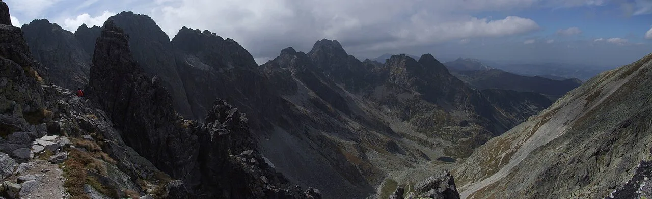
From Zawrat the path climbs onto the ridge and stays high, traversing the Świnica flank before the long pull toward Kozi Wierch. The terrain is rocky and steep throughout, with fixed chains on the steepest walls and ladders on short vertical steps, and the route constantly gains and loses height at around 2,100 m (6,890 ft). Kozi Wierch marks the highest point of the traverse and the best-known summit payoff, with wide views over the glacial valleys on both sides.
Beyond Kozi Wierch the path works across the Granaty, a jagged cluster of peaks that gives the middle of the route its sharpest scenery. Poles, chains and narrow ledges follow one another, and only one person can safely use a chain section at a time, so busy weekends turn these passages into bottlenecks. The ridge finishes at Krzyżne Pass, where the angle eases and the descent begins.
From Krzyżne the way down is steep and rocky at first, then softens into grassy meadows on the line toward Schronisko PTTK in the Five Lakes valley. That hut is the natural place to refuel before the long walk back to Łysa Polana or the traverse to Murowaniec. Many hikers rate the Five Lakes hut stop, with its views over the alpine ponds, as the reward after the ridge.
Chains, ladders and one-way sections: what the protection is and is not
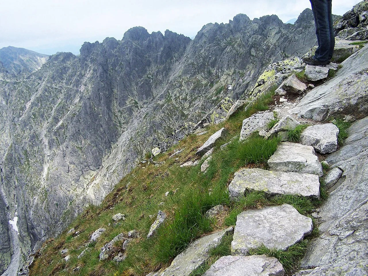
The steel chains, ladders and rungs on Orla Perć are fall protection at the hardest steps, not a continuous via ferrata cable you can clip into. There are stretches where you rely entirely on your own hands, feet and judgment, and that is why the route is a marked hiking trail rather than a protected climbing line. Hikers often carry a helmet and gloves for rockfall and balance, and some add a harness for extra security on the most exposed passages.
Between Zawrat and Kozi Wierch the route is one-way, so once you commit you cannot turn back on that stretch. This rule spreads traffic on the narrowest ground, and it also means you must be sure of your fitness before stepping onto the first chain. Treat the decision at Zawrat as final.
Wet or icy metal changes the equation. Chains that help in dry weather become slick and hazardous in rain or hail, and the rock underfoot turns slippery, so a forecast of afternoon storms argues for an early start or a different route.
Escape routes off the ridge
There are few exits, and knowing them matters. From the Zawrat to Kozi Wierch stretch, two escape lines drop back to the Five Polish Lakes valley: a yellow-marked trail to the fork at Tablica S. Bronikowskiego and a black-marked trail near Kozi Wierch into Dolina Pięciu Stawów Polskich. Beyond Kozi Wierch, three further escapes descend toward Murowaniec Hut on the other side of the ridge.
An escape is a real descent, not a shortcut home, and it changes your return logistics. Decide in advance which exit suits your transport plan, so a storm or a slower-than-expected pace sends you down a line you already know.
When to go: season window, snow, storms and daylight
Orla Perć is a summer route. The marked season in the High Tatras generally opens around June 15 and closes around October 15, though the exact dates shift with snow and weather each year, and late June through September gives the most stable conditions. Summer highs on the ridge sit around 15 to 20 °C (59 to 68 °F), and early autumn drops to 5 to 10 °C (41 to 50 °F) with morning frost.
Snow and ice linger on the passes and in shaded gullies early and late in the season, which is the specific reason the ridge should be left until the high route is fully clear. Afternoon thunderstorms are the other hazard: the ridge is fully exposed, and hail or lightning arriving three-quarters of the way along leaves little room to retreat. Choose a settled forecast, start before dawn, and accept that July and August weekdays still bring queues at the chain sections.
Daylight is the third constraint. Peak summer gives up to 16 hours of light, but by late September that shrinks to about 11 hours, which is tight for a full 10 to 14 hour day from Murowaniec. A headlamp is not optional on either end of the season.
Gear and water for the ridge
Wear stiff-soled boots with good ankle support and sticky rubber, and pack warm layers, rain gear and a helmet for the exposed sections. Gloves help on cold metal, and a headlamp covers a late finish.
There are no reliable water sources on the ridge itself, so carry enough for a long, hot day; one guide recommends at least 4 to 5 liters (about 1.1 to 1.3 gallons) plus electrolyte supplements to stave off cramps. Fill up at Murowaniec or at the Five Lakes hut before you go high, because the next tap is hours away.
Park rules, fees and where to stay near the trail
Tatra National Park has no admission fee, but its rules are strict: stay on marked trails, do not wild camp, do not swim in the glacial lakes, and do not light fires or pick plants. Plan your day so you never need to break them, since the ridge offers no legal alternative to the marked line.
Zakopane is the natural base for the Kuźnice and Murowaniec approach, and it also has the bus connections to Łysa Polana for the Five Lakes side. Staying in or near Zakopane lets you start in the dark without a long drive, which matters on a 10 to 14 hour day. Book summer beds well ahead, since July and August are the busiest weeks.
If you want a second, gentler day in the same park, Dolina Kościeliska gives a valley walk with caves and forest, and the Morskie Oko hike from Palenica Białczańska is a long but non-technical classic. Both balance the ridge day nicely in a week-long Tatra itinerary.
Planning Your Ridge Day
Orla Perć rewards preparation more than any other Polish trail: know your approach, budget the full 10 to 14 hours from Murowaniec or the longer Łysa Polana line, and treat the one-way Zawrat to Kozi Wierch stretch as a commitment. Pick a settled summer forecast, start in the dark, and carry the water and layers the ridge demands.
If the forecast turns or the exposure feels wrong, the valley routes below the ridge are excellent days in their own right and keep your Tatra trip intact. Make the call at the trailhead, not halfway along a chain.
Frequently Asked Questions
How long does Orla Perć take?
The ridge section from Zawrat Pass to Krzyżne Pass takes 6 to 7 hours for most prepared hikers, covering 4.3 km (2.7 mi) over about eleven peaks. The full outing from Murowaniec Hut covers roughly 14 km (8.7 mi) and can take 10 to 14 hours, and an approach from Łysa Polana through the Five Lakes valley runs longer still.
Is Orla Perć safe for hikers?
It is safe only for experienced mountain hikers with a head for heights and good fitness. The trail is exposed, protected by chains and ladders at the hardest steps rather than by a continuous via ferrata cable, and the Zawrat to Kozi Wierch stretch is one-way with few exits. Wet rock, afternoon storms and lingering snow are the main risks, so go in settled summer weather and start early.
Can you hike Orla Perć without via ferrata gear?
Yes. Orla Perć is a marked hiking trail, not a via ferrata, so a harness and lanyard are not required. Stiff boots, a helmet and gloves are sensible for the exposed passages, and some hikers add a harness for extra security on the steepest chains.
How do you get to the Orla Perć trailhead from Zakopane?
From Zakopane, buses run to Kuźnice, where the blue trail climbs to Murowaniec Hut in about 2 to 2.5 hours and the cable car rises to Kasprowy Wierch. Buses also serve Łysa Polana and Palenica Białczańska for the Five Lakes approach. Reserve parking at Palenica Białczańska online in summer to save a 15-minute walk each way.
When is the best time to hike Orla Perć?
Late June through September gives the most stable weather and the longest daylight. The marked season generally runs from around June 15 to October 15, though exact dates vary by year with snow and storms. Early autumn brings thinner crowds but colder mornings and frost.
Is there a fee to enter Tatra National Park?
There is no admission fee to enter Tatra National Park. The park rules do apply: stay on marked trails, do not wild camp, swim in the glacial lakes, light fires or pick plants.
Sources
Trail notes for your next trip
Optional updates when we add or revise hiking guides.
You might also like
Continue reading
More guides you'll find useful