Hiking in Lucerne: Peaks, Lake Trails and Easy Walks
Plan hiking in Lucerne: Pilatus, Rigi, Stanserhorn, Bürgenstock and Engelberg trails, with lift access, distances and walking times for each day out.
On this page
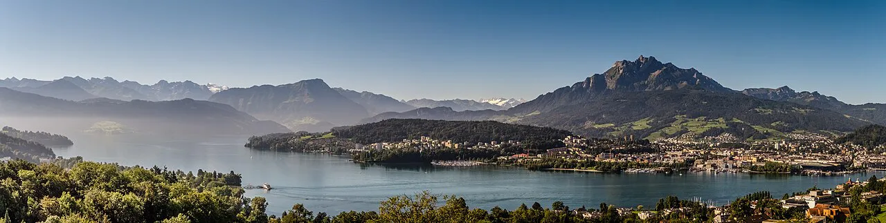
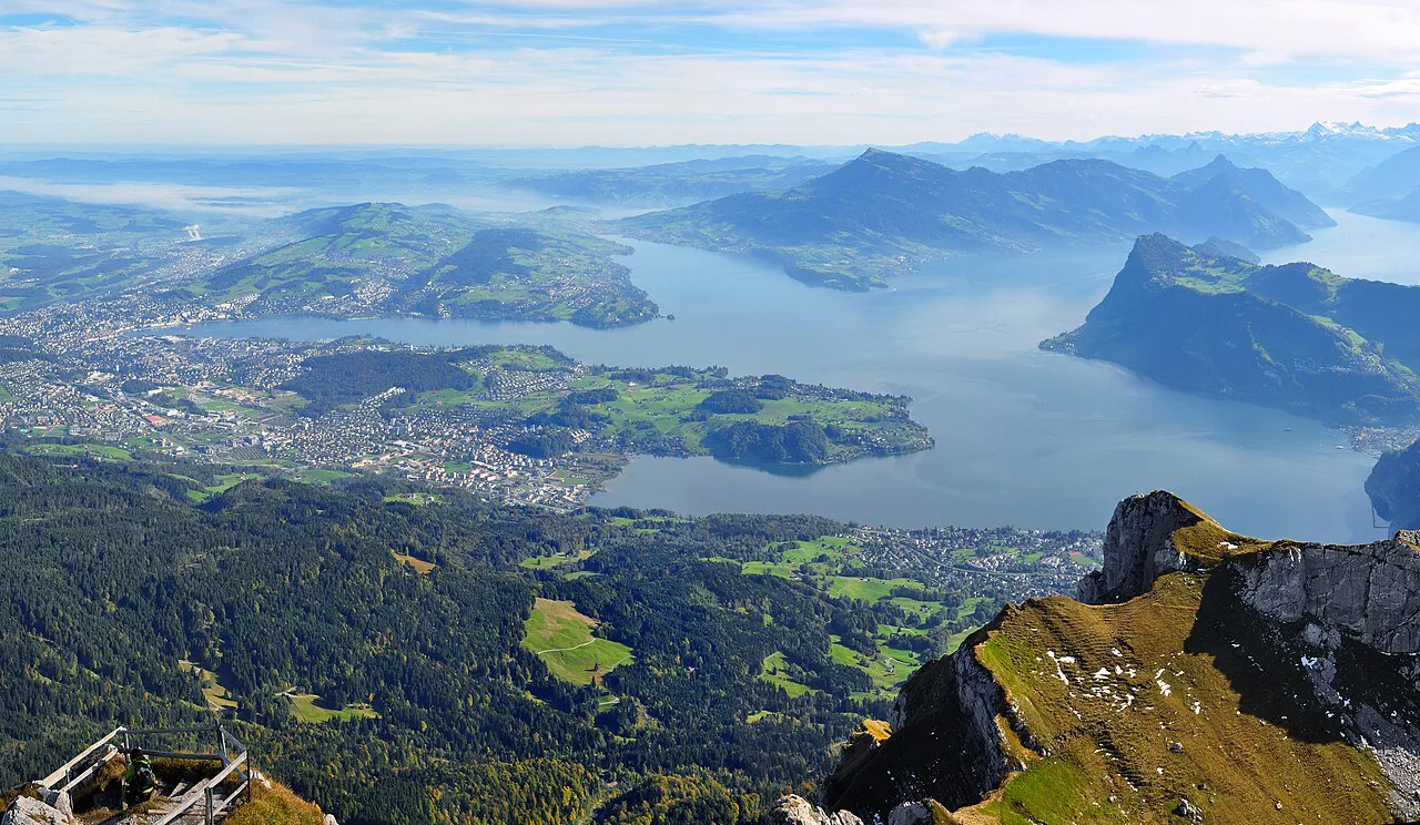
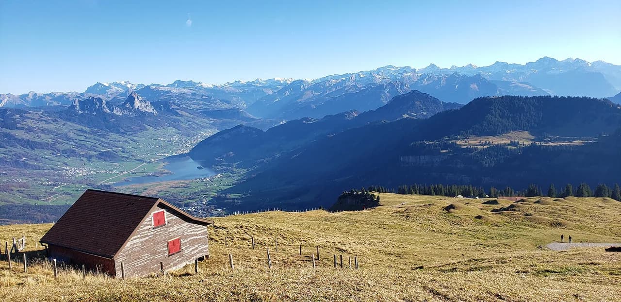
Lucerne works as a hiking base because the mountains start at the edge of the lake. Cogwheel railways, cable cars and boats lift you onto ridge paths above Lake Lucerne in under an hour, so a half-day walk can still put you at 2,132 m (6,995 ft) on the Pilatus ridge. The trails here suit hikers who want big views without a full alpine day, and families who want a short loop with a restaurant at the end.
The trade-off is that most routes are short and lift-assisted rather than long valley-to-summit walks. You choose a peak by what gets you up it: the steepest cogwheel railway in the world for Pilatus, Europe's first cogwheel mountain railway for Rigi, a double-decker cable car for Stanserhorn, a catamaran and funicular for Bürgenstock. If you want a genuine ridge day with scrambling, the Stoos ridge hike is the step up locally, while the UNESCO Biosphere Entlebuch south of the city holds the region's longest ascents.
How to choose a hike in Lucerne
Match the hike to your legs and your timetable rather than to a bucket list. For a summit with a cliff-edge path, take the Pilatus Tomlishorn walk; for a mostly downhill day ending at a spa, ride up to Rigi Kulm and walk to Rigi Kaltbad. Stanserhorn gives you a panorama circuit of about 25 minutes, and Bürgenstock gives you an engineered cliff walkway with a glass elevator at the end.
Families and short days belong on the Engelberg side. The Trübsee circuit above Engelberg mixes a lake, a farm cable car and a cheese dairy in about 1 hour 20 minutes, and the Brunni area near Engelberg has a barefoot path and a wooden-ball trail built for children. Bannalpsee, reached from the village of Fell above Wolfenschiessen, is the quietest of the short lake walks and the least crowded on a summer weekend.
The published figures are modest across the board: Tomlishorn 3.2 km (2 mi) round trip in about 1 hour, Rigi Kulm to Kaltbad 4 km (2.5 mi) in about 1 hour, Bürgenstock 3.3 km (2 mi) round trip in about 55 minutes, Bannalpsee 3.2 km (2 mi) in about 50 minutes, Trübsee 5 km (3.1 mi) in about 1 hour 20 minutes and Brunni 2.8 km (1.7 mi) in about 45 minutes. Stanserhorn's summit circuit is the shortest at 1.2 km (0.75 mi) and about 25 minutes.
Mount Pilatus and the Tomlishorn viewpoint
There are two ways up Pilatus from Lucerne: a bus to Kriens followed by a chain of gondolas and cable cars, or a boat or train to Alpnachstad and the cogwheel railway, which climbs to the summit station. From the top station, cross the Panorama Terrace, pass Hotel Pilatus-Kulm and follow signs for the Tomlishorn. The first stretch is broad, flat gravel that hugs the cliff on your right while the panorama opens over the railing on your left, and it doubles as part of the Pilatus Flower Trail.
The character changes at the stairs: a rockier 10 to 15 minute climb leads to the Tomlishorn viewpoint at 2,132 m (7,000 ft), the highest point on the ridge, with picnic tables for a break. The full out-and-back is posted at 3.2 km (2 mi) and takes about 1 hour. Because the path runs along an exposed cliffside, keep children and dogs close on the gravel sections and turn back if a storm is building, since there is no cover on the ridge.
Mount Rigi: Rigi Kulm to Rigi Kaltbad
Reach Vitznau by boat or by train and bus, then ride Europe's first cogwheel mountain railway to Rigi Kulm; the climb takes 32 minutes, and the left-hand side of the carriage has the better lake views. From the small chapel near the station, follow signs for Rigi Staffel on a gentle downhill path with a near-360-degree panorama. Benches and a mountain restaurant line the way, and Rigi Staffel station is your first chance to shorten the day by boarding the train.
Below Rigi Staffel the gravel path leads to the Känzeli viewpoint, a balcony over the lake, then continues through fields and trees to Rigi Kaltbad. The whole descent is 4 km (2.5 mi) and about 1 hour, and it is downhill the entire way, which makes it the best choice when your legs are tired or the cloud is sitting on the higher summits. At Rigi Kaltbad you can take the cogwheel train back to Vitznau, ride the cable car down, or finish with the spa.
Stanserhorn summit circuit
A short train ride from Lucerne reaches Stans, where a funicular and then the world's first double-decker aerial cableway lift you to the Stanserhorn. The summit circuit is wide and walkable for most people: the first third climbs, the middle third descends and the final third is mostly flat. Marmots have lived on this ridge since 1912, and the ground behind their colony is one of the best viewpoints on the mountain.
The loop is 1.2 km (0.75 mi) and takes about 25 minutes, with picnic tables, grill spots and firewood along the way. From the summit the path drops past alpine flowers and overlooks back to the station and restaurant, where a viewing platform faces the snowy peaks and Central Switzerland's first revolving restaurant serves local dishes. It is the shortest outing on this list and pairs well with an afternoon at Bürgenstock.
Bürgenstock Felsenweg and the Hammetschwand lift
From Lucerne, a 25-minute catamaran ride and Switzerland's first hydroelectric-powered funicular bring you to the Bürgenstock resort peninsula. The cliff path begins near the chapel, where a large sign points toward the Hammetschwand Lift, and the route follows a walkway that miners spent five years blasting and shaping above the lake. You can stay on the gravel the whole way; the stairs are only a shortcut.
The walk is 3.3 km (2 mi) round trip and takes about 55 minutes at an easy pace. At the end, the Hammetschwand lift rises 152 m up the cliff face at 3.15 m per second in a glass elevator, with a restaurant and more views at the top. Ride back down and retrace your steps, or take one of the other trails that wind back to the resort.
Bannalpsee from Fell
Take a train toward Engelberg and get off at Wolfenschiessen, then a bus to the tiny village of Fell, which some maps label Oberrickenbach. Two small cable car stations serve the hamlet; ride the Chrüzhütte cable car up and buy a round trip so you can descend on the other line later. From the top, follow signs for Urnerstaffel past farms and a small cafe rather than heading straight for the lake.
The path curves toward the Urnerstaffel mountain hotel, where local juice, meat and cheese are served, then winds above the teal water of Bannalpsee before dropping along the shore. The gravel can be loose and some sections are fairly steep, so take the descent steadily, especially in wet weather. Cross the dam at the far end, where the water mirrors the peaks on a still morning, and finish at the second cable car station; you may need to use the phone in the station to call the car down. The route is 3.2 km (2 mi) and about 50 minutes.
Engelberg: Trübsee and Brunni
The Luzern-Engelberg Express takes 43 minutes to Engelberg, and a gondola on the Titlis line climbs to Trübsee as its first stop. From the station, walk downhill along the left side of the lake past the playground and rowing boats, then follow signs for Untertrübsee behind the lake with Titlis above you. A small farmer-operated cable car saves the steep descent, and the Untertrübsee cheese dairy, a couple of minutes from the bottom station, sells regional products and ice cream from a self-service shop.
From the dairy, signs for Gerschnialp lead through fields and forest under the Titlis gondola to the Gerschnialp funicular, which drops you back into the village in 4 minutes; the whole circuit is 5 km (3.1 mi) and about 1 hour 20 minutes. For children, a short bus ride through Engelberg reaches the Brunni station, where a cable car and chairlift climb to a small lake ringed by the 220 m (720 ft) Tickle Path, a barefoot trail over pebbles, logs and water. The wooden-ball trail then runs about an hour down to Ristis, where a summer toboggan run and playground keep the afternoon going.
Harder days in the Entlebuch Biosphere
When the lift-assisted walks feel too short, head south into the UNESCO Biosphere Entlebuch, where mapped routes around Flühli, Schüpfheim and Escholzmatt run longer and climb more. One mapped option, the Flühli to Chessiloch waterfall loop, comes in at roughly 9 km (5.6 mi) with about 230 m (755 ft) of ascent, while the Schrattenfluh ridge loop is mapped at about 17.7 km (11 mi) with over 1,100 m (3,600 ft) of climbing and is rated hard.
Treat these as mapped suggestions rather than signed itineraries and carry a map, because the karst plateau gives few landmarks in mist. The Chessiloch suspension bridge, the longest in the biosphere at 65 m, sways underfoot and is worth the detour on the Flühli loop. For a longer multi-day traverse across Central Switzerland, the Tell Trail links peaks and lake shores around Lucerne and is the logical next step after these day walks.
Getting around without a car
Boats, cogwheel railways, cable cars and buses connect most of these trailheads, so a rental car is a liability rather than a help. The classic combination is a boat from Lucerne to Vitznau, the cogwheel railway to Rigi Kulm and the descent to Rigi Kaltbad, from where the cable car and bus return you to the city. On the Engelberg side, the train to Engelberg and the local bus to Brunni keep everything on one ticket system.
Two peaks in one day is realistic if you pick neighbours: Stanserhorn and Bürgenstock sit on the same side of the lake and combine well, and Rigi can follow a morning on Pilatus if you start early. Check the last descent before you set off on any route, because mountain railways and small cable cars such as the Bannalpsee lines stop running in the late afternoon.
When to go
Late spring through early autumn, roughly May to October, is the reliable window for hiking around Lucerne, with lower trails beside the lake usable earlier in spring and later in autumn. Higher routes, including the Pilatus ridge and the summit paths, hold snow into early summer and again from late autumn, so plan those for midsummer.
Afternoon storms are the real seasonal hazard on the exposed ridges and cliff paths at Pilatus, Rigi and Stanserhorn. Start early, watch the cloud building over the higher summits, and be prepared to take the lift down rather than finish a ridge in a thunderstorm.
Where to base yourself
Lucerne city is the simplest base: the boat pier, main station and bus terminal are within walking distance of each other, and every hike in this guide starts with a direct connection from one of them. Staying in the city also gives you restaurants and wet-weather options when the cloud sits low.
For earlier starts, stay on the lake or in the side valleys. Vitznau and Weggis put you at the foot of the Rigi railway, Stans is a short train hop from the Stanserhorn funicular and the starting point for the Bürgenstock peninsula, and Engelberg village is the base for both Trübsee and Brunni. Note that the last boat and train back to a lake village runs earlier than the last train to Lucerne.
Mountain restaurants and huts on the route
Every route here has food at or near the trailhead lift, which is why these walks suit short days without a pack full of supplies. Hotel Pilatus-Kulm sits by the summit station, Rigi Staffel and Rigi Kaltbad have restaurants and a spa, the Stanserhorn has a revolving restaurant, and the Bürgenstock cliff walk ends at a restaurant above the lift.
On the Engelberg side, the Untertrübsee cheese dairy and the restaurants at Ristis and Brunni cover the family routes, and the Urnerstaffel mountain hotel serves meals on the Bannalpsee circuit. None of these are mountain huts in the alpine-club sense, so there is no need to book a dormitory place; simply plan around lunch service if you want a hot meal.
Safety on Lucerne's peaks
The main hazards are exposure rather than altitude. The Tomlishorn path runs along a cliffside with a railing on the drop side, the Bannalpsee shore descent has loose gravel and steep sections, and the Rigi descent is long enough downhill to tire your knees even though it is never technical.
Carry a light shell and enough water for a longer day than planned, and treat the last lift or train down as a hard deadline rather than a target. If you want scrambling and a knife-edge ridge, save it for a settled day and look at the step up to the Stoos ridge or the Fronalpstock Hike from Stoos, both reached by the Schwyz side of the lake.
Plan Your Lucerne Hiking Day
Pick one peak per day and build the day around its lift. Pilatus for a summit and the cliff path, Rigi for a downhill walk with a spa at the end, Stanserhorn for the shortest panorama, Bürgenstock for the walkway and the glass elevator, and the Engelberg side for lakes and children. All of them are reachable from Lucerne by boat, train or bus.
Book your accommodation early in summer, keep one flexible day for the high routes, and confirm the last descent before you start walking. If you are extending the trip westward, the hiking in Interlaken guide covers the next range of mountains beyond Lake Thun, while hiking in Grindelwald offers the Eiger Trail for fitter hikers looking for a longer day.
Explore more Lucerne hiking guides
Frequently Asked Questions
What are the mountains around Lucerne?
The peaks on the rim of Lake Lucerne are Pilatus, with its Tomlishorn ridge, Rigi above Vitznau and Weggis, Stanserhorn above Stans, and Bürgenstock on its own peninsula. East of the city, the Engelberg valley gives access to Trübsee below Titlis and the Brunni area, and south of the lake lie the hills of the UNESCO Biosphere Entlebuch.
What is the easiest hike near Lucerne?
The Stanserhorn summit circuit is the shortest published route, at 1.2 km (0.75 mi) and about 25 minutes, and it is reached by funicular and double-decker cable car. The Bürgenstock cliff walk is also gentle at 3.3 km (2 mi) round trip and about 55 minutes, staying on gravel if you skip the stairs.
Can you hike around Lucerne without a car?
Yes. Boats from Lucerne reach Vitznau for the Rigi railway, trains serve Stans, Alpnachstad, Wolfenschiessen and Engelberg, and cable cars connect the villages to the higher trailheads. Plan around the last descent of the day, since small cable cars such as the Bannalpsee lines stop running in the late afternoon.
How long does the Pilatus Tomlishorn walk take?
The out-and-back route from the Pilatus summit station is posted at 3.2 km (2 mi) round trip and takes about 1 hour, including the 10 to 15 minute climb up the stairs to the viewpoint at 2,132 m (6,995 ft). Add time for the boat or train and the cogwheel railway or gondolas.
Is the Rigi lake-view hike downhill all the way?
The route from Rigi Kulm to Rigi Kaltbad is downhill the entire way, 4 km (2.5 mi) and about 1 hour on a gentle gravel path past Rigi Staffel and the Känzeli viewpoint. The cogwheel railway takes you up from Vitznau, so you can shorten the walk at Rigi Staffel or ride down from Kaltbad.
Which hikes near Lucerne are best for families?
The Brunni area above Engelberg has a barefoot path around a small lake and a wooden-ball trail down to Ristis, while the Trübsee circuit adds a playground, rowing boats and a cheese dairy. Both are reached by train to Engelberg and then a gondola or bus, and neither is long.
When is the best time to hike around Lucerne?
Late spring through early autumn, roughly May to October, is the most reliable window, with lower lakeside trails usable earlier and higher routes best in midsummer. Afternoon storms build on the exposed ridges at Pilatus, Rigi and Stanserhorn, so start early and keep an eye on the cloud.
What is the hardest day hike near Lucerne?
The Schrattenfluh ridge loop in the Entlebuch Biosphere is mapped at about 17.7 km (11 mi) with over 1,100 m (3,600 ft) of climbing and is rated hard. Within the lift-assisted peaks, the step up is the Stoos ridge, which is longer and more exposed than the short walks above the lake.
Sources
Trail notes for your next trip
Optional updates when we add or revise hiking guides.
You might also like
Continue reading
More guides you'll find useful