Mount Pilatus Hike: Trail Options, Times and Lift Access
Plan a Mount Pilatus hike from Alpnachstad or Fräkmüntegg, with walking times, difficulty, cogwheel railway and gondola access, and the best months to go.
On this page
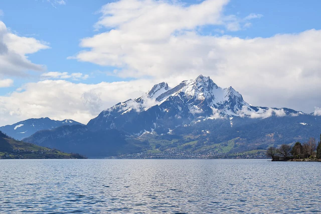
Mount Pilatus rises directly above Lucerne to 2,118 m (6,949 ft), and its trails give you an unusual choice: sweat the whole climb from the valley, or ride a gondola and cable car high on the mountain and walk the rest. That makes it one of the most flexible summit days in Central Switzerland, suited to strong hikers who want a full ascent and to half-day visitors who want a high start.
What the Pilatus hike offers and who each route suits
Two ascent lines define the day. The long climb from Alpnachstad via Ämsigen is a medium-difficulty route of about 4 hours 30 minutes past flower-filled meadows and rocky cliffs, and it suits a hiker with a full day and steady legs. The shorter line from Fräkmüntegg over the Klimsensattel is steep and challenging, and it suits someone who takes the gondola up from Kriens, walks to the summit and saves their energy for the top. If you want to compare this lift-assisted approach with other high starts, the hiking in Interlaken follows the same ride-up-and-walk formula.
Above Pilatus Kulm the mountain becomes gentle. Good footpaths run to the Esel, Oberhaupt and Tomlishorn viewpoints, so even a rider can build a real summit circuit. If you are weighing Pilatus against other days out of Lucerne, the mountain's selling point is that the cableways let you choose how much of the climb you do yourself; the surrounding region is covered in the Lucerne hiking guide.
Getting to the trailheads: Alpnachstad cogwheel railway, Kriens gondola and Fräkmüntegg
The Alpnachstad trailhead sits at the valley station of the cogwheel railway, which climbs to Pilatus Kulm on the world's steepest cog railway at an incline of 48 percent. Hikers who walk up can ride it down, turning a one-way ascent into a loop. The gondola from Kriens serves the middle stations Krienseregg and Fräkmüntegg, which is where the short steep summit route begins.
During the published maintenance window of 19 October to 27 November 2026, the gondolas and cable car are closed and the only access is by cogwheel railway from Alpnachstad. Plan any autumn hike with a Fräkmüntegg start for another season, and build the day around the Alpnachstad line instead. Pilatus-Bahnen publishes the operating details and the closure on its hiking page.
Alpnachstad to Pilatus Kulm via Ämsigen
This is the classic climb: from Alpnachstad you follow the line of the cogwheel railway through the Ämsigen sector to Pilatus Kulm in about 4 hours 30 minutes, gaining height through alpine meadows, streams and steep rocky ground. The route is rated medium difficulty. It is the more sustained of the two ascents, so treat it as a morning start and keep something in reserve for the descent.
The mountain's own guidance puts a full hike up at about 5 hours from Kriens or Alpnachstad, so budget the longer figure if you include the summit paths. There are no distance or ascent figures published for the route, so judge the effort by the walking time and the terrain rather than by a number on a signpost. Ride the cogwheel railway down and you finish where you started.
The Fräkmüntegg to Pilatus Kulm route via Heitertannliweg and the Klimsensattel
From the Fräkmüntegg station the route runs by the Heitertannliweg and over the Klimsensattel to Pilatus Kulm. It is short but steep, and the mountain rates it as challenging rather than a stroll. That combination makes it the efficient choice for a half-day visitor who rides up from Kriens and wants the summit under their own steam.
Because the climbing is concentrated, the route gives you the summit sooner but asks for sure footing on steeper ground; hiking boots and poles are worth carrying. It runs from June to October, and it depends on the gondola being open, so the autumn maintenance window rules it out for that period. Pair it with an easy walk on the Krienseregg side if you want a gentler second half.
Summit paths from Pilatus Kulm: Esel, Oberhaupt and Tomlishorn
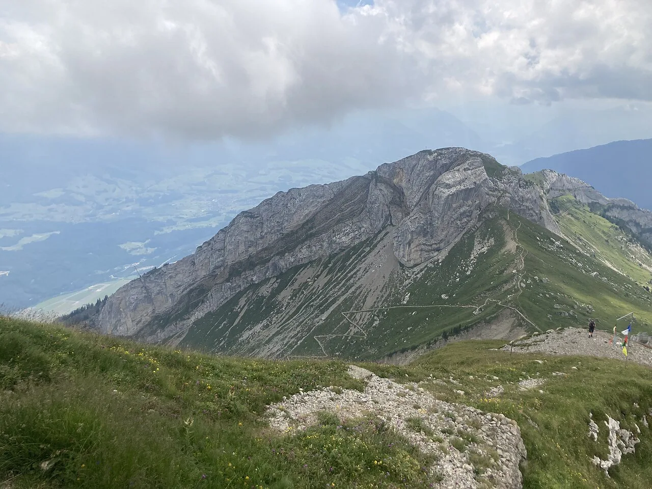
Once at Pilatus Kulm the viewpoints come quickly. It takes about 15 minutes to climb the Esel, around 20 minutes to walk round the Oberhaupt and 30 to 40 minutes to reach the Tomlishorn, the highest and outermost peak. Build a circuit in that order and you have a proper summit walk without adding another climb.
The paths are good footpaths, but they are exposed ridge walking, so take the short detours seriously in wind or low cloud. The 40-minute Drachenweg circular trail on top is the family version, with views over Lake Lucerne and the Central Swiss Alps. Between the three peaks and the dragon trail you can fill two or three hours above the station.
Easy options: Krienseregg to Fräkmüntegg and the Dragon Moor path
The gentlest full walk on the mountain goes from the Krienseregg middle station past the Schönenboden hut to Fräkmüntegg in about 1 hour 40 minutes. It stays in wooded terrain, which makes it the pick on a hot summer day and the sensible option with children. Both ends sit on the gondola line from Kriens, so you can walk one way and ride the other.
The Dragon Moor path is an easy circular trail over protected high moorland, open all year, with information on the history, flora and fauna along the way. Families with small children should note that the hiking trails on Pilatus are not suitable for pushchairs. Fireplaces with firewood are available at Krienseregg and Fräkmüntegg, but there are none at the summit.
The Flower Trail to Tomlishorn, June to October
The Flower Trail is the easy way to reach the Tomlishorn, the highest point of the mountain, along a leisurely path lined with protected alpine flowers. It operates from June to October and is the route to choose if you have ridden up and want the best viewpoint without a hard walk. Take your time on the flower sections and stay on the path.
For a longer day with a similar summit pay-off, the Stoos ridge hike offers a high-level traverse above Lake Lucerne that suits confident walkers. Comparing the two helps you decide whether you want a mountain railway summit or a full-day ridge walk. Note that Stoos lies outside the Pilatus massif, so it is a separate day out based from the same region.
Facilities on the route: restaurants and fireplaces
Food and drink are concentrated at the stations rather than spread along the trails. Restaurant Fräkmüntegg serves a hiker's breakfast, and the restaurants at Pilatus Kulm and Krienseregg give you options at either end of the day. The official fireplaces at Krienseregg and Fräkmüntegg come with firewood and some have seating, so a picnic and a barbecue are realistic.
There are no fireplaces at Pilatus Kulm, and the summit itself is not the place to plan a cookout. Carry water for the climbs, because the long routes from Alpnachstad and Fräkmüntegg have no reliable refill points between the valley and the top. Fill up at a station before you set off.
Difficulty, scrambling and exposure on the steeper routes
The two ascents demand different things. The Ämsigen climb from Alpnachstad is medium difficulty over varied ground, while the Fräkmüntegg route over the Klimsensattel is steep and rated challenging. Neither is a technical climb, but the steeper ground means good shoes and weatherproof clothing are the baseline rather than an afterthought.
Above Pilatus Kulm the paths are exposed in places, and the ridge to Tomlishorn is the airiest section. In wind, rain or low cloud, keep the summit circuit short and turn back rather than push on to the outermost peak. The mountain's own advice for the harder routes is proper hiking boots, poles and a map or hiking app.
When to go: season, snow on the summit paths and trail repair day
The hiking season usually runs from May to October, depending on snow conditions. Summit hikes to Pilatus Kulm are only recommended from mid-June, because many higher trails hold snow until then; lower routes around Fräkmüntegg can open earlier. Aim for July to September if you want the summit paths clear and the ground dry.
The Pilatus Putzete, when the trails are repaired after winter damage, usually falls on the third Saturday in June. Around that date some paths may be freshly worked, so check conditions with Pilatus-Bahnen before a mid-June summit day. Late-season walkers also need to plan around the autumn cableway closure.
Cogwheel railway tickets, seat reservation and lift maintenance closure
Tickets for the cogwheel railway and the cableway can be bought at any station on the day or online, so there is no need to commit in advance. A seat reservation for the cogwheel railway is worth adding, because waiting times build up when the mountain is busy. Purchase is separate from the reservation if you already hold a valid ticket.
The published closure of the gondolas and cable car runs from 19 October to 27 November 2026 for maintenance, and during that period the cogwheel railway from Alpnachstad is the only way up or down. Build a one-way walk and a rail descent around that window. Ticket prices are set by Pilatus-Bahnen and shown at the point of sale.
Mountain safety on Pilatus
Afternoon storms are the main summer hazard on exposed ground above Pilatus Kulm, so start early and be off the ridge by the time thunder builds. Snow can linger on the higher paths into June, and the steep Klimsensattel route becomes slippery when wet. Carry water, wear boots with grip and keep a map or hiking app handy on the descents.
The ridge is exposed to wind, and the drop on the Tomlishorn side demands care with children. In poor visibility, the marked paths to Esel and Oberhaupt are the safer summit options. Note that bikes also use some trails on the mountain, so keep left on blind bends.
Where to base yourself: Lucerne and the valley stations
Lucerne is the natural base: the Kriens gondola is the access point for the Krienseregg and Fräkmüntegg routes, while Alpnachstad serves the cogwheel railway and the Ämsigen climb. Staying in the city puts both valley stations within a short trip and gives you a town evening after a long day.
For an alternative low-level day with a lake panorama, the Rigi hike gives you a classic ridge walk reached by mountain railway from the same area. The Rigi lies outside the Pilatus massif, so treat it as a separate outing rather than an extension of a Pilatus day. Staying in Lucerne makes both easy to reach.
Plan Your Pilatus Day
Decide first how much climbing you want. A full ascent from Alpnachstad via Ämsigen takes about 4 hours 30 minutes and suits a strong hiker; the steep Fräkmüntegg route to Pilatus Kulm gets you to the top faster and leaves time for the Esel, Oberhaupt and Tomlishorn viewpoints. Whichever you pick, save the cableway or cogwheel railway for the descent.
Time your trip between mid-June and October for the summit paths, and plan an Alpnachstad start if you travel during the 19 October to 27 November 2026 cableway closure. Add a seat reservation for the cogwheel railway and keep an easy Krienseregg or Dragon Moor day as a backup for poor weather.
Frequently Asked Questions
How long does it take to hike up Mount Pilatus?
Allow about 4 hours 30 minutes for the climb from Alpnachstad via Ämsigen, and about 5 hours for a full ascent from Kriens or Alpnachstad. The steeper route from Fräkmüntegg over the Klimsensattel is shorter in time but harder in effort. Add two to three hours if you want to walk all the summit viewpoints.
How difficult is the Mount Pilatus hike?
The Ämsigen route from Alpnachstad is medium difficulty over varied ground, while the Fräkmüntegg route via the Heitertannliweg and Klimsensattel is steep and rated challenging. The summit paths to the Esel, Oberhaupt and Tomlishorn are straightforward footpaths with exposed sections. Easy walks on the Krienseregg and Dragon Moor side suit families.
Can you hike Mount Pilatus without taking the cable car?
Yes. The climb from Alpnachstad via Ämsigen and the climb from Fräkmüntegg to Pilatus Kulm are both on foot, and you can descend the same way. Most hikers walk up one side and ride the cogwheel railway or gondola down. If you start from Alpnachstad you can walk up and take the railway back.
When is the best time to hike Mount Pilatus?
The season usually runs from May to October depending on snow, but summit hikes to Pilatus Kulm are only recommended from mid-June. Lower routes around Fräkmüntegg can be clear earlier. July to September gives the most reliable conditions for the higher paths.
How do you get to the Mount Pilatus trailhead from Lucerne?
Use the gondola from Kriens for the Krienseregg and Fräkmüntegg trailheads, or reach Alpnachstad for the cogwheel railway and the Ämsigen climb. Lucerne is the convenient base for both. During the 19 October to 27 November 2026 maintenance window the gondolas and cable car are closed, and access is only by cogwheel railway from Alpnachstad.
Is the Mount Pilatus hike suitable for families?
Yes, around the middle stations. The walk from Krienseregg past the Schönenboden hut to Fräkmüntegg takes about 1 hour 40 minutes, and the Dragon Moor circular trail is easy and open all year. The hiking trails are not suitable for pushchairs. Fireplaces at Krienseregg and Fräkmüntegg make a family picnic easy.
Sources
Trail notes for your next trip
Optional updates when we add or revise hiking guides.
You might also like
Continue reading
More guides you'll find useful