Fronalpstock Hike from Stoos: Klingenstock Ridge Trail Guide
Walk the Klingenstock to Fronalpstock ridge above Lake Lucerne, with chairlift access from Stoos, walking times, exposure and the full on-foot circuit.
On this page
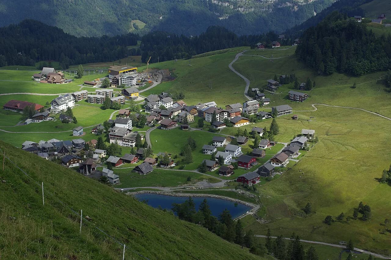
The ridge between Klingenstock and Fronalpstock is the highlight of the Stoos plateau above Schwyz: a high, narrow crest with Lake Lucerne falling away on one side and the Muota valley on the other. Chairlifts lift you to the start, so hikers of moderate fitness can spend their energy on the panorama rather than on a long approach. This guide lays out both versions of the day — the lift-assisted traverse and the full on-foot circuit — so you can pick the one that matches your legs and your schedule.
Why the Klingenstock to Fronalpstock ridge suits panorama chasers
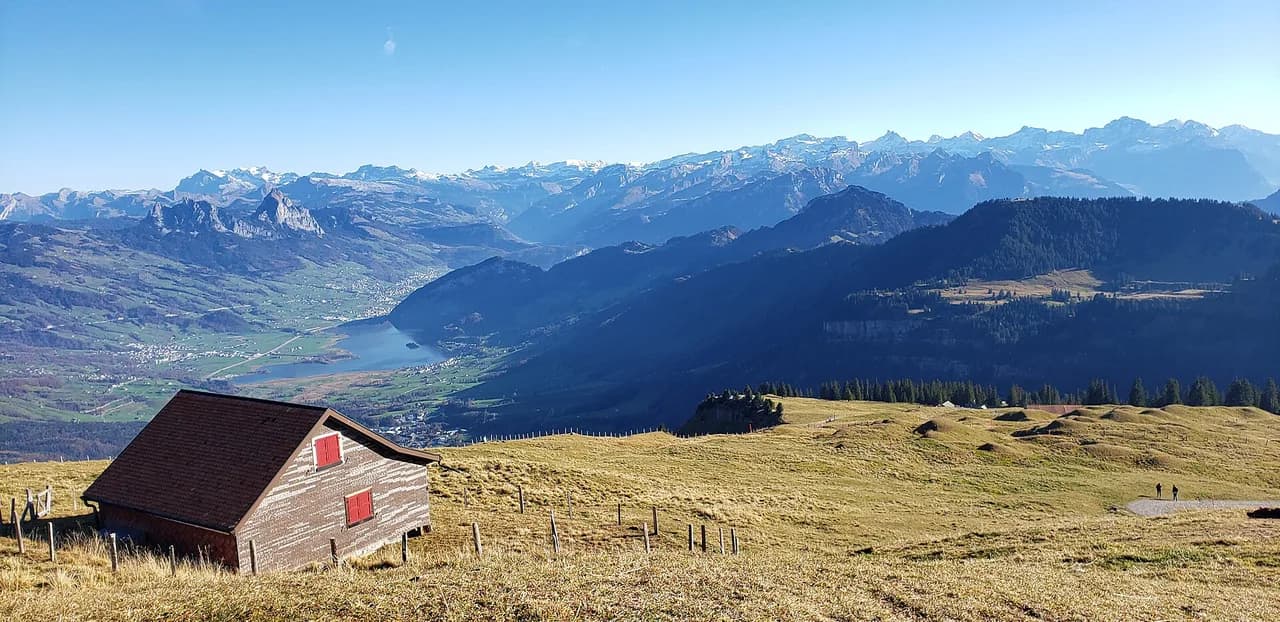
Few walks in central Switzerland deliver so much view for so little effort. From the crest you look across the Schwyz mountains, the peaks of Uri and the Glarus ranges, with the water of Lake Lucerne laid out below. The route is a traverse rather than an out-and-back, so the scenery keeps changing and you finish at a different lift station from the one you started at.
The trade-off is popularity: this is a famous trail, and on clear summer weekends the ridge gets busy. Start early if you want quiet moments on the narrow sections and a shorter wait at the chairlift valley stations. Booking the combined lift ticket online in advance is Stoosbahnen's own recommendation for avoiding queues at the ticket window.
Getting to Stoos: funicular from Schwyz or cable car from Morschach
Stoos is car-free and reached by two separate lifts from the valley. The funicular from Schwyz takes about seven minutes, while the cable car from Morschach takes about seventeen minutes. Both land on the plateau, and your choice mainly comes down to which valley station is easier for you to reach by car or public transport.
If you are connecting onward by train, the Schwyz side is usually the simpler link, since the funicular valley station sits below the town. Drivers will find parking at either valley station, but spaces fill on fine weekends. Allow extra time in the morning rather than cutting it fine for your lift slot.
Walking to the Klingenstock chairlift and riding up to the ridge
From the top station of the Schwyz-Stoos funicular, the footpath to the Klingenstock chairlift valley station takes about fifteen minutes. From the top station of the Morschach-Stoos cable car it is roughly twenty-five minutes. The chairlift ride itself takes about fifteen minutes and drops you at the start of the ridge, saving the 640 m (2,100 ft) of climbing that the path from Stoos would otherwise demand.
The walk between the plateau station and the chairlift is gentle and signposted, so it makes a relaxed warm-up. Keep a light layer accessible: the plateau can feel cool even when the valley below is warm.
Distance, ascent and walking time on the ridge
The ridge section from Klingenstock to Fronalpstock takes about two hours and thirty minutes at a steady pace, and it is the part most hikers come for. The climb from Stoos up to Klingenstock, if you walk it instead of riding, covers about 4 km (2.5 mi) with 640 m (2,100 ft) of ascent and takes roughly one and a half to two hours.
The complete circuit from Stoos over Klingenstock, Huserstock and Fronalpstock and back to Stoos is a much bigger proposition. It runs about 7.8 mi (12.6 km) with roughly 2,926 ft (892 m) of elevation gain and takes around five and a half to six hours. Treat that figure as the full day on foot, not as the ridge traverse alone.
Route description: Klingenstock to Huserstock to Fronalpstock
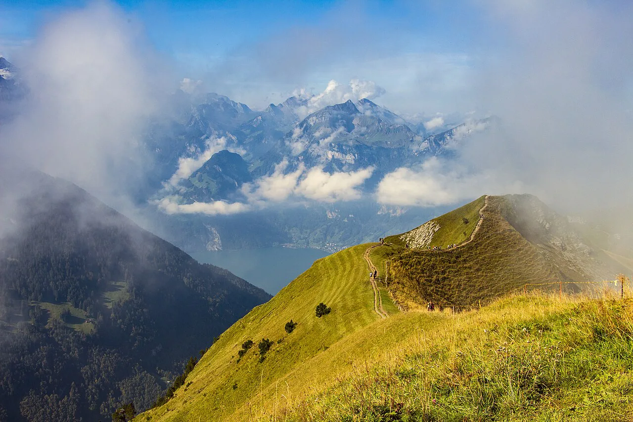
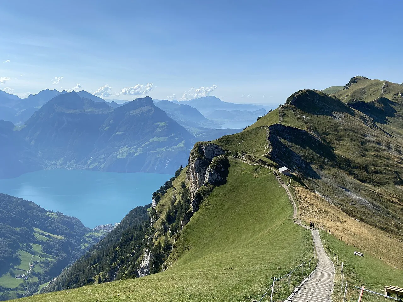
From the Klingenstock chairlift top station, the path follows the crest northeast. The first stretch is the airiest: the ground falls away steeply on both sides, with Lake Lucerne to the left and the Muota valley to the right. Walk within your comfort zone here and give other hikers room on the narrowest passages.
Huserstock is the intermediate summit that breaks up the traverse and lets you judge how the middle of the ridge feels. It is a useful turnaround point if weather turns or legs tire. Beyond it the path continues undulating along the crest, with short steeper steps where hands may be useful on rock.
The ridge finishes at Fronalpstock, where the summit and viewing platform mark the end of the traverse. From there the chairlift drops back to the plateau in about twenty minutes, and a short walk of roughly ten minutes brings you to the Schwyz-Stoos funicular top station, or about five minutes to the Morschach-Stoos cable car.
Exposure and conditions on a double-sided ridge
This is genuinely exposed terrain: the crest is narrow, and a slip on either side has serious consequences. The path is a hiking route, not a via ferrata, so there are no cables or fixed protection. Hikers who are uneasy on narrow ground should walk the ridge in good, dry weather only and turn back at Huserstock if the crest feels beyond them.
Afternoon thunderstorms build quickly in the Alps in summer, and a bare ridge is the last place you want to be when lightning arrives. Plan to be off the crest by early afternoon and watch the sky rather than the clock. Wind is the other factor: the traverse is fully open, so a jacket and a warm layer earn their place in the pack even on warm days.
Fronalpstock summit: viewing platform and mountain restaurant
The summit of Fronalpstock has a viewing platform and a mountain hotel with a restaurant, making it a comfortable place to end the traverse. It is the natural lunch stop before the chairlift down, and the terrace view over the lake is the reward for the ridge.
Because the restaurant sits at the top of a chairlift, it draws a crowd at midday in high season. Arriving earlier gives you a better chance of a table and a quieter summit. Check the restaurant's own page before you rely on it for a late meal.
The full circuit on foot from Stoos without the Klingenstock lift
Hikers who want the whole thing under their own steam can climb from Stoos to Klingenstock on foot, traverse the ridge, and descend from Fronalpstock back to the plateau. That version adds the 640 m (2,100 ft) ascent and around four kilometres (2.5 mi) of climbing to the day before the ridge even begins.
The complete loop, including the descent and the return across the plateau, is the route covered by the hard-rated 7.8 mi (12.6 km) circuit with 2,926 ft (892 m) of gain. Budget five and a half to six hours and start early. Riders can still use the Fronalpstock chairlift down if their legs give out, which makes the on-foot ascent a flexible choice rather than a commitment.
When to go: best months and how snow affects the ridge
Late spring through early autumn is the natural window for the traverse, with May to October the most popular period for the full circuit. Snow can linger on the crest into early summer and return in the first autumn storms, and a snow-covered ridge is a far more serious undertaking than the summer path. Check the operating information on the Stoos website if you plan to hike at the edges of the season.
Fees, tickets and the combined day ticket
For the lift-assisted version, Stoosbahnen recommends a day ticket that covers all the mountain railways needed for the approach and return, sold under the name Peak Experience Ticket. Buying it online in advance is the stated way to avoid waiting times at the valley station. Fares change, so check the current price on the Stoosbahnen ticket pages when you book.
If you plan to ride only one leg, or walk the whole way, you can buy individual lift tickets instead. Compare the cost of single rides with the day ticket before committing, since the combined product pays off mainly when you use several lifts in one day.
Where to base yourself: Schwyz, Morschach and Stoos
Stoos itself is car-free and puts you closest to the trailheads, which suits hikers who want an early start on the ridge. Schwyz and Morschach below both give you a normal town base with the lifts as your daily commute, and each connects to a different access route. For a wider menu of day hikes around the lake, the hiking in lucerne region has plenty to pair with this traverse, just as hiking in Interlaken offers a similar mix of lakeside and ridge days.
A quiet alternative for a second day is the rigi hike above the lake, which uses its own mountain railways and offers gentler gradients than the Stoos crest. Both areas are reachable from Lucerne by train and boat, so a two-base trip works well.
What to carry on an exposed ridge at this altitude
Pack for wind and quick weather changes: a waterproof shell, a warm mid-layer, gloves and a hat, even in midsummer. Sturdy footwear with good grip matters on the rocky steps, and trekking poles help on the steep sections though some hikers prefer free hands on the narrowest parts. Carry at least a litre of water per person, since the ridge has no reliable refill until Fronalpstock.
A map or offline route on your phone is worth having, along with a power bank. Mobile reception on the crest is patchy in places, so do not rely on it for navigation. Let someone know your plan and expected finish time before you set off.
Plan Your Fronalpstock Hike
Decide first between the lift-assisted traverse and the full on-foot circuit: the first is a relaxed half day with about two and a half hours on the ridge, the second is a five-and-a-half to six hour day with real climbing. Whichever you choose, ride up early, respect the exposure on the narrow crest, and be off the ridge before the afternoon storms build.
Book your lift ticket online, check the weather the evening before, and keep your plan flexible enough to turn around at Huserstock if conditions change. The effort is modest and the panorama is one of the finest in central Switzerland.
Frequently Asked Questions
How long is the hike from Klingenstock to Fronalpstock?
The ridge traverse between the two summits takes about two hours and thirty minutes at a steady pace, and that figure covers the crest only, not the lifts or the walk across the Stoos plateau. The full circuit from Stoos over Klingenstock, Huserstock and Fronalpstock and back is a much longer day of roughly five and a half to six hours with about 892 m (2,926 ft) of climbing.
How do I get from Stoos to the start of the ridge?
Ride the funicular up from Schwyz or the cable car up from Morschach, then walk to the Klingenstock chairlift valley station. The walk is about fifteen minutes from the Schwyz-Stoos funicular top station and roughly twenty-five minutes from the Morschach-Stoos cable car top station, and the chairlift ride to the ridge start takes about fifteen minutes.
Is the Stoos ridge hike difficult?
The terrain is the challenge rather than the distance. The crest is narrow with steep drops on both sides, there are no cables or fixed protection, and short rocky steps may need hands. Hikers who are comfortable on exposed ground in dry weather will enjoy it; anyone uneasy on narrow paths should turn back at Huserstock.
Can you hike the Fronalpstock ridge without using the Klingenstock chairlift?
Yes. Walking from Stoos up to Klingenstock adds about 4 km (2.5 mi) and 640 m (2,100 ft) of ascent, roughly one and a half to two hours before you reach the start of the ridge. You can still take the Fronalpstock chairlift down afterwards, which keeps the day manageable if your legs tire.
When is the best time to hike the Fronalpstock ridge?
Late spring through early autumn is the natural window, with May to October the most popular period for the full circuit. Snow can linger on the crest into early summer and return with the first autumn storms, so check current operating information if you plan to hike at the edges of the season.
Do I need a special ticket for the Stoos lifts?
The Peak Experience Ticket is a day ticket that covers all the mountain railways needed for the approach and return, and booking it online in advance avoids queues at the valley station. Single-ride tickets are also available, so compare them with the day ticket if you plan to use only one or two lifts.
Sources
Trail notes for your next trip
Optional updates when we add or revise hiking guides.
You might also like
Continue reading
More guides you'll find useful