Appenzell Hiking: Alpstein Trails, Lakes and Ridge Hikes
Plan Appenzell hiking around the Alpstein: Seealpsee, Äscher and Wildkirchli, Saxer Lücke and the three lakes, with distances, ascent and walking times.
On this page
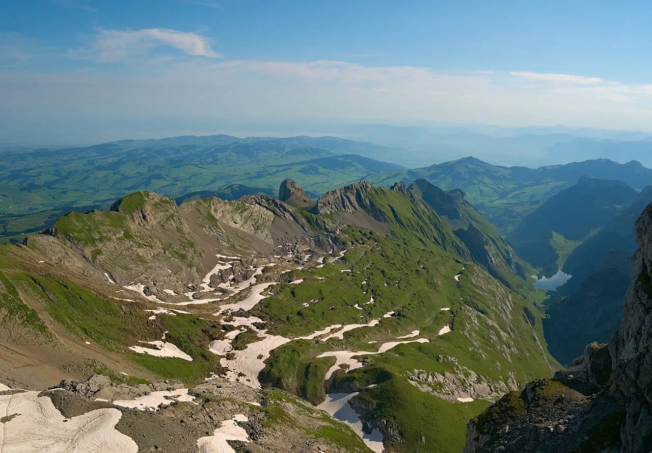
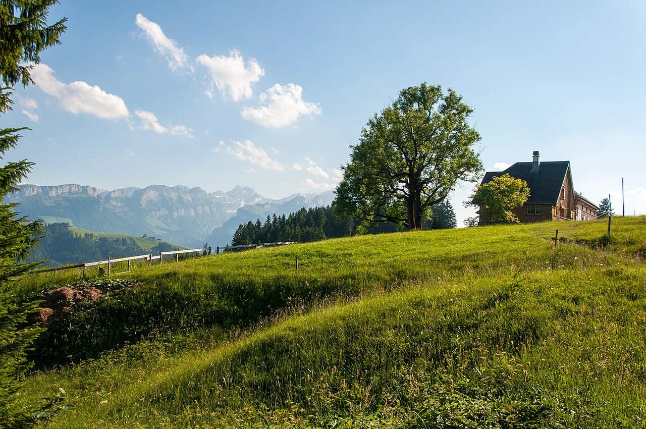
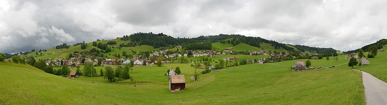
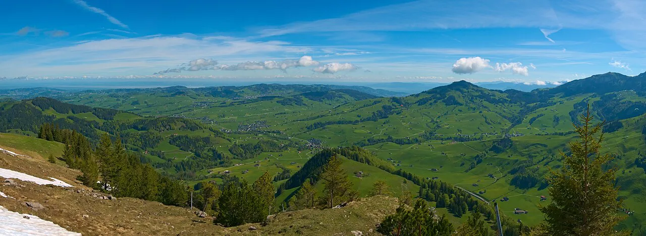
Appenzell hiking is really Alpstein hiking. This compact limestone massif in eastern Switzerland packs more than 60 named summits, three swimmable-looking alpine lakes and a network of ridge paths into an area you can cross on foot in a long day. The rewards are green pastures below, grey karst above, and inns tucked against the rock.
The trails suit different hikers. Families and short-break visitors gravitate to the Seealpsee basin and the Äscher inn; strong walkers go for the three-lake circuit or the Saxer Lücke ridge; everyone ends up eating at a mountain inn. Distances and ascent below come from documented routes in the region, graded on a Swiss Alpine Club scale.
Why the Alpstein is where Appenzell hiking happens
The Alpstein is the limestone range that fills the horizon south of Appenzell village. Its peaks sit close together, so a single day can link a lake, a pass and a summit without a long approach. The trade-off is popularity: the Seealpsee and Äscher paths are the busiest in the canton, and starting early is the simplest way to have them closer to yourself.
Routes carry white-red-white blazes for mountain trails and white-blue-white for harder alpine ground, as the region's route catalog describes. That marking system tells you quickly whether a path is a prepared hiking trail or something that asks for hands and a head for heights. Read the blaze at each junction rather than following the person ahead.
The landscape itself is the reason to come. Limestone has eroded into shark-fin spires, knife-edge ridges and caves such as Wildkirchli, where evidence of human use reaches back tens of thousands of years. Expect grass underfoot on the lower pastures and loose, polished rock on the upper sections.
Trailheads and bases: Appenzell village, Wasserauen, Brülisau and Ebenalp
Appenzell village makes the most comfortable base: a historic center, shops, and short onward connections to the valley stations. It suits travelers who want a town evening after a hike and don't mind a transfer each morning. The tourist office in Appenzell keeps printed and downloadable route descriptions that are worth collecting before you commit to a plan.
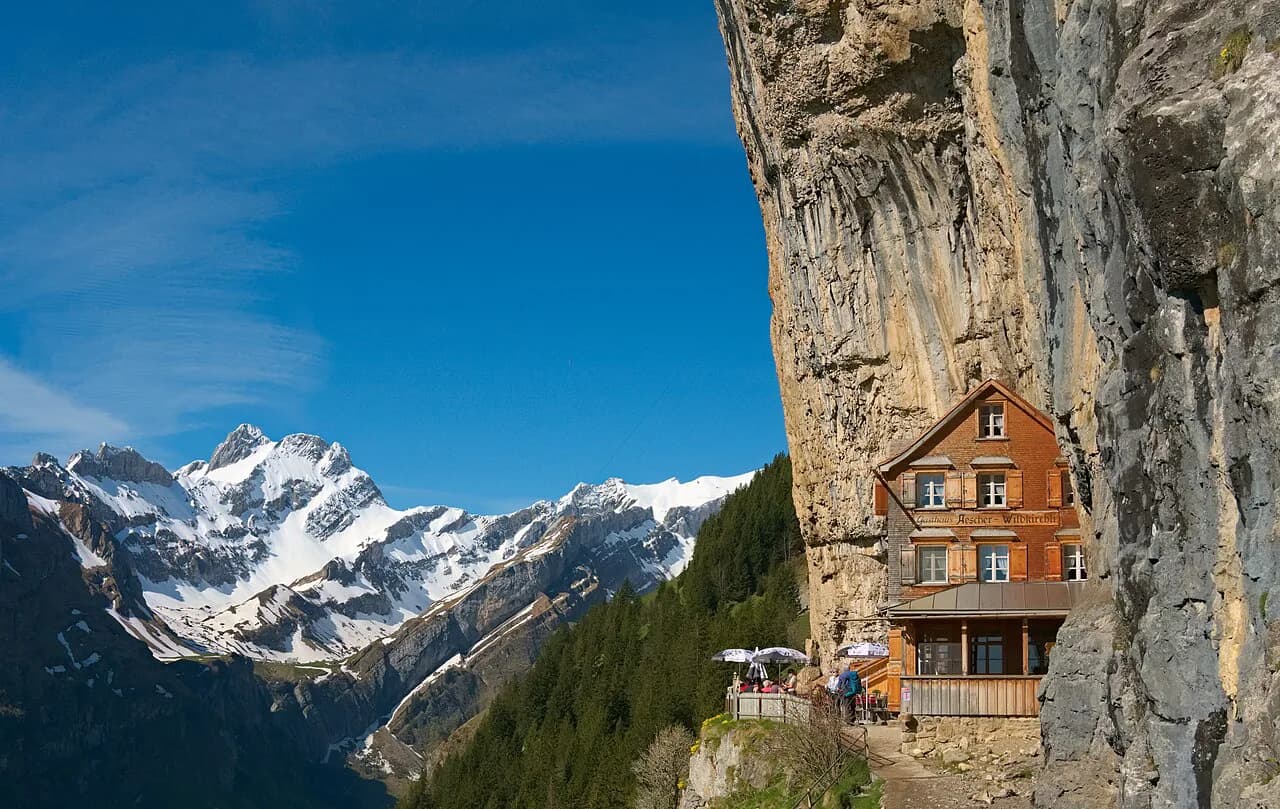
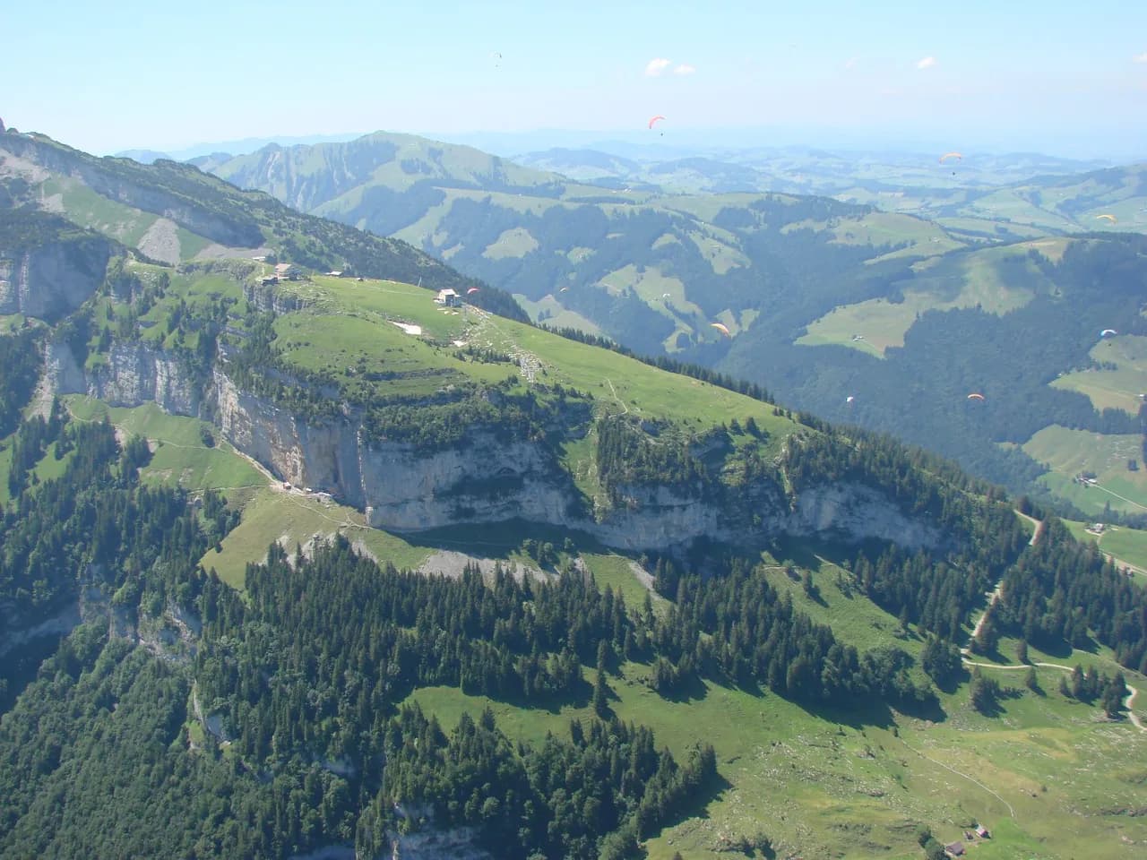
Wasserauen is the launch point for Seealpsee, Äscher and the Ebenalp. It is a small station at the end of the valley line, so most hikers arrive by train and walk straight onto the trail. The Ebenalp cableway rises from Wasserauen and shortens the climb to the Äscher and Wildkirchli, useful if you want the famous viewpoints without the full ascent.
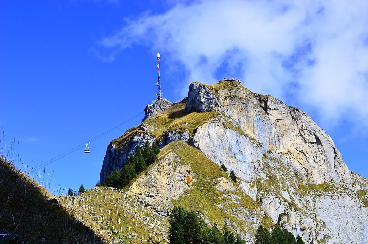
Brülisau, on the other side of the range, is the base for Hoher Kasten, Sämtisersee and Alp Sigel. A cableway climbs from Brülisau toward Hoher Kasten, which puts ridge-level walking within reach of a half day. Choose Wasserauen for the lakes and the Äscher, Brülisau for the eastern ridges and the Sämtisersee circuit.
Easy and half-day hikes: Äscher, Wildkirchli and Sämtisersee
The shortest rewarding day above Wasserauen chains the Wildkirchli caves, the Äscher inn and the Seealpsee basin. The documented version runs 9.4 km (5.8 miles) with 180 m (590 ft) of ascent and 890 m (2,920 ft) of descent over about 3 hours 37 minutes, because the cableway does the climbing and the trail does the dropping. The descent between Seealpsee and the inn is steep and rated T3, with fixed rope helping on the loosest stretch.
Sämtisersee makes a gentler half day from the Rüte side. The loop measures 9.9 km (6.1 miles), 490 m (1,610 ft) up and the same down, about 3 hours 23 minutes, and earns a moderate grade because the path is mostly walkable with sure feet. The lake sits in a hollow below the Alpstein walls, with the Plattenbödeli inn nearby for a break.
If you only have an afternoon, ride the Ebenalp lift up and walk down through the Wildkirchli caves to the Äscher and Seealpsee. It is the same descent as the circuit above, without the climb, and it keeps the best viewpoints in the second half of the day. Sturdy shoes matter more than fitness here.
The Seealpsee loop from Wasserauen
Walking up from Wasserauen to Seealpsee and back is the classic Appenzell outing. The documented loop covers 10.7 km (6.6 miles) with 720 m (2,360 ft) of climbing and the same descent over roughly 4 hours 45 minutes, graded hard on the SAC-based scale because of the steep ground rather than the distance. The lake appears suddenly below the path, with the Alpstein walls reflected in it on still mornings.
Most hikers break the day at the Berggasthaus Seealpsee, on the shore, before deciding whether to continue higher toward Äscher or turn back down the valley. That decision sets the day's character: a lake-and-inn outing, or a longer traverse with a steep exit. The path above the lake toward Äscher is the section that asks for care, with polished rock and exposure on the steepest steps.
Three lakes in a day: Seealpsee, Fählensee and Sämtisersee
The three-lake circuit is the big day in the western Alpstein. It covers 19.0 km (11.8 miles), climbs 1,180 m (3,870 ft) and descends 1,140 m (3,740 ft) over about 7 hours 44 minutes, and is graded hard. Linking three lakes means two passes, so the day rewards an early start and a steady pace more than speed.
Each lake has its own character. Seealpsee is the busiest and the most photographed; Fählensee sits in a bare rocky bowl beneath the Widderstein end of the range; Sämtisersee is the quietest and has an inn beside it. Walk the circuit anticlockwise if you want the steeper climb done with fresh legs and the long descent saved for the afternoon.
Saxer Lücke from Staubern or Hoher Kasten
Saxer Lücke, at roughly 1,670 m (5,480 ft), is the notch most photographs of the Alpstein come from: a gap between limestone towers with the Rhine Valley and the Vorarlberg Alps beyond. Two short loops reach it, one from the Sämtisersee side and one from the Staubern side, both around 8 km (5 miles) and 390 m (1,280 ft) of ascent, taking a little over 3 hours and graded moderate.
The ambitious version traverses the ridge. The Hoher Kasten summit loop from Sämtisersee runs 17.4 km (10.8 miles), 880 m (2,890 ft) up and 890 m (2,920 ft) down in about 6 hours 57 minutes; the Staubern to Saxer Lücke loop from Rüte is 17.7 km (11 miles) with 1,020 m (3,350 ft) in each direction and about 7 hours. Both are graded hard, and the ridge sections are exposed to wind and weather with no easy shortcut once you are up.
For a mountain day rather than a full traverse, ride the Brülisau cableway toward Hoher Kasten and walk the ridge path to the gap, then descend to one of the inns and out by bus. That pattern keeps the best of the scenery and cuts the total ascent, but leaves you dependent on lift hours, so plan the last descent with time in hand.
Longer Alpstein days: Rossmad, Meglisalp and Alp Sigel
The circuit from Seealpsee up to Rossmad and across to Meglisalp is the strongest single day in the central range. It measures 15.2 km (9.4 miles) with 1,060 m (3,480 ft) of climbing and the same descent, about 6 hours 53 minutes, graded hard with alpine experience recommended. Meglisalp's inns give you a mid-route rest before the long drop back.
The Hoher Kasten to Alp Sigel traverse is the panorama day. It stretches 14.4 km (8.9 miles), climbs 710 m (2,330 ft) and descends 880 m (2,890 ft) in about 6 hours 4 minutes, travelling via Fählensee. It is graded hard, but the climbing is spread across a ridge line rather than concentrated in one steep wall, so it suits fit walkers comfortable on exposed grass and rock.
Mountain inns on the route
Inns are part of the route planning here, not an afterthought. The Äscher, built into the cliff below Wildkirchli, the Plattenbödeli by Sämtisersee and the Berggasthaus at Seealpsee all sit on or beside the trails, and some can only be reached on foot. That foot-access is what makes them quiet: no road, no car park, just walkers arriving at the door.
Several inns also take overnight guests, which turns a long traverse into two shorter days. Book directly with the inn you want, since capacity in these small mountain houses is limited compared with the valley hotels in Appenzell village. Carry cash and water for the higher sections regardless of where you plan to stop.
When to go
The hiking window runs from late spring to early autumn, roughly May to October, when the trails to the lakes and high basins are generally free of snow. Lower valley paths can be open earlier and later in the year. Late autumn brings fog seas in the Rhine Valley, which is its own reason to climb above them.
Snow lingers on the karst and in the shaded passages of Saxer Lücke and the high ridges into early summer, and fresh snow can return in October. That matters because the steepest sections combine polished rock with snow, so a route that is straightforward in August becomes a different proposition in June. Plan the higher ridge days for mid-summer and save the lakes for the shoulder months.
Weather, rock and steep ground
The Alpstein's limestone is the main hazard. Rain and foot traffic polish the rock into something slick, especially on the steep T3 stretch between Seealpsee and Äscher, where fixed ropes help but do not remove the exposure. Wet weather turns a moderate path into a slow one, so build slack into your timings rather than committing to a fixed train out.
Afternoon thunderstorms are the seasonal pattern in these mountains. Starting early is not style here, it is the plan: on the ridge routes you want to be off the exposed ground by early afternoon. Pack a shell layer, since the summits and gaps catch wind even when the valley is still.
Where to base for each hike
Match your base to your main objective. Stay in Appenzell village for the inns, museums and easy evening, with a short morning transfer to Wasserauen or Brülisau. Stay at Wasserauen for back-to-back days on the Seealpsee, Äscher and Ebenalp side. Choose the Brülisau side if Saxer Lücke, Hoher Kasten and Sämtisersee are your priorities, since you can walk from the valley station instead of driving around the range.
If you are linking the Alpstein to a longer Swiss trip, Appenzell sits in the country's eastern hiking country, well away from the classic Bernese Oberland routes. Hikers heading west afterward find a different scale of landscape around Grindelwald, where the trails are longer and the huts are higher; that contrast is useful when you are dividing a two-week trip between regions. For a lakes-and-lifts alternative on the same westbound arc, compare this with hiking in Interlaken before you commit the days.
Planning Your Appenzell Hiking Days
Decide first how much climbing you want, not how many hikes you can tick off. Two valley days, a lake circuit and one ridge traverse make a better week than five summit attempts on tired legs. Appenzellerland Tourismus publishes the full route list, with PDF descriptions for each hike, which is the simplest way to confirm distances before you commit.
Book mountain-inn beds early if you plan to sleep high, and keep one flexible day for weather. The Alpstein rewards patience: a clear morning after rain, with the limestone still dark and the pastures bright, is what most people come for.
Explore more Appenzell hiking guides
Frequently Asked Questions
What are the best hikes around Appenzell?
For most visitors the Seealpsee loop from Wasserauen, the Äscher and Wildkirchli circuit above it, and the Sämtisersee loop from Rüte cover the classic ground in two or three days. Stronger hikers add the three-lake circuit or the Saxer Lücke ridge traverse from Staubern or Hoher Kasten.
Is the hike to Seealpsee hard?
The loop from Wasserauen climbs 720 m (2,360 ft) in each direction over about 4 hours 45 minutes and is graded hard on the Swiss Alpine Club-based scale, mostly because of steep, polished ground rather than distance. Sturdy shoes and sure feet matter more than speed.
How long does the Saxer Lücke hike take?
The short loops from the Sämtisersee and Staubern sides are around 8 km (5 miles) with about 390 m (1,280 ft) of ascent, taking a little over 3 hours. Full ridge traverses to Hoher Kasten or from Rüte run 17 km or more and take around 7 hours.
Can you reach the Äscher by cable car?
The Ebenalp cableway from Wasserauen shortens the climb to the Äscher and the Wildkirchli caves, leaving a steep descent rather than a long ascent. Service is seasonal, so check the cableway's operating calendar before you rely on it.
When is the hiking season in the Alpstein?
Late spring to early October is the reliable window, with the high routes and the lakes generally free of snow from around May onward. Snow can linger into early summer on shaded passes and return in October on the ridges.
Where should you stay to go hiking in Appenzell?
Appenzell village suits travelers who want restaurants and museums after the walk. Wasserauen is best for the Seealpsee and Äscher side, and the Brülisau side puts you at the foot of Hoher Kasten, Saxer Lücke and Sämtisersee. Mountain inns offer overnight stays for longer traverses.
Are dogs allowed on Appenzell hiking trails?
Dogs are generally welcome on the trails, but they should be kept on a leash near livestock, in nature protection areas and in busy sections. Individual mountain inns set their own rules about dogs indoors, so ask when you book a bed.
Sources
Trail notes for your next trip
Optional updates when we add or revise hiking guides.
You might also like
Continue reading
More guides you'll find useful