Seealpsee Hike: Wasserauen Trail, Distance and Time
The Seealpsee hike climbs from Wasserauen station to an Alpstein lake in about two hours. Get the route, distance, ascent and how to extend to Ebenalp.
On this page
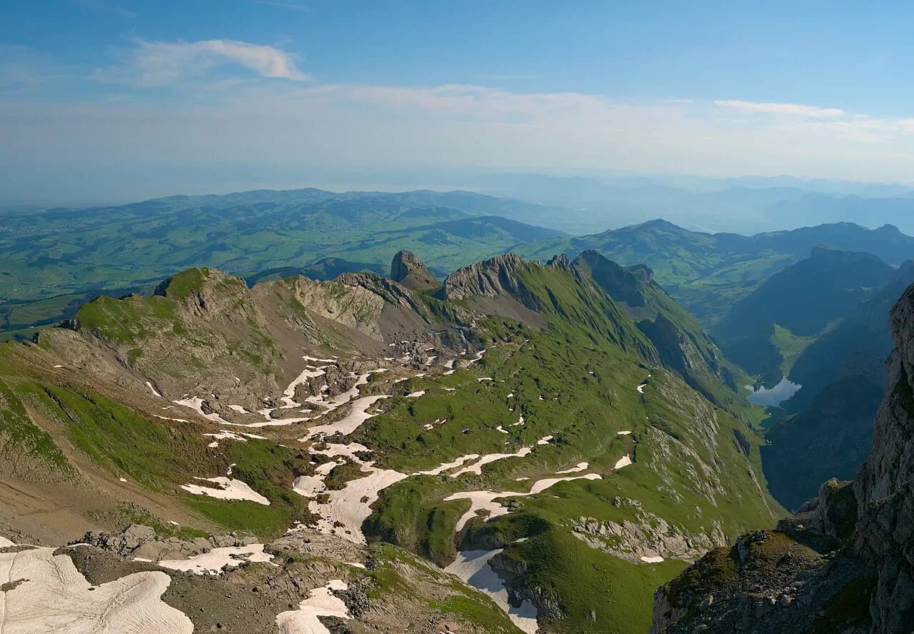
Seealpsee sits at 1,142 m (3,747 ft) in the Alpstein range above Wasserauen, a lake you reach only on foot and one of the most photographed spots in eastern Switzerland. The climb is short enough for a half day and scenic enough that the walk up never feels like transport. It suits hikers with basic fitness who want a mountain lake without a long approach, plus anyone building a longer day toward Ebenalp and the Äscher guesthouse.
Where the hike starts: Wasserauen trailhead, parking and train
The standard start is Wasserauen, where the road ends at a large paid car park beside the trailhead. Spaces fill quickly on fine weekends, so an early morning arrival saves a wait; payment works by cash at the machines or through the EasyPark app. Overnight stays in the car park are not allowed, and a few dedicated camper spaces sit near the Hotel Alpenrose instead.
A train station stands directly next to the car park, which makes a car optional for this hike and convenient for holders of a Swiss Travel Pass. Ride to Wasserauen and walk straight onto the trail. Timetables and frequencies change by season, so look up the connection on the Swiss federal railway site before you commit to a departure.
Drivers reach Wasserauen from the A1 on the western side or the A13 from the east, following signs for Weissbad and then Wasserauen to the end of the road. A large trail map board stands in the car park, useful for a quick photo before setting off. If you want a broader menu of trails from the same village, the appenzell hiking guide covers the surrounding options.
Distance, ascent and time
As a loop from Wasserauen, the hike covers 6.58 km (4.1 miles) with about 330 m (1,083 ft) of ascent and the same descent, topping out at 1,205 m (3,953 ft). Allow two to two and a half hours of walking, which leaves ample time for the lake itself. One measurement puts the direct climb to the shore at around 2.8 km (1.7 miles) and roughly an hour, so the lake arrives sooner than the loop total suggests.
The difficulty is easy. A few steep sections open the route, but nothing approaches scrambling and no via ferrata gear is needed. Treat the opening climb as the day's real effort and the rest as reward.
Route description: forest climb, waterfalls and huts
Walk the loop clockwise. Head to the left side of the mountain, where a trail climbs steeply through beech forest, crossing streams that form small waterfalls after rain. The shade makes this the gentler side to ascend on a warm day, and the water is the first real scenery of the hike.
Above the trees the gradient eases into open meadows dotted with wooden huts against the Alpstein walls. The path stays mostly flat across this shelf before dropping gently toward the shore, with the lake roughly 10 to 15 minutes beyond the last huts. The service road, a narrow tarmac lane serving the buildings, is the quicker and less interesting line — save it for the descent.
Arriving at Seealpsee: viewpoints, hotel and boat
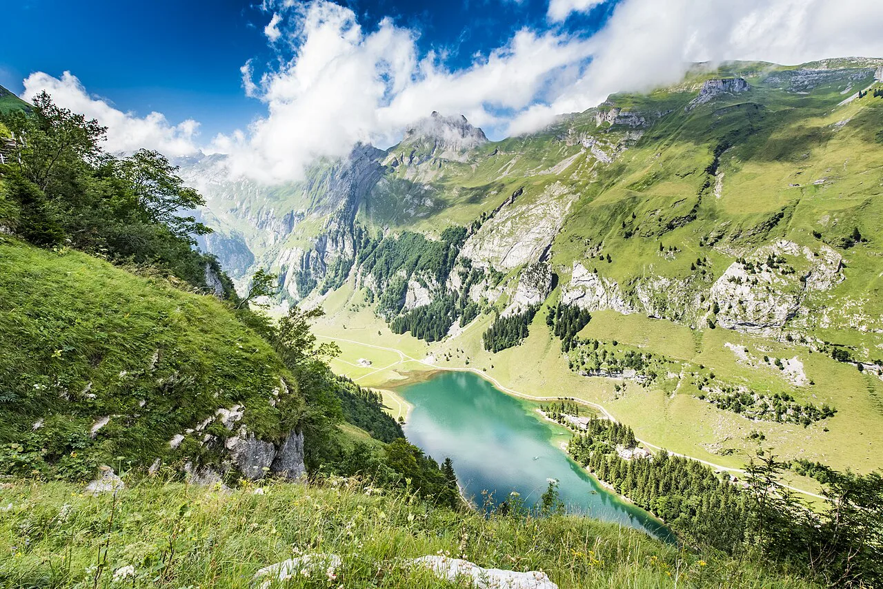
The lake appears suddenly from behind the treeline, and the two classic viewpoints sit on the eastern shore you arrive on. One is by the service road where a rowing boat is moored; the other is in front of the guesthouse. On a still morning the water mirrors the peaks, with the pointed Rossmad prominent at the head of the lake.
Water here is glacial and cold, so a swim is a short, bracing dip rather than a lingering one. A small farmhouse near the shore sells milk and yogurt from the cows grazing the surrounding meadows, a simple pleasure worth timing your break around.
Loop around the lake and extension to Ebenalp and Äscher
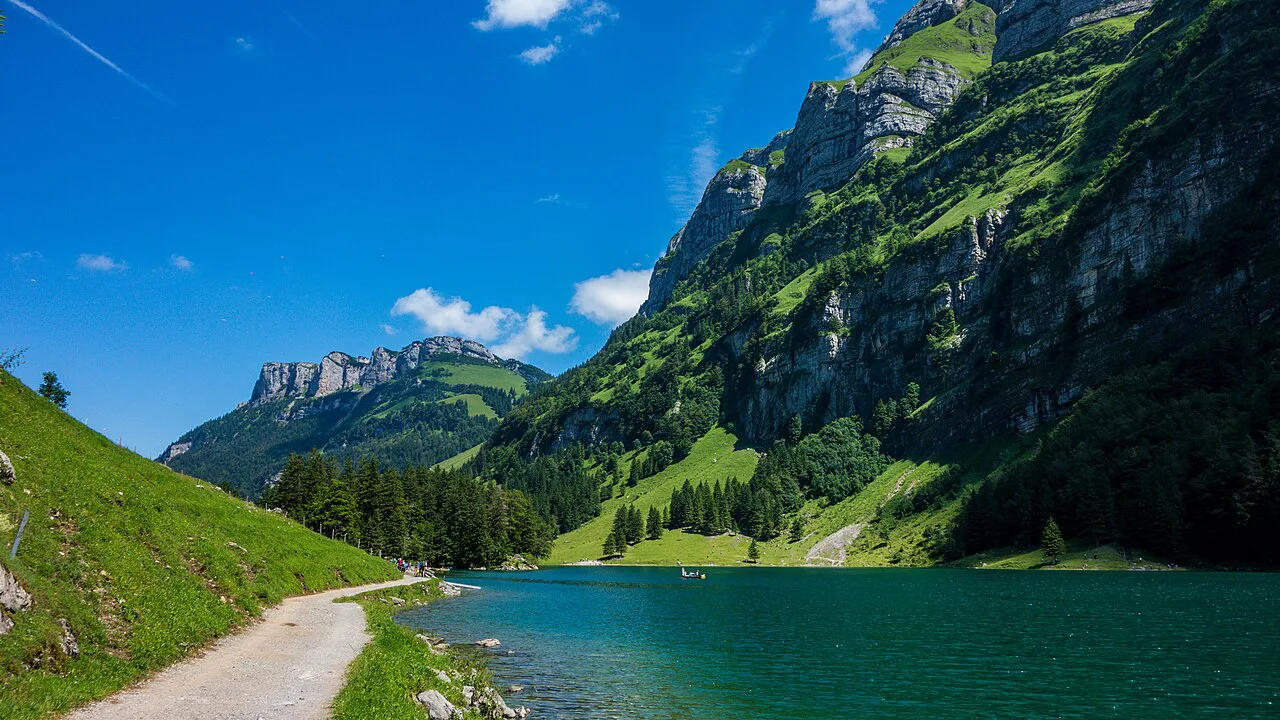
An easy, flat gravel path circles the lake in about 1.7 km (1 mile), adding roughly half an hour without any climbing. Walk it in the morning for reflections on the eastern side before the wind picks up. The contrast with the opening climb is stark: after the forest ascent, this is a stroll.
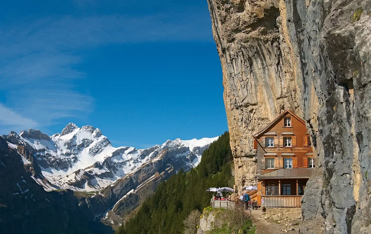
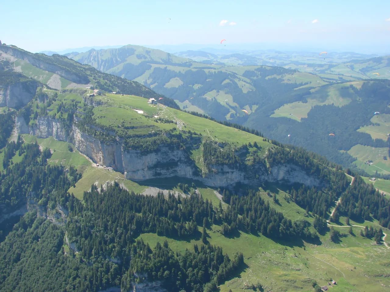
From Seealpsee you can continue to Ebenalp and the Äscher guesthouse, the restaurant set into the cliff face, and return by a different line to the Wasserauen car park rather than retracing your steps. The Aescher Hike in the Alpstein covers that cliff section in detail. Build the extension only if you have a full day, since it doubles the walking.
A cable car also runs up to Ebenalp for those who want the high ground without the extra ascent, with a short walk from the top station to Äscher. A separate route continues from Ebenalp past the Wildkirchli caves and the small chapel, which makes a natural add-on for the descent. Check the lift's operating season and current prices before relying on it outside summer.
Huts and guesthouses on the route
Berggasthaus Seealpsee and Berggasthaus Forelle stand right by the lake, with a few more guesthouses scattered around it, so an overnight at the shore is possible without carrying a tent. Below the trailhead, the Hotel Alpenrose sits next to the Wasserauen car park, and further options lie down the road around Weissbad. Book ahead in autumn, when fine weekends draw crowds for the fog and color.
When to go: seasons, autumn fog and lake reflections
Early autumn is the standout season here, when fog pools around the Alpstein peaks and the beech forest turns. Summer mornings give the calmest water for reflections, and late June is when the Milky Way lines up with the mountain for night photographers. Spring and late autumn can bring snow on the upper meadow sections, so carry traction and check conditions before a shoulder-season attempt.
The region runs webcams at the lake showing whether it is frozen and giving temperatures at the valley and at the shore, useful for deciding how many layers to bring. Rain in the days before your hike means more water in the forest streams and waterfalls on the climb, and more mud underfoot.
What to wear and mountain hazards
Trail shoes suffice for the forest path and the lakeside gravel, but the opening climb is steep enough to warrant grippy soles after rain. The meadows are exposed once you leave the trees, so a windproof layer and sun protection earn their place even on a short hike. Afternoon storms build quickly over the Alpstein in summer, and the open shelf above the forest offers little shelter, so start early and plan to be descending by mid-afternoon.
Plan Your Visit
Treat Seealpsee as a half-day hike: park or arrive by train at Wasserauen, climb clockwise through the forest, and give the lake an hour before taking the service road down. Add the lakeside loop for an easy extra, and only extend to Ebenalp and Äscher if the whole day is free. For the wider range, the hiking options around Appenzell Innerrhoden and the Hoher Kasten give you a second and third day. If you'd rather base yourself in a city and pick trails from there, hiking in Lucerne offers an easy alternative set of lake and peak walks.
Frequently Asked Questions
How long is the hike to Seealpsee?
The loop from Wasserauen covers 6.58 km (4.1 miles) with about 330 m (1,083 ft) of ascent in each direction, taking two to two and a half hours of walking. The direct climb to the lake is roughly 2.8 km (1.7 miles) and about an hour.
How difficult is the Seealpsee hike?
It is an easy hike. A few steep sections open the route through the forest, but there is no scrambling and no technical ground, which makes it suitable for most walkers with basic fitness.
How do you get to the Seealpsee trailhead?
The trailhead is at Wasserauen, at the end of the road, where a large paid car park sits beside a train station. Arriving by train avoids the parking crush, and holders of a Swiss Travel Pass can ride to the village directly.
Can you hike from Seealpsee to Ebenalp and Äscher?
Yes. From the lake you can continue up to Ebenalp and the Äscher guesthouse and return to the Wasserauen car park by a different line as a loop. A cable car also runs up to Ebenalp as an alternative, with a short walk from the top station to Äscher.
Is Seealpsee worth the hike?
The lake sits below the Alpstein walls at 1,142 m (3,747 ft) and delivers reflections, meadow huts and waterfalls on a short, easy climb. For the effort involved, few hikes in eastern Switzerland give as much scenery per hour.
Sources
Trail notes for your next trip
Optional updates when we add or revise hiking guides.
You might also like
Continue reading
More guides you'll find useful