Hoher Kasten Hike: Routes, Cable Car and Trail Times
Plan the Hoher Kasten hike in Appenzell: cable car access from Brülisau, the summit circular trail, and the long Fählensee and Saxer Lücke loop with times.
On this page
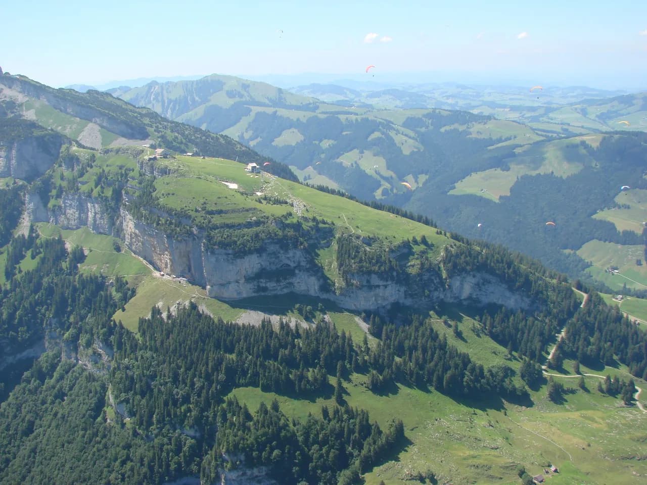
Hoher Kasten is the northern gateway to the Alpstein, a limestone summit above Brülisau with a cable car to the top and a ridge that links it to Saxer Lücke, Fählensee and the jagged Kreuzberge. It suits two very different hikers: those who want a short panoramic circuit at the summit, and strong walkers ready for a demanding 22 km (14 mi) loop with roughly 1,520 m (4,990 ft) of ascent and descent.
The layout makes the choice easy. The lift removes most of the climb, the Forstseeli and Sämtisersee trails give intermediate half-days, and the Geological Hiking Trail covers the whole massif in one long push. Pick by fitness and available daylight rather than by ambition.
What the Hoher Kasten hike offers and who it suits
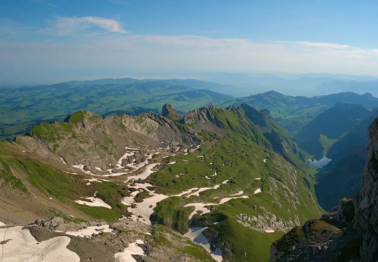
From the summit at 1,794 m (5,886 ft) the view runs over the Alpstein, the Rhine valley and, on a clear day, six countries. The summit paths are maintained to a certified standard for hiking trails, so the short walks need no more than shoes with grip and a head for heights on the viewing platforms. The Hoher Kasten operator lists the summit trails and their walking times.
The long loop is a different proposition. It is a hard, full-day route with several climbs and descents, and most hikers need seven and a half to nine hours of walking. If that sounds like too much, ride the lift up and walk the circuit clockwise, or base yourself on the ridge and turn back at Saxer Lücke.
Where Hoher Kasten sits in the Alpstein above Brülisau
The mountain stands at the northern edge of the Alpstein range, above the village of Brülisau in the St. Gallen part of the massif. The valleys below feed into the Alpstein's classic lake country: Sämtisersee and Fälensee sit on the mountain's flanks, and the Kreuzberge and Chrüzberg spikes form the skyline to the south.
Because the summit cable car starts in Brülisau, this is one of the few Alpstein summits you can stand on within minutes of leaving a bus. Hikers based in Appenzell or Wasserauen reach Brülisau by road or bus and start walking from the valley station.
Getting to the trailhead: Brülisau parking, Bus 192 and the cable car
By public transport, take the train to Weissbad station and change to Bus 192 for Brülisau. The bus stops beside the Brülisau parking area at the valley station. Bus 192 timetables change with the season, so look up the departure that fits your start before you travel.
Driving in, follow signs for Weissbad and then Brülisau. The paid parking area at Brülisau is large but fills quickly just before the cable car starts running, so an early arrival buys you a space as well as a quieter trail.
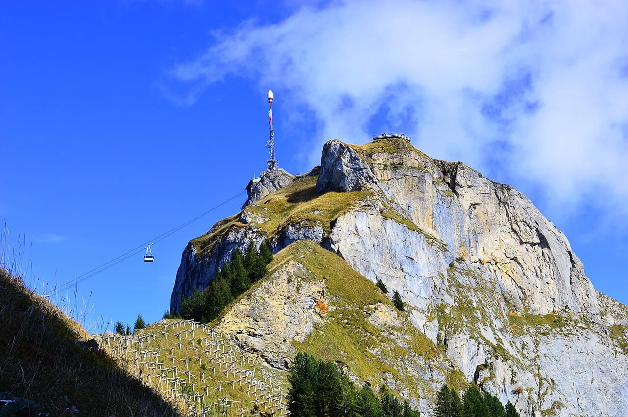
The cable car runs from Brülisau to the summit station, with mountain rides listed from 08:00 and downhill rides from 08:20, both continuing until 17:00. Fares and the operating calendar for each season are published by the lift company, and the fare page is where you match the ticket to your plan. Confirm the last descent on the day you walk if you plan to ride down.
Cable car and summit: Europa Rundweg circular trail
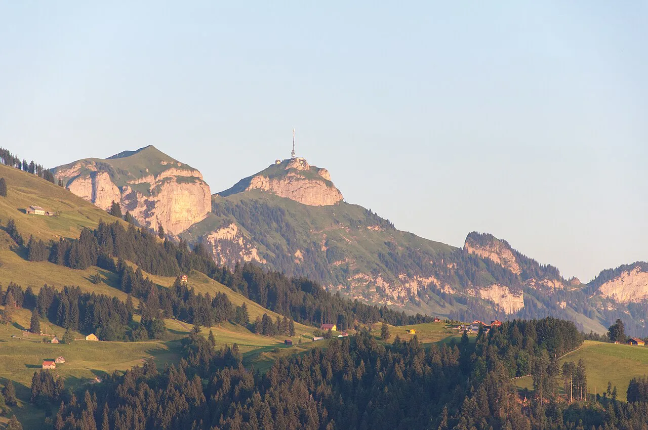
At the top, the Europa Rundweg is the simplest walk on the mountain: a circular trail of roughly 300 m along the summit edge that takes in the panorama over six countries. It is short enough for families and for anyone who wants the view without committing to a descent, and it starts and finishes at the summit station.
Beyond the platform, paths lead off along the ridge toward Staubern and down toward the lakes. Treat the summit as a junction rather than a destination: the ridge trail is where the walking begins, and the steep drop below the viewing points means you keep children and loose gear back from the edge.
Family hike to Forstseeli Lake: distance and timing
The Forstseeli hike is the family option, combining the panoramic summit with moorland, a small lake and meadows. The route is listed at three to four hours, which covers the walking rather than the time spent at the summit restaurant and viewpoints.
Plan it as a half-day and bring a layer for the summit, where the wind is stronger than in Brülisau. The path is easy going, but the return climb to the cable car adds up, so start early enough to leave a buffer before the last descent.
Hoher Kasten to Sämtisersee and Brülisau with the scooter option
The route from Hoher Kasten down past Sämtisersee, Alp Soll and Ruhesitz to Brülisau is listed at three and a half hours. It is a one-way descent through open pasture and lake shore, so arrange your day around finishing at the valley station rather than returning to the summit.
The lift company also promotes scootering on the mountain, which shares part of this corridor. If you are walking, expect to meet riders on the wider tracks and keep to the pedestrian side on blind bends; if you are scootering, the descent follows the same gravel surfaces.
Geological Hiking Trail: the long loop via Fählensee and Saxer Lücke
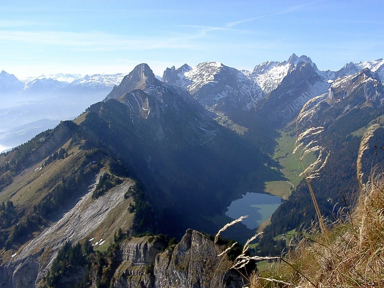
The Geological Hiking Trail is the big day on this mountain, linking the summit with Fählensee, Saxer Lücke and the ridge back to Hoher Kasten. The lift company lists it at five and a half hours for the trail itself; the full loop from Brülisau with the climb to the summit is a longer proposition and needs an early start.
Saxer Lücke is the pass between the Hüser and Chrüzberg peaks, and the view of the Kreuzberge wall from the saddle is the reason most people come. The trail then climbs along an open ridge to Hoher Kasten, with several short detours to viewpoints that are steep and, in places, exposed.
Distance, ascent and time on the loop
The full Brülisau circuit measures about 22.3 km (13.9 mi) with around 1,520 m (4,990 ft) of ascent and the same again of descent, and most hikers should budget seven and a half to nine hours. That puts it in the hard category: a long day with repeated climbs rather than a single sustained ascent.
There are two ways to cut the effort. Ride the cable car to the summit and walk the loop clockwise, saving roughly an hour to ninety minutes and a good share of the climbing, or start from the Staubern side and reach Saxer Lücke without the summit at all.
Route description section by section
From Brülisau the route begins on a paved lane that turns to gravel, passing through forest and pasture for about 7.5 km (4.7 mi) to Fählensee. The gradient is moderate and the views are limited at first, so this is the section to cover steadily rather than to linger in.
The climb from Fählensee to Saxer Lücke is the steepest part of the day and carries most of the elevation gain. It is short in distance but sustained, and the trail gets busier here because a single path serves the pass. Above the lake the Kreuzberge peaks come into view, and the last steps onto the saddle open the valley beyond.
Leaving the pass, the route climbs to the ridge and follows it at a gentler grade past Berggasthaus Staubern, with Hoher Kasten ahead for most of the way. On the final approach the summit looks unclimbable from below; the path actually runs around the cliffs to the far side, where an easy gravel track reaches the viewing platform.
Bollenwees and Staubern: huts and food on the way
Two mountain guesthouses anchor the long loop. Bollenwees sits above Fählensee with a terrace facing the water and serves snacks and local dishes; it also takes overnight guests, and beds should be reserved in advance in the popular months.
Berggasthaus Staubern occupies the ridge between Saxer Lücke and Hoher Kasten and works as both restaurant and guesthouse, with a terrace looking toward the Rhine valley. Reaching it from the Staubern cable car makes the shortest approach to the Saxer Lücke viewpoint.
At the summit, the revolving restaurant above the cable car station serves breakfast, lunch and afternoon plates. Its menu and table reservations sit with the restaurant operator, so book directly if you want a specific sitting.
Three-lake hike for strong walkers
The three-lake hike is the longest day the lift company lists around Hoher Kasten, at six and a half hours, and it strings together the Alpstein's main lakes on the mountain's flank. Treat the published time as walking time for fit hikers and add stops, which is where a summer day can run out.
Save it for settled weather with a long daylight window, and carry water and food rather than relying on a single hut being open. If you want a shorter introduction to the same country, the Seealpsee hike from Wasserauen is a gentler alternative on the other side of the range.
When to go: snow, season and daylight
Late spring to mid-autumn is the realistic window for the high loop, and the exact start depends on how much snow and ice sits on the passes. Saxer Lücke and the Fählensee climb hold snow late into spring, so an early-season attempt can mean turning back at the steep section.
Summer brings long days but also afternoon storms on the ridge, which is the last place you want to be in lightning. Start early, aim to be off the exposed crest by early afternoon, and check the mountain weather for Brülisau before setting out.
Exposure, scrambling and weather on the ridge
The stretch between Fählensee and Saxer Lücke is steep and sustained, and the ridge viewpoints beyond the pass stand on exposed ground above big drops. None of it is technical climbing, but the combination of gradient, exposure and distance is what makes the loop hard rather than its length alone.
Autumn can bring early snow and ice on the north-facing sections, and the ridge is windier than the valley in any season. Carry a shell, gloves and a headlamp for the long loop, and turn around if the weather closes in while you are still above the pass.
Where to base yourself: Brülisau, Appenzell and Wasserauen
Brülisau is the practical base: it is the cable car valley station, has the main parking area, and puts you on the first lift without a drive. Appenzell is a larger town with more amenities but sits further from the trailheads, which costs you time at the start of a long day.
Wasserauen is the other classic base for this part of the Alpstein and is convenient for the eastern trailheads. The wider Appenzell Innerrhoden area has enough walking for a week, so it is worth splitting a trip between the Hoher Kasten side and the Seealpsee and Ebenalp valleys. If you are weighing this corner of the range against peaks further west, the Lucerne hiking guide covers the same fitness-versus-cable-car decision on different summits.
Camping is not tolerated on the open ground of the Alpstein; tent campers should use designated camping areas instead. Book guesthouse beds ahead in the late-spring-to-autumn window, when the range fills with hikers.
Hoher Kasten hike map and route planning
A map at 1:25,000 covers the whole loop on one sheet, and the Brülisau, Fählensee, Saxer Lücke and Staubern names are enough to follow it. Download an offline copy and record the cable car's last descent before you commit to the ridge.
The lift company publishes a hiking map and current trail conditions for the summit paths. For the long loop, combine that with the route description and elevation figures above so your turnaround point is a decision, not an accident.
Hoher Kasten hike difficulty at a glance
The summit circuit and Forstseeli walk are easy half-days with a cable car ascent; the Sämtisersee descent and the three-lake hike are moderate days of three to six and a half hours on maintained paths. The Fählensee and Saxer Lücke loop is hard: 22.3 km, about 1,520 m of climbing, a steep central section and a long ridge.
Choose by your slowest realistic pace on a steep gravel climb, not by dry figures. If the loop is at the edge of your range, take the cable car up and walk clockwise, which keeps the best views and removes the least interesting kilometres.
Plan Your Visit
Hoher Kasten rewards two plans: a cable car ride and a short summit walk for anyone wanting the six-country view, and an early start from Brülisau for hikers ready to earn it through Fählensee and Saxer Lücke. Reserve the hut beds, watch the last descent time, and pick your day by the weather on the ridge.
Frequently Asked Questions
How long is the Hoher Kasten hike?
The summit circular trail is about 300 m. The Forstseeli hike is listed at three to four hours and the Sämtisersee descent at three and a half hours. The full Brülisau loop through Fählensee and Saxer Lücke covers about 22.3 km with seven and a half to nine hours of walking.
Can you hike Hoher Kasten without the cable car?
Yes. The long loop starts in Brülisau and climbs through forest and pasture to Fählensee before crossing Saxer Lücke and following the ridge to the summit. It is a hard full day, and riding the cable car up instead saves roughly an hour to ninety minutes of walking and climbing.
Where do you park for the Hoher Kasten cable car?
Use the paid parking area at Brülisau beside the cable car valley station. It fills quickly shortly before the first lift, so arrive early. By train, go to Weissbad and change to Bus 192 for Brülisau.
What is the best time of year to hike Hoher Kasten?
Late spring to mid-autumn is the practical window for the high loop, depending on how much snow and ice remains on the passes. Summer gives the longest days but brings afternoon storms on the ridge, so plan to be down from the crest early.
Are there huts to eat or stay on the Hoher Kasten hike?
Bollenwees above Fählensee and Berggasthaus Staubern on the ridge both serve food and take overnight guests; book beds ahead in the busy months. At the summit, the revolving restaurant serves breakfast, lunch and afternoon plates.
How hard is the Saxer Lücke and Fählensee loop?
It is hard: about 22.3 km with roughly 1,520 m of ascent and descent, a steep sustained climb from the lake to the pass, and exposed ridge viewpoints. The distance, gradient and exposure together are what make it a full day for fit hikers.
Sources
Trail notes for your next trip
Optional updates when we add or revise hiking guides.
You might also like
Continue reading
More guides you'll find useful