Rigi Hike: Panorama Trail, Cliff Walk and Cable Car Access
Plan a Rigi hike above Lake Lucerne: the Panorama Trail between Kaltbad and Scheidegg, the cliff walk, lift access from Weggis and Vitznau, and when to go.
On this page
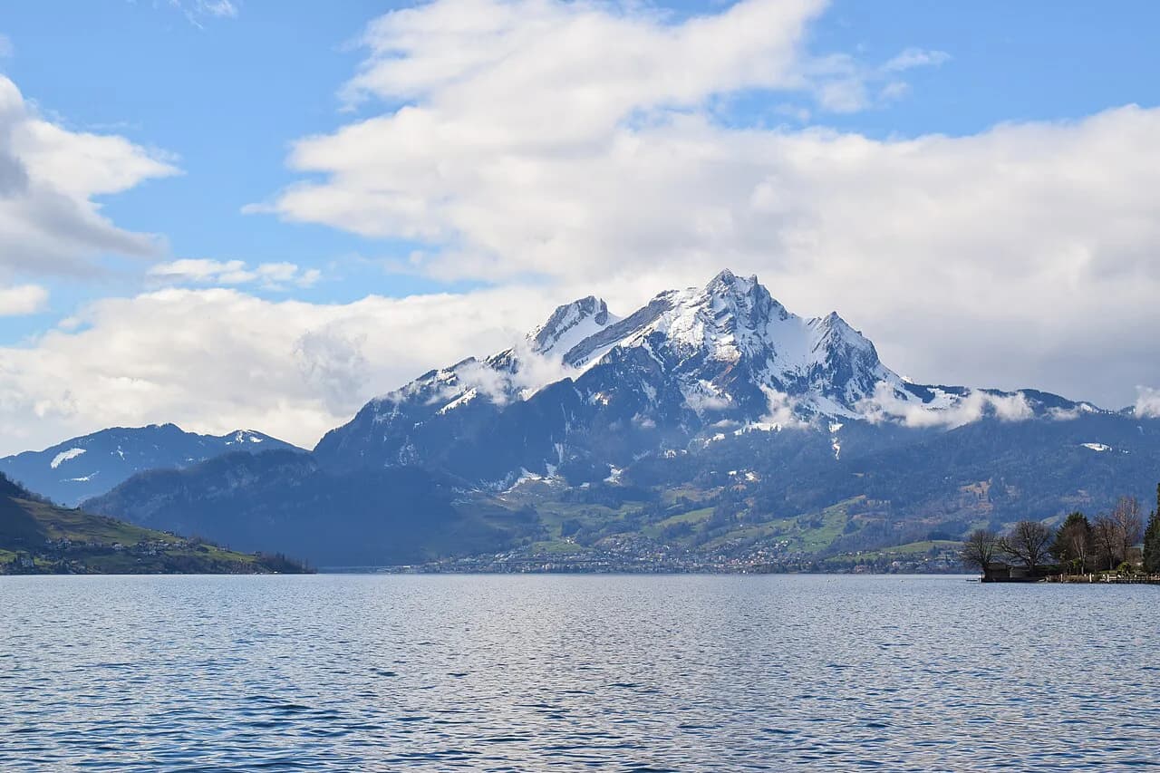
A Rigi hike delivers one of the widest views in central Switzerland: a long, grassy ridge above Lake Lucerne with the Alps on one side and the lake and city on the other. The mountain keeps 120 km (75 mi) of hiking trails open in summer and 35 km (22 mi) of winter routes, ranging from barrier-free walking paths to challenging, exposed trails, so it fits families, casual walkers and hikers who want a full day out equally well.
The choice that matters most is exposure, not distance. The Panorama Trail follows a converted railway line and stays gentle, while the Felsenweg cliff path runs along the mountainside with drop-offs beside the trail. Both sit high above the lake, and both can be combined with the cog railways so you walk one way and ride the other.
What the Rigi offers and who it suits
The Rigi is a compact massif between Lake Lucerne and Lake Zug, with Rigi Kulm as the summit and Rigi Kaltbad and Rigi Scheidegg as the two main mid-mountain hubs. Trails link the three, and the ridge between Kaltbad and Scheidegg gives the most continuous lake views with the least climbing. If you are working through a broader itinerary, this ridge pairs naturally with other days of hiking in Lucerne.
Family groups and anyone wanting a short, safe outing should look at the barrier-free paths and the Panorama Trail. Stronger hikers can add the climb to Rigi Kulm or take the exposed sections that the lift operator lists among the challenging routes. The mountain is not a glacier or high-alpine objective, but the upper ridge is open and weather moves in fast. If Rigi leaves you wanting more ridge walking, the Appenzell hiking guide covers a very different set of Alpstein trails.
Getting to the trailheads
Three approaches reach the walking: the Weggis cable car to Rigi Kaltbad, the Vitznau cog railway to Rigi Kaltbad and Rigi Kulm, and the Arth-Goldau cog railway up the eastern side. Weggis and Vitznau are lakeside villages reached by boat or bus from Lucerne, and their valley stations have parking. Arth-Goldau has a mainline rail station, which makes it the easiest approach if you are arriving by train from Zurich or Lucerne.
Which one to use depends on where you want to start and finish. Vitznau puts you directly on the cog railway to Kaltbad and Kulm; Weggis suits the cable car and a shorter ride to Kaltbad; Arth-Goldau is convenient if you plan to traverse the mountain and leave from the opposite side. Fares, timetables and seasonal operating periods vary by line and are published by Rigi Bahnen, so build your plan around the current timetable.
Rigi Panorama Trail: route and layout
The Panorama Trail runs between Rigi Kaltbad and Rigi Scheidegg along the alignment of an old railway line, which keeps gradients gentle and the walking easy. Because it follows the former trackbed, it holds a fairly constant height on the mountainside instead of climbing and dropping with the terrain. That makes it the best choice on the mountain for a relaxed half day with children or for a first visit.
Allow roughly three hours for the full trail at an unhurried pace, and longer with young children or photo stops. Treat that as a planning estimate rather than an official figure, and add time for the ride up and down. Hiking time on the Panorama Trail is governed more by how often you stop for the views than by the terrain itself.
Walk it one way and use the railways to return, or reverse the direction to suit the descent you prefer. The Kaltbad end connects directly with the Vitznau cog railway and the Weggis cable car, and the Scheidegg end links back into the mountain's lift and trail network.
Rigi Felsenweg cliff walk: exposure and layout
The Felsenweg is the section to choose if you want the drama of a path cut into the mountainside with the lake far below. It is not a via ferrata and needs no technical gear, but the drop-offs come on the downhill side and the path feels narrower than the Panorama Trail. Hikers uncomfortable with heights should walk the Panorama Trail instead and enjoy the same panorama from a wider trackbed.
The cliff path is best taken in dry weather and with steady footing, since wet rock and exposed edges make a poor combination. Exposure here means the sense of space beside you, not a need to use your hands. Keep group members who dislike heights on the inside of the path and take the cliff section slowly.
Route section by section
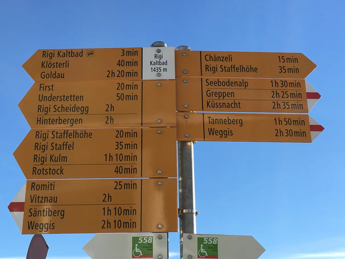
Start at Rigi Kaltbad, where the cable car from Weggis and the Vitznau cog railway meet. From the station the trail heads out along the mountainside toward Scheidegg, and the first stretch is the gentlest way to settle into the ridge and get your bearings above the lake.
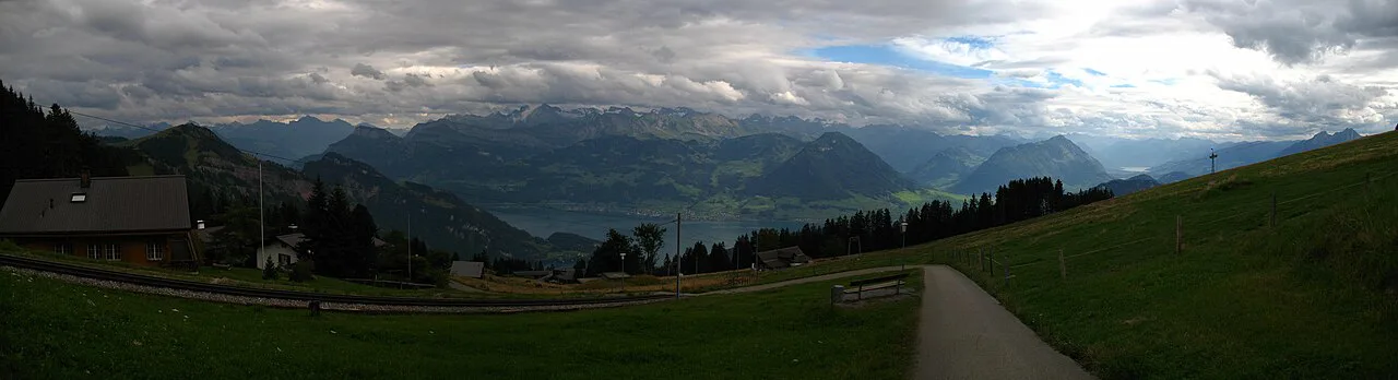
Midway, the character changes. The trackbed gives way to the cliff section, where the path hugs the slope and the ground falls away toward Lake Lucerne. This is where you gain the long, uninterrupted views across the water, and where the walking demands a little more attention.
At Rigi Scheidegg the trail opens out onto grassy ridge with the summit of Rigi Kulm visible along the crest. From here you can continue on foot toward the summit or drop to a railway station and ride down. The final stretch to Kulm is the steepest sustained walking of the day, so decide at Scheidegg whether you have the legs and the weather for it.
Summit options: Rigi Kulm
From Kaltbad you can climb to Rigi Kulm on foot or take the cog railway and walk the last section. The summit is the highest point of the massif and gives the full panorama over both lakes and the Alps. The climb is steady rather than technical, but it adds real height gain to a day that may already include the Panorama Trail.
The usual pattern is to walk from Kaltbad to Scheidegg, then decide between the summit path and the train. Descending by rail from Kulm saves your legs and gets you back to the lakeside in time for a boat. If you want to compare the Rigi ridge with another classic Lake Lucerne day, the Stoos ridge hike offers a sharper, more airy crest.
Distance, ascent and time at a glance
Rigi Bahnen does not publish fixed distance and ascent figures for the Panorama Trail and Felsenweg in its route information, so plan by walking time and by which stations you use as start and finish. The Kaltbad to Scheidegg traverse at a gentle gradient is a half day at an easy pace, and adding Kulm turns it into a full day with a substantial climb.
Roughly three hours covers the Panorama Trail itself, before you add the summit and the rail transfers. The winter network is shorter, at 35 km (22 mi), so winter days are best planned around the marked routes and the railway stations rather than a full traverse.
When to go
Summer is the season for the full traverse, when the whole network of 120 km (75 mi) is walkable and the high ridge is usually clear of snow. The mountain runs hiking routes year-round, with a separate winter network for the colder months. Snow can linger on the upper ridge into late spring and return early in autumn, so the summit path is the first section to be affected.
Afternoon storms are the real summer hazard on an exposed ridge; start early and be off the summit by mid-afternoon. In winter the marked winter trails are the sensible option, and snowshoes or winter boots matter more than distance. Look at the mountain webcams and the day's forecast before buying a ticket.
Huts, restaurants and water
The Rigi is a developed mountain rather than a hut-to-hut route: restaurants and mountain stations cluster at Kaltbad, Scheidegg and Kulm, and Rigi Bahnen publishes a gastronomy directory alongside the trail map. That means you can walk with a light pack and refill and eat at the stations. Between the hubs, carry your own water, since the ridge sections are open and exposed.
Practical rules: camping and tickets
Wild camping is not permitted on the Rigi, as Rigi Bahnen states in its trail information. Plan your overnight stays in the villages or in accommodation listed by the mountain railways. Hiking tickets combine the rail journey with the walking, and Rigi Bahnen publishes them alongside the timetable and fares; check current prices and dates before you travel.
Where to base yourself
Weggis and Vitznau sit at the foot of the mountain on the lake, giving the shortest access to the cable car and the cog railway and a choice of lakeside accommodation. Lucerne, a boat or bus ride away, suits travelers who want the city in the evening and the mountain by day. Arth-Goldau, on the mainline, is the practical base if you are moving on by train the next morning.
Each base changes the shape of your day: Weggis for the cable car, Vitznau for the cog railway and the summit, Arth-Goldau for the eastern approach. Book accommodation early in summer, when the lakeside villages fill with walkers and boat travelers.
Plan Your Rigi Hike
Choose the Panorama Trail if you want an easy, view-filled half day, the Felsenweg if you are comfortable with drop-offs beside the path, and a Kaltbad to Kulm climb if you want the summit. Decide the approach first: Weggis cable car, Vitznau cog railway or Arth-Goldau, and walk one way with a rail return.
Start early, keep an eye on the afternoon sky, and leave the exposed ridge before storms build. If you want more days above the lake, the Fronalpstock hike from Stoos makes a fine second outing.
Frequently Asked Questions
Where does the Rigi Panorama Trail start and finish?
It runs between Rigi Kaltbad and Rigi Scheidegg, following the alignment of an old railway line along the mountainside above Lake Lucerne. Kaltbad is served by the Weggis cable car and the Vitznau cog railway, so you can walk one way and ride back from Scheidegg. The gentle gradient makes it the most relaxed full-length route on the mountain.
How difficult is the Rigi hike?
Difficulty depends on which section you choose. The Panorama Trail stays gentle because it follows a former trackbed, while the Felsenweg cliff path runs along the mountainside with drop-offs beside the trail and suits hikers comfortable with exposure. Climbing to Rigi Kulm adds a sustained ascent that turns an easy half day into a full one.
Is the Rigi hike possible in winter?
Yes. The mountain keeps a separate winter trail network of 35 km (22 mi), alongside 120 km (75 mi) of summer trails, so marked winter routes link the stations through the colder months. Snow can linger on the upper ridge late into spring and return early in autumn, which affects the summit path first. Winter boots or snowshoes matter more than distance on those routes.
How do you reach the Rigi trailheads without a car?
Take a boat or bus from Lucerne to Weggis for the cable car to Rigi Kaltbad, or to Vitznau for the cog railway that continues to Rigi Kulm. Arth-Goldau has a mainline rail station and its own cog railway up the eastern side, which suits hikers arriving by train from Zurich or Lucerne. Fares and seasonal operating periods vary by line; check current details before travelling.
Sources
Trail notes for your next trip
Optional updates when we add or revise hiking guides.
You might also like
Continue reading
More guides you'll find useful