Schilthorn Hike: Birg to Grauseeli and the Mürren Descent
Plan the Schilthorn hike from Birg: the easy Grauseeli walk past Seewlifuhre, the exposed summit trails above Mürren, lift access and when to go.
On this page
The rock massif above Mürren packs two hiking days into one mountain. The Schilthorn Cableway lifts you from the village to Birg at 2,677 m (8,783 ft), which Schilthorn Piz Gloria describes as sitting 1,000 m above Mürren, an easy walk down to the mirror lake at Grauseeli, and long narrow descents from the summit station for hikers with strong legs and a head for exposure.
Choose by nerve as much as fitness. The lake walk suits families, short days and anyone easing into altitude, while the summit-to-village routes demand a full day, sure footing and settled weather. Both start from the same cableway line, so the decision can wait until you see the cloud sitting on the ridge.
Birg and the Schilthorn: where the lift stations sit
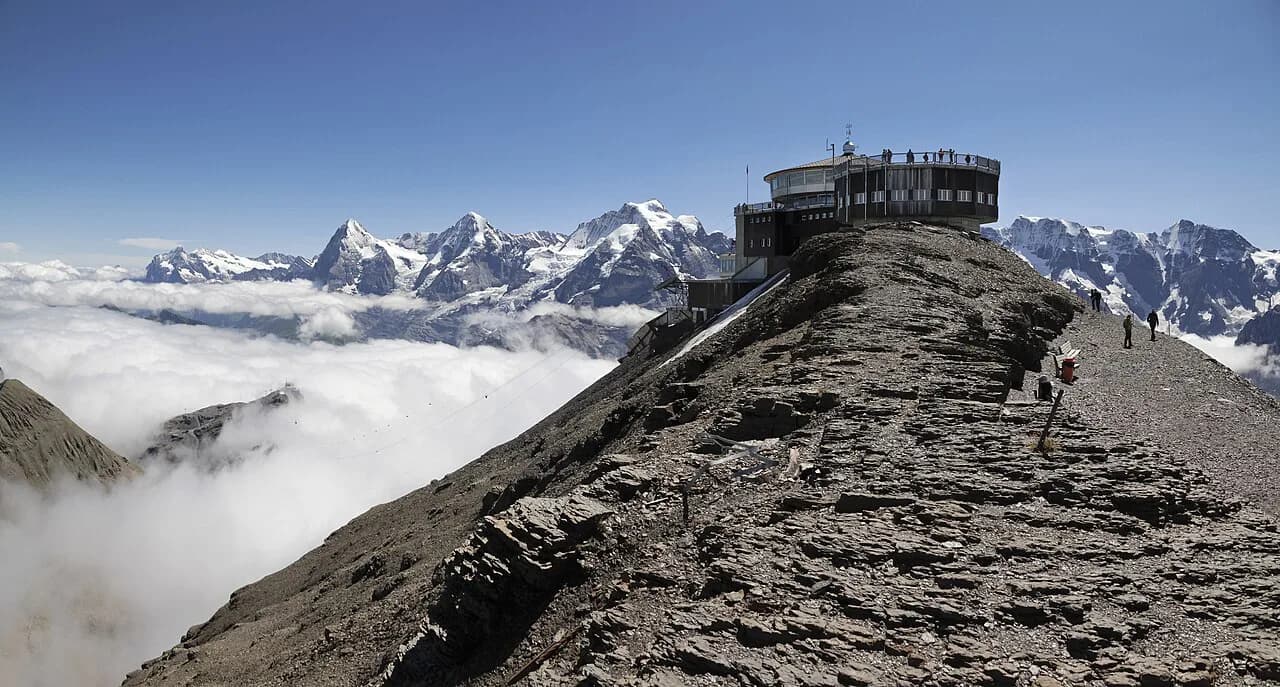
Birg occupies a ledge on the rock massif directly above Mürren, and the cableway station there doubles as a viewpoint with the Skyline Walk platform projecting over a vertical drop. Treat the station as the gateway to the short hike rather than a pass-through.
The vertical context sets the difficulty. Because Birg stands roughly 1,000 m (3,280 ft) above Mürren, any trail heading down to the village loses that height, which is why the descents from the upper stations take hours while the Grauseeli walk does not.
Getting to the trailhead
You reach Birg on the Schilthorn Cableway, the lift line that climbs through Mürren to the massif and continues to the summit station. Mürren itself is car-free, so the day starts with the valley transport up from Lauterbrunnen and a walk through the village to the cableway station.
Plan the last uphill stretch into the day's budget. Walking between Mürren and the cableway base takes a short but steady climb, and reaching Birg means a lift ride rather than a walk, so carry the layers you need on the terrace before you board. Check the cableway's own site for the current first and last departures, which change with the season.
If you are staying in the valley and want to compare this day with the rest of the network, the hiking in Lauterbrunnen guide covers the lifts, paths and village bases in one place.
Birg to Grauseeli: distance and difficulty
The Grauseeli route from Birg station runs over the Seewlifuhre to the lake, and the cableway operator rates it relatively easy. Expect a short mountain walk rather than a valley stroll: the ground is rocky and the exposure begins as soon as you leave the station terrace.
The lake is the payoff. Still water mirrors the surrounding peaks, which is why Schilthorn Piz Gloria singles it out as a photo stop in an unspoiled setting, and the shoreline gives you a natural place to sit before retracing the path.
Route description: Birg to Grauseeli
Leave the station on the marked path and cross the Skyline Walk platform first. It extends over a vertical precipice and gives the widest panorama of the day before you drop below the station, so walk it while your legs are fresh and the view is open.
Beyond the platform the trail traverses the Seewlifuhre, the stretch where the character changes from broad ledge to narrower mountain path. This is the section to watch in wind and after rain, because the footing is less generous than the station approach and the drop below stays with you.
The path then descends to Grauseeli itself. Arrive at the water on a calm day and the peaks repeat in the surface, the shot most hikers come for; in a stiff breeze the reflections break up but the shoreline still makes a fine lunch stop.
Skyline Walk and Thrill Walk at Birg
The Thrill Walk drops into the vertical rock walls below the cableway station, following a 200-metre cliff pathway underneath the building. Schilthorn Piz Gloria calls it a spine-tingling experience, and the exposure is immediate, so it rewards steady nerves rather than route-finding.
Neither structure is part of the trail's difficulty, so skip them if the drop below the station already feels like enough. Families often split here: one adult walks the cliff path while the other takes the children straight onto the Grauseeli track.
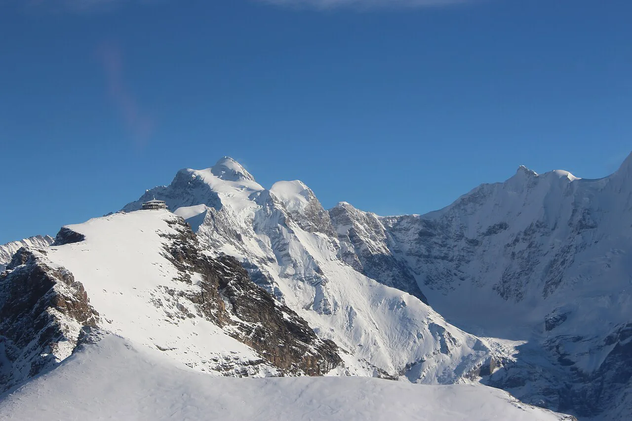
Long descents from the summit toward Mürren
Hikers who ride to the top and walk down face a long day on narrow, exposed ground, and experienced walkers describe the descent to Mürren in terms of many hours rather than a quick afternoon. Plan for roughly a full day's effort and leave the summit early.
Snow is the deciding factor on this side of the mountain. Forum walkers flag that parts of the trail can be precarious when snow lingers, which in practice means waiting until the high ground has cleared rather than trusting a calendar date.
A sensible plan starts at the top and works downward, so the exposed stretches are behind you before afternoon cloud builds on the ridge. If the forecast turns, the cableway gives you an exit from the intermediate stations without committing your whole day to the descent.
Exposure, snow and afternoon weather
Above Mürren the hazards are specific: narrow exposed traverses, old snow on shaded slopes early and late in the season, and thunderstorms that build through the afternoon. Turn around on the exposed sections rather than pushing through them if wind or cloud arrives, and be off the high ground before storms threaten.
The lake walk keeps you below the summit but not out of the weather. Carry a shell, take a map, and if the sky darkens over the massif, use the lift rather than the long descent.
When to go
Aim for summer, when the high ground has cleared of lingering snow and the lift runs its full seasonal schedule. Late spring can leave patches on the highest stretches, and autumn storms arrive sooner than hikers expect, so build in a spare day and watch the massif forecast.
Once the snow is gone, mornings are the hiking window: walk early for clearer views of the Eiger, Mönch and Jungfrau, and be back at the station or the village before the afternoon buildup.
Tickets, lifts and getting back
Buy your Schilthorn Cableway ticket at the station or through Schilthorn Cableway Ltd., and ask about return and single fares for the sections you actually plan to walk; check current fares, which depend on the sections travelled. If you intend to descend on foot, a one-way ticket to Birg or the summit is all you need.
Return from Mürren on the cableway toward Lauterbrunnen or by the valley transport that links the villages, and time the day around those last connections. Full timetables are on the transport operator's own site, and they change with the season.
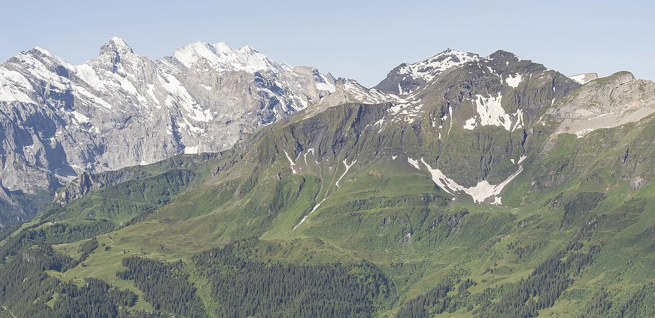
Where to base for the Schilthorn
Mürren puts you closest to the lifts and shortens every start, though you still climb to the cableway station. Staying in the village means the descent ends at your door, which matters on the long summit route.
Lauterbrunnen in the valley suits mixed trips: cheaper access from Interlaken, buses and trains along the valley, and the wider network of paths and lifts in easy reach. If you are weighing the valley against the nearby lakeside town, the hiking in Interlaken guide lays out its day hikes, lifts and trailheads. The trade-off is the extra lift ride and walk before you reach Birg.
Bistro Birg and what to carry
Bistro Birg serves pizza and pasta on a sun terrace facing the Eiger, Mönch and Jungfrau, which makes it the natural place to eat or wait out a cloud. It is a station restaurant rather than a mountain hut, so plan food and water for the length of your chosen route rather than relying on it mid-trail.
Carry the usual high-mountain kit: sturdy boots, a shell and warm layer, map and water, and traction if snow is still on the ground. There is no hut on the Grauseeli walk, so everything you need on that route comes up with you on the lift.
Outside the massif
Other days in the area sit outside the Schilthorn massif, including the North Face Trail, Mürren and the paths from Allmendhubel. A guided day on the cliffs around the valley is described in the Lauterbrunnen via ferrata guide.
Plan Your Visit
Decide between the two days before you buy a ticket: the Grauseeli walk suits families and half-days, while the summit descent to Mürren needs a full day, sure footing and settled snow conditions. Either way, start early, carry your own food, and keep an eye on the cloud building over the ridge.
If you want more options once you are based in the valley, compare the Lauterbrunnen valley hike along the waterfalls before committing the whole trip to high ground.
Frequently Asked Questions
What is the best hike from Mürren on the Schilthorn massif?
For most hikers it is the short walk from Birg station over the Seewlifuhre to Grauseeli, which the cableway operator rates relatively easy and which fits into a half-day. Strong, experienced walkers take the long descent from the summit station to Mürren instead, on narrow exposed ground with many hours of downhill walking and lingering snow as the main obstacle.
How high is Birg, and where does it sit above Mürren?
Birg station stands at 2,677 m (8,783 ft) on the rock massif above Mürren, roughly 1,000 m (3,280 ft) above the village. That vertical difference is the reason a descent on foot takes hours while the Grauseeli walk stays short.
How do you reach the Schilthorn cableway from Interlaken?
Take the train from Interlaken to Lauterbrunnen, then the valley transport up to Mürren, which is car-free, and walk to the Schilthorn Cableway station for the lift to Birg and the summit. Confirm the current connections and departure times with the transport and cableway operators, since they change with the season.
Is the Birg to Grauseeli hike difficult?
It is a short mountain walk rather than a flat valley path. The ground is rocky, the traversing section at the Seewlifuhre is narrower than the station approach, and the Thrill Walk cliff pathway under the station is optional and separate from the trail.
Sources
Trail notes for your next trip
Optional updates when we add or revise hiking guides.
You might also like
Continue reading
More guides you'll find useful