Mürren Hikes: Best Trails, Distances and Lift Access
Plan hikes from Mürren, from the easy North Face Trail to the long climb to Schilthorn, with distances, ascent, walking times and lift and train access.
On this page
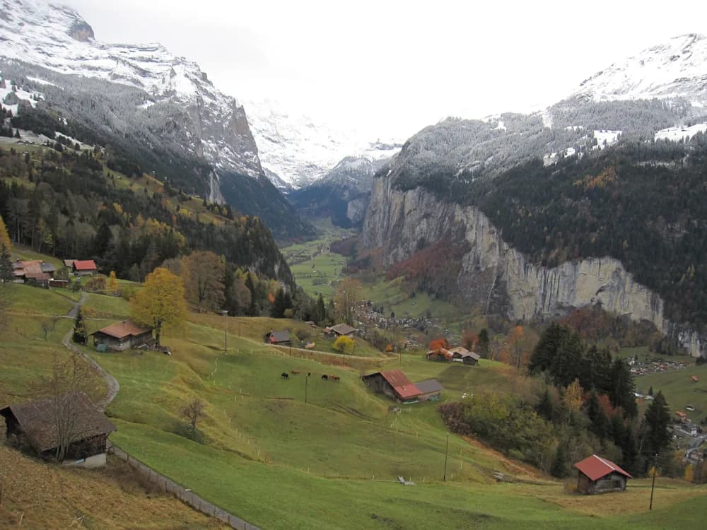
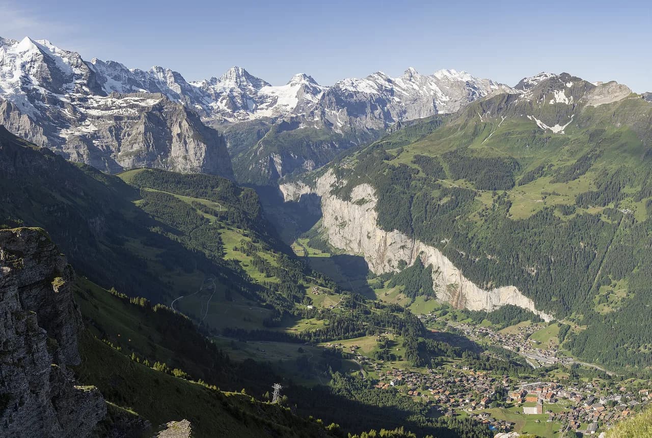
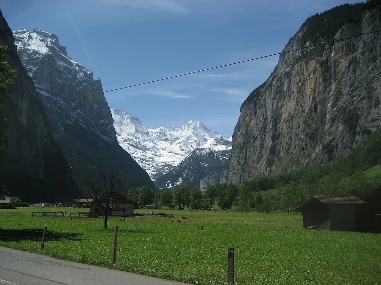
Mürren is a car-free village perched on a terrace above the Lauterbrunnen Valley, with the Eiger, Mönch and Jungfrau filling the skyline across the valley. That position makes it an unusually good hiking base: trails leave the village in several directions, and the BLM railway and Schilthornbahn link you to trailheads on the terrace, in the valley and on the slopes above. This guide sorts the routes by fitness, time and season so you can pick the day that fits.
The trail network suits hikers who want three to seven hours on their feet rather than a single signature route. Easy terrace walks such as the North Face Trail, a ridge walk to Grütschalp and the valley falls suit families and rest days.
What Mürren offers hikers and who it suits as a base
Mürren suits hikers who want lift-assisted starts and finishes without a car. The village is car-free and reached by train or cable car, and the surrounding trails climb through meadows, cliffs and high alpine slopes toward Schilthorn. Hikers based here can walk from the door, take the BLM railway to Grütschalp, or ride the Schilthornbahn toward higher ground.
Compared with staying down in Lauterbrunnen, Mürren puts you higher on the terrace, which cuts the climb to viewpoints such as Bryndli and Tanzbödeli but leaves the valley trails below a cable car ride away. A village-based day here typically means a morning climb, a picnic or hut stop, and a lift or train back; the wider hiking in lauterbrunnen covers the valley-floor routes if you want to split your stay.
The trade-off is exposure to weather: the terrace and summit trails are open and unsheltered, so an afternoon storm or fresh snow changes the plan fast. Check the forecast before you commit to the long Schilthorn ascent rather than the shorter hut climb.
Getting to Mürren and moving between trailheads
Most trips reach Mürren from Lauterbrunnen via Grütschalp, where a cable car connects with the Mürren BLM railway, and the village also sits on the Schilthornbahn line. The journey is scenic and places you directly on the terrace trails.
Once in Mürren, the BLM railway runs to Grütschalp and the Schilthornbahn climbs toward Birg and the Schilthorn summit. Between them, these two lines let you start a hike high, finish low in the valley, or cut a long descent short. Buy tickets for the day you travel and confirm the final descent time at the station before you set out.
From Gimmelwald, a cable car links down to Stechelberg in the valley, which lets you finish a Tanzbödeli circuit without retracing your steps. Plan your route around one of these mechanical links so a long day does not end with a road walk.
The North Face Trail: distance, ascent, walking time and the views
The North Face Trail is the classic easy-to-moderate starter from Mürren, a loop on the terrace beneath the north walls of the Bernese peaks. Hikers regularly recommend it as a first day from the village, and the North Face Trail, Mürren delivers the valley, the peaks and the meadow slopes in a single circuit.
Figures vary with the exact loop you take, so treat the trailhead map boards in Mürren as your source for the day's distance and ascent. Walking time typically runs a few hours at an easy pace with photo stops, and the route is well marked.
The payoff is the balcony view over Lauterbrunnen Valley with the Eiger, Mönch and Jungfrau across the way. Because the trail stays on the terrace, it is the best choice when cloud is sitting on the summits but the valley is still open.
Mürren to Grütschalp: a ridge walk with the Lauterbrunnen Valley below
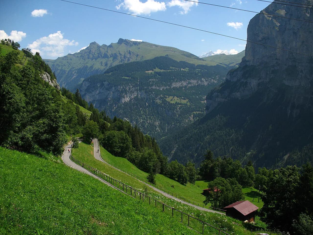
The walk from Mürren to Grütschalp follows the terrace edge, with the Lauterbrunnen Valley dropping away below and the big peaks across the valley. It is one of the simplest point-to-point days from the village, since the BLM railway carries you back up from Grütschalp; the Mürren to Gimmelwald Hike gives the alternative finish for walkers who want to drop further.
Take the ridge walk as a half day, then add a descent toward Gimmelwald if your legs still feel good. The terrain is meadow and dirt path rather than rock, so trail shoes are enough and the exposure is limited.
If you want a longer valley day instead, ride down and walk the valley floor, where the falls trail runs out from Lauterbrunnen.
The Mountain View Trail and the Mürren ridge via Bryndli
The Mountain View Trail and the ridge route via Bryndli are the moderate half-day options from Mürren, following the crest above the village toward open viewpoints. Forum regulars staying in the village pair a three-to-ten-mile day of this kind with a late lunch back on the terrace, and the ridge walk via Bryndli is the one they name for it.
These routes gain height gradually and give you a 360-degree view of the valley and the glaciers without the sustained steepness of the Schilthorn climb. They suit hikers covering three to ten miles (five to sixteen kilometres) in a day and wanting a flexible turnaround point.
Stay on the marked path where the ridge narrows, since the drops above the valley are real even though the ground is mostly meadow. Turn back at the first sign of a building afternoon storm rather than pushing to the highest point.
Tanzbödeli and Obersteinberg via Gimmelwald: distance, ascent and time
The Tanzbödeli circuit from Gimmelwald is the demanding full day on this terrace, and it delivers the best all-round panorama in the area. The route runs 13.9 km (8.6 miles) from Gimmelwald over Tanzbödeli and down to Obersteinberg and Stechelberg, climbing about 1,100 m (3,600 ft) in total.
Allow about four hours of moving time and up to seven hours for the day once you add time at the summit and a stop at the Obersteinberg hotel. The first climb from Gimmelwald to Tanzbödeli is about six steep kilometres in roughly two hours.
The path is mostly dirt and simple to follow, with a few rocky steps to clamber over and no serious drop-offs beside the trail. The difficulty is the sustained incline rather than technical ground, so it suits fit hikers with a full day and steady legs.
Finish by descending to Stechelberg and riding the cable car back up to Gimmelwald and Mürren, or reverse the loop if you prefer to climb from the valley. Carry water for the upper section, where the Obersteinberg hotel is the only reliable stop.
Mürren to Rotstockhütte: a shorter climb to a hut
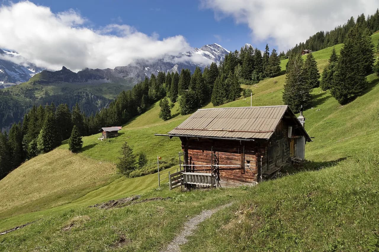
The climb from Mürren to Rotstockhütte is the manageable taster for the higher terrain, mostly dirt path with a few rock-and-path sections. It gains only about 300 to 400 m (roughly 1,000 to 1,300 ft), so most families can reach the hut at an easy pace.
Treat the hut as the turning point and a place to eat before you descend, rather than a summit day. Book any overnight stay directly with the hut operator, and carry cash and a warm layer for the changeable weather on the terrace.
Above the hut the ground steepens sharply, so if you are not continuing to Schilthorn, turn around and enjoy the view down the valley. This is also the sensible day when cloud is sitting on the peaks but the lower slopes are clear.
Mürren to Schilthorn: the long ascent to Piz Gloria
The climb from Mürren to Schilthorn is the toughest hike in the area, gaining about 1,600 m (5,250 ft) over 12.9 km (8 miles) to the Piz Gloria summit. The first stretch to Rotstockhütte is easy ground; the section beyond is very steep, collecting more than 1,000 m of ascent over just a few kilometres.
Start early from Interlaken or Lauterbrunnen to leave time for the climb and the return. The upper slope is straight uphill over rock and path but has no serious drop-offs, so the limiting factor is fitness and the altitude rather than exposure.
Most hikers ride the Schilthornbahn down from Piz Gloria rather than retracing the descent, which spares the knees after a long day. At the top, the revolving restaurant serves hot food with the 360-degree panorama across the Eiger, Mönch and Jungfrau.
The Mürren to Gimmelwald via ferrata: what it involves and who should go
The via ferrata from Mürren to Gimmelwald traverses ladders, steps and rock on a cliff edge above the Lauterbrunnen Valley, with a harness clipped to a fixed cable throughout. The exposure is the point: you are on the wall above a drop of roughly 500 m, so this is a route for hikers comfortable with heights and with the gear, and the lauterbrunnen via ferrata guide sets out the grading and kit in more detail.
Rent the kit in Mürren before you start: from the Mürren train station, walk about ten minutes past Hotel Edelweiss to the sports chalet and Intersport. First-timers should go with a guide or an experienced partner rather than teaching themselves on the cliff.
The route ends at Gimmelwald, where you can walk back up to Mürren or ride the cable car. Go in dry conditions with a settled forecast, since wet rock and wind make the traverse far more serious.
Trümmelbach and Staubbach falls in the valley below Mürren
Below Mürren, the Lauterbrunnen Valley holds two easy waterfall outings. Staubbach Falls, one of the highest in Switzerland at roughly 300 m, is reached by a short trail of about 6 km from Lauterbrunnen town, and Trümmelbach Falls is about 5 km from the town centre.
Combine the two for a half-day walk, then take the cable car and railway back up to Mürren. The paths are low and easy, which makes them the right choice when the high trails are clouded in.
Trümmelbach is a subterranean waterfall, so expect spray and cold inside the galleries, and wear shoes with grip. Check the falls' own visitor information for current entrance arrangements and hours before you set out.
Eiger Trail, Eigergletscher to Alpiglen: a day out by train
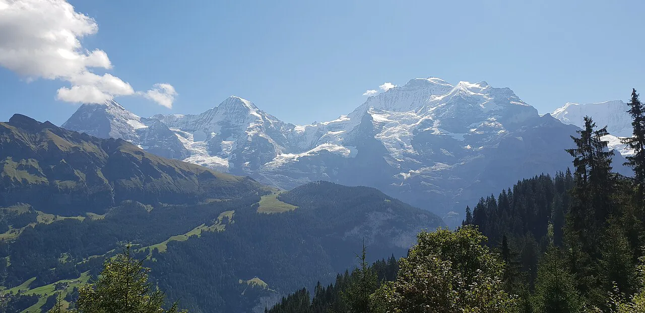
Outside Mürren itself, the Eiger Trail from Eigergletscher station to Alpiglen runs directly beneath the Eiger North Face. If you want to compare lift-served trailheads on this side of the mountains, hiking in Grindelwald covers the trails above the valley next door. The route is 6.5 km (4 miles) and takes about 2.5 hours at an easy pace, with about 200 m of climbing spread over the first couple of kilometres; the trailhead is reached by train via Kleine Scheidegg, so it is a train day rather than a walk from the village.
The trail is simple and stays on a prepared path, but it sits high and faces north, so snow lingers early and late in the season. Turn around at the Eiger viewpoint about 2 km in if the weather closes in.
When to go: summer hiking and the prepared winter trails
Summer is the main hiking season from Mürren, when the terrace trails and the high routes to Rotstockhütte and Schilthorn are clear of snow. Winter walking is possible on specially prepared, compacted trails marked for winter use, while many summer paths become unsafe.
In winter, take waterproof boots and carry microspikes for icy stretches, plus a headlamp for the short days. Check the avalanche forecast before going above the village, and keep to prepared routes after heavy snowfall.
In summer, start early on the Schilthorn ascent and be back on the terrace by mid-afternoon, when storms build over the peaks. The shoulder months bring snow on the upper passes and a mix of dry and wet days on the lower trails.
Huts and water on the Mürren trails
The Rotstockhütte is the main hut above Mürren and the natural break on the Schilthorn climb, while the Obersteinberg hotel is the stop on the Tanzbödeli circuit. Both are seasonal mountain operations, so confirm opening dates with the hut or hotel before you build a day around a meal or a bed.
Water points thin out above the terrace, so fill bottles in Mürren or at the huts and carry more than you think you need for the Tanzbödeli and Schilthorn days. A warm layer and a waterproof belong in the pack even on a clear morning.
Which Mürren hike suits your fitness, time and season
For a first day or a family group, take the North Face Trail or the walk to Grütschalp, both half-day outings on easy ground. For a solid half day with more height, choose the ridge via Bryndli or the Mountain View Trail, which reward moderate effort with big views.
For a full day, the Tanzbödeli circuit at 13.9 km and about 1,100 m of ascent is the balanced choice, with the Obersteinberg hotel as a stop. The Schilthorn ascent at 12.9 km and about 1,600 m is the big objective and suits hikers already comfortable with long climbs who will ride the cable car down.
If you want adrenaline rather than distance, reserve a day for the via ferrata with rented gear and, ideally, a guide. In poor weather, drop to the valley falls instead.
Planning a Mürren hiking day
Base your plan on the height you want to gain and how you will get back. The terrace trails and the ridge walks need only a train ride back to the village, while the Schilthorn day depends on the cable car descent and a good forecast.
Pack layers, water and grip for rock, and carry microspikes if you are walking in winter. Build the day around one lift or train leg so you never finish with a long road walk.
Frequently Asked Questions
What are the best easy hikes from Mürren?
The North Face Trail is the standard easy loop from the village, staying on the terrace beneath the north walls of the Bernese peaks. The walk to Grütschalp follows the terrace edge and uses the BLM railway for the return, and the valley trails to Staubbach and Trümmelbach falls stay low and simple on days when cloud sits on the summits.
How far and how steep is the hike from Mürren to Schilthorn?
The route from Mürren to the Piz Gloria summit covers 12.9 km (8 miles) and climbs about 1,600 m (5,250 ft). The stretch to Rotstockhütte is gentle, but beyond the hut the path gains more than 1,000 m over a few kilometres, so most hikers ride the Schilthornbahn down rather than walking back.
How long is the Tanzbödeli and Obersteinberg circuit?
From Gimmelwald the circuit runs 13.9 km (8.6 miles) with about 1,100 m (3,600 ft) of ascent, passing Tanzbödeli, the Obersteinberg hotel and Stechelberg. Allow roughly four hours of moving time and up to seven hours for the full day, and carry water for the upper section.
How difficult is the Mürren to Gimmelwald via ferrata?
It is a fixed-cable route on ladders and steps across a cliff above the Lauterbrunnen Valley, with a drop of roughly 500 m below the traverse. Hikers need a head for heights, rented harness and kit from the sports chalet in Mürren, and dry weather; anyone new to via ferratas should go with a guide.
Do you need a car to hike from Mürren?
No. Mürren is car-free, and you reach it by cable car and railway through Grütschalp or on the Schilthornbahn line. The BLM railway and the cable cars link the village to terrace and valley trailheads, so every route in this guide works on public transport.
Sources
Trail notes for your next trip
Optional updates when we add or revise hiking guides.
You might also like
Continue reading
More guides you'll find useful