Hiking in Lauterbrunnen: Valley, Terraces and High Routes
Plan hiking in Lauterbrunnen with flat valley-floor walks, the Mürren terrace trails and steep climbs to Männlichen, the Lobhornhütte and the Schilthorn.
On this page
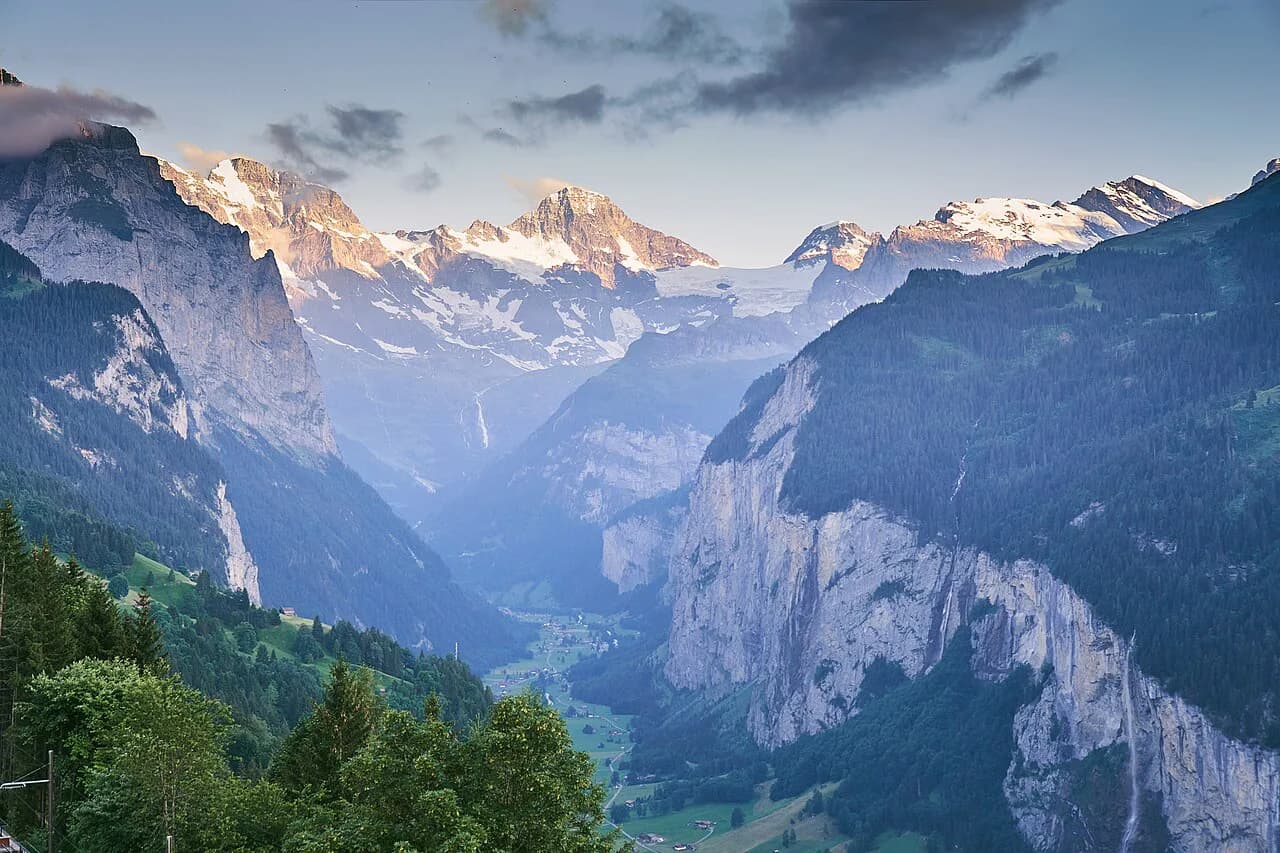
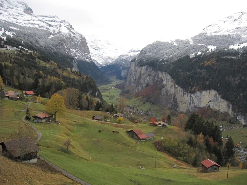
Lauterbrunnen gives you a rare combination: a valley floor so flat you can walk it in trainers, and rock walls above it that lead to terraces, huts and summits more than a thousand metres (3,300 ft) higher. The result is a hiking base where an easy waterfall stroll and a serious summit day start from the same village.
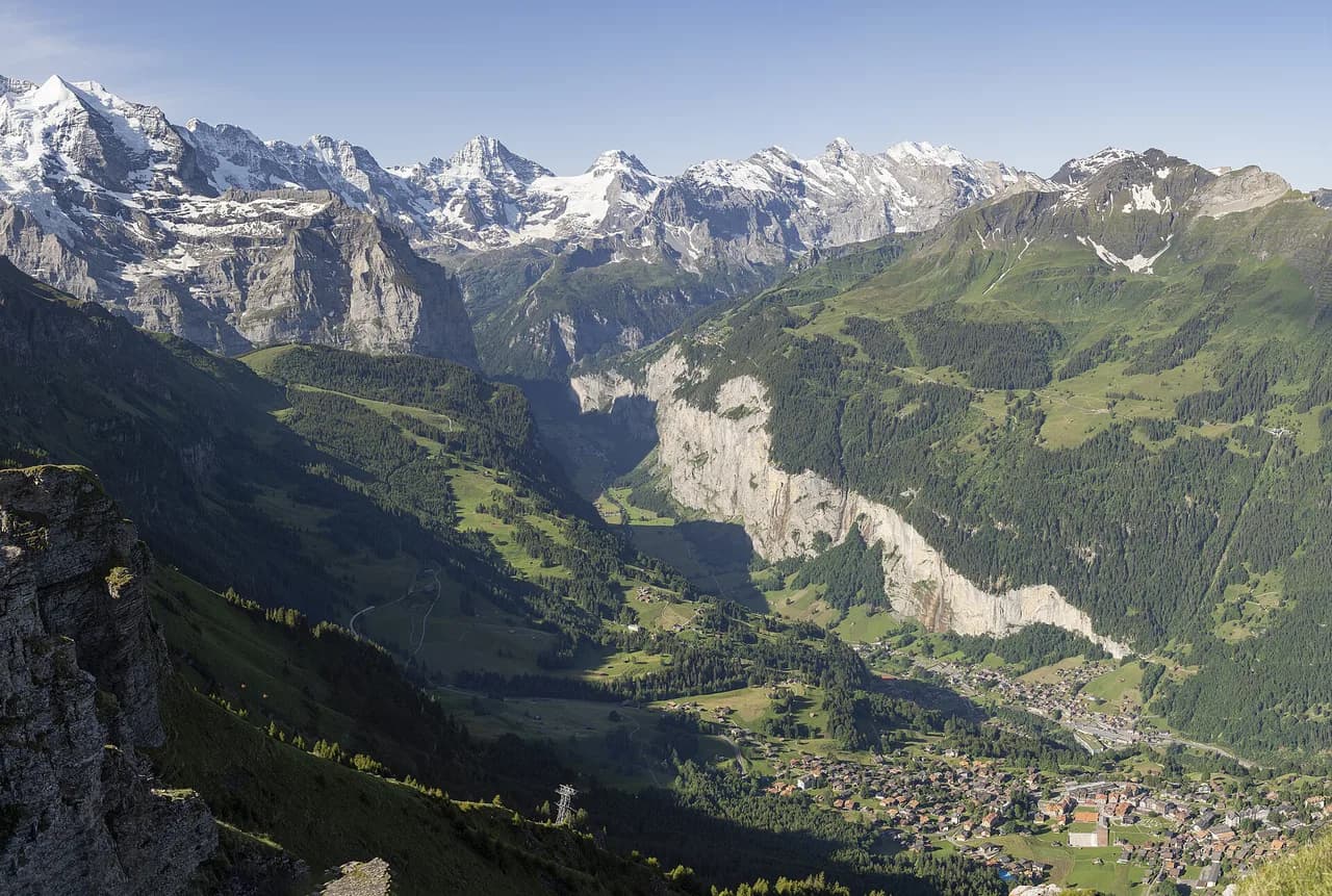
Think of the valley as four zones. The floor runs from the village south to Stechelberg; the Mürren terrace sits on the western shoulder above it; Wengen and Männlichen occupy the eastern slopes; and Isenfluh, on the far side of the valley, offers the quietest trails. Each zone has its own transport, so choosing a hike means choosing a zone first.
The four hiking zones around the village
Lauterbrunnen village sits on the valley floor, with Staubbach Falls dropping off the cliff directly behind it. Walk south along the floor and you pass a chain of waterfalls on your way to Stechelberg, where the valley road ends and the Schilthornbahn begins its climb. This is the zone for easy days, families and recovery legs.
Above the village to the west, the terrace of Grütschalp and Mürren is reached by cable car and railway rather than by road, so every hike there begins with a lift. To the east, Wengen and the Männlichen ridge offer the biggest vertical gains and the broadest views of the Eiger, Mönch and Jungfrau. Isenfluh, across the valley, is smaller and quieter, with a small cable car up to Sulwald.
The layout matters when you plan. A morning on the terrace usually means a cable car plus the Mürren railway; a valley-floor walk needs no lift at all; and a Männlichen day means committing to a cable car from Wengen or Grindelwald. Before you fix an itinerary, the local map collection shows the valley routes, the terrace paths and the connecting lifts on one sheet.
Valley-floor walks: Lauterbrunnen to Stechelberg
This is the gentlest hike in the valley and the one most people should do first. It runs about 4.3 km (2.7 mi) from Lauterbrunnen to Stechelberg with only around 118 m (390 ft) of ascent, and it takes one to two hours with stops. Much of the surface is paved, turning to gravel near the end, so it suits families and anyone wanting a half-day of walking between waterfall viewpoints.
Staubbach Falls and the Mürrenbachfall are the two set pieces along the way, and you can also watch paragliders launching above the meadows. The trade-off is popularity: this is a busy path in summer, and it has little shade in the middle of the day. Walk it early, or treat it as an evening leg after the day-trippers leave.
If you would rather not walk back, the PostAuto 141 bus returns from Stechelberg to Lauterbrunnen in about 18 minutes. It is the simplest transport link in the valley and saves you a repeat of the same scenery on tired legs.
The Staubbach Falls path itself is a short add-on: roughly 600 m (0.4 mi) with about 117 m (380 ft) of climbing, taking around 45 minutes at an easy pace. The reward is a close view of a fall that drops around 300 m (1,000 ft) from the cliff.
Trümmelbach Falls, a short bus or walk from the village, is a different kind of stop: a subterranean waterfall system inside the rock rather than an open trail. It is a visit rather than a hike, so budget it separately and treat the walk to its entrance as the day's legwork.
The Mürren terrace: Grütschalp, Mürren and Gimmelwald
The terrace above the valley is where most visitors want to end up, and the standard route is the traverse from Grütschalp south to Mürren. The path from Mürren station towards Grütschalp runs about 4.5 km (2.8 mi) with only around 60 m (200 ft) of height difference, taking a little over an hour at a steady walk. It follows the railway line and the meadows between Winteregg and Grütschalp, with the Eiger, Mönch and Jungfrau lined up across the valley.
You can walk it in either direction, and the descent from Mürren to Grütschalp is the kinder option if your knees prefer gravity to assist. A good plan is to ride the cable car up to Grütschalp, walk the terrace line to Mürren for lunch, then return by the railway.
From Mürren, the continuation to Gimmelwald via the North Face route is a 7 km (4.3 mi) circuit with around 380 m (1,250 ft) of ascent, taking two to three hours. It is rated easy despite the name, with modest climbing and big views into the valley walls, and it makes a sensible second half of a terrace day. The full route is broken down in the North Face Trail, Mürren guide.
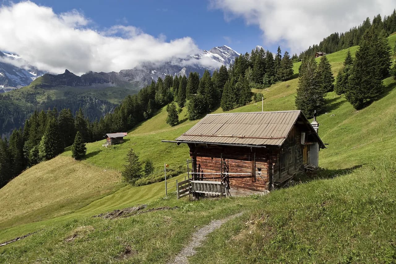
Mürren is the better base if you want several terrace days without repeating the cable car. The village sits right at the trailheads, including the start of the Schilthorn route and the valley-side paths. More options are grouped in the Mürren Hikes collection, from short viewpoints to full days on the ridge.
Mürren to Gimmelwald on the via ferrata
The cliff edge between Mürren and Gimmelwald carries a protected route rather than a hiking trail. The line is about 2.2 km (1.4 mi) with roughly 300 m (1,000 ft) of ascent and takes around two hours, using ladders and steps on the edge of a drop into the Lauterbrunnen valley.
This is a gear-dependent day: you need a harness and a via ferrata kit, not just boots. Gear can be rented from the Sportchalet Mürren, a short walk past the Edelweiss Hotel. If you have never clipped in before, go with a guide or take a course first; the exposure is the point, and it is real.
Reaching the start is straightforward by lift: the Grütschalp cable car beside the valley station connects to the Mürren railway, and the route begins near the top station. The versicherter Steig is a summer option; snow and wet rock make the ladders a poor place to be, so keep it for dry, warm conditions. The Lauterbrunnen via ferrata page covers grades and kit in more detail.
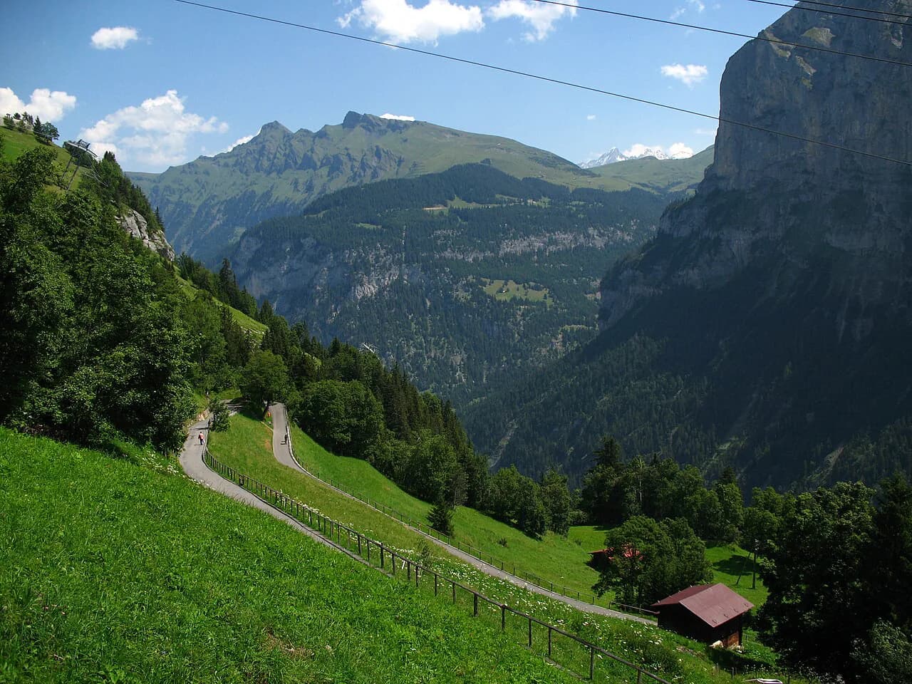
Climbing to Mürren on foot from the valley
If you prefer to earn the terrace, the direct climb from Lauterbrunnen to Mürren is a hard half-day. Trail trackers put the route at roughly 4.3 mi (6.9 km) with about 2,857 ft (870 m) of gain and a time of three to three and a half hours. Those figures come from user-tracked data rather than trail signage, so treat them as a planning estimate.
The route climbs steadily through forest and open slopes, and the gradient makes it a genuine ascent rather than a stroll. Take water; the terrace has taps and restaurants, but the climb itself has few reliable sources. Descending the same way is hard on the knees, so most hikers ride the cable car and railway back down.
The payoff is arriving at Mürren without queuing for a lift, and the option to continue straight onto the terrace trails. If you are undecided between the climb and the lift-and-walk-down version, compare it with the shorter terrace traverse and pick the one that matches your fitness on the day.
Wengen to Männlichen and the Royal Walk
The eastern slopes hold the valley's biggest climb. Wengen to Männlichen runs about 4.9 km (3 mi) with roughly 1,042 m (3,400 ft) of ascent, taking around two hours on a steep, narrow trail that follows the Eiger Ultra Trail line. It is not a beginner's route, and the downhill version is the more comfortable choice for most hikers.
At the top, the Männlichen Royal Walk adds a short summit loop: about 1.7 km (1 mi) round trip with roughly 120 m (390 ft) of climbing, taking 30 to 45 minutes. It is easy, family-friendly and delivers the panorama of Grindelwald and Wengen below without much effort. Ride the cable car to Männlichen and the whole day becomes gentle.
From Männlichen, a traverse towards Kleine Scheidegg takes around an hour and a half, with the option of continuing down to Wengen in another two and a half hours. This makes a fine point-to-point day: ride up, walk the ridge, and descend through the meadows to the village. If you want more ridge-and-lift options on this side of the mountains, this Grindelwald hiking guide covers the trails above the neighbouring valley.
Exposure is modest on the ridge but real on the climb: the upper slopes are open, and afternoon storms build quickly in summer. Start early and be ready to turn back rather than cross an exposed section with lightning nearby.
High route to the Schilthorn: Mürren and Rotstockhütte
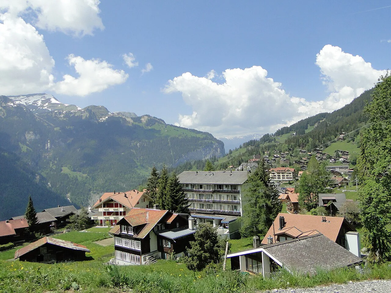
The Schilthorn ascent is two hikes in one. From Mürren to Rotstockhütte the path is gentle, gaining only 300 to 400 m (about 1,000 to 1,300 ft) and suiting families. Above the hut the character changes completely: a steep climb of more than 1,000 m (3,300 ft) to the summit on rocky ground.
End to end, the route from Mürren to the Schilthorn is about 12.9 km (8 mi) with roughly 1,600 m (5,250 ft) of ascent and around six hours of walking. Many hikers stop at the hut, which is a satisfying objective in its own right, and leave the summit stretch for a fitter day or a cable car ride.
The Schilthornbahn connects Mürren with the summit, so you can ride down after the climb instead of reversing the route. Rotstockhütte sits on the way and breaks the ascent into manageable halves. The summit itself has the Piz Gloria complex with its revolving restaurant and viewing terraces.
Above the hut the terrain is rocky and partly exposed, and early-season snow can linger on the upper slopes into June. Carry layers, start early, and turn around if the weather closes in rather than pushing for the summit in cloud.
Isenfluh, Sulwald and the Lobhornhütte
Isenfluh sits across the valley from the main village and offers a quieter, more pastoral day. A small cable car runs up to Sulwald, from where a panorama trail of about 3 km (1.9 mi) with roughly 500 m (1,640 ft) of climbing leads through forest and rock towards Alp Chüebodmi and the Sulsbach. Allow around two hours for the walk, longer with stops.
The trail continues to the Lobhornhütte at 1,955 m (6,414 ft), an alpine club hut with views across to the Eiger, Mönch and Jungfrau. Walking from Isenfluh to Sulwald instead of riding the cable car adds about 2.2 km (1.4 mi) and roughly an hour, and brings you past the Sulsbach waterfall.
This is the zone to choose when you want solitude and a hut lunch rather than a station cafe. The flip side is thinner transport: check the Isenfluh cable car times before you commit, since a missed last descent means a long walk out.
Tanzbödeli and Obersteinberg: the long steep day
The biggest single day in the valley combines Tanzbödeli with Obersteinberg. The route runs about 13.9 km (8.6 mi) with around 1,100 m (3,600 ft) of ascent and takes six to seven hours with stops, four of them walking. The Tanzbödeli section gives the 360-degree panorama, and the Hotel Obersteinberg provides a lunch or drink halfway.
The trail is steep for long stretches, and the altitude makes the climbing feel harder than the numbers suggest. Start early, carry more water than you think you need, and plan the descent before the afternoon storms build. This is a day for hikers with mountain legs, not a first outing.
As a base, Stechelberg shortens the approach to this side of the valley and puts you close to the Schilthornbahn as well. It is a quieter alternative to the village, with fewer dinner options but more trail on your doorstep.
Lifts and transport to the trailheads
Lauterbrunnen's trailheads are mostly lift-served, which is what makes the valley work for short trips. The Grütschalp cable car links the village to the terrace, the Mürren railway continues along it, and the Schilthornbahn climbs from Stechelberg through Gimmelwald and Mürren to the summit. On the eastern side, cable cars serve Wengen and Männlichen.
On the valley floor, the PostAuto 141 bus is the workhorse between Lauterbrunnen and Stechelberg, taking around 18 minutes and costing a few Swiss francs. Use it to make one-way walks possible: walk south, ride back, or reverse the plan and finish at a bus stop.
Lift operating seasons, first and last departures and any maintenance closures vary through the year and are worth reading on the lift company's own pages before you fix a plan. The tourist office map page is the fastest way to see which lifts and paths connect on the ground.
Distance, ascent and time at a glance
For a quick comparison: the valley-floor walk to Stechelberg is about 4.3 km with 118 m of gain and takes one to two hours; the Grütschalp to Mürren terrace line is about 4.5 km with 60 m and a little over an hour; the North Face circuit from Mürren is 7 km with 380 m and two to three hours.
The harder options scale up sharply: Wengen to Männlichen is 4.9 km with 1,042 m and around two hours; Mürren to the Schilthorn is 12.9 km with 1,600 m and about six hours; and the Tanzbödeli and Obersteinberg day is 13.9 km with 1,100 m over six to seven hours. The direct climb from the valley to Mürren sits between these, at roughly 6.9 km and 870 m over three to three and a half hours.
Match the numbers to your day: anything over 1,000 m of gain in this valley means an early start, and anything over 12 km means carrying lunch rather than relying on a hut. The terrace routes are the ones that stay comfortable when the forecast is uncertain.
Huts and mountain hotels on the routes
The main hut on a marked route is the Rotstockhütte, sitting between Mürren and the Schilthorn and splitting the climb in two. Higher on the Isenfluh side, the Lobhornhütte at 1,955 m serves walkers coming up from Sulwald. Both are alpine club style huts, so membership and booking arrangements come from the huts themselves and the Swiss Alpine Club rather than the village tourist office, and it is worth checking current prices and opening dates before setting out.
The Hotel Obersteinberg is a staffed mountain hotel rather than a hut, and it sits on the Tanzbödeli route as a natural lunch stop. Mürren itself has hotels and restaurants, which makes it the easiest place to stay if you want several terrace days without carrying food.
For hut beds, the local tourism office lists mountain hotels and SAC huts among the valley's accommodation, which is a useful starting point for finding the right operator. Confirm opening dates and booking rules with the hut directly, since they shift with the season.
When to go
Summer is the season for the high routes: the terraces and valley floor walk well from late spring, while the Schilthorn upper slopes and the Tanzbödeli day need the snow gone, often not until early summer. Early and late in the season, expect snow patches on high passes and carry traction.
Afternoon thunderstorms are the routine summer hazard here: build the day around a morning start, and be off ridges and exposed slopes by mid-afternoon. The valley floor walk and the terrace traverse are the sensible choices when the forecast is unsettled.
If you are combining Lauterbrunnen with a wider Swiss trip, the Bernese Oberland rewards a few days based in one valley rather than hopping between towns. Check the hiking in Switzerland guide for how the region fits together, and the hiking in interlaken page if you want a second base near Lake Thun.
Which base suits which hike
Lauterbrunnen village is the best all-round base: it has the valley-floor trail from the door, the Grütschalp cable car for terrace days, and the bus to Stechelberg for the Schilthorn side. Choose it if you want restaurants, shops and easy transport over trail-side solitude.
Mürren suits terrace and Schilthorn days best, since the trails start at the station and you skip the cable car each morning. Wengen is the pick for the Männlichen climb and the ridge traverse, while Stechelberg shortens the approach to the Obersteinberg side. Isenfluh is for quiet days on the Sulwald paths, with the trade-off of thin transport.
Base choice also sets your evening: Mürren and Wengen are car-free villages on the terraces, while Lauterbrunnen and Stechelberg sit on the valley road. If you are driving, the valley-floor villages are simpler for parking.
Maps and orientation
The valley's paths are well signposted, but the lift network is where a map earns its place: knowing which cable car connects to which terrace saves an hour of backtracking. Lauterbrunnen Tourismus publishes summer maps, winter maps and a local village map, and the summer sheet is the one to use for hiking planning.
Take the paper map even if you navigate by phone, since signal is patchy on the terraces and under the cliffs. Mark your lift times on it and note the last descent before you set off, especially for the Schilthorn and Männlichen sides.
Plan Your Lauterbrunnen Hiking Days
Build your trip around one zone per day. Put the flat valley-floor walk and the Grütschalp terrace first, add the Wengen to Männlichen climb or the Schilthorn ascent once your legs are used to the altitude, and save the Tanzbödeli day for settled weather.
Check the lift times and the tourist office maps the evening before each hike, and carry layers and water even on terrace days. Lauterbrunnen rewards hikers who start early and keep the plan flexible.
Explore more Lauterbrunnen hiking guides
Frequently Asked Questions
What are the best hikes in Lauterbrunnen for a first visit?
Start with the valley-floor walk from Lauterbrunnen to Stechelberg and the terrace traverse between Grütschalp and Mürren. Both are gentle, well served by lifts and buses, and they show you the two faces of the valley without committing to a big climb.
How long does the Lauterbrunnen to Mürren hike take?
The direct climb is usually tracked at three to three and a half hours over roughly 6.9 km with about 870 m of ascent. That figure comes from user-tracked route data rather than trail signage, so allow extra time if you stop often.
Do you need a cable car to reach the Mürren trails?
Yes, for most people. Mürren is car-free and reached by the Grütschalp cable car plus the Mürren railway, or by the Schilthornbahn from Stechelberg. You can also walk up from the valley floor, which takes around three hours.
Is the walk from Lauterbrunnen to Stechelberg flat?
It is close to flat, with only about 118 m of gain over roughly 4.3 km. The surface is mostly paved and turns to gravel near the end, which makes it the easiest full walk in the valley.
How hard is the climb from Mürren to the Schilthorn?
It depends where you stop. The section from Mürren to Rotstockhütte is gentle and suits families, while the stretch above the hut climbs more than 1,000 m on rocky ground. The full route is about 12.9 km with roughly 1,600 m of ascent and around six hours.
When is the hiking season in Lauterbrunnen?
The valley floor and terraces walk well from late spring, while the high routes need the snow gone, often not before early summer. Afternoon storms are common in summer, so plan early starts and be off exposed ground by mid-afternoon.
Where should you stay to reach the trailheads easily?
Lauterbrunnen village is the best all-round base for valley-floor walks and lift access. Mürren suits terrace and Schilthorn days, Wengen suits the Männlichen climb, and Stechelberg shortens the approach to the Obersteinberg side.
Sources
Trail notes for your next trip
Optional updates when we add or revise hiking guides.
You might also like
Continue reading
More guides you'll find useful