Wengen Hikes: Trails, Lift Access and Route Choices
Plan Wengen hikes from the car-free village: the Männlichen Panorama trail to Kleine Scheidegg, the Leiterhorn loop and the descent to Lauterbrunnen.
On this page
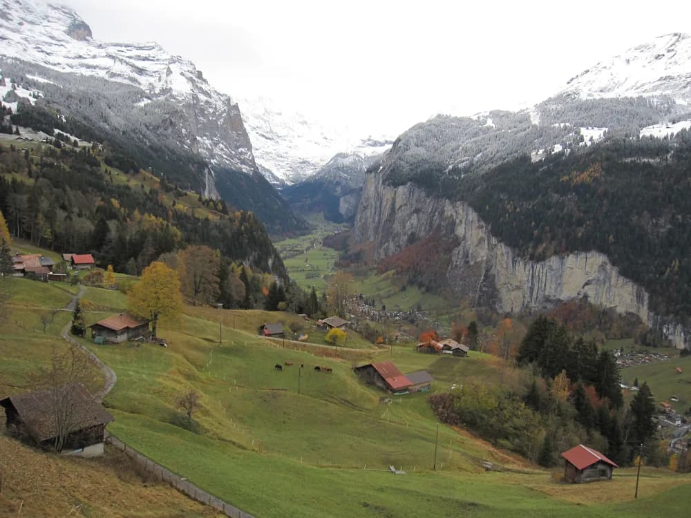
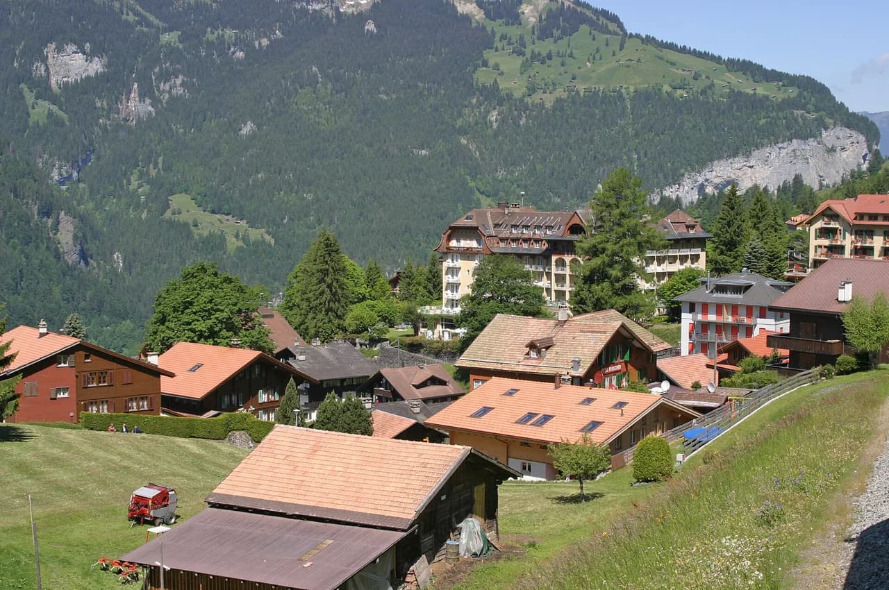
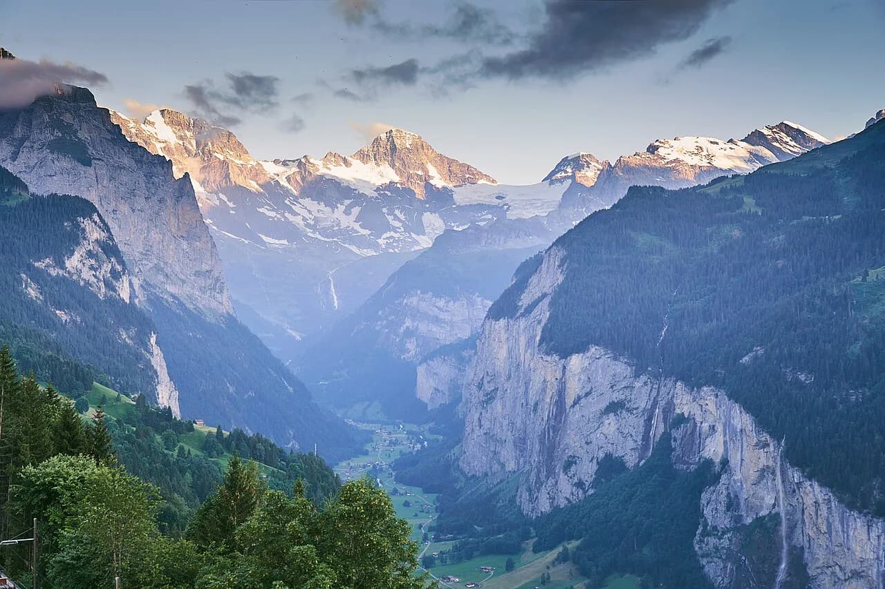
Wengen is a car-free village on a cliff-top terrace above Lauterbrunnen, and almost every hike here begins either at the railway station or at the top of a lift. That layout makes planning simple: you choose a route by how you reach its start, then walk back to the village or down to the valley floor by train. The rewards are close-up views of the Eiger, Mönch and Jungfrau and long stretches of meadow and forest above the Lütschine.
The routes below range from a high panorama traverse at over 2,000 m (6,560 ft) to a short forest loop with valley views that works when cloud hides the peaks. Each entry gives the access, the layout and the trade-offs, so you can match a hike to your fitness and to the weather on the day.
What Wengen offers hikers
The village sits at roughly 1,270 m (4,170 ft) on a shelf between Männlichen and the Lauterbrunnen valley wall, and the trail network radiates from the station in every direction. Trains run up from Lauterbrunnen and on to Kleine Scheidegg, so you can start high, finish low, or do both in one day without a car. The Jungfrau Region's marked paths connect the village with Wengernalp, Kleine Scheidegg, Männlichen and the forest above Lauterbrunnen.
Wengen Tourismus groups the local routes into a handful of headline walks and a longer list of alternatives, from the Lauberhorn downhill run to the Hunneflueh climb. Use that structure when you plan: pick one high route for a clear day and keep a low forest walk in reserve for the afternoons when the summits cloud over.
Getting to Wengen and moving around without a car
Wengen has no road access for visitors, so you arrive by train from Lauterbrunnen, which is itself reached by train from Interlaken. The same line continues uphill to Wengernalp and Kleine Scheidegg, which makes it the backbone of any hiking plan: you can ride to a trailhead, walk a traverse, and return by train from the other end. Allow time for the connections at Lauterbrunnen, where the valley line meets the mountain line.
For the high routes, the Männlichen lift from Wengen carries you up to the ridge station, and a cable car links Männlichen with Grindelwald on the other side; if you finish on that side, the Grindelwald hiking guide covers the trails down. Lift operating seasons and the day's first and last departures change through the year, so check the Jungfrau Region operating status before you commit to a one-way traverse. The alternative is to walk up from the village under your own power, which adds a long, steep climb before the traverse even begins.
Männlichen to Kleine Scheidegg: the Panorama trail
This high traverse begins at Männlichen station at 2,230 m (7,320 ft) and runs via Honegg and Rotstöckli to Kleine Scheidegg at 2,061 m (6,760 ft), with the Eiger, Mönch and Jungfrau filling the skyline for most of the way. It is the classic Wengen hike for a clear day: the path stays high, the views open constantly, and the finish at Kleine Scheidegg puts you on the train back to the village.
Because the route starts above 2,000 m (6,560 ft), snow can linger on the upper stretches well into the early summer and return in the autumn, so carry traction or choose a lower walk if a cold snap has passed through. Afternoon cloud builds against the Jungfrau wall, so an early lift and a morning start give the best chance of the full panorama.
The route is a point-to-point traverse rather than a loop, which means you need to plan the return before setting out: down by train from Kleine Scheidegg, or onward on foot toward Wengernalp and the village. Walking the full descent to Wengen adds a long, steady knee-bending section at the end of the day.
Wengernalp to Biglenalp to Kleine Scheidegg
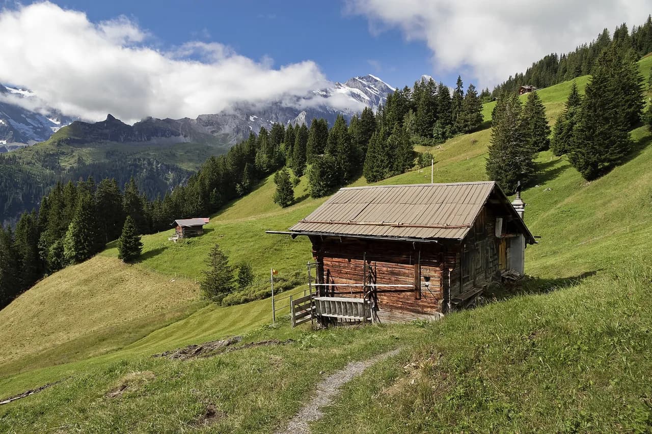
This walk starts at the Wengernalp bus and rail stop rather than in the village, so you ride up first and then walk across meadows and through woodland toward Biglenalp. The Eiger, Mönch and Jungfrau stay in view for much of the route, and at Biglenalp the path branches toward Kleine Scheidegg. It is a gentler introduction to the high country than the Männlichen traverse.
Use this route when you want a shorter day with a train or bus at both ends, or when the Männlichen lift is not running. The trade-off is that you lose the long high balcony section; what you gain is meadow walking, shade in the woodland stretches and a straightforward finish at Kleine Scheidegg.
Wengen to Wengwald to Lauterbrunnen
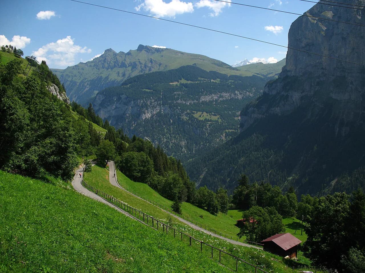
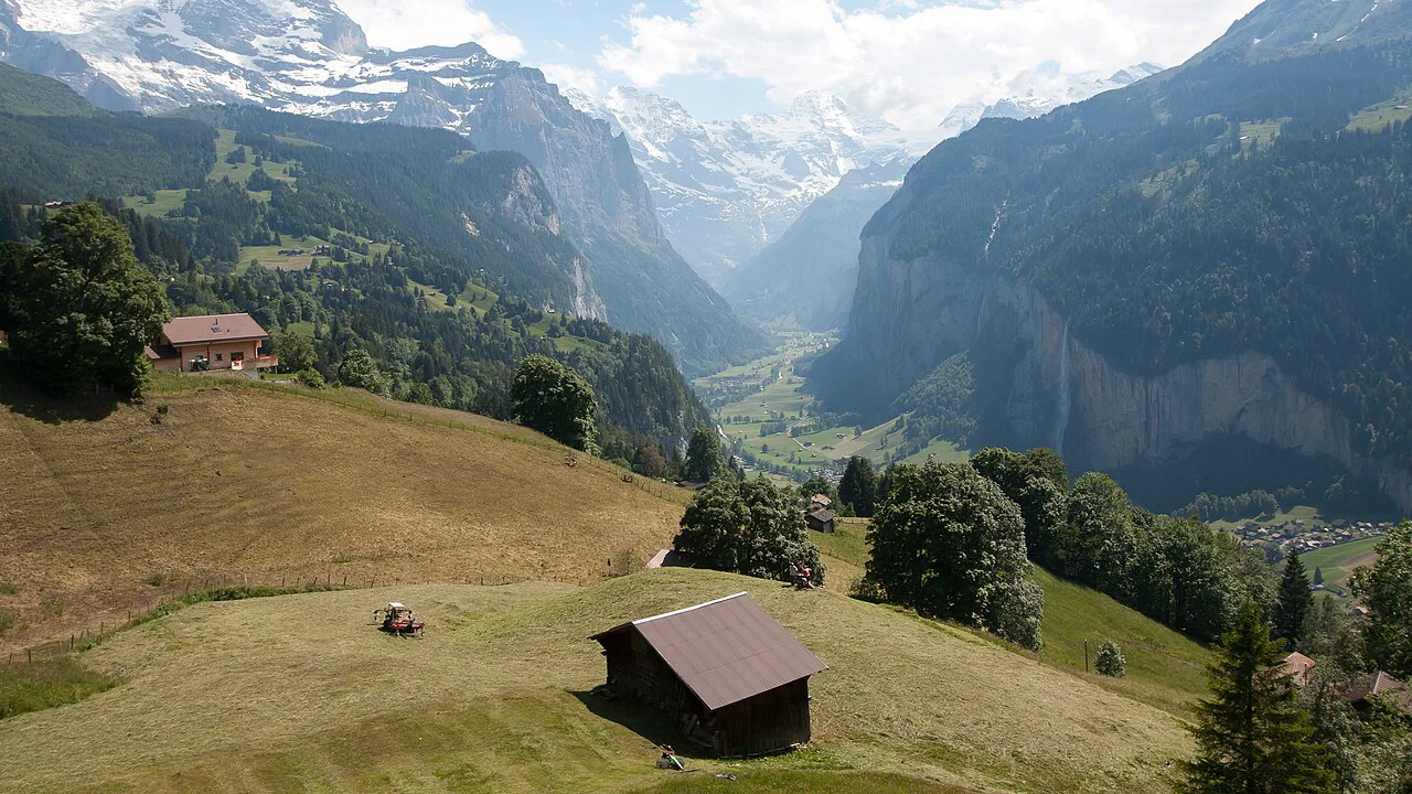
The valley descent leaves the village past the Reformed Church, which the local tourism office describes as Wengen's best vantage point, and drops through Wengwald to the floor of the Lauterbrunnen valley. Wengen Tourismus gives the descent as almost 500 m (1,640 ft), which puts Lauterbrunnen within reach on foot at the end of the day.
This is the route to choose when the peaks are in cloud or when you want a one-way walk with a train back up from Lauterbrunnen station. The path is mostly downhill, but the sustained gradient loads the knees, so poles help; once in the valley you can extend the day along the floor toward the Staubbach Falls on the valley hike.
Leiterhorn loop from the village
The Leiterhorn loop starts on Wengen's main street and climbs out of the village on a paved lane before switching to forest track and narrow dirt trail. One hiking blog reports the circuit as about 3 miles (roughly 4.8 km) with around 866 ft (about 264 m) of gain and a walking time of 1.5 to 2 hours, which makes it the best half-day option that needs no lift or train at all.
Navigation is the one thing to watch: early junctions are signed but not all of them name Leiterhorn, so follow signs toward Männlichen until the junction where the Leiterhorn road splits off to the left. Keep to the lower road there rather than the trail toward Männlichen, and the viewpoint above the Lauterbrunnen valley arrives shortly after.
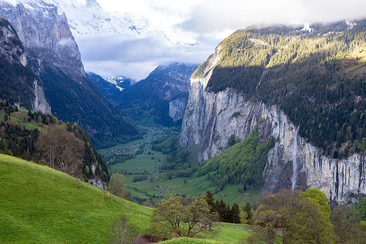
The payoff is a direct look down the valley toward Interlaken, with the Lütschine threading the floor, and on clear days the Eiger, Mönch and Jungfrau above. A picnic area with a fire pit and firewood sits near the viewpoint, and the trail is quiet compared with the high traverses. There is no water along the way, so fill bottles in the village before you start.
Other routes from Wengen
Beyond the headline walks, Wengen Tourismus lists the descent of the Lauberhorn downhill run, a route via Leiterhorn and Spätenalp to Burglauenen, the climb to the Hunneflueh and a short walk to the Staubbach bench. These are useful when you want a quieter day or a shorter outing on either side of a travel day.
The Leiterhorn and Spätenalp route to Burglauenen is a point-to-point walk that ends at a rail stop down the valley, so check the return train before you set out. The Hunneflueh climb is the steepest of the group and rewards the effort with a view over the village and the valley.
Lift and bus access to the trailheads
Plan Wengen hikes around three access points: the village station for walks on foot, the Männlichen lift for the high traverse, and the train or bus to Wengernalp for the meadow route. The lift and the mountain railway run on seasonal timetables, so check the Jungfrau Region operating status on the day and have a village-based walk ready as a fallback.
Lift tickets and rail fares are priced by the operating companies rather than by the village, so check the Jungfrau Region fare pages before buying; a return ticket for a one-way traverse is rarely the right choice. If you plan several lift rides in a week, compare a multi-day pass with single tickets.
Huts, water and food on the routes
Wengen itself has shops and restaurants for stocking up, and the stations at Männlichen, Kleine Scheidegg and Wengernalp have refreshment stops in season. The Leiterhorn loop has no water along the trail, so carry what you need from the village. On the high traverses, treat any open hut as a bonus rather than a certainty, since opening periods vary.
With no refuges guaranteed on these day routes, self-sufficiency is the rule: a packed lunch, at least a litre of water per person and a warm layer for the wind at 2,000 m (6,560 ft). If you want a bigger mountain day with fixed-cable terrain, the Lauterbrunnen Via Ferrata offers a very different kind of outing.
When to go
Summer is the reliable season for the high routes, with the Männlichen traverse and the Wengernalp meadows usually walkable once the snow has cleared. Late spring and early autumn can be excellent on the valley descent and the Leiterhorn loop even when the upper paths still hold snow. Afternoon thunderstorms are a real feature of the Bernese Alps in midsummer, so start early and be off exposed ridges by the afternoon.
When cloud sits on the Jungfrau wall, the Leiterhorn loop and the descent to Lauterbrunnen keep the day worthwhile, because the valley views do not depend on the summits being clear. That makes Wengen unusually forgiving for a mountain village: even a grey day has a good walk in it.
Difficulty, fitness and exposure at a glance
For most hikers, the Wengernalp to Kleine Scheidegg route is the gentlest high option, the Männlichen traverse is a moderate full day with real altitude, and the valley descent is easy in gradient but long on the knees. The Leiterhorn loop is short but steep out of the village, with rocky and rooty sections on the forest trail.
Exposure matters mainly on the Männlichen traverse, where the path runs open and high with little shelter from wind or weather. Snow on the passes early and late in the season, wet roots on the Leiterhorn descent and slick grass after rain are the everyday hazards; sturdy boots and poles cover most of them.
Where to base yourself
Staying in Wengen puts the village walks and the station lifts on your doorstep, which suits hikers who want to start on foot and keep travel time short. Staying on the valley floor in Lauterbrunnen means a train ride up each morning but easier access to the valley paths and the Staubbach Falls.
Wengen suits walkers who want the high traverses and a quiet evening above the valley; Lauterbrunnen suits those who prefer to mix valley-floor walks with the occasional ride up. Either base works for the routes above, because the mountain railway links them directly.
Plan Your Wengen Hike
Pick one high route and one village-based walk before you travel, then decide on the morning of the hike by looking at the cloud and the lift status. The Männlichen traverse earns a clear day, the Wengernalp meadows suit a shorter day, and the Leiterhorn loop and the Lauterbrunnen descent carry a cloudy one.
Frequently Asked Questions
What are the best hikes from Wengen?
The Männlichen to Kleine Scheidegg Panorama trail is the signature high route, with the Eiger, Mönch and Jungfrau in view for most of the way. The Wengernalp to Biglenalp to Kleine Scheidegg walk is a gentler high alternative, the descent past the Reformed Church to Lauterbrunnen is the classic one-way valley walk, and the Leiterhorn loop is the short forest circuit from the village.
How do you get to the start of the Männlichen Panorama trail?
Ride the Männlichen lift from Wengen to the top station, where the traverse begins at 2,230 m (7,320 ft). The lift runs on a seasonal timetable, so check its operating status before you commit to a one-way walk, and plan your return by train from Kleine Scheidegg.
How long is the hike from Wengen down to Lauterbrunnen?
Wengen Tourismus gives the descent as almost 500 m (1,640 ft) of altitude loss from the village to the valley floor. The route is mostly downhill but sustained, so allow more time than the distance alone suggests and carry poles if your knees complain on descents.
Is the Wengen to Leiterhorn hike family-friendly?
The loop is short and the climb out of the village is the steepest part. One hiking blog reports about 3 miles (roughly 4.8 km) with around 866 ft (about 264 m) of gain and a walking time of 1.5 to 2 hours, and notes a picnic area with a fire pit near the viewpoint. Expect rocky, rooty sections and no water on the trail.
Can you hike from Wengen without taking a lift?
Yes. The Leiterhorn loop, the valley descent to Lauterbrunnen and the Staubbach bench walk all start in or near the village on foot. The high traverses are the routes that depend on a lift or the mountain railway to reach their trailheads.
When is the best time to hike around Wengen?
Summer is the reliable window for the high routes, once the snow has cleared from the Männlichen and Wengernalp paths. Late spring and early autumn work well on the valley descent and the Leiterhorn loop, and starting early avoids the afternoon storms that build against the Jungfrau wall in midsummer.
Sources
Trail notes for your next trip
Optional updates when we add or revise hiking guides.
You might also like
Continue reading
More guides you'll find useful