Hiking in Lake Garda: Best Trails, Loops and Base Towns
Plan hiking in Lake Garda with cliffside stairways, the Ledro loop and the three GardaTrek routes, plus distances, ascent, seasons and the best base towns.
On this page
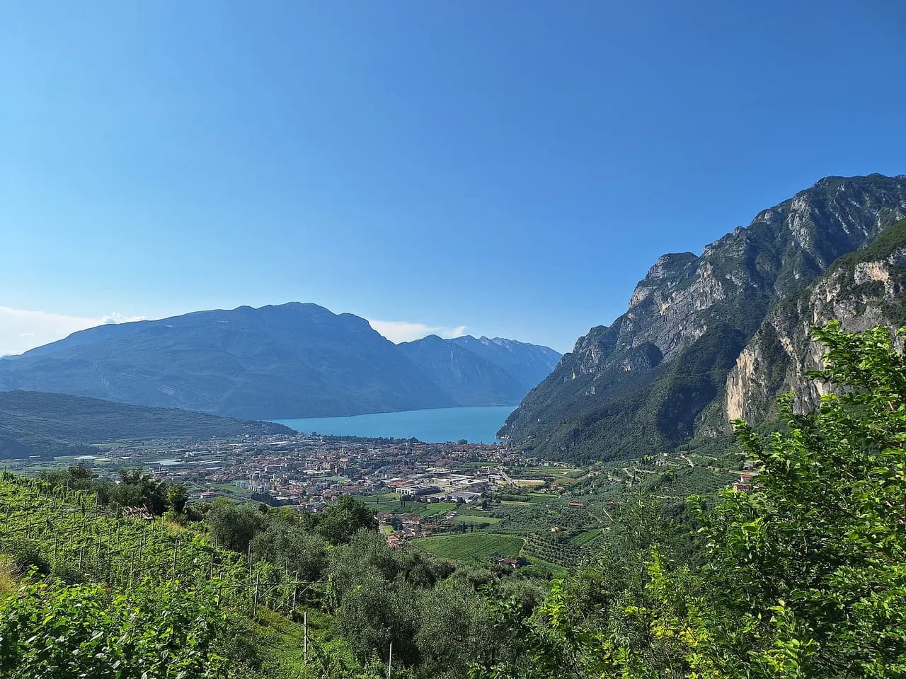
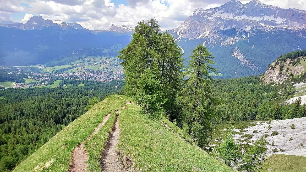
Lake Garda gives you two hikes for the price of one landscape: a shoreline of olive groves, fishing towns and vineyard slopes, and ridgelines above them that reach well over 2,000 m (6,562 ft) within sight of the water. The mild climate means you can walk the lowest paths through winter yet face genuine alpine exposure on the crest routes in summer. This guide sorts the north-lake walks, the GardaTrek loops and the Monte Baldo crest by distance, climb and season so you can choose the day that fits your legs.
Distances and ascents quoted here are the recorded route figures you can compare, not a universal standard. A 9 km (5.6 mi) walk with 270 m (886 ft) of climb asks for sure-footedness on stairways, while a 12.5 km (7.8 mi) crest route with 1,270 m (4,167 ft) of climb is a full mountain day. Read the numbers against your own usual walking, then fit the hike to the weeks you have.
Why Lake Garda suits hikers
Roughly 3,900 recorded routes are mapped around the lake, running from gentle morainic hills in the south to the rugged Monte Baldo peaks in the north, with rocky ridges, forests, olive groves and vineyards in between. That range means a beginner and a seasoned ridge-walker can start from towns a short drive apart. The trade-off is the lake itself: popular lakefront paths get busy in high season, so the quiet options are usually the higher or less famous ones.
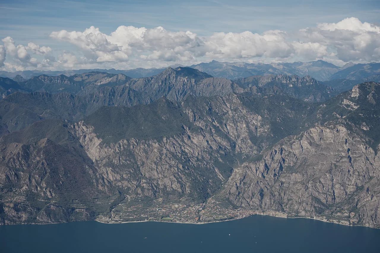
Monte Cadria at 2,254 m (7,395 ft) is the highest summit in the wider lake area, but most hikers stay well below that. The northern shore, squeezed between the Alps and the water, carries the sharpest climbs and the most dramatic views, and it holds the sub-Mediterranean climate that keeps olive groves alive at the foot of alpine slopes. The southern shore is where you go for shorter, gentler walks through vineyard country.
How the lake divides up
Riva del Garda and Torbole form the northern hub, and most of the serious hiking described here starts within reach of them. From Riva, the shoreline and inland valleys give access to the GardaTrek network, the paths toward Tenno, Arco and Nago, and the classic lakefront routes. If you want the widest choice of trails without a car, base here or in Arco.
Limone sul Garda on the west shore is the start for the Sentiero del Sole, an 8.97 km (5.6 mi) walk with 110 m (361 ft) of ascent and descent that takes about 2 hours 25 minutes and needs only easy-access paths. Torbole anchors the eastern end of the Busatte–Tempesta route. Malcesine sits directly beneath Monte Baldo and is the natural base for the crest trail and the cable car.
Ledro sits inland from Riva, west of the lake, and rewards the drive or bus ride with a 9.5 km (5.9 mi) circuit of its own water. If you want variety without long transfers between days, mix a Limone or Torbole lakefront day with a Lake Ledro day and a Monte Baldo day, keeping each base no more than an hour apart.
Easy and moderate hikes: three good first days
The Busatte–Tempesta Panoramic Trail is the signature short walk above the lake, running from Torbole along a cliffside route famous for its iron stairways and suspended walkways. Recorded at 9.04 km (5.6 mi) with 270 m (886 ft) of climb and descent over about 2 hours 43 minutes, it is rated moderate and asks for sure-footedness rather than technical skill. A longer 10.6 km (6.6 mi) version with 360 m (1,181 ft) of climb covers the same setting with more time on the trail; the full breakdown sits in the Busatte–Tempesta Trail: A Cliffside Walk Above Lake Garda guide.
The Sentiero del Sole from Limone sul Garda climbs gently from the lemon-town rooftops into the slopes above the lake, with a meagre 110 m (361 ft) of ascent spread over nearly 9 km (5.6 mi). It is a good choice for a hot day when you want shade and lake views without committing to a long climb. Walk it early or late, since the west shore catches direct sun through the afternoon.
The Tour of Lake Ledro is a relaxed loop on mostly easy paths, covering 9.5 km (5.9 mi) with 120 m (394 ft) of ascent in around 2 hours 33 minutes. Its lower elevation and gentle profile suit families and rest days, and the inland setting means you escape the lakefront crowds. Pair it with a swim stop if the weather is warm.
The GardaTrek loops: low, medium and top
GardaTrek is a network of three loop-shaped routes between lake and mountains, graded by height and effort so you can pick one to match the season. The Corona Bassa, or low loop, runs about 30 km and can be walked in one long day or two shorter stages from Riva del Garda, passing the lakeshore, turning inland toward Arco by way of Tenno and reaching in the region of 500 m at its highest point. Its low altitude and mild climate mean snow is unlikely even in the coldest winter months, making it the year-round option.
The Corona Media, the medium loop, is roughly 70 km in four stages and climbs past Lake Tenno to Rifugio San Pietro before reaching its high point at Bocca di Tovo at 1,079 m (3,540 ft). The first day out of Riva is the hardest, and the remainder follows mountainside trails at average altitudes between 400 and 600 m (1,312 to 1,969 ft). That profile keeps it walkable year round, with lake views that many find sharpest on a cold winter day.
The Corona Alta, or top loop, is about 90 km with a total climb of roughly 7,000 m (22,966 ft) over the course of a week, linking panoramic huts across the ridges. The first day climbs from Riva to Rifugio Pernici at 1,600 m (5,249 ft), and the route later reaches Rifugio San Pietro, Rifugio Prospero Marchetti and Rifugio Damiano Chiesa near the summit of Monte Altissimo. Because of the altitudes and the reliance on mountain huts, treat it as a summer route, roughly from the end of June to the end of September.
Monte Baldo: the Alta Via crest trail
The Alta Via del Monte Baldo Crest Trail 651 is the hard day above the lake: 12.5 km (7.8 mi) with 1,270 m (4,167 ft) of ascent and the same again on descent, taking about 6 hours on mostly accessible paths that still require sure-footedness. The height gain and length put it firmly in the demanding bracket, so plan it for a day when you can start early and keep a steady pace. You can trim the climb with the cable car from Malcesine into the upper mountain, though the crest route itself stays high and exposed.
At ridge height, weather turns quickly and a clear morning can give way to cloud or storms by afternoon, so set out with a plan to be off the crest by early afternoon. Snow can linger on the high ground early and late in the season, and the difference in effort between a summer ascent and a shoulder-season one is real. If you want the views without the full crest, work out a shorter traverse and descend by lift or trail.
Distance, ascent and walking time for each hike
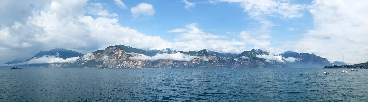
Use these recorded figures as a starting comparison. Busatte–Tempesta: 9.04 km (5.6 mi), 270 m (886 ft) of ascent, 2 hours 43 minutes, moderate. Sentiero del Sole: 8.97 km (5.6 mi), 110 m (361 ft), 2 hours 25 minutes. Tour of Lake Ledro: 9.5 km (5.9 mi), 120 m (394 ft), 2 hours 33 minutes. Crest Trail 651: 12.5 km (7.8 mi), 1,270 m (4,167 ft), about 6 hours, hard.
For the multi-day loops, the overall shapes are roughly 30 km with about 500 m of high point for the Corona Bassa, roughly 70 km across four stages for the Corona Media and roughly 90 km with about 7,000 m of total ascent for the Corona Alta. Those totals put each loop in a different category, so budget a long day, a four-day stretch or a full week accordingly. Estimating your own pace against the single-day figures above is the simplest reality check.
Trailheads, buses, ferries and lifts
Most trailheads around the lake are reachable by public transport in the populated towns, with buses and ferries connecting points around the shore. The Monte Baldo cable car from Malcesine provides direct access to the higher ground. Check the current bus and ferry schedules for your dates before you commit to a point-to-point day.
On the final day of the Corona Alta you can return to Riva del Garda with a combination of cable car and ferry rather than walking the steep descent back to the lake. That shortcut changes the logistics of the loop and is worth planning before you set out, so you know where your trip effectively ends. Build the transfer into your last day rather than leaving it to chance.
If you want a guided or self-guided format with accommodation and luggage transfer arranged, the tour options run from Lake Garda to Venice, from Merano to Lake Garda and from Verona to Lake Garda. These suit hikers who would rather walk than manage bookings, and they cover stages outside the immediate lake area as well as the approaches to Riva. Choose one only if the distance and the luggage handling match your trip.
When to go: season by altitude
Spring and autumn are the sweet spots around the lake, with mild temperatures and either blooming slopes or autumn color. Bookable hiking holidays in the region generally run from May to October, and the best hiking season is commonly given as May to September. Summer heat at low elevations is the main constraint, so shift your walking to morning and evening when it builds.
Altitude should guide your season choice more than the calendar. The low and medium GardaTrek loops stay around 500 m and 400 to 600 m and can be walked year round, while the top loop is a summer proposition because of its heights and hut stays. For the crest trail, aim for the middle of summer and avoid days after fresh snow on the high ground.
Huts and overnight stays on the longer loops
The Corona Alta relies primarily on mountain huts for accommodation, which shapes how you plan the week. Rifugio Pernici sits at 1,600 m on the first day's climb from Riva, Rifugio San Pietro is open year round and known for its setting, and Rifugio Damiano Chiesa lies close to the summit of Monte Altissimo. Booking those beds is the part of the route that decides your dates, so sort it before you commit to stages.
The Corona Media also passes Rifugio San Pietro after climbing from the lake, so hut availability can influence whether you use it as an overnight or a lunch stop. Booking arrangements, opening dates and prices are handled by each hut's operator, so confirm them before you set your itinerary.
Where to base yourself for which hikes
Riva del Garda is the strongest all-round base if you want the GardaTrek loops, lakefront walks and access to the northern valleys, with Torbole and Arco as quieter alternatives nearby. Torbole suits the Busatte–Tempesta route directly, and Arco puts you on the Corona Bassa's inland steps. Expect lakeside accommodation to fill in summer, so book well ahead for the high season.
Malcesine is the base for the Monte Baldo crest and the cable car, and its lakeside setting makes it easy to mix a mountain day with a lakefront evening. Limone sul Garda works for the Sentiero del Sole and the west-shore paths, while it sits about an hour from the Malcesine side of the lake. Choose your base by which hike is your priority, then accept a transfer for the others.
If you want to combine hiking with a city stay, Verona makes a practical base for the southern lake and the tours leading toward the water. From Verona you can also plan a hiking route through Valpolicella as part of a route to the lake. For a full day above the lake, though, staying near Riva or Malcesine saves the drive.
Hazards and exposure
The Busatte–Tempesta route's iron stairways and suspended walkways are the real exposure point: there are sheer sections where you want steady footing and a head for heights. Sturdy shoes and sure-footedness are required, and you should keep hold of children and dogs on the fixed sections. If vertigo is a problem, pick the lakefront paths instead.
On the Monte Baldo crest, the exposure is a combination of height gain, distance and weather, with 1,270 m of climbing and six hours of walking on mostly accessible paths that still require a careful step. Afternoon storms on a high ridge are the thing to avoid, so watch the clouds and turn around if they build early. The same caution applies to any route that crosses open ground above the tree line.
The lake's warm microclimate means lower slopes stay snow-free even in the coldest months, but that is precisely why you need to respect the bigger climbs when the season shifts. Alpine experience is the sensible preparation for the hard routes, and if you want to add vertical rock to your trip, look at the lake garda via ferrata options around Arco, where routes include Rio Sallagoni and the exposed ground above the lake.
Longer routes and pairing hikes
If the GardaTrek loops feel like the right length, plan them as your multi-day backbone and add day hikes from your base on either side. Walkers often combine a few days on the Corona Media with the lakeside paths around Riva and the Busatte–Tempesta route to vary the terrain. That mix gives you ridge views, shoreline walking and huts without committing to the full week on the top loop.
The Sentiero del Ponale is the other well-known link between Riva and the Ledro valley, following the old lakeside road above the water. It is a natural addition to a Ledro day, turning the circuit of the lake into a longer outing. Do not combine it with a high route on the same day unless you are happy with a long, tiring schedule.
For hikers building a wider northern Italy trip, other lakes make useful comparisons. Hiking in Lake Como offers steep olive terraces and high balcony paths around the Intelvi Valley, while hiking in Sardinia turns to coastal granite and long ridge walks such as the Sella del Diavolo. Both sit outside the Lake Garda destination and are worth a separate trip rather than a day out from Riva.
Plan Your Lake Garda Hike
Start with the season, then pick the hike that matches it. Choose the low GardaTrek loop or the lakefront paths in winter and early spring, aim for the medium loop and Sentiero del Sole in the shoulder months, and save the Corona Alta and the Monte Baldo crest for a settled summer week.
Book hut beds on the top loop before anything else, then sort your transfer back from the finish rather than walking every descent. Whichever route you choose, carry a map, start early on the high ground and keep an eye on how the clouds build over the ridge.
Explore more Lake Garda hiking guides
Frequently Asked Questions
What are the best hikes in Lake Garda for a first visit?
Start with the Busatte–Tempesta route above Torbole, which combines lake views with iron stairways over about 9 km (5.6 mi) and 270 m (886 ft) of climb. Add the Sentiero del Sole from Limone sul Garda and the Lake Ledro circuit for gentler days. Save the Monte Baldo crest for a second trip or a keen hiking day.
How long is the Busatte–Tempesta panoramic trail?
The main recorded version is 9.04 km (5.6 mi) with 270 m (886 ft) of ascent and descent, taking around 2 hours 43 minutes. A longer 10.6 km (6.6 mi) version with 360 m (1,181 ft) of climbing also exists. Treat either as a moderate walk that needs sure-footedness on the stairways.
Can you hike Monte Baldo without a guide?
Yes. The Alta Via del Monte Baldo Crest Trail 651 is a waymarked route, though at 12.5 km (7.8 mi) with 1,270 m (4,167 ft) of climb and about six hours of walking it is a hard day. A guide is only necessary if you want to add technical climbing or a via ferrata.
What is the GardaTrek and how many loops does it have?
GardaTrek is a network of three loop routes above the northern lake: the low loop at roughly 30 km, the medium loop at roughly 70 km in four stages, and the top loop at roughly 90 km with around 7,000 m (22,966 ft) of total ascent. Each is aimed at a different level of fitness and season.
When is the best time of year to hike around Lake Garda?
Spring and autumn are the most comfortable months around the lake, with mild temperatures and good views. The low and medium GardaTrek loops stay walkable year round, while the high routes are best in summer once the snow has cleared from the upper ground.
Are there hikes around Lake Garda that stay snow-free in winter?
Yes. The Corona Bassa tops out around 500 m and the Corona Media stays at average altitudes of 400 to 600 m, so snow is unlikely on either even in the coldest months. The Busatte–Tempesta and Sentiero del Sole routes also run low and remain usable through winter.
Do you need a car to reach Lake Garda trailheads?
No. Most trailheads in the populated towns can be reached by bus or ferry, and the Malcesine cable car gives direct access to the high ground of Monte Baldo. For point-to-point hikes, check current schedules before setting out.
Sources
Trail notes for your next trip
Optional updates when we add or revise hiking guides.
You might also like
Continue reading
More guides you'll find useful