Monte Baldo Hike: Trails, Cable Car Access and Ridge Routes
Plan a Monte Baldo hike above Lake Garda: cable car and road trailheads, ridge routes to Cima Telegrafo, and the distances, ascents and times involved.
On this page
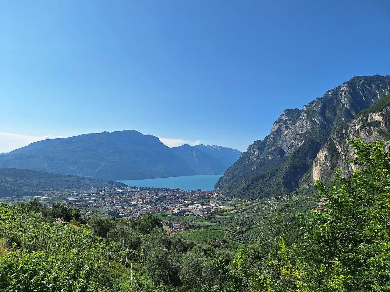
Monte Baldo is a roughly 40 km (25 mi) limestone ridge running between the provinces of Trento and Verona, with Lake Garda dropping away on its western flank and Cima Valdritta topping out at 2,218 m (7,277 ft). Hikers come for ridge walking with a lake panorama the whole way, spring flora that earned the range the nickname Garden of Europe, and a network of trails that ranges from a flat crest path to exposed summit traverses.
Two cable cars and several road ends open up the mountain, so the same summit can be a fifteen-minute ride plus an easy walk or a three-hour ascent on foot. Decide first whether you want lift assistance or a full climb, then pick the trailhead that suits your base. The sections below group the routes by effort and note where huts break up the day.
Where Monte Baldo sits and which side you start from
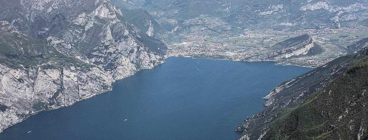
The massif stretches from the northern end above Torbole and Nago down to the southern heights above Caprino Veronese, always with the lake to the west and the Adige valley to the east. Because it crosses a regional border, trailheads come in two families: the Veneto side out of Malcesine, San Michele, Ferrara di Monte Baldo and Caprino Veronese, and the Trentino side out of Mori, Brentonico, San Valentino and Polsa.
Starting from Malcesine puts you at lake level with the rotating cable car overhead and the shortest route to the crest. Starting from Prada Alta or San Michele cuts the climb, while the Trentino villages give you a quieter approach and access to Monte Altissimo di Nago at 2,079 m (6,821 ft). Pick the side that matches your accommodation, because crossing the massif from one side to the other adds hours. The same base-village logic applies if you are weighing options for hiking in Lake Como.
Getting to the trailheads: cable cars and road access
The Malcesine cable car rises from about 80 m (262 ft) above sea level to the Tratto Spino station at 1,780 m (5,840 ft), in two sections with a rotating cabin on the upper leg. The ride takes about fifteen minutes and delivers you directly to the crest paths and the Rifugio Fiori del Baldo. In summer the lift also carries bicycles, which lets riders skip the road climb and use the high routes instead.
On the Verona side, the Prada cable car links the village of Prada with the upper mountain as an alternative to driving up. By road you can climb from Caprino Veronese toward Ferrara di Monte Baldo and Novezzina, or approach from Brentonico and San Valentino on the Trentino side. From Tremosine, the simplest combination is the drive to Malcesine followed by the lift.
Lift timetables, seasonal operating periods and ticket prices change from year to year, so buy through the lift operator and confirm the day's running times before you commit to a descent by cable car. If the lift is closed, the road approach to Tratto Spino or a full walking descent via San Michele keeps the day intact.
Easy walks from the cable car
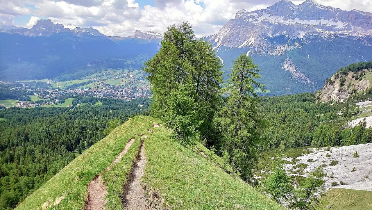
The Sentiero delle Creste starts right at the Tratto Spino station and follows the crest with minimal elevation gain, making it the best introduction to the ridge for anyone arriving by lift. The Anello di San Michele is a circular route of about 5 km (3 mi) around the intermediate cable car station, short enough for children and a picnic. These two routes suit anyone who wants the panorama without a big climb.
Near Novezzina, the path to the Monte Baldo Botanical Garden is a family walk that doubles as a botany lesson, with the garden's collection of endemic species along the way. Spring is the season for it, when the range's flowering is at its height. Treat the garden path as a half-day outing rather than a summit day.
Ridge and summit routes: Telegrafo and Valdritta
Route 651 climbs from Prada Alta to Cima Telegrafo at 2,200 m (7,218 ft) with roughly 700 m (2,297 ft) of ascent and about three hours of walking. The summit carries a weather station and sits a short, well-marked walk above the Rifugio Telegrafo. This is the classic half-day ascent on the Verona side and the natural choice if you want a summit without the full traverse.
The ridge trail to Rifugio Telegrafo runs 10.3 km (6.4 mi) with about 570 m (1,870 ft) of ascent and 580 m (1,903 ft) of descent, roughly four and a half hours on the move. It crosses limestone peaks with chamois, marmots and near-constant views over Lake Garda, and it demands a head for heights and sure footing.
From Rifugio Telegrafo, the continuation to Cima Valdritta, the range's highest point, includes some exposed passages. Hikers comfortable on rock will find it worthwhile; anyone uneasy with drops should turn around at Telegrafo and descend the way they came. The loop from Casera Trovai over Telegrafo and back along the ridge covers 13.1 km (8.1 mi) with 1,170 m (3,839 ft) of ascent and descent, a hard day of more than six hours.
Longer and harder options: Alta Via and the full crest
The Alta Via del Monte Baldo crosses the entire massif from north to south over several days, with overnight stays in the mountain huts along the way. Plan it as a hut-to-hut trip and treat the huts as both lunch stops and beds, since the walking days are long and the ridge offers little shelter.
The complete Via delle Creste runs from Prada to Navene as a high-altitude route that requires experience and good physical condition. A shorter hard variant is the loop from Prada through the Fiori del Baldo hut, 17.0 km (10.6 mi) with 1,260 m (4,134 ft) of ascent and descent and nearly seven hours of walking. Both are full days for fit hikers, not introductions to the mountain.
Distance, ascent and time for the main routes
Lift-assisted crest walking from Tratto Spino asks little of you beyond steady footwear and a windproof layer, while the San Michele circuit gives a defined 5 km (3 mi) loop. Route 651 to Cima Telegrafo needs about three hours and 700 m (2,297 ft) of climbing. The ridge route to Rifugio Telegrafo stretches to 10.3 km (6.4 mi) and roughly four and a half hours.
The hard days stack up quickly: the Casera Trovai loop totals 13.1 km (8.1 mi) with 1,170 m (3,839 ft) of climbing, and the Prada circuit reaches 17.0 km (10.6 mi) with 1,260 m (4,134 ft). Use these figures to judge whether a route fits your daylight, then add breaks at the huts. If a route pushes past your usual distance, pick the shorter lift-assisted option instead of compressing the day.
Huts and water on the route
Rifugio Telegrafo at 2,147 m (7,044 ft) sits just below Cima Telegrafo and serves as the high base on the southern crest. Rifugio Chierego at 1,911 m (6,270 ft) has a panoramic terrace and is reachable by less experienced hikers, while Rifugio Fiori del Baldo at 1,815 m (5,955 ft) sits near the cable car arrival station. Baita dei Forti at 1,790 m (5,873 ft) gives another lunch stop on the ridge.
Most huts open continuously from May to October, then at weekends in winter when conditions allow, and overnight stays are worth booking ahead in the high season. Carry at least 1.5 liters of water per person in summer, because the ridge is dry and exposed between the huts.
When to go: flowers, heat, foliage and snow
Spring brings the range's famous flowering and mild temperatures that suit medium-difficulty hikes, with the Novezzina botanical trail at its best. Autumn follows with beech foliage and quieter paths, the season for photographers who want the lake view without summer crowds.
Summer opens the widest choice of routes but brings strong sun on the crest and afternoon storms, so start early and plan to be off the exposed ridge by mid-afternoon. Winter turns the upper slopes into a ski and snowshoe area, and the crest paths then need winter equipment rather than trail shoes.
Exposure, scrambling and weather on the crest
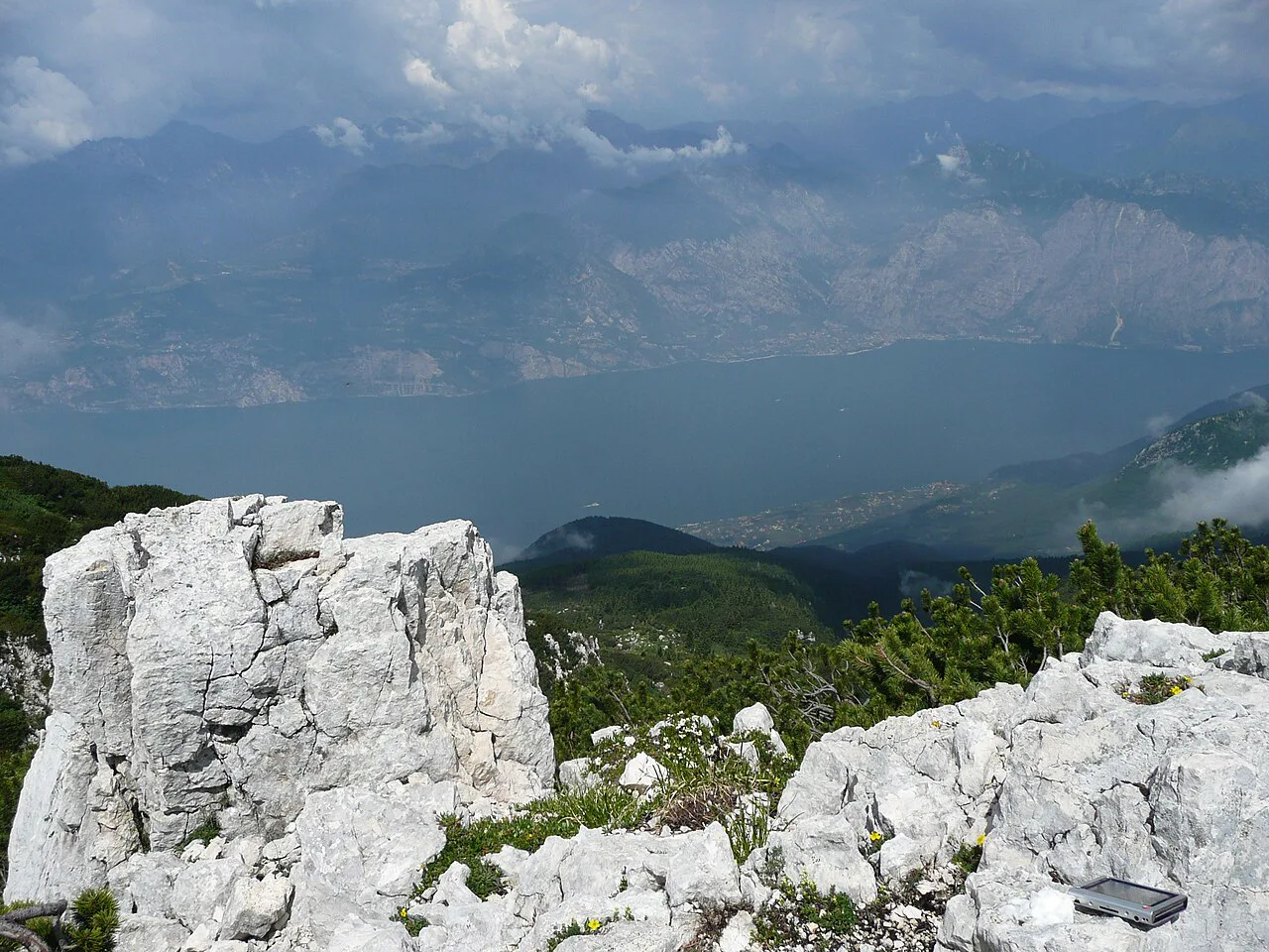
The Monte Baldo crest is genuinely exposed in places, and the sections above Rifugio Telegrafo toward Cima Valdritta include scrambling on rock. Only attempt those passages if you are sure-footed and comfortable with drops; otherwise ride the cable car up and enjoy the gentle crest path near Tratto Spino.
Altitude means the sun hits harder than at the lake, so a hat, sunglasses and high-factor sunscreen matter even on a cool day. Snow can linger on the higher passes into early summer, and thunderstorms build fast in the afternoon heat. Check the forecast before you set out and tell someone your route and return time.
Where to base yourself for which hike
Malcesine suits lift-assisted ridge days and short walks from Tratto Spino, with the cable car a short walk from the waterfront. Tremosine and Limone sit within easy driving distance of Malcesine for the same access, and the lake crossing by boat adds a scenic alternative for the return. Riva del Garda and Torbole work well for the northern Trentino approaches via Mori and Brentonico.
Staying at Prada Alta, Ferrara di Monte Baldo or San Michele puts you on the mountain itself, cutting the climb on Route 651 and the Chierego paths. This is the better base for early starts and multi-day plans along the Alta Via. If you are climbing rather than walking, the rock walls around Arco and the lake's west shore offer marked routes described in the lake garda via ferrata guide.
What to wear and carry on the ridge
Layering is the rule at altitude: a breathable base, a light fleece and a windproof or waterproof shell cover most summer days, with an extra thermal layer, gloves and a hat in spring and autumn. Ankle-high hiking shoes with grippy soles are the minimum for the crest, and crampons belong in the pack for winter snow.
Carry a map or offline navigation, a power bank, a first aid kit and enough food and water for the longest stretch between huts. Save the emergency numbers 112 and 118 on your phone before you leave the lake.
Plan Your Monte Baldo Hike
Choose your route by how you reach the mountain: the Malcesine cable car for the easy crest and San Michele loop, Prada Alta for the three-hour climb to Cima Telegrafo, and the Trentino villages for quieter northern approaches. Leave the exposed Valdritta passages and the multi-day traverses for days when you have the fitness, the weather window and the hut beds sorted.
Book hut stays for May to October, start early to avoid summer storms, and confirm the cable car's operating times with the lift operator for your dates. That done, the ridge above Lake Garda delivers some of the finest lake-view walking in the Italian Alps.
Frequently Asked Questions
How long does it take to climb Monte Baldo?
Route 651 from Prada Alta to Cima Telegrafo involves about 700 m (2,297 ft) of ascent and roughly three hours of walking. The ridge route to Rifugio Telegrafo covers 10.3 km (6.4 mi) in about four and a half hours, while the loop from Casera Trovai over Telegrafo takes more than six hours. The lift-assisted crest walk from Tratto Spino is far shorter.
Is the Monte Baldo cable car worth it for hikers?
Yes, if you want the ridge without the road climb. The Malcesine cable car rises to Tratto Spino at 1,780 m (5,840 ft) in about fifteen minutes, putting you beside the Sentiero delle Creste and Rifugio Fiori del Baldo. Hikers set on a full ascent should start from Prada Alta or San Michele instead.
Can you drive to the top of Monte Baldo?
You can drive high on both sides, reaching Ferrara di Monte Baldo and Novezzina from Caprino Veronese, or San Valentino and Polsa from Brentonico. The highest ridge and the summit paths are reached on foot or by cable car. Check road conditions and lift operating times with the local tourism office for your dates.
Where does the Monte Baldo ridge hike start?
The most direct start is the Tratto Spino cable car station above Malcesine, where the Sentiero delle Creste begins. On the Verona side, the ridge route to Rifugio Telegrafo starts from trailheads near Prada and Casera Trovai. Both give you limestone crest walking with Lake Garda below.
Which Monte Baldo hike is best for families?
The Anello di San Michele is a circular route of about 5 km (3 mi) around the intermediate cable car station. The Novezzina path to the Monte Baldo Botanical Garden is another short family option, especially in spring. The crest path from Tratto Spino also works if children are steady on uneven ground.
Sources
Trail notes for your next trip
Optional updates when we add or revise hiking guides.
You might also like
Continue reading
More guides you'll find useful