
Loughrigg Fell Walk from Ambleside: Route, Distance and Parking
A half-day Loughrigg Fell walk from Ambleside: the 10.4 km loop with 368 m of ascent, the summit plateau, Loughrigg Terrace and Rydal Cave, plus parking.
On this page
Loughrigg Fell is the low, complicated hill that rises immediately south of Ambleside, and its 10.4 km (6.5 mile) circuit is one of the best half-day outings in the Lake District for hikers who want fell-top views without a long or exposed scramble. It suits confident walkers with a map, families with older children, and anyone based in Ambleside or Rydal who would rather leave the car parked.
The Ambleside loop climbs 368 m (1,207 ft) in total and WalkLakes rates the minimum walking time at 2 hr 42 min, while AllTrails describes the circular as a three- to four-hour outing. Plan on half a day once you add stops at the summit, Loughrigg Terrace and Rydal Cave.
Loughrigg Fell walk at a glance
The route is a circuit, not an out-and-back: it leaves Ambleside town centre, crosses Rothay Park and Miller Bridge, climbs by Miller Brow to the fell gate, crosses the summit plateau to the trig point, drops to Loughrigg Terrace, detours to Rydal Cave, and returns along the quiet Under Loughrigg road.
WalkLakes gives the Ambleside circuit as 10.4 km (6.5 miles) with 368 m (1,207 ft) of ascent, rated 2 out of 5 for terrain, so expect rough paths and tracks rather than an engineered trail. The bare climb to the top is only part of the total, because the loop keeps undulating on the descent to the terrace and again on the return leg; that accumulated up-and-down is why the 368 m figure exceeds the simple height gain to the summit.
Difficulty sits squarely in the moderate band. There is no scrambling, but the top is a bumpy plateau of criss-crossing paths and the descent to Loughrigg Terrace uses old stone pitching that gets slippery in wet weather. Read it as a navigation-and-footing walk rather than a physical challenge.
Where the walk starts: Ambleside town centre and Rothay Park
Start at the Tourist Information Centre at the top of Ambleside, where a stone pillar with 1651 carved into its top stands outside on a stepped base. Turn left, pass the Climbers Shop and turn left again, then take Millans Park road on the right and immediately turn left into Vicarage Road, heading downhill toward the church spire.
Follow the lane past the schools and church into Rothay Park, cross the footbridge over the River Rothay and then the stone packhorse bridge. Turn right along Underloughrigg Road, cross the cattle grid and, within about 100 m (110 yards), turn left onto the signed public bridleway that climbs steeply away from the valley.
This opening is pleasant town-edge walking on quiet roads and park paths, which makes it an easy start for hikers staying in the centre. If you are planning several days in the area, the wider hiking in lake district guide covers the bigger fells and how they connect to Ambleside.
Trailhead and parking in Ambleside
The main car park sits above the town centre on the A591 toward Rydal, and Miller Field at the lower end of town is the larger fallback that often still has space when the main one fills. Smaller car parks are dotted around the centre. Ambleside gets busy at holiday times, so an early start is the simplest way to avoid circling.
Parking charges, ticket validity and any free periods change, so check the machine or the authority's parking page on the day rather than budgeting from an old figure. For the shorter variant from the Rydal side of the circuit, Pelter Bridge car park sits directly on the route.
Getting to Ambleside by bus
Regular buses link Ambleside with Windermere, Keswick and Kendal, which makes the loop straightforward without a car. Because the walk starts and finishes in the town centre, you can step off the bus and be on the Rothay Park path within minutes.
Route numbers, frequencies and last-bus times are worth checking with Stagecoach before you commit to a late finish, particularly outside summer. If you are coming from Windermere station, allow time for the connection rather than assuming the walk and the train will dovetail.
Route description: Rothay Park to the fell gate at Miller Brow
From the bridleway gate, follow the tarmac lane past Brow Head Farm, Miller Brow and Deer Hows until you reach the gate onto the open fell. Go through and bear right, leaving the track to follow the wall for a few metres. Where the wall doubles back on itself, bear left on a path that rounds a small knoll, and the main path appears climbing the fellside almost directly ahead toward a small notch in the skyline.
That notch is the key to the ascent: several paths fan out below it, and a path junction lies down to your left, but the direct line to the notch is the one to hold. Keep heading for it, skirting occasional boggy patches, until you reach a col below a cairn.
Once through the gate the character changes sharply, from enclosed lanes to open hillside, and this is where you want the map out. Paths here are faint in places and unsigned; the reliable approach is to navigate to the notch and then to the summit trig point rather than trusting any single path.
The climb to the summit plateau and trig point
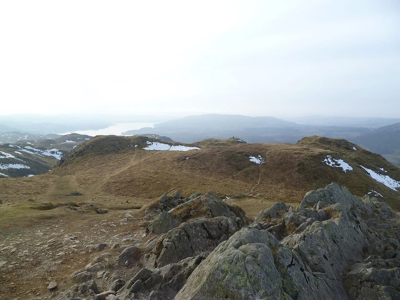
From the col below the cairn, bear right and then left around a boggy patch with small tarns, keeping the trig point in view slightly left and clearly higher. The gradients are short and steep rather than sustained, and the grassy, rubbly surface is typical of the central fells.
On the plateau itself, countless paths criss-cross the bumpy top. Pick whichever line looks most trodden and keep aiming for the trig point; the individual paths matter less than the destination. Small tarns and muddy puddles across the fell top hold water for most of the year, which is useful if you are walking with a dog.
This is the section where poor visibility turns a straightforward walk into a navigation exercise. If cloud is down on the plateau, carry a compass and know how to follow a bearing to the trig point and off toward Loughrigg Terrace. The same care applies to the Wainwrights generally: these are modest hills by height, but they are not waymarked trails.
Loughrigg summit: the view and the wind
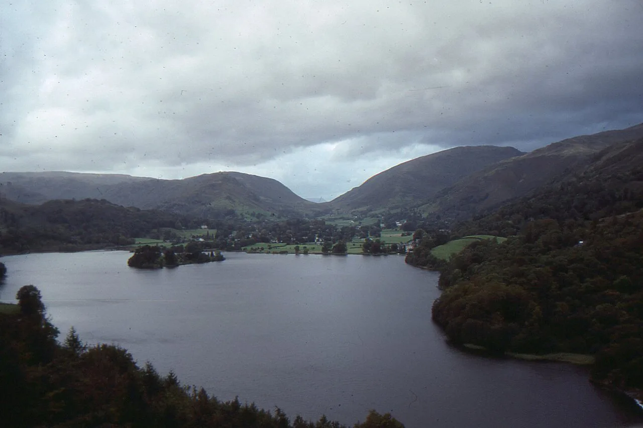
For a hill of this height the panorama is out of proportion to the effort: Windermere and the surrounding fells open up on the climb, Grasmere and Helm Crag appear as you approach the top, and Elter Water and Loughrigg Tarn sit below the southern side.
Treat wind as a real planning constraint rather than a quirk. The summit is exposed in every direction, and even on a warm day in the valley the top can be windy enough to cut a break short, so carry a shell and plan the exposed section for a settled day. Rocks around the trig point give reasonable seats when the breeze is moderate.
There are false summits along the way: a small plateau with a large cairn invites you to stop, and a second higher shoulder appears before the true top. Knowing that, you will not turn around early.
Descent to Loughrigg Terrace
From the trig point, bear right heading north-west toward the notch of Dunmail Raise. A path drops down the ridge, and you will clamber down short rocky steps along the way; there are no technical difficulties, but the descent asks for attention.
As the broad track of Loughrigg Terrace comes into view, the path becomes stone-pitched. That pitching is old and laid at the angle of the slope, so it is genuinely slippery in the wet. Take it slowly and use your poles if you have them.
Reaching the terrace, turn right and traverse the fellside until near its obvious end. Bear right onto the path that crosses the shoulder of a small knoll below Ewe Crag (the only path bearing right), climb over the shoulder and drop down the other side to pick up the permissive path to Rydal Cave.
Rydal Cave and the permissive path
Rydal Cave is a man-made feature, a former slate quarry that produced high-quality roofing slate in the nineteenth century. Access into the chamber is not difficult and many walkers cross the stepping stones to its interior, but blocks occasionally fall from the ceiling, so it is not a place to linger directly underneath the roof.
After rain the floor can be flooded and the stepping stones may be only just above the water, which turns the cave visit into a short look rather than a crossing. Judge it on arrival and be ready to skip the interior without treating it as a failed day.
With your back to the cave, bear right and then left to descend an increasingly rough track through zigzags, keeping the wall of Jobson Close on your left. Keep right on the track rather than dropping to the water's edge, and continue to the gate into the walled lane.
The return by Under Loughrigg road and Miller Bridge
Follow the tarmac lane down past the cottages and Cote How to Pelter Bridge. Do not cross the bridge: turn right onto the Under Loughrigg road, a quiet country lane that runs back beneath the fell with Rydal Water and Nab Scar above you.
Follow the lane to Miller Bridge, turn left over the bridge into Rothay Park and walk through the park back into the town centre. This final stretch is flat and easy, which makes it a gentle finish after the rough ground on top and a good place to lengthen your stride.
Distance, ascent and time
The full Ambleside circuit measures 10.4 km (6.5 miles) with 368 m (1,207 ft) of ascent, and WalkLakes gives a minimum walking time of 2 hr 42 min for fit walkers moving steadily. AllTrails puts the circular at three to four hours, which is a more realistic allowance once you factor in the summit, the cave and the terrace.
There is some road walking on the return, but most of the route is rough path and track. Boots with decent grip are a better choice than trainers, and trekking poles help on the pitched descent to Loughrigg Terrace.
When to go: seasons, visibility and ground conditions
Loughrigg works in any month, but the summit plateau is a different place in cloud. On a clear day the whole loop is straightforward; in mist, the criss-crossing paths and undulating top demand a map, compass and the ability to follow a bearing. WalkLakes is blunt about this: the fell is not a place to be caught in poor visibility without good navigation skills.
After prolonged rain expect boggy patches on the plateau and standing water around the cave, and expect the stone pitching below the summit to be slick. In autumn the wooded stretch near Rydal turns yellow and red, while winter brings ice on the pitched sections and short daylight that argues for an early start and a head torch in your pack.
Huts, water and facilities on the route
There are no bookable mountain huts or cafés on the route. Ambleside has plenty of cafés and restaurants for the finish, and Rydal has facilities near the end of the walk. Plan to carry everything you need for the three to four hours you will be out.
Water is available for most of the year in the small tarns and muddy puddles across the fell top, which helps if you are walking a dog, but treat standing water as not for drinking. Carry your own supply from Ambleside.
Alternative start points and shorter versions
The Ambleside start is the most convenient for buses and the main car parks, and it gives you the full loop as described. If you are staying closer to Rydal, or the town car parks are full, starting from the Rydal side shaves distance and lets you join the circuit at Pelter Bridge for the climb to the terrace and summit, then return the same way or complete whatever portion suits your time.
If you are choosing between half-day fells, the catbells walk above Derwent Water offers a sharper ridge in a comparable time, and the outing to Aira Force in the north of the park swaps fell top for woodland and waterfall scenery. If you would rather compare low-to-mid hills further afield, hiking in Yorkshire Dales offers similar half-day circuits through limestone country.
What to wear and carry on Loughrigg Fell
Pack for wet and windy weather regardless of the forecast for Ambleside: a waterproof shell, a warm mid-layer, gloves for the exposed top and boots with grip for the pitched descent. Bring a paper map at 1:25,000 scale along with a compass, and carry a head torch if you are starting in the afternoon.
A small daypack with water, food, a first-aid kit and a phone with an offline map covers the essentials. The walk is short enough that you can travel light, but the plateau and the terrace are no place to be caught without a shell or a way to navigate.
Plan Your Visit
Loughrigg Fell gives you a full Lakeland day out without the commitment of a high summit: a 10.4 km (6.5 mile) loop, 368 m (1,207 ft) of ascent and a route that touches a trig point, a quarry cave and a quiet valley road. It is the natural first fell for a trip based in Ambleside or Rydal.
Start early to secure parking, keep the map handy for the plateau and the pitched descent, and choose a settled day for the exposed top. Check parking charges and bus times with the relevant operator on the morning of your walk, then go and enjoy one of the best value half-days in the Lake District.
Frequently Asked Questions
How long is the Loughrigg Fell walk?
The Ambleside circuit is 10.4 km (6.5 miles) with 368 m (1,207 ft) of ascent. WalkLakes gives a minimum walking time of 2 hr 42 min and AllTrails describes the circular as three to four hours, so allow half a day once you add stops at the summit, Loughrigg Terrace and Rydal Cave.
What is the easiest route up Loughrigg Fell?
The most straightforward ascent from Ambleside is via Rothay Park and the bridleway past Miller Brow to the fell gate, then holding the line to the notch in the skyline and on to the trig point. The gradients are short rather than sustained, and there is no scrambling, though the plateau paths are faint in places.
Is the Loughrigg Fell walk hard?
No. It is a moderate half-day walk with a mix of lane, path and rough track. The main demands are navigation on the criss-crossing summit plateau and care on the old, slippery stone pitching on the descent to Loughrigg Terrace, especially in wet weather.
Where do you park for the Loughrigg Fell walk?
The main car park is above Ambleside town centre on the A591 toward Rydal, with Miller Field at the lower end of town as the larger fallback. Ambleside is busy at holiday times, so arrive early. Parking charges and ticket terms change, so check them on the day.
Can you walk Loughrigg Fell from Ambleside without a car?
Yes. Regular buses connect Ambleside with Windermere, Keswick and Kendal, and the loop starts and finishes in the town centre, so you can step off the bus and be on the Rothay Park path within minutes. Check the last return bus time before setting out.
When is the best time of year to walk Loughrigg Fell?
The loop works in any season, but choose a settled day for the exposed summit. Autumn colours the woods near Rydal, while winter brings ice on the pitched sections and short daylight. In cloud, the plateau is a navigation exercise, so carry a map and compass.
Sources
Trail notes for your next trip
Optional updates when we add or revise hiking guides.
You might also like



Continue reading
More guides you'll find useful





