
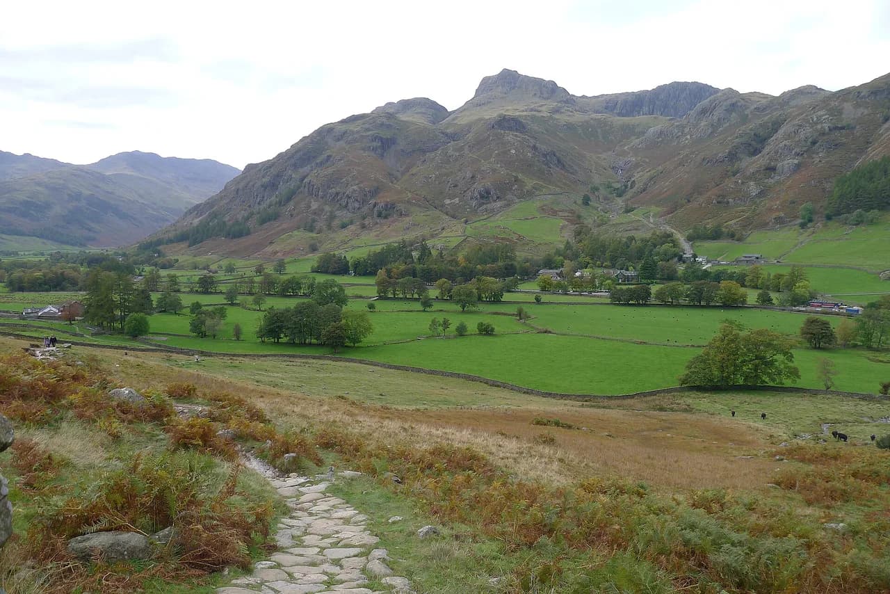
Langdale Pikes Walk: Route, Distance, Ascent and Trailheads
Plan the Langdale Pikes walk from Great Langdale with route choices to Stickle Tarn, Loft Crag, Pike of Stickle and Harrison Stickle, plus distance and times.
On this page
The Langdale Pikes give you a serious mountain day without a long approach: from the valley floor at Great Langdale you climb past waterfalls and a tarn to a cluster of rocky summits with views across the Langdale valley to Bowfell and the Scafell range. The walk suits hikers with some hill fitness who are comfortable on steep, rocky ground, and it rewards them quickly.
The classic circuit covers 13.2 km (8.2 mi) with 1,014 m (3,327 ft) of climbing and takes most hikers 5 to 6 hours. Shorter options exist, but each has its own character, and choosing between them is the main planning decision. For the wider picture, start with this guide to hiking in lake district terrain and how the valleys connect.
What the Walk Offers and Who It Suits
From the summits you look straight down the Great Langdale valley, with Bowfell and the Scafell range ahead and, on a clear day, a glimpse of Windermere in the distance. The terrain is rugged throughout, with crags, a glacial tarn and rocky top sections rather than smooth paths.
The full round over several peaks is best for experienced hikers used to long days and steep ascents. If your map-reading is rusty or you have not walked multi-peak days before, the shorter routes here still reach good ground and give you a feel for the terrain. Routes range from a steady climb to the tarn up to more strenuous ascents of Harrison Stickle and Loft Crag, so match the choice to your fitness rather than to the summit list.
Where the Walk Starts: Old and New Dungeon Ghyll
Two starting points sit at the head of Great Langdale, roughly 15 minutes by car from Chapel Stile. The New Dungeon Ghyll car park is the natural start for the Stickle Ghyll route, because the path up beside the stream begins there. Old Dungeon Ghyll suits the routes that head first for Loft Crag and Pike of Stickle.
Parking, refreshments and toilets are available around the Dungeon Ghyll hotels and the main National Trust car park, so you can fill bottles and eat before or after the walk without leaving the valley. Arrive early on fine weekends, when the head of the valley fills quickly.
Getting to Great Langdale Without a Car
A bus service runs from Ambleside through the Langdale Valley, which makes the trailheads reachable by public transport if you are based in Ambleside or nearby. Timetables change with the season, so plan the day around the published service for your date and keep a margin for the last bus back. From Keswick, the drive south on the A591 and then toward Ambleside and Great Langdale takes about 30 to 40 minutes by car.
Distance, Ascent and Time
The classic circuit of the Langdale Pikes measures 8.2 mi (13.2 km) with 1,014 m (3,327 ft) of climbing and typically takes 5 to 6 hours. Treat that as a full day with breaks, not a half-day outing, and start early enough to be off the tops before the light goes in autumn.
The circular route over the pikes is often quoted at 6.9 mi (11.1 km) and is generally considered highly challenging, which fits the steep, rocky ground near the summits. That figure reflects one variation of the loop, so do not expect every descent line to match it exactly.
The Stickle Tarn route from New Dungeon Ghyll usually takes around 4 to 5 hours round-trip and suits intermediate hikers. A circuit of Pike of Stickle and Harrison Stickle from Old Dungeon Ghyll runs 5 to 6 hours and is recommended for experienced hikers. The shortest option, Loft Crag then Pike of Stickle from Old Dungeon Ghyll, takes about 3 to 4 hours.
Route Description: Stickle Ghyll to Stickle Tarn
From the New Dungeon Ghyll car park the path follows Stickle Ghyll, a stream of cascading waterfalls, climbing steadily beside the water. The gradient is relentless rather than technical, so set a rhythm and expect the tarn to appear later than the map suggests.
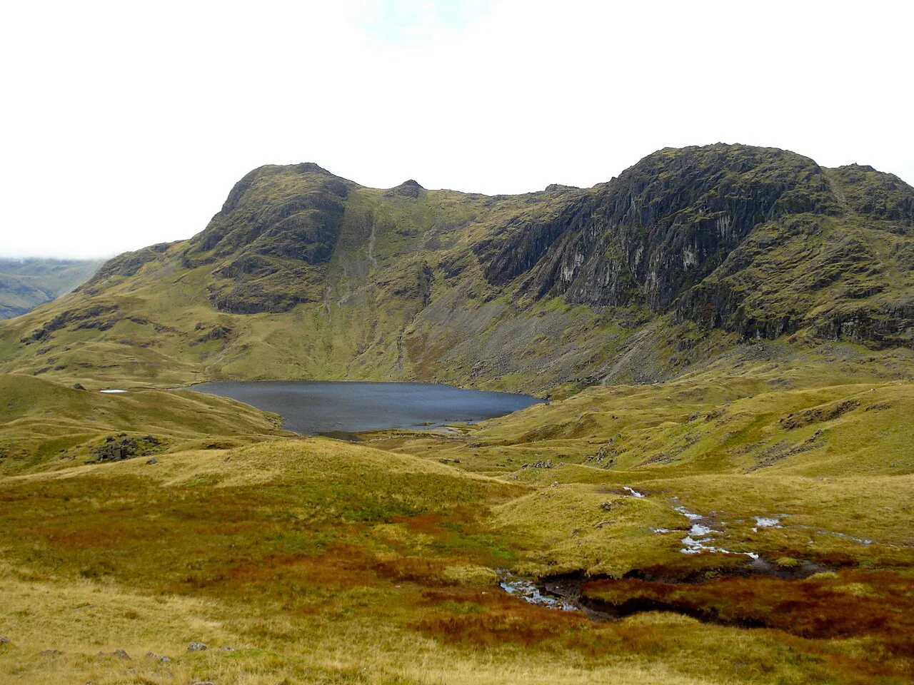
Stickle Tarn sits just below the peaks, beneath the dark wall of Pavey Ark, and its reflective surface makes it a good photography stop and picnic spot before the summit paths begin. From the tarn, trails lead on toward Pike of Stickle and Harrison Stickle.
Route Description: Tarn to the Summits
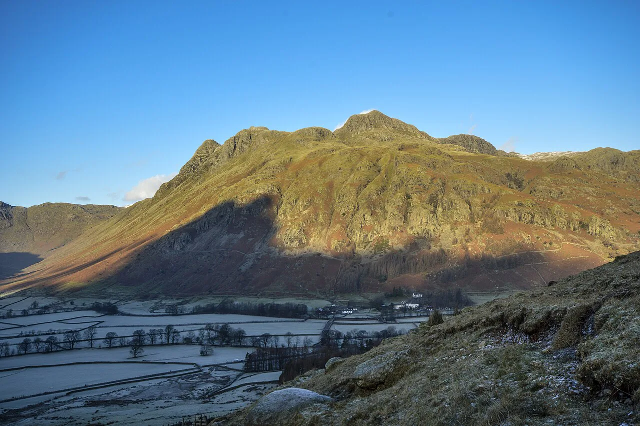
Above Stickle Tarn the ground steepens and the paths become less defined near the summits, which is where map, compass or GPS earn their place in poor visibility. Take each summit in turn rather than rushing the traverse, and note that the rocky crags around Loft Crag and Harrison Stickle draw climbers, so watch for activity above and below the path.
Pike of Stickle, Loft Crag and Harrison Stickle each give their own panorama over Great Langdale, and Harrison Stickle is described as the highest of the Langdale Pikes. The summit section is rough underfoot on tired legs, so save something for the descent.
If you want more tops, the Langdale 7 Summits link seven summits into one long day; several of the peaks here are counted among the wainwrights, so you can tick them off as you go.
The Shorter Loft Crag and Pike of Stickle Option
Start at Old Dungeon Ghyll, climb to Loft Crag first, then continue to Pike of Stickle for a shorter day with the best of the views. The route takes about 3 to 4 hours, which makes it the sensible choice when you have a travel day at either end.
Expect easy scrambling on Pike of Stickle. It is short and straightforward in dry weather but needs hands and care when the rock is wet, so it is not the route for a beginner's first mountain day unless you are comfortable moving over rough ground.
Exposure, Scrambling and Weather on the Tops
The Langdale Pikes are known for bad weather and difficult conditions, and the terrain is rocky, steep and uneven. Carry full waterproof layers, sturdy boots and enough food and water for the whole day, and turn back if the weather changes or the ground ahead feels beyond you.
Navigation is the real crux: paths near the summits are less defined, so carry a map and compass and know how to use them when the cloud drops. Afternoon storm build-up in summer is common in the Lake District, so aim to be descending by mid-afternoon.
When to Go
Late spring through early autumn gives the longest days and the best odds of dry rock on the scrambling sections. Winter and early spring often put snow and ice on the tops, which turns the easy scramble on Pike of Stickle into a different proposition and demands an ice axe and the skills to use it.
Blea Tarn, between Great and Little Langdale, offers a gentle circular walk with views back to the pikes on misty mornings and calm days. It is a good rest-day option when the summits are clouded, and is easily reached by car with parking nearby.
Facilities and Refreshments in the Valley
Both the Old Dungeon Ghyll Hotel and the New Dungeon Ghyll Hotel serve refreshments, and the main National Trust car park has toilets. The Old Dungeon Ghyll is a popular finish for its historic character and is a short walk from the valley trailheads.
Where to Base Yourself
Chapel Stile, at the mouth of Great Langdale, has stone cottages, cafes and pubs and is a 15-minute drive from the trailheads, which suits a short break built around the pikes. Ambleside gives you a wider choice of beds and shops plus the bus into the valley, a useful trade-off if you want to leave the car parked all week.
If you plan to tick off more fells during the same trip, compare the Langdale Pikes with other classic Lake District routes such as the striding edge traverse on Helvellyn before you commit your days. It is also worth setting these pikes against Yorkshire Dales hikes if you are weighing up a second walking region for the same trip.
Plan Your Day on the Langdale Pikes
Pick the route before the trailhead: the 5 to 6 hour classic circuit and the 3 to 4 hour Loft Crag and Pike of Stickle option start from different points and suit different levels of fitness. Start early, carry a map you can read in cloud, and save the scrambling for dry rock.
Check the Ambleside bus times and the weather forecast for your date before you set out. Both change what the day looks like far more than any summit list does.
Frequently Asked Questions
How long does it take to walk the Langdale Pikes?
The classic circuit usually takes 5 to 6 hours. The Loft Crag and Pike of Stickle route from Old Dungeon Ghyll takes about 3 to 4 hours, and the Stickle Tarn route from New Dungeon Ghyll around 4 to 5 hours.
Are the Langdale Pikes hard?
The full round is a strenuous day with 1,014 m (3,327 ft) of climbing on steep, rocky ground, and the ground near the summits is rough and less defined. The shorter routes to Stickle Tarn and Loft Crag suit hikers with moderate hill fitness.
Is there an easy walk to the Langdale Pikes?
The gentlest option is the climb to Stickle Tarn from New Dungeon Ghyll, which avoids the scrambling and gives close views of Pavey Ark and Harrison Stickle. It still climbs steadily beside the stream for most of the way.
Where do you park for the Langdale Pikes walk?
Use the New Dungeon Ghyll car park for the Stickle Ghyll route and Old Dungeon Ghyll for the Loft Crag and Pike of Stickle start. The main National Trust car park in the valley has toilets, and both hotels serve refreshments.
How far is the Langdale Pikes circular route?
The classic circuit covers 13.2 km (8.2 mi) with 1,014 m (3,327 ft) of climbing. A shorter circular variation is listed at 6.9 mi (11.1 km) and is rated highly challenging.
Do you need to scramble on the Langdale Pikes?
Only Pike of Stickle has easy scrambling on the shorter route, and it needs care when the rock is wet. The rest of the walk is steep, rocky going rather than hands-on scrambling.
Can you reach the Langdale Pikes by bus?
A bus runs from Ambleside through the Langdale Valley to the valley trailheads. Services change with the season, so check the timetable for your date before relying on the last bus back.
Sources
Trail notes for your next trip
Optional updates when we add or revise hiking guides.
You might also like



Continue reading
More guides you'll find useful





