
Wainwrights: Plan Your Lake District Fells Guide
The Wainwrights are 214 Lake District fells in seven fell groups. Learn how the areas differ in height and access, plus how to plan your first walks.
On this page
The Wainwrights are 214 fells in the English Lake District, the summits Alfred Wainwright documented across seven Pictorial Guides. Bagging them is the classic British hill-list challenge: some are short afternoon hills above a village, others are remote 900 m (2,953 ft) tops that demand a full day and settled weather. This guide breaks the list into its seven fell areas so you can see which valley each group hangs off and choose days that match your fitness and the season.
What a Wainwright is
A Wainwright is one of the 214 Lakeland fells described in Wainwright's seven-volume Pictorial Guides, which remain the reference for the list. The count and the book-by-book structure are widely reproduced by hillwalking sites and guides. Because the list was fixed by Wainwright's own survey work, summit heights in different sources often differ by a metre or two, so pick one list and stick with it when you keep records.
Completions are personal projects rather than official events: there is no governing body issuing certificates, and no fixed route or timetable to follow. Practically, that means you decide the order, the pace and whether you count a summit reached by scrambling or climbing as well as by walking. A separate Outlying Fells list covers lower ground beyond the seven guides and is usually treated as an extra list rather than part of the 214.
The seven fell areas and where each sits
Wainwright divided the fells into Eastern, Far Eastern, Central, Southern, Northern, North Western and Western groups, and the groupings still make sense as a planning tool. Each area clusters around particular valleys and towns, so you can base yourself in one place and work through a group over several days rather than driving across the park between every summit.
The Eastern Fells sit between the Keswick to Ambleside road and Ullswater, the Far Eastern Fells lie east of Kirkstone Pass, and the Central Fells are framed by Derwent Water and Borrowdale to the west and Thirlmere and Dunmail Raise to the east. The Southern Fells lie south of Great Langdale and Borrowdale, while the Northern Fells cluster north of Keswick. The North Western and Western groups occupy the quieter ground toward Buttermere and the western valleys.
Eastern Fells: Helvellyn and Fairfield
The Eastern Fells hold the highest ground in the group's northern half, with Helvellyn at 950 m (3,117 ft) and Fairfield at 873 m (2,864 ft) as the headline summits. Supporting tops such as Nethermost Pike, Dollywaggon Pike and St Sunday Crag make the area ideal for ridge days that collect several fells in one outing.
Helvellyn's eastern approaches include the celebrated arête of Striding Edge, a narrow crest with genuine exposure that should only be taken in dry, calm conditions. The guide to Striding Edge explains how the edge is walked and where the awkward steps fall. If you enjoy comparing classic ridge days across Britain, hiking in Scotland offers similarly exposed crests to weigh against this one. Snow and ice linger on these east-facing crags well into spring, so early-season plans should allow for that or shift to lower ground.
Fairfield anchors a second high circuit above Rydal and Grasmere, with the horseshoe around the valley offering a long but logical traverse of several Eastern and Central tops. Picking the circuit direction to put the steepest pull on the ascent keeps the day more comfortable.
Far Eastern Fells: High Street and the Kentmere and Mardale hills
East of Kirkstone Pass the Far Eastern Fells run along High Street at 828 m (2,717 ft) and drop through the Kentmere and Mardale hills, including Ill Bell, Harter Fell and Kentmere Pike. These summits are generally lower than the Eastern giants, but the approach valleys are remoter and the days often feel quieter.
Place Fell above Ullswater and the Angletarn Pikes offer shorter days with valley views, while Wansfell above Ambleside is a popular half-day outing from the town. For a first Far Eastern day, pick a hill with a clear path from a road end and save the long ridge traverses until you know how you handle the terrain.
Central Fells: the Langdale Pikes and High Raise
Between Derwent Water and Borrowdale on one side and Thirlmere and Dunmail Raise on the other, the Central Fells hold the Langdale Pikes, including Harrison Stickle at 736 m (2,415 ft) and Pike of Stickle at 708 m (2,323 ft), plus High Raise at 762 m (2,500 ft). The group is compact, which makes multi-summit link-ups practical for walkers with limited days.
Loughrigg Fell at 336 m (1,102 ft) and Helm Crag above Grasmere are the gentle end of the group and useful for testing kit and navigation on short winter days. Pavey Ark and its Jack's Rake scramble sit at the harder end of the Central list and require confident movement on steep ground.
Southern Fells: the highest summits
The Southern Fells contain the highest ground in the Lake District: Scafell Pike at 978 m (3,209 ft) and Scafell at 964 m (3,163 ft), with Bowfell, Crinkle Crags and Coniston Old Man rounding out the big days. Ridge traverses such as Crinkle Crags to Bowfell collect several summits and are among the most rewarding outings in the group.
These summits lie above 900 m (2,953 ft), so cloud, wind and winter snow arrive earlier and stay later than on the lower fells. Plan the biggest days for settled summer weather and carry a map and compass, since paths on the Scafell massif fade on the plateau in poor visibility.
Northern Fells: Skiddaw, Blencathra and the low outliers
North of Keswick, Skiddaw at 931 m (3,054 ft) and Blencathra at 868 m (2,848 ft) dominate the Northern Fells. Blencathra's Sharp Edge is a narrow arête with real exposure, while Skiddaw offers broad, long climbs that are less technical but still a serious day.
The group also holds short outliers such as Binsey at 447 m (1,467 ft) and Latrigg at 367 m (1,204 ft) above Keswick, which suit half-days or bad-weather plans. Latrigg in particular is a quick reward on a cloudy afternoon, giving you a summit without committing to a high traverse.
North Western Fells: Catbells and the Coledale and Newlands ridges
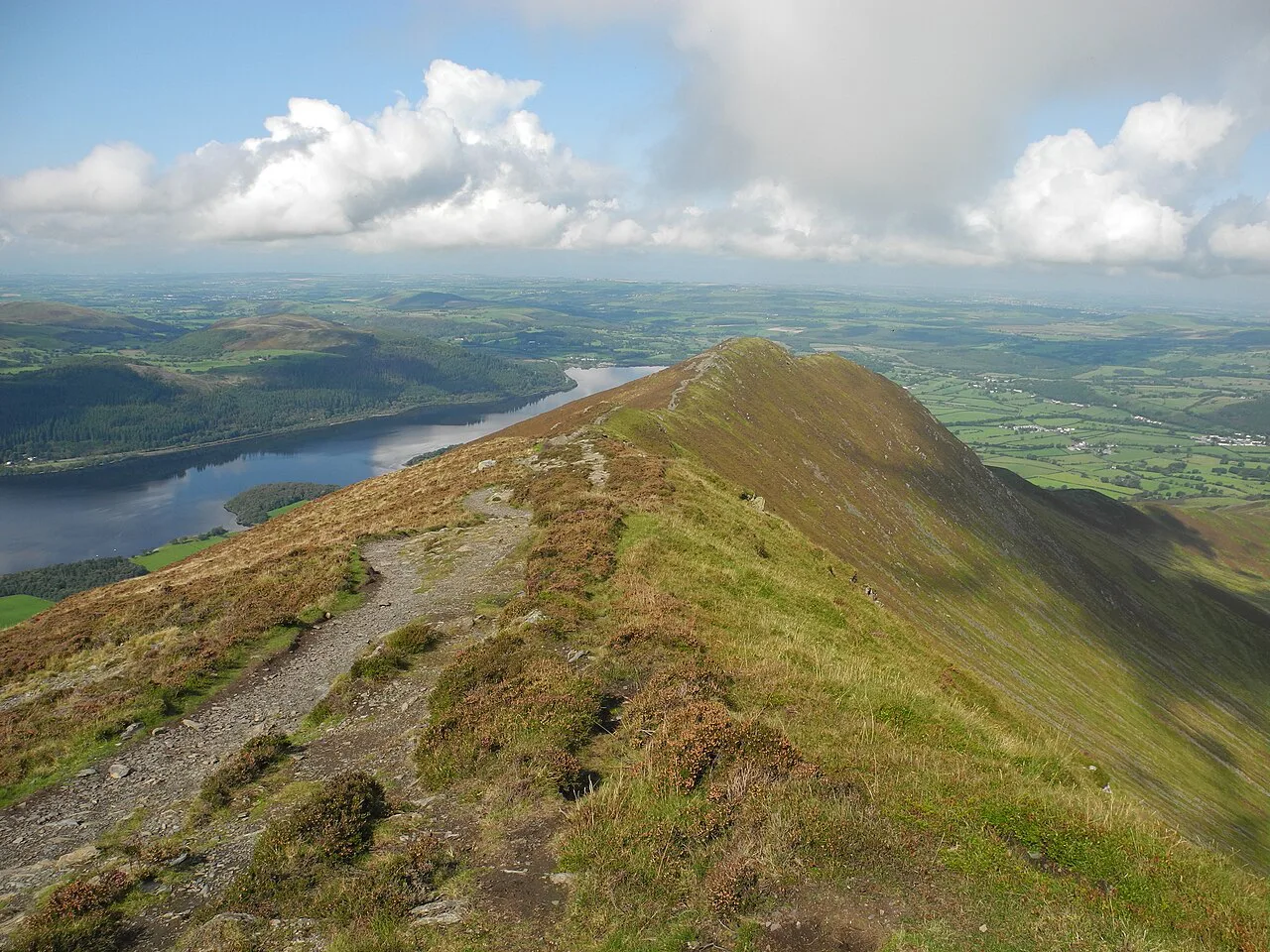
The North Western Fells rise close to Keswick, with Catbells at 451 m (1,480 ft) as the beginner classic above Derwent Water. The Coledale and Newlands ridges, taking in Grisedale Pike, Causey Pike and Dale Head, give stronger walkers long horseshoe days with sustained ascent.
Catbells is a short but steep pull from Hawes End, and the Catbells Walk guide describes where the path steepens and what to expect on the crest. Because the ridge is busy, starting early makes the summit and the descent noticeably calmer.
Castle Crag at 290 m (951 ft) is the smallest fell in the group and a popular first Wainwright, with a short day that still teaches you to follow a rocky path and read a map. Sale Fell and Rannerdale Knotts are similar low options that work well in short daylight.
Western Fells: Great Gable, Pillar and Haystacks
The Western Fells lie west of Crummock Water and Buttermere and include Great Gable at 899 m (2,949 ft), Pillar at 892 m (2,927 ft) and Haystacks at 597 m (1,958 ft). Great Gable and Pillar are long, sustained days from the Wasdale and Ennerdale valleys, while Haystacks is a shorter, rockier hill with fine views over Buttermere.
This is the quietest of the seven areas and the least served by public transport, so a plan built around one base and several consecutive days saves driving. Allow for steep valley heads and pathless sections on the fell tops, and treat afternoon storms as a real risk on these exposed western ridges.
The Outlying Fells
The Outlying Fells form a separate list of lower, shorter hills beyond the 214, useful for bad weather, short winter days or recovery after a big outing. They often sit near villages and road ends, which makes them convenient fillers between classic Wainwright days. Decide early whether you are counting them separately so your completion plan stays consistent.
Heights at a glance
Only the Southern Fells hold summits above 900 m (2,953 ft), and the Eastern and Northern groups reach the upper 800 m (2,625 ft) to low 900 m range. The Central and Far Eastern groups mostly sit between 300 m (984 ft) and 800 m (2,625 ft), while the North Western and Western groups mix high tops with very low fells such as Castle Crag and Barrow.
That spread matters for planning: if you have three days, mixing one Southern giant with two lower fells from the Central or North Western lists gives you variety without exhausting legs. If you want a gentler trip, the low fells clustered around Keswick and Ambleside let you string together several short days.
Choosing a first Wainwright
Castle Crag, Sale Fell and Loughrigg Fell are good first Wainwrights because they involve short approaches and modest height gain, letting you practise navigation and test gear before committing to bigger days. Treat the first few outings as training for the high fells rather than as a race to count summits.
Once you are comfortable on rough ground, move to classic summit days such as Helvellyn, Blencathra or Scafell Pike. These carry more exposure and weather risk, so choose a settled forecast and start early enough to be off high ground before afternoon storms build.
Big days and link-ups
Ridge rounds are the efficient way to collect several fells in one walk: the Coledale Horseshoe, Fairfield Horseshoe and Kentmere Round are established link-ups that each visit multiple summits. They demand more ascent and time than an out-and-back, but reduce the number of separate days you need.
Link-ups also concentrate the exposure and the navigational decisions, so save them for when you have several fell days behind you and know how your pace holds up on a long descent. Building in a shorter recovery day between big rounds keeps a longer trip sustainable.
Fitness and difficulty on the ground
A typical guided Wainwright day runs between 6 and 18 km (roughly 4 to 11 mi) with 400 to 1,200 m (about 1,300 to 3,900 ft) of ascent and lasts four to nine hours. That range shows how varied the list is: you can start with a half-day hill and build toward long ridge traverses.
Terrain varies from smooth grassy paths to steep, loose scree and exposed arêtes, so boot choice and confidence on rough ground matter as much as raw fitness. If you are unsure about a route's grade, walk a similar-height fell first and treat the harder summits as a later step.
Access, bases and moving between valleys
Keswick is the natural base for the Northern and North Western fells, Ambleside works well for the Central and Eastern groups, and Ullswater villages give access to the Eastern and Far Eastern areas. Wasdale, Buttermere and Borrowdale put you close to the Western and Southern giants without long drives.
Public buses link several valleys and trailheads, and using them avoids the parking pressure at popular road ends such as Hawes End and the Langdale valley. Check operators' current timetables before relying on a late return, since rural services thin out in the evening.
Aira Force on the Ullswater side is a short walk from a car park and makes a useful low-level add-on to an Eastern Fells trip when the tops are in cloud. The Aira Force Walk guide covers the paths around the falls.
When to go
Late spring to early autumn gives the longest daylight and the most reliable dry rock for the arêtes and scrambles. High summits such as Scafell Pike and Great Gable can hold snow into spring and pick it up again in late autumn, so the shoulder seasons suit lower fells better.
Winter days are short and the high fells demand experience with ice and navigation in cloud, but the low fells around Keswick and Ambleside remain walkable on many days. Whatever the season, start early enough to leave a margin before dark and watch for afternoon storms on exposed ridges.
Keeping a record and planning a completion
A tick list or a paper map with summits marked works well; a Wainwright map and tick list is sold as a planning aid by map retailers. Keep a simple spreadsheet of date, summit, route and weather so you can see which areas still need attention.
Group your remaining fells by valley so each trip covers several summits on one drive, and plan the biggest rounds for the best weather rather than a fixed schedule. Build in spare days for bad weather, because a single lost day can throw off a tight completion plan.
Plan Your Visit
Start with a short, low fell to test kit and navigation, then graduate to the classic summit days and ridge rounds as your confidence grows. Base yourself in Keswick, Ambleside or an Ullswater village according to which group you are working through, and let the weather decide which days go high.
A completion is a long project, so treat each trip as a mix of big and small days rather than chasing the list. Keep your record current, watch the forecast for the high fells, and the 214 will come together over a few seasons.
Frequently Asked Questions
What are the Wainwrights?
They are the 214 Lake District fells described by Alfred Wainwright in his seven Pictorial Guides. Hillwalkers treat the list as a completion challenge, ticking off summits across the Eastern, Far Eastern, Central, Southern, Northern, North Western and Western groups.
Are the Outlying Fells part of the 214?
No. The Outlying Fells are a separate list of lower hills beyond the seven guides. Many walkers count them as an extra project rather than part of the 214, so decide which list you are following before you start recording.
Which is the easiest Wainwright to start with?
Castle Crag, Sale Fell and Loughrigg Fell are low, short days that suit a first outing and give you a chance to practise navigation and test gear. Build up to the higher summits once you are comfortable on rougher ground.
Which Wainwrights are the hardest?
The Southern giants such as Scafell Pike and Scafell, and long western days to Great Gable and Pillar, involve the most ascent and the most sustained exposure. Blencathra's Sharp Edge and Helvellyn's Striding Edge add narrow, exposed ground that demands dry, calm conditions.
Are there Wainwrights near Windermere?
Yes. Loughrigg Fell and Wansfell sit close to Ambleside and Windermere, and the Central and Eastern groups are within easy reach of the town. These make convenient short days when you are based around the lake.
Can you walk the Wainwrights using public transport?
Buses link several Lake District valleys and trailheads, including access points for Catbells and the Langdale and Ullswater areas. Rural services are limited in the evening, so check current timetables before you rely on a late return.
Sources
Trail notes for your next trip
Optional updates when we add or revise hiking guides.
You might also like



Continue reading
More guides you'll find useful





