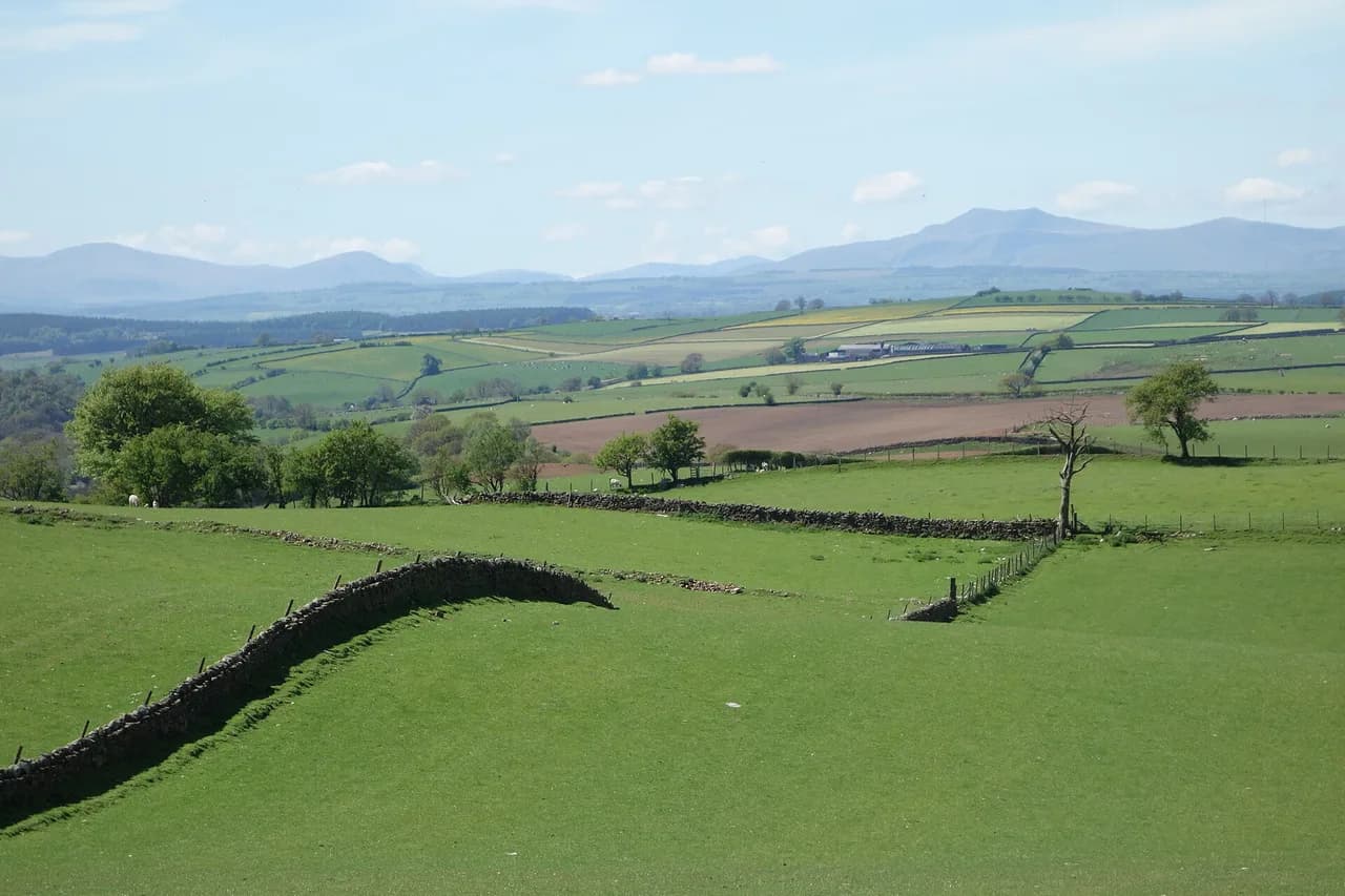
Buttermere Walk: Lake Circuit or Scale Force Extension?
Walk the full Buttermere circuit on lakeside paths and bridleways, then add Scale Force, with distances, ascent, walking times and trailhead details.
On this page
Buttermere delivers one of the Lake District's most satisfying low-level days: a lake loop that hugs the shoreline, slips through a blasted rock tunnel and never climbs more than a gentle rise. It suits hikers with half a day, mixed-ability groups and anyone who wants big scenery without a summit. The same valley also hides Scale Force, which Visit Keswick calls the highest waterfall in the Lake District, reachable by a rougher extension onto open fell.
You have two clear choices. The short circuit stays close to the water and is measured at 7 km (4.3 miles) with 154 m (505 ft) of height gain and 2–3 hours of walking. The long route adds Crummock Water and the waterfall for 12 km (7.5 miles), 360 m (1,180 ft) of gain and 4–5 hours on foot. Pick by the hours you actually have, not by ambition.
Where the walk starts: Buttermere village and Gatesgarth
Both routes begin and finish in Buttermere village, at grid reference NY 175 169 on the B5289 road toward Honister Pass. From the village center, walk about 50 m along the road and pick up the bridleway on the right that drops to the lakeshore. That short approach sets the pattern for the whole circuit: footpaths and bridleways, with the lake always close.
Gatesgarth Farm, at the Honister end of the lake, works as a second access point and a natural halfway point for a shorter outing. There is a car park there, and an ice cream van is normally parked at it in season. Starting at Gatesgarth cuts the lake section but skips the village facilities, so weigh convenience against having food and pubs at the finish.
For the wider picture of valleys, bases and lift access across the region, the hiking in lake district guide is a sensible planning companion before you commit to a base.
Buttermere circuit: distance, ascent and walking time
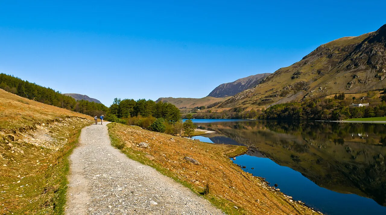
The lake circuit is 7 km (4.3 miles) with 154 m (505 ft) of height gain and a walking time of 2–3 hours. The terrain is lakeside path and bridleway, a short tunnel, woodland, becks and gravel beaches. Nobody is going to confuse it with a fell day, but the undulations are constant enough that you will feel the loop in your legs.
A leisurely pace puts the circuit at around two hours of moving time, and the shoreline has enough bays and pebble beaches that a picnic stop can add an hour without effort. Treat three hours as a realistic half-day plan once you allow for stops.
Hikers working through Alfred Wainwright's fell lists often use Buttermere as a base for the surrounding tops; the wainwrights guide explains how those summit routes are organized if you want to add height after the lake.
Route description: village to the lakeshore and Hassness tunnel
From the village the bridleway drops to the water, where you turn left and follow the shoreline path around the lake. The path runs close to the water for most of the way, passing gravel beaches and short wooded stretches. Keep the lake on your left if you want to follow the standard clockwise description.
The Hassness tunnel is the circuit's talking point: a short passage blasted through rock by a previous landowner so he could walk a complete loop. It is brief, and it marks the only spot where you briefly leave the open shore. Footing inside is uneven and dark, so take it slowly and watch your head.
Beyond the tunnel the path rejoins the B5289, and you follow the road to Gatesgarth Farm. This road stretch is short and not normally busy, but it is still road walking, with no separate footway.
Gatesgarth Farm to Peggy's Bridge and Burtness Wood
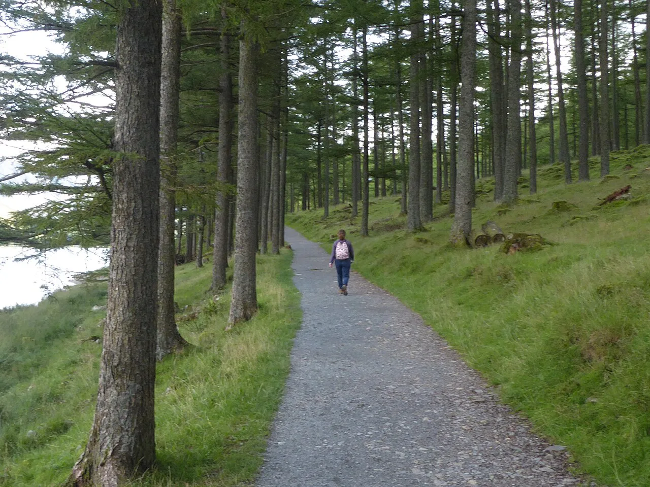
At the entrance to Gatesgarth Farm, join the bridleway and follow it across the valley floor to Peggy's Bridge. Cross the bridge, turn right at the junction and pick up the Burtness Wood bridleway beside Buttermere. This is the quietest and most sheltered part of the loop, with the water close on one side and trees on the other.
Where the bridleway splits at Horse Close, just before the trees, take the right branch by the lake and thread through Burtness Wood. The path emerges at small bays that make good picnic stops, then rejoins the bridleway at the end of the lake by a footbridge.
One rocky patch on the circuit is the only place a pushchair becomes awkward, and it is short. If you are walking with wheels or unsure of your footing, going anticlockwise puts that rougher ground later in the day and lets you retrace your steps if it looks too much.
Sourmilk Gill and the return to the village
Where Sourmilk Gill meets Buttermere Dubs beside the footbridge, the water coming down from Bleaberry Tarn high above can turn into a white torrent after heavy rain. Turn right off the Burtness Wood bridleway, cross the footbridge and follow the bridleway on the far side back to the village. That final stretch closes the loop with a gentle walk rather than a sting in the tail.
If you want a waterfall day at the other end of the Lakes, the aira force walk is a shorter, similarly low-level option.
The Scale Force extension: distance and route
The long Blue Route extends the circuit to 12 km (7.5 miles) with 360 m (1,180 ft) of height gain and 4–5 hours of walking. It follows the short route's steps one to six, then ignores the footbridge and continues along the bridleway beside Buttermere Dubs and Crummock Water. From there the route leaves the lake opposite Scales Island, turns west and climbs toward Scales Beck before swinging southwest for a steeper pull to the foot of the waterfall.
A footbridge sits below Scale Force; from it, take the higher path that traverses back across the fell in an easterly direction to rejoin the bridleway by Crummock Water. Retrace your steps to Scales Bridge, cross it and follow the bridleway on the other side back into Buttermere village. The climb away from the lake is the only sustained ascent of the day, and the return is all downhill or flat.
Scale Force is described as the highest waterfall in the Lake District, and it drops in three distinct falls that stay impressive even in dry spells. The terrain changes character here: lakeside paths and bridleways give way to open fell and a remote waterfall, so carry more than you would for the circuit alone.
Which direction to walk the circuit
The loop works either way, and the standard clockwise description simply follows the most natural line from the village. On busy days, setting off in the opposite direction to the main flow reduces the time you spend passing other walkers on narrow shoreline path.
Anticlockwise also changes where the rocky patch falls in your day, which matters if you are judging it with children or a pushchair. Either way, the tunnel comes at a fixed point on the circuit and is the one section where you need a hand free and a light source in dull weather.
When to go: seasons, water levels and ground conditions
Buttermere is a low-level walk, so it stays viable across a long season, but the shoreline rewards dry weather: the gravel beaches and picnic bays are the point of the circuit. After heavy rain, Sourmilk Gill turns into white froth and the becks run high, which is spectacular but makes the wet ground underfoot slower.
The Scale Force extension climbs onto open fell, so save it for a day with a settled forecast and good visibility. The waterfall is most dramatic in wet periods, but the higher path down from it is exposed and slick after rain.
For a short summit day with comparable views and a similar amount of driving from Keswick, the catbells walk above Derwent Water is the obvious alternative.
Families, buggies and the rougher sections
The circuit is well maintained and gentle, and two stiles plus the short rocky patch are the only real obstacles; a buggy will get over the rough ground, but a wheelchair will not manage it. The tunnel is tight and dark, so plan to carry smaller children or use a headlamp.
Keep dogs on a lead through Syke Farm Yard if you route through the farm, and expect livestock ground along the bridleways. The lakeside bays are the natural reward for children: shallow water, stones to skim and space to run.
Practicalities: parking, food and facilities in the village
A car park sits in the center of Buttermere between the Bridge Hotel and the Fish Inn, by the river. Charges and opening times can change, so check the payment board on arrival rather than budgeting in advance.
Food is easy in the village: the Bridge Hotel and the Fish Inn both have beer terraces and serve bar snacks, and Croft Farm Cafe and Syke Farm Cafe have inside and outside seating for snacks and ice creams. Opening hours vary with season, so check ahead on a winter visit.
For a more demanding day on sharp ground once the lake loop is behind you, striding edge is the classic next step and a different kind of outing entirely.
Where to stay for the Buttermere walk
Staying in Buttermere village puts you on the trailhead without driving: the Bridge Hotel, the Fish Inn and nearby farm cafes cover food, and the lake is a few minutes' walk from the car park. A cottage around the village works well for groups who want a longer stay and a mix of short lake days and fell days.
Keswick is the practical alternative base, with a wider choice of accommodation and shops. It also suits hikers who plan to split their time between Buttermere and the northern fells.
Plan Your Buttermere Day
Choose the 7 km (4.3 miles) circuit if you have half a day or are walking with family; choose the 12 km (7.5 miles) Scale Force route if you want a waterfall and a proper climb in your legs. Both start at the same village trailhead, so the decision is purely about time and effort. If you are weighing up other regions for a similar short-versus-long choice, the Yorkshire Dales hiking guide covers routes by distance and level.
Start early enough to park in the village, carry cash or a card for the payment board, and take a headlamp for the Hassness tunnel if gray weather is forecast. If the village car park is full, Gatesgarth Farm offers an alternative start point with its own parking.
Frequently Asked Questions
How long is the Buttermere walk around the lake?
The lake circuit is 7 km (4.3 miles) with 154 m (505 ft) of height gain and a walking time of 2–3 hours. A relaxed pace with picnic stops can push it toward three hours.
Can you add Scale Force to the Buttermere walk?
Yes. The extension runs 12 km (7.5 miles) with 360 m (1,180 ft) of height gain and takes 4–5 hours. It follows the lakeside circuit first, then climbs away from Crummock Water to the waterfall.
Is the Buttermere circuit flat?
Not strictly flat, though the undulations are gentle and none are strenuous. The height gain totals 154 m (505 ft) over the full circuit, mostly as short rises on lakeside paths and bridleways.
Which direction should you walk around Buttermere?
Either direction works. Clockwise is the standard description; going anticlockwise on busy days keeps you against the main flow and changes when you meet the tunnel and the short rocky patch.
Is the Buttermere circuit suitable for families?
It suits families well. Paths are well maintained and the lakeside bays make good picnic and paddling stops. Two stiles and one short rocky patch are the only awkward ground, and a buggy can manage the rough section while a wheelchair cannot.
Where does the Buttermere walk start?
The routes start and finish in Buttermere village at grid reference NY 175 169. Walk about 50 m along the B5289 toward Honister Pass to reach the bridleway that drops to the lakeshore.
Can you park at Gatesgarth instead of Buttermere village?
Yes. Gatesgarth Farm has a car park at the Honister end of the lake and makes a sensible alternative start or midpoint. Parking charges are displayed at the site.
What is the waterfall on the longer route?
Scale Force, described by Visit Keswick as the highest waterfall in the Lake District. It drops in three distinct falls and sits on the longer Blue Route beyond Crummock Water.
Sources
Trail notes for your next trip
Optional updates when we add or revise hiking guides.
You might also like



Continue reading
More guides you'll find useful