Greenway del Lago di Como: A Stage-by-Stage Lakeside Walk
Walk the Greenway del Lago di Como from Colonno to Griante: 11.5 km of lakeside path, village lanes and villa gardens, split into five easy stages.
On this page
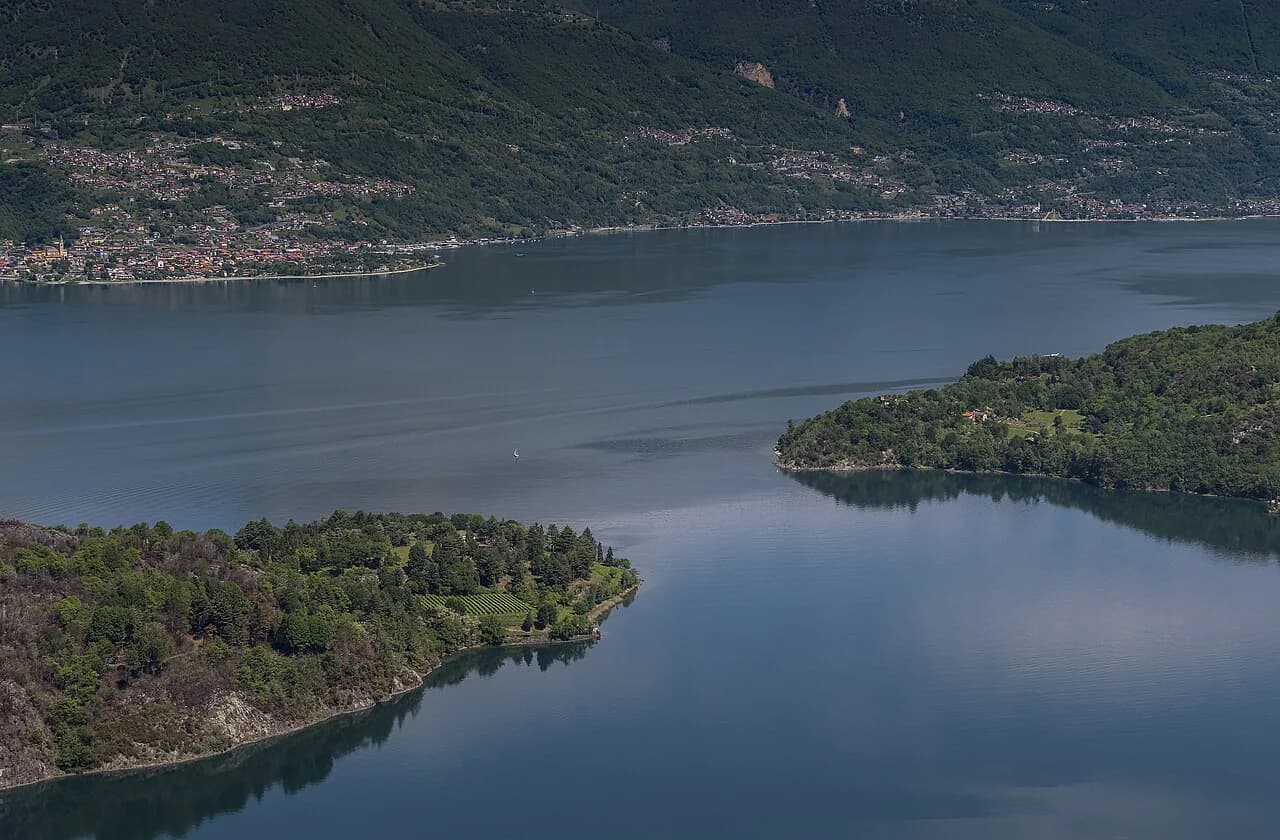
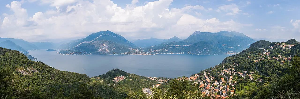
The Greenway del Lago di Como is a low-level walk along the western shore of Lake Como, linking the villages of Colonno, Sala Comacina, Ossuccio, Lenno, Mezzegra, Tremezzo and Griante on the line of the old Via Regina. It suits hikers who want lake views, village lanes and garden stops rather than a summit, and it works for walkers of most fitness levels because the climbs are short.
Because the route hugs the shore, your main planning decisions are which direction to walk and how you will return from the far end. The sections are short enough that you can treat the Greenway as a full day out or as a half-day stroll based at one of the villages in the Tremezzina. If you like the idea of quiet village-to-village lakeside walking, hiking in Lake Garda offers similar low-level routes.
What the Greenway del Lago di Como is and who it suits
The Greenway follows the Via Regina, the Roman road that once connected Como with the passes to the north, and its modern version threads through villages, olive groves, parks and lakeside promenades. Blue Greenway signs and circular trail markers set into the pavement keep you on line through the built-up stretches.
This is a walk for anyone comfortable on their feet for a few hours, including families and older walkers, not a mountain day. Hikers used to demanding routes should treat it as a rest-day leg-stretcher and save their energy for bigger objectives in the range around the lake, which the broader hiking in Lake Como guide covers.
Expect pavement, cobbles, stone staircases and short road crossings rather than rough trail. The walking is easy, but the route does cross the main Strada Regina in several places, so watch traffic at those points.
Where it starts and ends: Colonno and Griante
The route begins on the southern edge of Colonno, where Via Cappella climbs past the village center toward the old Roman road. It finishes at Griante, at the hamlet of Maiolica near the ferry landing and the Anglican church, where a bus stop and a bar mark the end of the path.
Walking north-to-south, from Griante to Colonno, reverses the climbs and leaves you closer to Menaggio and the northern lake at the start. Either direction works; pick the one whose return journey suits you, then catch the bus or ferry from the far end rather than retracing the whole route on foot.
Getting to the trailhead by C10 bus, ferry and car
The C10 bus runs along the western shore from Como, picking up near the waterfront station in the city, and stops at the villages along the Greenway including Colonno. Because the walk is linear, the simplest logistics are to arrive by bus at one end and take a bus or ferry back from the other.
Ferries and boats call at the main villages on the route, so a lake crossing can replace a road return, particularly from Tremezzo or Griante where the jetties sit close to the path. Timetables and fares change by season, so plan the return leg on the day you walk and check the current timetable from the Navigazione Lago di Como before committing to a late finish.
By car, there are parking spaces near the Greenway start on the southern side of Colonno, and the lakeside villages all have small car parks. Spaces fill quickly on fine weekends, so arriving by bus removes the parking problem as well as the need to retrieve a car at the far end.
Distance, ascent and walking time
The full Greenway measures 11.5 km (7 mi) with about 160 m (525 ft) of total ascent, and fit walkers cover it in roughly three hours without stops. Most people take longer, because cafes, village centers, villas and the lakeshore pull you off the main line.
The climbing is broken into short bursts, with the sharpest gains in the stretch between Lenno and Tremezzo, where the fifth leg rises about 70 m (230 ft) over roughly 2.5 km (1.5 mi). A version of the route measured at about 10.5 km also circulates, reflecting slightly different start and end points, so treat 11.5 km as the working figure for planning.
Colonno to Sala Comacina: up through the village
The first leg runs 1.63 km (1 mi) from the southern edge of Colonno, gaining about 40 m (130 ft) as it climbs Via Cappella and Via Civetta into the historic center. You cross the bridge over the Pessetta stream and join the old Via Regina, then continue through olive groves toward the cemetery at Sala Comacina.
Keep left of the San Rocco chapel to reach the medieval heart of Sala Comacina, where the path opens a view over the Church of San Bartolomeo, the water and Isola Comacina, the only island in the lake. This is a good spot for a first pause before the route turns north.
Sala Comacina to Ossuccio: main-road crossing and lakeside churches
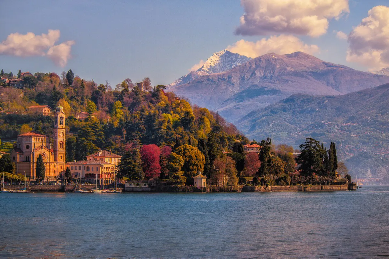
This 1.96 km (1.2 mi) section rolls along the Via Regina with modest ups and downs toward Ossuccio. After the bridge over the Premonte valley, the cobbled path arrives at the main road at Spurano, and you cross carefully to reach the Church of San Giacomo e Filippo, a Romanesque building right at the water's edge.
Watch for the crossing at Spurano; the path technically continues on the other side, so take a moment to read the traffic before stepping out.
From the church, narrow stairs take you toward the Sanctuary of the Beata Vergine del Soccorso, and a right turn on Via Andrea Castelli leads through the village. A public park and playground a few hundred meters on give you a bench, a bar and a view of Isola Comacina.
Ossuccio to Lenno: villas and the Lavedo peninsula
The third leg covers 1.80 km (1.1 mi) at low gradient, continuing through the hamlet of Isola past the parish church of Santi Eufemia e Vincenzo and Villa del Balbiano. The architecture becomes the main attraction here, with gates, gardens and lakefront facades appearing at every turn.
For the Villa del Balbianello detour, look for the path on the right just after Hotel Lavedo; the walk out to the villa adds about a kilometer each way. The pedestrian entrance follows a seasonal pattern from mid-March to mid-November with limited opening days, so check the villa's current visitor information before building your day around the garden visit.
Back on the main route, you reach Lido di Lenno where boats can drop visitors at the villa or carry walkers onward. The path then follows the lakeside promenade past the medieval tower of Villa Aureggi, the church of Santo Stefano and the baptistery of San Giovanni Battista to the jetty.
Lenno to Tremezzo: the climbing leg
Leg four is the longest of the shorter stages at 2.49 km (1.5 mi), with about 70 m (230 ft) of ascent and 60 m (200 ft) of descent. After the bridge over the Pola and the little beach by the cafe, a short path climbs 10 minutes to Mezzegra, where the parish church of Sant'Abbondio gives the best lake panorama on the whole walk.
From the church the route drops past the Casa dei Presepi with its nativity collection to the 18th-century Palazzo Brentano, then threads through the hamlet of Bonzanigo and the Palazzo Rosati before turning down toward the lake on Via delle Gere.
Tremezzo to Griante: parks, villas and the finish
The last leg measures 3.72 km (2.3 mi) and is nearly level, running through Bolvedro to the shore and then along the water. Past the parish church of San Lorenzo, the path crosses the Parco Teresio Olivelli with its fountain, then follows the promenade beneath the Hotel La Darsena.
The Tremezzina tourist office and the Tremezzo jetty sit just off the route, and the chapel of San Bartolomeo and the covered walkway with its cafes make a natural lunch stop. Villa Carlotta and its gardens come up just before the village of Griante and are the headline garden visit on the route.
At Griante the path passes the hamlet of Maiolica, with its bars and restaurants and the Anglican Church of the Assumption, and finishes at a bus stop and bar where the walking trail ends. The village itself is a short walk inland if you want a last espresso or a pizza before heading home.
Villas, gardens and side trips along the way
The villa gardens are what lift the Greenway above an ordinary lakeside stroll: Villa Carlotta near Tremezzo, the Balbianello house on the Lavedo peninsula and Villa del Balbiano near Ossuccio all sit within a short detour. Budget your day around one garden visit rather than three, since each costs time and money at the gate.
For anything with a climbing objective, the western shore also opens onto the Larian Triangle above Menaggio, where the Monte Grona hike reaches the Rifugio Menaggio with a much bigger day than the Greenway offers. Keep the two separate in your plan: doing both on the same day would leave you racing the light.
When to go: season, weather and lake light
The Greenway is walkable all year and takes on a different character each season; cooler, quieter days in spring and autumn are often the most pleasant for walking the villages without crowds.
Mid-summer heat and lake humidity make an early start worthwhile, and afternoon light on the western shore falls across the water toward the eastern mountains. In winter, some cafes and villa gardens close, and lakeside sections can be exposed to wind, so windproof layers and a warm hat earn their place.
Walking the route in short sections
The Greenway divides naturally into the five legs above, so you can choose a single stage of under an hour or join two for a half-day. Starting or finishing at Lenno or Tremezzo works particularly well, since both have frequent bus and boat connections back to the other villages.
A shorter alternative uses the same villages but heads away from the lake: the Intelvi Valley above Argegno sits on the inland side and gives you steep wooded climbs if you want elevation without high mountain terrain.
If you enjoy walking from village to village on restored mule tracks, the sentiero del viandante on the eastern shore of the lake is a longer route with the same historic-path character.
What to carry on an easy lakeside walk
Treat the Greenway as a town-and-village walk with a mountain backdrop: lightweight shoes with a grippy sole handle the cobbles and stone staircases better than smooth trainers. Carry water, since fountains on the route are not guaranteed outside village centers, and pack a light layer for the shaded sections beneath the hillsides.
Sun protection matters even on an overcast summer day, because much of the lakeside promenade is open to the sky. A small daypack with room for lunch and a swim towel covers everything else the route demands.
Carry a charged phone with an offline map, because the route crosses built-up areas and a few turns are easy to miss where lanes fork. If you have a guidebook page or the marked map, it is enough backup.
Plan Your Visit
Lock in the plan in this order: direction, return leg, then which stages to walk. With 11.5 km (7 mi) and about 160 m (525 ft) of ascent over roughly three hours, the Greenway makes an easy full day or a relaxed half-day if you skip a couple of legs.
Base yourself at Tremezzo, Lenno or Menaggio if you want to be within a short bus ride of every stage, and pick your garden visit in advance so the day has a center. If you want a bigger objective after the Greenway, look to the Monte San Primo hike above the lake for a proper climb.
Frequently Asked Questions
How long is the Greenway del Lago di Como?
The full route runs 11.5 km (7 mi) from Colonno to Griante with about 160 m (525 ft) of total ascent, and fit walkers finish in roughly three hours. Most people take longer because of village stops, villa gardens and cafe breaks.
Where does the Greenway del Lago di Como start and finish?
It starts on the southern edge of Colonno, where Via Cappella climbs into the village, and ends at Griante near the Maiolica hamlet ferry landing, where a bus stop and bar mark the finish. You can walk it in either direction.
How many stages does the Greenway del Lago di Como have?
The route divides into five legs: Colonno to Sala Comacina, Sala Comacina to Ossuccio, Ossuccio to Lenno, Lenno to Tremezzo and Tremezzo to Griante. Each is short enough to walk on its own as a half-day outing.
Is the Greenway del Lago di Como easy to walk?
Yes. The path uses pavement, cobbles, stone staircases and lakeside promenades with only short climbs, so it suits families and older walkers. The real hazards are the road crossings of the Strada Regina rather than steep ground.
How do you get back to Colonno from Griante?
Take the C10 bus along the western shore or a ferry from the Griante and Tremezzo jetties, both of which sit close to the path. Timetables vary by season, so check the day's schedule before setting out.
When is the best time to walk the Greenway del Lago di Como?
The route is walkable all year, and spring and autumn give cooler, quieter conditions. In midsummer, start early to avoid the heat and lake humidity, and expect some cafes and villa gardens to close in winter.
Can you walk only part of the Greenway del Lago di Como?
Yes. Any of the five legs works as a standalone walk, and Lenno and Tremezzo are good places to start or finish because both have frequent bus and boat connections to the other villages.
Sources
Trail notes for your next trip
Optional updates when we add or revise hiking guides.
You might also like
Continue reading
More guides you'll find useful