Sentiero del Viandante: Lake Como's Wayfarer's Path Guide
Plan the Sentiero del Viandante, the 75 km Wayfarer's Path on Lake Como's east shore: stages, the Varenna to Dervio day, town access and the best months.
On this page
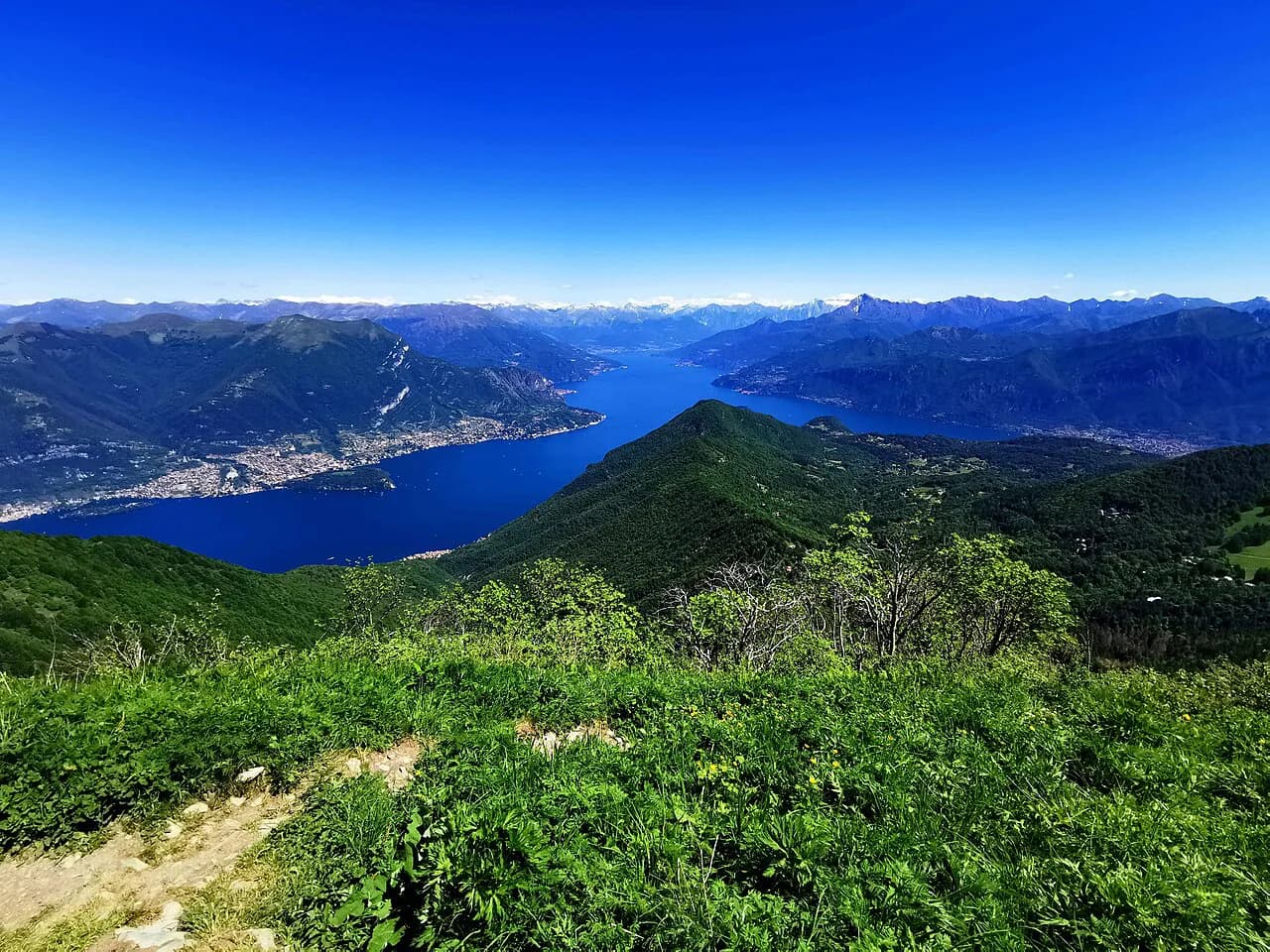
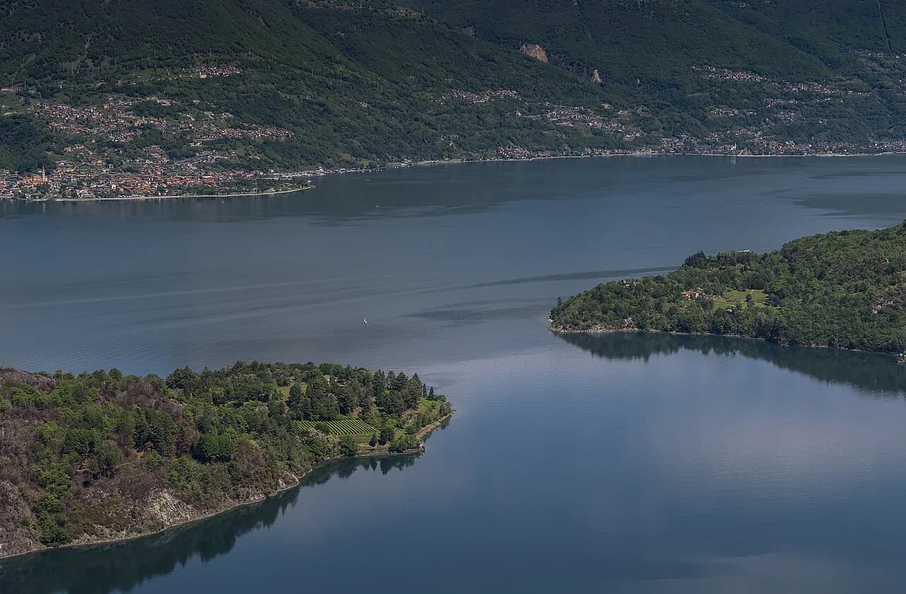
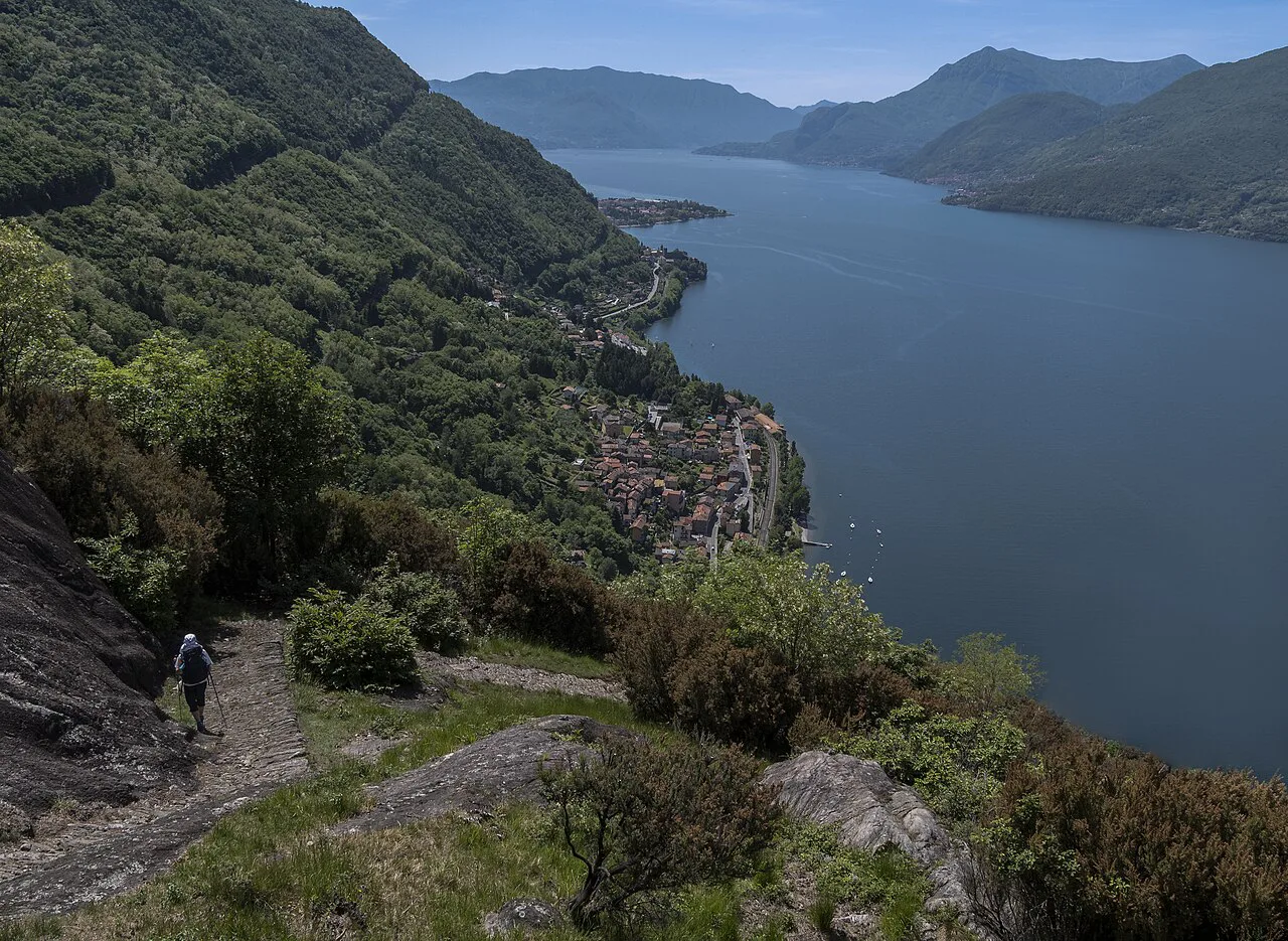
The Sentiero del Viandante, the Wayfarer's Path, is a town-to-town walk along the eastern shore of Lake Como rather than a wilderness trek, and that is exactly what makes it a good first long-distance route in the Italian lakes. Every stage ends in a village with a station or a boat landing, so you can walk the whole thing in one go, take a single day out of a lakeside holiday, or cut a hot afternoon short by hopping on a train. The payoff is constant: stone hamlets, old mills, chapels, vine and olive terraces, and the lake always below you.
What the Sentiero del Viandante is
The full route measures about 75 km (47 mi) and is waymarked throughout with orange arrows, so you can walk it end to end or in stages without route-finding stress. It runs along the eastern shore of Lake Como and continues into the lower Valtellina, which means the northern days feel different from the southern ones: quieter, more agricultural, with the lake narrowing toward Colico and the Adda plain opening beyond.
This is not a newly built trail. The path follows a corridor that carried goods, mules and travellers along the lake's eastern side for centuries, and its various historical names, including Via Ducale and Via Regia, survive in place names along the way. Walking it today is partly a lesson in how the lake economy worked before the shore road arrived in the 19th century.
Where the route runs, south to north
The stage list runs from Lecco north through Abbadia Lariana, Mandello del Lario and Lierna, then to Varenna and Perledo, Bellano, Dervio, Dorio and Colico, before continuing through Piantedo, Delebio, Rogolo and Cosio Valtellino to Morbegno. Treat that order as your planning spine: pick the towns you can reach easily and build days between them.
Landmarks give each day its character. The Romanesque church of San Giorgio above Mandello is the highlight of the Abbadia Lariana to Mandello stretch, the Lierna to Varenna section splits into high and low variants, and the Bellano to Dervio day passes the Sanctuary of Our Lady of Tears at Lezzeno. Further north, Corenno Plinio above Dervio is known as the village of a thousand steps, and the Dorio to Colico stage looks over the small lake of Piona.
Height and terrain
The path averages around 400 m (1,312 ft) in altitude, roughly 200 m (656 ft) above the water, and in places rises to between 500 and 600 m (1,640 to 1,969 ft). That modest height is why the lake views stay with you for hour after hour without any sustained alpine climbing. It also means the route stays walkable in months when higher Italian routes are still under snow, a contrast worth weighing against hiking in Switzerland if you are planning a shoulder-season trip.
The exception is the Lierna to Varenna section, where the corridor climbs highest and the ground is steepest above the shore. Expect stone steps, mule-track paving and short steep pulls rather than exposure; trekking poles earn their place on the descents into Bellano and Dervio. After rain the paved and cobbled stretches get slippery, so keep that in mind on the stepped villages.
The high and low variants between Lierna, Varenna and Perledo
Between Lierna and Perledo the route offers two signed options. The high route runs Lierna to Esino, Varenna and Perledo and is the one to choose for the widest views over the lake; the low route keeps closer to the water through Varenna and passes the springs of Fiumelatte. Both end in the same area, so the choice is about effort and outlook rather than logistics.
Take the high variant if you have a full day and clear weather, since it puts you above the villages with the lake spread out below. Take the low variant if the forecast is unsettled, if you are walking with children, or if you want to finish in Varenna with time for the ferry. The Fiumelatte spring, one of the shortest rivers in Italy, is a worthwhile detour on the low line.
The classic day: Varenna to Dervio
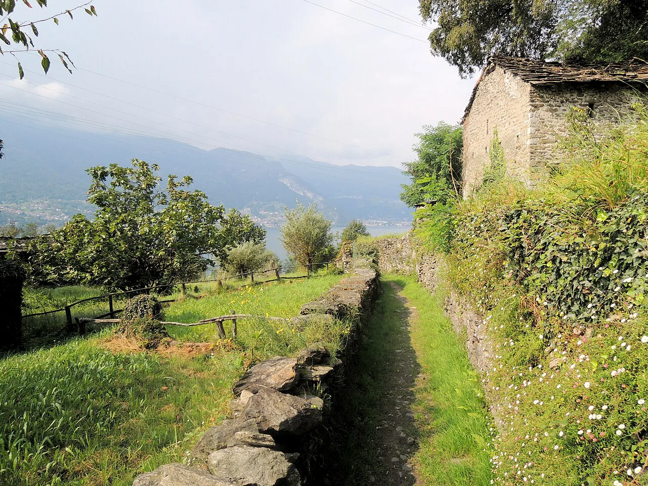
If you have one day on Lake Como, walk the third stage from Varenna to Dervio. It covers 12 km (7.5 mi) and takes around four hours, making it easier than several other stages while still delivering traditional villages, historic architecture and the Orrido di Bellano gorge. It is the most efficient way to sample the Wayfarer's Path without committing to a multi-day itinerary.
You can split the day at Bellano, walking either Varenna to Bellano or Bellano to Dervio, which suits a late start or a hot midsummer afternoon. Bellano sits roughly halfway and has its own station, so a split costs you nothing in transport terms. Either half still gives you the lake-below-you feeling that defines the route.
Trailhead access by train and boat
Every town on the route is a stop on the Lecco to Colico rail line or on the lake's navigation service, which is what makes staged walking practical here. Start each day at the station of the town where you finished or where you plan to begin, and use the boat when you want a different view of the shore on the return leg. Buy tickets at the station or landing before you set off; check current prices and timetables with Trenord and the Lake Como navigation service before setting out.
For the Varenna to Dervio day, Varenna is the natural base: it has both a station and a ferry landing, so you can arrive by train, walk north, and return from Dervio by rail. Parking in the lakeside villages is limited and seasonal, so arriving by public transport removes the biggest logistical headache on this route.
Distance, ascent and time
Plan daily effort stage by stage rather than expecting one figure for the whole route. The official stage pages describe the passage through each pair of towns, and the only measured day widely published is Varenna to Dervio at 12 km (7.5 mi) and about four hours. For everything else, use the town-to-town layout and the height profile above the lake to judge your own pace.
A realistic pace on cobbles, steps and mule track is slower than on forest trail, especially in heat. If you normally walk 4 km/h (2.5 mph) on flat ground, budget less than that here and add time for the villages, which are the reason to come. Splitting long stages at a station town is the simplest way to keep days enjoyable.
When to go
Because the path sits low above the lake, spring and autumn are the sweet spots: mild temperatures, clearer air and fewer walkers on the stepped sections. Midsummer works if you start early and finish before the afternoon heat builds, and the lake towns give you a swimming option at the end of the day. Winter walking is possible on the lower stretches but short daylight limits how much you can cover.
Rain changes the character of the route more than cold does: the stone paving and the descents into Bellano and Dervio become slick, and the lake views disappear. Build a flexible day into a multi-day plan so you can swap a walking day for a boat trip if the weather turns.
Where to stay
Base yourself in a town with both a station and a landing and you can reach most stages without a car. Varenna suits the central days, Bellano puts you between the Varenna and Dervio halves, and Lecco or Mandello del Lario work well for the southern stages around San Giorgio. Colico and Morbegno anchor the northern end near Piona and the lower Valtellina.
If you want a second, gentler waterside walk on a rest day, the Greenway del Lago di Como on the western shore links villages and villas at lake level and makes a relaxed contrast to the stepped eastern path. It is a separate route, useful as a low-effort day between harder stages.
Food, water and villages on the route
There are no mountain huts on the Wayfarer's Path; the infrastructure is the villages themselves. Each stage ends in a town with bars, bakeries and restaurants, so carry water for the walking hours and plan to eat in the towns rather than on the trail. Fountains in the villages are useful for refills, but do not count on them on the higher stretches between Lierna and Varenna.
The terraces of vines and olive trees along the route hint at what to order: local wine and olive oil appear on menus in the lakeside towns. Menaggio, on the western shore, is the base for the Monte Grona hike and Rifugio Menaggio, a steeper outing if you want a bigger day between Wayfarer's stages.
Walking the Varenna to Dervio stretch in two halves
If the full 12-kilometer trek from Varenna to Dervio feels long for a day out, the route can be split in two: Varenna to Bellano on one outing, or Bellano to Dervio on another. Planning around these two halves is useful because each gives you a clear village to start from and a clear village to finish in, rather than committing to the whole run at once.
The third stage of the Wayfarer's Path is described as easier than other stages of the route, and very scenic, with a full walk of it taking around four hours. That time estimate refers to walkers covering the whole stretch; when you cut it at Bellano, you are out for roughly half of that, which keeps the day short enough to fit around a lake crossing or a train connection at either end.
The Bellano half of the split is where you find Orrido di Bellano, one of the features named along the way. The broader route as a whole is marked throughout with the typical orange-colored arrows, so look for that marking at junctions when you pick up the path in either village. Beyond the villages themselves, the trail passes clusters of rustic stone houses and ruins of old mills, castles and fortifications, chapels and small churches, and terraces of vines and olive trees.
Plan Your Visit
The Sentiero del Viandante rewards a simple plan: choose two or three town-to-town days, sleep in places with a station or landing, and let the train or boat handle the returns. The Varenna to Dervio day is the best single introduction, and the high route above Lierna is the one to save for clear weather.
Walk it in spring or autumn if you can, carry water for the stretches between villages, and keep one flexible day for rain. For the wider picture of routes around the lake, from shoreline promenades to the Larian Triangle summits, the Lake Como hiking guide maps out how the pieces fit together.
Frequently Asked Questions
How long is the Sentiero del Viandante?
The full Wayfarer's Path measures about 75 km (47 mi) and is marked with orange arrows from Lecco along the eastern shore of Lake Como into the lower Valtellina toward Morbegno. You can walk it end to end or in selected stages.
How many days does it take to walk the Sentiero del Viandante?
The official stage list breaks the route into town-to-town days from Lecco to Morbegno, but no single published figure covers the whole itinerary. Most walkers select several stages based on fitness and available time, and the Varenna to Dervio day alone takes around four hours for 12 km (7.5 mi).
Which section of the Sentiero del Viandante is the easiest?
The Varenna to Dervio stage is described as easier than other stages of the route, which makes it a good choice for a first day or for walkers with limited time. It can also be split at Bellano into two shorter halves.
Can you walk the Sentiero del Viandante in stages using trains and boats?
Yes. The towns along the route sit on the Lecco to Colico rail line or on the lake's navigation service, so you can finish a stage and return by public transport. Check the current timetables with the rail and boat operators before you set out.
Where does the Sentiero del Viandante start and finish?
The waymarked route begins at Lecco on the southern end of Lake Como's eastern shore and runs north through Varenna, Bellano, Dervio and Colico before continuing through the lower Valtellina to Morbegno.
When is the best time to hike the Sentiero del Viandante?
Spring and autumn give the most comfortable temperatures on this low lakeside path, while midsummer is workable with an early start. Rain makes the stone paving and stepped descents slippery, so keep a flexible day in a multi-day plan.
Sources
Trail notes for your next trip
Optional updates when we add or revise hiking guides.
You might also like
Continue reading
More guides you'll find useful