Monte San Primo Hike: Routes, Distances and When to Go
Plan the Monte San Primo hike above Lake Como with four real routes, distances, ascent, walking times, summit views and the best months to climb.
On this page
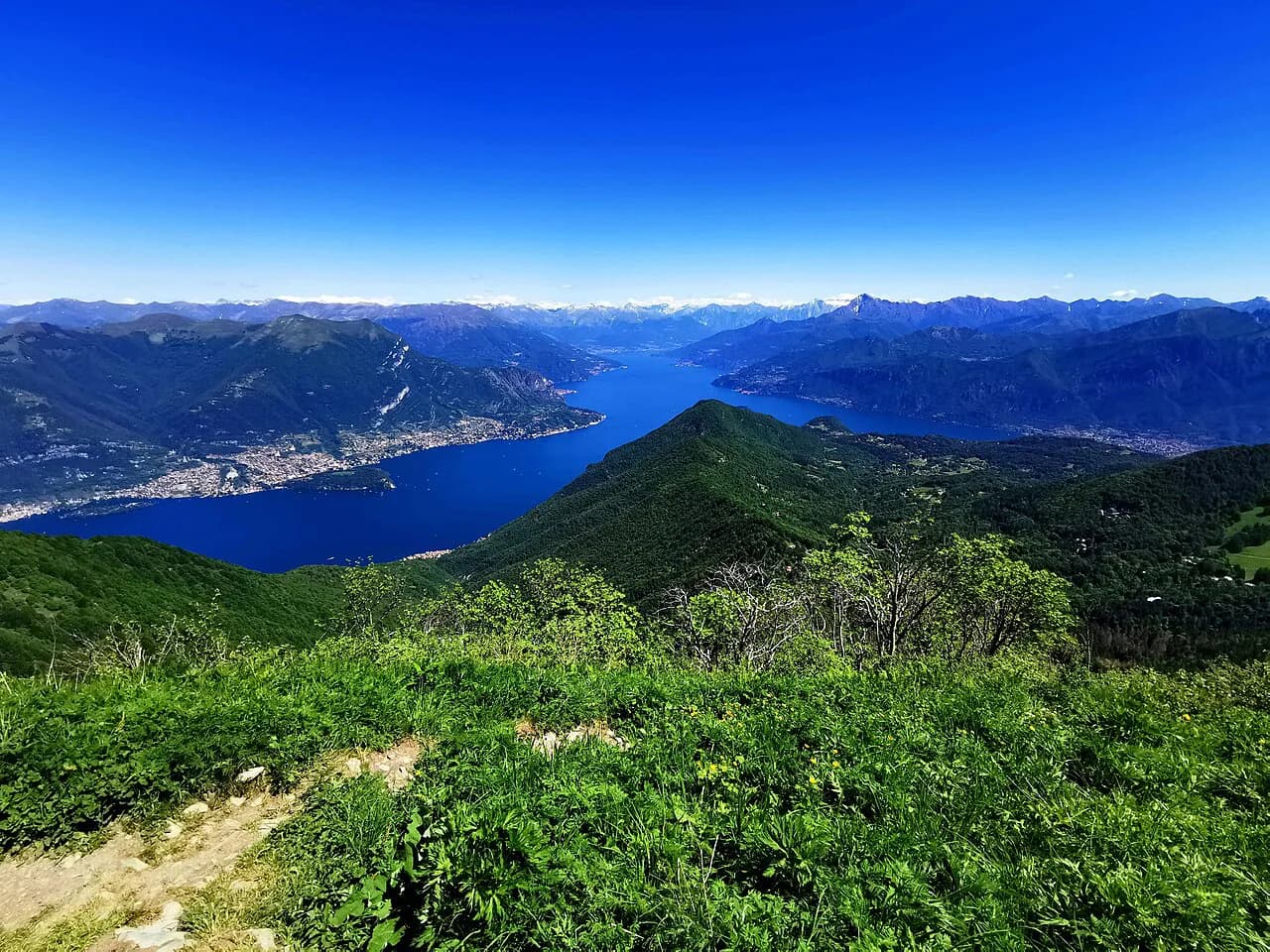
Monte San Primo rises to 1,685 m (5,528 ft), the highest summit of the Larian Triangle, the wedge of mountains between Lake Como's Como branch and its Lecco branch. From the top you look down on the point where the lake splits into its two arms, an upside-down Y, and on clear days across the Po Valley toward Milan and the Alps beyond. That combination of a modest half-day climb and a genuinely panoramic summit makes it one of the most satisfying day hikes above the lake.
The summit suits hikers with a reasonable level of fitness who want a full day out rather than a technical scramble. You can start from a road pass high on the ridge, from a lakeside village, or from a small village on the Como side, and the length and effort change dramatically with that choice. The route descriptions below give you the figures for each so you can match the summit to your time and legs.
Where Monte San Primo sits
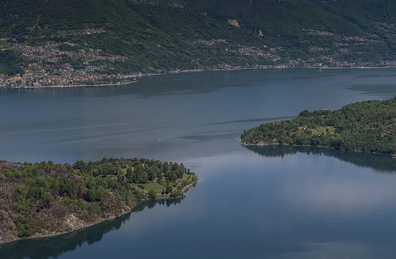
The mountain stands above the villages of Zelbio and Magreglio on the Como side of the Larian Triangle, with the Lecco branch of the lake running east behind it. It is the culminating point of the triangle, which is why the summit view shows both arms of Lake Como at once. The Bellagio peninsula, which divides the two branches, lies just to the southwest and gives the easiest approach for drivers and bus passengers.
Because the massif fills the space between two inhabited lake shores, every route up gains height from a different starting elevation. The Colma di Sormano road pass and the Magreglio area put you high on the mountain before you take a step, while Nesso starts right at the water. Pick the start that fits the day you have rather than the one that looks shortest on a map, since the vertical difference is what your legs will remember.
Trailheads and access
The high-level start is Colma di Sormano, a road pass on the ridge southwest of the summit, where the ridge approach to Monte San Primo begins on a wide dirt track through dense woods. Nesso, on the Como branch of the lake, is the lake-level start for the long loop, and it is served by the lakeside road on the Como shore. Magreglio, close to the pass above Bellagio, is the start for the shorter Alpe del Picet loop.
None of these trailheads has a published parking charge, bus timetable or lift in the trail descriptions, so plan transport directly with the local tourism office for the day you travel. What is stable is the layout: the Colma di Sormano and Magreglio starts save you the full lower forest climb, while Nesso forces you to earn every metre from lake level. Early starts matter most for the Nesso loop, which runs long.
Route option 1: Colma di Sormano to Monte San Primo
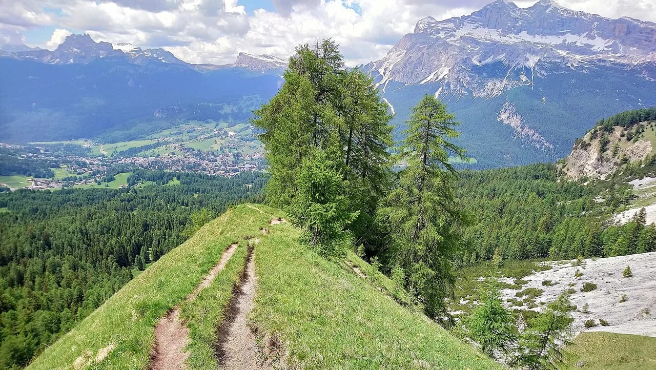
The classic ridge traverse runs 15.4 km (9.6 mi) with 600 m (1,969 ft) of ascent and 600 m of descent, taking about 5 hours at a steady pace. It begins on a wide dirt track from Colma di Sormano and works through dense woodland before the trees open into meadow and the incline steepens. The route is rated moderate, requiring good fitness and sure-footedness rather than technical skill.
This is the option to choose if you want the summit with the least painful vertical gain and you have a car or a lift to the pass. Because the ascent and descent figures balance, the walk returns you to your starting level rather than dropping you at a different trailhead. The main trade-off is that the easy early forest kilometres dilute the summit reward, so budget the full five hours rather than squeezing it into an afternoon.
Route option 2: Larian Triangle Ridge Crest Trail
The Larian Triangle Ridge Crest Trail covers 7.61 km (4.7 mi) with 580 m (1,903 ft) of ascent and descent in roughly 3.5 hours, the shortest proper route to the summit in the trail listings. It starts in tranquil woodlands, crosses open meadows, and then climbs consistently toward the top. Komoot classes it as moderate, matching a half-day outing for a fit hiker.
Take this one if you want the ridge experience without the full-day commitment of the Colma di Sormano traverse. It sticks to the crest and the open ground, so the changing scenery arrives quickly and the summit stays in view for much of the climb. The shorter distance means less margin for error if weather turns, so start early enough to be off the open ridge before afternoon storms build.
Route option 3: Monte San Primo loop from Nesso
The loop from Nesso is the big day: 15.6 km (9.7 mi) with 1,290 m (4,232 ft) of ascent and 1,300 m of descent, about 7.5 hours on foot. It is rated hard because you climb the whole mountain from lake level and descend it again, not because of scrambling. That full vertical is what makes it a serious outing for experienced hikers with an early start.
Choose the Nesso loop if you want the satisfaction of climbing Monte San Primo end to end and you have the legs for a long day. It rewards you with the lower forest and lake shore on the way up, which the road-pass routes bypass entirely. Give yourself daylight on both sides of the walk and carry enough water for the sustained climb, since the summit is your turnaround, not your halfway rest.
Route option 4: Monte San Primo and Alpe del Picet loop near Magreglio
The Alpe del Picet loop near Magreglio covers about 4.8 mi (7.7 km) and is rated challenging, a compact circuit that links the summit area with the Alpe del Picet grazing ground. It is the best fit for a half-day or for hikers based near Bellagio who want a summit without a long drive. Take the rating seriously even though the distance is short, because the climbing is concentrated.
Use this loop if you are combining the hike with a day around Bellagio and want to be back by afternoon. The circuit format keeps logistics simple, with no need to arrange a pickup at a second trailhead. For a true comparison of the four options side by side, use the ridge crest trail and Colma di Sormano figures above and treat this loop as the shorter, punchier alternative.
Route description section by section
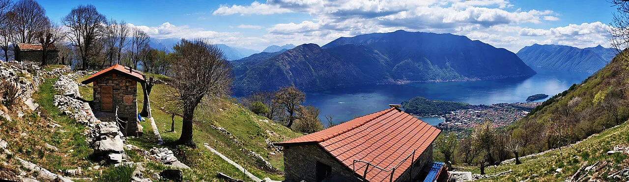
Most routes begin in dense woodland, on a wide track from the passes or on steeper paths from Nesso, with the trees sheltering you from wind and sun. The middle section on the ridge opens into meadow and consistent inclines, where the ground can be wet and the wind gets to you. The final pull to the summit is the steepest and most exposed stretch, and Rifugio Martina, on the mountain below the summit, is the key landmark and rest point on the way.
On the way down, the steep path from Rifugio Martina toward the summit is the section to be careful on. Hikers who have walked it recommend taking that pitch in ascent rather than descent, so plan your direction of travel to climb it. If your chosen route comes down it, slow down and use your hands where needed.
Which direction to walk
Where the choice exists, climb the Rifugio Martina pitch rather than descend it, since the steep path is easier and safer going up. That points to starting from the pass above and approaching the summit from the hut side, or reversing a standard loop that would otherwise finish with a steep descent. The ridge crest trail works in either direction because the ascent and descent figures are balanced, so the terrain, not the gradient, should drive your choice.
The Nesso loop sets its own direction because you start at the lake and must climb back to it. Take the forest climb first and use the ridge and meadow for the descent, so the steep, loose ground comes when your legs are fresher. On the Colma di Sormano traverse, decide your return point before you set off, since the pass is a trailhead rather than a through-route.
Distance, ascent and time at a glance
The four routes sort cleanly by effort. The Colma di Sormano traverse is 15.4 km with 600 m of ascent and about 5 hours; the Larian Triangle Ridge Crest Trail is 7.61 km with 580 m of ascent in about 3.5 hours; the Nesso loop is 15.6 km with 1,290 m of ascent over about 7.5 hours; and the Alpe del Picet loop near Magreglio is roughly 4.8 mi, rated challenging.
Use those figures to pick your day. If you have a half-day, the ridge crest trail or the Magreglio loop gives you the summit; if you have a full day and want the big climb, the Nesso loop delivers. The Colma di Sormano traverse sits between the two, fitting a comfortable full day where the ascent never gets desperate but the distance keeps you walking.
Difficulty and exposure
The ridge is open and exposed above the woodland, so wind and quick weather changes hit you sooner than they do on the forest tracks. The routes are moderate to hard on paper, but the technical demand is low: there is no scrambling, just sustained climbing and steep ground around Rifugio Martina. Sure-footedness and sturdy shoes are the practical requirements.
The real hazards are weather and footing. Afternoon storms build over the Larian Triangle, so aim to be off the ridge by early afternoon, and treat wet meadow and steep dirt as slower ground than the dry figures suggest. In spring and late autumn, snow can linger on the passes and upper slopes, which turns the easy ridge into a slippery traverse; pack for the forecast and turn back rather than pressing on.
When to go
The best months are late spring through early autumn, when the ridge is clear and the days are long enough for the Nesso loop. A guided version of the Monte San Primo hike runs from March to October, which gives you a sense of the hiking season on the mountain. Full-day routes need the longer daylight of summer rather than the shoulder months.
Guided hikes are a useful alternative if you want a leader and local route knowledge rather than navigating yourself. The guided panorama hike is a 4-hour walk covering 7.5 km (4.7 mi), with transfers extending the whole outing to up to 6 hours. That format suits hikers short on time or unsure of the trails, while the self-guided options above give you the full ridge and the big Nesso climb.
Winter changes the mountain entirely. Expect snow on the upper slopes and shorter days, and leave the exposed ridge and the steep hut path for hikers with winter equipment and experience. The Nesso loop is out of reach for most parties in winter conditions, so use the high passes as a base and keep your ambitions modest.
Summit views
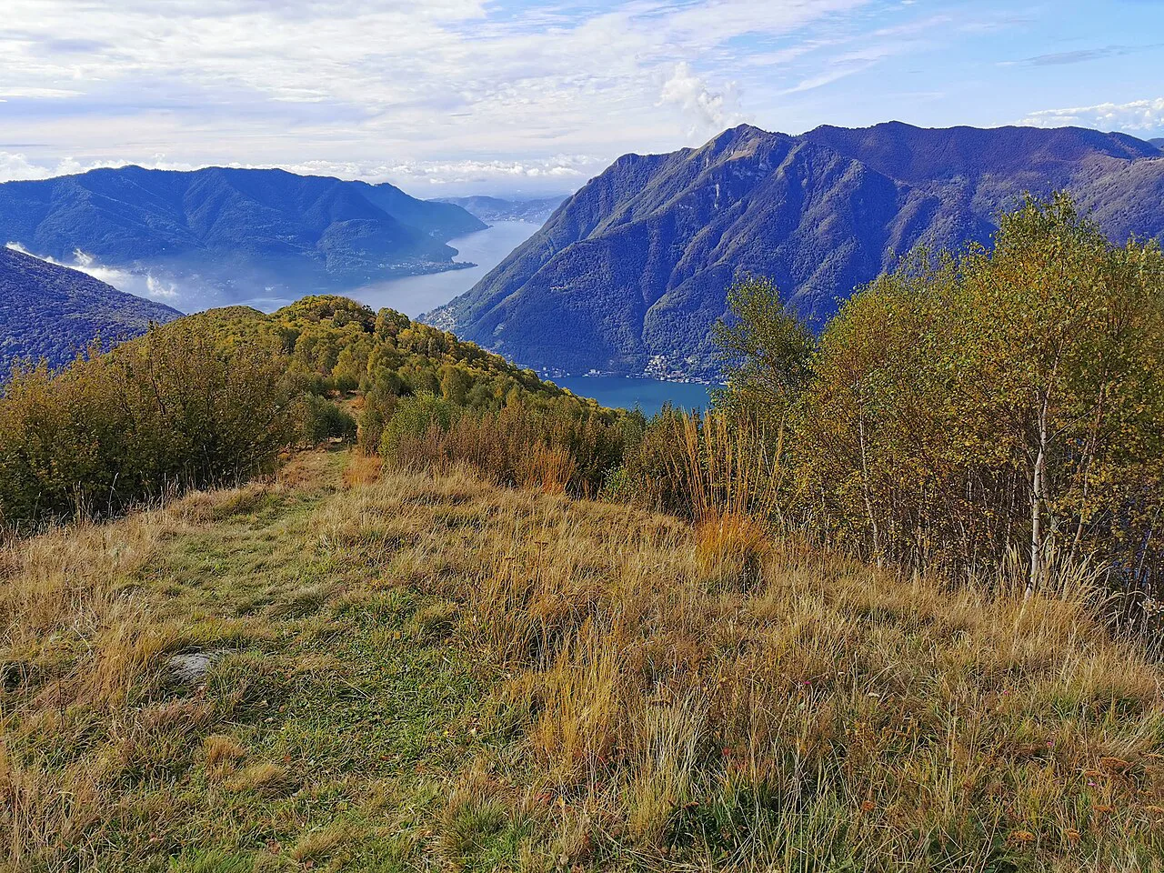
From the top you see Lake Como branching into its two arms, the inverted Y that makes this summit distinctive. On clear days the view runs across the Po Valley and the Milan area, and across much of the Alps, with the Apennines visible to the south in fine weather. That 360-degree panorama is the payoff for every route.
The viewpoint also tells you what you are climbing for: the split of the two lake branches and the long ridge of the Larian Triangle itself. Clear winter days give the sharpest distant views, while summer gives the longest walking days. Plan for the visibility you want and accept the trade-off with the season's weather.
What to carry and where to eat
Carry water, layers and a map or downloaded route, since the routes cross woodland and open meadow with few reliable markers on the open ground. Rifugio Martina is the main place to eat on the mountain, sitting below the summit on the ascent path, and it makes the natural lunch stop on the Colma di Sormano and Magreglio routes. Pack food as backup.
On the long Nesso loop, the hut comes after the main climb, so start with enough food for the ascent. A map, a headlamp and a windproof layer are worth carrying whatever the morning weather, because the ridge is more exposed than the trailhead.
Base villages and the Bellagio side
Choose a base by which hike you want. Magreglio is the closest base for the short Alpe del Picet loop and the pass routes, while Nesso suits hikers who want the lake-level challenge on their doorstep. Zelbio, on the Como side of the Larian Triangle, puts you close to the mountain's western flanks and the ridge approaches.
For a broader base with ferries and lakeside paths, stay on the Bellagio side and drive or take transport to the pass for the ridge routes. If you want easier lakeside days between hikes, the greenway del lago di como makes a relaxed contrast to the summit climb.
Planning Your Monte San Primo Hike
Pick your route by the day you have: the Larian Triangle Ridge Crest Trail or the Magreglio loop for a half-day, the Colma di Sormano traverse for a comfortable full day, and the Nesso loop for a long, hard climb from the lake. If you want a lower-altitude alternative with the same half-day-or-full-day choice, hiking in Lake Garda offers the same dilemma between short ridge walks and long lake-level climbs. Whichever you choose, climb the steep Rifugio Martina pitch rather than descend it, and set off early enough to be off the open ridge before the afternoon storms.
Check the weather forecast and any transport timetable with the park and the operator before you go, then let the mountain give you the inverted Y of Lake Como from the top. If you want other Lake Como days out around this summit, the wider hiking in Lake Como guide covers the surrounding trails.
Frequently Asked Questions
How difficult is the Monte San Primo hike?
It ranges from moderate to hard. The ridge crest trail is the shortest route at 7.61 km with 580 m of ascent and about 3.5 hours, while the Nesso loop is hard because it climbs the full mountain from lake level, with 1,290 m of ascent over about 7.5 hours. The terrain is never technical, but the steep ground around Rifugio Martina and the exposed ridge call for sure footing and sturdy shoes.
How long is the Monte San Primo hike?
The route sets the length. The Colma di Sormano traverse covers 15.4 km with about 600 m of ascent in roughly 5 hours, the ridge crest trail covers 7.61 km in about 3.5 hours, and the Nesso loop covers 15.6 km in about 7.5 hours. The loop near Magreglio is the compact option at about 4.8 mi.
Where do you park for the Monte San Primo hike?
The main high-level trailheads are the Colma di Sormano road pass and the village of Magreglio. Parking arrangements and charges at these trailheads are set by the local road authority, so confirm them locally rather than relying on a guide.
Can you hike Monte San Primo from Bellagio?
Bellagio is a practical base rather than a trailhead. The closest start is the pass above the town and the village of Magreglio, which serves the Alpe del Picet loop. Arrange transport from Bellagio to the pass and start early enough for the summit.
What is the weather like on Monte San Primo?
The ridge is open and exposed above the woodland, so wind and quick weather changes arrive sooner than on the forest tracks. Afternoon storms build in the warmer months, so aim to be off the exposed ground by early afternoon, and expect snow on the upper slopes in spring and late autumn.
Which is the best route up Monte San Primo?
The Larian Triangle Ridge Crest Trail suits a half-day with the summit as the goal, the Colma di Sormano traverse suits a comfortable full day, and the Nesso loop is for hikers who want the big climb from the lake. Whichever you choose, climb the steep Rifugio Martina pitch rather than descending it.
Sources
Trail notes for your next trip
Optional updates when we add or revise hiking guides.
You might also like
Continue reading
More guides you'll find useful