Monte Grona Hike: Trailhead, Route and Via Ferrata Options
Plan the Monte Grona hike above Lake Como: the Monti di Breglia trailhead, distance, ascent and time, the Via Normale, and the via ferrata alternative.
On this page
Monte Grona rises to 1736 m (5,696 ft) on the north-western shore of Lake Como, close enough to Menaggio that you can be on the summit cross within a morning's walk from the road-head above Breglia. That short approach is the appeal: no long valley trudge, just switchbacks through birch woods, a hut with one of the best views on the lake, and a steep final pull onto a rocky top. It suits fit day hikers who want a real summit with exposed ground at the end, and it gives via ferrata users a second, equipped way up the same mountain.
Where Monte Grona sits above Lake Como
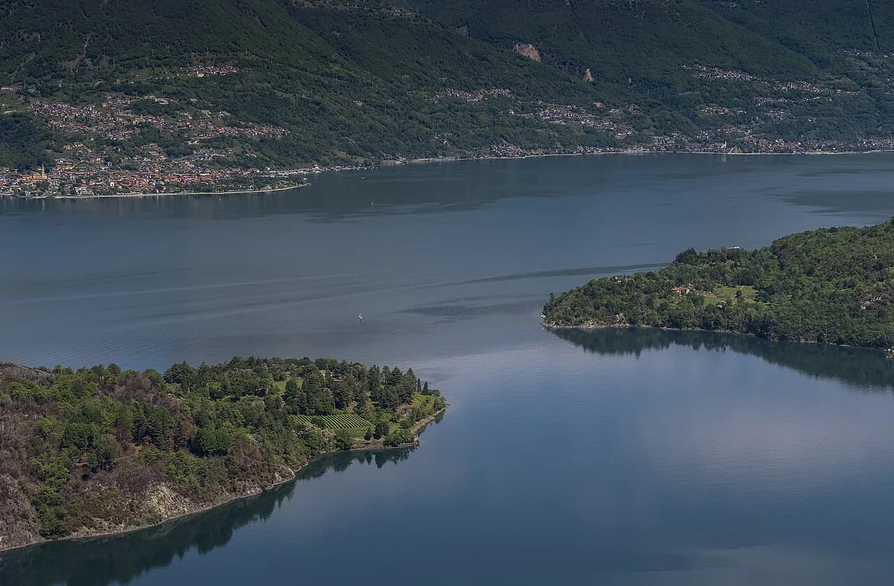
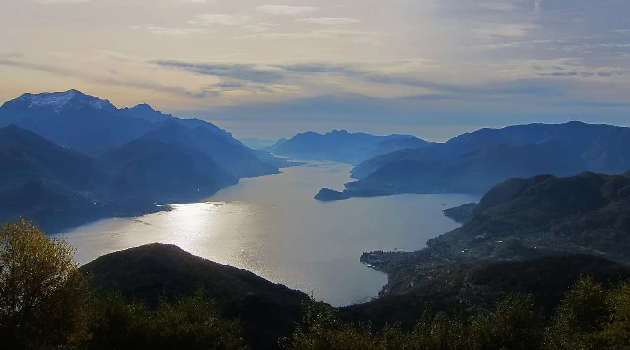
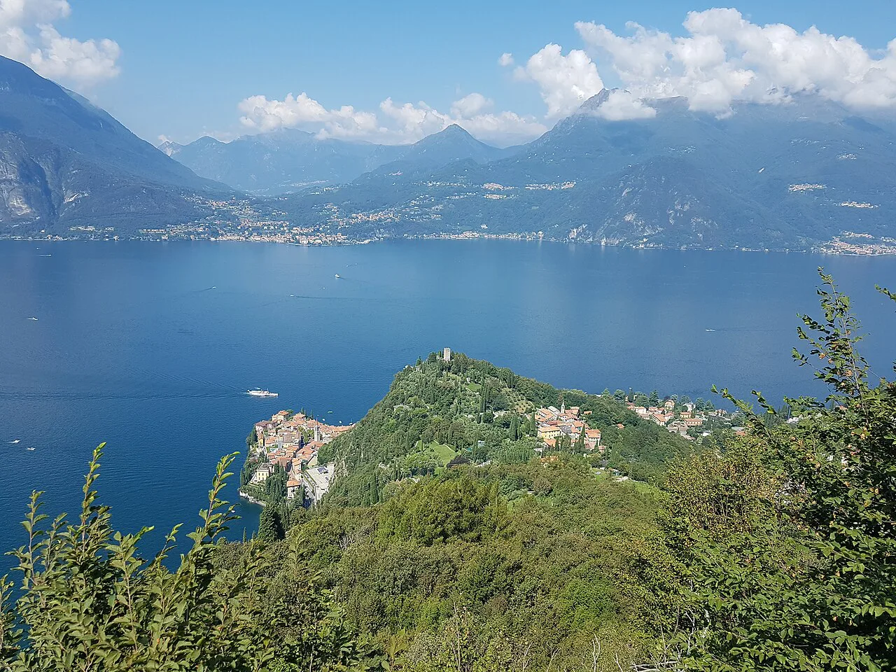
Monte Grona belongs to the Lugano Prealps and, together with Monte Bregagno, marks the group's eastern edge above the lake. The mountain stands on the north-western part of Lake Como, and from the summit the panorama sweeps across Lake Como, Lake Lugano and Lago di Piano, with the Grigne and the Alps beyond. Because the summit sits directly above Menaggio and Breglia, the whole climb stays inside the Lake Como basin — no transfer to another range.
For orientation, treat Menaggio as the town at the foot of the mountain, Breglia as the last village on the access road, and Monti di Breglia as the alp where the paved surface ends and the walking starts.
Trailhead and parking at Monti di Breglia
From Menaggio, follow the Val Solda road toward Porlezza for about 1 km, then turn right for Plesio and continue through Breglia. Just before the church, a signed narrow paved road climbs left for roughly 3 km to the houses of Monti di Breglia; the road continues bumpy and unpaved to a hairpin bend where the car park sits at 1046 m (3,432 ft). Drive it expecting a single-track final stretch and little room to turn around.
Parking at that top car park is ticketed: buy a €3 ticket from the automatic machine at the road entrance. The machine takes payment at the entrance rather than at the car park itself, so stop on the way up instead of discovering it after the walk.
If you are coming by public transport, plan around Menaggio rather than the trailhead: no bus timetable for services up to Breglia or Monti di Breglia appears here, so check current services with the local bus operator before you set a departure time.
Distance, ascent and time
The classic route from Breglia to the summit and back is 9.0 km (5.6 mi) with about 1,000 m (3,280 ft) of climbing, and it is graded strenuous: figure 5 to 7 hours for the round trip. The ascent to Rifugio Menaggio alone takes about 50 minutes from the top car park, which gives you a useful early checkpoint on your pace.
The longer ridge day that combines Monte Grona with Monte Bregagno is a different proposition: 13 km (8 mi) with 1,120 m (3,674 ft) of ascent and around 6 hours of walking, measured from the same road-head. Choose it only if the shorter summit day leaves you with legs and daylight to spare.
Route description: birch woods to the fork
From the car park at Monti di Breglia the trail climbs in switchbacks through birch woods and among ferns, already opening views over Lake Como. After about 30 minutes you reach a fork at roughly 1120 m (3,675 ft), near a fenced reforestation area: keep left for Rifugio Menaggio and Monte Grona, or right for Sant'Amate and Bregagno.
Rifugio Menaggio, La Forcoletta and the summit cross
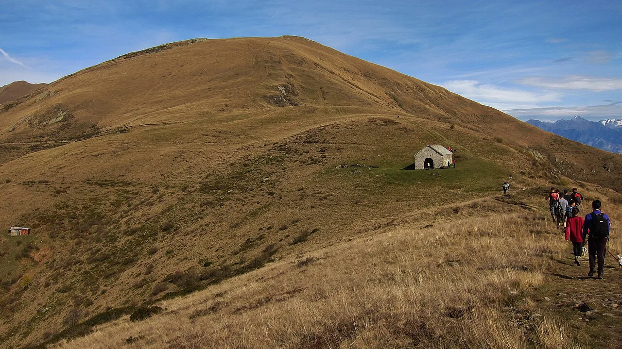
The left branch brings you to Rifugio Menaggio at 1383 m (4,537 ft) after about 50 minutes, a panoramic balcony over the lake and the natural place to break, fill water and decide on your summit line. Above the hut the path continues to La Forcoletta, and from there the Via Normale climbs the remaining stretch to the summit cross of Monte Grona at 1736 m — about an hour from the hut.
Rifugio Menaggio is owned by CAI Menaggio and was the base used when the equipped route on the mountain was built and later rebuilt, which is why the hut and the via ferrata start sit in the same place on the map. The ridge above the hut is rocky, with small pinnacles reminiscent of the Grignetta, so the ground is rougher than the wooded approach suggests.
Via Normale or Via Direttissima: which summit line suits you
Two lines reach the top. The Via Normale runs about a kilometre by La Forcoletta and is the standard walking route. The Via Direttissima climbs the exposed south face directly to the summit; it is steep from the first step, passes Pizzo Coppa with wide views over Lake Como and Lake Lugano, and is not recommended in winter snow.
The Direttissima trade-off is views for nerves: the path is exposed on an east-sloping section and the descent demands as much concentration as the climb, with a short cabled passage near the top. If scrambling on fixed cables without a harness is not your idea of a good day, take the Via Normale up and down and leave the south face to equipped parties.
La Ferrata del Centenario and the equipped ground
The equipped route, La Ferrata del Centenario, was commissioned by CAO Como for its centenary and built with CAI Menaggio; it was restructured in 2001 and further repaired in later years, with cables, anchors and a chain along its length. It branches off near the base of the Denti di Grona, the limestone towers forming the south-east spur, and splits into a Normal line and a Direttissima line.
The ferrata is a separate objective from the hike: hikers without a ferrata kit turn around or descend where the equipped climbing starts, while ferrata parties continue on cable and ladder ground to the 1736 m summit. The opening section is immediately vertical before easing onto slabs higher up, so a complete kit — harness, helmet and lanyard — and prior practice on equipped ground are the baseline.
Descent options from the top are the Via Normale turning north-east or the Direttissima via the south gully, the latter steeper and more exposed. If you climbed the ferrata, reversing the Normal line on foot keeps the exposure manageable on tired legs.
Adding Sant'Amate and Monte Bregagno
From the Grona summit, a slight descent and a level walk of about 30 minutes brings you to Sant'Amate at 1623 m (5,325 ft), a small chapel on the grassy Sella di Sant'Amate with Lake Como to the east and Val Sanagra and Lake Lugano to the west. From the saddle the route climbs the meadows of the Costone del Bregagno, reaching Monte Bregagnino at 1904 m (6,247 ft) in about 40 minutes.
A further 40 minutes along the now nearly flat Costone leads to the grassy final slope and the broad summit of Monte Bregagno at 2107 m (6,913 ft). For the return, retrace the ridge to Sant'Amate in about 1 hour 15 minutes, then descend panoramically to Monti di Breglia in roughly 45 minutes — that descent, not the climb, is where the 13 km day adds up.
Views from the summit
On a clear day the top delivers Lake Como in almost its entirety, with Legnone straight ahead, the Grigne and a distant Resegone, Valtellina and the Rhaetian Alps to the north, the Piedmontese Pre-Alps, Lake Lugano and even the Apennines far to the south. Haze often hides the longest distances, so an early start buys you the sharpest air of the day.
When to go
Late spring through early autumn is the natural window: the upper slopes are snow-free, the birch woods give shade on the lower switchbacks, and the ridge to Bregagno is walkable on grass. Summer heat is the real constraint rather than the angle of the path — the exposed south face can be punishing in high temperatures, so start early and carry more water than the distance suggests.
Snow lingers on the upper ground early and late in the season, and the Direttissima is not recommended in winter snow; if you go outside high summer, ask at Rifugio Menaggio what the summit ground is like before committing. Afternoon storms build quickly on a summit this exposed, so plan to be off the cross by early afternoon.
What to carry
Take hiking or trail shoes with grip, warm layers and a waterproof shell for sudden weather changes, sun cream and sunglasses for the exposed sections, and a small emergency kit. Trekking poles help on the steep descent, and light crampons are worth packing if you expect ice or snow on the upper slopes.
Where to base yourself
Menaggio suits anyone relying on lake boats or buses, with the access road to Breglia branching just outside town, and Breglia shortens the drive to the trailhead and puts you on the path sooner. Staying in either village also leaves room for an easier day on the water when the summit forecast turns.
For contrast with the granite and grass of Grona, the Monte San Primo hike covers the open ridges of the Larian Triangle on the opposite side of the lake, a gentler half-day when you want views without the exposed finish. If you are weighing up a larger trip in the same vein, hiking in Lake Garda offers comparable lakeside summit days as a point of comparison.
A flat lakeside rest day between summit days
After the steep ground of Grona, the Greenway del Lago di Como makes a low-level contrast along the western shore, linking lakeside villages on old mule tracks and paved lanes rather than climbing above the water. It pairs well with a Grona summit day because it uses different muscles and stays open when afternoon cloud sits on the peaks.
Plan Your Monte Grona Day
Build the day around the Monti di Breglia car park: buy the parking ticket at the entrance machine, walk the birch switchbacks to the 1120 m fork, and use Rifugio Menaggio as your decision point. From there the Via Normale is a straightforward summit walk, the Direttissima trades security for exposure and views, and the ferrata is a separate equipped climb for parties with kit.
Allow 5 to 7 hours for the Breglia summit circuit, and only commit to the Sant'Amate and Monte Bregagno extension if you have the 13 km day and 6 hours of walking in you. Start early in summer, carry water for the exposed upper section, and confirm hut opening and bus times with Rifugio Menaggio and the local operator before you travel.
Frequently Asked Questions
How long does the Monte Grona hike take?
The classic route from Breglia to the summit and back is 9.0 km with roughly 1,000 m of climbing and takes 5 to 7 hours at a steady pace. Reaching Rifugio Menaggio takes about 50 minutes from the top car park, and the summit is roughly an hour above the hut by the Via Normale.
Is the Monte Grona hike difficult?
It is graded strenuous. The wooded approach is moderate, but the summit section is steep and rocky, and the Via Direttissima climbs an exposed south face with a short cabled passage near the top. Hikers who dislike exposure should use the Via Normale in both directions.
Where do you start the Monte Grona hike?
Most hikers start at the car park at Monti di Breglia, 1046 m, at the end of the narrow road above Breglia. From Menaggio, drive toward Porlezza, turn right for Plesio, pass through Breglia and follow the signed lane to the hairpin car park.
Can you hike Monte Grona without via ferrata gear?
Yes. The Via Normale reaches the summit on foot by La Forcoletta without equipped climbing. La Ferrata del Centenario is a separate equipped route on the south-east spur and needs a harness, helmet and lanyard, plus practice on cable ground.
Is there a hut on the Monte Grona hike?
Rifugio Menaggio sits at 1383 m on the left branch of the trail, about 50 minutes above the top car park, and serves as the natural break before the summit. Ask the hut directly about opening periods and service before you plan a stop.
When is the best time to hike Monte Grona?
Late spring through early autumn gives snow-free upper slopes and walkable ridge grass. Summer heat on the exposed south face is the main comfort issue, so start early, and avoid the Direttissima when snow remains on the upper ground.
Sources
Trail notes for your next trip
Optional updates when we add or revise hiking guides.
You might also like
Continue reading
More guides you'll find useful