Hiking in Sardinia: Best Coastal and Mountain Trails by Area
Plan hiking in Sardinia by area: coastal trails from Cagliari to Baunei, the Gorropu canyon and Is Cannoneris forest, with distances, elevation and season.
On this page
Sardinia gives you three hiking landscapes within a few hours' drive: granite cliffs dropping into turquoise water in the south, a limestone gorge in the center-east, and old oak forest in the southwest hills. Most routes are day hikes from a base village, and several finish at a beach where you can swim before walking back. That combination makes the island unusually easy to plan around a single week.
The routes below are grouped so you can pick a base and never drive more than an hour to a trailhead. Coastal traverses that end somewhere else are flagged where they need two cars or a booked transfer, because that choice shapes your whole day. Distances, ascents and walking times come from published route descriptions, and where a figure isn't given, the layout and trade-offs are described instead.
Why Sardinia suits hikers
The island's appeal is range rather than altitude. You can walk a two-hour clifftop path above Cagliari in the morning and be in a shaded oak reserve the next day, without any alpine equipment or altitude acclimatization. Terrain is mostly rocky paths and macchia scrub, so the challenge comes from heat, exposure and narrow ground rather than from height gained.
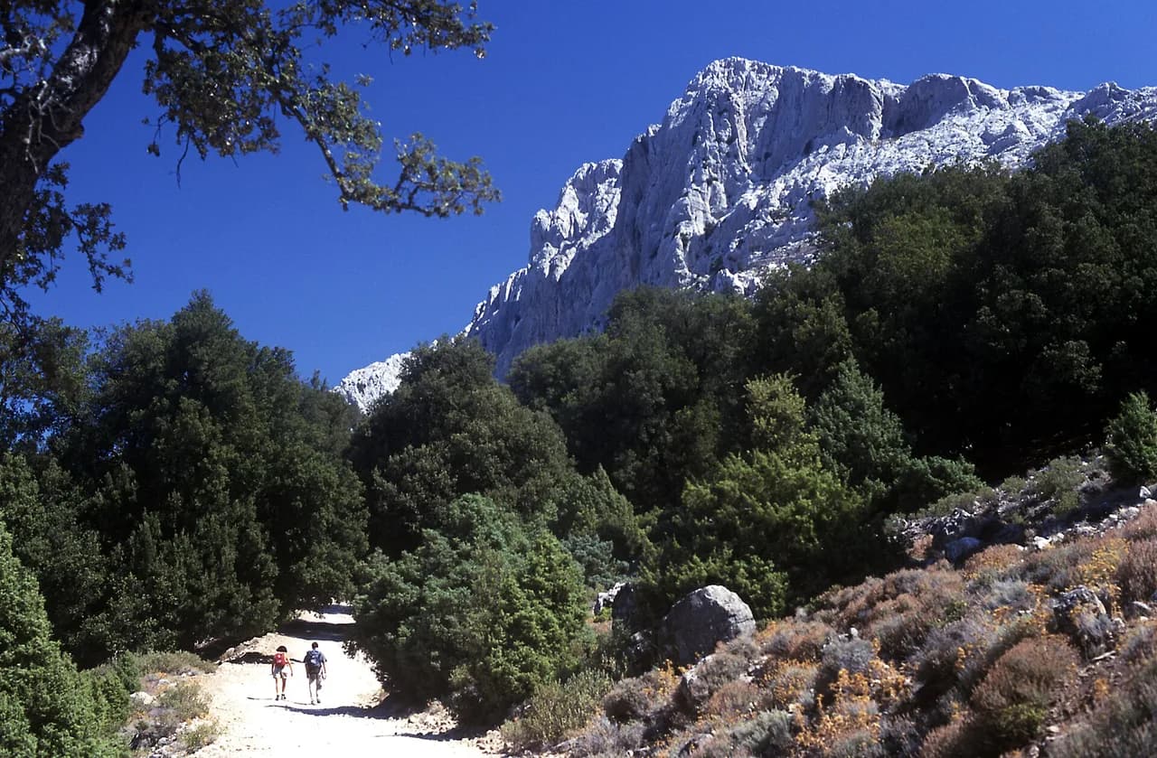
The best-known coastal routes run along the Golfo di Orosei in the east, where the limestone walls of the Supramonte of Baunei drop straight to the sea. That same geology produces Gorropu Canyon inland, a gorge framed by walls around 500 metres (1,640 feet) high. Forest routes in the southwest give you a cooler alternative when coastal paths feel too hot.
When to go: spring and autumn versus summer heat
Spring and autumn are the strong seasons. Operators running multi-day coastal walks list start dates from March through October and recommend March to June and September to October, with wildflowers in spring and milder temperatures plus quieter beaches in autumn. July and August are described as too hot for comfortable hiking, and one operator rules out August departures altogether for that reason. If you're weighing islands, the same season logic shapes hiking in lake garda, where summer heat also pushes walkers to spring and autumn, and the Malta hiking guide sets out the same spring-and-autumn pattern for Mediterranean coastal trails.
On the trail, the pattern is simple: start early, carry more water than you think you need, and treat exposed clifftop sections as morning work. Several routes on this list have no fountains or kiosks along the way, so you carry everything and plan a refill at the trailhead café or parking lot before setting off. Winter and early spring suit the inland waterfall and forest walks better than high summer.
Hiking in the south: Sella del Diavolo from Cagliari
Sella del Diavolo is the easiest big-view hike on the island and the only one here you can do without a car. The trailhead sits behind Calamosca Beach at the back of the Calamosca hotel, reachable on Cagliari city bus line 11 from the center. The route is well marked on mostly rocky ground and takes around two hours out and back with little elevation gain.
From the top you look over the Gulf of Cagliari and Poetto Beach, with a watchtower and a small necropolis on the summit area. There are no fountains on the route, so bring a hat and water, and avoid the hottest midday hours in summer. An alternative start near the Marina Piccola parking lot climbs to the Poetto tower on a slightly harder line.
The Roman Road to Su Cordolinu from Pinus Village
This out-and-back follows an old Roman road along the coast from Pinus Village, about an hour's drive from Cagliari, to the Su Cordolinu island. It is well marked, wide enough that you'll meet cyclists, and takes nearly four hours round trip. There are no kiosks along it, and Su Cordolinu is a good picnic stop with a pine wood behind it for shade.
If you want more, continue a short way toward Chia Beach and its Aragonese watchtower. The route works as a straightforward independent walk, and guided half-day versions include transport to the trailhead for hikers without a car.
Cala Cipolla to Tuerredda along the Capo Spartivento coast
This well-marked coastal walk covers 14 kilometres (8.7 miles) one way from Cala Cipolla, past Chia Su Giudeu beach, to Tuerredda, and takes around four hours. Along the way you pass Capo Spartivento lighthouse, now a boutique hotel, and quiet coves including Pedra Longa and Cala Antoniareddu, the latter hard to reach by car.
Grade it easy to moderate, with the caveat that add-ons such as the climb to the observatory change the day. Because it is point to point, the practical plan is two cars, one parked near the observatory off the SS195 road and one at the far end, or a round trip that roughly doubles the distance. Wear hiking shoes and carry water and food.
Masua to Cala Domestica: the exposed cliff traverse
This is the most demanding coastal route in the south: a 12-kilometre (7.5-mile) point-to-point traverse from Masua Pan di Zucchero beach, near the Porto Flavia mine site, to Cala Domestica, taking at least four hours. The path narrows to about 50 centimetres (under 30 inches) in places and runs along cliffs through thick scrub, so it is a poor choice if you suffer from vertigo.
There are no facilities on the route, so carry all your water and food, wear sturdy boots and expect to push through branches. At the far end, a Spanish watchtower above Cala Domestica gives a wide view back along the coast. Hikers without experience on exposed ground should join a guided group, and the local cooperative based in Nebida runs them.
Sentiero dei Cinque Faraglioni from Nebida to Masua
This 8.6-kilometre (5.3-mile) route with about 448 metres (1,470 feet) of ascent starts at Nebida, where you drop by steps from the parking lot to the Laveria Lamarmora mining works and then walk on toward Masua. It sits at moderate grade with a few steep downhill sections, and the reward is close views of the five sea stacks, Pan di Zucchero the most famous among them.
The hike ends at Masua beach, which is swimmable in season, so pack a towel and swimsuit. Ground is slippery in places and deserves proper hiking shoes. Two cars make the logistics simple, because walking back to Nebida turns it into a very long day.
Is Cannoneris: the shaded oak-forest circuit
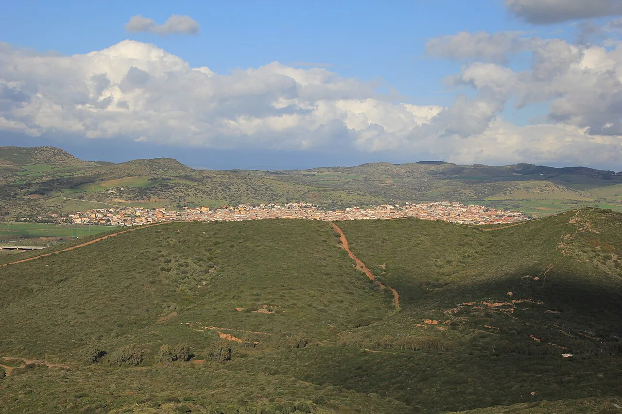
For a cool day inland, Is Cannoneris is an easy circular trail of about four hours through ancient oak forest on the eastern edge of Sulcis, with a high point at 979 metres (3,212 feet). The trailhead is near Domus de Maria, roughly 1.5 hours' drive from Cagliari on the SS195, past the village and beyond a small barracks to a parking lot and picnic area.
Waymarking is red and white and sometimes painted on rocks, and heavy shade makes it a family option even on warmer days. Expect goats and deer. Guided walks of the reserve run from nearby Chia for anyone who wants transport and interpretation.
Sa Spendula waterfall and Monte Margiani from Villacidro
This out-and-back from the Campanas de Sisinni Conti parking lot near Villacidro, about 45 minutes from Cagliari, leads to the Sa Spendula waterfall and its natural pool. The first half is easy; the second climbs steadily to the summit of Monte Margiani at 900 metres (about 2,953 feet), so allow around two hours in total.
Shade is plentiful, but water in the stream is scarce in the hot months, which makes winter and early spring the sensible window. Bring your own water and a snack, and wear shoes with grip for the upper section.
Sa Perda Stampada from Coccorrocci
On the central east coast, a circular route of roughly 12.5 kilometres (7.8 miles) starts by the Coccorrocci campsite near Marina di Gairo, south of Tertenia. Allow between 4.5 and 5.5 hours. It is a challenging walk with a few steep ascents and descents that are hard on the knees, and you can travel the loop in either direction.
The draw is the Perda Stampada itself, a massive rock with a window-like hole standing at 200 metres (656 feet) above the sea, with Coccorrocci beach below. Near the campsite, the Is Piscineddas natural pools and picnic tables make a good finish. Public transport is thin here, so plan on your own car.
Gorropu Canyon: two approaches
Sardinia's standout gorge has two main walking approaches. From the Genna 'e Silana pass car park, an out-and-back of about 8 kilometres (5 miles) drops into the canyon in roughly two hours, but the climb back out takes about four and is steep and genuinely hard. From Sa Barva bridge, about 15 kilometres (9.3 miles) outside Dorgali, a 14-kilometre (8.7 miles) out-and-back follows the Rio Flumineddu to the gorge mouth in around five hours.
A small admission fee applies to enter the canyon, so carry small change. The Rifugio Gorroppu parking area is the only place to buy water or food, and the gorge draws crowds at weekends and on public holidays. It is busy enough to justify an early start, and guided hikes run from both Dorgali and Orosei.
Cala Goloritze from Su Porteddu
The Cala Goloritze hike is 8 kilometres (about 5 miles) out and back with roughly 500 metres (1,640 feet) of ascent, starting from the Su Porteddu parking lot on the Golgo Plateau above Baunei. The descent through forest to the beach takes about 1 hour 15 minutes to 1.5 hours; the return climbs steeply and takes 1.5 to 2 hours. Down is easy, up is the workout.
There are no vendors on the beach, so carry all food and water; a café at Su Porteddu sells bottles and sandwiches before you set off. The path is easy to follow and needs no guide. An early descent lets you spend the day swimming at a beach you can only reach on foot.
Punta Salinas loop above Cala Goloritze
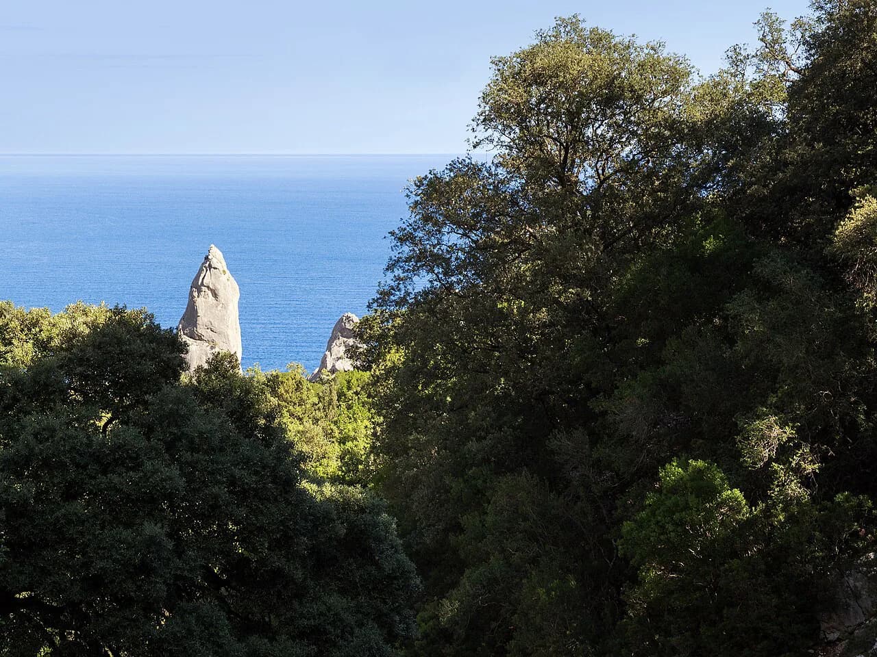
The Punta Salinas circuit gives a bird's-eye view of Cala Goloritze and its pinnacle. It starts from the same Su Porteddu lot and shares the first stretch with the beach trail before branching off. The loop is about 9 kilometres (5.6 miles) and takes around five hours, though stops for views easily push it past seven.
This trail is not marked, and although most of it is self-evident, a few junctions are easy to misread. For that reason it is a route for confident navigators or for a guided day arranged locally in Baunei. The terrain is tricky underfoot, so good hiking shoes and a full supply of water and food are essential.
Cala Mariolu and the Golgo Plateau trailheads
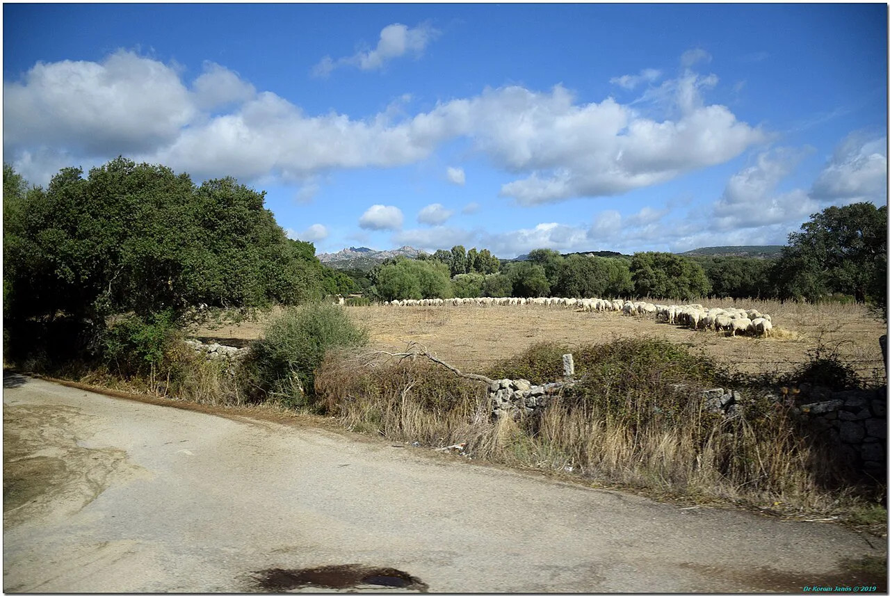
The Golgo Plateau parking lot is a hub for several of the region's best beach descents, Cala Mariolu among them, alongside Cala Sisine and the Goloritze path. From one lot you can pick a route by length and steepness without moving the car. These descents into the Gulf of Orosei are steep on the way back up, and the heat on exposed sections is the main limiting factor.
For the full coastal traverse of this coastline, the multi-day Selvaggio Blu route is a step up in commitment, with scrambling, route-finding and sustained exposure above the sea. Treat it as a separate objective from a day descent and prepare accordingly, because it demands more than a normal coastal path.
A multi-day coastal route on the southwest coast
A bookable self-guided package links Buggerru to Sant'Antioco over eight days along the southwest coast, with daily distances from 8 to 16.5 kilometres and luggage moved between locally run accommodations. The stages go from Buggerru to Portixeddu (13 kilometres, 610 metres of ascent), Ingurtosu to Scivu through the Piscinas dunes (14.5 kilometres), a loop from Capo Pecora (15 kilometres), Acqua Sa Canna to Portoscuso (8 kilometres), a Carloforte walk on San Pietro (16.5 kilometres) and a final day from Capo Sperone to Sant'Antioco via Torre Cannai and Maladroxia beach (12 kilometres).
Several days include passenger transfers, and naturetravellab.com lists self-guided navigation with route notes, maps and a navigation app plus phone support, so you walk at your own pace carrying only a daypack. It suits hikers with basic fitness who want quiet coast rather than resort paths. From Cagliari, you reach the start by train to Iglesias and a bus to Buggerru, and you return from Sant'Antioco by bus to Carbonia and train onward.
Bases for each group of hikes
Match your base to the group you want. Cagliari covers Sella del Diavolo, the Roman road, Cala Cipolla to Tuerredda and the drive to Is Cannoneris and Sa Spendula. Baunei and Santa Maria Navarrese, or Tortoli nearby, put you closest to the Su Porteddu lot and the Golgo Plateau descents. Dorgali and Orosei serve Gorropu Canyon, and Buggerru or Iglesias anchor the southwest coastline.
Transport is the deciding factor. Without a car you are limited to Sella del Diavolo on city bus line 11 and to guided or package options that include transfers. With a car, the point-to-point coastal routes need two vehicles unless you retrace your steps.
Footwear, water and exposed terrain
Every route here rewards real hiking shoes: rocky paths, narrow cliff traverses and slippery mining terrain feature throughout, and sandals or running shoes leave you exposed on descents. The Masua to Cala Domestica path squeezes to about 50 centimetres wide with cliff edges, so it is off-limits if vertigo is an issue. Summer heat is the other hazard, and exposed clifftop sections get no shade.
Water is the planning constraint. Sella del Diavolo, the Roman road, Cala Goloritze, Masua to Cala Domestica and the Sa Perda Stampada loop have no drinking water along the way, so carry enough for the full outing and refill before the trailhead. In the hot months, start at first light and be back at the car by early afternoon.
Where to stay and how to link hikes into a week
A practical split is two or three nights in Cagliari for the southern coastal and forest walks, two nights around Baunei or Santa Maria Navarrese for Cala Goloritze, Punta Salinas and the Golgo Plateau, and two nights near Dorgali or Orosei for Gorropu Canyon. That covers most of the island's signature routes without long daily drives, and you can add a southwest base if you plan the Buggerru to Sant'Antioco package.
Leave a buffer day. Coastal weather and summer heat can push a planned clifftop traverse into the following morning, and inland forest walks work as a fallback when the coast feels too exposed. This kind of flexible structure is also what most walking holidays build in, which is worth knowing when comparing a self-planned week with a packaged one.
Plan Your Visit
Choose your season first, then your base, then the trail. Spring and autumn give you the best conditions for the exposed coastal routes, while winter and early spring suit the inland waterfall and forest walks. Start early on any route with no water along it and carry everything you need from the trailhead.
If you want a fix on the island's most famous coastal crossing before committing, read up on the Selvaggio Blu, Sardinia route and compare it with the day descents from the Golgo Plateau. Then line up your trailheads, parking logistics and two-car plans before you book accommodation.
Explore more Sardinia hiking guides
Frequently Asked Questions
What is the best month for hiking in Sardinia?
March to June and September to October give the most comfortable conditions, with wildflowers in spring and milder temperatures in autumn. July and August heat makes exposed coastal routes hard work, so hikers often start at first light or choose shaded forest walks instead.
Can you hike in Sardinia without a car?
Yes, but your choices narrow. Sella del Diavolo above Cagliari is reachable on city bus line 11, and some guided hikes and self-guided packages include transfers to and from trailheads. Most other routes on this list need a car or a booked transfer.
How fit do you need to be for hiking in Sardinia?
Most routes are day hikes from easy to moderate, with steep descents and climbs. The Masua to Cala Domestica traverse is the most demanding here, and the climb out of Gorropu Canyon is the hard part of that hike. Hikers with basic fitness can manage a full week.
How long does the Cala Goloritze hike take?
The out-and-back route is about 8 kilometres with roughly 500 metres of ascent. The descent to the beach takes around 1 hour 15 minutes to 1.5 hours, and the return climb takes 1.5 to 2 hours, so a half day with beach time is a realistic plan.
Are there long-distance hikes in Sardinia?
Yes. The Selvaggio Blu is a multi-day coastal traverse with scrambling and sustained exposure, and a self-guided eight-day coastal route runs from Buggerru to Sant'Antioco on the southwest coast. The latter uses daily stages from 8 to 16.5 kilometres with luggage transport included.
What should you carry on a Sardinian coastal hike?
Water for the whole route, since several trails have no fountains or kiosks. Add solid hiking shoes, a hat and sun protection, and food if the route has no café at the end. On point-to-point routes, arrange your second car or transfer in advance.
Sources
Trail notes for your next trip
Optional updates when we add or revise hiking guides.
You might also like
Continue reading
More guides you'll find useful