Hiking in the Pyrenees: Best Trails, Bases and Seasons
Plan a Pyrenees hiking trip around the Gavarnie cirques, Ordesa and the Valle de Tena, with route layout, trailhead access, hut basics and the best months.
On this page
The Pyrenees deliver big mountain scenery without the crowds of the Alps: half-day walks into enormous glacial cirques, full-day canyon routes in Ordesa National Park, and long traverses along the GR11. The range stretches the whole French-Spanish border, so the first decision is which side and which cluster of valleys you want to base yourself in. This guide focuses on the central Pyrenees, pairing hikes with the villages and trailheads that make them practical.
Why the Pyrenees suit hikers
The central Pyrenees offer three distinct hiking experiences within a short drive of each other: the limestone cirques of the French Hautes-Pyrénées, the kilometre-deep canyon country of Ordesa, and the alpine meadows and reservoirs of the Valle de Tena. That variety means you can mix a short family walk in the morning with a serious climb the next day. The range is high enough to hold snow on passes into early summer but low enough to walk in valley floors well before then.
A key advantage is that the French-Spanish border runs along the crest, so many hikes let you cross between countries on foot. The trail networks on both sides are well used, with waymarked routes and mountain refuges, though signage and trail quality vary between the two countries. You can plan a trip that stays on one side or combines both.
How the range divides: French cirques versus Spanish valleys
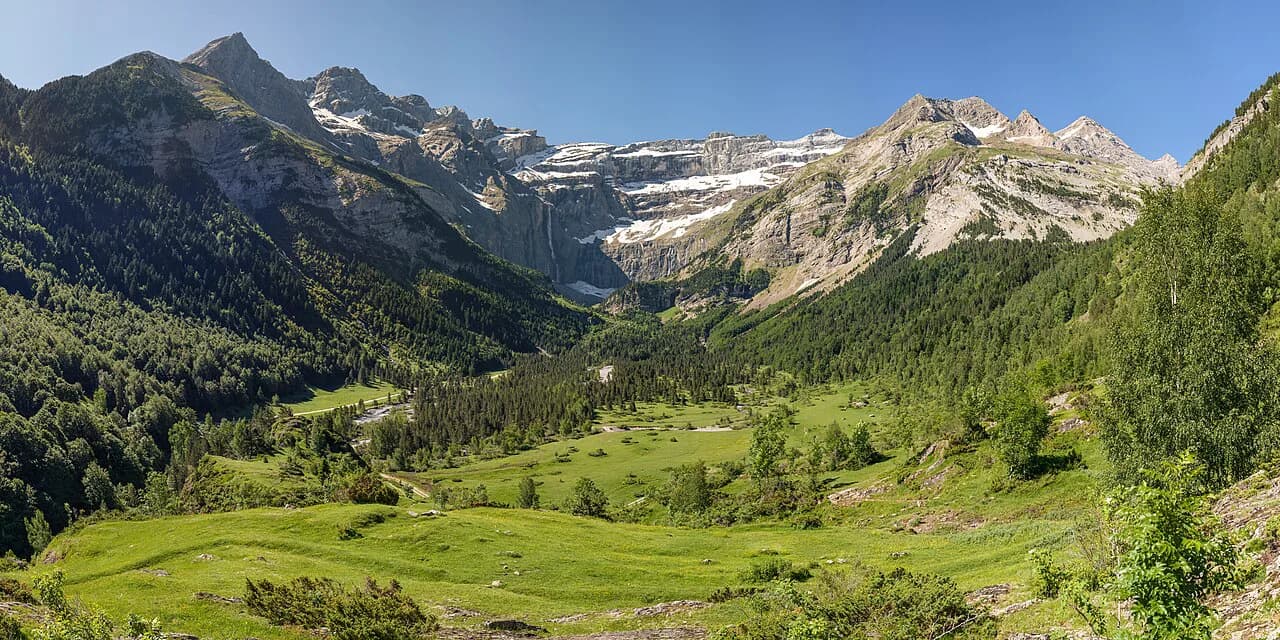
The French Hautes-Pyrénées, around Gavarnie and Gèdre, are defined by three great cirques: Gavarnie, Estaubé and Troumouse. Each is a natural amphitheatre of cliffs and waterfalls, reached by short to moderate walks from roadheads. This is the place for dramatic wall-and-waterfall scenery with relatively easy access, and the base villages sit within a 30-40 minute drive of each other.
On the Spanish side, Ordesa National Park and the Valle de Tena offer longer valley walks and bigger vertical gains. Ordesa is a canyon system with waterfall-fed gorges, while the Tena valley opens into wide meadows beneath peaks like Peña Foratata. These areas suit hikers who want full-day routes and high mountain lakes rather than quick cirque visits.
Best hikes for first-time Pyrenees visitors: Cirque de Gavarnie and Cirque d'Estaubé
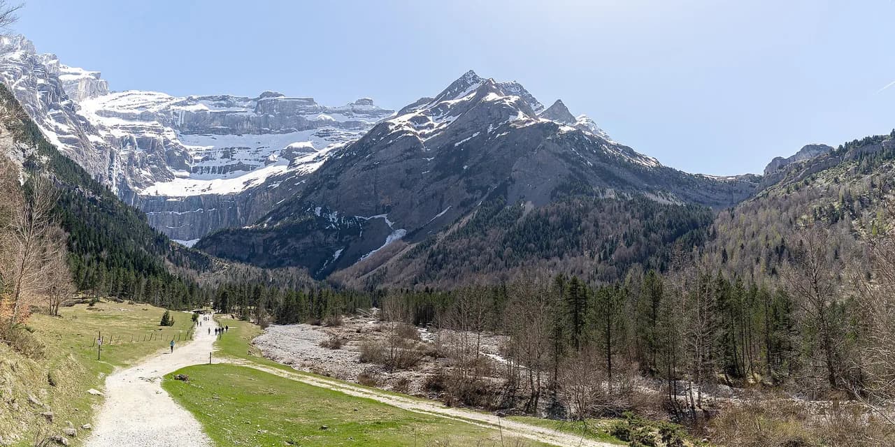
Cirque de Gavarnie is the most famous hike in the French Pyrenees, a walk from the village of Gavarnie up to the base of a massive cliff wall with waterfalls. The route starts on a main track out of the village, with mule trains offering transport for less inclined hikers. It takes about an hour to reach the best viewpoint and another hour to continue to the falls themselves; the path steepens as you approach the base. The cirque is a UNESCO World Heritage Site, and its scale is deceptive, so allow more time than the distance suggests.
Cirque d'Estaubé is the next cirque over from Troumouse and makes an easy half-day walk. You start by crossing the Gloriettes dam, a slender concrete structure holding back a turquoise lake, then climb over a ridge for about an hour before dropping into a deep valley surrounded by steep walls. The trail is straightforward and can be combined with Troumouse in a single day if you start early.
The high cirque day: Cirque de Troumouse and the toll road
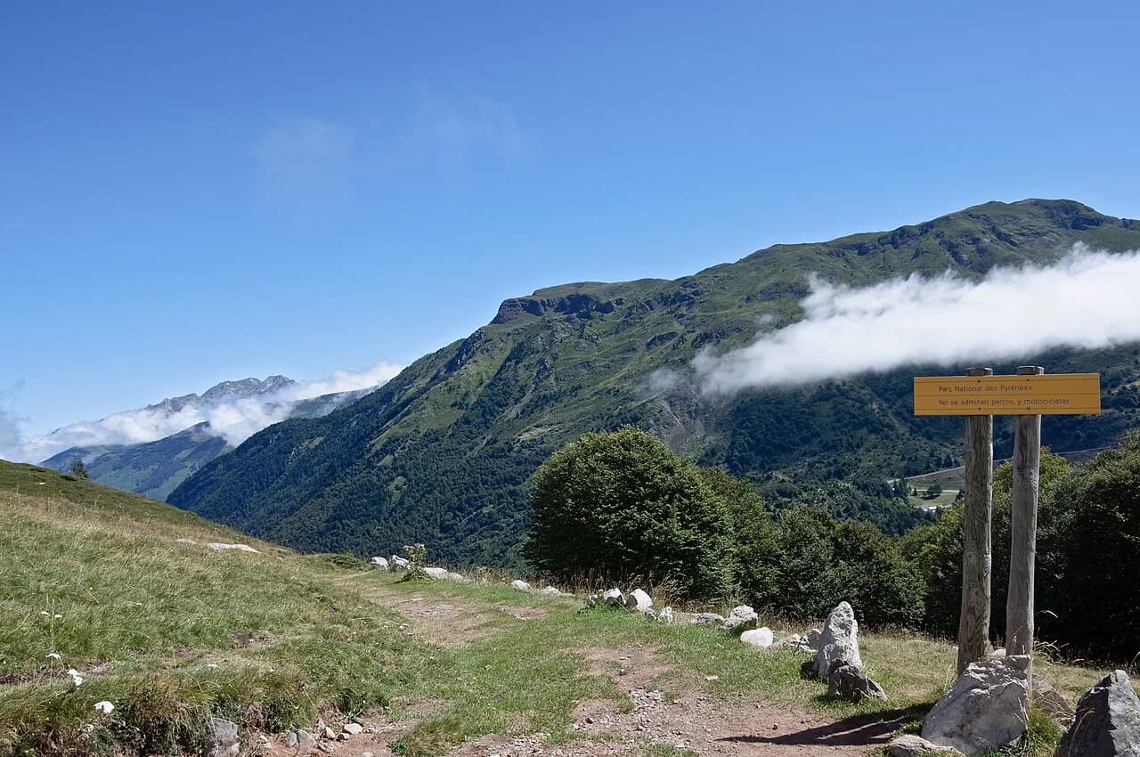
Cirque de Troumouse sits highest of the three cirques and can be reached either by a two-hour hike from below or by a toll road, which costs 10 euros, that climbs to an upper car park. The road saves the climb and puts you within a short walk of the cirque floor, where 180 degrees of peaks surround you. If the upper car park is full, you may have to walk up from the lower parking area. The cirque is a natural sun trap, often clear when the valleys below are clouded in.
Ordesa National Park: canyon and valley walks from Torla
Ordesa National Park protects a deep canyon system where waterfalls drop from high limestone walls. The classic walk follows the valley floor from the park entrance near Torla, passing cascades and viewpoints, and can be extended to reach the cirque at the head of the valley. The park offers a range of routes from easy riverside strolls to steep climbs up to miradors, the cliff-edge viewpoints. The kilometre-deep walls make the scale feel enormous, even on short walks.
Torla is the main base for Ordesa, a stone village with services and access to the park road. From Torla you can walk into the park or drive to trailheads further up the valley. The park has shuttle buses in peak season, but the exact schedule and whether they run should be checked with the park office before you rely on them.
Valle de Tena and Biescas: alpine meadows, reservoirs and Peña Foratata
The Valle de Tena is a wide valley with a string of villages, reservoirs and high peaks. Biescas, at the valley entrance, and Sallent de Gállego, further up, are the main bases. Hikes range from easy walks along the Embalse de Bubal reservoir to climbs beneath Peña Foratata, the pierced peak that dominates the skyline. The valley also has a network of trails that link villages, making it possible to plan point-to-point days.
The GR11, the Spanish long-distance path that traverses the Pyrenees, passes through the Tena valley. You can walk sections of it as day hikes, or use it to link villages. Further east, the GR11 continues through the Benasque area, where Aneto, the highest peak in the Pyrenees, rises above the trails. For a dedicated guide to the full route, see the GR11 (Senda Pirenaica).
Bigger days for fit hikers: the GR11, high passes and summits above Benasque and Sallent de Gállego
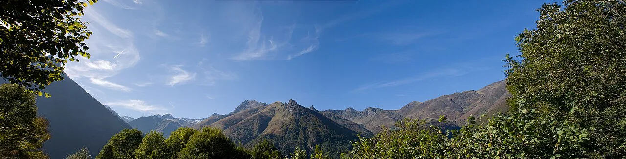
Fit hikers can tackle high passes and summits on both sides of the border. From the Tena valley, routes climb to Ibón de Anayet, a mountain lake beneath the peaks, and beyond to the French border at the Col du Pourtalet. Above Benasque, the trails lead to the highest summits, including Aneto, though glacier travel and scrambling may be required. These routes demand early starts and careful weather assessment.
The GR11 stages between the Tena valley and Benasque include some of the most remote and dramatic sections of the range. Walking these as day trips requires arranging transport or using a guide, as the trail often stays high and away from roads. A local operator such as Hike Pyrenees can arrange luggage transfer and accommodation for multi-day walks.
Via ferrata, scrambling and exposure: where the walking turns serious
The Pyrenees have several via ferrata routes, mainly on the Spanish side, where limestone walls have been equipped with cables and ladders. These routes are graded by difficulty, and you need a via ferrata kit and helmet. Guides are advisable if you are new to the sport, as the exposure can be significant. The via ferrata are mostly near the main valleys, but they are not as numerous as in the Alps.
Scrambling sections on high routes, particularly on the summits around Benasque and the passes along the GR11, require sure footing and a head for heights. Snow can linger on north-facing slopes into June, and afternoon storms build quickly in summer. If you are unsure of conditions, ask at a local refuge or guide office before setting out.
Trailheads, buses, lifts and toll roads: getting to the start of each hike
Most trailheads in the central Pyrenees are reached by road, and a car gives the most flexibility. Public transport is limited: bus services connect the main towns, but schedules are sparse and should be checked with the regional operators. For the cirques, Gavarnie and Gèdre have parking areas, and the Troumouse toll road climbs to the upper car park. In Ordesa, a shuttle bus may operate from Torla in peak season, and the park office publishes details.
On the Spanish side, the Valle de Tena is served by roads from Biescas and Sabiñánigo, with buses from Zaragoza and Huesca. The Canfranc-Estación area has a railway station, and the old station building is now a hotel, but service is limited. For guided trips, operators often provide transfers from Zaragoza or Barcelona.
Base villages compared: Gavarnie, Gèdre, Torla, Biescas and Sallent de Gállego
Gavarnie sits at the foot of its cirque and has the most tourist infrastructure, with hotels and restaurants, but it can be busy in summer. Gèdre is quieter, with limited services, and is a good base for the other cirques if you have a car. The village of Gèdre has a hotel, the Hotel Brèche de Roland, which offers comfortable rooms and a restaurant. Between the two, Gavarnie is the more convenient for the classic hike.
In Spain, Torla is the gateway to Ordesa, a small village with guesthouses and a park information point. Biescas is a larger town at the mouth of the Tena valley, with more services and access to the reservoir walks. Sallent de Gállego, further up the valley, is a stone-built village with a Gothic church and good access to the higher trails. Choose Torla for Ordesa, Biescas for easy valley walks, and Sallent for high mountain routes.
Huts, refuges and luggage transfer on multi-day routes
Mountain refuges (refugios) are spaced along the GR11 and other long-distance routes, offering basic dormitory accommodation and meals. They are run by the Spanish and French alpine clubs and by private operators. Booking ahead is essential in summer, especially on popular stages. The refuges are not hotel-standard, and you should carry a sleeping bag liner and cash.
For multi-day walks without a pack, some operators offer luggage transfer between hotels or villages. This allows you to walk with a daypack and sleep in comfort. Hike Pyrenees runs self-guided itineraries with luggage transfer on their Village to Village route in the Tena valley and other areas. These services are typically booked as part of a package.
When to go: snow on the passes, summer storms and the June-to-September window
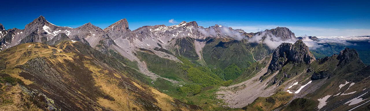
The main hiking season runs from June to September, when the high passes are usually free of snow. Early summer can still have snow patches on north-facing slopes, and late September may see fresh snow. Afternoon thunderstorms are common in summer, so start early and plan to be off exposed ridges by mid-afternoon. The cirques are often clear when valleys are cloudy, so don't be put off by morning mist.
What a guided or self-guided Pyrenees trip includes and who it suits
Guided trips typically include accommodation, most meals, transport during the trip, and the services of a guide. Hike Pyrenees offers both guided and self-guided walking holidays in the Spanish and French Pyrenees, with options for different fitness levels. Their self-guided trips provide route notes and GPX files, while guided trips offer flexibility with two walks each day on some itineraries. These trips suit hikers who prefer logistics handled and want local expertise.
Self-guided trips are ideal if you are comfortable navigating with a map and want to walk at your own pace. They often include luggage transfer and pre-booked accommodation. Guided trips can be better for solo travelers or those new to mountain hiking, as they provide security and company. The right choice depends on your experience and how much planning you want to do.
Mountain hazards and the sensible response
The main hazards are weather, exposure and steep ground. Afternoon storms can bring lightning and hail, so check the forecast and turn back if clouds build. Snow can persist on passes into July, requiring an ice axe and crampons on some routes. On exposed sections, watch for loose rock and use your hands where necessary. Carrying a map and compass, and knowing how to use them, is essential.
Where to go next: Catalan Pyrenees and Picos de Europa as neighboring options
If you want to extend your trip, the Catalan Pyrenees to the east offer a different character, with high peaks and Romanesque churches. The Carros de Foc, a circuit of refuges in Aigüestortes i Estany de Sant Maurici National Park, is a classic multi-day route. Further west, the Picos de Europa is a separate limestone range with dramatic gorges, just outside the Pyrenees. If you'd rather trade granite walls for limestone calanques plunging into the sea, calanques hiking offers another Mediterranean mountain option. For a wider choice of big mountain terrain across the country, this hiking in Europe guide covers routes from the Pyrenees outward.
For a coast-to-coast traverse of the French Pyrenees, the GR10 runs from the Atlantic to the Mediterranean. It is a long-distance route that takes about a month to complete, but you can walk sections. To plan a full traverse, see the GR10: Hiking the French Pyrenees from Hendaye to Banyuls-sur-Mer.
Plan Your Visit
Start by choosing your base: Gavarnie or Gèdre for the cirques, Torla for Ordesa, or Biescas and Sallent de Gállego for the Tena valley. Then match your hikes to your fitness and the season, and book accommodation and any luggage transfer well ahead. The Pyrenees reward those who plan for mountain weather and embrace the range's quieter trails.
Explore more Pyrenees hiking guides
Frequently Asked Questions
What is the most beautiful hike in the Pyrenees?
The Cirque de Gavarnie is often considered the most spectacular, with its massive cliff wall and waterfalls. The Ordesa valley and the Cirque de Troumouse are also stunning.
Is Pyrenees hiking beginner friendly?
Yes, many valley and cirque walks are suitable for beginners, such as Cirque d'Estaubé and the lower Ordesa valley. High passes and summits require more experience.
What is the best time of year to visit the Pyrenees for hiking?
June to September is the main season when high passes are clear of snow. July and August are busiest, while June and September offer fewer crowds.
How many days do you need to hike the Pyrenees?
A week allows you to explore one or two areas and do several day hikes. Two weeks lets you combine the French cirques with the Spanish valleys or attempt a multi-day trek.
Do you need a car to hike in the Pyrenees?
A car is helpful for reaching remote trailheads, but some areas like Ordesa have shuttle buses. Guided trips often include transport.
Can you hike hut to hut in the Pyrenees?
Yes, the GR11 and GR10 pass many mountain refuges where you can stay overnight. Booking ahead is recommended in summer.
Sources
Trail notes for your next trip
Optional updates when we add or revise hiking guides.
You might also like
Continue reading
More guides you'll find useful