Calanques Hiking: Best Trails, Distances and When to Go
Plan Calanques hiking with classic day trails from Cassis and Marseille, real distances, ascent and walking time, plus the best months and water rules.
On this page
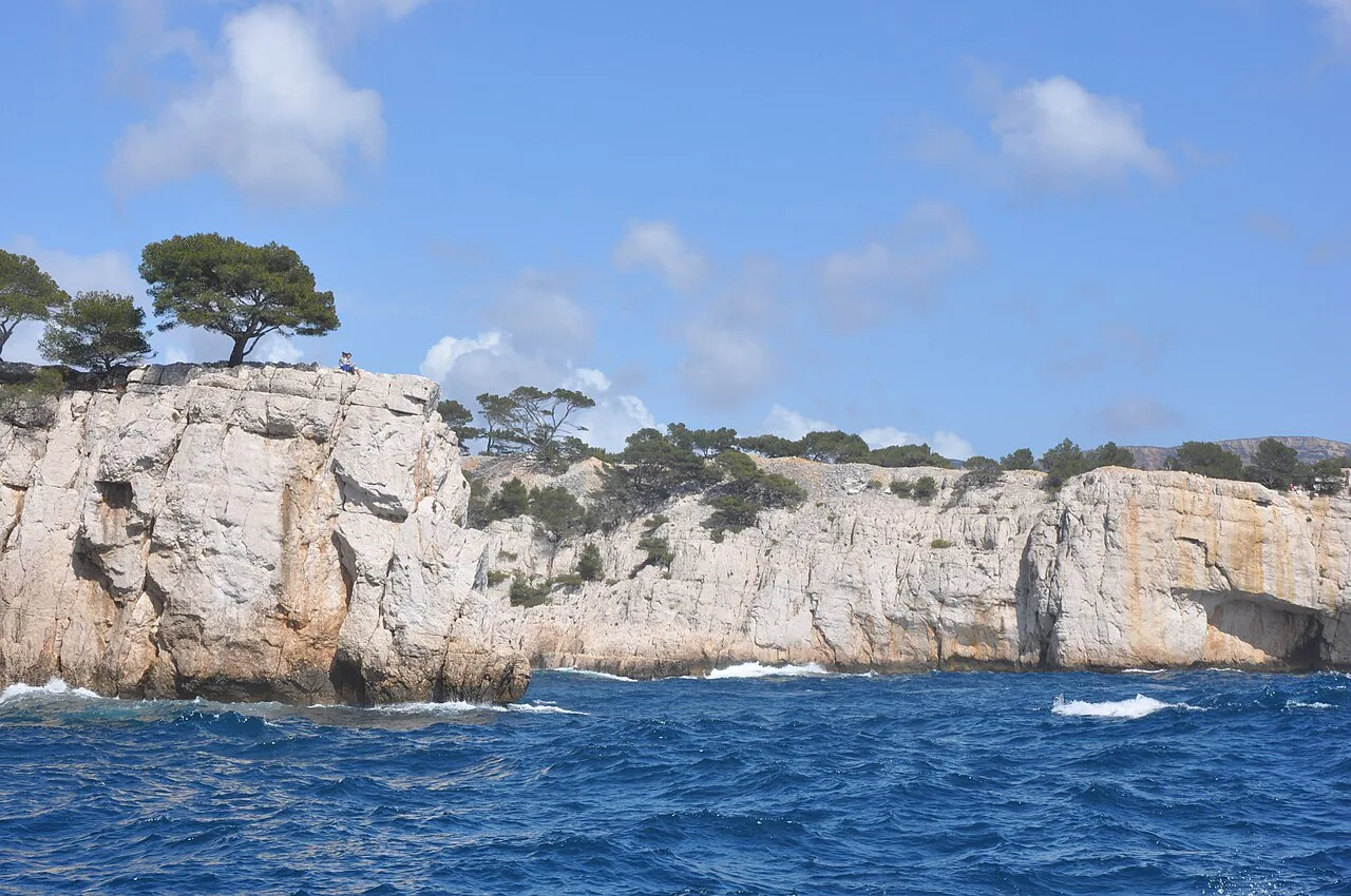
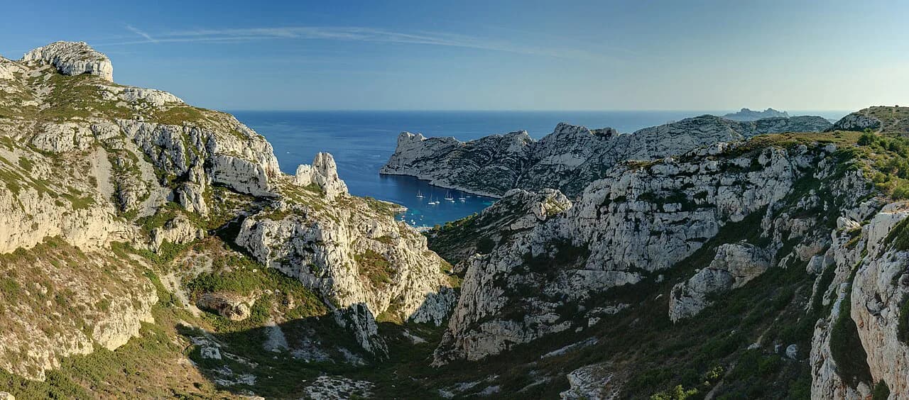
Calanques hiking puts you on white limestone clifftops and rocky paths above turquoise inlets, all within a short hop of Marseille and Cassis. The trails suit fit day hikers rather than strollers: the rock is sharp, there is no shade to speak of and the climbs are short but steep. Pick your base first, then the trail that fits your legs and the season.
Where the Calanques are and which base fits which hike
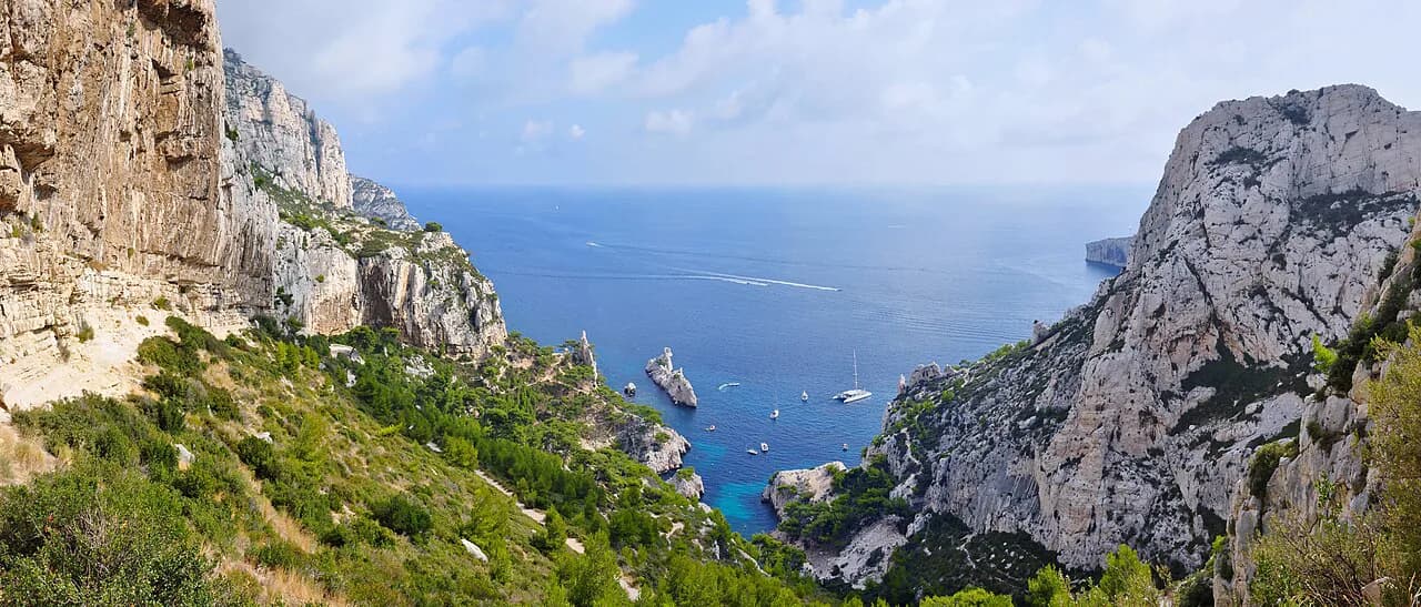
The Calanques National Park stretches along the Mediterranean coast between Marseille and Cassis, a limestone massif cut by narrow inlets. Cassis, a small harbour town, is the natural base for the eastern hikes: the walk to Calanque d'En Vau and Port-Pin starts from town. Marseille and the university district of Luminy suit the western side, with the Calanque de Sugiton trailhead close at hand, while the little port of Callelongue anchors the Marseilleveyre loop on the far south-west edge.
Cassis to Calanque d'En Vau via Port-Miou and Port-Pin
This is the signature Calanques day hike: roughly 9.3 km (5.8 miles) with about 400 m (1,310 ft) of ascent, moderate in grade, leaving from Cassis. You pass three inlets in sequence. Port-Miou comes first, a long narrow ria lined with boats; Port-Pin next, a rocky beach that begs a swim; then En-Vau, a fjord-like cove where the cliff walls close in around bright blue water.
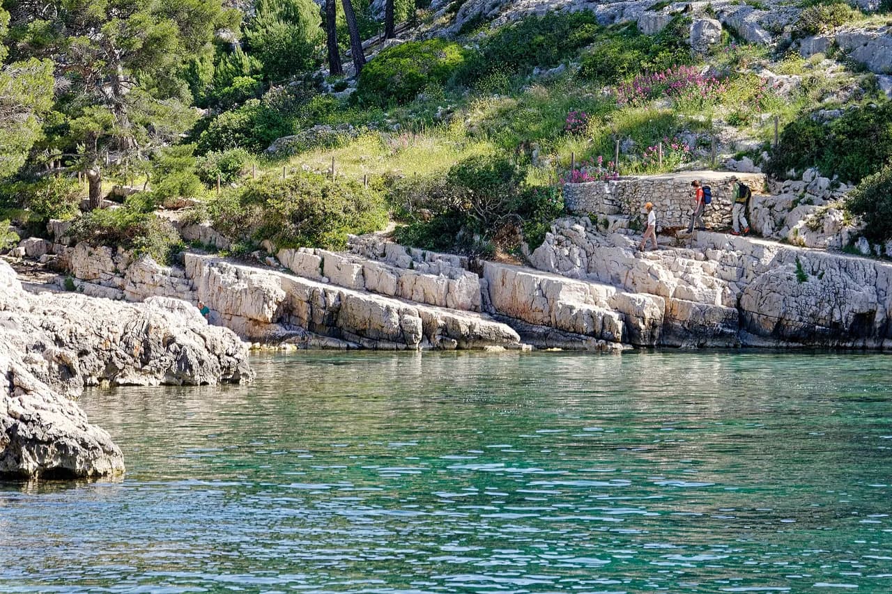
The path is rocky, with a few steep pulls and uneven footing where the limestone has been polished by boots. Plan on a full half-day or more if you swim at Port-Pin, and carry all your water from Cassis because the coves have no supply. The final descent into En-Vau is the steepest section, so keep something in reserve for the climb back out; if you want the descent and ascent drawn out step by step, the calanque d en vau hike guide walks the route section by section.
Calanque de Sugiton from Luminy
From the Luminy trailhead the loop to Sugiton runs about 8 km (5 miles) with roughly 300 m (985 ft) of gain, a gentler proposition than En Vau thanks to a wider path. The route drops to twin coves that are excellent for a swim, and the standard loop swings past the Belvédère de Sugiton viewpoint, which looks across to the neighbouring Calanque de Morgiou. A short ladder and a couple of chains lead to a second viewpoint near the water that most walkers miss.
Follow the marked route rather than inventing shortcuts; the ladder-and-chain section is easy but only worth it if you are comfortable using your hands. The calanque de sugiton hike page lays out the lookout loop and the descent to the twin coves in order, which is the simplest way to see how the Pierres Tombées path connects with the rest of the massif.
Calanque de Marseilleveyre from Callelongue
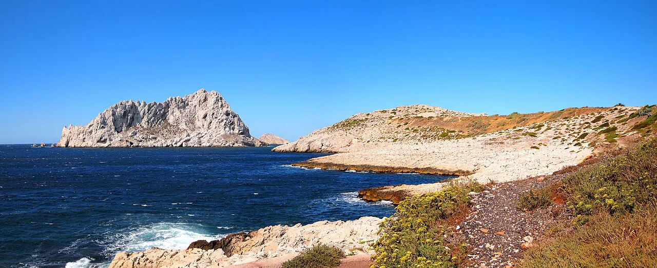
The Marseilleveyre loop starts at the little port of Callelongue and covers about 8.2 km (5.1 miles) with around 400 m (1,310 ft) of climb, moderate throughout. The path gains height into the massif, descends through the Malvalon Valley and reaches a small sand-and-pebble beach facing the Riou Archipelago, then returns along the coast. Because the cove is reached only on foot or by boat, it stays quieter than En Vau and Sugiton.
Treat the coastline return as the exposed part of the day: full sun, little cover and jagged rock underfoot. Sturdy shoes matter here as much as on the bigger-name trails, and the national park asks walkers to swap open footwear for closed hiking shoes on its paths.
Crossing the massif on the GR 98-51
If you want a longer, sportier day rather than a single cove, the GR 98-51 crosses the massif and links several inlets on one route. It is the option for hikers with good fitness and long daylight, since the accumulated climb and rocky ground add up over the day. The Marseille tourist office rates the massif crossing as the sportiest way to see the Calanques on foot and publishes its own selection alongside the accessible Sugiton lookout, so compare the two before you commit.
Getting to the trailheads
Parking at the trailheads is very limited, so arriving early in the day is the practical move, especially in high season. Public transport reaches the area well, and the park encourages walkers to use it rather than drive to the start of a route. Allow extra time if you are relying on buses, and check the return times before you set off, because a missed last bus turns a day hike into a long walk.
When to go
Spring, roughly April and May, and autumn, September and October, give warm but not scorching weather and the widest trail access. Summer heat is intense, and the park can close trails during heatwaves because of fire risk; if you are there in summer, look up official access updates before you leave and note whether a park pass needs booking in advance.
A spring or autumn trip gives you the best of both: swimmable water at Port-Pin and Sugiton, and cooler air on the climbs. Three full days in the region is enough to walk the En Vau, Sugiton and Marseilleveyre routes without rushing any of them.
Water, sun and footwear
There is no fresh water anywhere in the Calanques, so carry at least 1.5 litres per person for a half day and double it for longer outings or hot weather. The park also asks walkers to bring sun protection, food, a rubbish bag, and closed hiking shoes, since open footwear is prohibited on the trails. Lightweight long sleeves work better than sunscreen on the shadeless limestone.
Huts and overnighting
These are day hikes rather than hut-to-hut routes, and the walking is built around half-day and full-day itineraries returning to Cassis, Marseille or La Ciotat. There are no mountain huts along the coves, so base yourself in one of those towns and treat each calanque as an out-and-back or a loop; a Cassis base keeps the eastern trails on foot from your door.
Rules on the land
Stay on marked trails, respect plant regeneration areas fenced with poles and wire, keep dogs on a leash, and take all rubbish out because there are no bins in the park. Smoking is banned, which matters in a landscape that burns easily. Leave stones where they lie, since they shelter insects and lizards.
Hazards on the rock
The limestone is slippery in places and sharp in others, and walkers get into serious trouble in the Calanques every year by underestimating the terrain. Prepare an itinerary with an IGN map or the My Calanques app, choose a route that matches your experience, and check the weather before setting out. The emergency number in France is 112; call it early rather than late if something goes wrong.
Walking the Calanques with a dog
Dogs are allowed on the trails of Calanques National Park, but the park's regulations require that you keep your dog on a leash to avoid it roaming off the trails. That single rule shapes how a dog-friendly day in the massif works. The park asks visitors to stay on marked trails, and a leashed dog keeps you and your animal within that framework rather than letting it cut across the garrigue or scramble down to coves on its own line. The leash rule sits alongside the park's other good-conduct expectations: respect plant regeneration areas bordered by poles and wire, do not feed or disturb local wildlife, and do not remove stones, which are refuges for insects and lizards.
The practical conditions matter as much as the rule. The park notes that walking in the Calanques requires preparation: the sun blazes, the rocks are slippery or sharp, and the trails can be tricky. For a dog this means the same essentials the park lists for people apply to the day as a whole. There is no fresh water in the Calanques, so the park's guidance to carry at least 1.5 litres per person for a half-day, and twice as much for longer outings or hot weather, has to be planned around your dog as well. The park also recommends sturdy shoes and prohibits open shoes, and asks walkers to take a rubbish bag because there are no rubbish bins in the Calanques.
Route choice is where the leash rule becomes concrete. The hike from Cassis to Calanque d'En Vau passes Port-Miou, Port-Pin and En-Vau over 9.3km with 400m of elevation, and the trail is described as a little rocky with some steep ascents. The Sugiton loop from Luminy covers 8km with 300m of elevation on a more gentle route with a wide path, and the linked map includes a short, easy ladder and a couple of chains near an additional viewpoint above the water. The Marseilleveyre loop from Callelongue runs 8.2km with 400m of elevation, climbing into the park and descending through the Malvalon Valley to a small sand and pebble beach. Access to Calanque de Marseilleveyre is by boat or on foot only.
Season and access conditions affect the whole plan. The park advises finding out about access conditions and preparing your itinerary before heading out, and warns that every year tourists have to call emergency services and have serious, sometimes deadly, accidents. The emergency services phone number is 112. In summer, many trails close during heatwaves due to fire risks, and park passes must be pre-booked; spring (April–May) and autumn (September–October) are described as the best times for warm weather and having all the trails open. Parking is very limited, so arriving early for your hike helps.
Plan Your Calanques Hiking Day
Choose Cassis for the En Vau and Port-Pin classics, Luminy for the Sugiton loop, and Callelongue for the quieter Marseilleveyre circuit. Fit your fitness to the numbers: roughly 8 to 9 km (5 to 5.8 miles) and 300 to 400 m (985 to 1,310 ft) of climb per day is the honest range for most of these routes.
Walk in spring or autumn, start early, carry more water than you think you need, wear closed shoes and leave the car behind where you can. If you want more climbing after the coast, hiking in the Alps is a very different day out. For a second mountain range with its own trails, bases and seasons, our hiking in the Pyrenees guide is a useful comparison to weigh against the Calanques.
Explore more Calanques hiking guides
Frequently Asked Questions
How long does Calanques hiking take?
Most of the classic day hikes take a full half-day to a full day. The Cassis to En Vau route covers about 9.3 km with 400 m of ascent, the Sugiton loop from Luminy about 8 km with 300 m, and the Marseilleveyre loop from Callelongue about 8.2 km with 400 m. Add time for swimming, and longer again if you cross the massif on the GR 98-51.
How hard is the hiking in the Calanques?
The routes are moderate in grade but relentless in surface: short steep climbs, polished limestone, sharp rock and almost no shade. Fitness matters less than footing and heat management. Closed hiking shoes are required on park trails, and there is no fresh water to refill from, so the climbs feel harder than the numbers suggest.
Which hike in the Calanques is best?
Cassis to Calanque d'En Vau is the signature walk, passing Port-Miou, Port-Pin and the fjord-like En-Vau cove in one route. For easier going and a swim, the Sugiton loop from Luminy has a wider path and a viewpoint over Morgiou. Choose Marseilleveyre from Callelongue if you want fewer people and Riou Archipelago views.
When is the best time to go Calanques hiking?
April to May and September to October give warm weather without the worst heat and the widest trail access. Summer can be intense, and the park can shut trails during heatwaves because of fire risk, so consult access updates before setting out and book any required park pass in advance.
Sources
Trail notes for your next trip
Optional updates when we add or revise hiking guides.
You might also like
Continue reading
More guides you'll find useful