Calanque de Sormiou Hike: Trailhead, Route and Difficulty
Walk from Les Baumettes down to Calanque de Sormiou in the Calanques National Park: bus access, the route over the ridge, exposure and the best months.
On this page
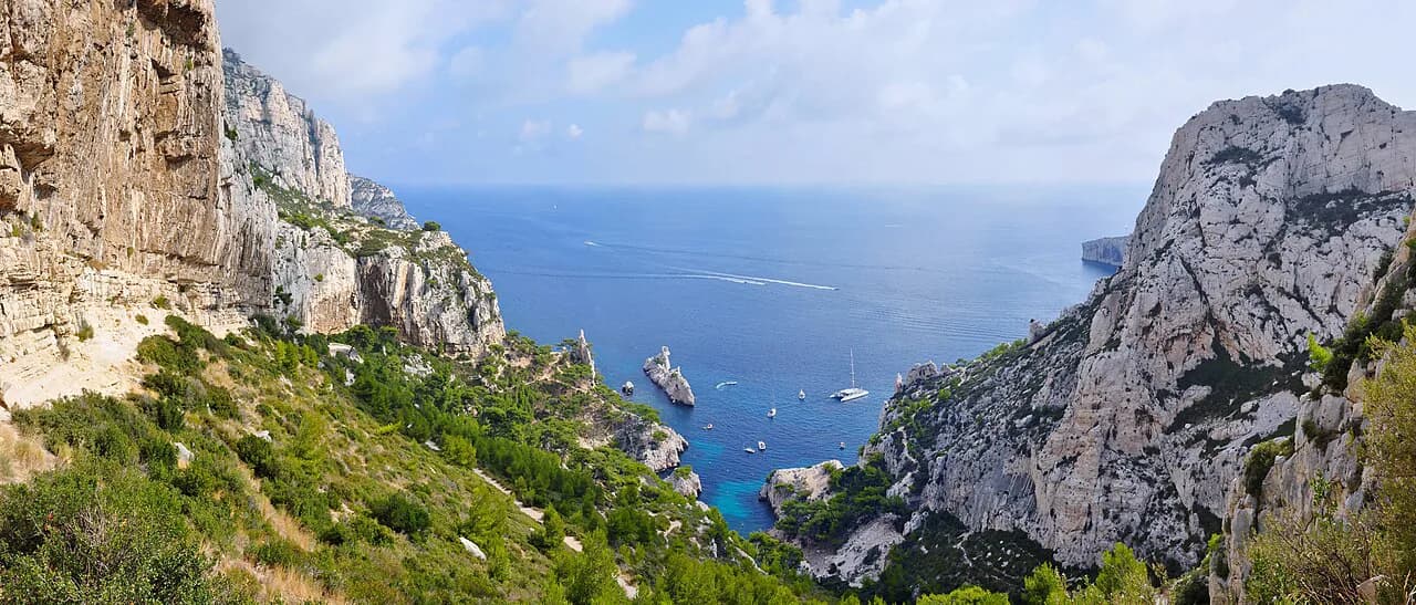
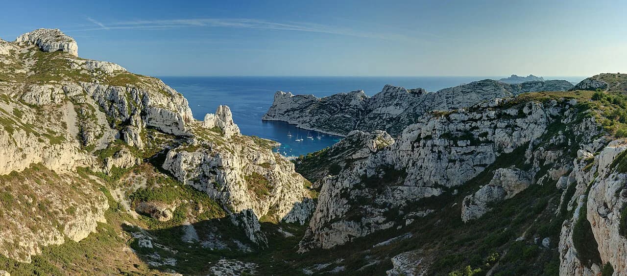
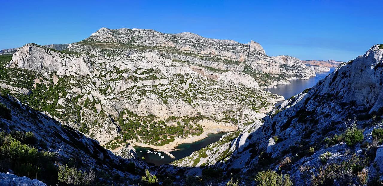
Calanque de Sormiou gives you two landscapes in one half-day: a high limestone crest with wide views over the Marseille coastline, then a sheltered cove with a beach and a cluster of cabanons at the head of the inlet. It suits hikers who want a real walk out of the city without a car, since the trailhead sits at the end of a city bus line.
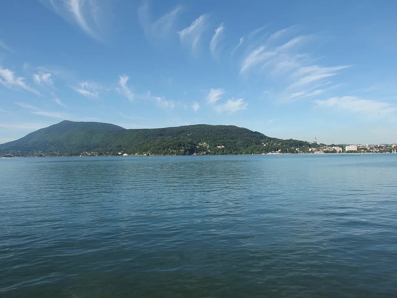
The walk is short enough for an afternoon but steep enough to feel like a mountain outing, with limestone steps, loose stones and long sun-exposed stretches. Pair it with the wider network of coastal paths in this calanques hiking area and you can stretch it into a full day toward Morgiou or Les Goudes. If you enjoy limestone ridges and sun-exposed crests, hiking in Annecy offers a different take on the same kind of day out above the water.
What the Sormiou walk offers and who it suits
You start high on the ridge above the coast and descend into the calanque, so the payoff comes early: the turquoise water and the pale limestone walls appear below you as you walk. From the crests the shallow Posidonia seagrass meadow shows as a darker halo beneath the surface, which is the detail that makes this cove stand out from the others.
Treat it as a half-day for a fit walker and a relaxed full day if you swim, picnic and linger on the beach. Families with steady older children manage it; anyone uneasy on rough ground or steep steps will find the descent and the climb back out the demanding part. There is no shade on the upper slopes, so an early start matters more here than on wooded trails.
Getting to the trailhead at Les Baumettes
The trailhead for the classic approach is the Les Baumettes district in Marseille's 8th arrondissement, where bus line 22 terminates. Guided Sormiou outings meet at that same terminus, which confirms it as the practical start point for walkers arriving by public transport.
Coming by car, you drive up to the Sormiou gate above the calanque, where the road down to the cove is restricted. Park near the gate and walk in, or use the Baumettes streets and start from the bus terminus. Road access to the calanque floor itself is limited, so plan on covering the last stretch on foot either way.
Route description: over the ridge to the calanque
From the Baumettes terminus the path climbs through scrub onto the plateau, then follows the rim above the Sormiou valley. The gradient is steady rather than brutal, but the surface is limestone rubble and worn rock, so you will be watching your feet on the steeper pitches.
At the head of the valley the route drops toward the calanque on a stepped descent, with the water and the beach coming into view as you lose height. The final approach passes the cabanons clustered at the inlet before reaching the beach at the head of the cove.
For the return you climb back the way you came, which reverses every metre of the descent. A more interesting option is to continue along the coast toward Les Goudes, turning the walk into a through-route rather than an out-and-back.
One well-documented circuit links Les Baumettes with Sormiou and continues to Les Goudes, giving you a one-way coastal traverse. If you want a shorter companion walk on another day, the Calanque de Sugiton is reached from the Luminy side of the massif.
Distance, ascent and time
The guided version of the Sormiou outing is published as a medium-level day of 300 m (about 985 ft) of ascent, running seven hours in total with roughly five hours of actual walking, from 9:30 a.m. to 4:30 p.m. That figure covers the full guided itinerary rather than the shortest out-and-back from the bus terminus.
For the self-guided walk, plan on a few hours of walking each way with the bulk of the climbing on the return. Reviews of the calanque describe the hike in as roughly an hour of walking, which fits a brisk pace on the descent, and the climb back out takes longer.
Difficulty and exposure
The route is medium in difficulty: no scrambling or via ferrata terrain, but sharp limestone underfoot and steps that demand attention when dry and extra care when damp. Reviews describe the hike as a little challenging without being dangerous, which matches a walk that is short but always changing gradient.
Exposure is the real theme: the upper slopes are fully open to the sun, and the crests catch the wind. Carry a hat and windbreaker, and start early in warm months so the climb out does not land in the hottest part of the day.
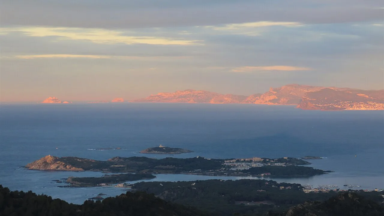
The calanque floor: beach, cabanons and the seagrass
At the bottom the cove narrows to a beach backed by small cabanons, with the Posidonia meadow visible offshore from the heights above. The view from the crests is the reason to take your time on the descent rather than rushing for the water.
Swimming is the reward on a hot day, but the beach is small and popular, so an early arrival gives you space and shade. Keep the picnic you carried in with you and take everything out again.
Water and food on the route
There are no water points anywhere on the Sormiou route, so carry at least 1 L (about 2 pints) per person and more in summer heat. The guided outing lists that litre as the minimum equipment requirement, along with proper hiking boots, sun cream, a hat and a windbreaker, and asks walkers to bring a picnic.
Fill bottles in Marseille before boarding the bus, and treat the beach as a place to eat what you brought rather than to resupply. A refillable bottle of two litres is a sensible summer load for the climb back to the plateau.
When to go: seasons, heat and fire risk
The guided Sormiou outing runs all year round, which tells you the route works in every season, though summer demands early starts and extra water. Spring and autumn give the best balance of swimmable water and comfortable climbing temperatures.
In high summer the massif can be closed to walkers on days of extreme fire hazard, and organized outings are cancelled by mountain leader Philippe Chabot's guiding service for what it calls black days and exceptional weather. On such days the paths are not an option, so keep a city or coastal alternative in reserve and check the park's access status before setting out.
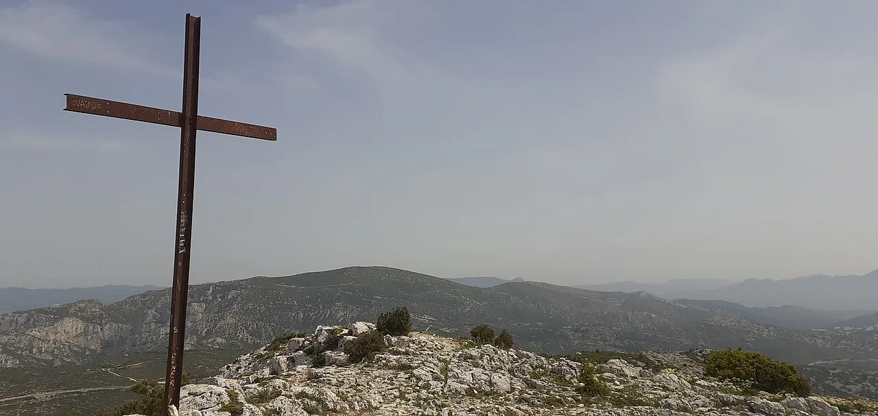
Longer versions: Morgiou, Sugiton and Les Goudes
Once at Sormiou the coastal network opens up. Continuing to Les Goudes turns the walk into a traverse, while the Calanque de Morgiou is reached on its own path from the Luminy side, making it a good second day rather than a detour from Sormiou.
Walkers who want a bigger day should consider the Calanque d'En-Vau Hike, on the Cassis side of the massif and reached from a different trailhead. Cassis is the other main access point for the wider Calanques network and works as a base for that side of the park.
Where to base yourself in Marseille
Staying in the 8th arrondissement or anywhere along bus line 22 keeps the trailhead simple: you walk out of your accommodation, ride to the Baumettes terminus and start climbing. Central Marseille around the Vieux-Port gives you more restaurants and ferries but adds a bus connection to the start.
If you plan several calanque walks, split your base between the Marseille side for Sormiou and Sugiton and the Cassis side for En-Vau, since the two trailhead clusters are far apart by road.
What a guided Sormiou hike includes
The guided Sormiou outing is run by a mountain leader in French and English, for groups of seven to twelve people, with a picnic and water left to participants. It meets at the bus 22 Baumettes terminus and runs from 9:30 a.m. to 4:30 p.m.
Adults pay 25 euros and children 20, with a 250 euro group rate and meals not included, so the value comes from the naturalist commentary on the seagrass, the cabanons and the park's heritage rather than from logistics. A guided day suits first-time visitors who want the ecology explained and anyone nervous about route-finding on the limestone.
Plan Your Visit
The Sormiou walk rewards simple planning: fill your bottles in the city, take the bus to the Baumettes terminus, climb early and give yourself time on the crests before the descent. Boots with grip matter more than distance here, because the limestone steps and loose rubble are what slow you down.
Build the day around the season. Spring and autumn give comfortable climbing and swimmable water, while summer asks for a dawn start and a fallback plan for fire-risk closures. Whichever you choose, the cove at the bottom and the seagrass below the cliffs make the climb back out worth it.
Frequently Asked Questions
Can you walk to Calanque de Sormiou from Marseille?
Yes. Bus line 22 runs to the Les Baumettes terminus in Marseille's 8th arrondissement, and the walking route to the calanque starts from there, climbing over the ridge before descending to the beach.
How hard is the Calanque de Sormiou hike?
It is a medium-difficulty walk: no technical scrambling, but rough limestone steps, steady climbing and full sun on the upper slopes. The guided version is graded medium, and hikers describe the route as challenging without being dangerous.
How long does the Sormiou hike take?
Allow a few hours for the self-guided out-and-back, with the climb out taking longer than the descent. The guided full itinerary runs seven hours including about five hours of walking.
Is there water on the Sormiou trail?
No. There are no water points on the route, so fill your bottles in Marseille and carry at least 1 L (about 2 pints) per person, more in hot weather.
How do you reach the Sormiou trailhead without a car?
Take bus line 22 to its Les Baumettes terminus, which is also the meeting point for guided outings, and start walking from there.
When is the best time to hike to Calanque de Sormiou?
Spring and autumn give the most comfortable conditions. The route is walkable all year, but summer heat and fire-risk closures make early starts and a backup plan sensible.
Sources
Trail notes for your next trip
Optional updates when we add or revise hiking guides.
You might also like
Continue reading
More guides you'll find useful