Calanque de Sugiton Hike: Trailhead, Route and Reservations
Plan the Calanque de Sugiton hike from the Luminy trailhead near Marseille, with route layout, distance, ascent and free summer reservations.
On this page
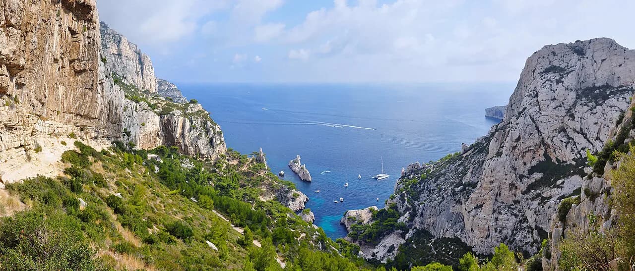
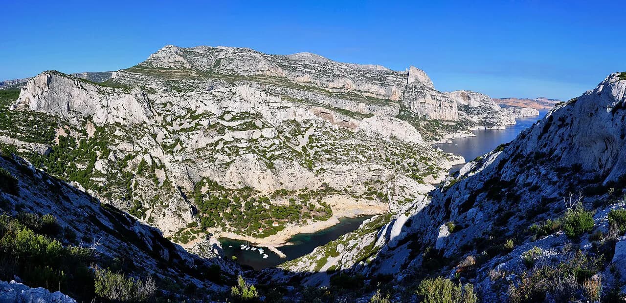
The Calanque de Sugiton hike delivers one of the shortest routes to a true Calanques cove: a limestone bowl of pale cliffs and pine scrub opening onto deep blue water, reached from the edge of Marseille. It suits hikers with a half day and ordinary fitness who want the scenery of the national park without committing to a long traverse. The walk is short enough to combine with a swim or a second viewpoint, and steep enough at the end to feel like a real hike rather than a stroll.
Plan the day around two things: the final descent, which you have to climb back out of, and the park's summer visitor limit on Sugiton and Pierres Tombées. Both shape how long the outing takes and whether you can walk down to the water at all. This guide separates the approach from Luminy from that last drop so you can decide in advance whether the beach is worth the extra climb.
What the Sugiton hike offers and who it suits
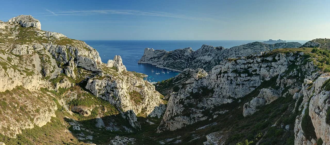
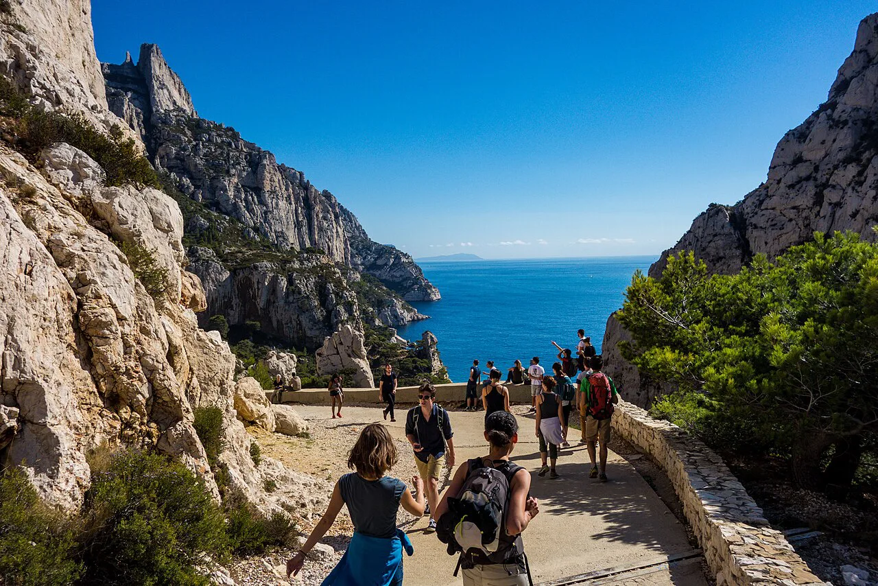
Sugiton sits where the Marseille suburbs give way to the national park, and the calanque is the most remarkable site in the area, roughly a 10-minute walk from the Aix-Marseille University campus in Luminy. That closeness makes it the classic first Calanques hike for visitors based in Marseille. The draw is the combination of a short approach, high viewpoints over the cove and a final scramble down to the rock platforms.
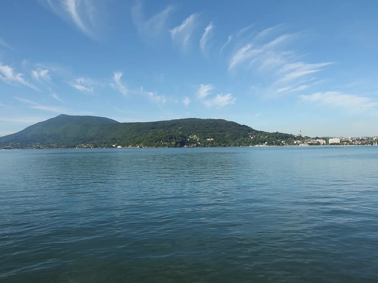
Hikers who want a two- to three-hour outing with big views and time to sit above the water will find it well matched. If you want solitude or a full day of linking coves, look instead at the longer routes in the calanques hiking guide, where stages connect several calanques in one walk. Sugiton rewards an early start more than distance does, and the same logic of a short climb to a big view applies to hiking in Annecy above its lake.
Where the hike starts: Luminy and the trailhead
The walk begins at Luminy, the university campus on the southeastern edge of Marseille, where the streets end and the park tracks begin. From the campus you follow waymarked paths south toward the Belvédère de Sugiton, the upper viewpoint over the cove. Treat Luminy as the start and finish of the hike; there is no lift or cable car serving Sugiton, so every metre of the route is on foot.
Arriving by car puts you in competition for space around a busy campus on weekday mornings, so aim to start early or arrive after the teaching day. The park publishes access guidance for the massifs, and the Mes Calanques app is the official tool for checking conditions and, in the restricted period, your booking.
Getting to Luminy without a car
Luminy is served by public transport from central Marseille, which makes a car-free day realistic for most visitors. Buses run from the city toward the campus, and the walk to the calanque begins from the terminus area rather than from a remote mountain road. Allow extra time on the return, when afternoon services are busier and the climb back to the campus has already used your legs.
Because timetables change with the season and the academic calendar, look up the current route and departure times with the Marseille transport operator before you set out rather than relying on a plan made months earlier. Carry water for the exposed sections regardless of how you travel, since the limestone holds heat.
Route description: from Luminy to the Belvédère de Sugiton
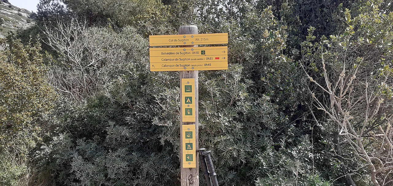
From the campus the path climbs gently through garrigue and pine before settling into a rolling traverse toward the rim of the calanque. The ground is typical Provence limestone: loose stones, worn rock slabs and sections where the path narrows along the edge. Waymarks keep you on line, and the first big reveal comes at the Belvédère de Sugiton, where the whole cove opens below you.
The viewpoint is the natural place to stop, drink and decide whether to continue. It looks straight down the white cliffs to the water and across to the rocks of Pierres Tombées, and it gives the best photographs of the day. Hikers short on time or uneasy on steep ground can make the belvedere their turnaround and still see the calanque properly.
Descending to the calanque and the Pierres Tombées viewpoint
Below the belvedere the path drops steeply toward the shore, with some scrambling and loose footing on the way down. The descent takes far less time than the climb back, and the return to the rim is the hardest part of the day for most people. Budget energy for it, and turn around before you are tired rather than at the water.
Near the shore, the Pierres Tombées side gives a second angle on the calanque, with flat rock ledges and clear water below the cliffs. This is where the cove's popularity shows: the park records summer peaks of up to 2,500 visitors a day at Sugiton, which is why numbers are limited on set dates. Expect company on warm weekends and plan an early start if you want quiet on the ledges.
Distance, ascent and walking time
One published route figure for the Sugiton walk gives 6.4 km (4 mi) with about 275 m (902 ft) of ascent, which fits the out-and-back shape from Luminy with the drop to the cove included. Treat that as a representative number rather than a park measurement, since variants from the campus and along the rim add or subtract short sections.
Walking time depends mostly on the final climb: fit hikers who stop at the belvedere finish comfortably in a couple of hours, while a descent to the water and a long stop on the rocks stretches the outing toward half a day. Add time for heat, photographs and the queue of feet on the narrow sections near the rim.
Difficulty, exposure and footing
The approach is moderate walking on rough, rocky ground, and the descent to the shore is the technical part: short scrambles, loose stones and drops beside the path. Exposure is real on the cliffside sections, so keep children and nervous walkers on the upper path if the edge bothers them. Sturdy shoes with grip matter more here than on a smooth forest trail, and sandals are a poor choice for the descent.
In summer the route is hot and shade is scarce once you leave the pines, so start early, carry more water than you think you need and turn back if the heat builds. Rock that has been in the sun all day stays warm into the evening and reflects heat back at you on the climb out.
When to go: seasons, heat and afternoon storms
Spring and early summer give the best balance of warm water views and manageable temperatures, and autumn brings clearer light and fewer people on the rim. Midsummer afternoons are the hardest: exposed limestone, little shade and the risk of thunderstorms building over the massif. On a storm forecast, stay off the upper cliffs and out of the cove, where there is nowhere to shelter.
Winter walking is possible on the approach paths, but the descent to the water can be slippery after rain and the coves feel cold and windy. Check the park's fire-risk status before any summer outing; the massif can be closed at short notice, and the park cancels bookings and emails a cancellation notice when that happens.
Free summer reservations for Sugiton and Pierres Tombées
To protect the eroding ground, the national park limits visitor numbers to Sugiton and Pierres Tombées on specific dates each year, and access on those days requires a prior, free booking. The park sets the restricted dates and the booking calendar each year, so check the current listing before you commit to a date; for 2026 the limited period covers 20-21 June, every day from 27 June to 30 August, and 5-6 September and 12-13 September.
Bookings for 2026 open on 11 June at 9:00 am CET. After that, reservations open at 9:00 am three days before your visit and close at 6:00 pm the day before, and group bookings cover up to five people. Present your booking details on arrival to access the cove. Outside the restricted dates nothing in the park's notice closes the calanque, but the reservation system still applies only to the listed days.
Fire-risk closures and how bookings are handled
The Calanques massifs are closed to access on high fire-risk days, and Sugiton is no exception. When a closure falls on your booked date, the park sends a cancellation notice by email on the day before your visit, so check your inbox the evening before you travel. Do not assume a booking overrides a closure.
What to bring and where to find water
Carry your own water: the route is short but exposed, and there are no reliable refill points between Luminy and the shore. Bring a hat, sun cream, a wind layer for the rim and footwear with real grip for the descent. A light towel and swimwear make sense if you plan to sit by the water, and a dry bag keeps valuables safe on the rock ledges.
Pack out everything you bring, including fruit peel and wrappers, and stay on the marked paths on the eroding slopes. The park's app carries the current rules for the massif alongside your booking, which is worth opening before you leave the city.
Extending the day to other Calanques viewpoints
Strong walkers can link Sugiton with the paths toward Morgiou, another calanque village cove within the same massif and a natural second stop from Luminy. The calanque de morgiou hike adds distance and a further climb but keeps you inside the national park scenery. Check fire-risk status and water supplies before extending, since the extra hour or two is on the same exposed limestone.
East of Marseille, the Calanque d'En-Vau Hike near Cassis is the other classic outing, with a longer approach and a dramatic inlet between high cliffs. It sits outside the Sugiton massif, so treat it as a separate day rather than an add-on. For a full menu of coves, from Sormiou to En-Vau, the calanques hiking guide sets out which routes suit which fitness and season.
Plan Your Visit
The Sugiton hike is the easiest full taste of the Calanques from Marseille: a short approach from Luminy, a big viewpoint at the belvedere and an optional steep drop to the water. Decide before you start whether you are walking to the rim or all the way down, and leave enough in the tank for the climb back.
Time your trip for spring or autumn if you can, start early in summer, and sort your free reservation for the restricted dates as soon as the booking window opens. Confirm the massif's fire-risk status the evening before, then walk in with water, grip and a plan to stop at the view if the descent looks beyond the group.
Frequently Asked Questions
How long is the Calanque de Sugiton hike?
One published route figure gives 6.4 km (4 mi) with about 275 m (902 ft) of ascent for the out-and-back from Luminy, including the drop to the cove. Variants from the campus and along the rim shift those numbers slightly, so treat them as a guide rather than a fixed measurement.
How do I get to the Calanque de Sugiton trailhead?
Start at Luminy, the university campus on the southeastern edge of Marseille, where the streets end and park tracks begin. Buses connect the campus with central Marseille; check current routes and times with the city transport operator.
Do I need to book to hike to Sugiton?
On the dates when the national park limits visitor numbers, access to Sugiton and Pierres Tombées requires a prior, free booking. The park sets those dates and the booking calendar each year, with reservations opening three days before a visit and closing at 6:00 pm the day before.
Is the Sugiton hike difficult?
The approach from Luminy is moderate walking on rough limestone, and the descent to the shore adds short scrambles, loose stones and exposure beside the cliffs. The climb back to the rim is the hardest part, so stop at the Belvédère de Sugiton if the descent looks beyond the group.
When is the best time to hike to Sugiton?
Spring and autumn give the most comfortable temperatures and the clearest light. Summer afternoons are hot, shade is scarce and storms can build over the massif, so start early and stay off the upper cliffs when thunder is forecast.
Can you swim at Calanque de Sugiton?
The coves hold clear water and hikers often sit by it, but the park's notice focuses on protecting the eroding ground rather than on swimming facilities. There are no lifeguards or beach services at the calanque, so judge conditions on the day and follow the rules shown in the park's app.
Sources
Trail notes for your next trip
Optional updates when we add or revise hiking guides.
You might also like
Continue reading
More guides you'll find useful