Calanque de Morgiou Hike: Luminy Trail, Distance and Route
The Calanque de Morgiou hike from Luminy runs 2.6 km each way in the Calanques National Park. Compare the two descent routes, the chain and the return.
On this page
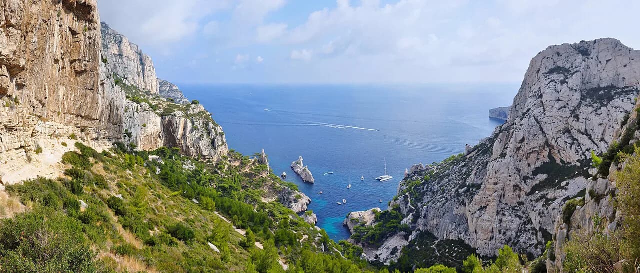
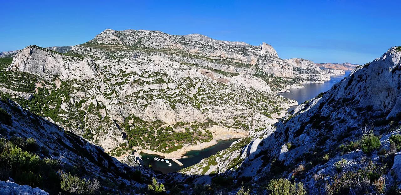
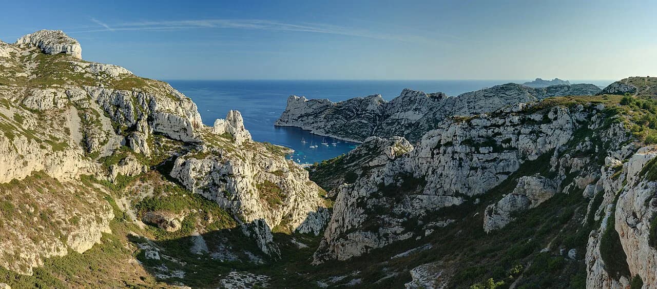
The Calanque de Morgiou is a narrow limestone inlet on the edge of Marseille where a small port and a sheltered beach sit below high white walls. The walk in from Luminy suits hikers with half a day, a reasonable head for heights and a taste for a rough, rocky descent rather than a long approach. It is one of the shorter outings in the Calanques, but the return climb makes it a real walk rather than a stroll.
Trailhead at Luminy
The walk begins at the end of Avenue de Luminy, at the edge of the university and art-school campuses in Marseille's southern suburbs. A gate marks the start, and a water fountain stands just before it, so fill bottles there rather than carrying the whole day's supply from the city. Parking is on the surrounding streets; when those fill, a gravel car park beside the business school takes the overflow.
There is no lift or cable car on this route, so every metre of the descent to the inlet has to be climbed back out. The trailhead sits at the same gate used by walkers heading for the Col de Sugiton, which means the first stretch is shared and busy on fine weekends. Arriving early gives you a parking space and cooler air on the climb back.
Getting there by bus
Bus 21 runs from Marseille's Castellane bus station on Avenue du Prado toward Luminy and drops you a short walk from the trailhead gate, so the hike can be done without a car. Timetables and fares are set by the city transport operator and change by season, so look them up before you travel. Allow extra time for Marseille traffic if you drive instead.
Distance, ascent and time
The Luminy–Morgiou route is 2.6 km (1.6 mi) each way, with about 50 minutes of walking in each direction, so plan for around two hours on the move once you add the beach time. Treat the descent and the return as two separate efforts: the way down is quick, while the way back is almost all uphill on rough ground. A route recorded as a 5.1 mi (8.2 km) loop with 1,056 ft (322 m) of gain covers more ground than the direct line and is not the same as the one-way walk.
Route description from Luminy to the descent
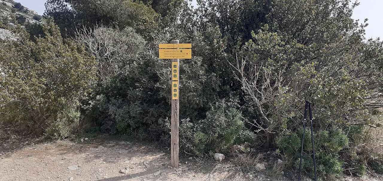
From the gate, follow the broad track marked with blue and yellow dotted lines. The surface is a false flat at first, passing the campuses on your left before the trees close in on both sides. Most walkers on this track continue to the Col de Sugiton, so watch for the point where your line leaves the main flow.
After about 13 minutes, leave the main track and follow the yellow dotted line branching to the right, which starts the descent on the eastern side of Morgiou. A few minutes earlier, where the vegetation thins and a stone carries an information board, you can cut right across the hill and cross the second track to pick up the same yellow dotted line. Both options put you on the descent with views opening over the inlet.
Choosing your descent
Three minutes into the descent you reach the junction that decides the character of the walk. The left branch on the yellow dotted line is the high route, with the best viewpoints over the calanque but a chain to negotiate near the beach. The right branch drops through an inclined valley to the road and enters Morgiou through the small cabins alleys, which is less dramatic but has no technical difficulty.
Choose before you commit, because turning back from the high route means climbing three quarters of the way up the coast again to reach the easier line. If you are uneasy on exposed ground or with heights, take the valley path from the junction and enjoy the calanque from the port instead. Either way, you finish in the same place, so the decision costs you nothing but a little time.
The chain above the beach
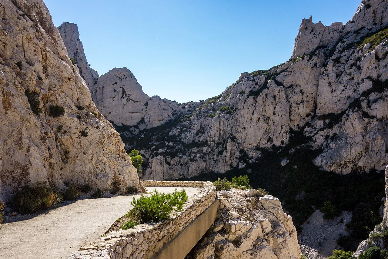
On the high route, the yellow dotted line brings you out above the port and the small beach, where a fixed chain protects a short passage. It is not technically hard, but it is the one place where the ground falls away and a slip would matter. Grip the chain, keep three points of contact on the rock and move one at a time if you are in a group.
Past the chain, the yellow dotted line ends about 150 m (490 ft) further on, and the last stretch to the inlet follows a red-marked path. Loose scree on this section demands care on the descent, when tired legs and gravity do most of the work. The alternative valley route avoids all of this and meets the road instead.
The easier descent to the port
The easier itinerary splits from the high route about 250 m (820 ft) into the descent, where the yellow path turns right into the inclined valley. It reaches the road quickly and then follows it into Morgiou through the cabins alleys, so you arrive at the port rather than dropping onto the beach from above. It is the sensible choice for anyone carrying a heavy pack, walking with children or simply wanting a straightforward line.
Arriving at the port and small beach
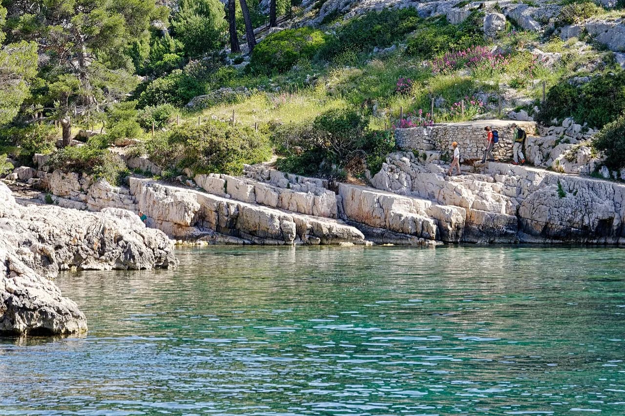
The final approach opens up views over the inlet, the boats and the small beach tucked below the walls. This is the place to linger: the water is calm in settled weather, and the rocks around the cove give you somewhere to sit when the sand is crowded. Carry your own water and food, since the walk itself has no facilities beyond the fountain at Luminy.
If you want a second calanque the same day, the Col de Sugiton junction on the way back allows a detour to the Belvedere de Sugiton and onward to the Calanque de Sugiton. That adds a half-day if you do both properly, so decide at the junction rather than at the end of a long climb.
When to go
Spring and autumn give the most comfortable conditions: cooler air on the climb out and softer light on the limestone. Summer brings intense heat on the exposed descent and the return, so start early and carry more water than you think you need. In winter the walk is quiet and clear on still days, though wind on the ridgeline makes the high route less pleasant.
Access to the Calanques National Park is regulated from June to mid-September because of wildfire risk, with tracks sometimes closed or open only for reduced hours, and the reservation system in place for Sugiton is booked through the park's site. Morgiou's own summer arrangements are set by the park, so read the current access notice before you set out. The park's closure map is the authority, not a blog.
Hazards and kit
The two real hazards are the loose scree on the descent and the heat on the way back up. Wear shoes with good grip, take 1 to 1.5 liters of water per person and keep a layer for the wind that funnels through the inlet. In high summer, start before the day heats up and turn around if the wind picks up, since fire risk rises in hot, windy weather.
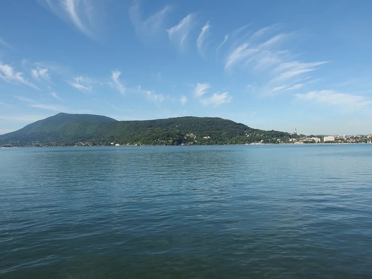
Morgiou is one of several inlets reached from the same suburban trailheads, and the wider calanques hiking picture helps you pick a base and a second day out. Sormiou and Sugiton sit on the same Luminy and Baumettes approach lines, while the Cassis inlets need their own start point further east. Reading the range as a whole stops you from stringing together trailheads that are hours apart. If you are planning a longer mountain trip as well, the Annecy hiking guide shows how a lakeside base can be paired with ridge and summit trails of a very different scale.
Extending the day
The Belvedere de Sugiton sits above the Col de Sugiton and gives a view across both Sugiton and Morgiou, reached by an extra kilometer or so of walking from the junction. Combining it with Morgiou makes a good half-day, and the climb back to Luminy is the same whichever calanque you finish at. If you want a bigger day in the park, the Calanque d'En-Vau hike from Cassis is a longer and more demanding alternative.
Plan Your Visit
For most hikers, the Morgiou walk is a two-hour outing with a swim and a picnic in the middle: 2.6 km (1.6 mi) down in about 50 minutes, the same back up, and a decision at the junction about whether to take the chain. Take the high route if you want the views and are comfortable on exposed ground, and the valley route if you want an easier line to the port. Either way, start early, carry water from the fountain at Luminy and read the park's summer access notice before you go.
Frequently Asked Questions
How long is the hike from Luminy to the Calanque de Morgiou?
It is 2.6 km (1.6 mi) each way, with roughly 50 minutes of walking in each direction. Allow around two hours on the move, plus time at the beach and the climb back out.
Is the Morgiou hike difficult?
The route is a moderate walk rather than a technical climb. The high path involves a short fixed chain near the beach and loose scree, while the easier valley route has no technical difficulty and is the better choice for anyone uneasy with heights.
Do you need to pass a chain to reach Morgiou beach?
Only on the high route. The chain protects a short passage above the port and small beach, and the alternative descent through the valley and the cabins alleys avoids it entirely.
Can you reach the Calanque de Morgiou by bus?
Yes. Bus 21 from Castellane bus station in Marseille runs to Luminy and drops you a short walk from the trailhead. Look up the current timetable and fare with the city transport operator before you travel.
When is the best time to hike to Morgiou?
Spring and autumn give the most comfortable conditions, with cooler air on the climb and softer light. Summer is hot and exposed, so start early, and read the park's access notice for any seasonal restrictions before setting out.
Sources
Trail notes for your next trip
Optional updates when we add or revise hiking guides.
You might also like
Continue reading
More guides you'll find useful