Calanque d'En-Vau Hike: Two Routes, Distance and Difficulty
Two ways to hike to Calanque d'En-Vau near Cassis: the forest track from La Gardiole or the coastal path via Port Miou and Port Pin, with distance and difficulty.
On this page
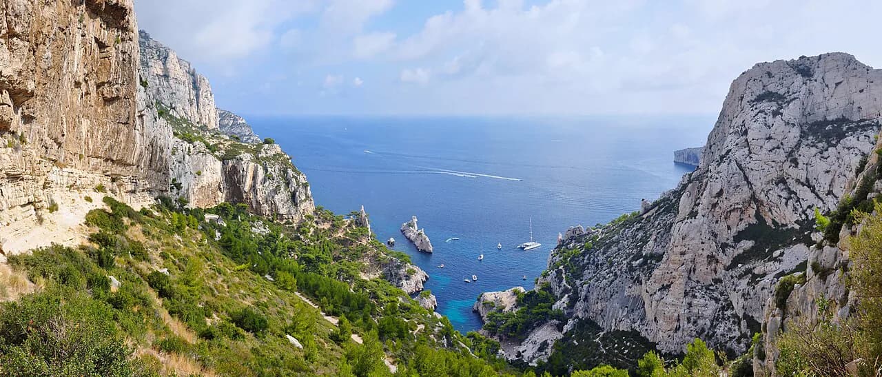
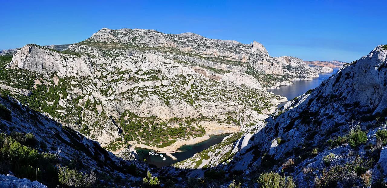
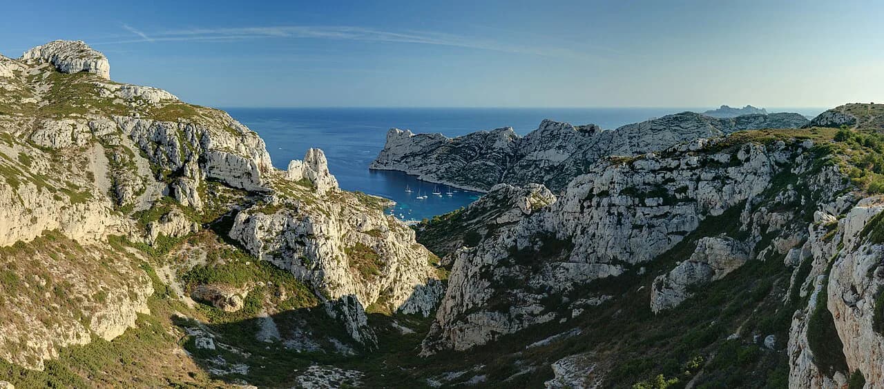
Calanque d'En-Vau is the deepest and most dramatic of the inlets east of Cassis, a narrow fjord of white limestone with a small pebble beach at its head. The reward is out of proportion to the effort on the inland approach, but the coastal version adds a scrambling climb and a steep final descent. Choosing between them comes down to how much time you have and how confident you are on loose stone.
Both routes sit inside the Calanques National Park, the protected limestone coast that runs from Marseille to Cassis, so the same planning rules apply whichever trailhead you pick. The wider calanques hiking picture, including the Marseille inlets, is worth reading before you commit to a single trail. If you are weighing other mountain trips for the same season, the Annecy hiking guide covers lake and ridge trails with a similar trade-off between easy tracks and steeper viewpoints.
The two trailheads and how they differ
The inland start is the col de la Gardiole, reached from the D559 (route de la Gineste) at a gate opposite the military camp of Carpiagne. From that gate a vehicle track drops into a small valley and climbs to the col, where the red-marked path to En-Vau begins. The coastal start is the car park above Port Miou at the end of Avenue Notre Dame in Cassis, where the walk begins along the old Solvay quarry and the boat moorings.
The difference matters for planning. The Gardiole route is a single wide track with no technical ground, so it suits anyone who wants the calanque without the crowd and the scrambling. The Port Miou route is the classic Cassis walk, but it packs three inlets, a climb and a rough descent into a longer day, and it starts where the parking and the boat jetties are.
Route A from La Gineste and La Gardiole
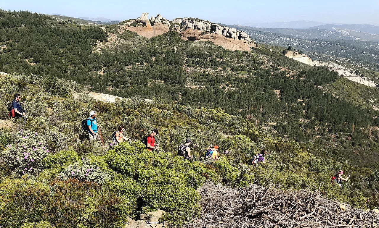
From the gate on the Gineste road, follow the track as it descends into the valley and rises to the col de Gardiole, then take the red-marked path. It starts on a concrete strip before turning into a broad track that curves around the forest house of la Gardiole. After the house the path bears right and enters a shaded valley, and you stay on it to the end of that valley until the calanque appears at the last bend.
This is the short version: 6 km (3.7 mi) in about two hours, graded easy because it follows the security-vehicle track for most of its length. No source gives a total ascent figure for it, so judge the day by the time and the heat rather than by a metre count. The middle section is enclosed and the views are modest until the final curve, when the cliffs of En-Vau open up suddenly.
Route B through Port Miou and Port Pin
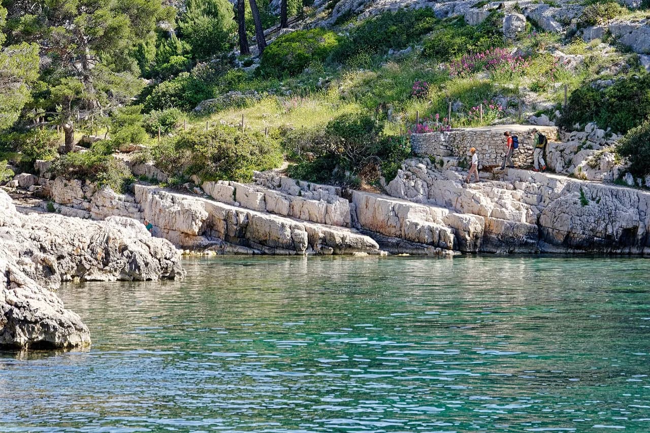
Start at the Port Miou car park, ten minutes' walk from the trailhead, and head down to the inlet. The first stretch runs flat between the old quarry and the moorings, looking down on the boats of Port Miou; the water here is a working harbour, so the swimming stop is the next cove. Beyond Port Miou the path turns rocky and winding, and about 35 minutes from the start you drop to the sand-and-gravel beach of Port Pin.
The three-inlet circuit is roughly 7 km (4.3 mi) and about three hours of walking without the descent to the En-Vau beach. Treat that as the honest figure for a family day out: it counts the climb out of Port Pin and the return leg, which is why the beach descent is usually saved for a second visit or a generous schedule.
The two ways up from Port Pin
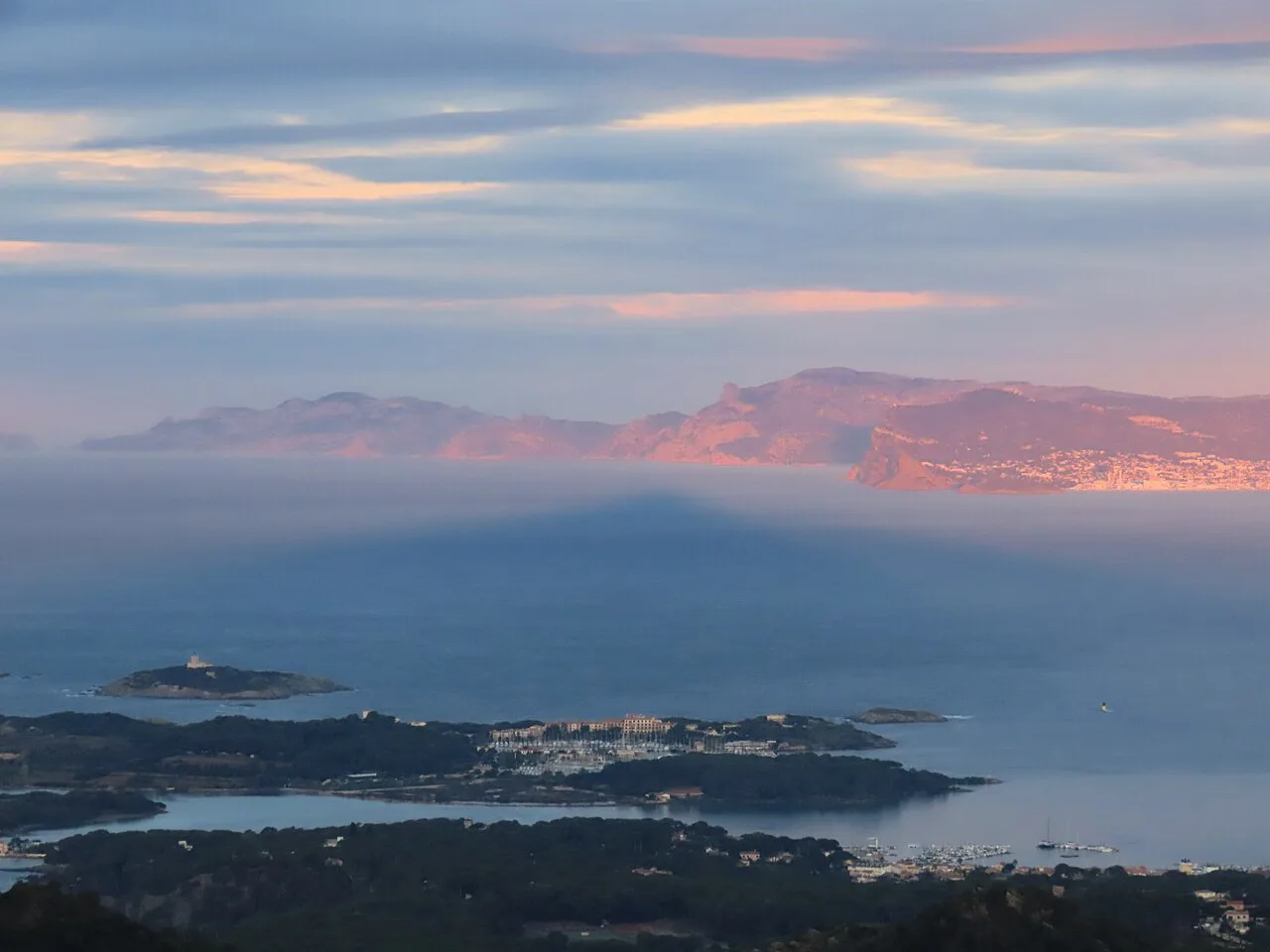
Above Port Pin the route splits. The blue-marked panoramic path on the left is the harder option, climbing over very stony ground to a shoulder above the calanque, but it delivers the viewpoints: Port Pin and the bay of Cassis with Cap Canaille behind, then a belvedere looking straight down the cliffs of En-Vau, and further on a panorama across the Riou archipelago. The red-marked GR51 on the right is quicker but stays inside the forest with no viewpoint worth the detour.
If you only have one day and want the photograph, take the blue path up and accept the slower pace; if the weather is closing in or your legs are already tired, the GR51 gets you back to Port Miou with less exposure. Either way, the ridge above Port Pin is where the walk stops being a stroll.
The descent to the En-Vau beach
Reaching the water is a separate decision from reaching the calanque. From the plateau the marked descent to the beach takes about 30 minutes and is signed as difficult, with steep, slippery stone underfoot in the middle section. The beach itself is small and fills early in summer, so the descent and the climb back out are best done before the day heats up.
Hikers coming from La Gardiole arrive at the head of the calanque without this problem, which is the main argument for the inland route if you have children or a dodgy knee. From the coastal side, the trick is to leave the beach while you still have energy for the climb rather than timing it for the hottest hour.
Return options from En-Vau
You can retrace the blue panoramic path for the views a second time, drop back down the GR51 for speed, or take the red-and-white track through the la Fontasse forest. The Fontasse option is the longest but the flattest, a wide, level track where the vistas are pleasant rather than spectacular, and it rejoins the Cassis path near a signposted junction. From there the track descends gradually and then zigzags down to the Port Miou car park, with the Soubeyranes cliffs in view on the way.
Distance, ascent and time at a glance
Route A: 6 km (3.7 mi) from La Gineste, about two hours, easy, on a broad track. Route B: roughly 7 km (4.3 mi) and about three hours from Port Miou without the beach descent, moderate partly because of the short steep climb above Port Pin. Add about 30 minutes each way if you go down to the sand at En-Vau. Distances here are walking distances, not signs counted on the ground.
Walk the routes on their own terms: the Gardiole track is steady and untechnical, the Port Miou circuit is shorter than it feels because of the repeated up-and-down. If you want a number to train against and your watch tracks ascent, record it yourself; published elevation totals for these paths vary with the exact line you take.
Difficulty and exposure
The hard parts of the En-Vau hike are concentrated and easy to identify. Loose stone on the descent to the beach, narrow uneven ground between Port Miou and Port Pin, and the climb out of Port Pin are the places where a slip is most likely, so stiff-soled shoes with grip make more difference than poles. Most of the Port Miou route is unsheltered, which is why early starts matter more here than on the shaded Gardiole track.
Afternoon heat is the real hazard on the coastal circuit, and the classic response is to carry more water than feels necessary and turn around if the day gets too hot. On the Gardiole side the enclosed valley traps warmth in the middle, but the shade of the trees and rock walls is a genuine comfort.
When to go and summer access
Spring and autumn give the best combination of cool walking and clear water, and the paths are quietest early in the morning. In the hotter summer months the massif trails can be closed on fire-risk days, with access status published through the Mes Calanques app; check it the evening before you travel. Closed days are a planning factor, not a reason to give up on the calanque, because the boat trips from Cassis run through the summer.
Winter walking is possible on the Gardiole track and along the Port Miou path, but short daylight and cold wind on the exposed sections compress the day. Aim to be back at the car park well before dusk whichever season you pick.
Water, facilities and swimming stops
No facilities stand along the walk, so you carry everything in and out, including water for the whole route. Port Miou is a mooring basin rather than a swimming spot; Port Pin has the first cove beach and En-Vau has the small pebble beach at the end. Plan your swim for Port Pin or En-Vau rather than the harbour.
The Gardiole route has no beach at the start and no water point before the calanque, which makes it a simple out-and-back with a rest at the viewpoint above En-Vau. Bring a refilled bottle and snacks for the walk back regardless of which trailhead you use.
Getting to the trailheads and alternatives by sea
For the coastal route, drive or take a bus to Cassis and park at the Port Miou car park, which is a paid car park ten minutes from the start; roadside spaces in the neighbouring streets are an alternative in quieter months. The inland route needs a car because the start sits on the D559 near the Carpiagne camp with no village and no services. Neither trailhead has a lift or cable car.
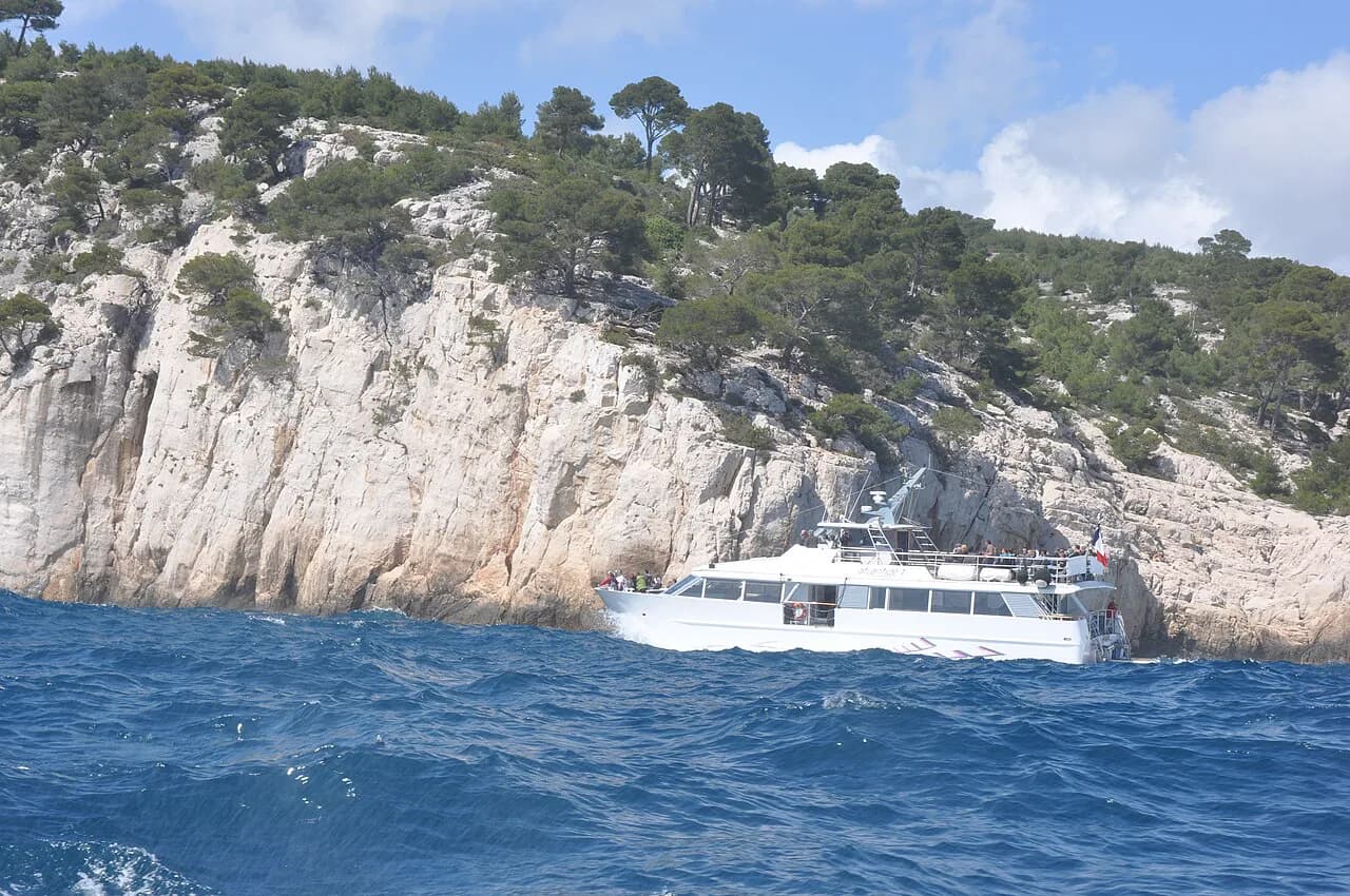
If the paths are closed or the walk is beyond the group's fitness, boats leave Cassis for the calanques in summer and show you En-Vau from the water, with tickets sold at the harbour. That is the sensible fallback rather than a substitute for the climb, because the calanque looks very different from sea level.
Plan Your Visit
Pick the Gardiole track if you want the shortest, simplest way to stand above En-Vau, and the Port Miou circuit if you want the three inlets, the panoramic ridge and a swim at Port Pin. Add the beach descent only if you have the energy for the climb back out, and start early in every season.
Before you go, confirm the access status for the day, fill your bottles and put on shoes you trust on loose stone. Hikers with a taste for the Marseille side of the park can compare the same limestone scenery on the Calanque de Sugiton hike.
Frequently Asked Questions
How long is the hike to Calanque d'En-Vau?
From La Gineste and the col de la Gardiole it is 6 km (3.7 mi) return in about two hours. From Port Miou in Cassis the three-inlet circuit is roughly 7 km (4.3 mi) and about three hours without the descent to the En-Vau beach, plus about 30 minutes each way if you go down to the sand.
Is the Calanque d'En-Vau hike difficult?
The Gardiole route is easy, following a wide vehicle track with no technical ground. The Port Miou route is moderate: the climb above Port Pin is short and steep, the ground between Port Miou and Port Pin is rocky, and the final descent to the beach is signed as difficult and slippery.
Where do you start the hike to Calanque d'En-Vau?
There are two starts. The inland one is a gate on the D559 route de la Gineste opposite the camp de Carpiagne, where the track leads up to the col de la Gardiole. The coastal one is the Port Miou car park in Cassis, a ten-minute walk from the water.
Can you hike to En-Vau from Cassis without a car?
Yes, if you arrive in Cassis by bus or train the coastal route begins at Port Miou, at the end of Avenue Notre Dame, which is walkable from the town centre. The Gardiole start on the Gineste road has no village or services, so it needs a vehicle or a taxi.
How steep is the descent to the beach at En-Vau?
It is steep and stony, taking about 30 minutes, with slippery rock in the middle section and a climb back out of similar length. Hikers with children or knee trouble often stop at the belvedere above the calanque instead and take the wide la Fontasse track back.
Are the Calanques trails closed in summer?
Massif trails can be closed on fire-risk days in the hotter summer months, and the status is published through the Mes Calanques app. Check it the evening before you travel and have a boat trip from Cassis as a backup for closed days.
Can you swim at Calanque d'En-Vau?
Yes, the small pebble beach at the head of the calanque is where people swim, and Port Pin has a cove beach on the way. Port Miou itself is a mooring basin for boats, so save the swim for the later coves.
Sources
Trail notes for your next trip
Optional updates when we add or revise hiking guides.
You might also like
Continue reading
More guides you'll find useful