St Ives to Zennor Walk: South West Coast Path Guide
Walk the South West Coast Path between St Ives and Zennor: distance, time, cliff exposure, trailhead parking and the shorter Zennor circular alternative.
On this page
The stretch of the South West Coast Path between St Ives and Zennor is one of Cornwall's most rewarding half-days out: a rollercoaster of headlands and inlets above dark blue water, with a fishing town at one end and a tiny moorland village at the other. It suits walkers who are comfortable with repeated steep climbs and rough footing, not those after a flat promenade.
You can walk it in either direction, and the choice changes the day as much as your legs do. Whichever way you go, you need a plan for the return leg, because the two villages sit several miles apart on the B3306 coast road.
What the St Ives to Zennor coast path section offers
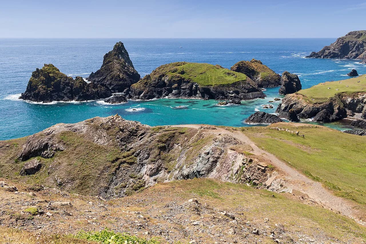
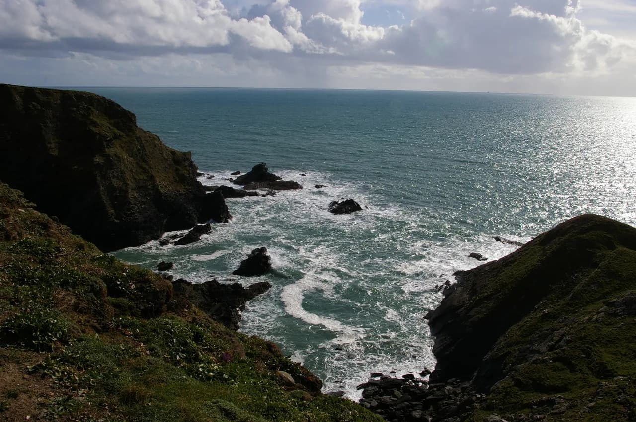
This section follows the ins and outs of headlands and inlets, cutting through tough coastal foliage and dodging boulders that sit right in the path. In return you get views up and down the Cornish coast, coves of bright blue water, and a genuine sense of remoteness within a few miles of two busy places.
It is a walk for fit hikers with decent boots. Expect steep ascents, the occasional clamber, and short sections where you pick your line over rock rather than following a smooth trodden strip. If you want an easier introduction to the Cornish coast, the wider collection of coastal walks covers gentler options. If rough, boulder-strewn ground is exactly what you enjoy, compare it with hiking in Dartmoor for a similarly tough day inland.
Which direction to walk: St Ives to Zennor versus Zennor to St Ives
Walking Zennor to St Ives puts the harder climbing early, when your legs are fresh, and finishes with a gentle descent over the top of St Ives towards Godrevy Lighthouse, with the town's beaches, pubs and buses waiting at the end. The Classic Cottages route description treats it as a 6.5 mile (10.5 km), 3 to 4 hour walk that is challenging at times, and recommends eating in Zennor before setting off.
The reverse, St Ives to Zennor, gives you the town's facilities before you start and a quiet village at the finish. The trade-off is that you arrive in Zennor with tired legs and still need transport back, and the toughest valley work comes later in the day when afternoon weather can build.
A longer through-walk variant is also recorded: Walking Britain lists the Zennor to St Ives coast path walk at 11.0 miles (17.9 km), with 1,900 feet (576 m) of ascent and around 6 hours. Treat that as a full-day version of the same coastline, not as the standard point-to-point figure, and decide which one matches your available daylight.
Trailhead and parking at St Ives
From St Ives, the coast path heads north out of town, and the natural start is wherever you can leave the car or step off a bus near the town end of the path. St Ives is compact and congested in summer, so park once for the day and walk from there rather than trying to reposition the car mid-route.
Build the return into your plan before you set out. The simplest arrangement is to walk one way and ride back along the B3306 corridor, checking the current timetable with the local bus operator on the day you travel.
Trailhead and parking at Zennor
Zennor's car park sits part way down the village road on the right-hand side, and it charges through an honesty box rather than a barrier or machine. The village gets busy on sunny weekend afternoons, so arrive early or be prepared to park on the road, taking care not to block the narrow lane.
From the car park, a small path past the back of The Tinners pub leads onto a lane that winds down towards the sea. After the house called Carn Cobba, the coast path splits: turn left for the cliff route towards St Ives, or carry straight on for Zennor Head.
Getting back: bus and road options between the two villages
The two ends are linked by the B3306, the coast road that twists between St Ives and Zennor past moorland and stone walls. Driving between them is straightforward but slow, and parking at both ends on the same day is impractical in summer, so most hikers use the bus for one leg.
Bus services on this corridor are the practical way to close the loop: ride out, walk back, or the reverse. Confirm the current timetable and the nearest stop at each village with the local operator before you commit, because the service is not frequent enough to rely on without checking.
Distance, ascent and time
The standard one-way walk covers 6.5 miles (10.5 km) in 3 to 4 hours, with repeated steep ascents and rough ground underfoot for much of the way. That timing assumes a steady pace with short stops for photos; add time for the cove detours and for a proper break at a viewpoint.
The longer recorded variant comes in at 11.0 miles (17.9 km) with 1,900 feet (576 m) of ascent and roughly 6 hours of walking. The gap between the two figures reflects different route layouts along the same coast, so pick one and plan your day around it rather than averaging them.
Route description: Zennor Head, Pendour Cove and the coves
Leaving Zennor, the path passes Zennor Head, a little headland with old mill houses that once underpinned the area's income. To the west lies Pendour Cove, tied to the Cornish tale of the Mermaid of Zennor, and the views stretch up and down the coast with the sea opening out northwards.
Round the corner the path turns east and drops into a steep valley below the village, where the descent is genuinely sharp and loose scree makes footing slippery. Cross the bridge at the bottom and climb to a viewpoint above Pendour Cove, then follow the cliff path to a small bench that makes a good snack stop.
Beyond the bench, a small left fork drops steeply to Veor Cove, a beach worth the detour at low tide. At high tide there is no beach left, and the climb back up is steep, so time this side trip with the tide rather than squeezing it in on a whim.
Carnelloe and the approach into St Ives
The path continues past Carnelloe, where signs warn of open mine shafts in the ground beside the route. Keep dogs and children close on this stretch and stay on the established path rather than cutting across the rough ground.
A viewpoint above Carnelloe Long Rock looks out towards Gurnard's Head and makes a fine lunch spot. From there the cliff path climbs again, passes behind a house and follows a long lane before turning across fields for the final approach.
As you near St Ives, the views keep coming: the path runs above the town with Godrevy Lighthouse offshore, then descends gently to the streets and harbour. The descent is the easiest walking of the day, which is exactly what you want at the end.
Exposure, footing and weather on the cliff path
This is an exposed coast path: wind, salt spray and sudden rain are all part of the day, and the rocky sections demand attention when wet. Carry a waterproof and a warm layer even on a bright morning, and turn back or shorten the route if the weather closes in rather than pushing on around the headlands.
The footing is the other real hazard. Boulders in the path, slippery scree in the valley below Zennor and steep cove descents all reward boots with grip and trekking poles, and afternoon storms build quickly on this coast in summer, so an early start is the safer habit.
When to go: best months and ground conditions
Late spring through early autumn gives the most reliable weather and the driest ground, with long daylight for the 3 to 4 hour crossing and the option of the cove detours. High summer brings the busiest conditions in St Ives and Zennor, so start early to get parked and to be off the exposed headlands before any afternoon build-up.
Winter and early spring still work on clear days, but the rocky sections stay wet and the days are short. The blackberries along the field paths ripen in late summer and early autumn, a small bonus on the inland return of the Zennor circular.
Refreshments and facilities at each end
In Zennor, the Chapel Guesthouse and Cafe is the place for a bite before you set off, and The Tinners Arms sits by the path for a drink afterwards. An ice cream at Moomaids cafe rounds off the shorter circular nicely.
St Ives offers the full range of cafes, pubs and bakeries, including the Sloop for a post-walk drink. Facilities between the two villages are essentially nonexistent, so carry water and food for the whole crossing.
St Senara church in Zennor is worth a short visit at the end of the walk, chiefly for the Mermaid of Zennor carving that gives the village much of its folklore.
Shorter alternative: the circular walk from Zennor
If the full crossing is more than you want, a circular of about 6 km (3.7 miles) starts at the Zennor car park, drops to the coast, heads towards Gurnard's Head and returns through fields to the village. The start is steep and tricky, but the rest is fairly gentle, which makes it a good family option.
The best known walking in Cornwall extends well beyond this stretch; if you want a different day out, Bodmin Moor offers inland alternatives, though it lies outside this coastal section.
Where to base yourself for this walk
St Ives is the obvious base if you want restaurants, beaches and transport at the end of the day, while Zennor suits anyone who prefers quiet, moorland edges and a village pace. Staying in St Ives also makes the one-way walk logistically simple, since you can ride the bus out in the morning and walk home.
If you plan several days in the area, the South West Coast Path in Cornwall continues in both directions with plenty more cliff walking. For a change of pace and a completely different kind of day, via ferrata Cornwall offers a vertical alternative at Goodygrane Activity Centre, with routes graded by difficulty rather than distance.
Plan Your Day on the Coast Path
Decide your direction first, then your transport: walk Zennor to St Ives for a fresh-legged start and a town finish, or reverse it for an early dose of St Ives cafes and a quiet village ending. Either way, an early start gets you parked and off the exposed headlands before the afternoon weather builds.
Pack for wind and rain, wear boots with grip, carry water for the full crossing and keep children and dogs close past Carnelloe. For more cliff walking in the county, the walks collection covers the rest of the Cornish coast.
Frequently Asked Questions
How long does the St Ives to Zennor walk take?
The standard one-way crossing is recorded as a 6.5 mile (10.5 km) route taking 3 to 4 hours with steep ascents and rough ground. A longer recorded variant covers 11.0 miles (17.9 km) with 1,900 feet (576 m) of ascent in around 6 hours.
Is the St Ives to Zennor walk hard?
It is a demanding half-day: steep valley climbs, boulders in the path and slippery scree below Zennor, plus exposed headlands. Fit hikers with boots and poles cope well; anyone uncomfortable on rough cliff ground should choose the shorter Zennor circular instead.
Can you walk one way from St Ives to Zennor and get the bus back?
Yes, buses run along the B3306 corridor linking the two villages, so the usual plan is to ride out and walk back or the reverse. Confirm the current timetable with the local bus operator before you set out, since the service is not frequent.
Where do you park for the Zennor coast path walk?
Use the village car park part way down the road on the right, which takes payment through an honesty box. Village parking fills on sunny weekend afternoons, so arrive early or park considerately on the road.
Is there a shorter circular walk from Zennor?
Yes, a roughly 6 km (3.7 miles) circuit starts at the Zennor car park, drops to the coast towards Gurnard's Head and returns through fields. The first descent is steep and tricky, but the rest is fairly gentle and suits families.
Sources
Trail notes for your next trip
Optional updates when we add or revise hiking guides.
You might also like
Continue reading
More guides you'll find useful