Rame Head Walk: Coastal Route, Parking and Distance
Plan the Rame Head walk in Cornwall: the short headland path to the medieval chapel, the 9 km circular via Penlee Point and Cawsand, and parking basics.
On this page
Rame Head is the southeastern corner of Cornwall, a high, open headland topped by a ruined medieval chapel that once served as a hermitage and a lighthouse. The walk suits hikers who want big sea views without a long climb, and the headland itself can be reached in well under an hour from the car park. Come for the cliffs, the light over Plymouth Sound and the quieter feel of a peninsula that draws far fewer people than the coast further west.
The choice is simple. A short amble from the car park to the chapel and back fills an hour comfortably, while the full circuit to Penlee Point and Cawsand covers 9.0 km (5.6 miles) at a moderate grade. The longer route adds a gun battery turned nature reserve, a grotto and a smuggling village, and it is the version worth building a day around.
Where Rame Head is and how to reach it
Rame Head sits on the Rame Peninsula, the arm of Cornwall that shelters Plymouth Sound from the west. The South West Coast Path runs straight past the chapel headland, so the walk stitches into a much longer route if you want it to. For a short outing, drive to the headland car park and walk from there.
Approach roads are narrow Cornish lanes with passing places, so allow extra time and drive slowly. Whitsand Bay lies just to the west and makes a natural second starting point: park there and walk through to Kingsand and Cawsand, or reverse the direction, for roughly 8 km (5 miles) each way. If you are weighing this against other routes on the peninsula, the walks in cornwall guide sets out the wider options across the county.
Trailhead and parking at Rame Head
The headland car park sits at the end of the lane beside the National Coastguard station, which is the practical marker to aim for on the final approach. A public toilet stands here too, which makes it a sensible place to start and finish a short walk. Details of the car park and the coastguard station are described alongside the route notes for the headland.
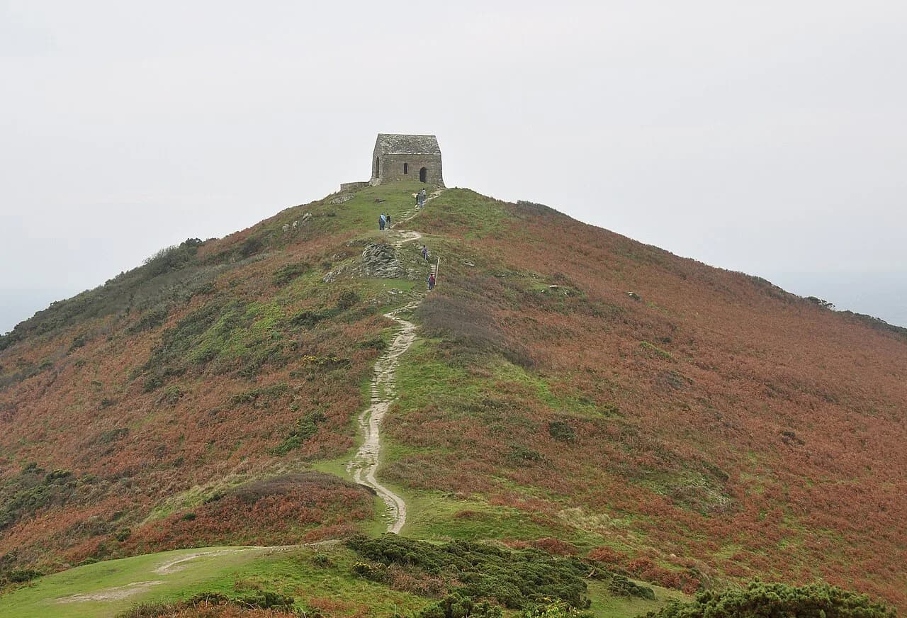
From the car park, pass through the gates and follow the path up across a gently sloping field toward the chapel, then take the steeper pull up the rocky outcrop itself. That final rise is short but loose underfoot in places, so boots with grip are worth having even on this easy outing. Return the same way, or continue west along the coast path for the full circuit.
Short headland walk: car park to the chapel
This is the version for a spare hour, a stiff breeze or tired legs. You gain the chapel platform quickly, with the whole of Whitsand Bay opening up behind you and the coast curving away toward Cawsand and Kingsand in the other direction. The platform in front of the chapel is broad and open, and metal outlines on it mark its use as a strategic viewpoint in the Second World War.
Wildlife is part of the draw: the scrub around the headland holds Dartford warbler, and deer are sometimes seen moving through the cover near the sea. Gorse flowers brighten the grassland even in winter, which makes this a genuine year-round option rather than a summer-only stroll. Keep to the paths across the field sections and give grazing animals room.
The full circular: Rame Head, Penlee Point and Cawsand
The classic circuit runs 9.0 km (5.6 miles) at a moderate grade, looping around Rame Head past the chapel and on to the remains of a large gun battery at Penlee Point, now a nature reserve, before dropping into Cawsand. Cawsand was once known as Cornwall's smuggling capital, and the village streets give the walk a built finish rather than an exposed one. The route directions are published as a guided circular with the full distance stated.
Walking it in this direction puts the high, exposed cliff-top stretch on the Penlee and Rame Head side early, with the more sheltered lanes and village edges at the end. Reverse it if you prefer to climb gradually and finish on the headland. Either way, the cliff-top legs are the ones to time carefully around wind and weather.
Route description section by section
Start at the chapel headland. From the car park the path crosses the field and climbs to the ruined chapel, where the views run back along Whitsand Bay and around toward Cawsand and Kingsand. This is the high point of the short walk and the first viewpoint of the longer one.
Continue west above the cliffs on the southern edge of the Penlee and Rame Head headland. The South West Coast Path here follows high, open clifftop ground, with the grotto as a landmark before the path turns sharply right and carries on above the drop. The official route description tracks this cliff section in detail.
Next comes Penlee Point, where the gun battery remains sit on a nature reserve, then the path descends toward Cawsand. Village lanes and the waterfront give you a place to sit down before the return leg, and the coast path links back to the headland. If you want to see how this section fits the county's larger coastal network, the South West Coast Path in Cornwall guide covers the adjoining stretches.
Mount Edgcumbe to Kingsand alternative circuit
For a second day on the peninsula, the Mount Edgcumbe to Kingsand circuit runs 9.1 km (5.7 miles) at a moderate grade through Mount Edgcumbe Country Park, with views over Plymouth Sound. The route takes in Drake's Island, where Drake set sail to circumnavigate the globe, and the breakwater that Napoleon called an engineering masterpiece as he left England. It is a country-park walk with village finish rather than a cliff-headland one, and it suits a day when the exposed headland feels too windy. If you would rather trade the coast for open moorland, the Dartmoor hiking guide makes a good contrast to these peninsula circuits.
Distance, ascent and typical walking time
The short headland walk is a matter of a kilometre or two each way from the car park, with a brief steep rise onto the rocky outcrop. Count on well under an hour of walking for the round trip, plus time on the chapel platform. It is the right choice if you have an hour and want the view without committing to a full day.
The full circular is 9.0 km (5.6 miles) and moderate, which translates to roughly three to four hours of walking for most hikers once the cliff sections and village edges are counted. The Mount Edgcumbe circuit at 9.1 km (5.7 miles) sits in the same bracket. Treat these as planning ranges and adjust for your pace, stops and the wind.
No reliable ascent total is published for these routes, so plan on rolling coastal ground with short sharp rises rather than a single big climb. The steepest moment on the headland route is the pull onto the outcrop itself.
When to go: seasons, ground conditions and coastal weather
This coast works across the year. Gorse flowers in the grassland even in February, and the headland is at its quietest outside summer, when the peninsula sees far less traffic than the rest of Cornwall. Spring and early autumn give the best balance of light, dry ground and manageable wind.
After rain, the field crossings and the rocky climb to the chapel turn slick, so grip matters more than distance on this walk. Wind is the other variable: the headland is exposed on every side, and the cliff-top legs between Rame Head and Penlee Point take the full force of it. Pick a calmer day for the full circuit and save the short chapel walk for breezier ones.
Hazards on the cliffs and the sensible response
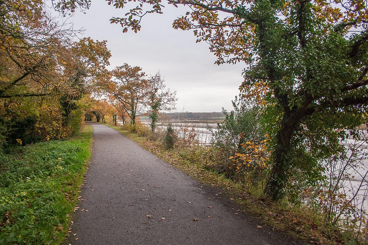
The Penlee and Rame Head cliffs are high and unfenced in places, and the coast path runs close to the edge above the southern shoreline. Keep back from the lip, particularly in gusty conditions, and keep dogs and children close on the cliff-top legs. The ground is uneven underfoot, so take the descent into Cawsand steadily rather than rushing it.
There is no reliable water or shelter on the exposed headland stretch, so carry what you need and plan your break for the village end of the circuit. In poor visibility, follow the waymarked coast path rather than cutting across field edges. For a broader look at the county's clifftop routes, the cornwall coastal walks collection is a useful comparison.
Facilities and points of interest on the route
The headland car park has a public toilet, and Cawsand and Kingsand both offer places to eat and drink at the end of the longer circuit. The chapel, the Penlee Point gun battery and the grotto are the three landmarks that anchor the route, and each gives a natural stopping point. The coastguard station beside the car park is a working facility rather than a visitor attraction.
If you want to add an adrenaline day to a coastal trip, the via ferrata cornwall course at Goodygrane Activity Centre near Long Downs offers a climbing-based alternative well inland from the peninsula. It is a different kind of outing entirely, and best treated as a separate day rather than combined with the headland walk.
Plan Your Rame Head Walk
Choose the short headland walk if you have an hour and want the chapel and the Whitsand Bay view. Choose the 9.0 km (5.6 miles) circular if you want the full sweep past Penlee Point and a village finish in Cawsand. Either way, drive the lanes slowly, start from the headland car park, and take the wind seriously on the cliff sections.
Pair the walk with a second day at Mount Edgcumbe, and use the wider walks in cornwall guide when you want to extend a trip across the county. Current car park charges and any changes to facilities are posted locally at the headland.
Frequently Asked Questions
How long is the Rame Head walk?
The short route from the headland car park to the chapel and back takes well under an hour of walking. The full circular past Penlee Point and Cawsand is 9.0 km (5.6 miles) at a moderate grade, which most hikers cover in roughly three to four hours with stops.
Where do you park for the Rame Head walk?
Park at the headland car park at the end of the lane, beside the National Coastguard station, which also has a public toilet. The approach lanes are narrow with passing places, so allow extra time for the final drive.
Is the Rame Head walk circular?
The chapel walk from the car park is an out-and-back along the same path. The longer route is a circular that loops from the headland past Penlee Point and the gun battery and down into Cawsand before returning.
Can you walk from Cawsand to Rame Head?
Yes. The coast path links Cawsand and Kingsand with the Rame Head headland, and the 9.0 km (5.6 miles) circular uses that connection. You can start in the village instead of the car park and climb to the headland first.
What is there to see on the Rame Head walk?
The ruined medieval chapel on the promontory, the Second World War viewpoint platform in front of it, the Penlee Point gun battery on its nature reserve, the grotto on the cliff path and the villages of Cawsand and Kingsand. Dartford warbler and deer are sometimes seen in the scrub.
How hard is the Rame Head circular?
It is rated moderate: 9.0 km (5.6 miles) of coastal ground with short steep rises and high, exposed cliff-top sections. The steepest moment is the rocky climb onto the chapel outcrop, which is brief but loose in places.
Do you need hiking boots for the Rame Head walk?
Boots with grip are worthwhile even on the short walk, because the field crossings and the rocky pull up to the chapel get slick after rain. The cliff-top legs of the circular are uneven underfoot.
When is the best time to walk Rame Head?
Spring and early autumn give the best mix of dry ground, good light and manageable wind, and gorse flowers in the grassland even in winter. The headland is quieter than the rest of Cornwall outside summer.
Sources
Trail notes for your next trip
Optional updates when we add or revise hiking guides.
You might also like
Continue reading
More guides you'll find useful