Kynance Cove Walk: Lizard Point Circular Route Guide
Walk from Lizard Village to Kynance Cove on Cornwall's serpentine coast, with distance, difficulty, route landmarks and the best months for wildflowers.
On this page
The Kynance Cove walk gives you the classic Lizard coastline in a single half day: a lighthouse, a Marconi wireless hut, cliff-top heath and a beach of dark red and green serpentine rock stacks. The circular route from Lizard Village is moderate by the standards of the peninsula, and most hikers with a reasonable level of fitness can finish it in an afternoon.
The route follows the South West Coast Path, so you walk on waymarked National Trail rather than faint sheep tracks, and the plateau keeps the climbing modest apart from the dips where streams cut down to the sea. That makes it a good choice for a first coastal walk in Cornwall or for a day when you want big views without a full-day commitment. If you are weighing this against other short coastal days further east, the Jurassic Coast hikes offer a comparable mix of big views and modest distances.
Why the Lizard to Kynance Cove walk suits most hikers
The Lizard is a high but comparatively flat plateau, so the walking is mostly open cliff-top with short, steep pulls where valleys reach the sea and little extended climbing. The circular from Lizard Village to Kynance Cove carries a moderate grade, and the main effort is concentrated in the cove descent and the climb back out.
What you get for that effort is the most southerly point of the British mainland, the old lifeboat station above Polpeor Cove, a restored Marconi wireless hut and the serpentine stacks of Kynance. The cliffs are exposed, the ground is often wet underfoot, and the views run west toward Mullion and Predannack.
Trailhead and access
Start in Lizard Village, where the coast path leaves the village lanes for the cliffs above the point. Village parking is the practical base for a circular walk, since the route returns to the same streets.
Kynance Cove has its own parking area close to the cove path, which makes it the obvious start for the shorter one-way option from the cove to Lizard Village. Arrive early in summer, when the cove car park fills and the narrow approach road becomes slow.
If you are based elsewhere on the peninsula, the walking hub at Helston and the villages of Mullion and Cadgwith give you alternative access points onto the same stretch of coast. Our walks in cornwall guide sets out the wider network if you want to link several days.
Distance, ascent and time
The full Lizard and Kynance Cove circular is 4.4 miles (7.1 km) at a moderate grade, covering the Victorian excursion route from the village to the point and then along the coast to the cove. Allow a relaxed half day, with time on the cliff tops and at the beach.
The shorter option, Kynance Cove and Lizard Village, is 2.9 miles (4.7 km) one way, which suits a half-day outing or a lift back to the start. If you only have a couple of hours, walk the village to the point and back rather than committing to the full circuit.
There is also a 3.2-mile (5.1 km) moderate variant from Lizard village to the cove for hikers who want the coastal highlights without the full loop. Pick by the time you have and by how much cliff walking you want underfoot.
Route description
From Lizard Village the path runs south past the lighthouse to Lizard Point, where the old lifeboat station sits above Polpeor Cove and the reef runs out into the sea. This is the most southerly point of the mainland, and the cliff edge here is unfenced in places, so keep back from the lip when the wind is up.
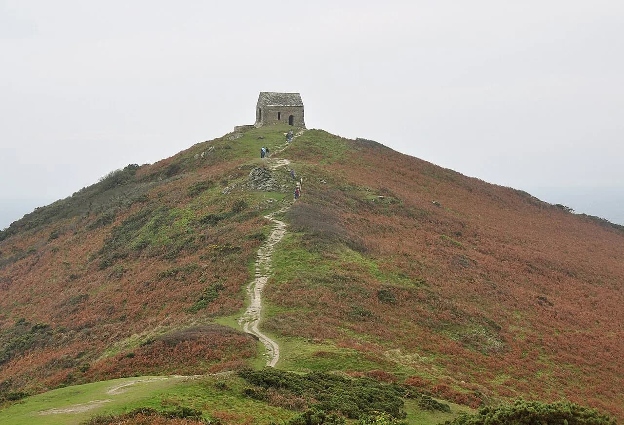
West of the point the route passes the restored Marconi wireless hut, a reminder of the transatlantic experiments conducted from these cliffs, then follows the coast path above serpentine cliffs toward Kynance. The walking is straightforward waymark-following, with the sea always on your left.
The final approach to Kynance drops steeply to the cove between rock stacks, and the return climbs back onto the plateau before turning inland to the village. On the longer Cadgwith to Lizard variant, 7 miles (11.3 km) at a moderate grade, you also pass the Devil's Frying Pan and the lifeboat station.
Kynance Cove and the tide
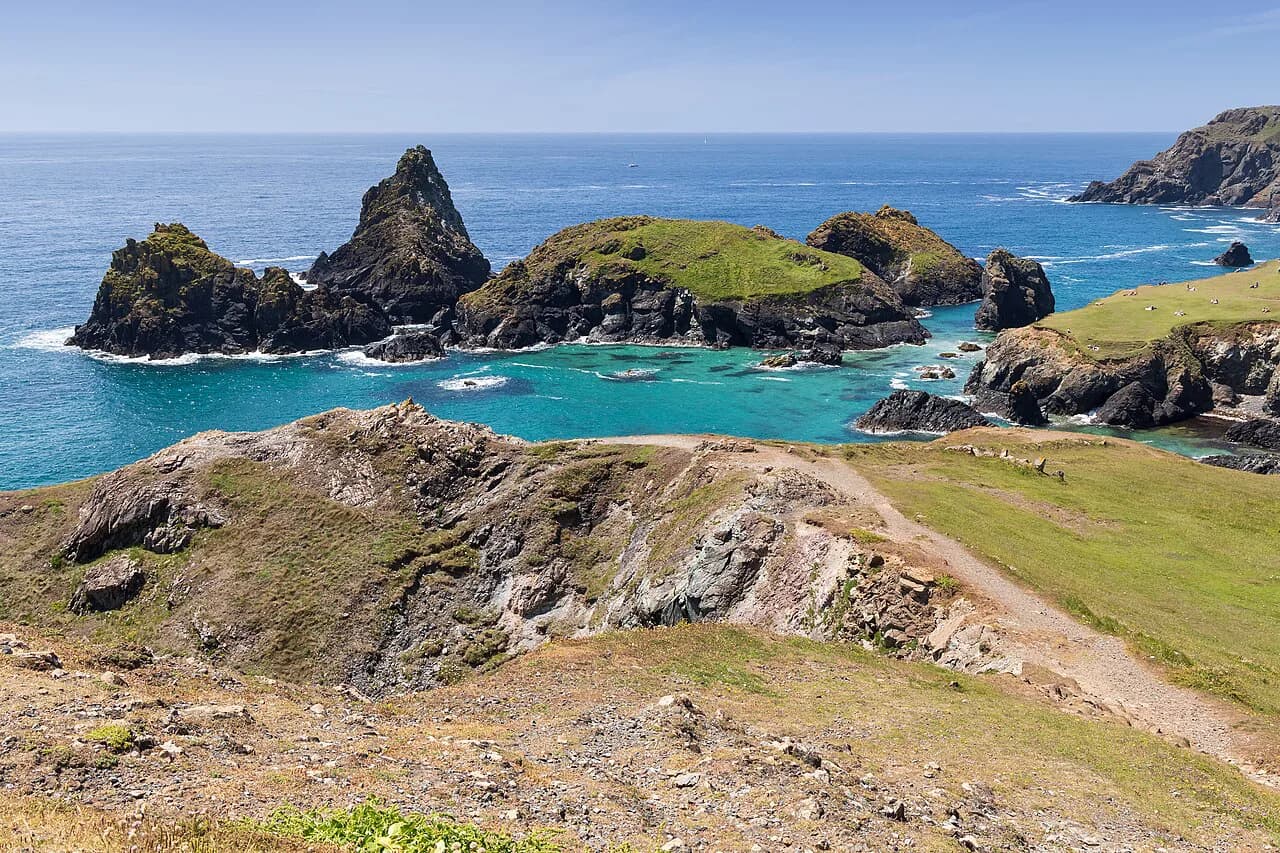
Kynance is a beach of serpentine stacks and caves, with the dark red and green rock giving the cove its distinctive color. The last stretch of path reaches the sand through the stacks, and the beach itself changes shape with the tide, so the cove looks different at high and low water.
Plan the beach stop around the tide instead of turning up at any hour; a rising tide can cut off the far end of the cove. The South West Coast Path route pages list the cove as part of the Lizard Point walks, and the iWalk Cornwall circular directions flag the coastal sections where tide state matters, so check current tide times and route notes before setting out.
Alternative start and finish points
Walking Kynance Cove to Lizard Village one way, 2.9 miles (4.7 km), puts the cove first and finishes in the village for food and transport. It is the better direction if you want the beach early and the village at the end of the day.
The stretch between Mullion Cove and Kynance is 8.6 miles (13.9 km) and rated leisurely, so it works as a longer coastal day for hikers who want the western cliffs as well as the cove. It is a one-way walk, and you need to arrange transport between the two ends.
Longer and harder variants in the Lizard National Nature Reserve
Predannack to Kynance Cove is 5.1 miles (8.2 km) at a moderate grade, crossing the national nature reserve on the rugged serpentine cliffs. It adds wildflower-rich heath and a wilder feel than the village circuit, and it suits hikers who want a longer day on the western side.
For a step up in effort, Coverack to Lankidden Cove is 7.3 miles (11.8 km) at a moderate-to-strenuous grade, on one of the remotest parts of the peninsula. The ground here is rougher and the cliffs more exposed, so treat it as a full day rather than an add-on.
When to go
Spring and early summer bring the Lizard's wildflowers, including Cornwall's county flower, and the cliff tops are at their best for color. The same season gives the clearest chance of seeing Cornish choughs along the coast, and the weather is usually more settled than in the winter gales.
Autumn and winter walking on the Lizard is quieter, but the cliffs are windier and the ground wetter, and short daylight limits longer variants. Summer brings the most visitors to the cove, so start early if you want the beach before the crowds.
Hazards and conditions
The main hazards are cliff exposure on unfenced sections and slippery serpentine rock where the path drops to the cove. Wear boots with grip, keep children and dogs close at the edge, and avoid the beach descent when the rock is wet.
Afternoon sea fog and sudden squalls can reduce visibility on the plateau, so carry a map and compass even on the waymarked route. The coast path is well signed, but the cliff edge is not fenced everywhere and the tide changes the cove more than the map suggests.
Facilities and practicalities
Lizard Village has the shops, cafés and parking you need for a day hike, and the village is the natural base for the circular. Kynance Cove has a small car park and a café near the cove, both busiest in summer.
Check tide times and the weather before setting out, and carry water and a windproof layer; the plateau offers little shelter. If you want a different kind of coastal challenge, via ferrata cornwall at Goodygrane Activity Centre offers a guided rock route away from the peninsula's cliffs.
Plan Your Visit
The Kynance Cove walk from Lizard Village is the best single day on the peninsula for most hikers: 4.4 miles (7.1 km) of moderate coast path with the most southerly point, a wireless hut, a lighthouse and a serpentine beach. Walk it clockwise, start early in summer, and time the beach stop to the tide.
If you have less time, take the 2.9-mile (4.7 km) one-way route from the cove to the village or the 3.2-mile (5.1 km) shorter circular. If you have more, extend west to Predannack or combine the coast with the inland paths for a full Lizard day.
Frequently Asked Questions
How long is the walk from Lizard Point to Kynance Cove?
The circular route from Lizard Village to the point and on to Kynance Cove is 4.4 miles (7.1 km) at a moderate grade. The shorter one-way option from Kynance Cove to Lizard Village is 2.9 miles (4.7 km), and a shorter circular version is 3.2 miles (5.1 km).
Is the Kynance Cove walk difficult?
It is rated moderate. The Lizard is a relatively flat plateau, so the climbing is limited to short, steep pulls at the coves and stream valleys; the main effort is the descent to Kynance and the climb back out. Exposure at the cliff edge and wet serpentine rock are the things to watch.
Can you walk to Kynance Cove from Lizard Village?
Yes. The waymarked South West Coast Path runs from the village past the lighthouse and Lizard Point to the cove. The full loop returns to the village, or you can walk it one way from the cove and arrange a lift back.
When is the best time to walk to Kynance Cove?
Spring and early summer are best for wildflowers and choughs, with more settled weather than winter. Summer is busiest at the cove, so start early, and autumn or winter walking is quieter but windier and wetter underfoot.
Is the Kynance Cove walk accessible?
The cliff-top sections are on uneven, exposed coast path with steep drops to the coves, so it is not a wheelchair route. The final descent to the beach is steep and slippery when wet; hikers with limited mobility should enjoy the viewpoint paths above the cove instead.
Do you need to check the tide for the Kynance Cove walk?
Tide state matters at Kynance beach, where the sand and the far end of the cove change with the water. Check tide times for the day and plan the beach stop accordingly; the sand is not walkable at every hour.
Sources
Trail notes for your next trip
Optional updates when we add or revise hiking guides.
You might also like
Continue reading
More guides you'll find useful