Lac de Chéserys Hike from Chamonix: Routes and Ladders
Plan the Lac de Chéserys hike above Chamonix: two trailheads, ladder passages, lift access and the best months for the lakes and Lac Blanc.
On this page
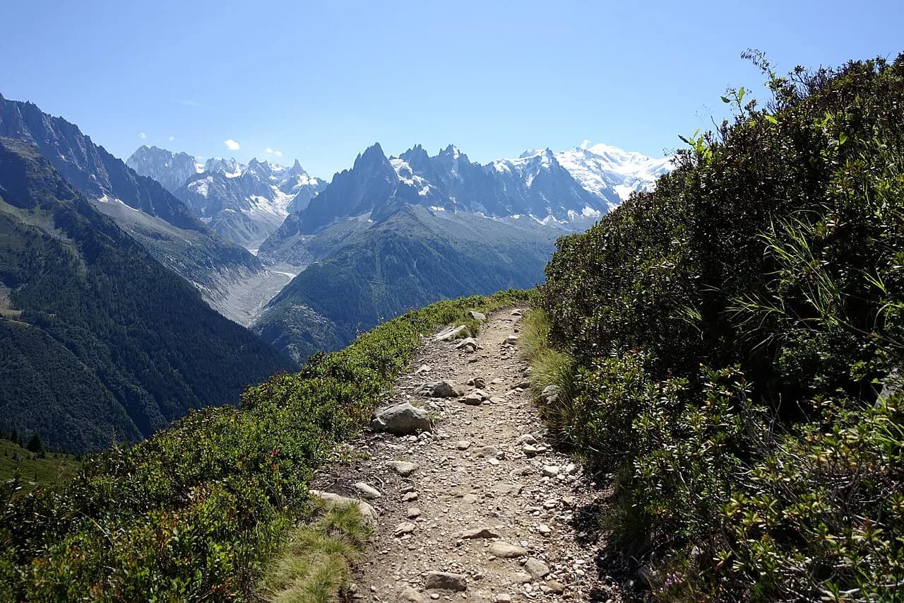
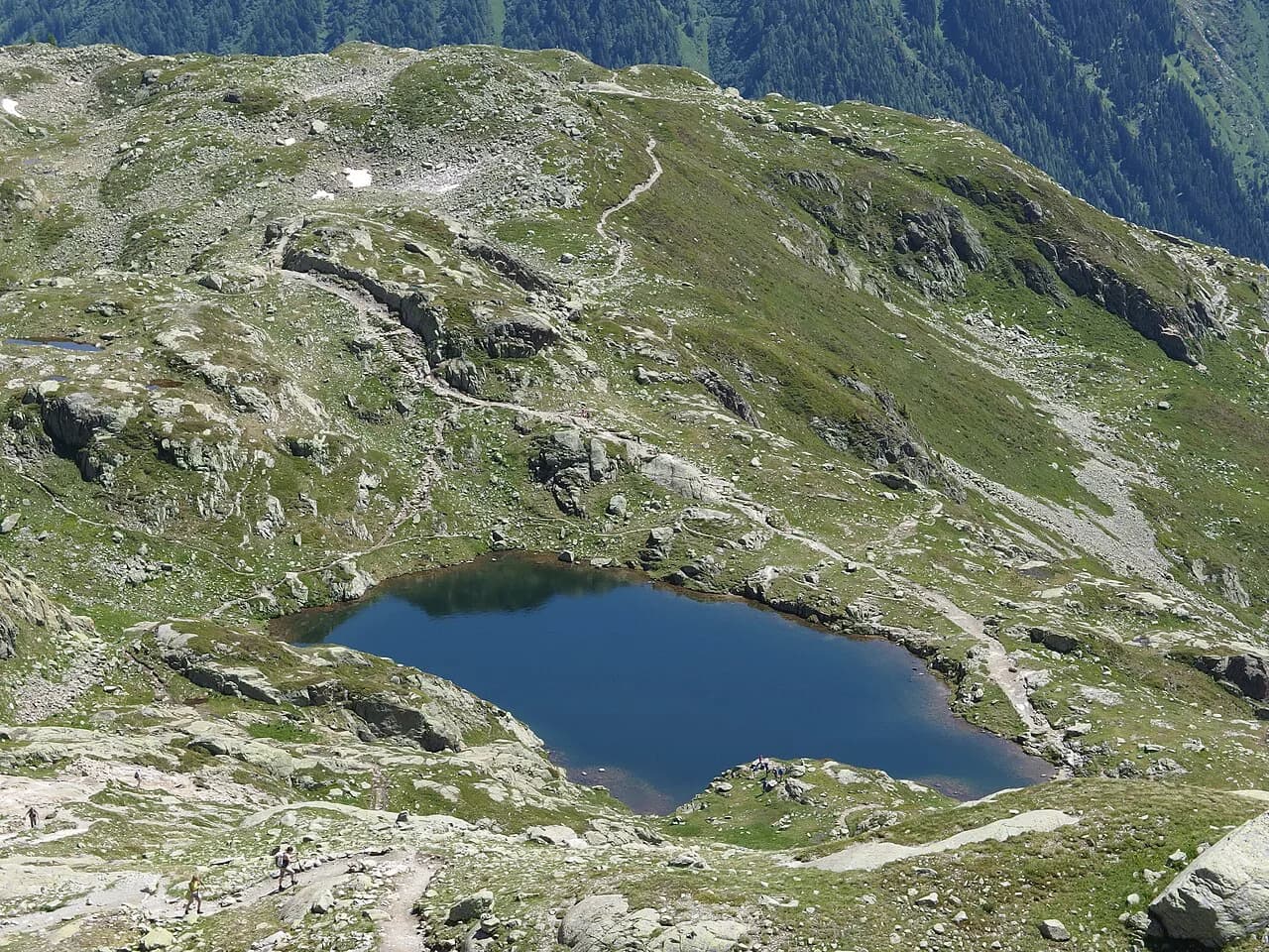
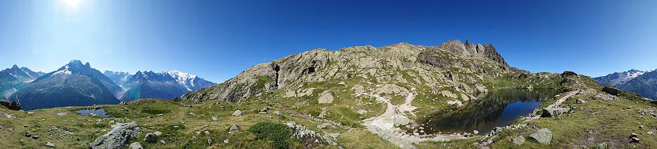
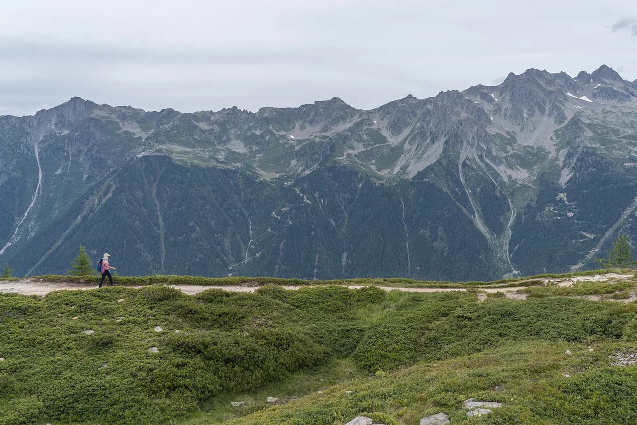
The Lacs des Chéserys are a scatter of small tarns on a granite shelf in the Aiguilles Rouges, directly above the Chamonix valley and looking across at Mont Blanc and the Aiguilles de Chamonix. They suit hikers who want that high-alpine view without committing to the busiest section of the Lac Blanc hike, and several of the pools sit within a few minutes of the main path.
There are two practical ways in: a free valley-floor start from Tré le Champ above Argentière, or a lift-assisted start from Les Praz that removes most of the climb. The first option includes ladder passages on the direct line, while the second trades ladders for crowds. Choosing between them is the main planning decision on this hike.
Where the lakes sit
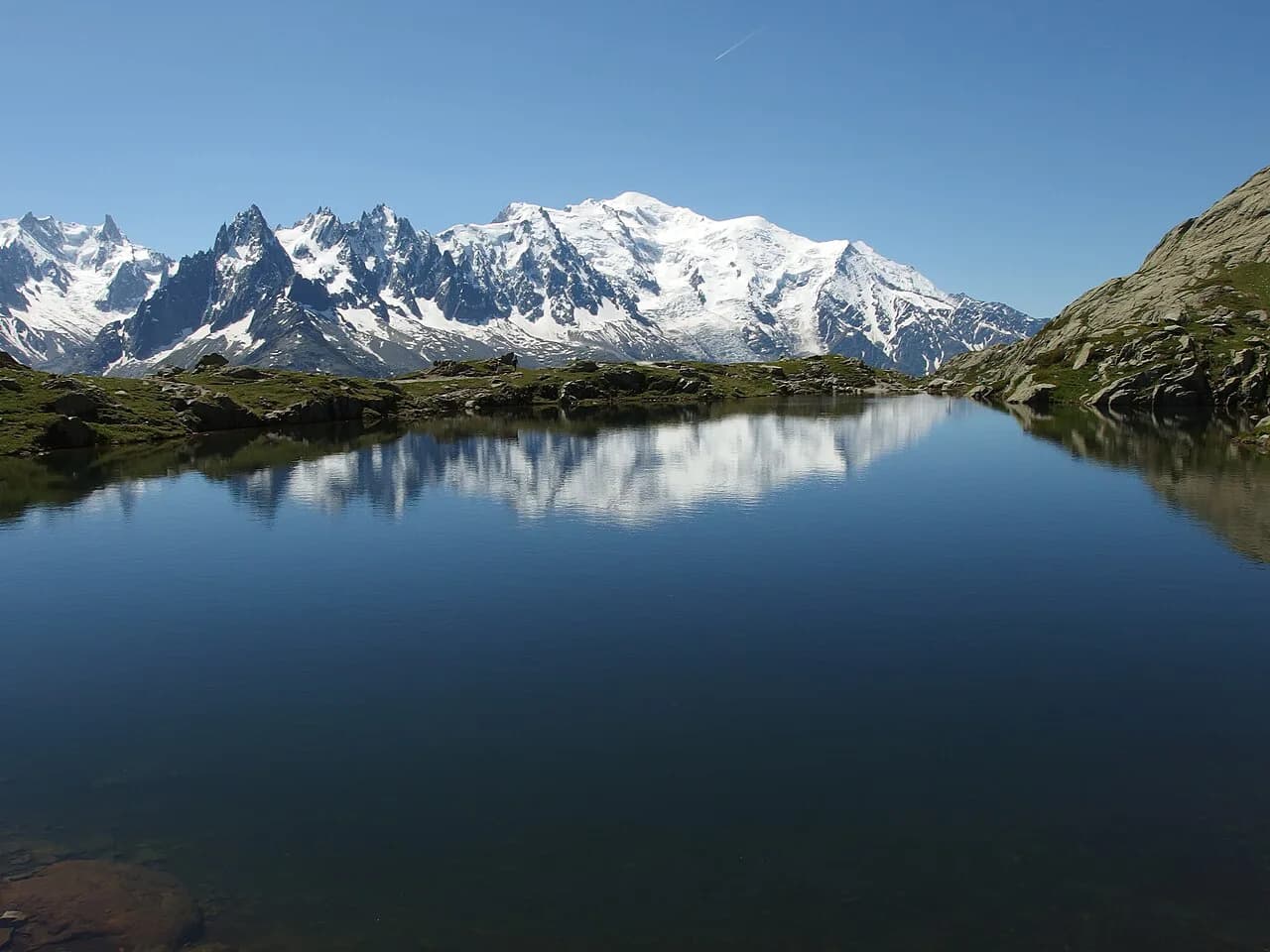
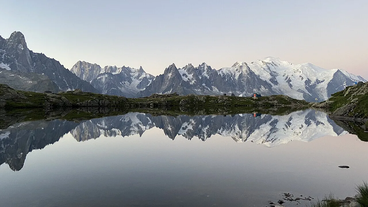
The lakes lie in the Aiguilles Rouges nature reserve on the western side of the Chamonix valley, below Lac Blanc and above the forested slopes that drop toward Argentière and Les Praz. The Mont Blanc massif stands opposite, so the reflection in the still western pools is of the big peaks rather than of the valley itself. That westward lake, just beneath Lac Blanc, is the one most hikers aim for.
Because both trailheads sit within the same small corner of the reserve, you can combine them into a traverse rather than an out-and-back. Climb one way and descend the other and you get a loop without retracing the exposed sections. For a wider look at how this hike fits with the rest of the valley, the hiking in chamonix guide sets out the other routes around the Mont Blanc massif. If you want the full circuit around the range rather than a single valley day, the Mont Blanc hiking guide covers it stage by stage.
Trailhead options
The free start is the Tré le Champ parking area, on the road above Argentière toward the Col des Montets. The lot fills quickly, and the Col des Montets car parks a short distance away add only about ten minutes of walking to the day. Starting here means climbing the full height from the valley, first through forest and then onto open rock.
The lift-assisted start is Les Praz, roughly 2.5 km (1.6 mi) north of Chamonix center, where the Flégère gondola rises to the mid-station. From there the classic loop climbs steadily to the lakes and Lac Blanc, with the option of the Index chairlift for a higher, flatter and more exposed traverse. Both lifts work as a combined ticket for the point-to-point line.
Getting to Les Praz without a car
Chamonix bus lines 1 and 2 run between the town center and Le Tour with a stop at Les Praz – Flégère, and the Mont-Blanc Express train stops at Les Praz station about five minutes' walk from the gondola base. That makes the lift start realistic from lodgings in Argentière, Vallorcine or Les Houches as well as from Chamonix itself. Guest cards from valley accommodation cover local buses and trains, so the transfer can cost nothing beyond your room.
By car there is a small paid lot at the lift base that fills fast in peak season, which is one reason the Tré le Champ option appeals if you are driving and starting early. Walking from Chamonix center to Les Praz takes roughly 30 to 40 minutes on flat ground, a reasonable warm-up before the climb.
Lift access and season
The Flégère gondola and Index chairlift run a summer season that typically begins in late June and ends in mid-September, with the first weeks and last weeks on shorter hours. A hiker blog tracking the 2026 timetable gives Flégère return adult fares at the level of a modest day-out cost and a combined Flégère plus Index ticket for the point-to-point route, with reduced rates for children and seniors. Confirm operating dates and fares with the lift operator before you rely on the Index connection.
Outside that window, the lifts do not run as a shortcut, and access means walking up from Les Praz or from Tré le Champ. Plan the day around the last descent: miss it and you add a long knee-jarring descent through the forest to the valley floor. The Grand Balcon Sud Hike, Chamonix follows the same balcony of trails and gives a sense of what the mid-station opens up.
Route from Tré le Champ
From Tré le Champ the path enters forest and climbs on an easy, well-graded trail, with views opening across the valley as the trees thin. Higher up it meets rock walls where the direct line uses short ladders, and while the rungs are not technically hard, they demand a head for exposure and space. Hikers who dislike ladders should skip this approach and use the Col des Montets path instead.
Above the walls the trail reaches the lakes themselves, a mix of small pools on open granite slabs. The western lake, sitting just below Lac Blanc, gives the cleanest reflection of the Mont Blanc skyline when the wind drops. Expect company on summer weekends and far more solitude in October, when the larch and low vegetation turn.
Route from the Flégère side
From the Flégère mid-station the classic loop to the lakes and Lac Blanc covers 8.05 km (5.0 mi) with about 564 m (1,850 ft) of ascent and takes around four hours at a steady pace. The trail is well marked and mostly dirt and rock, steep in places but without technical ground. Crowds build sharply after mid-morning in July and August, so an early gondola makes a real difference.
The alternative is the Index chairlift to a higher start, then a point-to-point traverse to the Flégère gondola of 7.61 km (4.7 mi) with only about 185 m (607 ft) of gain, also roughly four hours. What it saves in climbing it gives back in character: narrow, rocky and exposed in places, with snow patches that can linger into July. Confident hikers on rugged ground get a quieter route and a striking high-level traverse.
The link to Lac Blanc
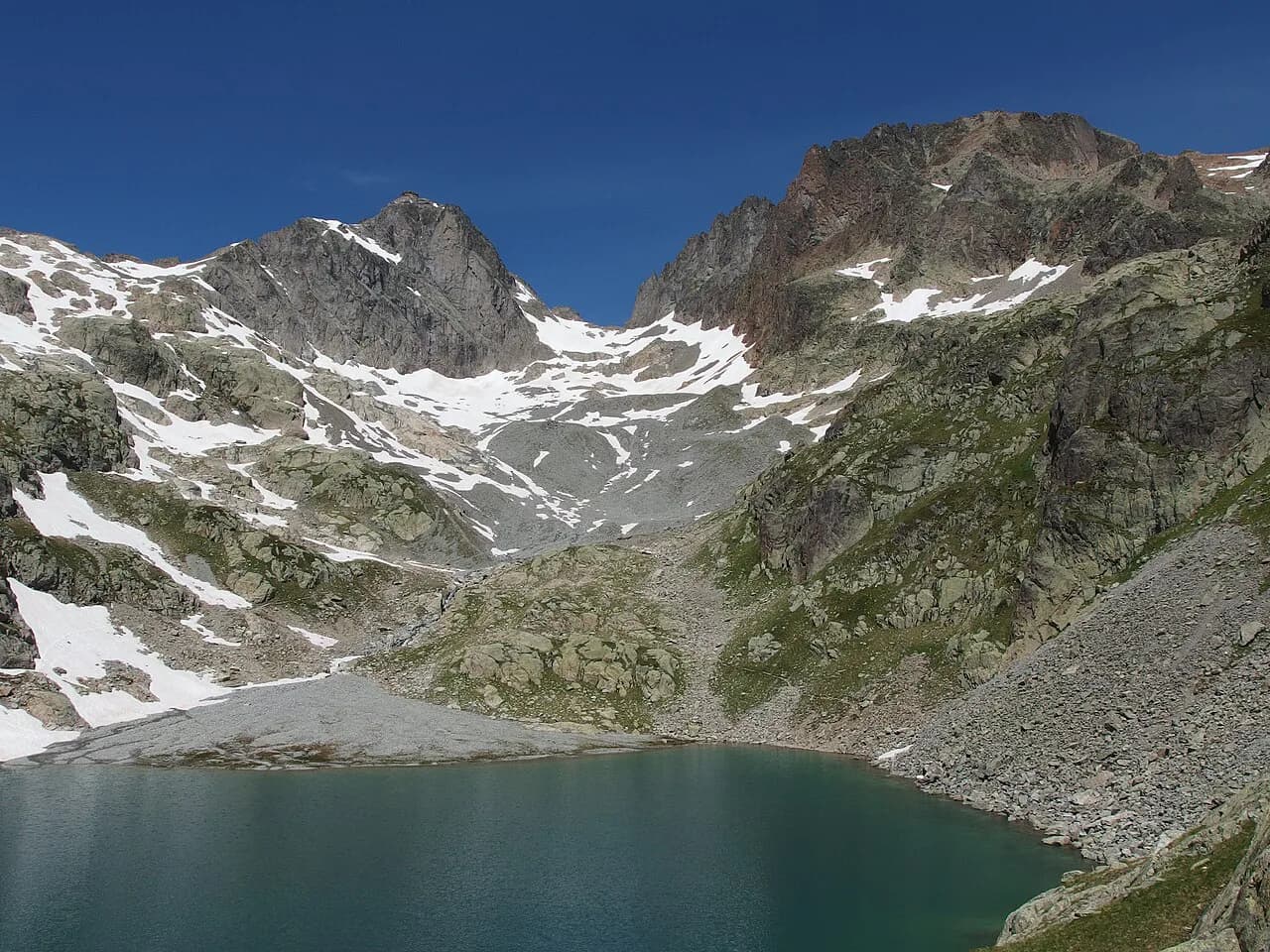
From the western Chéserys lake it is about 25 minutes up to Lac Blanc, with one more ladder on the way. That makes Lac Blanc a short add-on rather than a separate outing, and the easy option is to visit it before dropping back to the quieter pools. The Lac Blanc Hike from Chamonix page covers the lake, its refuge and the full circuit in more detail.
The descent from Lac Blanc toward the Chéserys side begins with steep wooden stairs and two ladder sections with rungs fixed into the rock face. Lines form at the top of the ladders on busy afternoons, and hikers who freeze there can hold up everyone behind them. If ladders are not for you, reach the lakes from the Col des Montets side and leave Lac Blanc for another day.
Descent by the Col des Montets
The Col des Montets path has no ladders and makes the better descent for children and dogs, as well as for anyone who found the climb uncomfortable. It rejoins the road near the col, where a short walk along the road brings you back to the Tré le Champ parking. Used as a descent, it turns the day into a loop with only the lower forest repeated.
Distance, ascent and time across the approaches
For the Tré le Champ and Col des Montets lines, the day is shorter in distance but steeper overall than the lift routes, since you climb from the valley floor rather than from the gondola. Judge it by vertical gain and how comfortable you are on ladders, not by a single headline figure. The Flégère loop figures above apply to the lift-assisted classic; the Index traverse figures apply only to that point-to-point line.
Allow extra time for photo stops at the lakes and for the short climb to Lac Blanc if you add it. A relaxed day from the lifts fits comfortably into daylight even in September, while a valley-floor start from Tré le Champ calls for an earlier alarm.
The ladders and exposed passages
The ladder pitches on the direct line from Tré le Champ and below Lac Blanc are short but airy, with drop-offs beside the rungs and a need for three points of contact. Hikers with a fear of heights, small children without a confident adult, or anyone in smooth-soled shoes should choose the ladder-free Col des Montets route. Trekking poles are best stowed on the ladders so both hands stay free.
The Index traverse adds its own exposure: narrow traverses and loose scree above steep ground, and in June and early July snowfields that make the path slippery on the exposed side. Microspikes help on old snow, but the real decision is whether you are happy on that kind of ground at all. If not, the Flégère loop keeps you on straightforward trail.
Refuge du Lac Blanc
The Refuge du Lac Blanc sits just above the lake and opens in June, closing at the end of September, with no winter room and credit cards not accepted. Treat it as a lunch, drink and shelter stop rather than an overnight plan if you are on a day hike. The listing gives the guardian's phone and the hut's own website for bookings and current conditions.
Camping is not allowed around Lac Blanc, while in the Chéserys area it is tolerated with registration on the Aiguilles Rouges nature reserve website. Swimming in Lac Blanc is not permitted, a rule stated for the lake and worth respecting on a hot afternoon. The rule applies to the lake itself rather than to every pool on the shelf, but the reserve's own guidance is the authority.
When to go
July through mid-September is the reliable window, with the upper trail clear of snow by late July and the lakes fully thawed. June and early July often leave snow on the Index traverse and on the climb from the Chéserys lakes to Lac Blanc, and those patches can be steep and slick. Mid-September still walks well, with thinner crowds and drier ground, though shorter lift hours narrow the day.
August brings the stablest weather and the most people, with the Flégère classic filling up after 10 a.m. October is the quietest month for the lakes themselves, cool and often clear, with the larch turning gold, but the lifts are shut and every metre is on foot.
Water, food and toilets
There are toilets at the Flégère base and mid-station and at the refuge when it is open, and none at the lakes or on the trails between them. Carry at least 1.5 to 2 liters of water per person, since there is no potable water on the route and the refuge's supply is not something to count on. Add a picnic or snacks, because the refuge menu is basic and its season is short.
Sun exposure on the granite shelf is strong and there is little shade above the treeline, so a hat, sunglasses and sunscreen belong in the pack. Afternoon storms build quickly in the Aiguilles Rouges in summer, and starting early keeps you off the open rock when they arrive. A light shell is worth the weight even on a clear forecast.
Huts and overnight options near the lakes
Overnight options in the immediate area come down to the Refuge du Lac Blanc in season, with no camping at the lake and only registered bivouacs tolerated around the Chéserys pools. For a roof and a bed, the valley villages below offer the wider choice, with Les Praz and Argentière closest to the two trailheads. Staying in Les Praz puts you within walking distance of the first gondola.
Hikers wanting a bigger day can link the lakes with the balcony trails above the valley or add a via ferrata on a rest day. If steep ground is your thing, the chamonix via ferrata guide covers the bolted routes above the valley.
Plan Your Visit
Decide first whether you want ladders: if you do, Tré le Champ gives a free and satisfying climb to the western lake; if not, the Col des Montets path or the lift-assisted Flégère loop is the way in. Second, decide whether to ride the Flégère gondola or climb from the valley floor, and build the day around its opening times.
Either way, start early, carry your own water, and treat Lac Blanc as a 25-minute add-on above the quiet lakes rather than the whole objective. That order gives you the best chance of having the Chéserys reflections to yourself.
Frequently Asked Questions
Can you hike to the Lac des Chéserys?
Yes. Two marked routes reach the lakes: a climb from Tré le Champ above Argentière that includes short ladders, and a route from the Flégère mid-station reached by gondola from Les Praz. A ladder-free descent via the Col des Montets lets you make a loop without repeating the exposed sections.
How long does the Lac de Chéserys hike take?
The lift-assisted Flégère loop to the lakes and Lac Blanc covers 8.05 km (5.0 mi) with about 564 m (1,850 ft) of ascent and takes roughly four hours. The Index-to-Flégère point-to-point line is 7.61 km (4.7 mi) with about 185 m (607 ft) of gain, also around four hours, but on rougher ground. Routes from the valley floor at Tré le Champ add the full height of the climb.
Where do you start the hike to the Chéserys lakes?
The free start is the Tré le Champ parking area above Argentière, with overflow parking at the Col des Montets a ten-minute walk away. The lift start is the Flégère gondola base at Les Praz, about 2.5 km (1.6 mi) north of Chamonix center, served by buses 1 and 2 and by the Mont-Blanc Express train.
Can you reach Lac de Chéserys by cable car?
Not directly. The Flégère gondola lifts you to the mid-station and the Index chairlift to a higher shoulder, but the final approach to the lakes is on foot. The combined Flégère plus Index ticket suits the point-to-point traverse from the Index side down to Les Praz.
Are the ladders on the Chéserys route difficult?
They are short but exposed, with drop-offs beside the rungs and a need for steady hands. The pitches on the direct line from Tré le Champ and below Lac Blanc are manageable for hikers comfortable on airy ground in grippy shoes. Anyone uneasy with heights should climb via the Flégère side and descend by the Col des Montets, which has no ladders.
When is the best time to hike Lac de Chéserys?
Late July through mid-September gives clear trails, thawed lakes and the most dependable weather. June and early July can leave snow on the upper Index traverse and on the climb to Lac Blanc, and those patches demand care. October is quiet and colorful but means walking every metre once the lifts close.
Can you bivouac at the Lacs des Chéserys?
Camping is not allowed around Lac Blanc. In the Chéserys area a bivouac is tolerated only with registration on the Aiguilles Rouges nature reserve website, so sort that out before you set off. The Refuge du Lac Blanc is the roofed option, open from June to the end of September.
Is the Lac de Chéserys hike harder than Lac Blanc?
It is the same high ground, so the difficulty depends on the route rather than the destination. The Flégère loop to both lakes stays on marked, non-technical trail, and the Index traverse saves ascent but trades it for exposure and late snow. The Tré le Champ climb is shorter in distance but includes ladders.
Sources
Trail notes for your next trip
Optional updates when we add or revise hiking guides.
You might also like
Continue reading
More guides you'll find useful