Lac des Chéserys Hike from Chamonix: Routes, Lifts and Times
Plan the Lac des Chéserys hike above Chamonix: three approaches with ladders or lifts, distances, ascent, walking times and reserve rules.
On this page
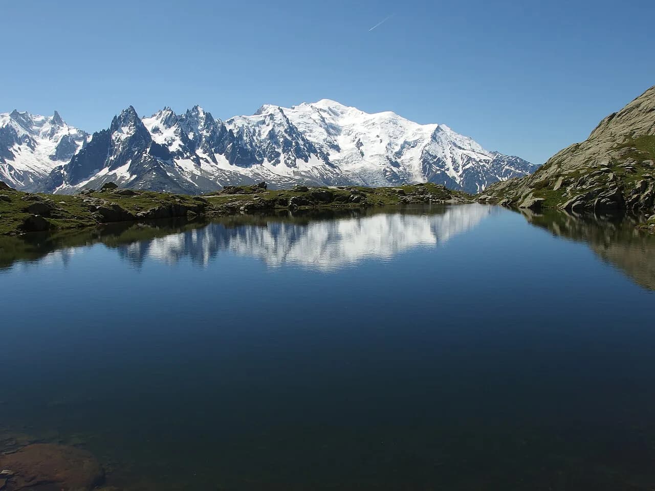
The Chéserys lakes sit high in the Aiguilles Rouges reserve above the Chamonix valley, a scatter of small tarns that reflect the Mont Blanc massif on a still morning. The upper lake is the one on the postcards, and the walk to it suits hikers with a full half-day, a head for steep ground and a taste for big views without glacier gear.
Three approaches reach the same water: a lift-assisted loop from Les Praz, a hands-on climb from Tré-le-Champ that uses ladders and metal bars, and a long, quiet climb from the Col des Montets road. If you are weighing this against the more famous lake above it, the broader hiking in Chamonix guide sets out the rest of the valley.
Where the lakes sit and what the circuit offers
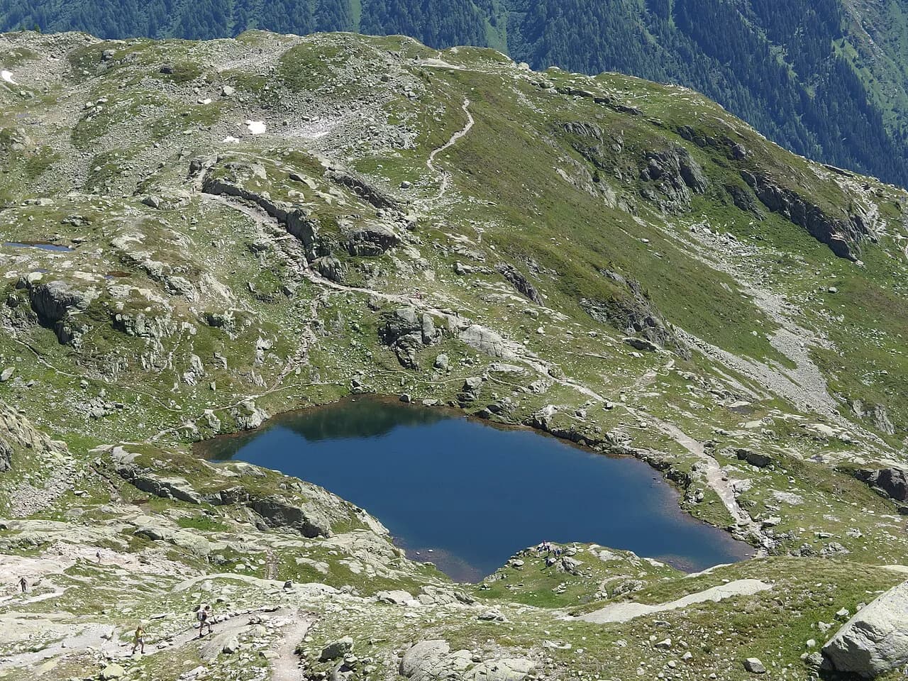
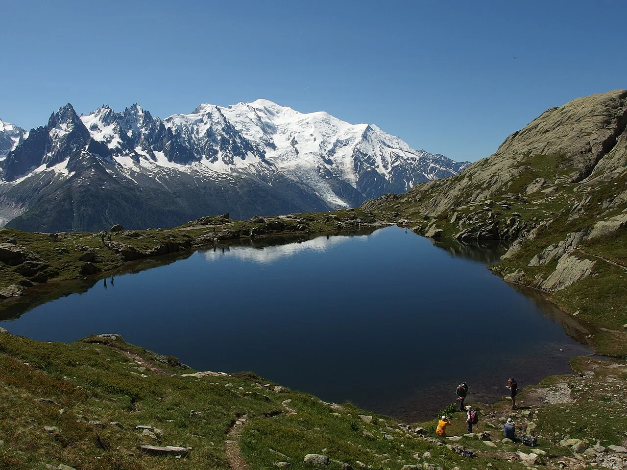
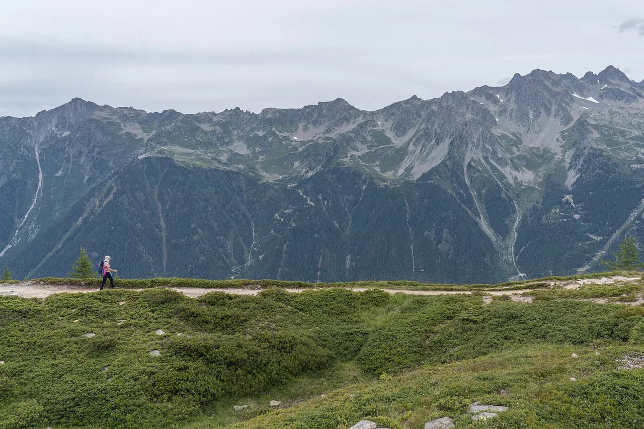
The Lacs des Chéserys lie inside the Réserve naturelle des Aiguilles Rouges, below Lac Blanc and directly opposite the Mont Blanc range. The upper lake is the iconic viewpoint, flanked by the Aiguille Verte, the Drus and the Grandes Jorasses across the valley, while several smaller lakes sit below it.
The lakes are quieter than Lac Blanc and better suited to hikers who want the panorama without the crowds, and the Chamonix tourist office lists the site as open from 15 May to 31 October depending on snow. Mirror reflections need windless water, so early morning and late evening give the stillest surface, while midday breeze ripples it.
The lakeshore is a good place to stop rather than pass through: the small beach on the north side of the upper lake frames the Mont Blanc massif behind the water. Most of the lakes other than the main one lie off the marked trail and are fenced off to protect vegetation.
Lac des Chéserys vs Lac Blanc: which lake to make the goal
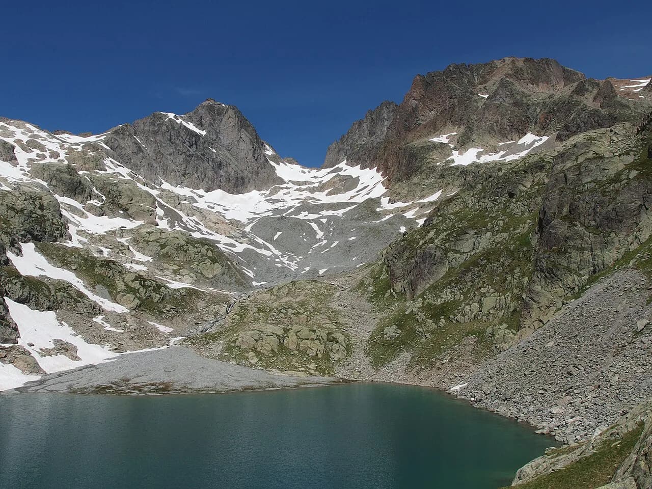
Lac Blanc sits about 150 metres (roughly 490 ft) of ascent above the Chéserys shore, so the Chéserys lakes make a satisfying goal on their own if time or legs are short. Turning the walk around at the upper Chéserys lake saves the steepest finish and keeps the day closer to four hours.
Adding Lac Blanc brings the summer-only refuge, mineral ground and the bigger water, but also most of the foot traffic. If the higher lake is the main draw, plan the day around the Lac Blanc Hike from Chamonix rather than bolting it on late.
The usual full circuit links the two: climb to Chéserys, continue to the refuge at Lac Blanc, then descend past the Flégère. That route takes in both lakes and the ladders, and the Grand Balcon Sud Hike, Chamonix section below Flégère gives an easy addition if you still have daylight.
Route options at a glance
From the Flégère gondola above Les Praz, a classic loop runs 8.05 km (5.0 mi) with about 564 m (1,850 ft) of ascent and takes around four hours, well marked and mostly on dirt and rock. From L'Index chairlift the point-to-point to the Flégère gondola is 7.61 km (4.7 mi) with only about 185 m (607 ft) of ascent but narrow, exposed ground and snow that can linger into July.
From Tré-le-Champ near Argentière, the ladder route climbs roughly 950 m (3,120 ft) over about 9 km (5.6 mi) round trip and is the shortest but the most technical way up. From the Col des Montets the round trip is about 11 km (6.8 mi) and the same 950 m of ascent, steep first and then a flat balcony path with the steepest technical ground left out.
Route 1: Flégère gondola loop to the lakes and Lac Blanc
Ride the Flégère gondola from Les Praz to the mid-station and walk north on the marked trail, gaining steadily through open slopes toward the Chéserys plateau. Continue past the upper Chéserys lake to the Refuge du Lac Blanc, then return by the same trails or via the Flégère for a loop of about four hours at a steady pace.
Expect the busiest trail of the three, especially after mid-morning in July and August, and a line of hikers on the switchbacks. The route is straightforward walking, but the ground near the lakes is rocky and a few short ladder sections near Lac Blanc need hands on the rails.
Route 2: Tré-le-Champ, the Aiguillette d'Argentière and the ladders
Start at the Tré-le-Champ parking area, follow the forest path past the small cabin and cross the stream on a wooden footbridge, then climb toward the Aiguillette d'Argentière. This is where the character changes: ladders, metal bars, wooden steps and short walkways cross rocky ground with real exposure, and it is the route to skip if heights unsettle you.
Past the technical section a normal path leads through switchbacks to the Tête aux Vents junction at 2,133 m (6,998 ft), where trails from the Col des Montets, Argentière and the Flégère lifts converge. From there the wide track runs to the Chéserys lakes in a few minutes.
The full round trip is about 9 km with roughly 950 m of ascent, so allow two and a half to four hours up. The ladders are also walked by Tour du Mont Blanc hikers in the opposite direction, so expect to wait and give priority to those climbing; for the full circuit, the Mont Blanc hiking guide covers each stage.
Route 3: Col des Montets, the quieter balcony approach
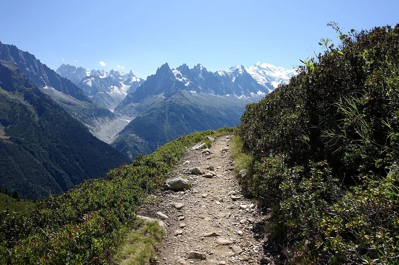
From the large parking area at the Col des Montets the trail begins across the road and climbs steeply, gaining about 550 to 660 m over the first 2.5 km (1.6 mi) without any technical difficulty. After 30 to 45 minutes the worst of the gradient is over and a viewpoint opens toward the Aiguille du Tour and the Argentière glacier.
Above that, a flatter balcony path crosses the La Remuaz plateau near 2,000 m (6,560 ft) and runs almost level to the junction with the other routes, with the Mont Blanc skyline ahead. The round trip is about 11 km with roughly 950 m of ascent, and it is the calmest of the three approaches.
The L'Index chairlift point-to-point
The L'Index chairlift from Les Praz drops you on rocky, exposed ground where the walk to Lac Blanc and the Chéserys lakes uses much less climbing than the valley routes. A combined Flégère and Index ticket lets you ride up, traverse to the lakes and descend by the Flégère gondola without retracing your steps.
This is not the easy option it looks like on paper: the upper trail is narrow, holds snow late and passes above steep drops, so it suits confident hikers with proper footwear. On the descent toward the Flégère you pass beneath the Grand Balcon Sud and Plan Praz, another well-used section of the same valley.
Orientation on the ground
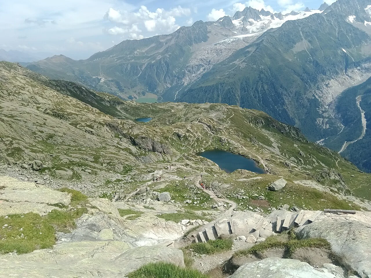
All approaches funnel into the junction at a large cairn below the lakes, where paths from Tré-le-Champ, the Col des Montets, Argentière and the Flégère lifts meet. From there a wide earth path leads past the lower lakes, up through a short rocky notch, to the upper water.
The final rise from the Chéserys shore to Lac Blanc takes under an hour and climbs the ladders fixed in the rock below the refuge. Downhill, the same ladders are the part most hikers slow for, so leave extra time if you are descending that way.
Ladders, ledges and snow
The Tré-le-Champ route is the genuinely technical option, with a ladder triple linked by walkways, metal steps and bars on the Aiguillette d'Argentière band. When the rock is wet or snow-covered this is ankle-twisting, hand-on-rock ground, and it demands boots with grip and a tolerance for exposure.
On the upper Index route, large snowfields can survive into July, and a slip on a narrow snow ledge above steep rock has serious consequences. Carry microspikes early in the season and turn around if the snow stops you walking comfortably without a firm edge.
Getting to the trailheads
The Flégère gondola base sits at Les Praz, about 2.5 km north of Chamonix centre, served by Chamonix bus lines 1 and 2 and by the Mont-Blanc Express train to Les Praz station, five minutes' walk from the lift. There is a small paid car park at the lift base that fills early in peak season.
Tré-le-Champ has roadside parking on the Argentière side of the valley, while the Col des Montets has a large car park directly beside the road pass. Both are reached by car from Chamonix, and the Col des Montets approach starts from the far side of the road from the parking area.
Lift season and tickets
For the 2026 summer season the Flégère gondola is scheduled to open from 20 June to 13 September, with departures from 8:20 or 8:35 depending on the date and last ascents between 4:00 and 5:30 pm. The 2026 combined Flégère and Index adult ticket is listed at €33, with the simple Flégère round trip at €25.
Those dates and prices are specific to one season and need checking before you rely on them, since lift schedules and fares change year to year. The Mont Blanc Multipass sold in the valley bundles lift rides and lets you use the same ticket across the Flégère and Index lines.
When to go
The reliable window for the Chéserys hike is July through mid-September, once most of the snow has gone and the lakes have thawed. June and early July often leave snowfields on the Index route and on the steep section up to Lac Blanc, and by mid-September the summer lifts begin to close, which makes the valley-floor approaches the only option.
Late July brings wildflowers and sunbathing marmots, while August stabilises the weather but draws the biggest crowds, especially after 10 am. The Chamonix tourist office gives the lakes a season from 15 May to 31 October subject to snow, though the lift-free approaches make the walk possible long before the lifts run.
Refuge du Lac Blanc, water and toilets
The Refuge du Lac Blanc near the lake serves simple alpine meals, snacks and drinks in summer, but it does not always open in early June or late September, so carry your own lunch outside peak weeks. The Flégère mid-station has a snack bar that is not reliably open, and there is no water or food between the lakes.
Toilets exist at the Flégère base and mid-station and at the refuge when it is staffed, but there are none at the Chéserys lakes or along the trails between them. Bring at least 1.5 to 2 litres per person, more if you take the long balcony route in full sun.
Rules in the reserve
Swimming is banned in both Lac Blanc and the Chéserys lakes under a prefectoral decree, so plan on looking rather than dipping. The lakes sit inside the Aiguilles Rouges reserve, where the tourist office asks for low-impact behaviour to protect the fragile alpine flora and fauna.
Bivouacking is tolerated at the Chéserys lakes between 19:00 and 09:00 with a reservation and no camping allowed, with cooking restricted to stoves and no fires. Camping, drones, dogs and flower or rock collecting are not permitted in the reserve, and the toilets at Lac Blanc are for refuge guests.
What to wear and carry
Approach shoes or light boots with good tread suit the marked trails, but the ladder sections call for a firm sole and free hands, so keep your pack light enough to climb comfortably. Layered clothing, sun protection and a light rain shell cover the rapid alpine changes even on a clear forecast day.
Carry water, snacks, a map or downloaded route and some cash for the lifts or a refuge stop, and add microspikes if you go before July on the Index or upper Chéserys ground. Trekking poles help on the long descents, but stow them for the ladders so both hands stay free.
Where to base yourself
Les Praz is the natural base if you want to walk to the Flégère lift in minutes, and Chamonix centre gives you the full bus and train network with a 30 to 40 minute flat walk to the lift base. Argentière and Vallorcine suit the Tré-le-Champ and Col des Montets routes, with the Mont-Blanc Express linking the valley villages.
If you also want vertical ground with cables and rungs, the Chamonix Via Ferrata routes make a complementary day based from the same valley villages. Beyond the valley, the Mer de Glace and Plan de l'Aiguille area is a separate outing reached from Chamonix centre rather than from the Chéserys trailheads.
Plan Your Chéserys Day
Decide on the approach first: lift-assisted from Les Praz for the shortest climb, Tré-le-Champ for the ladders and the shortest round trip, or the Col des Montets for the quietest path with the same total ascent. Either way, the upper Chéserys lake is the viewpoint worth lingering at, and Lac Blanc is a worthwhile extra climb.
Check the Flégère and Index operating window and last ascent before committing to a lift-based loop, and bring enough water for the day since nothing runs between the trailheads and the refuge. Start early for still water, empty trails and a margin before afternoon storms build over the Aiguilles Rouges.
Frequently Asked Questions
How long is the hike to Lac des Chéserys?
From the Flégère gondola the loop taking in the Chéserys lakes and Lac Blanc is about 8 km and around four hours. The Tré-le-Champ ladders route is roughly 9 km round trip and the Col des Montets approach about 11 km, both with around 950 m of ascent.
Can you drive to Lac des Chéserys?
No, the lakes are reached only on foot. You can drive to the lift base at Les Praz, to Tré-le-Champ or to the Col des Montets car park, and walk from any of them.
Is the Lac des Chéserys hike harder than Lac Blanc?
The lakes sit roughly 150 m below Lac Blanc, so reaching them alone is slightly easier. The technical bite comes from which route you choose: Tré-le-Champ has ladders and exposure, while the Col des Montets and lift routes are plain walking.
Can you swim in Lac des Chéserys?
No, a prefectoral decree bans swimming in both Lac Blanc and the Chéserys lakes to protect water quality. Plan to admire them from the shore.
Can you bivouac at Lac des Chéserys?
Bivouacking is tolerated overnight at the Chéserys lakes with a reservation, with no camping and no fires; the reserve also bans drones and dogs. Check current details with the Chamonix tourist office and the reserve rules.
When is the best time to hike Lac des Chéserys?
July through mid-September gives the most reliable snow-free ground and open lifts. June can leave snow on the higher paths and the lifts start closing in mid-September, so the valley-floor approaches matter outside that window.
Do you need the Flégère cable car to reach Lac des Chéserys?
No, the walk can be done entirely from the valley floor via Tré-le-Champ or the Col des Montets. The Flégère gondola simply cuts the climbing and shortens the day, and the Index chairlift offers a point-to-point option with very little ascent.
Sources
Trail notes for your next trip
Optional updates when we add or revise hiking guides.
You might also like
Continue reading
More guides you'll find useful