Lac Blanc Hike from Chamonix: Route, Distance & Ascent
Plan the Lac Blanc hike above Chamonix: routes from La Flégère and L'Index, distance, ascent, walking time, lift access, food stops and best months.
On this page
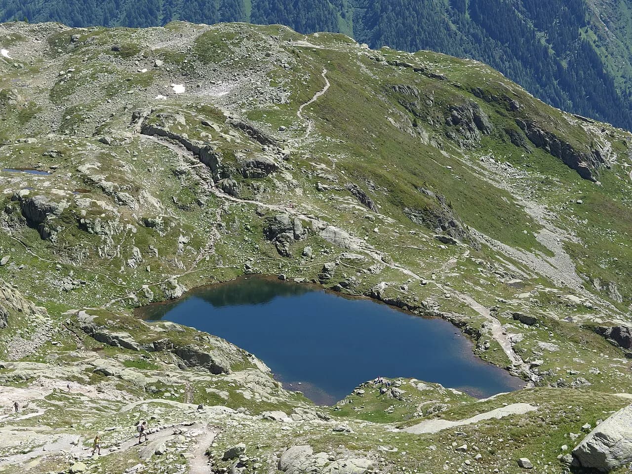
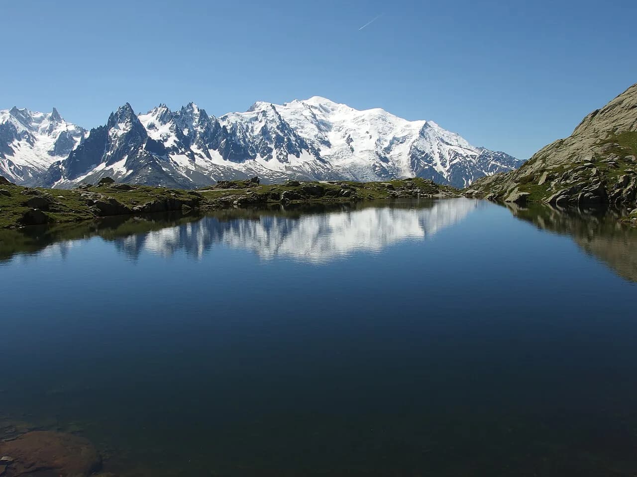
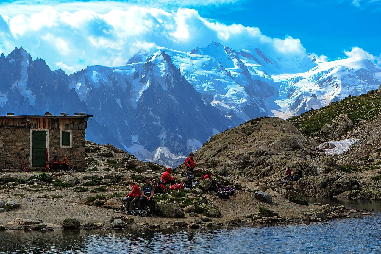
Lac Blanc sits at roughly 2,350 m (7,700 ft) in the Aiguilles Rouges nature reserve, on the opposite side of the Chamonix Valley from Mont Blanc. The lake is small, the setting is not: a granite bowl, a refuge on the rise above the water, and a full-width view of the Mont Blanc massif filling the far side of the valley. Fit hikers with a head for rough ground get the classic high-alpine day out of the valley here.
Two lift-served approaches do most of the climbing for you. The Flégère gondola from Les Praz gives the direct out-and-back, while the Index chairlift above it adds a traverse through the Combe des Crochues to a cairn junction, where the route joins the Flégère path. Both are day hikes, not strolls, and both are covered below by distance, effort and terrain.
Where the Lac Blanc hike sits above the valley
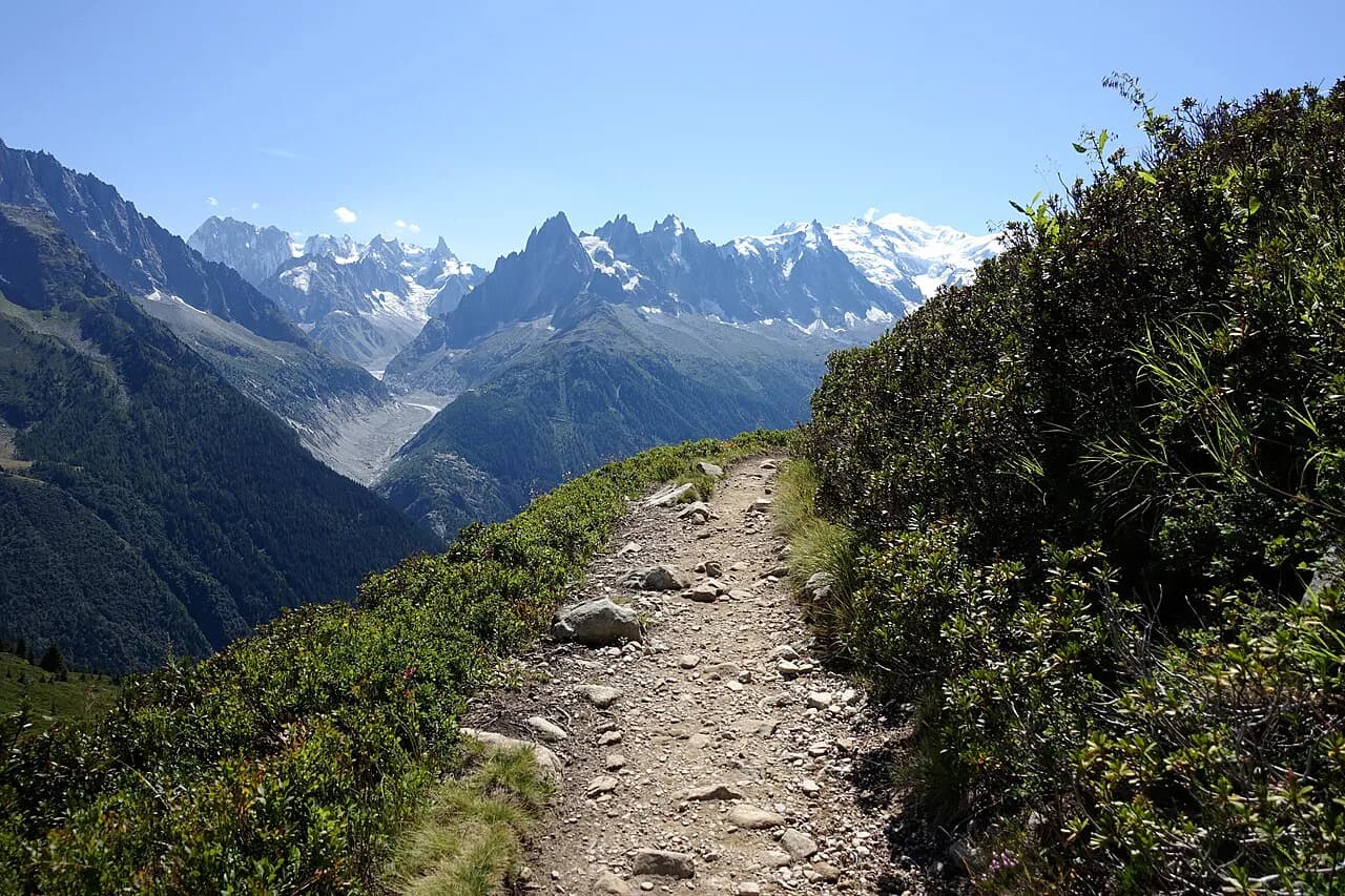
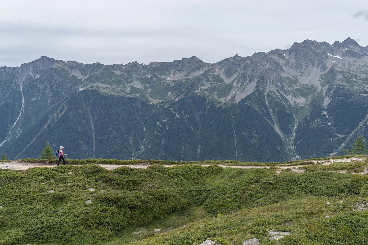
The lake lies in the Aiguilles Rouges nature reserve, the range that runs along the northwest side of the Chamonix Valley. From the water, the view runs southeast across the valley floor to the Mont Blanc massif, and the position is why the hike is so popular: you get big-mountain scenery without committing to glacier terrain.
This is a summer day hike for people who already walk regularly. The climb is short in distance but steep and rocky, the path is exposed to sun and weather once you are above the treeline, and the altitude is enough to make you slow down. Families with strong older children manage it; younger children usually do not enjoy the upper switchbacks.
Lift access from Les Praz and the last descent
The Flégère gondola starts at Les Praz, a village a short distance northeast of Chamonix town, and the Index chairlift continues from the top station at La Flégère. The official timetable sets the day's limits: in the main summer window the lifts run from morning until late afternoon, with a last ascent in the afternoon and a last descent shortly after. Those times are the real constraint on your start, because missing the last descent turns a lift-assisted day into a long walk down.
Access depends on the Flégère cable car running and on snow and weather conditions, so a shoulder-season plan needs a fallback. Fares are not listed here because lift pricing changes; buy at the station or through the lift operator's own sales channel on the day. A one-way ticket for the descent is worth considering if you want to walk up and save your knees on the way down.
Trailhead and parking at Les Praz and La Flégère
Drivers can park at the Flégère cable car base in Les Praz; the official route description gives the cable car car park or the La Flégère bus stop as the starting points, with the hiking signposted on your right at the top station. Parking near the lift fills on fine summer days, so arriving for the first gondolas is the practical choice.
Without a car, the bus stop at La Flégère puts you at the lift base, and Les Praz is also served from Chamonix. A flat riverside path along the Arve links Chamonix with Les Praz in roughly half an hour on foot, which makes a car-free day straightforward: walk or ride to the lift, ascend, hike, and descend by gondola.
The classic out-and-back from La Flégère
From the top of the Flégère gondola, the route to Lac Blanc is an out-and-back on rough, rocky ground with steep switchbacks. One third-party account puts the out-and-back at about 3.9 miles (6.3 km) with over 1,700 ft (520 m) of gain in roughly two miles of climbing; the sign at the trailhead estimates about 1 hour 45 minutes each way, which fits a steady, fit hiker rather than a casual walker.
Allow three to four hours for the round trip plus time at the lake, and more if you stop often for the view, which you will. The route is busy on summer weekends and holidays, so an early lift gives you the upper path and the lake in relative quiet before the midday flow arrives.
The loop via L'Index and the Combe des Crochues
The Index variant is the official route described by the Chamonix tourist office. From the chairlift station, head right and downhill toward Lac du Fouet, then follow the path to the bottom of the Combe des Crochues. A flanking traverse leads to a rocky spur that has to be skirted; the spur marks the boundary of the Aiguilles Rouges nature reserve, and the traverse then climbs to a large cairn where it joins the Flégère path above the refuge and the lake.
The official figures for this circuit are modest because the lifts do the vertical work: 2.9 km (1.8 miles) with about 30 m (100 ft) of gain and loss and a round-trip walking time of 2 hours 45 minutes, rated medium on the slopes. Treat those numbers as the circuit between lift stations, not as a substitute for the Flégère out-and-back distance. The landscape is graded medium and the path stays rocky, so boots with grip still matter.
On the return you can walk the whole loop back to La Flégère or ride the Index chairlift down to the gondola top station to shorten the day. That choice is what makes the loop flexible: hikers who are tiring can cut the descent, while those with time can extend along the balcony paths toward Plan Praz before dropping to Chamonix.
Terrain section by section
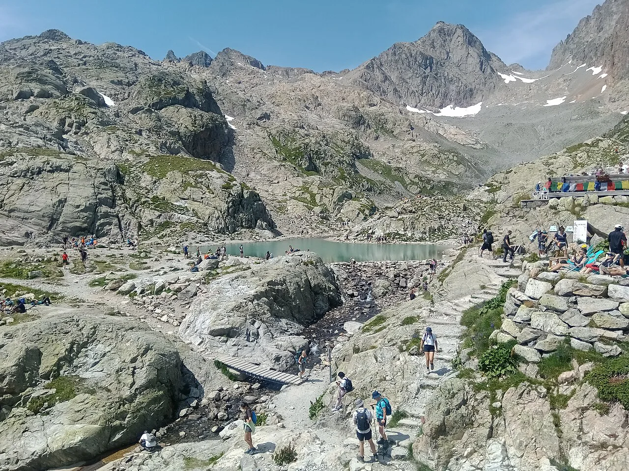
Above La Flégère the path starts as a wide gravel track, then turns rocky and steep, with a flatter boardwalk section that can be muddy early in the season. Past a small tarn the route becomes rougher and narrower, with cable-protected steps and places where hands help more than poles. The final pull to the lake comes after a false ridge, so save something for it.
The Index approach is different in character: a descending traverse, the skirt around the rocky spur, then a climb to the cairn junction and the last stretch past the refuge. From the Brévent side, the connecting route crosses dry, boulder-strewn ground above the Col du Brévent where the path is easy to lose between rocks and the waymarking is sparse. Carry a map or a loaded route on your phone and confirm your position at each sign.
Distance, ascent and time at a glance
Compare the options by effort rather than by distance alone. The Flégère out-and-back asks for roughly 520 m of climbing over about 6.3 km round trip, while the Index circuit is listed at 2.9 km and 30 m of gain and loss with 2 hours 45 minutes of walking, thanks to the chairlift. A descent on foot from the lake to Les Praz adds several hundred metres of knee-loading downhill, so budget legs and daylight for it.
The stage from the Brévent gondola over the ridge to the refuge, for those linking Lac Blanc into a longer traverse, runs about 10.6 km (6.6 miles) with 579 m (1,900 ft) of gain and 732 m (2,400 ft) of loss. That figure includes the long drop through Flégère before the final climb, so it is a bigger day than the lake alone suggests.
Descending without the lifts
If you walk down, the direct paths from La Flégère toward Chamonix are steep and can be confusing where they thread through forest. The gentler option is to descend by gondola to Les Praz and walk the flat river path back to town, which keeps the day's strain on the climb rather than on tired quads.
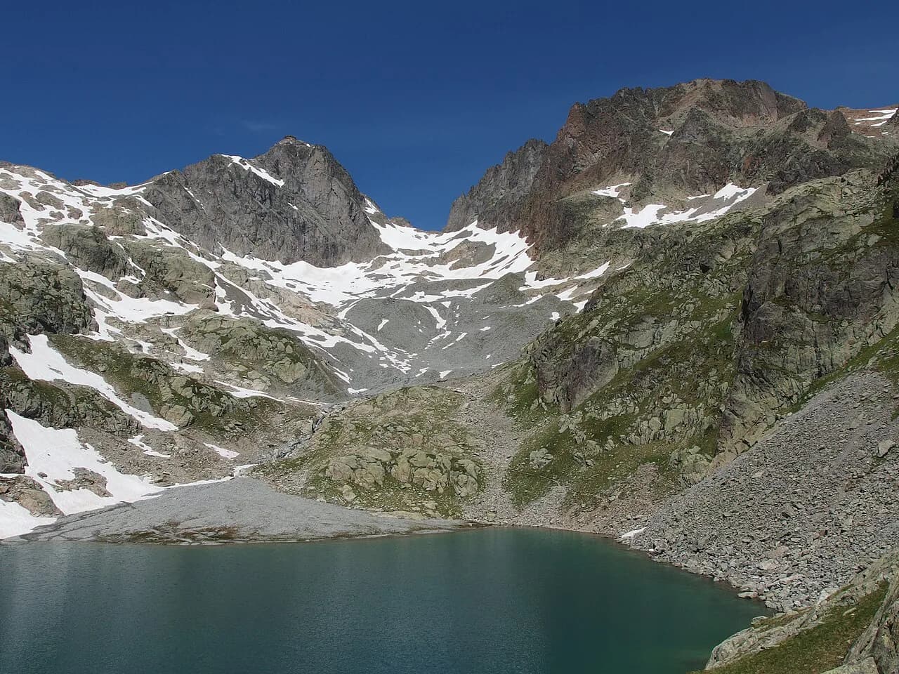
For a second lake without a second big climb, continue from Lac Blanc toward the Lacs des Chéserys, a cluster of small tarns below the Aiguilles Rouges crest. The same ban on swimming applies there, and the terrain stays rocky, so the extension suits hikers with daylight to spare and stable feet.
When to go
The lift season defines the practical window, and the official timetable for the Flégère cable car runs from 20 June to 13 September, with slightly longer hours from 11 July to 30 August and shorter hours at the edges. Outside those dates you are walking from the valley. Snow lingers on the upper slopes early and late in the season, and the path above the treeline holds it longer than the meadows below.
July and August bring the most reliable conditions and the biggest crowds. June and September are quieter and often clear, but check the lift dates and expect patches of old snow on shaded stretches. Afternoon thunderstorms are the real hazard in high summer: start early, and turn around if cloud builds over the crest.
Rules in the reserve
Swimming is prohibited at Lac Blanc and at the Lacs des Chéserys by prefectural decree, so plan on looking rather than plunging. Dogs are not permitted on the path because it runs inside the Aiguilles Rouges nature reserve. Access to the trail itself is free, though the lifts carry a transport fee.
These are working rules for a fragile alpine environment, and they apply whether you arrive by lift or on foot. Keep to the trail where it crosses vegetated ground, and carry out everything you bring up, including picnic waste.
Refuge and cafés on the route
Refuge du Lac Blanc stands just above the water and serves as the food stop at the top of the hike, with meals and drinks for day hikers and beds for those staying the night. Booking a bed is a separate exercise from the day hike: there are few places and demand is high, so arrange it directly with the refuge well ahead if you want to sleep at altitude.
Below the lake, the café at La Flégère and the smaller setup at L'Index cover drinks and simple food, and both are seasonal, with occasional closing days. Carry water and snacks regardless, because the upper trail has no shade or shelter and the mountain cafés keep summer hours rather than all-day service.
Getting back to Chamonix
The simple return is the gondola down to Les Praz, then the bus or the riverside walk back to Chamonix. If you have hiked the loop and finished at La Flégère, you are already at the lift; if you have crossed from the Brévent side, you may finish lower on the valley road and need the bus.
Keep the last descent time in mind when planning the day's extension. The balcony paths toward Plan Praz and the continuation along the Grand Balcon Sud make fine additions, but they put you further from the lift, so decide early whether you are descending on foot or by cable.
Where to base yourself
Les Praz is the obvious base for this hike: the gondola leaves from the village, the bus stop is beside it, and you can walk into Chamonix along the Arve in about half an hour. Staying here removes the morning logistics and lets you catch an early lift.
Chamonix town center gives you more shops, restaurants and bus connections, plus the wider range of day hikes that make up the valley's hiking. Choose the town if you want options beyond Lac Blanc; choose Les Praz if the lake is the priority.
Planning the Day
Decide first which route you want: the direct Flégère out-and-back for a straightforward climb to the lake, or the Index circuit for a shorter, more varied traverse with the chairlift as an escape. If you find yourself weighing this same lift-served-versus-full-climb trade-off elsewhere in the Alps, the Annecy hiking guide covers comparable lake and ridge trails. Then set your start against the lift's last descent, not against your enthusiasm, and pack layers, water and grippy footwear for rough rock.
If you want a bigger day in the same range, add the ridge or the Chéserys lakes, and if you want vertical adventure of a different kind, the valley's via ferrata routes are the next step up. Otherwise, take the early gondola, walk slowly on the switchbacks, and leave time to sit above the water looking across at Mont Blanc.
Frequently Asked Questions
How long does the Lac Blanc hike take?
From La Flégère the out-and-back is usually a three to four hour round trip for a steady hiker, including time at the lake; the trailhead sign estimates about 1 hour 45 minutes each way. The Index circuit is listed at 2 hours 45 minutes of walking, because the lifts cover most of the climb.
How difficult is the hike to Lac Blanc?
It is a short but genuinely rough mountain path: steep rocky switchbacks, cable-protected steps and a final pull to the lake on ground that is easy to roll an ankle on. The Index circuit is rated medium on the slopes but remains stony throughout. Fitness and good footwear matter more than distance.
Can you hike to Lac Blanc without the cable car?
Yes, by walking up from Les Praz or Chamonix, but the direct paths are steep and lose nothing of the climb the lifts do for you. A sensible compromise is to walk up and ride the gondola down, which protects tired legs on the descent.
Is swimming allowed at Lac Blanc?
No. Swimming is prohibited at Lac Blanc and at the Lacs des Chéserys by prefectural decree, so plan on enjoying the view rather than a dip.
Where does the Lac Blanc hike start?
Both lift-served routes start at the Flégère cable car base in Les Praz, where there is parking and a bus stop. The Index circuit begins with the chairlift from La Flégère, and the Flégère out-and-back starts from the gondola top station.
When is the best time to hike to Lac Blanc?
The lifts run from late June into mid-September, and July and August are the most reliable months for clear paths. June and September are quieter but can hold old snow on shaded upper slopes, and afternoon storms make an early start the safer habit.
Are there facilities on the route?
Refuge du Lac Blanc above the lake serves meals and drinks, and there are small seasonal cafés at La Flégère and L'Index. Carry water and snacks anyway, because the upper trail is exposed and the cafés keep summer hours.
Sources
Trail notes for your next trip
Optional updates when we add or revise hiking guides.
You might also like
Continue reading
More guides you'll find useful