Henrhyd Falls Walk: Nant Llech Route, Distance and Parking
Plan the Henrhyd Falls walk in the Brecon Beacons on the Nant Llech circuit, with distance, ascent, time, parking and the path behind the cascade.
On this page
The Henrhyd Falls walk gives you the highest waterfall in South Wales without a long mountain approach, then adds a riverside ramble through the wooded Nant Llech valley. It suits hikers who want a half-day outing with real atmosphere rather than a summit day, and it works well for mixed-ability groups because the falls themselves sit barely any distance from the car park. The trade-off is footing: the path follows the stream under tree cover and turns muddy after rain.
This is a compact day inside the Brecon Beacons National Park, so it slots easily into a longer trip built around the walks in brecon beacons. Treat the falls as the first objective and the valley as the second, and you get a route that feels far quieter than its film fame would suggest.
Waterfall at the head of a wooded gorge
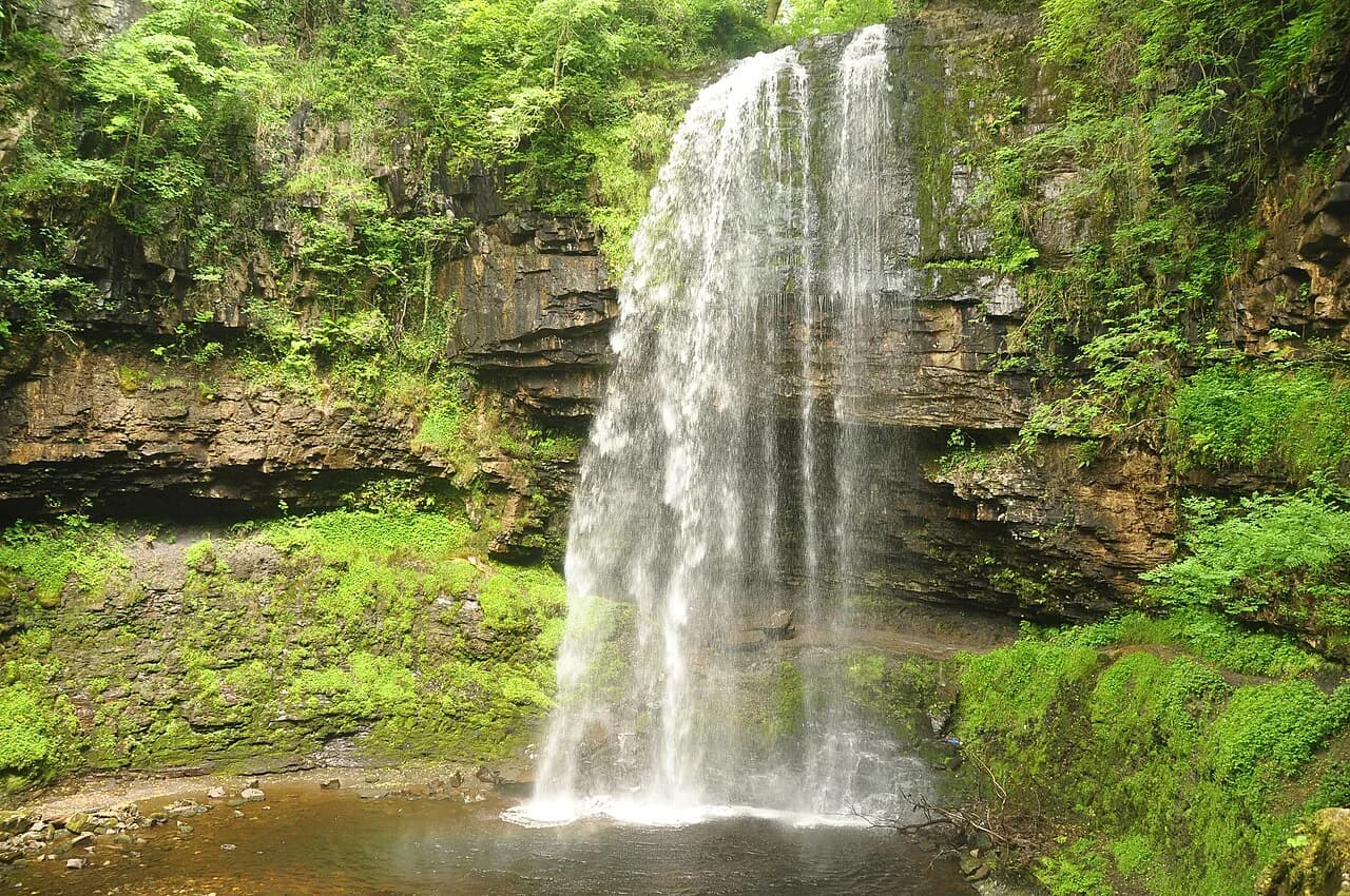
Henrhyd Falls drops into Graig Llech Gorge on the south side of the Brecon Beacons National Park, a short way from the village of Coelbren and within easy reach of Abercraf and Swansea. The setting is intimate rather than dramatic: a cascade hidden in a wooded ravine, with the Nant Llech stream running away from it through a sheltered valley. That combination makes it a good choice for a short hike on a changeable day, because most of the route sits under a canopy of trees.
The effort required is modest by national park standards, which is exactly why the falls are worth pairing with a bigger day elsewhere in the Brecon Beacons National Park. Arrive expecting a short walk rather than a mountain expedition, and you will find the valley rewards a slow pace.
The waterfall is the headline, and the National Trust describes the route as an adventurous walk through Graig Llech Gorge and the tranquil Nant Llech valley to see the highest waterfall in South Wales. That framing tells you what to expect: a gorge path with some bite to it rather than a flat stroll to a viewing platform.
Where Henrhyd Falls is
The falls lie between Abercraf and Coelbren on the southern edge of the national park, roughly half an hour from Swansea by road. The walking route begins around the corner northward from Coelbren, which is the practical landmark to aim for if you are navigating by village rather than by postcode. Once you are in the valley, the stream itself is the guide.
Because the waterfall sits at the head of a gorge rather than on an open hillside, the approach is short but enclosed. You drop toward the water through trees, and the sound of the cascade arrives before the view does. Keep that in mind when planning light: the gorge is shaded for much of the day.
Trailhead and parking by Coelbren
Parking is the usual start point, and from there the falls are about 150 metres (roughly 500 feet) away, so anyone who only wants to see the waterfall can do so in minutes. That short approach is the reason the site works for families and for hikers nursing tired legs. The longer outing begins once you turn away from the cascade and follow the Nant Llech downstream.
The riverside path runs beneath trees for most of its length, which keeps you covered in wet weather but also means the surface stays damp and churned. Walkers who have done the route consistently flag mud as the main annoyance, so waterproof boots are the sensible choice over light trainers. Poles help on the steeper, greasy sections near the gorge.
Distance, ascent and time
The full Henrhyd Falls and Nant Llech walk is measured at 3.6 miles (5.8 km) with around 498 feet (152 metres) of elevation gain, rated moderate and typically taking 1.5 to 2 hours. Those figures describe the complete valley route rather than the quick hop to the waterfall, so budget your day against the circuit, not the viewpoint.
The simpler option is the out-and-back along the stream, which the walking guide puts at approximately 1.5 miles each way to the point where the Nant Llech meets the River Tawe. That version keeps the ascent gentle and concentrates the effort at the gorge end. Choose it if you want a short afternoon; choose the fuller figure if you want a half day.
For context on how this compares with other days in the range, the Pen y Fan walk is the big-summit alternative and demands far more climbing, while this valley route stays low and sheltered. Hikers building a trip around variety often use one as a weather day and the other as the main event.
Route description
From the parking area, follow the short path down to the falls and stand at the base of the cascade, where the water drops into the gorge. The path then continues behind the falling water, a feature that makes this walk distinctive and also makes the rock underfoot slippery. Take the enclosed section slowly and keep a hand free for the rock.
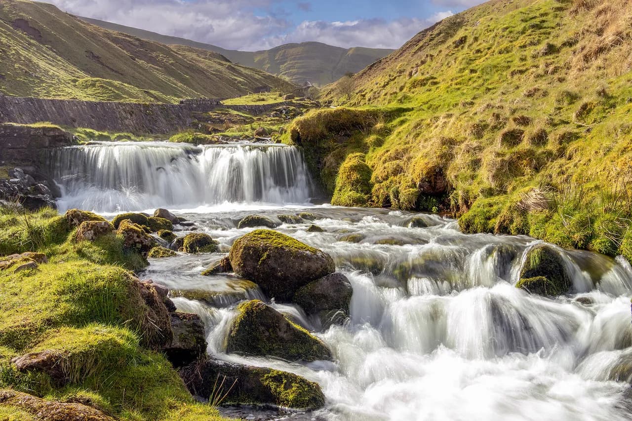
Beyond the falls, the route turns downstream and follows the Nant Llech through the valley, crossing and recrossing the stream on a soft, shaded path. The walking is gentle in gradient but uneven underfoot, with roots and wet patches demanding attention rather than speed. The stream leads you all the way to the confluence with the River Tawe, a natural turning point marked by the meeting of the two waters.
If you have walked the Four Falls Trail in the same part of the park, you will recognize the character here: wooded water, short steep steps and a lot of atmosphere packed into a small area. This route is the quieter, shorter counterpoint to that better-known waterfall circuit.
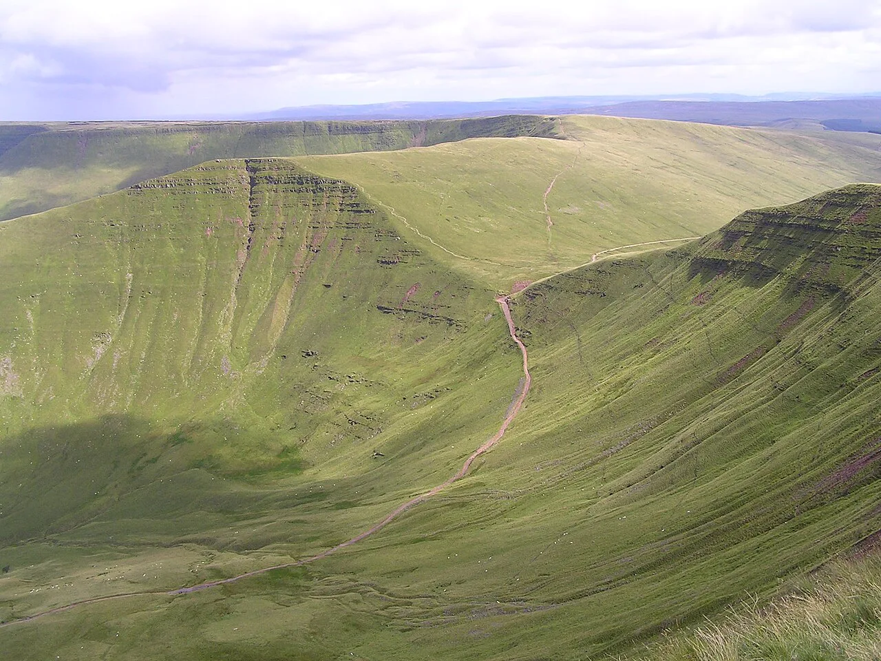
The viewpoint above the gorge
A short extra climb above the valley gives you a vista over the gorge and makes an excellent midpoint break before you turn back. The published route description includes this upward spur as an optional addition to the riverside out-and-back, so it is worth the extra effort if visibility is good. On a clear day the view gives you the shape of the valley you have just walked through.
The price is additional ascent on top of the valley figures, so decide at the junction rather than committing early. If legs or weather are marginal, the riverside return is a perfectly satisfying finish on its own.
Return and circular options
Most walkers retrace the Nant Llech path back to the car park, which keeps the day short and the navigation simple. The alternative is to climb out over the ridge and close a loop, but that demands extra ascent and a clear head for route-finding on open ground. Only choose it if you are comfortable reading a map and the cloud is well above the tops.
Whichever way you finish, the valley layout means you are never far from the stream and its handrails of tree cover and path. That makes the return forgiving in poor weather, though it also means few long views until you climb.
What to wear and carry
Waterproof hiking boots are the single most useful item here: the path follows the stream under trees and the surface is often muddy. Add a lightweight waterproof shell and a mid-layer fleece, since the canopy shields you from wind but not from rain dripping off the leaves. A small pack with water and a snack covers the two-hour version comfortably.
Because the walk is short, pack light but pack dry. A spare pair of socks in the car is a small kindness after a wet descent through the gorge.
When to go
The canopy makes this a strong choice from late spring through autumn, when the trees are in leaf and the valley feels enclosed and green. Water levels respond to rainfall, so the cascade is at its most forceful after wet spells, while long dry stretches thin the flow. The gorge path stays slick after rain, so allow more time on the rocky steps in those conditions.
Winter visits are quieter but come with shorter daylight in a shaded ravine, so start early enough to finish the valley section in good light. Afternoon storms in the Brecon Beacons can arrive quickly in summer; turning back at the confluence rather than pushing on is the sensible response.
Filming location
Henrhyd Falls served as the entrance to the Batcave in The Dark Knight Rises, which is the reason the waterfall is better known than its quiet location would suggest. That fame brings occasional extra visitors, but the valley beyond the falls absorbs them quickly. Treat the film connection as a bit of trivia for the walk in, not the reason to come.
Practical rules
The National Trust looks after the Henrhyd Falls site, and access arrangements, group sizes and facilities are set by the Trust rather than by the valley itself. If you are bringing a large group or an organized party, contact the National Trust before you travel so the day runs smoothly.
The path behind the cascade is the wettest part of the route and slippery when the water is high, so judge the conditions on the day rather than assuming the traverse is always comfortable. Sturdy footwear and a steady pace are the practical answer.
Nearby in the Brecon Beacons
The falls sit in the southern part of the park, close to Abercraf and Coelbren, and pair naturally with other short valley and ridge days. Hikers wanting a bigger mountain day can head for Pen y Fan, while the Llyn y Fan Fach walk offers a ridge-and-lake circuit in the western Brecon Beacons. If you are weighing up a longer trip further afield, hiking in Wales covers mountain, coast and waterfall trails across the country.
If you prefer granite summits and open views, the Sugar Loaf Walk, Brecon Beacons gives you a shapely hill above Abergavenny with a very different feel from the wooded gorge. Use it as a contrast day rather than a substitute for the waterfall.
Waterfall country extends beyond this one valley, but anything further afield sits outside the Nant Llech area and deserves its own day. Keep this outing focused on the gorge and you will see it at its best.
Plan Your Visit
The Henrhyd Falls walk is a short, atmospheric half day that rewards waterproof boots and a relaxed pace more than fitness. Park by Coelbren, see the cascade first, then follow the Nant Llech to the River Tawe and climb to the viewpoint if the day is clear. Build it into a wider Brecon Beacons itinerary alongside a summit day for contrast.
Frequently Asked Questions
How long is the Henrhyd Falls walk?
The full Henrhyd Falls and Nant Llech walk is measured at 3.6 miles (5.8 km) with about 498 feet (152 metres) of ascent, typically taking 1.5 to 2 hours. The simpler out-and-back along the stream to the River Tawe confluence is roughly 1.5 miles each way. The falls themselves are only about 150 metres from the car park.
Is there a circular walk around Henrhyd Falls?
Most walkers retrace the riverside path along the Nant Llech back to the car park. A loop is possible by climbing out over the ridge, but it adds ascent and requires confident map reading on open ground. The published route figures describe the out-and-back valley walk rather than a marked circuit.
Can you walk behind Henrhyd Falls?
Yes. The path continues behind the falling water, which is one of the reasons the walk is popular. The rock behind the cascade is wet and slippery, so take that short section slowly and keep your footing secure, especially when the stream is running high.
What was filmed at Henrhyd Falls?
The waterfall appears in The Dark Knight Rises as the entrance to the Batcave. That association is the main reason the falls are better known than their quiet location would suggest. Beyond the falls, the valley along the Nant Llech is usually much quieter.
Where do you park for the Henrhyd Falls walk?
Parking is by Coelbren on the southern side of the Brecon Beacons National Park, between Abercraf and Coelbren, roughly half an hour from Swansea. From the car park the falls are about 150 metres away. The longer valley route starts from the same point.
How difficult is the Nant Llech walk?
It is rated moderate, with 3.6 miles (5.8 km) and about 498 feet (152 metres) of ascent taking 1.5 to 2 hours. The gradient is gentle but the path is muddy and tree-covered, so waterproof boots matter more than fitness. The gorge section behind the falls is the most slippery part.
What should I wear for the Henrhyd Falls walk?
Waterproof hiking boots are the priority because the path follows the stream under trees and is often muddy. Add a lightweight waterproof jacket and a mid-layer, since the canopy shelters you from wind but not from rain. A small pack with water covers the two-hour version comfortably.
Sources
Trail notes for your next trip
Optional updates when we add or revise hiking guides.
You might also like
Continue reading
More guides you'll find useful