Hiking in Wales: Mountain, Coast and Waterfall Trails
Plan hikes in Wales across Eryri, Bannau Brycheiniog and the Pembrokeshire coast, with distances, ascent, trailheads, seasons and mountain hazards.
On this page
Wales suits hikers who want variety without long transfers: Eryri in the north holds the country's highest summits, Bannau Brycheiniog in the south combines sandstone escarpments with waterfall country, and the Pembrokeshire coast delivers cliff walking and beaches. A car helps, but several trailheads are served by buses and the Snowdon Sherpa network, so a car-free day is realistic if you plan around one hub.
Why Wales suits hikers: three national parks and a long coast path
Wales holds three national parks — Eryri (Snowdonia) in the north, Bannau Brycheiniog (Brecon Beacons) in the south and the Pembrokeshire Coast — plus the long-distance Wales Coast Path around the whole shoreline. The mountains are not high by Alpine standards, but the climbs are short and steep, so ascent figures matter more than distance when you are judging a route.
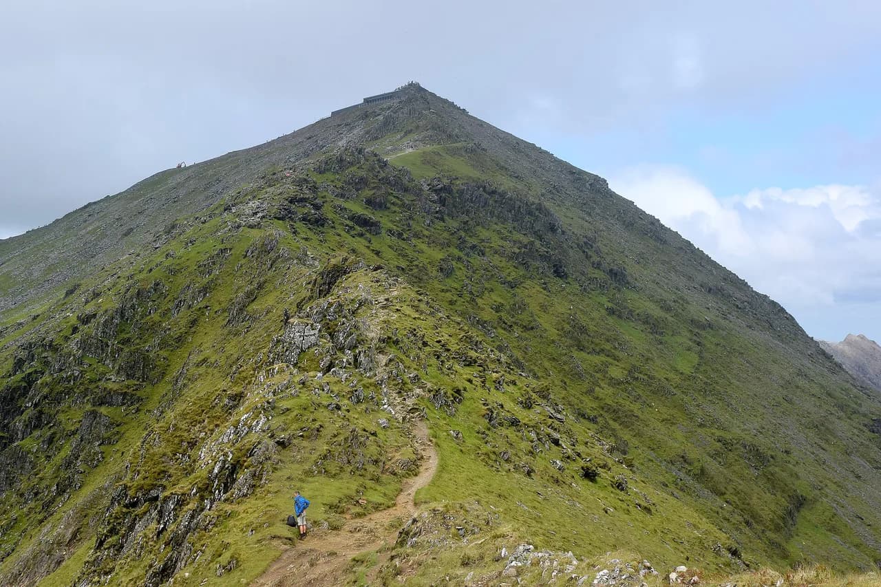
Snowdon (Yr Wyddfa) is the highest summit in Wales and England at 1,085 m (3,560 ft), and several waymarked paths lead to the top from different valleys. Pen y Fan, at 886 m (2,907 ft), is the highest peak in South Britain and the most popular hill day in the Brecon Beacons, drawing families as well as ridge runners.
What separates Welsh hiking from a generic hill walk is the mix: a morning on an exposed ridge, an afternoon on a coastal path with tidal inlets, and a waterfall circuit in oak woodland. Build your trip around one region rather than trying to sample all three, because the drive from Eryri to Pembrokeshire eats a full day.
How the hiking regions differ: Eryri, Bannau Brycheiniog, Mid Wales and Pembrokeshire
Eryri gives you the big summits — Snowdon, Cadair Idris, the Glyderau around Llyn Idwal — and the busiest trailheads, especially Pen y Pass in summer. Bannau Brycheiniog is gentler in shape but holds the Four Waterfalls walks at Ystradfellte and the Pen y Fan escarpment, which makes it the better choice for a mixed-ability group. If you are weighing up another UK mountain region for a similar summit-and-ridge trip — or want a gentler weekend of hill walking — our guide to hiking in the Lake District and the Peak District Hiking Guide: Choosing Your Best Routes both offer useful comparisons.
Mid Wales and the Cambrian Mountains are quieter: Pumlumon Fawr, the Elan Valley reservoirs and forestry walks around Llyn Clywedog see a fraction of the Eryri crowds. The trade-off is thinner public transport and fewer facilities, so treat these as days where you carry everything you need.
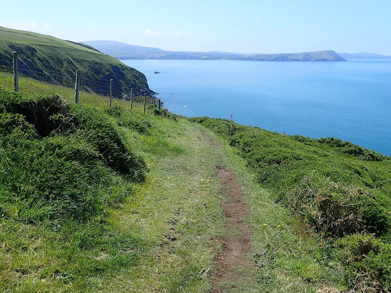
Pembrokeshire is coastal walking first, with the Bosherston Lily Ponds and Barafundle Bay circuit as the classic short day. The coast path here is undulating rather than mountainous, so a 10 km (6 mi) section can still take longer than the distance suggests.
Moderate mountain hikes: Snowdon, Pen y Fan and Cadair Idris
The Snowdon loop via the Pyg and Miners' Tracks runs 12.3 km (7.6 mi) with about 680 m (2,230 ft) of ascent and descent, taking roughly five hours at a steady pace. It is graded moderate, and the miners' section is mostly good path, but the zigzags above the lake are rocky and need care in wind.
The Pen y Fan and Corn Du circuit from the Storey Arms is shorter but steeper in character: 7.56 km (4.7 mi) with around 450 m (1,480 ft) of climbing, typically two and three-quarter hours. The paved lower path gives way to a steady stair-like climb, and the summit plateau is exposed to wind even on a mild day.
Cadair Idris on the Minffordd path is the hardest of this trio: 10.5 km (6.5 mi) with about 850 m (2,790 ft) of ascent, usually taking five hours. The route climbs through the ravine beneath Llyn Cau and gains the rim at Craig Cwm Amarch before the summit, so you get the lake view on the way up rather than at the top.
For a quieter ascent, the Minffordd route can be extended over Mynydd Moel, which adds time but delivers a ridge quieter than the main summit. Hillwalkers report that Mynydd Moel is quieter than Penygadair with equally impressive views, which makes it a good lunch stop before the descent.
Hard mountain days in Bannau Brycheiniog
The Pen y Fan, Cribyn and Fan y Big loop from Storey Arms is a full day: 25 km (15.5 mi) with roughly 1,110 m (3,640 ft) of ascent, usually taking eight hours or more. The ground is mostly runnable path, but the distance and the repeated climbs of each escarpment make it a hard grade rather than a long moderate.
The Pen y Fan Horseshoe Ridge is the shorter classic at 18.5 km (11.5 mi) with about 720 m (2,360 ft) of ascent, typically six hours. You take in Corn Du, Pen y Fan, Cribyn and Fan y Big in one circuit, so the day is about ridge time and weather rather than technical difficulty.
Waun Fach via the Dragons Back covers 10.8 km (6.7 mi) with about 550 m (1,800 ft) of ascent in roughly three and three-quarter hours. The climb onto the ridge is steep in places, and the tops are exposed enough to be very windy; keep an eye on the sky before committing to the ridge line.
Easier mountain and lake walks: Llyn Idwal and short Cadair Idris options
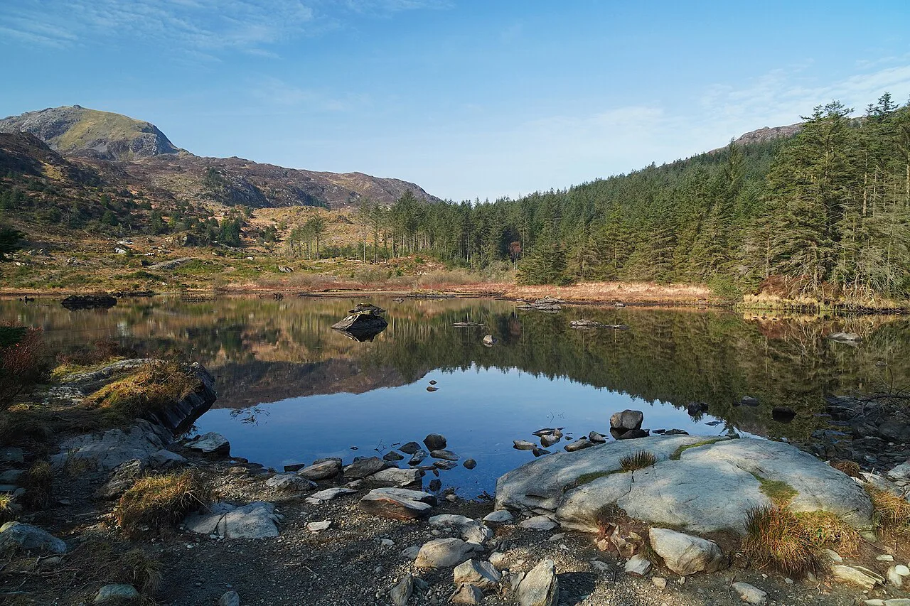
The Llyn Idwal loop from Ogwen Cottage is 4.77 km (3 mi) with about 200 m (660 ft) of ascent, usually an hour and a half. The glacial lake sits in a cwm below the Glyderau, and the path around the shore is a good introduction to Eryri ground without committing to a summit.
Cadair Idris has four routes to the summit, so you can pick a shorter or gentler line if the Minffordd path is beyond the group. The Pony Path from the north is the easier option, and it suits walkers who want the summit without the steep ravine section.
For families in Eryri, the Gelert's Grave walk from Beddgelert is 2.5 km (1.5 mi) and takes about an hour, following the Glaslyn river to the bronze hound. It works well as an afternoon leg-stretch after a bigger morning, and the village gives you cafés and parking in one place.
Waterfall walks in Bannau Brycheiniog
The Ystradfellte Four Waterfalls Walk from Cwm Porth is 7.25 km (4.5 mi) with only about 120 m (390 ft) of ascent, taking roughly two hours. Despite the easy grade, the path drops into a gorge with wet rock and steep steps, and on the main route you can walk behind one of the cascades.
A second access point at Gwaun Hepste gives a slightly longer version at 7.96 km (5 mi) with about 190 m (620 ft) of ascent, usually two and a quarter hours. Either way, waterproof boots beat trainers because the gorge floor stays damp year-round.
Coastal hikes in North Wales: Anglesey and the Llŷn Peninsula
The Anglesey Coast Path runs around the whole island, and the Amlwch to Cemaes Bay section covers 14 km (8.7 mi) with about 430 m (1,410 ft) of ascent in four to five hours. You pass the Porth Wen brickworks with its beehive kilns and reach Wales's most northerly point before Llanbadrig church.
For this section, park at Traeth Mawr in Cemaes Bay and take the number 16 bus to Amlwch so you finish at the car. That linear arrangement avoids a return walk and is the standard way to link two coastal villages.
The Porthdinllaen walk on the Llŷn Peninsula is 5.7 km (3.5 mi) and takes about two hours from Morfa Nefyn, following the coast path to the fishing village and the Ty Coch Inn. The inn is reached on foot or by boat only, so time your finish around its serving hours.
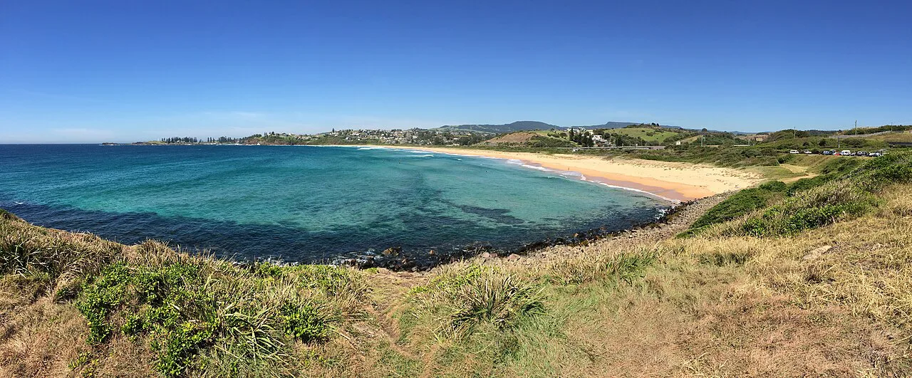
Pembrokeshire coast: Bosherston Lily Ponds to Barafundle Bay
The Bosherston Lily Ponds to Barafundle Bay loop is 9.86 km (6.1 mi) with only about 80 m (260 ft) of ascent, usually two and a half hours. It is graded moderate because of the cliff and beach sections rather than the climbing, and it strings together lakeside boardwalks, a sand beach and limestone cliffs.
Tide and weather decide how much of the beach and rock platform you can use, so keep to the marked path where the ground is wet. Seabird cliffs along this stretch are sensitive in the nesting season, which is another reason to stay on the trail.
Mid Wales and the Cambrian Mountains
Pumlumon Fawr, also called Plynlimon, is the highest point of the Cambrian Mountains and makes a 6–8 km (3.7–5 mi) circular with about 450 m (1,480 ft) of ascent. It gives 360-degree views over Mid Wales and a level of solitude the Eryri honeypots cannot match.
The Elan Valley Trail runs from the visitor centre toward the Craig Goch dam, 6.7 km (4.2 mi) out and back with about 175 m (570 ft) of ascent. The bridleway on the far side of the reservoir is the quieter line, and the dam itself is the natural turnaround.
The Pen y Garn circular from the Arch covers 10.4 km (6.5 mi) with about 334 m (1,100 ft) of ascent. For something shorter and steeper, Bryn-y-Fan above Llyn Clywedog climbs about 208 m (680 ft) in 3.2 km (2 mi), which feels punchy for its length.
Route summary: distance, ascent and time by hike
Match the route to your day length: Llyn Idwal and Gelert's Grave fit a half day, the Pen y Fan and Corn Du circuit and the Snowdon loop fill a normal walking day, and the Storey Arms loop needs a full day with an early start. The Snowdon circuit and Cadair Idris Minffordd path carry the biggest ascent per kilometre, so they feel harder than their distances suggest.
If you want a coastal day instead of a summit, the Amlwch to Cemaes Bay section and the Bosherston loop have modest ascent and give you bus and car options at each end. The Four Waterfalls route is the best wet-weather alternative, since the gorge and woodland shelter you from wind on the tops.
Trailheads, parking and public transport
Key trailheads named in the route descriptions are Minffordd car park for Cadair Idris, Pen y Pass for the Snowdon loop, Ogwen Cottage for Llyn Idwal, Storey Arms for the Pen y Fan circuits, Traeth Mawr at Cemaes Bay, Morfa Nefyn and Cwm Porth for the waterfalls. Pen y Pass also has the option of parking at Nant Peris and taking the Sherpa bus up to the pass, which removes the summit-day parking problem.
For the Ceredigion coast, the 552 service links the Llangrannog end back to the start, running on Thursdays to Saturdays only, so a midweek one-way walk needs a second car. The Anglesey section works the other way round: park at the finish and bus to the start in the morning.
Some trailheads charge for parking, so carry change or a card rather than assuming a free lay-by. The relevant national park authority pages list current charges and any seasonal restrictions on the busiest passes.
When to go: seasons, daylight and Welsh weather
Late spring to early autumn, roughly May to September, gives the best odds of warmer, drier weather and long daylight hours for the longer ridge days. Welsh weather stays unpredictable year-round, and the uplands see more rain and stronger wind than the coast, so build a shorter backup walk into every trip.
In winter the higher Eryri peaks can hold snow and ice and turn into mountaineering ground rather than walking terrain. That is the moment to pick a low-level valley or coastal route instead of a summit, and to carry an ice axe and crampons only if you have the skills to use them.
Waterfall country is at its most impressive after heavy rain, but the same rain makes the gorge steps slippery and the rivers high. Go on the day after a downpour rather than during it, and check the levels at the Cwm Porth entrance before descending.
Mountain hazards and the right kit
Welsh summits are exposed to fast-moving cloud, wind and rain even in summer, so pack waterproof jacket and trousers, warm layers, a map and compass or a charged navigation app, and sturdy boots with grip. The path beneath Cadair Idris climbs beside crags and the Snowdon zigzags are rocky, so sure-footedness matters more than technical skill.
Afternoon storms build quickly on the Bannau Brycheiniog escarpments, where the ridge is the only way off the summits. Plan the Pen y Fan loops to be down or onto lower ground by mid-afternoon, and turn back if the cloud drops onto the ridge.
Coastal paths bring their own hazards: cliff edges, loose ground and tide-cut sections on the beaches. Keep back from the edge in wind, and check tide times before walking any beach or causeway section.
Dogs, livestock and farmland
Wales is generally dog-friendly, but Eryri and Bannau Brycheiniog are sheep country, and dogs must be kept on a lead around livestock. Coastal paths are often better for off-lead walking, though cliff edges and nesting birds still call for restraint.
Some trails close sections for nesting birds, and signage on the ground takes priority over any route description. On the Yr Allt circular above Llyn Clywedog, sheep graze the whole area, so keep dogs on a lead there too.
Where to base yourself for each region
For Eryri, base in Llanberis or Beddgelert: Llanberis puts you on the Snowdon path network and near Pen y Pass, while Beddgelert gives you river walks and a short drive to the Ogwen valley. For Cadair Idris, staying in Dolgellau puts the Minffordd car park within a short drive.
For Bannau Brycheiniog, Brecon or the villages near Ystradfellte work for both the Pen y Fan escarpment and the waterfalls. In Pembrokeshire, base near Pembroke or Bosherston so the Lily Ponds and Barafundle circuit is a short drive, and use the coast path for an evening leg-stretch.
Mid Wales is the one region where a car is close to essential: the Elan Valley and Pumlumon trailheads are remote, and buses are sparse. Choose Rhayader for the reservoirs and Aberystwyth for the Ceredigion coast sections.
A sample three-day hiking plan
Day one: the Pen y Fan and Corn Du circuit from Storey Arms, 7.56 km and around 450 m of ascent, to get your legs working without committing to a full ridge day. Day two: the Snowdon loop via the Pyg and Miners' Tracks, starting early from Pen y Pass or using the Nant Peris park-and-ride.
Day three: a lower day in waterfall country or on the coast, either the Four Waterfalls route from Cwm Porth or the Bosherston Lily Ponds loop depending on where you are based. Keep the hardest day, such as the Storey Arms triple-summits loop, separate from your travel days so a late finish does not clash with a long drive.
Two routes beyond Wales
Just outside Wales, the Clwydian hillside route from Loggerheads to Moel Famau covers 12.8 km (8 mi) with about 422 m (1,380 ft) of ascent to a summit short of true mountain height, and the Clwydian Range across the Dee Estuary offers further options.
Plan Your Visit
Pick one region, choose two or three routes from the same list of difficulty grades, and build the trip around the trailheads you can actually reach. Book accommodation near the trailhead rather than in a distant town, because Welsh roads are slow and summer parking fills early.
Snowdon Walk and Cadair Idris give you detailed breakdowns for the two most famous summit days, and the Pembrokeshire Coast Path guide covers the coastal sections in more depth.
Explore more Wales hiking guides
Frequently Asked Questions
What are some of the best walks in Wales?
For a summit day, the Snowdon loop via the Pyg and Miners' Tracks and the Cadair Idris Minffordd path are the two classic mountain routes. For something easier, the Llyn Idwal loop and the Bosherston Lily Ponds to Barafundle Bay walk combine short distance with big scenery.
Which is harder, Snowdon or Pen y Fan?
Snowdon is harder by ascent and by time on your feet: the Pyg and Miners' loop climbs around 680 m over 12.3 km, while the Pen y Fan and Corn Du circuit climbs about 450 m over 7.56 km. Pen y Fan's steeper, stair-like climb can feel tough on the legs, but the day is shorter.
How long does it take to walk the entire Welsh coastal path?
The Anglesey Coast Path alone runs around 140 miles around the island and is usually walked in 10–13 days. The full Wales Coast Path is much longer still, so most hikers choose one or two sections, such as Amlwch to Cemaes Bay in four to five hours.
What is the best time of year to go hiking in Wales?
Late spring to early autumn gives the longest daylight and the best odds of dry weather, which matters most for the long ridge days in Bannau Brycheiniog. Winter is for low-level valley and coast walks, since the higher Eryri peaks can hold snow and ice.
Do I need a car for hiking in Wales?
Not for every day: Pen y Pass, Ogwen Cottage and the Anglesey coast section can be reached by bus, and parking at Nant Peris with the Sherpa bus works for Snowdon. Mid Wales is the exception, where remote trailheads such as Pumlumon and the Elan Valley are easiest by car.
Are dogs allowed on Welsh hiking trails?
Dogs are generally welcome, but Eryri and Bannau Brycheiniog are sheep country and dogs must be on a lead around livestock. Some paths close sections for nesting birds, so follow signage on the ground.
Sources
Trail notes for your next trip
Optional updates when we add or revise hiking guides.
You might also like
Continue reading
More guides you'll find useful