Cadair Idris Walk: Minffordd Path Route, Distance and Time
Plan the Cadair Idris walk via the Minffordd Path: trailhead parking, distance, ascent, summit timings, Llyn Cau, the ridge to Mynydd Moel and when to go.
On this page
The Cadair Idris walk gives you more variety per mile than almost any mountain day in Wales: oak woodland, a dark lake under crags, a narrow ridge with drops on both sides and a summit trig point above Dolgellau. The Minffordd Path is the shortest way up, which is exactly why it feels so steep, and it rewards that effort with the finest line on the mountain. It suits hillwalkers who are comfortable on sustained gradients and exposed ground, and who want the option of a full horseshoe rather than a simple up-and-back.
Trailhead at the Cadair Idris car park
Everything on the Minffordd Path starts and finishes at the Cadair Idris/Dol Idris car park off the B4405, signposted from the A487 between Dolgellau and Tywyn. Bring cash: the machine takes £5 notes but not cards, with £4 charged for three hours and £6 for all-day parking, and the car park closes at midnight with no overnight stays. Spaces fill, so on summer weekends arrive in the morning rather than at midday.
Facilities here come and go with the season. The site has toilets and a tea room, but both have been shut at peak summer with portable toilets standing in, so plan on carrying water and food regardless. Fill bottles before you leave the valley; there is no reliable water source on the upper mountain. The Ordnance Survey Explorer OL23 sheet covers Cadair Idris and Llyn Tegid and is the map to carry.
Getting there without a car: Bus 30
Public transport to this trailhead is thin but workable. Bus 30 runs between Dolgellau and Tywyn along the A487 and stops at the junction of the B4405, a short walk from the Dol Idris parking, and Tywyn has a railway station on the Cambrian line.
Because the connecting walk from the junction adds distance to an already steep day, most walkers drive, and buses suit anyone basing themselves in Dolgellau without a car. Match your descent to the afternoon service rather than assuming a late bus, and ask the operator for the current timetable when you arrive. If you are weighing up other Welsh upland days against this one, our hiking in Wales guide sets out the wider options across the country.
Distance, ascent and time
The full Minffordd Path horseshoe runs about 6 miles (9.7 km) and took a steady walker just over 5 hours including stops. The climb to the summit alone took roughly 2 hours 40 minutes, with 40 minutes from Craig Cwm Amarch to the top and 30 minutes across to Mynydd Moel. Budget longer if you stop at the lake or the summit shelter.
The National Resources Wales route notes classify all three recommended Cadair Idris routes as hard and strenuous, and the Minffordd is the steepest of them.
Route description: woods, bridge and Llyn Cau
From the car park the path enters woodland and climbs immediately, with a stream and waterfalls on your right. After about half an hour you cross a slate bridge over the river, the point where the horseshoe descent rejoins the main path later in the day. Keep that bridge in mind on the way up; it marks the last sheltered spot before the open mountain.
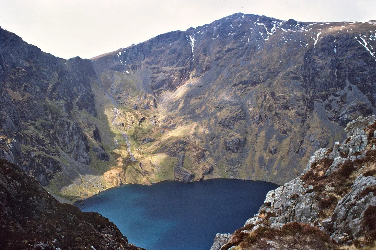
Another half hour of steep going brings you out at Llyn Cau, a glacial lake cupped beneath the crags and the best natural rest stop on the route. The cwm walls were carved by ice from the Ordovician volcanic rock that forms the massif, which is why the lake sits in such a deep bowl.
The ridge and scree to Craig Cwm Amarch
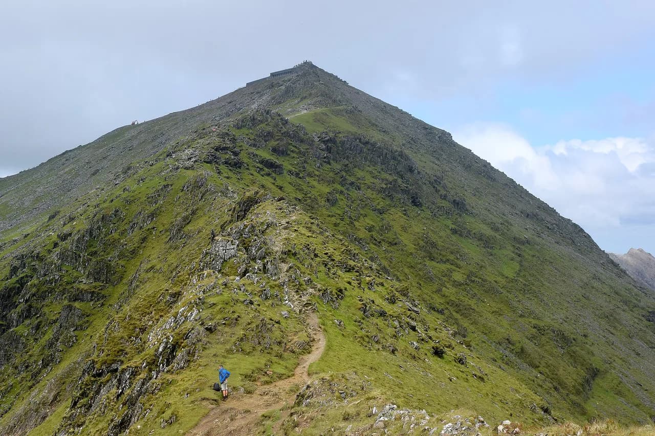
Above the lake the path stiffens again, climbing to the ridge and then following it with big drops on either side and a short stretch of loose scree. Cross the stile at Craig Cwm Amarch at 791 m (2,595 ft) and resist the urge to stop celebrating: this is a false summit, and the real top is still a descent and a second climb away. Take the ridge seriously in wind, when the exposed sections are where you feel it most.
From Craig Cwm Amarch the path drops steeply down the Craig Cau ridge before climbing again to the summit, where the Pony Track joins from the north. That final pull is short but it arrives when your legs already know they have climbed.
The summit and trig point
The summit trig point stands at 893 m (2,930 ft), with views over Llyn Cau directly below and across the Snowdonia ranges. A stone shelter on top holds about 15 to 20 people and is the reason to carry an extra layer: the wind up here can be strong enough to knock you off balance even on a fine day.
Extending the horseshoe to Mynydd Moel
To make the circuit, head from the summit towards Mynydd Moel and keep left where a right-hand path drops away and misses the top. Cross the fence by the stile and reach Mynydd Moel at 863 m (2,832 ft), where a small stone shelter offers a last break. The fence here marks the boundary of the Cadair Idris Nature Reserve.
The descent back to the trailhead
The way down is steep, with stepped sections that punish tired knees, and poles earn their place here. Cross back over the fence, follow the path with the fence on your left, then cross further stiles before the path bends right towards the river and rejoins the slate bridge. From the bridge, the wooded steps lead back to the car park.
Exposure, wind and scree
The Minffordd Path is not a technical climb, but it is a mountain day with real consequences if the weather turns. The ridge between Llyn Cau and the summit is narrow with drops on both sides, and the scree section demands care when wet. Wind is the defining hazard on the top: if you cannot stand steadily at the trig point, turn around rather than pushing on to Mynydd Moel.
When to go
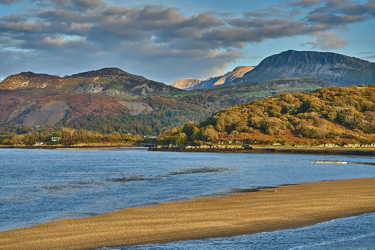
Late spring through early autumn gives the most reliable conditions, and summer brings heather in bloom on the lower slopes and the longest daylight for the horseshoe. Winter and early spring can leave snow and ice on the ridge and the northern gullies, which turns a walk into a mountaineering day requiring axe and crampons. Check the mountain forecast for the Cadair Idris massif the evening before and pick a day with light winds rather than simply a dry one.
Huts, campsites and bases near the trailhead
There is no hut network on the Minffordd Path, so accommodation sits in the valley. A campsite lies just down the road from the parking at Cwmrhwyddfor, and the Gwesty Minffordd Hotel is a short walk away, while Dolgellau offers the widest choice, including a YHA hostel. Basing yourself in Dolgellau keeps the Bus 30 option open and shortens the morning drive.
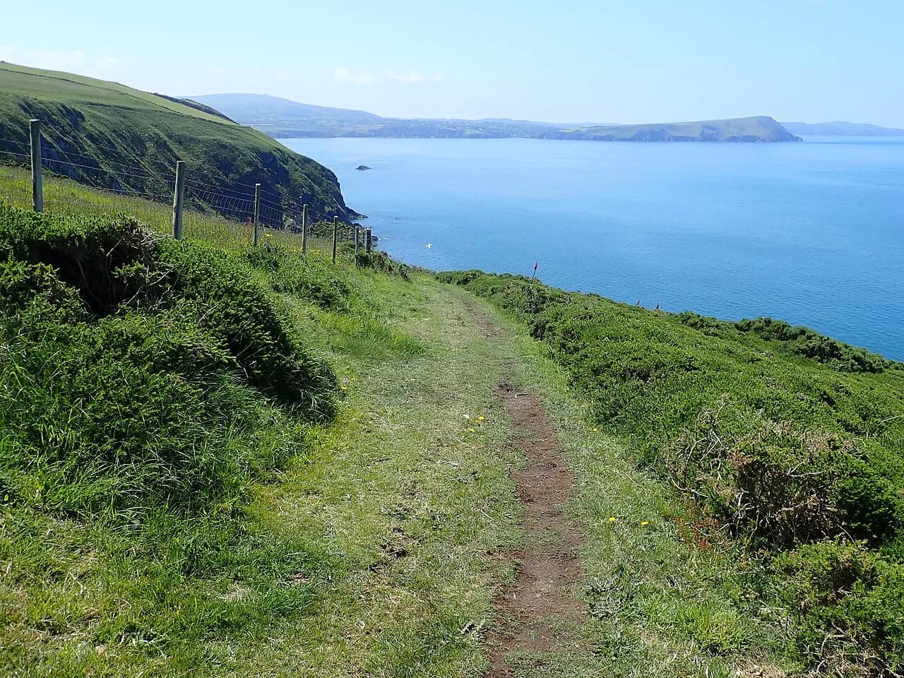
If you want a sea-level day to recover, the Pembrokeshire Coast Path National Trail offers a very different kind of Welsh walking, with cliff scenery rather than summit ridges.
Minffordd Path compared with the other Cadair Idris routes
Cadair Idris has three recommended walking routes, all graded hard or strenuous, and the Minffordd is the shortest and steepest of them. The Pony Track gives a longer, more gradual line from the north, while a scramble path adds hands-on rock to the equation. Choose the Minffordd for the lake and ridge scenery, the Pony Track for an easier gradient, and the scramble only if you are confident on exposed rock.
Other Snowdonia peaks lie outside the Cadair Idris massif and make a separate day. For comparison with Wales's best-known mountain, our Snowdon walk guide covers the routes up Yr Wyddfa (Snowdon). If you want shorter, lower Welsh upland days between bigger summits, the Brecon Beacons hiking guide covers the options in the south.
Walking Cadair Idris with a dog: what to expect on the Minffordd Path
The Minffordd Path is a steep walk, and the three recommended Cadair Idris walking routes are all designated hard and strenuous, so a dog needs to be a confident, fit hill walker rather than a first-timer. From the Cadair Idris/Dol Idris car park (postcode LL37 9AJ) the path climbs through woods with a stream and waterfalls on your right, reaching a bridge crossing the river after about 30 minutes, then Llyn Cau about half an hour later. Plan rests at the lake rather than on the steeper ground above it.
Above Llyn Cau the route gains the ridge, where the path is steep with big drops on either side, and there is a short section across scree and rocks. That exposure continues along the ridge to Craig Cwm Amarch at 791 metres, down the steep Craig Cau ridge and up again to the 893-metre summit. Underfoot it is rough, loose and steep in both directions, including the stepped descent at the end, so keep the lead handy on the narrow ridge and scree sections.
Once on the summit plateau there is a stone shelter large enough for about 15 to 20 people, useful in the strong wind that makes standing difficult at the trig point; a smaller stone shelter sits on Mynydd Moel at 863 metres. Beyond Cadair Idris, a fence crossed by stiles forms the boundary of the Cadair Idris Nature Reserve, so keep the dog on the path and close to you near the stiles and livestock.
Facilities at the trailhead are limited: there are toilets on site and a tea room, and the car park has no overnight parking, but neither is a place to leave a dog, so plan the day around the walk itself. OS Explorer OL23: Cadair Idris & Llyn Tegid covers the route.
Plan Your Cadair Idris Day
Decide before you set off whether you are doing the summit out-and-back or the full horseshoe to Mynydd Moel, because the extra ridge time and the steep stepped descent change the day considerably. Carry cash for the car park, an extra layer for the summit shelter, and poles for the way down. Confirm the current parking charges with the car park operator and the Bus 30 times with the bus operator before you travel.
Frequently Asked Questions
How long does it take to walk up Cadair Idris via the Minffordd Path?
A steady walker reached the summit in roughly 2 hours 40 minutes, with about 40 minutes from Craig Cwm Amarch to the top, and the full horseshoe to Mynydd Moel and back took just over 5 hours including stops. Add time for a break at Llyn Cau and at the summit shelter, and allow more on a windy day when the ridge slows you down.
How long is the Minffordd Path on Cadair Idris?
The full horseshoe is about 6 miles (9.7 km) with three summits: Craig Cwm Amarch at 791 m (2,595 ft), the main top at 893 m (2,930 ft) and Mynydd Moel at 863 m (2,832 ft). An out-and-back to the summit is shorter but retraces the same steep ground in both directions.
Where do you park for the Cadair Idris walk?
The Cadair Idris/Dol Idris car park sits off the B4405, signposted from the A487 between Dolgellau and Tywyn. The machine runs on cash rather than cards and charges separate short-stay and all-day rates, and the site closes at midnight with no overnight parking; the car park operator publishes the current charges. Arrive in the morning on summer weekends because the spaces fill by midday.
Can you get to Cadair Idris by bus?
Bus 30 links Dolgellau and Tywyn along the A487 and stops at the junction of the B4405, a short walk from the Dol Idris parking, and Tywyn has a railway station. The connecting walk adds distance to a steep day, so most walkers drive and bus users tend to base themselves in Dolgellau.
Is the Cadair Idris walk hard?
All three recommended Cadair Idris routes are graded hard and strenuous, and the Minffordd is the shortest, steepest option. Expect a sustained climb through woodland, a narrow ridge with drops on both sides, loose scree and a false summit before the true top. Fitness matters less than comfort on exposed ground and steep, stepped descent.
Sources
Trail notes for your next trip
Optional updates when we add or revise hiking guides.
You might also like
Continue reading
More guides you'll find useful