Yr Wyddfa (Snowdon) Walk: Six Routes, Distances and Times
Compare all six walking routes up Yr Wyddfa (Snowdon) by distance, ascent and difficulty, with trailhead parking, the Sherpa bus and when to go.
On this page
Yr Wyddfa, the mountain most English speakers call Snowdon, is Wales' highest summit at 1,085 m (3,560 ft), and six waymarked paths reach it from different sides of Eryri National Park. Each one is a full mountain day with little shelter, so the route you pick should match your fitness and head for exposure rather than its reputation. Fit day hikers who want the classic circuit usually get the most from the two Pen y Pass paths, while beginners and families do better on the long, gradual climb from Llanberis.
This guide sets out where each route starts and finishes, its distance and ascent, what the ground is like underfoot, and how to reach the trailheads by car, bus or train. It also covers summit facilities, the months that give the most reliable conditions, and the winter hazards that change the character of the upper mountain. If you are weighing Eryri against the rest of the country, our wider hiking in wales planning covers coast paths and hill ranges beyond this massif.
The Yr Wyddfa walk at a glance
Whichever path you take, plan on a demanding day out: Visit Wales classes all six routes as hard, strenuous walks and suggests allowing six to eight hours for the round trip, with little shelter from wind, rain or sun on the upper slopes. Its route guide notes that a reasonably fit walker can expect roughly four to seven hours. Set off early enough to descend in daylight, since short winter days catch out walkers who start late.
The two sources in print describe the routes on different bases, so keep the numbers apart. Visit Wales gives round-trip distances of 11 km (7 miles) to 14.5 km (9 miles), while Climb Snowdon gives one-way distances to the summit paired with total elevation gain, from 5.5 km (3.5 miles) and 723 m (2,372 ft) on the Pyg Track up to 7.25 km (4.5 miles) and 975 m (3,199 ft) on the Llanberis Path. Use the basis that suits your planning and do not mix them in one comparison.
The spread matters more than any single figure. The Pyg and Miners' tracks gain 723 m (2,372 ft) because they start high at Pen y Pass, the Rhyd Ddu Path gains 895 m (2,936 ft), and the Watkin Path tops the list at 1,015 m (3,330 ft) because it begins close to sea level.
The Llanberis Path: the longest and most gradual climb
The Llanberis Path leaves the village at the foot of the mountain and runs 7.25 km (4.5 miles) one way to the summit with 975 m (3,199 ft) of ascent, making it the longest of the six but the gentlest in gradient and the surest underfoot. That combination makes it the usual first choice for families, first-timers and runners, and it is also a sensible pick for solo walkers who want a well-trodden line.
The trade-off is popularity: in peak season this is often the busiest path on the mountain, which is no surprise given the parking in Llanberis and the village's accommodation and cafés. If you want solitude, look at the western paths instead and accept a longer drive to the start.
Above the point where the path runs alongside the railway, the upper section banks out with snow and ice in winter and becomes one of the more serious ascents on the mountain. In those conditions you need winter boots and, often, crampons and an ice axe, plus the experience to use them.
The Miners' Track from Pen y Pass
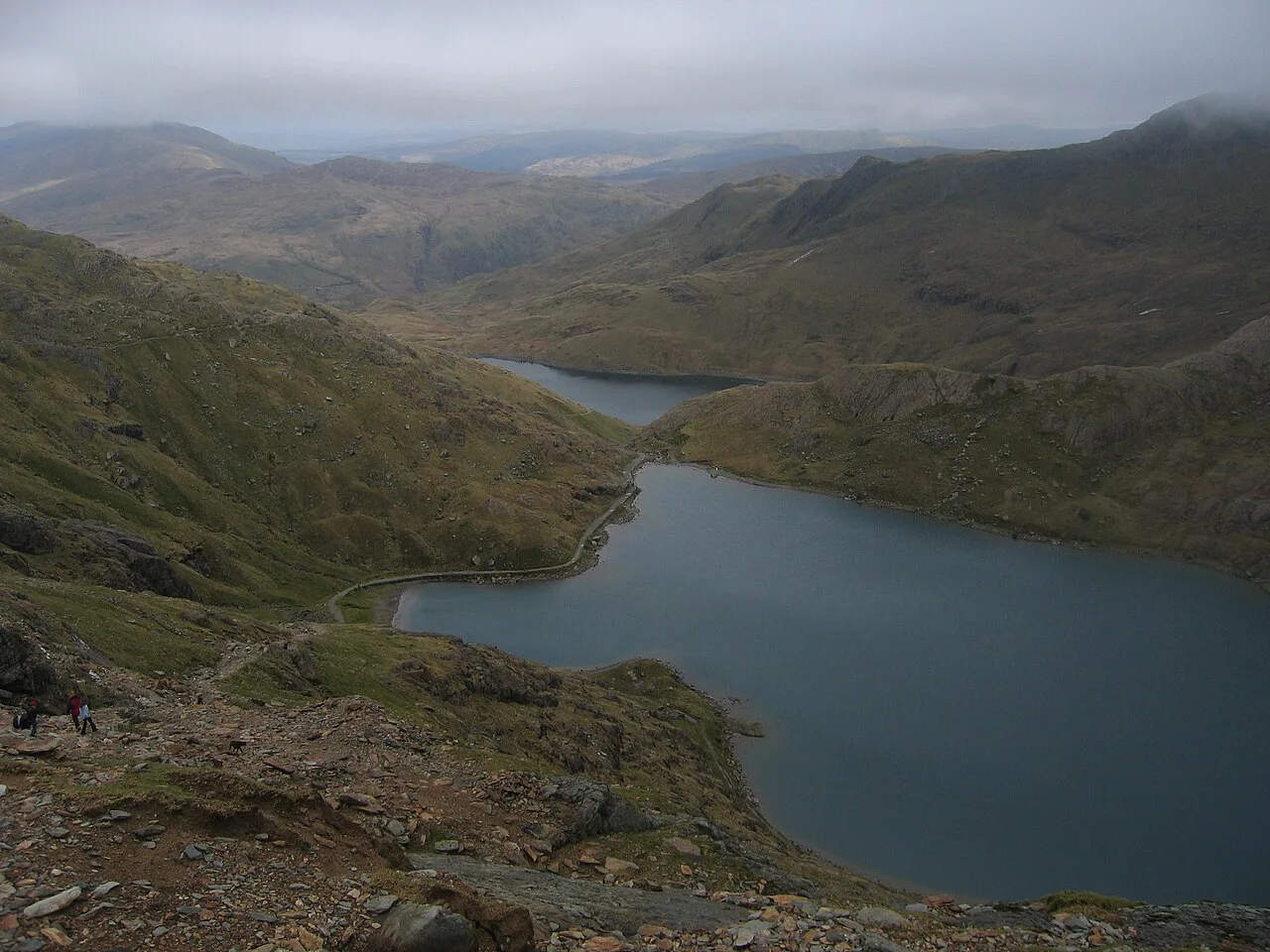
The Miners' Track begins at Pen y Pass car park and covers 6.5 km (4 miles) one way to the summit with 723 m (2,372 ft) of ascent. The opening stretch past the old mine buildings is among the easiest walking on the mountain, following a shallow gradient up to Glaslyn.
The character changes at Glaslyn, where the route steepens into zig-zags up to join the Pyg Track for the final climb. Visit Wales describes this upper section as steep and zig-zaggy in parts, so save energy for it rather than racing the flat lakeside miles.
On the way you pass the ruins of the old copper mine, with the crushing mill and barracks surviving as jagged remains lower down the mountain, which make distinctive photo stops. Alpine flowers grow on the surrounding slopes, and the rare Snowdon Lily flowers mainly in inaccessible crevices in May.
The Pyg Track: shortest route, roughest ground
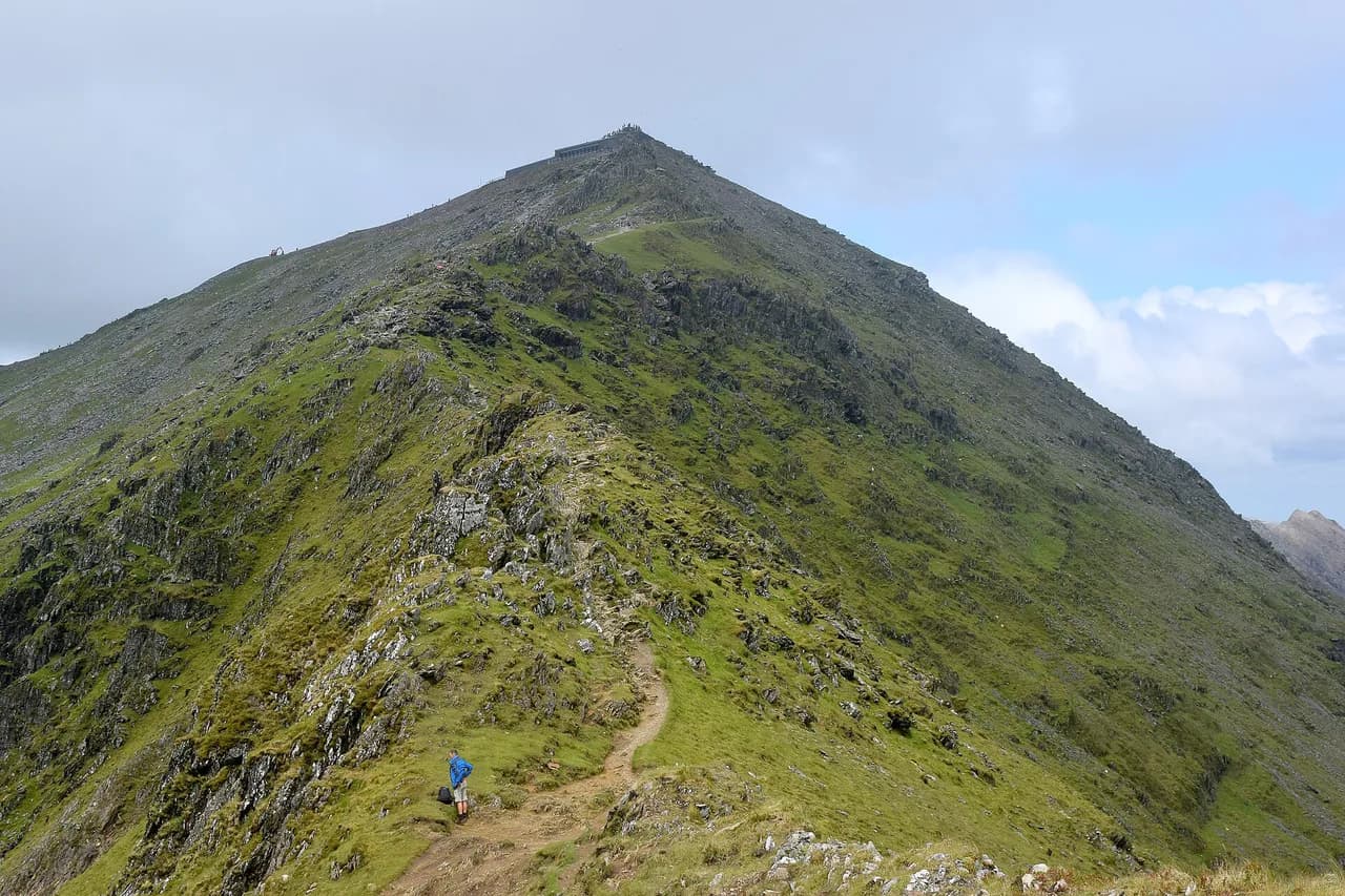
The Pyg Track is the shortest line to the summit at 5.5 km (3.5 miles) one way with 723 m (2,372 ft) of ascent, starting from the pre-booked car park at Pen y Pass at around 359 m (1,178 ft). Do not mistake the sharp peak visible from the start for the summit: that is Crib Goch, the knife-edge ridge, and the true top lies further on.
Short does not mean easy. Parts of the Pyg are tough, technical and rough underfoot, which makes it a more demanding climb than several longer routes, and it draws crowds in the busier months. Boots with good ankle support and a sturdy sole are the right footwear here; the Visit Wales route guide advises against trainers for any ascent.
It joins the Miners' Track before the last pull to the summit, which is what makes the two paths so easy to combine into one day.
Pairing the Pyg and Miners' tracks into a circuit
Climbing by the Pyg Track and descending by the Miners' Track is one of the most popular walking circuits on the mountain, and it shows you two very different faces of the same slope. Go up the rougher Pyg ground while your legs are fresh and come down the steadier lakeside line, where the old mine buildings give you landmarks to tick off.
Visit Wales recommends the same pairing as a popular circular, and the combined day still counts as a full six to eight hours on the mountain for most walkers. Start early from Pen y Pass, carry more water than you think you need, and keep something in reserve for the descent, which is where tired legs cause most stumbles.
The Rhyd Ddu Path: the quietest line to the summit
From Rhyd Ddu car park the path runs 7 km (4.25 miles) one way with 895 m (2,936 ft) of ascent, and it is probably the quietest of the six footpaths. You can see the summit from the start, which makes the route feel wonderfully direct, and the upper sections follow the Snowdon South Ridge.
The ridge crossing at Bwlch Main is not straightforward and the route is narrow near the top, so you need a head for heights and sure feet. Visit Wales flags exactly this, describing a narrow ridge near the summit that rewards confident walkers with some of the best views in Wales.
In wind, cloud or wet rock, treat the ridge as the crux of the day and be ready to turn back rather than press on for the summit. The car park here is usually quieter than Pen y Pass, which suits anyone arriving later in the morning.
The Snowdon Ranger Path from Llyn Cwellyn
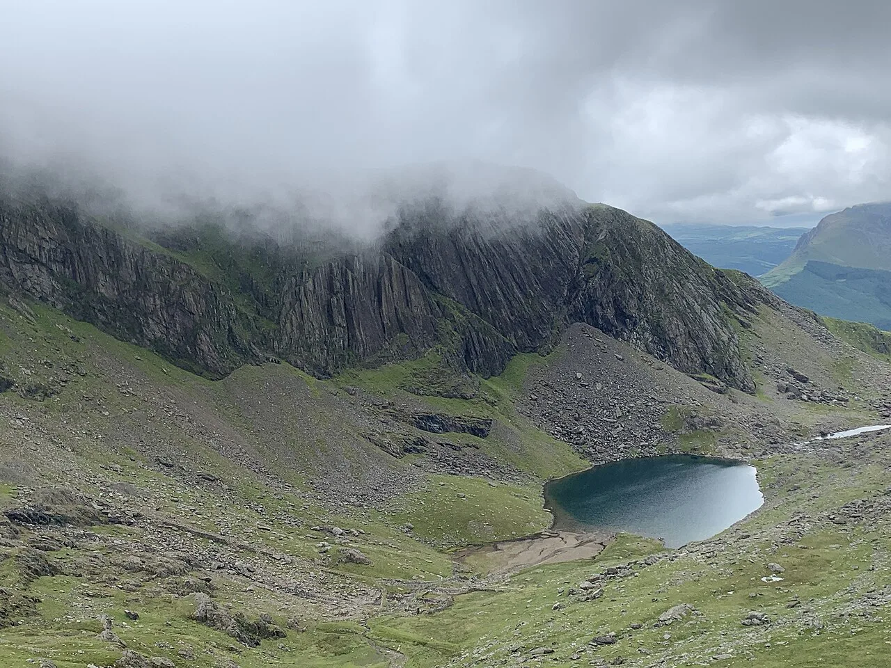
The Snowdon Ranger Path starts at Llyn Cwellyn car park and climbs 6.5 km (4 miles) one way with 936 m (2,888 ft) of ascent, giving wide views over the lakes scattered across this side of the mountain. It is thought to be the oldest route up Yr Wyddfa and is considerably quieter than Llanberis.
The first section is relatively straightforward, then the gradient ramps up as the trail swings over the dark cliff tops of Clogwyn Du'r Arddu. That upper stretch is where you feel the height gain, so pace the early kilometres and keep your best effort for the cliffs.
The Watkin Path from Nant Gwynant
The Watkin Path climbs from Pont Bethania car park in Nant Gwynant, covering 6.5 km (4 miles) one way with 1,015 m (3,330 ft) of ascent, the most of any route because it starts almost at sea level. That low start makes it the hardest and most spectacular way up, and it passes waterfalls and the famous Gladstone Rock.
The lower path is simple and scenic, with old copper mine workings visible along the way; the difficulty arrives higher up, where loose scree makes the going dangerous in wet weather or poor visibility. Keep to the marked line on the scree, space out from other walkers so you do not knock stones down, and turn around if the cloud closes in.
This is the route to choose when you have already climbed Yr Wyddfa by an easier path and want more of a challenge, rather than a first mountain day.
The Snowdon Horseshoe and Crib Goch
The Snowdon Horseshoe is a circular ridge route that takes in the Crib Goch ascent, and it is far more of a mountaineering outing than the six walking paths, with sustained scrambling and serious exposure. Choose it only if you have scrambling experience, a good head for heights and settled weather, because the ridge gives no easy escape once you are on it.
For most hikers the horseshoe is a goal for a later trip, after a first ascent by one of the paths has taught you how the mountain's weather behaves.
Trailhead parking, Pen y Pass booking and the Sherpa bus
Pen y Pass car park is pre-book only for most of the year, and you reserve a space online before you travel, which means the Pyg and Miners' tracks need planning rather than a spur-of-the-moment start. Llanberis usually has plenty of parking, while the Nant Peris car park fills rapidly in the main season, so aim to be there by at least 7am.
The car parks for the Watkin and Rhyd Ddu paths are often quieter, which makes the western routes attractive if you are arriving later or visiting at a busy time. Wherever you start, use the designated car parks only; roadside parking damages habitats and causes problems for local services.
The Sherpa'r Wyddfa bus links the various starting points and is the practical fix when you want a one-way walk or cannot book Pen y Pass. From Llanberis it gives you a way to reach the Pen y Pass trailheads and return to the village at the end of the day.
Getting there without a car
Trains run to Bangor and to stations along the North Wales Coast Railway, and you continue by bus or taxi from there; Traveline Cymru is the journey planner to use for the connecting legs. Build in slack for connections, since the mountain day itself takes six to eight hours and you do not want to miss the last bus back.
Regular buses also run between Llanberis and the Nant Peris park and ride, which serves walkers heading for Pen y Pass without their own transport. Staying in Llanberis keeps the train, bus, railway and the Llanberis Path trailhead all within reach on foot.
The summit: Hafod Eryri, the toilet and water
Hafod Eryri, the visitor centre and café at the top, opens only when the railway is running, and it holds the only toilet on Yr Wyddfa, so use the facilities at the car park before you set out. The café sells drinks, cakes and pasties and gets busy at peak times.
Tap water at the summit is not safe to drink and you cannot refill a bottle there, so carry enough for the whole walk or buy more at the café. Filling up before you start, using the Refill scheme points in the valleys, keeps your pack weight sensible without running short.
For a railway-assisted day, the Snowdon Mountain Railway climbs from Llanberis to the summit when weather and operating restrictions allow. You cannot buy a one-way ticket down at the top, so if you walk up expecting to ride down, that plan will not work.
When to go: snow, ice and the best months
The mountain is often covered in snow and ice from November through to April, and it can last into May, which turns the upper sections into winter terrain. From May to the end of October there is a good chance of walkable weather, though mist, rain and storms can still stop a climb.
May, June and September are the pick of the year: cooler temperatures, spring and autumn scenery and thinner crowds than midsummer. July and August are warmest but often wetter and the busiest, so use the quieter western paths if you visit then.
October is unpredictable, so watch the forecast closely and take the short days seriously by starting early. Check a dedicated mountain forecast before any ascent, because conditions at the summit can differ sharply from the valley.
Shelter, food and where to stay
There are no huts on the mountain and no bins, so you carry everything out, including organic waste such as fruit peel. The Halfway House café on the Llanberis Path gives a mid-climb break, and Penceunant café at the base of that trail makes a good post-climb stop.
For an early start on the Pyg or Miners' tracks, the YHA hostel at Pen y Pass puts you at the trailhead, and it books up in the busier months. Llanberis offers the widest choice of accommodation, restaurants and outdoor shops, while Nant Peris and Rhyd Ddu suit walkers heading for the quieter western paths.
Weather, footwear and knowing when to turn back
Conditions change fast: a sunny valley morning can turn into ice-cold wind, heavy rain and thick mist higher up, and there is usually a chilly breeze at the summit. Carry waterproofs even on a bright day, use boots with ankle support rather than trainers, and pack warm layers, a map, compass, headtorch and whistle.
High winds are dangerous as well as unpleasant, and they are a legitimate reason to choose a lower route or abandon the day. Tell someone your route and expected return time, and treat turning around as a normal decision rather than a failure.
Keep well-behaved dogs under control and in sight, and follow the Countryside Code by staying on the paths to protect the fragile ground. If you are exploring further afield in Wales after this, the Pembrokeshire Coast Path swaps summit days for cliff walking on the southwest coast.
Costs and hiring a guide
Walking up Yr Wyddfa is free, with no charge for access to the mountain itself; your spending is on parking, transport and any guided service you choose. That makes the day good value compared with lift-served mountains elsewhere, provided you sort out the trailhead logistics in advance.
Qualified local guides run guided ascents from Llanberis and can take the route choice and navigation off your hands if you are new to mountains, rusty, or keen to try a harder line with support. Book directly with the provider to see current dates and what the day includes.
Plan Your Yr Wyddfa Day
Match the route to the walker: the Llanberis Path for a gradual first ascent, the Pyg and Miners' tracks combined for a classic circuit from Pen y Pass, Rhyd Ddu for quiet and exposure, the Snowdon Ranger for lake views, and the Watkin for the biggest climb and the best waterfalls. If you are weighing other Welsh hill days against this one, our hiking in Brecon Beacons guide sets out the Four Ranges in the same route-by-route way. Book Pen y Pass ahead, check the Sherpa'r Wyddfa bus times if you want a one-way day, and start early enough to be down before dark.
Aim for May, June or September if you can choose, carry water for the whole day and use the car park toilets before you leave, because the summit has the only other ones and no drinking water. Boots, waterproofs and a willingness to turn back in wind or cloud are what separate a good day from a long one.
Frequently Asked Questions
How long does it take to walk up Yr Wyddfa and back?
Allow six to eight hours for the round trip on any of the six paths, which is the figure Wales' tourism board gives for all of them. Walkers with reasonable fitness often finish nearer four to seven hours, but the upper mountain is exposed, so start early enough that you are down before daylight fades.
Which Yr Wyddfa route is easiest for a beginner?
The Llanberis Path is the usual first choice. It is the longest of the six but has the gentlest gradient and the most reliable footing, and it starts in a village with parking, cafés and accommodation. The Pen y Pass paths are shorter but start higher and climb more steeply.
Can you walk up Yr Wyddfa and take the train down?
Not on the day: the Snowdon Mountain Railway does not sell one-way tickets down at the summit, so a walk up means a walk down. The railway runs seasonally and depends on the weather, and the summit café only opens when trains are running.
Where do you park for the Pyg Track and Miners' Track?
Both start at Pen y Pass, where the car park is pre-book only for most of the year, so reserve a space online before you travel. As an alternative, park in Llanberis or at Nant Peris and ride the Sherpa'r Wyddfa bus to the pass.
Is there a toilet or drinking water on the summit of Yr Wyddfa?
Hafod Eryri holds the only toilet on the mountain and opens only while the railway is running, so use the car park facilities before you start. Tap water at the summit is not safe to drink, so carry enough for the whole walk.
Is walking up Yr Wyddfa free?
Access to the mountain is free, with no charge for walking any of the six paths. Your costs come from parking, transport to the trailhead and any guide you hire, so budget for those rather than for the mountain itself.
Which Yr Wyddfa route is quietest?
The Rhyd Ddu Path is probably the quietest of the six, and it also gives some of the best views, though the narrow ridge at Bwlch Main near the top demands a head for heights. The Snowdon Ranger Path from Llyn Cwellyn is another good choice when you want to avoid the crowds.
When is the best time of year to climb Yr Wyddfa?
May, June and September offer the best balance of cooler temperatures, spring or autumn scenery and thinner crowds. Snow and ice usually cover the mountain from November to April and can linger into May, while July and August are warmest but often wet and busy.
Sources
Trail notes for your next trip
Optional updates when we add or revise hiking guides.
You might also like
Continue reading
More guides you'll find useful